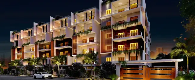
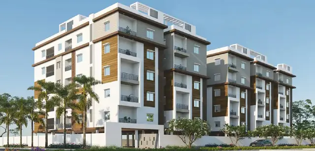
Jaya Medha
Bysani · Mahabubnagar · RERA P01400007226
Jaya Medha is a new plotted development in Amistapur, Bhoothpur, Mahabubnagar. The registered promoter is Bysani Subramanyam. The project covers 16,187.43 sqmts and comprises 59 residential plots; plot sizes are 68.61–268.21 sq.m. It is registered under TG-RERA number P01400007226, and the promoter’s Form B undertaking states completion before 31st March, 2025.
01What we found
Read from TG-RERA filings, approvals, land and registration records and court records. A court case is counted only when the court record states this project's survey number with its village, or names the project.
02Check before you pay
8 items to check before you pay, 4 high - from the title chain, court records and approvals, each with what to ask the builder or your advocate. An item may not be a problem with the project: records can be incomplete.
1. Project at a glance
Project identity
| Item | Record |
|---|---|
| Registered project name | Jaya Medha RERA record |
| Project type | New plotted development / residential open-plot layout RERA record RERA filing |
| Phase / registered portion | No separate phase is identified; the registration concerns the plotted layout on the survey numbers listed below. RERA record |
| TG-RERA registration | P01400007226; registered 08/11/2023; validity stated through 31/03/2025. The certificate says “1 years”; no extension is recorded in the supplied registration evidence. Registration validity is distinct from the completion undertaking. RERA record |
| Registered promoter | Bysani Subramanyam on the registration certificate; the Form B declaration is by Bysani Subramanyam, Bysani Harinadh and Bysani Gopinath. |
| RERA status | The project is recorded as “New Project.” The supplied certificate records the registration period above; a current registration status beyond that period is not established by the supplied evidence. RERA record |
Land and geographic identity
| Item | Record |
|---|---|
| Locality / revenue village | Amistapur (also rendered “Amsithapur” / “Amsithapur Revenue Village” in layout-document text); the RERA record identifies Amistapur. RERA record RERA filing |
| Mandal / district / PIN | Bhoothpur / Mahabubnagar / 509382 RERA record RERA filing |
| Project survey numbers and subdivisions | 496/2 A U/1, 496/2A E/1 and 496/2 A EE RERA record |
| Other survey references appearing on layout-plan details sheets | 496/2A (P), 158 and 159(P) appear in the application/layout details; their relationship to the registered project parcel is not established here. |
| Registered site extent | RERA land details: 16,187.43 sqmts. The layout-plan details sheet states 16186.93 sq.mt. RERA filing |
| Layout area figures | Layout drawing-derived record: total site area 16,186.93 sq.m, net layout area 16,114.07 sq.m, road-widening area 72.86 sq.m. Layout record |
| Boundaries | East: YESHAMONI KISTAMMA LAND; West: VAGU; North: MANDADI HANMANTHU LAND; South: YESHAMONI KISTAMMA LAND. RERA filing |
Development identity
| Item | Record |
|---|---|
| Layout sanctioning authority | BHOOTHPUR Municipality/Municipal Corporation; the registration record also identifies DTCP as the authority name. RERA record |
| Principal approval | Tentative Layout Plan No. 0005/LO/3106/2023, approved 29 July, 2023; application No. 005742/LO/DTCP/3106/0005/2023. Approvals record |
| Layout application / file reference | TS/044982/2023 Approvals record |
| Approved built-up area | Not disclosed as a building measure; this is a plotted layout. The RERA field “Approved Built up Area” states 16187.43 sqmts. RERA filing |
| Plots | 59 individual plots stated in the tentative approval and layout records. Layout record |
| Buildings / floors | No building count, floor configuration or building-level approvals are established in the supplied project evidence. The tentative layout condition says detached dwelling houses for single-family occupation may be built on sites, subject to competent-authority approval. |
| Parking | No common parking area is shown in the layout details; parking count or plot-wise parking allocation is not established. |
Offering and status
| Item | Record |
|---|---|
| Offered unit type | Residential plots; 59 plots are recorded in the layout. Layout record |
| Plot-size range | Software-measured from the layout plot schedule: 68.61–268.21 sq.m ( 82.1–320.8 sq.yd); median 139.35 sq.m ( 166.7 sq.yd). These are drawing-derived measurements, not separate RERA unit disclosures. Layout record |
| Booked / available counts | Not established in the supplied evidence. |
| Construction / development stage | RERA record gives 80% completeness; this is a recorded progress figure, not an independent site verification. RERA record |
| Completion date | Promoter Form B undertaking: completion before 31st March, 2025. This is separate from the certificate’s registration-validity end date. |
| Occupancy / completion certificate | No occupancy or completion certificate is supplied. The project is a plotted layout; the supplied approval is a tentative layout approval, not an occupancy certificate. Document index |
2. The project story
Jaya Medha is a proposed residential plotted development in Amistapur, Bhoothpur Mandal, Mahabubnagar District, on the RERA-identified survey subdivisions 496/2 A U/1, 496/2A E/1 and 496/2 A EE. The project is arranged as 59 individual plots, with internal roads and land set aside for open space/park, social infrastructure and utilities. The tentative layout approval describes the development as a layout and requires the applicant to carry out its infrastructure and other development works. RERA record Layout record
The RERA record reports 80% completeness, but the supplied materials do not independently verify the current site condition or establish that the proposed infrastructure is complete. The promoter’s Form B affidavit undertakes completion before 31st March, 2025; the project’s registration validity is stated separately as ending on that date. No occupancy/completion certificate is included in the supplied evidence. RERA record Document index
3. Master plan, architecture & building design
The project is a plotted layout rather than a building scheme. The tentative plan records 59 plots and identifies these land-use allocations:
| Layout use | Area | Share stated in drawing |
|---|---|---|
| Plotted area | 9,116.60 sq.m | 56.58% |
| Roads | 4,955.82 sq.m | 30.75% |
| Organized open space / park | 1,463.79 sq.m | 9.08% |
| Social infrastructure | 411.82 sq.m | 2.56% |
| Utilities | 165.98 sq.m | 1.03% |
| Total net layout | 16,114.01 sq.m on the plan details sheet | 100.00% |
The layout details list roads as 9.14 MT. WIDE ROAD, 9.14 MT WIDE EXISTING, and 18.00 MT WIDE PROPOSED ROAD. The tentative approval describes a 0 Acer 14.47 Gts open-space/park reservation, 0 Acer 4.07 Gts social-infrastructure reservation, 0 Acer 1.64 Gts utilities reservation and road area of 1 Acer 8.98 Gts. It also records 0 Acer 14.71 Gts 1780 Sq. Yds as mortgage area for plots 1, 48, 30, 12, 29, 11 and 6.
The supplied evidence does not establish building footprints, house designs, floor configurations, building heights, or a building-by-building construction programme. The tentative approval states that only detached single-family dwelling houses may be built on a site, subject to competent-authority approval.
4. Homes, configurations & floor plans
This is a plotted project, so apartment configuration, carpet-area and saleable-area schedules are not applicable in the supplied RERA record. The layout schedule records 59 plots. Software-measured plot sizes range from 68.61 sq.m (82.1 sq.yd) to 268.21 sq.m (320.8 sq.yd); the median is 139.35 sq.m (166.7 sq.yd). The measurement is derived from the layout drawing and should be checked against the drawing and plot schedule. Layout record
| Plot-size band | Plot count |
|---|---|
| 0–100 sq.yd (0–84 sq.m) | 2 |
| 100–150 sq.yd (84–125 sq.m) | 4 |
| 150–200 sq.yd (125–167 sq.m) | 39 |
| 200–250 sq.yd (167–209 sq.m) | 6 |
| 250–300 sq.yd (209–251 sq.m) | 6 |
| 300–400 sq.yd (251–334 sq.m) | 2 |
Layout record
No plot-wise booked/available inventory is supplied. The floor-plan file set contains two layout sheets and no house floor plans with measured residential rooms. Floor plans
5. Parking & vehicle circulation
The layout identifies roads for vehicle circulation, including the stated 9.14 m and 18.00 m road widths. It records Common Parking Area 0.00 in the layout-plan details. No sanctioned parking-space count, visitor or accessible parking provision, plot-wise parking allocation, vehicle entry/exit arrangement, or EV charging provision is established by the supplied project evidence.
The tentative approval says roads are to remain open for access to neighbouring sites and that no compound wall or fencing may be constructed around the site. Plot ownership or a drawn parking space, if any, is not established as an exclusive parking right by these records.
6. Amenities, recreation & open spaces
| Facility | Description / size | Evidence source | Declared progress / verified status |
|---|---|---|---|
| Organized open space / park | 1,463.79 sq.m; 9.08% of net layout area | Reserved in layout record; completion not independently verified. | |
| Tot-lot | Listed as a layout amenity; no separate size stated | Listed in plan details; completion not independently verified. | |
| Social infrastructure | 411.82 sq.m; 2.56% | Land reservation stated; facility type and completion not established. | |
| Utility area | 165.98 sq.m; 1.03% | Land reservation stated; facilities and completion not independently verified. | |
| Internal roads and footpaths | Layout road area 4,955.82 sq.m; 30.75% | RERA amenities | Listed in RERA amenity data; progress shown as 0% there. |
| Green strip / tot-lot / park | No additional dimensions stated | RERA amenities | RERA amenity data lists the item with progress 0%; independent completion verification is not supplied. |
The tentative approval requires the applicant to complete layout infrastructure and amenities and to transfer reserved open space, utilities and roads to the Municipality by registered gift deed before release of the tentative layout. The supplied evidence does not establish completion of those works or transfer.
7. Utilities, building services & safety
The tentative layout approval lists required layout works including storm-water drains, underground drainage lines and a common septic tank/STP, internal water-supply pipelines and overhead tank, an assured water source, electrical supply lines, street lights, transformer, avenue plantation, park development and rainwater-harvesting pits. It also describes utilities land as reserved for items including water reservoir, septic tank/sewerage treatment plant, electric transformer and solid-waste management. These are approval conditions and stated development requirements; completion and operating capacity are not independently established.
| Evidence in project record | Internal water-supply pipelines, overhead tank and assured water source are specified in the tentative approval. |
|---|---|
| Status / limitation | Proposed/required works; source, storage capacity and completed status are not supplied. |
| Evidence in project record | Underground drainage, storm-water drains and common septic tank/STP are specified. |
|---|---|
| Status / limitation | Proposed/required works; capacity, treatment performance and completed status are not supplied. |
| Evidence in project record | Electrical supply lines, transformer and street lights are specified. |
|---|---|
| Status / limitation | Proposed/required works; capacity and completed status are not supplied. |
| Evidence in project record | Solid Waste Management is listed among utility provisions. |
|---|---|
| Status / limitation | No system details or completion verification supplied. |
| Evidence in project record | Harvesting pits, avenue plantation and park development are specified. |
|---|---|
| Status / limitation | Proposed/required works; completion not independently verified. |
| Evidence in project record | RERA amenity data lists “Fire Protection And Fire Safety Requirements” with progress 0%. |
|---|---|
| Status / limitation | No project-specific fire-system design, clearance or completion evidence supplied. RERA amenities |
| Evidence in project record | No project-specific accessibility, CCTV or access-control details supplied. |
|---|---|
| Status / limitation | Not established. |
8. Location, access & connectivity
The registered location is Amistapur, Bhoothpur Mandal, Mahabubnagar District, Telangana 509382. The supplied cadastral geocode identifies the parcel centroid as 16.70817, 78.02858. RERA record RERA filing Location record
The location data provides one sampled connectivity reference: the nearest sampled Outer Ring Road interchange is approximately 72.0 km away. No other measured distances, public-transport information or project approach-road details are supplied. Location record The layout records internal road widths of 9.14 m and 18.00 m and requires roads to remain open for neighbouring-site access.
9. Developer & development status
The registration certificate names Bysani Subramanyam as promoter. The Form B declaration is signed by Bysani Subramanyam, Bysani Harinadh and Bysani Gopinath, who declare ownership of land described there as Ac 04-00 Gts in Sy No. 496/2 and undertake completion before 31st March, 2025. The declaration also states that 70% of amounts realized from allottees will be deposited in a separate scheduled-bank account. These are promoter declarations.
The supplied record identifies GSTIN 36AAFHB2311C1Z5 and a promoter address at Sai Laxmi Residency, Station Road, Amistapur, Amistapur, Bhoothpur, Mahabubnagar, 509382. The promoter’s legal entity type and a project-specific official website or contact number are not established. Corporate record Parties record
RERA records 80% completeness; this is not independent site verification. The completion undertaking and registration validity both refer to 31st March, 2025, but they represent different matters. No extension or occupancy/completion certificate is included in the supplied evidence. RERA record
10. Approvals, official records & documents
| Identifier / date | P01400007226; issued 08/11/2023; stated valid through 31/03/2025 |
|---|---|
| What the supplied evidence establishes | Registration of Jaya Medha and certificate conditions, including a separate-account requirement. |
| Identifier / date | 0005/LO/3106/2023; 29 July, 2023 |
|---|---|
| What the supplied evidence establishes | Tentative residential plotted-layout approval for 59 plots on survey numbers 496/2 A U/1, 496/2A E/1 and 496/2 A EE, subject to listed development and transfer conditions. |
| Identifier / date | 005742/LO/DTCP/3106/0005/2023; TS/044982/2023 |
|---|---|
| What the supplied evidence establishes | Layout application and file references appearing in the supplied project records. |
| Identifier / date | Layout sheets for 59 plots, roads, open space, social infrastructure, utilities and proposed mortgage plots |
|---|---|
| What the supplied evidence establishes | Drawing-derived layout and land-use information; the details sheets also carry application/file references. |
| Identifier / date | Dated 10/09/2023 |
|---|---|
| What the supplied evidence establishes | Promoter declarations concerning claimed ownership, encumbrances, fund handling, approvals and completion before 31st March, 2025. |
| Identifier / date | Not supplied |
|---|---|
| What the supplied evidence establishes | No such certificate is established by the documents reviewed. Document index |
The supplied approval evidence concerns a tentative layout plan. It does not include building-specific approvals, individual house plans or an occupancy/completion certificate.
1. Project at a glance
Project identity
Registered project name: Jaya Medha
Project type: New plotted development / residential open-plot layout
Phase / registered portion: No separate phase is identified; the registration concerns the plotted layout on the survey numbers listed below.
TG-RERA registration: P01400007226; registered 08/11/2023; validity stated through 31/03/2025. The certificate says “1 years”; no extension is recorded in the supplied registration evidence. Registration validity is distinct from the completion undertaking.
Registered promoter: Bysani Subramanyam on the registration certificate; the Form B declaration is by Bysani Subramanyam, Bysani Harinadh and Bysani Gopinath.
RERA status: The project is recorded as “New Project.” The supplied certificate records the registration period above; a current registration status beyond that period is not established by the supplied evidence.
Land and geographic identity
Locality / revenue village: Amistapur (also rendered “Amsithapur” / “Amsithapur Revenue Village” in layout-document text); the RERA record identifies Amistapur.
Mandal / district / PIN: Bhoothpur / Mahabubnagar / 509382
Project survey numbers and subdivisions: 496/2 A U/1, 496/2A E/1 and 496/2 A EE
Other survey references appearing on layout-plan details sheets: 496/2A (P), 158 and 159(P) appear in the application/layout details; their relationship to the registered project parcel is not established here.
Registered site extent: RERA land details: 16,187.43 sqmts. The layout-plan details sheet states 16186.93 sq.mt.
Layout area figures: Layout drawing-derived record: total site area 16,186.93 sq.m, net layout area 16,114.07 sq.m, road-widening area 72.86 sq.m.
Boundaries: East: YESHAMONI KISTAMMA LAND; West: VAGU; North: MANDADI HANMANTHU LAND; South: YESHAMONI KISTAMMA LAND.
Development identity
Layout sanctioning authority: BHOOTHPUR Municipality/Municipal Corporation; the registration record also identifies DTCP as the authority name.
Principal approval: Tentative Layout Plan No. 0005/LO/3106/2023, approved 29 July, 2023; application No. 005742/LO/DTCP/3106/0005/2023.
Layout application / file reference: TS/044982/2023
Approved built-up area: Not disclosed as a building measure; this is a plotted layout. The RERA field “Approved Built up Area” states 16187.43 sqmts.
Plots: 59 individual plots stated in the tentative approval and layout records.
Buildings / floors: No building count, floor configuration or building-level approvals are established in the supplied project evidence. The tentative layout condition says detached dwelling houses for single-family occupation may be built on sites, subject to competent-authority approval.
Parking: No common parking area is shown in the layout details; parking count or plot-wise parking allocation is not established.
Offering and status
Offered unit type: Residential plots; 59 plots are recorded in the layout.
Plot-size range: Software-measured from the layout plot schedule: 68.61–268.21 sq.m ( 82.1–320.8 sq.yd); median 139.35 sq.m ( 166.7 sq.yd). These are drawing-derived measurements, not separate RERA unit disclosures.
Booked / available counts: Not established in the supplied evidence.
Construction / development stage: RERA record gives 80% completeness; this is a recorded progress figure, not an independent site verification.
Completion date: Promoter Form B undertaking: completion before 31st March, 2025. This is separate from the certificate’s registration-validity end date.
Occupancy / completion certificate: No occupancy or completion certificate is supplied. The project is a plotted layout; the supplied approval is a tentative layout approval, not an occupancy certificate.
2. The project story
Jaya Medha is a proposed residential plotted development in Amistapur, Bhoothpur Mandal, Mahabubnagar District, on the RERA-identified survey subdivisions 496/2 A U/1, 496/2A E/1 and 496/2 A EE. The project is arranged as 59 individual plots, with internal roads and land set aside for open space/park, social infrastructure and utilities. The tentative layout approval describes the development as a layout and requires the applicant to carry out its infrastructure and other development works.
The RERA record reports 80% completeness, but the supplied materials do not independently verify the current site condition or establish that the proposed infrastructure is complete. The promoter’s Form B affidavit undertakes completion before 31st March, 2025; the project’s registration validity is stated separately as ending on that date. No occupancy/completion certificate is included in the supplied evidence.
3. Master plan, architecture & building design
The project is a plotted layout rather than a building scheme. The tentative plan records 59 plots and identifies these land-use allocations:
| Layout use | Area | Share stated in drawing |
|---|---|---|
| Plotted area | 9,116.60 sq.m | 56.58% |
| Roads | 4,955.82 sq.m | 30.75% |
| Organized open space / park | 1,463.79 sq.m | 9.08% |
| Social infrastructure | 411.82 sq.m | 2.56% |
| Utilities | 165.98 sq.m | 1.03% |
| Total net layout | 16,114.01 sq.m on the plan details sheet | 100.00% |
The layout details list roads as 9.14 MT. WIDE ROAD, 9.14 MT WIDE EXISTING, and 18.00 MT WIDE PROPOSED ROAD. The tentative approval describes a 0 Acer 14.47 Gts open-space/park reservation, 0 Acer 4.07 Gts social-infrastructure reservation, 0 Acer 1.64 Gts utilities reservation and road area of 1 Acer 8.98 Gts. It also records 0 Acer 14.71 Gts 1780 Sq. Yds as mortgage area for plots 1, 48, 30, 12, 29, 11 and 6.
The supplied evidence does not establish building footprints, house designs, floor configurations, building heights, or a building-by-building construction programme. The tentative approval states that only detached single-family dwelling houses may be built on a site, subject to competent-authority approval.
4. Homes, configurations & floor plans
This is a plotted project, so apartment configuration, carpet-area and saleable-area schedules are not applicable in the supplied RERA record. The layout schedule records 59 plots. Software-measured plot sizes range from 68.61 sq.m (82.1 sq.yd) to 268.21 sq.m (320.8 sq.yd); the median is 139.35 sq.m (166.7 sq.yd). The measurement is derived from the layout drawing and should be checked against the drawing and plot schedule.
0–100 sq.yd (0–84 sq.m): 2
100–150 sq.yd (84–125 sq.m): 4
150–200 sq.yd (125–167 sq.m): 39
200–250 sq.yd (167–209 sq.m): 6
250–300 sq.yd (209–251 sq.m): 6
300–400 sq.yd (251–334 sq.m): 2
No plot-wise booked/available inventory is supplied. The floor-plan file set contains two layout sheets and no house floor plans with measured residential rooms.
5. Parking & vehicle circulation
The layout identifies roads for vehicle circulation, including the stated 9.14 m and 18.00 m road widths. It records Common Parking Area 0.00 in the layout-plan details. No sanctioned parking-space count, visitor or accessible parking provision, plot-wise parking allocation, vehicle entry/exit arrangement, or EV charging provision is established by the supplied project evidence.
The tentative approval says roads are to remain open for access to neighbouring sites and that no compound wall or fencing may be constructed around the site. Plot ownership or a drawn parking space, if any, is not established as an exclusive parking right by these records.
6. Amenities, recreation & open spaces
| Facility | Description / size | Evidence source | Declared progress / verified status |
|---|---|---|---|
| Organized open space / park | 1,463.79 sq.m; 9.08% of net layout area | Reserved in layout record; completion not independently verified. | |
| Tot-lot | Listed as a layout amenity; no separate size stated | Listed in plan details; completion not independently verified. | |
| Social infrastructure | 411.82 sq.m; 2.56% | Land reservation stated; facility type and completion not established. | |
| Utility area | 165.98 sq.m; 1.03% | Land reservation stated; facilities and completion not independently verified. | |
| Internal roads and footpaths | Layout road area 4,955.82 sq.m; 30.75% | Listed in RERA amenity data; progress shown as 0% there. | |
| Green strip / tot-lot / park | No additional dimensions stated | RERA amenity data lists the item with progress 0%; independent completion verification is not supplied. |
The tentative approval requires the applicant to complete layout infrastructure and amenities and to transfer reserved open space, utilities and roads to the Municipality by registered gift deed before release of the tentative layout. The supplied evidence does not establish completion of those works or transfer.
7. Utilities, building services & safety
The tentative layout approval lists required layout works including storm-water drains, underground drainage lines and a common septic tank/STP, internal water-supply pipelines and overhead tank, an assured water source, electrical supply lines, street lights, transformer, avenue plantation, park development and rainwater-harvesting pits. It also describes utilities land as reserved for items including water reservoir, septic tank/sewerage treatment plant, electric transformer and solid-waste management. These are approval conditions and stated development requirements; completion and operating capacity are not independently established.
| Evidence in project record | Internal water-supply pipelines, overhead tank and assured water source are specified in the tentative approval. |
|---|---|
| Status / limitation | Proposed/required works; source, storage capacity and completed status are not supplied. |
| Evidence in project record | Underground drainage, storm-water drains and common septic tank/STP are specified. |
|---|---|
| Status / limitation | Proposed/required works; capacity, treatment performance and completed status are not supplied. |
| Evidence in project record | Electrical supply lines, transformer and street lights are specified. |
|---|---|
| Status / limitation | Proposed/required works; capacity and completed status are not supplied. |
| Evidence in project record | Solid Waste Management is listed among utility provisions. |
|---|---|
| Status / limitation | No system details or completion verification supplied. |
| Evidence in project record | Harvesting pits, avenue plantation and park development are specified. |
|---|---|
| Status / limitation | Proposed/required works; completion not independently verified. |
| Evidence in project record | RERA amenity data lists “Fire Protection And Fire Safety Requirements” with progress 0%. |
|---|---|
| Status / limitation | No project-specific fire-system design, clearance or completion evidence supplied. |
| Evidence in project record | No project-specific accessibility, CCTV or access-control details supplied. |
|---|---|
| Status / limitation | Not established. |
8. Location, access & connectivity
The registered location is Amistapur, Bhoothpur Mandal, Mahabubnagar District, Telangana 509382. The supplied cadastral geocode identifies the parcel centroid as 16.70817, 78.02858.
The location data provides one sampled connectivity reference: the nearest sampled Outer Ring Road interchange is approximately 72.0 km away. No other measured distances, public-transport information or project approach-road details are supplied. The layout records internal road widths of 9.14 m and 18.00 m and requires roads to remain open for neighbouring-site access.
9. Developer & development status
The registration certificate names Bysani Subramanyam as promoter. The Form B declaration is signed by Bysani Subramanyam, Bysani Harinadh and Bysani Gopinath, who declare ownership of land described there as Ac 04-00 Gts in Sy No. 496/2 and undertake completion before 31st March, 2025. The declaration also states that 70% of amounts realized from allottees will be deposited in a separate scheduled-bank account. These are promoter declarations.
The supplied record identifies GSTIN 36AAFHB2311C1Z5 and a promoter address at Sai Laxmi Residency, Station Road, Amistapur, Amistapur, Bhoothpur, Mahabubnagar, 509382. The promoter’s legal entity type and a project-specific official website or contact number are not established.
RERA records 80% completeness; this is not independent site verification. The completion undertaking and registration validity both refer to 31st March, 2025, but they represent different matters. No extension or occupancy/completion certificate is included in the supplied evidence.
10. Approvals, official records & documents
| Identifier / date | P01400007226; issued 08/11/2023; stated valid through 31/03/2025 |
|---|---|
| What the supplied evidence establishes | Registration of Jaya Medha and certificate conditions, including a separate-account requirement. |
| Identifier / date | 0005/LO/3106/2023; 29 July, 2023 |
|---|---|
| What the supplied evidence establishes | Tentative residential plotted-layout approval for 59 plots on survey numbers 496/2 A U/1, 496/2A E/1 and 496/2 A EE, subject to listed development and transfer conditions. |
| Identifier / date | 005742/LO/DTCP/3106/0005/2023; TS/044982/2023 |
|---|---|
| What the supplied evidence establishes | Layout application and file references appearing in the supplied project records. |
| Identifier / date | Layout sheets for 59 plots, roads, open space, social infrastructure, utilities and proposed mortgage plots |
|---|---|
| What the supplied evidence establishes | Drawing-derived layout and land-use information; the details sheets also carry application/file references. |
| Identifier / date | Dated 10/09/2023 |
|---|---|
| What the supplied evidence establishes | Promoter declarations concerning claimed ownership, encumbrances, fund handling, approvals and completion before 31st March, 2025. |
| Identifier / date | Not supplied |
|---|---|
| What the supplied evidence establishes | No such certificate is established by the documents reviewed. |
The supplied approval evidence concerns a tentative layout plan. It does not include building-specific approvals, individual house plans or an occupancy/completion certificate.
Frequently asked questions
Is Jaya Medha registered with Telangana RERA?
Yes. Jaya Medha is registered with the Telangana Real Estate Regulatory Authority as P01400007226; the registration status is New Project.
Who is the developer of Jaya Medha?
The promoter named in the RERA registration is Bysani.
Where is Jaya Medha located?
Jaya Medha is in Amistapur, Bhoothpur, Mahabubnagar, Telangana (509382).
When will Jaya Medha be completed?
The promoter's proposed date of completion filed with RERA is 31/03/2025. This is the promoter's declaration, not a guarantee.
More projects in Amistapur