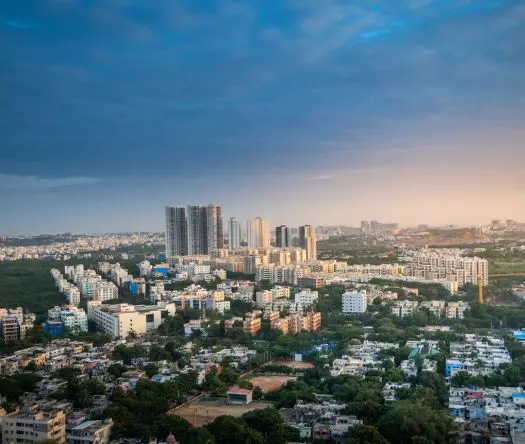
Sri India Township Phase-II
MANDA SATYANARAYANA REDDY AND OTHER · Rangareddy · RERA P02400008070
SRI INDIA TOWNSHIP PHASE-II is a plotted development in Meddigadda Thanda, Amangal, Ranga Reddy, 509321, developed by MANDA SATYANARAYANA REDDY AND OTHER. The registered land extent is 7891.37 sqmts, with seven plots; the supplied records do not state tower or floor configurations or plot configurations. It is registered with TG-RERA under P02400008070, with a proposed completion date of 31/01/2026.
01What we found
Read from TG-RERA filings, approvals, land and registration records and court records. A court case is counted only when the court record states this project's survey number with its village, or names the project.
02Check before you pay
10 items to check before you pay, 6 high - from the title chain, court records and approvals, each with what to ask the builder or your advocate. An item may not be a problem with the project: records can be incomplete.
1. Project at a glance
Project identity
| Field | Record |
|---|---|
| Registered project name | SRI INDIA TOWNSHIP PHASE-II RERA record |
| Project type | Plotted development RERA record |
| Phase / registered portion | Phase-II; the registered land is identified as Survey Nos. 966/P and 968/P. Further phase-wise land detail is not disclosed in the supplied record. RERA record |
| TG-RERA registration | P02400008070 RERA record |
| Registration validity | 19/04/2024 to 31/01/2026, as recorded on the certificate. Validity is distinct from the stated project completion date. Approvals record |
| Registered promoter | MANDA SATYANARAYANA REDDY AND OTHER RERA record Corporate record |
| RERA status | The supplied record identifies it as a registered “New Project.” Current registration status after the recorded end date is not established by the supplied evidence. RERA record Approvals record |
Land and geographic identity
| Field | Record |
|---|---|
| Locality | Meddigadda Thanda RERA record |
| Revenue village | Medigadda / Amangal Revenue Village; the layout document describes the locality as Meddigadda Thanda Gram Panchayat in Amangal Revenue Village. RERA record |
| Mandal / district / PIN | Amangal / Ranga Reddy / 509321 RERA record |
| Project survey numbers and subdivisions | 966/P and 968/P RERA record Land records |
| Extent recorded in RERA project land details | Total area: 7891.37 sqmts; affected area: 2306.71 sqmts; net area: 5584.66 sqmts. RERA filing Land records |
| Extent recorded in draft layout document | Layout area: Ac. 1.95 Cents; 9438.00 SQ.YDS; net layout area: Ac. 1.38 Cents; 6679.20 SQ.YDS. The document separately records Ac. 0.57 Cents; 2758.80 SQ.YDS as vacant land. |
| Boundaries in RERA land details | East: existing 100 feet wide road; west: existing DTCP-approved layout; north and south: vacant land. RERA filing |
Development identity
| Field | Record |
|---|---|
| Sanctioning authority | District Town and Country Planning Officer, Ranga Reddy District (DTCP). Approvals record |
| Principal approval | Draft Technical Layout Pattern approval, Draft-TLP.No.02/2024/DTCPO/RR, dated 31.01.2024. The file records TLP.No. 02 / 2024 / DTCPO / RR. and states that the layout is legally valid only on release/approval by the concerned Gram Panchayat after fulfilment of conditions. Approvals record |
| Layout reference numbers | Lr.Roc.No.26/2024/DTCPO/RR; E.Pan.No. 12024/162; C.No. 26 / 2024 / DTCPO / RR.; approved DTLP.No. 25/2023/H; portal reference 103120244. Approvals record |
| Layout scale and plot count | Scale: 1"=66'-0"; 07 plots. |
| Built-up area | RERA fields record approved built-up area of 4661.98 sqmts. A building configuration is not supplied for this plotted layout. RERA filing |
| Building / floor configuration | No tower count, building floor configuration, or building parking levels are established in the supplied project records. The layout document restricts house construction to detached single-family dwelling houses on plots. |
Offering and status
| Field | Record |
|---|---|
| Purchase offering | Plots in a seven-plot residential layout; plot-by-plot sizes and inventory availability are not supplied. |
| RERA saleable-area range / booked and available counts | Not disclosed in the supplied structured RERA data. |
| Development status | RERA identifies the project as “New Project.” The supplied layout-document progress entries show internal roads/footpaths and the green strip/park at 30%; this is a filed progress figure, not an independent site inspection. RERA record RERA amenities |
| Completion date | 31/01/2026, recorded as the proposed completion date and in the Form-B undertaking. RERA record |
| Occupancy / completion certificate | No occupancy certificate or completion certificate is included in the supplied evidence. The project is a plotted layout; the records supplied do not establish certificate status for any individual building. Document index |
2. The project story
SRI INDIA TOWNSHIP PHASE-II is registered with TG-RERA as a plotted development in Meddigadda Thanda, within Medigadda / Amangal Revenue Village, Amangal Mandal, Ranga Reddy District. Its registered land identity is Survey Nos. 966/P and 968/P. The filed draft layout is for seven residential plots, with roads and a public-purpose open-space/park allocation. The layout conditions provide for detached single-family dwellings and do not permit shops, business premises or industrial units except on sites specially reserved for those uses; no such reserved commercial site is identified in the supplied layout extract. RERA record Land records
The approval document is expressly a draft layout pattern. It states that the layout is legally valid only upon release/approval by the concerned Gram Panchayat after fulfilment of layout conditions. It also records that the developer is responsible for layout development and that final layout release follows completion of development works and release of mortgaged land. The materials supplied do not establish that final layout release has occurred.
3. Master plan, architecture & building design
The filed draft layout gives a layout area of Ac. 1.95 Cents; 9438.00 SQ.YDS, with Ac. 0.57 Cents; 2758.80 SQ.YDS recorded as vacant land and a net layout area of Ac. 1.38 Cents; 6679.20 SQ.YDS. Its land-use schedule allocates 10.0% to open space (Ac. 0.138 Cents; 668.00 SQ.YDS), 6.52% to roads (Ac. 0.090 Cents; 435.60 SQ.YDS), and 83.48% to plotted area (Ac. 1.152 Cents; 5575.68 SQ.YDS). It identifies seven plots and shows Plot No. 01, extent Ac. 0.174 Cents; 842.16 SQ.YDS, as mortgage land.
The layout references existing 33'-0" and 50'-0" wide roads, a proposed 33-0" wide road, and an existing 100'-0" road widened to 200'-0" (NH-765). It also specifies a 10.0 Mts wide front building line. These are drawing/document descriptions; the supplied materials do not provide plot-by-plot dimensions or a verified on-ground measurement.
The RERA land-details record lists 4661.98 sqmts as approved built-up area and 704.15 sqmts as mortgage area. No building plans, plot schedules with individual dimensions, or building-level floor plans are available in the supplied evidence. RERA filing Document index
4. Homes, configurations & floor plans
The filed development is a seven-plot residential layout. The supplied data does not include plot-by-plot sizes, plot numbers with sale status, or RERA-filed saleable-area bands, so an individual plot configuration table cannot be prepared. The draft layout identifies 83.48% of its stated land-use schedule as plotted area and reserves Plot No. 01 as mortgage land.
The available floor-plan record contains two drawings, but both remain pending scan review; no software-measured carpet areas or room measurements are available. The project is plotted rather than an apartment configuration in the supplied RERA record. Accordingly, apartment counts, carpet area, balcony area and loading are not established here. Floor plans RERA record
5. Parking & vehicle circulation
No sanctioned parking-space count, visitor or accessible parking allocation, or plot-specific parking arrangement is supplied. The layout document identifies road areas and references existing and proposed roads, but does not establish individual plot parking rights or exclusive ownership of any parking space.
6. Amenities, recreation & open spaces
The layout approval document identifies public-purpose land as a park/open space and requires the open-space and road areas to be gifted to the Gram Panchayat before release of the final layout. The TG-RERA amenities record reports internal roads/footpaths and the green strip/park at 30%; other listed service and infrastructure progress entries are recorded at 0% or have no affirmative availability value. These are filed progress data, not independent verification of on-site completion. RERA amenities
| Description / size | Open space: Ac. 0.138 Cents; 668.00 SQ.YDS; stated as 10.0% in the layout schedule. |
|---|---|
| Evidence source | RERA amenities |
| Declared progress / verified status | Layout allocation is documented; TG-RERA amenities record reports green strip/park at 30%. Not independently verified complete. |
| Description / size | Road area: Ac. 0.090 Cents; 435.60 SQ.YDS, stated as 6.52% in the layout schedule. |
|---|---|
| Evidence source | RERA amenities |
| Declared progress / verified status | TG-RERA amenities record reports 30%. Not independently verified complete. |
The vendor listing mentions a clubhouse, swimming pool, gym and children’s play area, but those are not established as sanctioned or delivered facilities in the supplied TG-RERA/layout evidence and are not treated here as confirmed project provisions. Promoter website
7. Utilities, building services & safety
The draft layout conditions and amenities record identify proposed or required infrastructure including side drains, underground drains, nala channelization, avenue plantation, rainwater-harvesting pits (4 per Acre), fencing of open spaces, street lighting, electricity facilities, a sewerage-disposal system and protected water supply. The TG-RERA amenities record lists sewerage, storm-water drains, water conservation/rainwater harvesting and an electrical meter room/sub-station/receiving station, but their progress fields are 0%; water supply is listed without an affirmative “YES” value or supplied progress percentage. These records do not establish that the services are complete or operational. RERA amenities
The supplied materials do not establish water-source or storage capacity, treatment capacity, drainage capacity, electrical backup, fire-protection systems, security/CCTV, accessibility provisions or utility-service completion. Document index RERA amenities
8. Location, access & connectivity
The registered location is Medigadda, Amangal, Ranga Reddy, 509321, with the layout described as at Meddigadda Thanda Gram Panchayat in Amangal Revenue Village. The RERA land record identifies an existing 100 feet wide road on the eastern boundary; the draft layout also references existing 33'-0" and 50'-0" roads, a proposed 33-0" road and an existing 100'-0" road widened to 200'-0" (NH-765). RERA filing
The supplied location data gives an approximate distance of 43.4 km to the nearest sampled Outer Ring Road interchange. It does not provide distances to public transport, schools, hospitals or other landmarks. Location record
9. Developer & development status
The registered promoter is MANDA SATYANARAYANA REDDY AND OTHER. The RERA record classifies the organization type as “Others” and describes the organization as “Partners”; a more specific legal entity type, corporate registration number and registered office are not established by the supplied evidence. RERA record Corporate record RERA filing
The registration certificate names Manda Satyanarayana Reddy as promoter and records an address in Champapet, Saroornagar Mandal, Ranga Reddy District, PIN 500079. A partner resolution filed for the promoter authorizes Manda Satyanarayana Reddy to act before authorities. No official promoter website or project contact details are provided in the supplied record.
The Form-B declaration records a completion undertaking of 31 January 2026. The registration certificate records validity through 31/01/2026; these are separate dates serving different purposes. The supplied evidence does not establish an extension, final layout release, or completion certificate. Document index
10. Approvals, official records & documents
| Record | Supplied evidence and scope |
|---|---|
| TG-RERA registration | Form-C registration certificate for SRI INDIA TOWNSHIP PHASE-II, registration P02400008070, identifying the promoter, location, survey numbers and validity dates. |
| Draft layout approval | Draft Technical Layout Pattern for seven plots in Survey Nos. 966/P and 968/P, issued by the District Town and Country Planning Officer, Ranga Reddy District; Draft-TLP.No.02/2024/DTCPO/RR, dated 31.01.2024. The document states that Gram Panchayat release/approval and fulfilment of conditions are required for legal validity/final release. |
| Layout conditions and infrastructure | Filed layout document records plot count, land-use allocations, road references, mortgage land, open space and stated development requirements. |
| Promoter declaration | Form-B affidavit dated 10th April, 2024, declaring title basis, land free from encumbrances, and completion undertaking of 31 January, 2026. |
| Title and encumbrance materials | Title search report, filed title instruments and encumbrance statement are included in the broader project file; they are not approvals or completion certificates. |
| Completion / occupancy records | No completion certificate or occupancy certificate is included in the supplied materials. Document index |
1. Project at a glance
Project identity
Registered project name: SRI INDIA TOWNSHIP PHASE-II
Project type: Plotted development
Phase / registered portion: Phase-II; the registered land is identified as Survey Nos. 966/P and 968/P. Further phase-wise land detail is not disclosed in the supplied record.
TG-RERA registration: P02400008070
Registration validity: 19/04/2024 to 31/01/2026, as recorded on the certificate. Validity is distinct from the stated project completion date.
Registered promoter: MANDA SATYANARAYANA REDDY AND OTHER
RERA status: The supplied record identifies it as a registered “New Project.” Current registration status after the recorded end date is not established by the supplied evidence.
Land and geographic identity
Locality: Meddigadda Thanda
Revenue village: Medigadda / Amangal Revenue Village; the layout document describes the locality as Meddigadda Thanda Gram Panchayat in Amangal Revenue Village.
Mandal / district / PIN: Amangal / Ranga Reddy / 509321
Project survey numbers and subdivisions: 966/P and 968/P
Extent recorded in RERA project land details: Total area: 7891.37 sqmts; affected area: 2306.71 sqmts; net area: 5584.66 sqmts.
Extent recorded in draft layout document: Layout area: Ac. 1.95 Cents; 9438.00 SQ.YDS; net layout area: Ac. 1.38 Cents; 6679.20 SQ.YDS. The document separately records Ac. 0.57 Cents; 2758.80 SQ.YDS as vacant land.
Boundaries in RERA land details: East: existing 100 feet wide road; west: existing DTCP-approved layout; north and south: vacant land.
Development identity
Sanctioning authority: District Town and Country Planning Officer, Ranga Reddy District (DTCP).
Principal approval: Draft Technical Layout Pattern approval, Draft-TLP.No.02/2024/DTCPO/RR, dated 31.01.2024. The file records TLP.No. 02 / 2024 / DTCPO / RR. and states that the layout is legally valid only on release/approval by the concerned Gram Panchayat after fulfilment of conditions.
Layout reference numbers: Lr.Roc.No.26/2024/DTCPO/RR; E.Pan.No. 12024/162; C.No. 26 / 2024 / DTCPO / RR.; approved DTLP.No. 25/2023/H; portal reference 103120244.
Layout scale and plot count: Scale: 1"=66'-0"; 07 plots.
Built-up area: RERA fields record approved built-up area of 4661.98 sqmts. A building configuration is not supplied for this plotted layout.
Building / floor configuration: No tower count, building floor configuration, or building parking levels are established in the supplied project records. The layout document restricts house construction to detached single-family dwelling houses on plots.
Offering and status
Purchase offering: Plots in a seven-plot residential layout; plot-by-plot sizes and inventory availability are not supplied.
RERA saleable-area range / booked and available counts: Not disclosed in the supplied structured RERA data.
Development status: RERA identifies the project as “New Project.” The supplied layout-document progress entries show internal roads/footpaths and the green strip/park at 30%; this is a filed progress figure, not an independent site inspection.
Completion date: 31/01/2026, recorded as the proposed completion date and in the Form-B undertaking.
Occupancy / completion certificate: No occupancy certificate or completion certificate is included in the supplied evidence. The project is a plotted layout; the records supplied do not establish certificate status for any individual building.
2. The project story
SRI INDIA TOWNSHIP PHASE-II is registered with TG-RERA as a plotted development in Meddigadda Thanda, within Medigadda / Amangal Revenue Village, Amangal Mandal, Ranga Reddy District. Its registered land identity is Survey Nos. 966/P and 968/P. The filed draft layout is for seven residential plots, with roads and a public-purpose open-space/park allocation. The layout conditions provide for detached single-family dwellings and do not permit shops, business premises or industrial units except on sites specially reserved for those uses; no such reserved commercial site is identified in the supplied layout extract.
The approval document is expressly a draft layout pattern. It states that the layout is legally valid only upon release/approval by the concerned Gram Panchayat after fulfilment of layout conditions. It also records that the developer is responsible for layout development and that final layout release follows completion of development works and release of mortgaged land. The materials supplied do not establish that final layout release has occurred.
3. Master plan, architecture & building design
The filed draft layout gives a layout area of Ac. 1.95 Cents; 9438.00 SQ.YDS, with Ac. 0.57 Cents; 2758.80 SQ.YDS recorded as vacant land and a net layout area of Ac. 1.38 Cents; 6679.20 SQ.YDS. Its land-use schedule allocates 10.0% to open space (Ac. 0.138 Cents; 668.00 SQ.YDS), 6.52% to roads (Ac. 0.090 Cents; 435.60 SQ.YDS), and 83.48% to plotted area (Ac. 1.152 Cents; 5575.68 SQ.YDS). It identifies seven plots and shows Plot No. 01, extent Ac. 0.174 Cents; 842.16 SQ.YDS, as mortgage land.
The layout references existing 33'-0" and 50'-0" wide roads, a proposed 33-0" wide road, and an existing 100'-0" road widened to 200'-0" (NH-765). It also specifies a 10.0 Mts wide front building line. These are drawing/document descriptions; the supplied materials do not provide plot-by-plot dimensions or a verified on-ground measurement.
The RERA land-details record lists 4661.98 sqmts as approved built-up area and 704.15 sqmts as mortgage area. No building plans, plot schedules with individual dimensions, or building-level floor plans are available in the supplied evidence.
4. Homes, configurations & floor plans
The filed development is a seven-plot residential layout. The supplied data does not include plot-by-plot sizes, plot numbers with sale status, or RERA-filed saleable-area bands, so an individual plot configuration table cannot be prepared. The draft layout identifies 83.48% of its stated land-use schedule as plotted area and reserves Plot No. 01 as mortgage land.
The available floor-plan record contains two drawings, but both remain pending scan review; no software-measured carpet areas or room measurements are available. The project is plotted rather than an apartment configuration in the supplied RERA record. Accordingly, apartment counts, carpet area, balcony area and loading are not established here.
5. Parking & vehicle circulation
No sanctioned parking-space count, visitor or accessible parking allocation, or plot-specific parking arrangement is supplied. The layout document identifies road areas and references existing and proposed roads, but does not establish individual plot parking rights or exclusive ownership of any parking space.
6. Amenities, recreation & open spaces
The layout approval document identifies public-purpose land as a park/open space and requires the open-space and road areas to be gifted to the Gram Panchayat before release of the final layout. The TG-RERA amenities record reports internal roads/footpaths and the green strip/park at 30%; other listed service and infrastructure progress entries are recorded at 0% or have no affirmative availability value. These are filed progress data, not independent verification of on-site completion.
| Description / size | Open space: Ac. 0.138 Cents; 668.00 SQ.YDS; stated as 10.0% in the layout schedule. |
|---|---|
| Declared progress / verified status | Layout allocation is documented; TG-RERA amenities record reports green strip/park at 30%. Not independently verified complete. |
| Description / size | Road area: Ac. 0.090 Cents; 435.60 SQ.YDS, stated as 6.52% in the layout schedule. |
|---|---|
| Declared progress / verified status | TG-RERA amenities record reports 30%. Not independently verified complete. |
The vendor listing mentions a clubhouse, swimming pool, gym and children’s play area, but those are not established as sanctioned or delivered facilities in the supplied TG-RERA/layout evidence and are not treated here as confirmed project provisions.
7. Utilities, building services & safety
The draft layout conditions and amenities record identify proposed or required infrastructure including side drains, underground drains, nala channelization, avenue plantation, rainwater-harvesting pits (4 per Acre), fencing of open spaces, street lighting, electricity facilities, a sewerage-disposal system and protected water supply. The TG-RERA amenities record lists sewerage, storm-water drains, water conservation/rainwater harvesting and an electrical meter room/sub-station/receiving station, but their progress fields are 0%; water supply is listed without an affirmative “YES” value or supplied progress percentage. These records do not establish that the services are complete or operational.
The supplied materials do not establish water-source or storage capacity, treatment capacity, drainage capacity, electrical backup, fire-protection systems, security/CCTV, accessibility provisions or utility-service completion.
8. Location, access & connectivity
The registered location is Medigadda, Amangal, Ranga Reddy, 509321, with the layout described as at Meddigadda Thanda Gram Panchayat in Amangal Revenue Village. The RERA land record identifies an existing 100 feet wide road on the eastern boundary; the draft layout also references existing 33'-0" and 50'-0" roads, a proposed 33-0" road and an existing 100'-0" road widened to 200'-0" (NH-765).
The supplied location data gives an approximate distance of 43.4 km to the nearest sampled Outer Ring Road interchange. It does not provide distances to public transport, schools, hospitals or other landmarks.
9. Developer & development status
The registered promoter is MANDA SATYANARAYANA REDDY AND OTHER. The RERA record classifies the organization type as “Others” and describes the organization as “Partners”; a more specific legal entity type, corporate registration number and registered office are not established by the supplied evidence.
The registration certificate names Manda Satyanarayana Reddy as promoter and records an address in Champapet, Saroornagar Mandal, Ranga Reddy District, PIN 500079. A partner resolution filed for the promoter authorizes Manda Satyanarayana Reddy to act before authorities. No official promoter website or project contact details are provided in the supplied record.
The Form-B declaration records a completion undertaking of 31 January 2026. The registration certificate records validity through 31/01/2026; these are separate dates serving different purposes. The supplied evidence does not establish an extension, final layout release, or completion certificate.
10. Approvals, official records & documents
TG-RERA registration: Form-C registration certificate for SRI INDIA TOWNSHIP PHASE-II, registration P02400008070, identifying the promoter, location, survey numbers and validity dates.
Draft layout approval: Draft Technical Layout Pattern for seven plots in Survey Nos. 966/P and 968/P, issued by the District Town and Country Planning Officer, Ranga Reddy District; Draft-TLP.No.02/2024/DTCPO/RR, dated 31.01.2024. The document states that Gram Panchayat release/approval and fulfilment of conditions are required for legal validity/final release.
Layout conditions and infrastructure: Filed layout document records plot count, land-use allocations, road references, mortgage land, open space and stated development requirements.
Promoter declaration: Form-B affidavit dated 10th April, 2024, declaring title basis, land free from encumbrances, and completion undertaking of 31 January, 2026.
Title and encumbrance materials: Title search report, filed title instruments and encumbrance statement are included in the broader project file; they are not approvals or completion certificates.
Completion / occupancy records: No completion certificate or occupancy certificate is included in the supplied materials.
Other registrations of Sri India Township
Frequently asked questions
Is SRI INDIA TOWNSHIP PHASE-II registered with Telangana RERA?
Yes. SRI INDIA TOWNSHIP PHASE-II is registered with the Telangana Real Estate Regulatory Authority as P02400008070; the registration status is New Project.
Who is the developer of SRI INDIA TOWNSHIP PHASE-II?
The promoter named in the RERA registration is MANDA SATYANARAYANA REDDY AND OTHER.
Where is SRI INDIA TOWNSHIP PHASE-II located?
SRI INDIA TOWNSHIP PHASE-II is in Meddigadda Thanda, Medigadda, Amangal, Rangareddy, Telangana (509321).
When will SRI INDIA TOWNSHIP PHASE-II be completed?
The promoter's proposed date of completion filed with RERA is 31/01/2026. This is the promoter's declaration, not a guarantee.
More projects in Medigadda