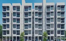
True Central Kothur
NEW ECO VISION INFRA DEVELOPERS · Rangareddy · RERA P02400001023
TRUE CENTRAL KOTHUR is a plotted residential open layout in Nandhigam Village, Nandigama Mandal, Ranga Reddy District. The registered promoter is New Eco Vision Infra Developers. The layout covers 12,140.05 Sq.m; the supplied records do not state a complete plot count or plot-size configurations. TG-RERA registration number P02400001023 records a proposed completion date of 30/01/2021.
01What we found
Read from TG-RERA filings, approvals, land and registration records and court records. A court case is counted only when the court record states this project's survey number with its village, or names the project.
02Check before you pay
10 items to check before you pay, 5 high - from the title chain, court records and approvals, each with what to ask the builder or your advocate. An item may not be a problem with the project: records can be incomplete.
1. Project at a glance
Project identity
| Item | Project record |
|---|---|
| Registered project name | TRUE CENTRAL KOTHUR RERA record |
| Project type | Plotted development; the HMDA plan describes a proposed residential open layout. RERA record |
| Phase / registered portion | No separate phase designation is disclosed. The registered project concerns the plotted layout on Survey No. 547/P. RERA record |
| TG-RERA registration | P02400001023. The certificate records validity from 12/07/2019 to 30/01/2021; an extension is not recorded in the supplied certificate. Registration validity is separate from the project’s completion date. Approvals record |
| Registered promoter | New Eco Vision Infra Developers. RERA record |
| RERA status | The certificate records registration; the supplied certificate’s validity ended on 30/01/2021. Current registration status is not independently established by the supplied materials. Approvals record |
Land and geographic identity
| Item | Project record |
|---|---|
| Locality / revenue village | Nandhigam Village in the RERA identity record; the HMDA plan identifies Nandigama Village. RERA record RERA filing |
| Mandal / district / PIN | Nandigama Mandal, Ranga Reddy District; PIN 509216 in the registration certificate. RERA record |
| Project survey number and subdivision | 547/P (also written 547/p in the HMDA plan). No further project subdivision is stated in the supplied layout approval. RERA record Land records |
| Registered layout extent | 12,140.05 Sq.m. RERA filing |
| Total / net area | The HMDA approval records total site area 12140.05 Sq.m, affected area 0, and net site area 12140.05 Sq.m. |
| Boundaries | North: ROAD WIDTH 9; South: OTHERS PROPERTY; East: OTHER PROPERTY; West: OTHERS PROPERTY. RERA filing |
| Cadastral-record extent | Bhu Bharati GIS lists Survey No. 547/P with extent 68515.41 sq.m on a whole-survey basis; this is a survey-level record, not the registered project-layout extent. Cadastral map |
Development identity
| Item | Project record |
|---|---|
| Sanctioning authority | Hyderabad Metropolitan Development Authority (HMDA). |
| Principal layout approval | HMDA Layout Permit 000025/LO/Plg/HMDA/2019, dated 30 January, 2019; file 016963/SMD/LT/U6/HMDA/03112018. The RERA filing also lists plan approval number 000025/LO/PLG/HMDA/2. Approvals record |
| Approved use / layout character | Proposed residential open layout for plots. |
| Approved built-up area | Not stated in the supplied layout approval; building plans are not supplied. |
| Buildings, floor configuration and parking levels | Not applicable to the supplied plotted-layout plan; no building or parking-level details are provided. |
| Plot count / unit count | The supplied approval identifies mortgaged plots 21–26 (six plots) but does not establish a complete total plot count. The RERA-filed plot inventory/count is not supplied. |
Offering and status
| Item | Project record |
|---|---|
| RERA-filed offering | Residential plots; plot-by-plot sizes and total inventory are not provided in the supplied RERA records. RERA record |
| Construction / development stage | No current, independently verified site-progress record is supplied. Document index |
| Completion dates | RERA header lists proposed completion 30/01/2021; Form B records a two-year completion undertaking. These are promoter-filed declarations, not evidence of completion. RERA record |
| Occupancy / completion certificate | No occupancy or completion certificate is supplied. For a plotted layout, no building-level OC scope is established by these documents. Document index |
| Plot area and layout land uses | The HMDA layout records plotted area 7259.84 Sq.m, layout roads 3553.77 Sq.m, open space 1022.10 Sq.m, and social infrastructure 303.74 Sq.m. It separately identifies 1158.33 Sq.m in plots 21–26 as mortgaged to HMDA. |
2. The project story
TRUE CENTRAL KOTHUR is registered as a plotted residential development on Survey No. 547/P in Nandhigam/Nandigama Village, Nandigama Mandal, Ranga Reddy District. The HMDA-filed plan is for an open layout over 12,140.05 Sq.m, with internal roads, open space and a social-infrastructure area shown in its area schedule. RERA record RERA filing
The available documents describe a layout, not a programme of apartment blocks or villas. They do not establish the complete plot inventory, current construction or infrastructure progress, or that any part has received a completion certificate. The promoter’s Form B states a two-year completion undertaking, while the RERA header records a proposed completion date of 30/01/2021; neither is independent confirmation of delivered works. RERA record
3. Master plan, architecture & building design
The HMDA plan depicts a residential plot layout rather than buildings. It records a total and net site area of 12,140.05 Sq.m, with 0 shown for master-plan-road affected area. The plan lists 7259.84 Sq.m as plotted area, 3553.77 Sq.m as road area, 1022.10 Sq.m as organized open space/park/utility area, and 303.74 Sq.m as social infrastructure area. These are layout-plan area categories, not building, saleable or carpet areas.
The plan specifies an abutting road width of 9.14 and identifies plots 21 to 26, totaling 1158.33 Sq.m, as mortgaged to HMDA. It also refers to a Utility SUMPTR. The supplied records do not provide plot-by-plot measurements, a complete plot schedule, building footprints, building plans or architectural floor plans.
4. Homes, configurations & floor plans
This is a plotted project; the supplied RERA records do not contain a complete plot schedule or RERA-filed plot-size bands. The HMDA plan’s land-use schedule is:
| Layout component | Area shown | Evidence |
|---|---|---|
| Plotted area | 7259.84 Sq.m | HMDA layout plan |
| Road area | 3553.77 Sq.m | HMDA layout plan |
| Organized open space/park/utility area | 1022.10 Sq.m | HMDA layout plan |
| Social infrastructure area | 303.74 Sq.m | HMDA layout plan |
| Mortgage area, plots 21–26 | 1158.33 Sq.m | HMDA layout plan |
A third-party listing supplies individual plot-size figures from 1412 sq.ft through 4757 sq.ft, but those figures are not presented as RERA-filed plot sizes and are not used here to establish the project’s saleable inventory. Promoter website
The floor-plan review contains two layout sheets and no dwelling-unit drawings measured for carpet area. Accordingly, no carpet area, loading, room arrangement or unit configuration is available for this plotted development. Floor plans
5. Parking & vehicle circulation
No sanctioned car or two-wheeler parking count, visitor or accessible parking allocation, or plot-specific parking arrangement is established in the supplied layout records. The plan identifies internal layout roads and an abutting road width of 9.14, but does not provide detailed vehicle-circulation dimensions or parking bays.
6. Amenities, recreation & open spaces
| Facility | Description / size | Evidence source | Declared progress / verified status |
|---|---|---|---|
| Internal roads | 3553.77 Sq.m road area; plan states abutting road width 9.14 | HMDA layout plan | Shown in the plan; completion is not independently verified. |
| Organized open space / park / utility area | 1022.10 Sq.m in the plan’s area schedule | HMDA layout plan | Shown in the plan; completion is not independently verified. |
| Social infrastructure area | 303.74 Sq.m | HMDA layout plan | Shown in the plan; no specific facility, building or delivery status is supplied. |
| Utility sump | “Utility SUMPTR” | HMDA plan extraction | Identified in the plan extraction; capacity and completion status are not supplied. |
| Clubhouse, swimming pool, gym, indoor games and children’s zones | No sanctioned details or sizes supplied | Third-party listing Promoter website | Listing claims only; not established as sanctioned or delivered project facilities. |
| Landscaped gardens | No plan size supplied | Third-party listing Promoter website | Listing claim; independent completion status is not supplied. |
7. Utilities, building services & safety
The HMDA approval extraction lists proposed layout infrastructure including storm-water drains, underground drainage lines, a common septic tank/STP, internal water-supply pipelines, an overhead tank, electrical supply lines, a transformer, street lights, avenue plantation, park development and rainwater-harvesting pits. These are approval-record descriptions; the supplied evidence does not establish construction completion, system capacities, service connections or independent testing.
The plan extraction also refers to a utility sump without providing a capacity. No project-specific details are supplied for fire-safety systems, emergency access, waste segregation, CCTV/security, accessibility provisions, backup power or EV charging. Document index
8. Location, access & connectivity
The registered location is Nandhigam Village, Nandigama Mandal, Ranga Reddy District, PIN 509216 in the TG-RERA certificate. The HMDA plan likewise places the layout in Nandigama Village and shows an abutting road width of 9.14. RERA record
The location record gives a sampled distance of 22.2 km to the nearest sampled Outer Ring Road interchange, marked approximate. Location record A third-party listing gives school and hospital distances and describes the location as Kothur, NH 7, Hyderabad; these are not used as registered-location or RERA-verified connectivity details. Promoter website
9. Developer & development status
The registered promoter is NEW ECO VISION INFRA DEVELOPERS, identified in the RERA filing as a partnership. The supplied partnership record names ALUKA NARENDAR REDDY and ELUKA SRIDHAR REDDY as partners; the registration certificate records the promoter as New Eco Vision Infra Developers. RERA record Corporate record
The promoter’s Form B declares legal title, states that the land is free from encumbrances, and undertakes completion within two years. These are promoter declarations in the filed affidavit, not independent findings about title or completed development. The RERA header lists a proposed completion date of 30/01/2021; current site progress and a revised completion date are not established in the supplied records. RERA record
10. Approvals, official records & documents
| Record | What the supplied document establishes |
|---|---|
| TG-RERA registration certificate, P02400001023 | Form C records registration of TRUE CENTRAL KOTHUR from 12/07/2019 to 30/01/2021 and includes registration conditions. |
| HMDA layout approval, 000025/LO/Plg/HMDA/2019 | HMDA plan dated 30 January, 2019 for a proposed residential open layout in Survey No. 547/p, with an extent of 12,140.05 Sq.m. |
| HMDA approval / draft-permission record | Records six plots, 21–26, totaling 1158.33 Sq.m, mortgaged to the Metropolitan Commissioner, HMDA, and lists conditions for development and release of the final layout. |
| Layout drawing and area schedule | Records the plotted, road, open-space/park/utility and social-infrastructure areas summarized above. |
| Form B affidavit-cum-declaration | Promoter declarations on title, encumbrances, accounts, approvals and a two-year completion undertaking. |
| HMDA payment records | E-payment slips and challan information; these records do not themselves establish layout or building approval. |
| Occupancy/completion certificate | Not present in the supplied documents. Document index |
1. Project at a glance
Project identity
Registered project name: TRUE CENTRAL KOTHUR
Project type: Plotted development; the HMDA plan describes a proposed residential open layout.
Phase / registered portion: No separate phase designation is disclosed. The registered project concerns the plotted layout on Survey No. 547/P.
TG-RERA registration: P02400001023. The certificate records validity from 12/07/2019 to 30/01/2021; an extension is not recorded in the supplied certificate. Registration validity is separate from the project’s completion date.
Registered promoter: New Eco Vision Infra Developers.
RERA status: The certificate records registration; the supplied certificate’s validity ended on 30/01/2021. Current registration status is not independently established by the supplied materials.
Land and geographic identity
Locality / revenue village: Nandhigam Village in the RERA identity record; the HMDA plan identifies Nandigama Village.
Mandal / district / PIN: Nandigama Mandal, Ranga Reddy District; PIN 509216 in the registration certificate.
Project survey number and subdivision: 547/P (also written 547/p in the HMDA plan). No further project subdivision is stated in the supplied layout approval.
Registered layout extent: 12,140.05 Sq.m.
Total / net area: The HMDA approval records total site area 12140.05 Sq.m, affected area 0, and net site area 12140.05 Sq.m.
Boundaries: North: ROAD WIDTH 9; South: OTHERS PROPERTY; East: OTHER PROPERTY; West: OTHERS PROPERTY.
Cadastral-record extent: Bhu Bharati GIS lists Survey No. 547/P with extent 68515.41 sq.m on a whole-survey basis; this is a survey-level record, not the registered project-layout extent.
Development identity
Sanctioning authority: Hyderabad Metropolitan Development Authority (HMDA).
Principal layout approval: HMDA Layout Permit 000025/LO/Plg/HMDA/2019, dated 30 January, 2019; file 016963/SMD/LT/U6/HMDA/03112018. The RERA filing also lists plan approval number 000025/LO/PLG/HMDA/2.
Approved use / layout character: Proposed residential open layout for plots.
Approved built-up area: Not stated in the supplied layout approval; building plans are not supplied.
Buildings, floor configuration and parking levels: Not applicable to the supplied plotted-layout plan; no building or parking-level details are provided.
Plot count / unit count: The supplied approval identifies mortgaged plots 21–26 (six plots) but does not establish a complete total plot count. The RERA-filed plot inventory/count is not supplied.
Offering and status
RERA-filed offering: Residential plots; plot-by-plot sizes and total inventory are not provided in the supplied RERA records.
Construction / development stage: No current, independently verified site-progress record is supplied.
Completion dates: RERA header lists proposed completion 30/01/2021; Form B records a two-year completion undertaking. These are promoter-filed declarations, not evidence of completion.
Occupancy / completion certificate: No occupancy or completion certificate is supplied. For a plotted layout, no building-level OC scope is established by these documents.
Plot area and layout land uses: The HMDA layout records plotted area 7259.84 Sq.m, layout roads 3553.77 Sq.m, open space 1022.10 Sq.m, and social infrastructure 303.74 Sq.m. It separately identifies 1158.33 Sq.m in plots 21–26 as mortgaged to HMDA.
2. The project story
TRUE CENTRAL KOTHUR is registered as a plotted residential development on Survey No. 547/P in Nandhigam/Nandigama Village, Nandigama Mandal, Ranga Reddy District. The HMDA-filed plan is for an open layout over 12,140.05 Sq.m, with internal roads, open space and a social-infrastructure area shown in its area schedule.
The available documents describe a layout, not a programme of apartment blocks or villas. They do not establish the complete plot inventory, current construction or infrastructure progress, or that any part has received a completion certificate. The promoter’s Form B states a two-year completion undertaking, while the RERA header records a proposed completion date of 30/01/2021; neither is independent confirmation of delivered works.
3. Master plan, architecture & building design
The HMDA plan depicts a residential plot layout rather than buildings. It records a total and net site area of 12,140.05 Sq.m, with 0 shown for master-plan-road affected area. The plan lists 7259.84 Sq.m as plotted area, 3553.77 Sq.m as road area, 1022.10 Sq.m as organized open space/park/utility area, and 303.74 Sq.m as social infrastructure area. These are layout-plan area categories, not building, saleable or carpet areas.
The plan specifies an abutting road width of 9.14 and identifies plots 21 to 26, totaling 1158.33 Sq.m, as mortgaged to HMDA. It also refers to a Utility SUMPTR. The supplied records do not provide plot-by-plot measurements, a complete plot schedule, building footprints, building plans or architectural floor plans.
4. Homes, configurations & floor plans
This is a plotted project; the supplied RERA records do not contain a complete plot schedule or RERA-filed plot-size bands. The HMDA plan’s land-use schedule is:
| Layout component | Area shown | Evidence |
|---|---|---|
| Plotted area | 7259.84 Sq.m | HMDA layout plan |
| Road area | 3553.77 Sq.m | HMDA layout plan |
| Organized open space/park/utility area | 1022.10 Sq.m | HMDA layout plan |
| Social infrastructure area | 303.74 Sq.m | HMDA layout plan |
| Mortgage area, plots 21–26 | 1158.33 Sq.m | HMDA layout plan |
A third-party listing supplies individual plot-size figures from 1412 sq.ft through 4757 sq.ft, but those figures are not presented as RERA-filed plot sizes and are not used here to establish the project’s saleable inventory.
The floor-plan review contains two layout sheets and no dwelling-unit drawings measured for carpet area. Accordingly, no carpet area, loading, room arrangement or unit configuration is available for this plotted development.
5. Parking & vehicle circulation
No sanctioned car or two-wheeler parking count, visitor or accessible parking allocation, or plot-specific parking arrangement is established in the supplied layout records. The plan identifies internal layout roads and an abutting road width of 9.14, but does not provide detailed vehicle-circulation dimensions or parking bays.
6. Amenities, recreation & open spaces
| Facility | Description / size | Evidence source | Declared progress / verified status |
|---|---|---|---|
| Internal roads | 3553.77 Sq.m road area; plan states abutting road width 9.14 | HMDA layout plan | Shown in the plan; completion is not independently verified. |
| Organized open space / park / utility area | 1022.10 Sq.m in the plan’s area schedule | HMDA layout plan | Shown in the plan; completion is not independently verified. |
| Social infrastructure area | 303.74 Sq.m | HMDA layout plan | Shown in the plan; no specific facility, building or delivery status is supplied. |
| Utility sump | “Utility SUMPTR” | HMDA plan extraction | Identified in the plan extraction; capacity and completion status are not supplied. |
| Clubhouse, swimming pool, gym, indoor games and children’s zones | No sanctioned details or sizes supplied | Third-party listing | Listing claims only; not established as sanctioned or delivered project facilities. |
| Landscaped gardens | No plan size supplied | Third-party listing | Listing claim; independent completion status is not supplied. |
7. Utilities, building services & safety
The HMDA approval extraction lists proposed layout infrastructure including storm-water drains, underground drainage lines, a common septic tank/STP, internal water-supply pipelines, an overhead tank, electrical supply lines, a transformer, street lights, avenue plantation, park development and rainwater-harvesting pits. These are approval-record descriptions; the supplied evidence does not establish construction completion, system capacities, service connections or independent testing.
The plan extraction also refers to a utility sump without providing a capacity. No project-specific details are supplied for fire-safety systems, emergency access, waste segregation, CCTV/security, accessibility provisions, backup power or EV charging.
8. Location, access & connectivity
The registered location is Nandhigam Village, Nandigama Mandal, Ranga Reddy District, PIN 509216 in the TG-RERA certificate. The HMDA plan likewise places the layout in Nandigama Village and shows an abutting road width of 9.14.
The location record gives a sampled distance of 22.2 km to the nearest sampled Outer Ring Road interchange, marked approximate. A third-party listing gives school and hospital distances and describes the location as Kothur, NH 7, Hyderabad; these are not used as registered-location or RERA-verified connectivity details.
9. Developer & development status
The registered promoter is NEW ECO VISION INFRA DEVELOPERS, identified in the RERA filing as a partnership. The supplied partnership record names ALUKA NARENDAR REDDY and ELUKA SRIDHAR REDDY as partners; the registration certificate records the promoter as New Eco Vision Infra Developers.
The promoter’s Form B declares legal title, states that the land is free from encumbrances, and undertakes completion within two years. These are promoter declarations in the filed affidavit, not independent findings about title or completed development. The RERA header lists a proposed completion date of 30/01/2021; current site progress and a revised completion date are not established in the supplied records.
10. Approvals, official records & documents
TG-RERA registration certificate, P02400001023: Form C records registration of TRUE CENTRAL KOTHUR from 12/07/2019 to 30/01/2021 and includes registration conditions.
HMDA layout approval, 000025/LO/Plg/HMDA/2019: HMDA plan dated 30 January, 2019 for a proposed residential open layout in Survey No. 547/p, with an extent of 12,140.05 Sq.m.
HMDA approval / draft-permission record: Records six plots, 21–26, totaling 1158.33 Sq.m, mortgaged to the Metropolitan Commissioner, HMDA, and lists conditions for development and release of the final layout.
Layout drawing and area schedule: Records the plotted, road, open-space/park/utility and social-infrastructure areas summarized above.
Form B affidavit-cum-declaration: Promoter declarations on title, encumbrances, accounts, approvals and a two-year completion undertaking.
HMDA payment records: E-payment slips and challan information; these records do not themselves establish layout or building approval.
Occupancy/completion certificate: Not present in the supplied documents.
Frequently asked questions
Is TRUE CENTRAL KOTHUR registered with Telangana RERA?
Yes. TRUE CENTRAL KOTHUR is registered with the Telangana Real Estate Regulatory Authority as P02400001023; the registration status is New Project.
Who is the developer of TRUE CENTRAL KOTHUR?
The promoter named in the RERA registration is NEW ECO VISION INFRA DEVELOPERS.
Where is TRUE CENTRAL KOTHUR located?
TRUE CENTRAL KOTHUR is in NANDHIGAM VILLAGE, Nandhigam, Nandigama, Rangareddy, Telangana (509216).
When will TRUE CENTRAL KOTHUR be completed?
The promoter's proposed date of completion filed with RERA is 30/01/2021. This is the promoter's declaration, not a guarantee.
More projects in Nandhigam