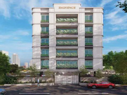
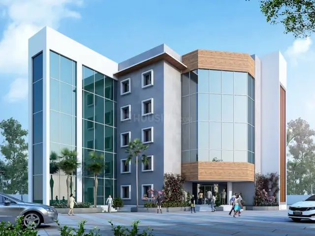
Icon Hill Ridge - II
ICON DEVELOPERS GROUP · Rangareddy · RERA P02400009281
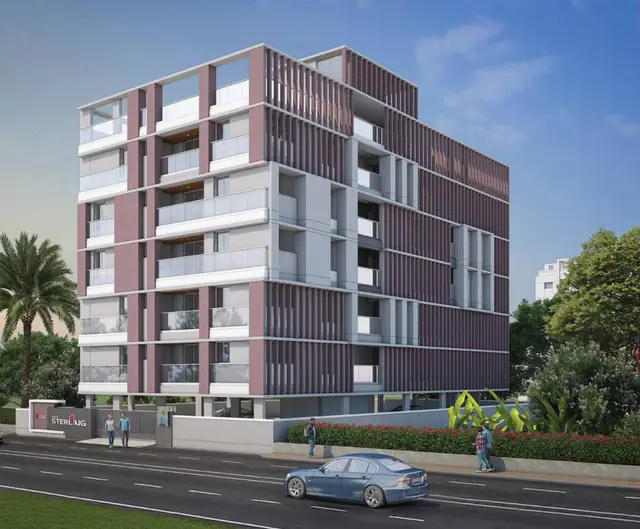
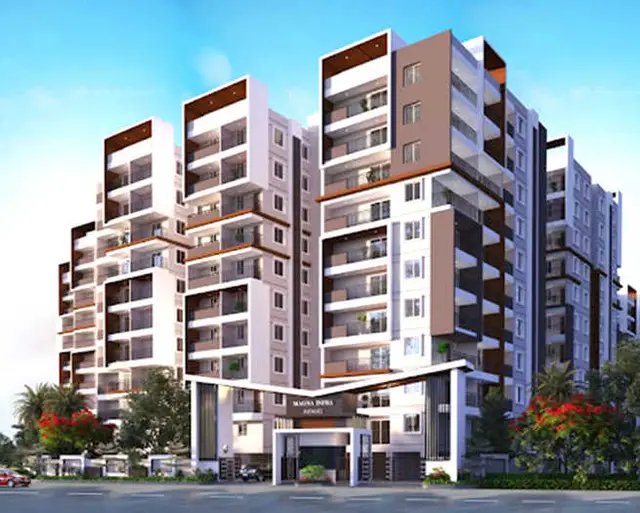
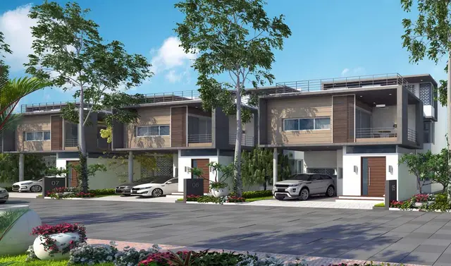
ICON HILL RIDGE - II is a residential apartments project at SNEHITA HILLS, Peeramchruvu village, Gandipet mandal, Ranga Reddy district, developed by registered promoter ICON DEVELOPERS GROUP. It is on 739.44 sq. m of land and comprises one residential building with 1 Stilt + 5 upper floors and 10 dwelling units, offered as 3BHK. The project is registered under TG-RERA **P02400009281**; the header records proposed completion as **26/06/2027**.
More from Icon Developers Group · 3 projects →
01What we found
Read from TG-RERA filings, approvals, land and registration records and court records. A court case is counted only when the court record states this project's survey number with its village, or names the project.
02Check before you pay
8 items to check before you pay, 3 high - from the title chain, court records and approvals, each with what to ask the builder or your advocate. An item may not be a problem with the project: records can be incomplete.
1. Project at a glance
Project identity
| Item | Record |
|---|---|
| Registered project name | ICON HILL RIDGE - II RERA record |
| Project type | Residential apartments RERA record |
| Phase / registered portion | The registration identifies ICON HILL RIDGE - II. The filed building approval describes the site as SNEHITA HILLS PHASE-I; the precise relationship between that phase label and the registered project is not further specified in the supplied record. RERA record |
| TG-RERA registration | P02400009281 RERA record |
| Registration validity | 26/02/2024 to 26/02/2027, unless extended by the Authority. This is the registration-validity period, distinct from the promoter’s stated completion date. RERA record |
| Registered promoter | ICON DEVELOPERS GROUP, identified in the registration as the promoter. RERA record |
| RERA status | Registered; the supplied registration record states the validity period above. RERA record |
Land and geographic identity
| Item | Record |
|---|---|
| Locality | SNEHITA HILLS; the filed approval also uses SNEHITA HILLS PHASE-I. RERA record |
| Revenue village | Peeramchruvu; the building-plan documents spell it PEERANCHERUVU / Peeramcheruvu. RERA record |
| Mandal / district | Gandipet, Ranga Reddy. RERA record |
| PIN | 500091. RERA record |
| Survey identity | Survey No. 24 IN PART NO 5. The filed plan identifies Plot No. 147 and Plot No. 146/P (Northern Part) in that survey portion. RERA record |
| Site extent | RERA land record: 739.44 sq. m total and net area. The filed approval-plan extraction records 739.29 sq.mt as minimum/plot and net area. Land records |
| Boundaries | East: 40 FEET ROAD; west: PLOT NO 145 PART AND 132 PART; north: PLOT NO 148; south: PLOT NO 146 PART SOUTHERN PART. Land records |
| Filed-plan road reference | 12.00 MTR ROAD. |
Development identity
| Item | Record |
|---|---|
| Sanctioning authority | Bandlaguda Jagir Municipal Corporation; the filed plan also identifies TS-DTCP as authority/delegated authority. Approvals record |
| Principal building approval | 0006/BP/3130/2024, approved 26 February, 2024. The associated file number is 000386/BP/DTCP/3130/0005/2024. Approvals record |
| Approved development | One residential building; 1 Stilt + 5 upper floors. |
| Approved built-up area | 1,990.55 m² excluding parking; 2,388.65 m² including parking, as recorded in the filed approval-plan extraction. The building-permit extraction separately records residential upper-floors area of 1,990.55 m² and stilt area of 383.61 m². |
| Height | The filed approval-plan extraction records Total height: 19.99mt., 17.73 mt. from GL, and 14.98 mt. Excluding Stilt Floor. The building-permit extraction records Height (m): 14.98. |
| Units | 10 dwelling units in the approved-plan extraction; the RERA-filed offering also lists 10 units. RERA unit table |
| Parking provision | The filed approval-plan extraction records TOTAL PARKING AREA: 398.10 and VACANT PLOT AREA: 341.18; it does not provide a count of parking spaces. |
| Approval validity | The building-permit extraction states a six-year permission period from the order date, with validity recorded through 26 February, 2027. This is separate from RERA registration validity. |
Offering and status
| Item | Record |
|---|---|
| RERA-filed configuration | 3BHK. [unit_types] RERA unit table |
| RERA-filed saleable area | 245.26 sq. m per listed configuration. This is saleable area, not a carpet-area measurement. [unit_types] RERA unit table |
| Booked / available | 0 booked; 10 available, as shown in the supplied TG-RERA configuration record. The portal data has no stated as-of date, so counts are indicative. [unit_types] |
| Promoter-declared completion | 26.02.2027 in the Form B declaration. The RERA header also records proposed completion as 26/06/2027; the supplied records do not establish which date is the current approved completion deadline. RERA record |
| Construction stage | No independently verified site-progress status is supplied. The TG-RERA amenity record shows 0% for each listed item; this is not an independently verified construction assessment. RERA amenities |
| Occupancy / completion certificate | The supplied building-permit extraction says a completion notice and occupancy certificate are required after construction and records completion_certified: false. No occupancy certificate is supplied. |
2. The project story
ICON HILL RIDGE - II is registered as a residential apartment project at SNEHITA HILLS, in Peeramchruvu village, Gandipet mandal, Ranga Reddy district. The registered land reference is Survey No. 24 IN PART NO 5, with the filed plan locating the building on Plot No. 147 and Plot No. 146/P (Northern Part). RERA record Land records
The filed building approval describes one residential building with a stilt level and five upper floors, and records ten dwelling units. The RERA offering is ten 3BHK units. The supplied evidence does not establish construction progress through an independent site inspection; the RERA progress fields supplied here show 0% for the listed project facilities. No occupancy certificate is included. [unit_types] RERA amenities
The promoter’s Form B declaration states a completion undertaking of 26.02.2027. The project header separately records a proposed completion date of 26/06/2027; the available record does not establish a revised or currently approved completion date. RERA record
3. Master plan, architecture & building design
The filed plan describes a single residential building on a site recorded in the plan extraction as 739.29 sq.mt, with 1 Stilt + 5 upper floors. It records 1,990.55 as total proposed built-up area excluding parking and 2,388.65 including parking. The building-permit extraction records 1,990.55 m² for residential upper floors and 383.61 m² for the stilt area. These are approval-plan figures; no FSI-counted area, carpet area for the whole building, or independently measured building footprint is supplied.
The plan extraction records 398.10 as total parking area and identifies percolation pit and soak pit under utilities. The building-permit conditions also call for a rainwater-harvesting structure (percolation pit), transformer space and a garbage house. The supplied evidence does not detail the number of flats per floor, lifts, stairs, circulation layout, landscaped-area dimensions or detailed residential/common-area distribution.
4. Homes, configurations & floor plans
The TG-RERA filing lists ten 3BHK units, all shown as available, with a RERA-filed saleable area of 245.26 sq. m. No carpet-area measurement for the filed 3BHK configuration is supplied. The approved-plan drawings have software-measured designs labelled 1BHK, 2BHK, 4BHK and 5BHK, but those measurements are not RERA-filed unit disclosures and are not counted here as the project’s registered offering. [unit_types] RERA unit table Floor plans RERA unit details
| Configuration | Units | Booked | Available | RERA saleable area | Measured carpet area | Loading (if supplied) |
|---|---|---|---|---|---|---|
| 3BHK | 10 | 0 | 10 | 245.26 sq. m | Not supplied for this configuration | Not supplied |
Saleable area and carpet area are different measures: the supplied drawing-measurement note states that drawing-based carpet area is measured from plan geometry and is smaller than saleable area, which also includes the home’s share of common areas. No RERA-filed carpet area or loading figure is provided for the 3BHK offering. Floor plans [unit_types]
5. Parking & vehicle circulation
The filed approval-plan extraction records TOTAL PARKING AREA: 398.10. The supplied records do not establish a number of parking spaces, the allocation of spaces to individual units, a visitor or accessible-parking provision, or whether parking is surface, stilt, mechanical or otherwise arranged. The approval describes a stilt level, but that alone does not establish a particular parking allocation or exclusive ownership for a buyer.
The filed plan refers to a 12.00 MTR ROAD; the RERA land record gives an eastern boundary of 40 FEET ROAD. No ramp, internal-driveway or pedestrian-separation details are supplied in the reviewed evidence. Land records
6. Amenities, recreation & open spaces
The TG-RERA amenity record lists the following infrastructure and facilities. It shows 0% against each listed item; this is the filed progress value and is not independent verification of completion or site condition. RERA amenities
| Facility | Description / size | Evidence source | Declared progress / verified status |
|---|---|---|---|
| Green Strip / TOT LOT / Park | Size not supplied | TG-RERA amenity record RERA amenities; filed plan condition refers to a fenced TOT-LOT and maintained greenery | TG-RERA record: 0%; not independently verified |
| Aggregate area of recreational open space | Area not supplied | TG-RERA amenity record RERA amenities | 0%; not independently verified |
| Community buildings | No description or size supplied | TG-RERA amenity record RERA amenities | 0%; not independently verified |
| Internal roads & footpaths | No dimensions supplied | TG-RERA amenity record RERA amenities | 0%; not independently verified |
| Street lighting | No specification supplied | TG-RERA amenity record RERA amenities | 0%; not independently verified |
No project-specific clubhouse or indoor recreation schedule with sizes or capacities is supplied. The separate vendor material lists additional recreational claims, but these are not presented here as TG-RERA-declared or sanctioned facilities. Promoter website RERA amenities
7. Utilities, building services & safety
The TG-RERA amenity record marks water supply, sewerage, storm-water drains, water conservation/rainwater harvesting, energy management, and electrical meter room/sub-station/receiving station as available, but shows 0% progress for each. The record does not specify capacities, system design, source of water, treatment plant details, backup power capacity or delivery status. RERA amenities
The filed building-permit conditions require a rainwater-harvesting structure (percolation pit), space for a transformer and a garbage house. The filed plan extraction also lists a percolation pit and soak pit. These are approval/documented requirements or plan references; the supplied evidence does not verify installation or operation.
The filed-plan conditions mention electric-vehicle charging infrastructure for parking places and broadband/digital-connectivity provisions for new buildings. The supplied records do not confirm installed EV charging facilities, lift numbers or capacities, fire-safety systems, accessible circulation, CCTV, access control, waste-segregation arrangements or independent completion checks.
8. Location, access & connectivity
The registered location is SNEHITA HILLS, Peeramchruvu village, Gandipet mandal, Ranga Reddy district, PIN 500091. The filed plan locates the site in SNEHITA HILLS PHASE-I and identifies a 12.00 MTR ROAD; the RERA land record states that the eastern boundary is a 40 FEET ROAD. RERA record Land records
The supplied location record lists Financial District (Nanakramguda) — 6.5 km. No other measured distance, public-transport detail or project-specific approach-route description is supplied. Location record
9. Developer & development status
The registered promoter is ICON DEVELOPERS GROUP. The RERA filing identifies the organization type as Partnership and provides GSTIN 36AAJFI6063L1ZY. The supplied record does not provide a verified registered office address or official contact details for this Overview. RERA record Corporate record Parties record
The promoter’s Form B affidavit, dated 20/12/2024, declares that the project will be completed by 26.02.2027. The project header records proposed completion as 26/06/2027; the available material does not establish a revised approved deadline. No independently verified construction-progress report or occupancy certificate is supplied. RERA record
10. Approvals, official records & documents
| Supplied evidence | P02400009281, Form C registration certificate; validity 26/02/2024–26/02/2027 unless extended. |
|---|---|
| Scope / note | ICON HILL RIDGE - II; promoter identified as Icon Developers Group. |
| Supplied evidence | Approval No. 0006/BP/3130/2024, dated 26 February, 2024; file No. 000386/BP/DTCP/3130/0005/2024. |
|---|---|
| Scope / note | Building permit for one residential building, 1 Stilt + 5 upper floors, at Survey No. 24, IN PART NO.5. |
| Supplied evidence | Plan references Plot No. 147 and Plot No. 146/P (Northern Part), Survey No. 24 in part no.5, SNEHITA HILLS PHASE-I, Peeramchruvu. |
|---|---|
| Scope / note | Plan extraction records ten dwelling units and built-up/parking figures. |
| Supplied evidence | Form B affidavit dated 20/12/2024. |
|---|---|
| Scope / note | Includes the promoter’s completion undertaking and other declarations. |
| Supplied evidence | No certificate supplied; building-permit extraction records completion certification as false. |
|---|---|
| Scope / note | No occupancy-certified portion is established by the supplied evidence. |
| Supplied evidence | LRS Proceeding No. 4859/LPS/HMDA/2008; LRS number HMDAL013264; Floor handed over 1700/2024, dated 23 February, 2024; transaction reference TS/0875/2024. |
|---|---|
| Scope / note | Recorded as references in the building-permit extraction; underlying records are not supplied here. |
The supplied evidence does not include an occupancy certificate or a separate approved-layout certificate. The municipal building-permit conditions state that occupancy is compulsory before occupation and require the promoter to submit commencement and completion notices.
1. Project at a glance
Project identity
Registered project name: ICON HILL RIDGE - II
Project type: Residential apartments
Phase / registered portion: The registration identifies ICON HILL RIDGE - II. The filed building approval describes the site as SNEHITA HILLS PHASE-I; the precise relationship between that phase label and the registered project is not further specified in the supplied record.
TG-RERA registration: P02400009281
Registration validity: 26/02/2024 to 26/02/2027, unless extended by the Authority. This is the registration-validity period, distinct from the promoter’s stated completion date.
Registered promoter: ICON DEVELOPERS GROUP, identified in the registration as the promoter.
RERA status: Registered; the supplied registration record states the validity period above.
Land and geographic identity
Locality: SNEHITA HILLS; the filed approval also uses SNEHITA HILLS PHASE-I.
Revenue village: Peeramchruvu; the building-plan documents spell it PEERANCHERUVU / Peeramcheruvu.
Mandal / district: Gandipet, Ranga Reddy.
PIN: 500091.
Survey identity: Survey No. 24 IN PART NO 5. The filed plan identifies Plot No. 147 and Plot No. 146/P (Northern Part) in that survey portion.
Site extent: RERA land record: 739.44 sq. m total and net area. The filed approval-plan extraction records 739.29 sq.mt as minimum/plot and net area.
Boundaries: East: 40 FEET ROAD; west: PLOT NO 145 PART AND 132 PART; north: PLOT NO 148; south: PLOT NO 146 PART SOUTHERN PART.
Filed-plan road reference: 12.00 MTR ROAD.
Development identity
Sanctioning authority: Bandlaguda Jagir Municipal Corporation; the filed plan also identifies TS-DTCP as authority/delegated authority.
Principal building approval: 0006/BP/3130/2024, approved 26 February, 2024. The associated file number is 000386/BP/DTCP/3130/0005/2024.
Approved development: One residential building; 1 Stilt + 5 upper floors.
Approved built-up area: 1,990.55 m² excluding parking; 2,388.65 m² including parking, as recorded in the filed approval-plan extraction. The building-permit extraction separately records residential upper-floors area of 1,990.55 m² and stilt area of 383.61 m².
Height: The filed approval-plan extraction records Total height: 19.99mt., 17.73 mt. from GL, and 14.98 mt. Excluding Stilt Floor. The building-permit extraction records Height (m): 14.98.
Units: 10 dwelling units in the approved-plan extraction; the RERA-filed offering also lists 10 units.
Parking provision: The filed approval-plan extraction records TOTAL PARKING AREA: 398.10 and VACANT PLOT AREA: 341.18; it does not provide a count of parking spaces.
Approval validity: The building-permit extraction states a six-year permission period from the order date, with validity recorded through 26 February, 2027. This is separate from RERA registration validity.
Offering and status
RERA-filed configuration: 3BHK. [unit_types]
RERA-filed saleable area: 245.26 sq. m per listed configuration. This is saleable area, not a carpet-area measurement. [unit_types]
Booked / available: 0 booked; 10 available, as shown in the supplied TG-RERA configuration record. The portal data has no stated as-of date, so counts are indicative. [unit_types]
Promoter-declared completion: 26.02.2027 in the Form B declaration. The RERA header also records proposed completion as 26/06/2027; the supplied records do not establish which date is the current approved completion deadline.
Construction stage: No independently verified site-progress status is supplied. The TG-RERA amenity record shows 0% for each listed item; this is not an independently verified construction assessment.
Occupancy / completion certificate: The supplied building-permit extraction says a completion notice and occupancy certificate are required after construction and records completion_certified: false. No occupancy certificate is supplied.
2. The project story
ICON HILL RIDGE - II is registered as a residential apartment project at SNEHITA HILLS, in Peeramchruvu village, Gandipet mandal, Ranga Reddy district. The registered land reference is Survey No. 24 IN PART NO 5, with the filed plan locating the building on Plot No. 147 and Plot No. 146/P (Northern Part).
The filed building approval describes one residential building with a stilt level and five upper floors, and records ten dwelling units. The RERA offering is ten 3BHK units. The supplied evidence does not establish construction progress through an independent site inspection; the RERA progress fields supplied here show 0% for the listed project facilities. No occupancy certificate is included. [unit_types]
The promoter’s Form B declaration states a completion undertaking of 26.02.2027. The project header separately records a proposed completion date of 26/06/2027; the available record does not establish a revised or currently approved completion date.
3. Master plan, architecture & building design
The filed plan describes a single residential building on a site recorded in the plan extraction as 739.29 sq.mt, with 1 Stilt + 5 upper floors. It records 1,990.55 as total proposed built-up area excluding parking and 2,388.65 including parking. The building-permit extraction records 1,990.55 m² for residential upper floors and 383.61 m² for the stilt area. These are approval-plan figures; no FSI-counted area, carpet area for the whole building, or independently measured building footprint is supplied.
The plan extraction records 398.10 as total parking area and identifies percolation pit and soak pit under utilities. The building-permit conditions also call for a rainwater-harvesting structure (percolation pit), transformer space and a garbage house. The supplied evidence does not detail the number of flats per floor, lifts, stairs, circulation layout, landscaped-area dimensions or detailed residential/common-area distribution.
4. Homes, configurations & floor plans
The TG-RERA filing lists ten 3BHK units, all shown as available, with a RERA-filed saleable area of 245.26 sq. m. No carpet-area measurement for the filed 3BHK configuration is supplied. The approved-plan drawings have software-measured designs labelled 1BHK, 2BHK, 4BHK and 5BHK, but those measurements are not RERA-filed unit disclosures and are not counted here as the project’s registered offering. [unit_types]
| Configuration | Units | Booked | Available | RERA saleable area | Measured carpet area | Loading (if supplied) |
|---|---|---|---|---|---|---|
| 3BHK | 10 | 0 | 10 | 245.26 sq. m | Not supplied for this configuration | Not supplied |
Saleable area and carpet area are different measures: the supplied drawing-measurement note states that drawing-based carpet area is measured from plan geometry and is smaller than saleable area, which also includes the home’s share of common areas. No RERA-filed carpet area or loading figure is provided for the 3BHK offering. [unit_types]
5. Parking & vehicle circulation
The filed approval-plan extraction records TOTAL PARKING AREA: 398.10. The supplied records do not establish a number of parking spaces, the allocation of spaces to individual units, a visitor or accessible-parking provision, or whether parking is surface, stilt, mechanical or otherwise arranged. The approval describes a stilt level, but that alone does not establish a particular parking allocation or exclusive ownership for a buyer.
The filed plan refers to a 12.00 MTR ROAD; the RERA land record gives an eastern boundary of 40 FEET ROAD. No ramp, internal-driveway or pedestrian-separation details are supplied in the reviewed evidence.
6. Amenities, recreation & open spaces
The TG-RERA amenity record lists the following infrastructure and facilities. It shows 0% against each listed item; this is the filed progress value and is not independent verification of completion or site condition.
| Facility | Description / size | Evidence source | Declared progress / verified status |
|---|---|---|---|
| Green Strip / TOT LOT / Park | Size not supplied | TG-RERA amenity record; filed plan condition refers to a fenced TOT-LOT and maintained greenery | TG-RERA record: 0%; not independently verified |
| Aggregate area of recreational open space | Area not supplied | TG-RERA amenity record | 0%; not independently verified |
| Community buildings | No description or size supplied | TG-RERA amenity record | 0%; not independently verified |
| Internal roads & footpaths | No dimensions supplied | TG-RERA amenity record | 0%; not independently verified |
| Street lighting | No specification supplied | TG-RERA amenity record | 0%; not independently verified |
No project-specific clubhouse or indoor recreation schedule with sizes or capacities is supplied. The separate vendor material lists additional recreational claims, but these are not presented here as TG-RERA-declared or sanctioned facilities.
7. Utilities, building services & safety
The TG-RERA amenity record marks water supply, sewerage, storm-water drains, water conservation/rainwater harvesting, energy management, and electrical meter room/sub-station/receiving station as available, but shows 0% progress for each. The record does not specify capacities, system design, source of water, treatment plant details, backup power capacity or delivery status.
The filed building-permit conditions require a rainwater-harvesting structure (percolation pit), space for a transformer and a garbage house. The filed plan extraction also lists a percolation pit and soak pit. These are approval/documented requirements or plan references; the supplied evidence does not verify installation or operation.
The filed-plan conditions mention electric-vehicle charging infrastructure for parking places and broadband/digital-connectivity provisions for new buildings. The supplied records do not confirm installed EV charging facilities, lift numbers or capacities, fire-safety systems, accessible circulation, CCTV, access control, waste-segregation arrangements or independent completion checks.
8. Location, access & connectivity
The registered location is SNEHITA HILLS, Peeramchruvu village, Gandipet mandal, Ranga Reddy district, PIN 500091. The filed plan locates the site in SNEHITA HILLS PHASE-I and identifies a 12.00 MTR ROAD; the RERA land record states that the eastern boundary is a 40 FEET ROAD.
The supplied location record lists Financial District (Nanakramguda) — 6.5 km. No other measured distance, public-transport detail or project-specific approach-route description is supplied.
9. Developer & development status
The registered promoter is ICON DEVELOPERS GROUP. The RERA filing identifies the organization type as Partnership and provides GSTIN 36AAJFI6063L1ZY. The supplied record does not provide a verified registered office address or official contact details for this Overview.
The promoter’s Form B affidavit, dated 20/12/2024, declares that the project will be completed by 26.02.2027. The project header records proposed completion as 26/06/2027; the available material does not establish a revised approved deadline. No independently verified construction-progress report or occupancy certificate is supplied.
10. Approvals, official records & documents
| Supplied evidence | P02400009281, Form C registration certificate; validity 26/02/2024–26/02/2027 unless extended. |
|---|---|
| Scope / note | ICON HILL RIDGE - II; promoter identified as Icon Developers Group. |
| Supplied evidence | Approval No. 0006/BP/3130/2024, dated 26 February, 2024; file No. 000386/BP/DTCP/3130/0005/2024. |
|---|---|
| Scope / note | Building permit for one residential building, 1 Stilt + 5 upper floors, at Survey No. 24, IN PART NO.5. |
| Supplied evidence | Plan references Plot No. 147 and Plot No. 146/P (Northern Part), Survey No. 24 in part no.5, SNEHITA HILLS PHASE-I, Peeramchruvu. |
|---|---|
| Scope / note | Plan extraction records ten dwelling units and built-up/parking figures. |
| Supplied evidence | Form B affidavit dated 20/12/2024. |
|---|---|
| Scope / note | Includes the promoter’s completion undertaking and other declarations. |
| Supplied evidence | No certificate supplied; building-permit extraction records completion certification as false. |
|---|---|
| Scope / note | No occupancy-certified portion is established by the supplied evidence. |
| Supplied evidence | LRS Proceeding No. 4859/LPS/HMDA/2008; LRS number HMDAL013264; Floor handed over 1700/2024, dated 23 February, 2024; transaction reference TS/0875/2024. |
|---|---|
| Scope / note | Recorded as references in the building-permit extraction; underlying records are not supplied here. |
The supplied evidence does not include an occupancy certificate or a separate approved-layout certificate. The municipal building-permit conditions state that occupancy is compulsory before occupation and require the promoter to submit commencement and completion notices.
Frequently asked questions
Is ICON HILL RIDGE - II registered with Telangana RERA?
Yes. ICON HILL RIDGE - II is registered with the Telangana Real Estate Regulatory Authority as P02400009281; the registration status is New Project.
Who is the developer of ICON HILL RIDGE - II?
The promoter named in the RERA registration is ICON DEVELOPERS GROUP.
Where is ICON HILL RIDGE - II located?
ICON HILL RIDGE - II is in SNEHITA HILLS, Peeramchruvu, Gandipet, Rangareddy, Telangana (500091).
When will ICON HILL RIDGE - II be completed?
The promoter's proposed date of completion filed with RERA is 26/06/2027. This is the promoter's declaration, not a guarantee.
More projects in Peeramchruvu