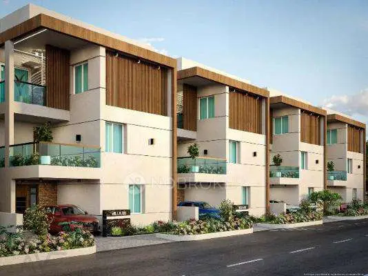
Vrindavan
PERENNIAL CONSTRUCTIONS · Medchal-Malkajgiri · RERA P02200006141
VRINDAVAN is a plotted development, an open residential layout in Aushapur, Ghatkesar Mandal, Medchal-Malkajgiri District. The registered promoter is PERENNIAL CONSTRUCTIONS, a partnership. The project covers 40386.62 sq.m. and its layout drawing identifies 84 plots; plot sizes are 150.5–3497.52 sq.m. TG-RERA registration number P02200006141 records a proposed completion date of 09/12/2024.
01What we found
Read from TG-RERA filings, approvals, land and registration records and court records. A court case is counted only when the court record states this project's survey number with its village, or names the project.
02Check before you pay
10 items to check before you pay, 6 high - from the title chain, court records and approvals, each with what to ask the builder or your advocate. An item may not be a problem with the project: records can be incomplete.
1. Project at a glance
Project identity
| Item | Project record |
|---|---|
| Registered project name | VRINDAVAN RERA record |
| Project type | Plotted development / open-plot layout RERA record RERA filing |
| Registered phase or portion | Not separately identified in the supplied record; registration is for VRINDAVAN, survey no. 13P |
| TG-RERA registration | P02200006141 RERA record |
| Registration validity | 24/04/2023 to 09/12/2024; the certificate says validity was subject to extension by the Authority. The supplied certificate records no extension. Approvals record |
| Registered promoter | PERENNIAL CONSTRUCTIONS, a partnership RERA record Corporate record RERA filing |
| RERA status | Recorded as On-Going Project in the project record. RERA record RERA filing |
Land and geographic identity
| Item | Project record |
|---|---|
| Revenue village | Aushapur RERA record Land records |
| Locality | Aushapur RERA record RERA filing |
| Mandal / district / PIN | Ghatkesar / Medchal-Malkajgiri / 501301 RERA record RERA filing |
| Survey number(s) and subdivisions | 13P; no further subdivision is identified in the supplied project record. RERA record Land records |
| Site area | 40386.62 sq.m. total; 38841.14 sq.m. net after 1545.48 sq.m. road-widening area. Land records |
| Boundaries | North: agricultural land in Sy. Nos. 10 and 14; South: Hyderabad–Warangal Highway Road; East: agricultural land in part of Sy. No. 15; West: agricultural land in part of Sy. No. 13. Land records |
| Cadastral record | Bhu Bharati shows survey 13P with an extent of 55603.41 sq.m. on a whole-survey basis; this is a cadastral record, not the registered project-site extent. Cadastral map |
Development identity
| Item | Project record |
|---|---|
| Sanctioning authority | Hyderabad Metropolitan Development Authority (HMDA) Approvals record |
| Principal layout approval | Draft Layout Permit No. 000401/LO/Plg/HMDA/2021, approved 09 December 2021; application reference 045942/GHT/LT/U6/HMDA/20052021. Approvals record |
| Layout drawing | Proposed draft open-plot layout; the drawing identifies 84 plots. Layout record |
| Approved built-up area | Not stated in the supplied layout approval records; the project is a plotted layout, and no building schedule is supplied. Approvals record RERA filing |
| Buildings, floors and parking levels | No sanctioned building count, floor configuration, building height or parking-level schedule is supplied. The HMDA letter states that buildings should not be constructed on plots before the final layout is issued. |
| Mortgage plots | The HMDA letter identifies 14 plots—Plots 61 to 67, 78 to 84—with an extent of 3848.94 sq.m., mortgaged in favour of HMDA. |
| RERA-declared units | Plot-level RERA inventory counts, unit configurations and booked/available counts are not supplied in this overview data. RERA record RERA unit table |
Offering and status
| Item | Project record |
|---|---|
| Offering | Plots in an open residential layout; the layout drawing identifies 84 plots. Layout record |
| Plot sizes | Software-measured from the layout drawing: 150.5–3497.52 sq.m. (180–4183 sq.yd.); median 167.23 sq.m. (200 sq.yd.). Drawing-based measurement, not a RERA-filed unit schedule. Layout record |
| Booked / available plots | Not supplied. RERA unit table |
| Progress | Project record states 80% completeness; this is a reported figure, not independent site verification. RERA record |
| Completion dates | Promoter-declared proposed and revised completion date: 09/12/2024. RERA record RERA filing |
| Registration deadline | Registration validity ended 09/12/2024, separately from the promoter’s declared completion date. |
| Occupancy / completion certificate | No occupancy or completion certificate is identified in the supplied records; the project is a plotted layout, and the supplied HMDA record is a draft layout permit. Document index |
2. The project story
VRINDAVAN is recorded with TG-RERA as a plotted development at Aushapur, Ghatkesar Mandal, Medchal-Malkajgiri District, on survey 13P. Its filed layout material describes an open residential layout rather than an apartment or multi-building scheme. The drawing identifies 84 plots, with internal roads, park/open-space and social-infrastructure areas. RERA record Land records
The project’s HMDA record is a draft layout permit dated 09 December 2021. It includes conditions concerning infrastructure, roads, open-space handover, mortgage plots and completion of developmental works; it also says final-layout release and release of mortgaged plots are to be considered after the conditions are met. The supplied material does not establish that final-layout release has occurred.
The project record reports 80% completeness, but no independent site inspection or completion evidence is supplied here. The promoter’s Form B affidavit undertakes completion by 09/12/2024; the registration certificate separately records validity through that date. Neither figure establishes that the layout works were completed or that a completion certificate was issued. RERA record
3. Master plan, architecture & building design
This is a plotted layout, so the supplied design evidence concerns plot arrangement and land use rather than building architecture. The layout drawing identifies 84 plots and lists total plot area of 40386.62 sq.m., net area of 38841.14 sq.m., and road widening of 1545.48 sq.m. Layout record
The drawing’s area statement allocates the net layout area as follows: 25020.99 sq.m. plotted area, 9536.37 sq.m. roads, 3310.99 sq.m. organized open space/park/utility area, and 972.95 sq.m. social infrastructure. It records 0.00 sq.m. amenity area. The figures are from the proposed layout drawing; the separate HMDA letter also contains an area statement. Layout record
The drawing identifies a 60.00 abutting road width and a 40' WIDE ROAD. The HMDA letter refers to proposed 30m wide master-plan roads, layout roads, and restrictions on blocking roads or enclosing the site with a compound wall.
The drawing lists plot sizes from 150.5 sq.m. to 3497.52 sq.m., measured by software from printed drawing labels; the median is 167.23 sq.m. These are drawing-derived measurements, not a RERA-filed plot schedule. Layout record
4. Homes, configurations & floor plans
This is a plotted project, not an apartment offering. The layout drawing identifies 84 plots; the supplied material does not give RERA-filed plot-by-plot saleable areas, booked plots or available plots. RERA unit table
| Figure | 84 |
|---|---|
| Basis | Printed plot numbers and areas on the layout drawing; software-measured extraction. Layout record |
| Figure | 150.5–3497.52 sq.m. (180–4183 sq.yd.) |
|---|---|
| Basis | Software-measured from the drawing; verify against the approved drawing and plot schedule. Layout record |
| Figure | 167.23 sq.m. (200 sq.yd.) |
|---|---|
| Basis | Software-measured from the drawing. Layout record |
| Figure | 200 sq.yd. (42 plots); 400 sq.yd. (13); 278 sq.yd. (5); 212 sq.yd. (3); 192 sq.yd. (2) |
|---|---|
| Basis | Software-measured extraction of drawing labels. Layout record |
| Figure | Not supplied |
|---|---|
| Basis | No plot-level RERA inventory schedule supplied. RERA unit table |
The layout-derived plot-size bands are: 150–200 sq.yd.: 4 plots; 200–250: 47; 250–300: 11; 300–400: 15; 400–500: 4; 500–1000: 1; 1000+: 2. These are drawing-based, software-extracted bands, not a substitute for the registered plot schedule. Layout record
No apartment carpet-area or loading figures apply to the plotted offering. The supplied floor-plan record contains two layout sheets and no measured dwelling floor plans. Floor plans
5. Parking & vehicle circulation
The supplied layout and RERA records do not establish a sanctioned parking-space count, visitor or accessible parking provision, or a legally documented parking allocation for individual plots. The HMDA letter identifies internal roads and requires roads to remain open for accessibility to neighbouring sites; it also prohibits blocking roads and enclosing the site with a compound wall.
The layout drawing’s road-width labels are 60.00 and 40' WIDE ROAD. The HMDA letter separately refers to proposed 30m wide master-plan roads. No vehicle-entry, ramp, driveway, pedestrian-separation or EV-charging details are supplied.
6. Amenities, recreation & open spaces
The layout drawing records park/open-space/utility and social-infrastructure land, but the supplied evidence does not establish that facilities are complete or independently verified.
| Facility | Description / size | Evidence source | Declared progress / verified status |
|---|---|---|---|
| Park / organized open space / utility area | 3310.99 sq.m. in the layout drawing | Draft layout drawing | Shown in the proposed layout; completion not independently verified. |
| Social infrastructure | 972.95 sq.m. | Draft layout drawing | Land allocation shown; no facility schedule or completion evidence supplied. |
| Tot lot | Drawing lists 2918.83 SQ MTS | Draft layout drawing | Listed on the drawing; delivery status not established. |
| Community buildings | Not quantified | RERA amenities record RERA amenities | Listed at 0% in the supplied amenities record. |
| Other marketed amenities | Vendor lists a community hall, swimming pool, gym, children’s play area and clubhouse | Vendor listing Promoter website | Marketing-source claims; not established by the supplied layout approval record or independent completion evidence. |
The RERA amenities record marks internal roads and footpaths, water supply, sewerage, storm-water drains, green strip/tot lot/park, street lighting, water conservation/rainwater harvesting, electrical meter room/sub-station/receiving station and aggregate recreational open space as available at 100%. These are recorded availability percentages, not independent verification of completed facilities. RERA amenities
7. Utilities, building services & safety
The HMDA draft layout letter lists common septic tank / STP, overhead tank, electrical supply lines, street lights, transformer and rainwater-harvesting pits among the proposed infrastructure. It does not provide capacities or establish completion.
The RERA amenities record marks water supply, sewerage (including chambers, lines, septic tank and STP), storm-water drains, street lighting, rainwater harvesting and electrical meter room/sub-station/receiving station as available at 100%. It records treatment and disposal of sewage and sullage water, solid-waste management, energy management and fire protection/fire-safety requirements at 0%. These are record fields; no independent inspection evidence or technical capacities are supplied. RERA amenities
A vendor listing states borewell water supply, power backup, CCTV and fire safety, among other features. These are vendor-reported claims, not established here as sanctioned or completed project facilities. Promoter website
8. Location, access & connectivity
The registered project location is Aushapur Village, Ghatkesar Mandal, Medchal-Malkajgiri District, Telangana, PIN 501301, survey 13P. The layout approval identifies the Hyderabad–Warangal Highway Road as the southern boundary and describes road widening and proposed master-plan roads. RERA record Land records
The supplied location data lists Financial District (Nanakramguda), 1.2 km from the provided geocode. The geocode is labelled as a cadastral parcel centroid; the material does not establish this as a verified travel distance or route distance. Location record
A vendor listing names nearby transport and everyday services in general terms, without measured distances. These are vendor-reported location claims. Promoter website
9. Developer & development status
The TG-RERA-registered promoter is PERENNIAL CONSTRUCTIONS, a partnership, with registered project location records identifying its office at PERENNIAL HOUSE, JODI METLA, AUSHAPUR, Ghatkesar, Medchal-Malkajgiri, 501301. Its GSTIN is 36AAYFP1380J2ZL. Corporate record RERA filing RERA filing
The project record names MOHANLAL BANOTH and JAIPAL REDDY GOPU as authorized signatories. The promoter’s Form B affidavit is dated 11 September 2022 and declares a completion undertaking of 09/12/2024. Parties record
The supplied project record reports 80% completeness. The figure is not accompanied here by an independent site verification report. No phase-wise schedule or final-layout/completion-certificate record is supplied. RERA record Document index
10. Approvals, official records & documents
| Identifier / date | P02200006141, issued 24/04/2023; validity to 09/12/2024 |
|---|---|
| What the supplied record establishes | Form C registers VRINDAVAN as a project on survey 13P and lists statutory conditions. No extension is recorded in the supplied certificate. |
| Identifier / date | 000401/LO/Plg/HMDA/2021, dated 09 December 2021 |
|---|---|
| What the supplied record establishes | Draft layout permit for an open-plot layout at Aushapur, survey 13P; includes mortgage, infrastructure, road-access and handover conditions. |
| Identifier / date | 045942/GHT/LT/U6/HMDA/20052021 |
|---|---|
| What the supplied record establishes | Application reference associated with the draft layout permit. |
| Identifier / date | HMDA drawing, DRAFT LAYOUT PLAN SCALE:1:600 |
|---|---|
| What the supplied record establishes | Shows plot arrangement, land-use areas, roads and 14 mortgage plots; the drawing is identified as a proposed draft layout plan. |
| Identifier / date | Dated 11 September 2022 |
|---|---|
| What the supplied record establishes | Promoter declarations include title, encumbrances, separate-account controls, approvals and completion undertaking. |
| Identifier / date | Not established by supplied records |
|---|---|
| What the supplied record establishes | The project is a plotted layout; the supplied HMDA document is a draft layout letter, not a building-specific commencement certificate. |
| Identifier / date | Not supplied |
|---|---|
| What the supplied record establishes | No certificate for the layout or any phase/tower is identified in the supplied documents. Document index |
The supplied HMDA draft letter also records mortgage deed 8022/2021 and gift deed 8021/2021 among its referenced instruments.
1. Project at a glance
Project identity
Registered project name: VRINDAVAN
Project type: Plotted development / open-plot layout
Registered phase or portion: Not separately identified in the supplied record; registration is for VRINDAVAN, survey no. 13P
TG-RERA registration: P02200006141
Registration validity: 24/04/2023 to 09/12/2024; the certificate says validity was subject to extension by the Authority. The supplied certificate records no extension.
Registered promoter: PERENNIAL CONSTRUCTIONS, a partnership
RERA status: Recorded as On-Going Project in the project record.
Land and geographic identity
Revenue village: Aushapur
Locality: Aushapur
Mandal / district / PIN: Ghatkesar / Medchal-Malkajgiri / 501301
Survey number(s) and subdivisions: 13P; no further subdivision is identified in the supplied project record.
Site area: 40386.62 sq.m. total; 38841.14 sq.m. net after 1545.48 sq.m. road-widening area.
Boundaries: North: agricultural land in Sy. Nos. 10 and 14; South: Hyderabad–Warangal Highway Road; East: agricultural land in part of Sy. No. 15; West: agricultural land in part of Sy. No. 13.
Cadastral record: Bhu Bharati shows survey 13P with an extent of 55603.41 sq.m. on a whole-survey basis; this is a cadastral record, not the registered project-site extent.
Development identity
Sanctioning authority: Hyderabad Metropolitan Development Authority (HMDA)
Principal layout approval: Draft Layout Permit No. 000401/LO/Plg/HMDA/2021, approved 09 December 2021; application reference 045942/GHT/LT/U6/HMDA/20052021.
Layout drawing: Proposed draft open-plot layout; the drawing identifies 84 plots.
Approved built-up area: Not stated in the supplied layout approval records; the project is a plotted layout, and no building schedule is supplied.
Buildings, floors and parking levels: No sanctioned building count, floor configuration, building height or parking-level schedule is supplied. The HMDA letter states that buildings should not be constructed on plots before the final layout is issued.
Mortgage plots: The HMDA letter identifies 14 plots—Plots 61 to 67, 78 to 84—with an extent of 3848.94 sq.m., mortgaged in favour of HMDA.
RERA-declared units: Plot-level RERA inventory counts, unit configurations and booked/available counts are not supplied in this overview data.
Offering and status
Offering: Plots in an open residential layout; the layout drawing identifies 84 plots.
Plot sizes: Software-measured from the layout drawing: 150.5–3497.52 sq.m. (180–4183 sq.yd.); median 167.23 sq.m. (200 sq.yd.). Drawing-based measurement, not a RERA-filed unit schedule.
Booked / available plots: Not supplied.
Progress: Project record states 80% completeness; this is a reported figure, not independent site verification.
Completion dates: Promoter-declared proposed and revised completion date: 09/12/2024.
Registration deadline: Registration validity ended 09/12/2024, separately from the promoter’s declared completion date.
Occupancy / completion certificate: No occupancy or completion certificate is identified in the supplied records; the project is a plotted layout, and the supplied HMDA record is a draft layout permit.
2. The project story
VRINDAVAN is recorded with TG-RERA as a plotted development at Aushapur, Ghatkesar Mandal, Medchal-Malkajgiri District, on survey 13P. Its filed layout material describes an open residential layout rather than an apartment or multi-building scheme. The drawing identifies 84 plots, with internal roads, park/open-space and social-infrastructure areas.
The project’s HMDA record is a draft layout permit dated 09 December 2021. It includes conditions concerning infrastructure, roads, open-space handover, mortgage plots and completion of developmental works; it also says final-layout release and release of mortgaged plots are to be considered after the conditions are met. The supplied material does not establish that final-layout release has occurred.
The project record reports 80% completeness, but no independent site inspection or completion evidence is supplied here. The promoter’s Form B affidavit undertakes completion by 09/12/2024; the registration certificate separately records validity through that date. Neither figure establishes that the layout works were completed or that a completion certificate was issued.
3. Master plan, architecture & building design
This is a plotted layout, so the supplied design evidence concerns plot arrangement and land use rather than building architecture. The layout drawing identifies 84 plots and lists total plot area of 40386.62 sq.m., net area of 38841.14 sq.m., and road widening of 1545.48 sq.m.
The drawing’s area statement allocates the net layout area as follows: 25020.99 sq.m. plotted area, 9536.37 sq.m. roads, 3310.99 sq.m. organized open space/park/utility area, and 972.95 sq.m. social infrastructure. It records 0.00 sq.m. amenity area. The figures are from the proposed layout drawing; the separate HMDA letter also contains an area statement.
The drawing identifies a 60.00 abutting road width and a 40' WIDE ROAD. The HMDA letter refers to proposed 30m wide master-plan roads, layout roads, and restrictions on blocking roads or enclosing the site with a compound wall.
The drawing lists plot sizes from 150.5 sq.m. to 3497.52 sq.m., measured by software from printed drawing labels; the median is 167.23 sq.m. These are drawing-derived measurements, not a RERA-filed plot schedule.
4. Homes, configurations & floor plans
This is a plotted project, not an apartment offering. The layout drawing identifies 84 plots; the supplied material does not give RERA-filed plot-by-plot saleable areas, booked plots or available plots.
| Plot information | Figure | Basis |
|---|---|---|
| Number of plots | 84 | Printed plot numbers and areas on the layout drawing; software-measured extraction. |
| Smallest to largest plot | 150.5–3497.52 sq.m. (180–4183 sq.yd.) | Software-measured from the drawing; verify against the approved drawing and plot schedule. |
| Median plot size | 167.23 sq.m. (200 sq.yd.) | Software-measured from the drawing. |
| Most common printed plot sizes | 200 sq.yd. (42 plots); 400 sq.yd. (13); 278 sq.yd. (5); 212 sq.yd. (3); 192 sq.yd. (2) | Software-measured extraction of drawing labels. |
| Booked / available counts | Not supplied | No plot-level RERA inventory schedule supplied. |
The layout-derived plot-size bands are: 150–200 sq.yd.: 4 plots; 200–250: 47; 250–300: 11; 300–400: 15; 400–500: 4; 500–1000: 1; 1000+: 2. These are drawing-based, software-extracted bands, not a substitute for the registered plot schedule.
No apartment carpet-area or loading figures apply to the plotted offering. The supplied floor-plan record contains two layout sheets and no measured dwelling floor plans.
5. Parking & vehicle circulation
The supplied layout and RERA records do not establish a sanctioned parking-space count, visitor or accessible parking provision, or a legally documented parking allocation for individual plots. The HMDA letter identifies internal roads and requires roads to remain open for accessibility to neighbouring sites; it also prohibits blocking roads and enclosing the site with a compound wall.
The layout drawing’s road-width labels are 60.00 and 40' WIDE ROAD. The HMDA letter separately refers to proposed 30m wide master-plan roads. No vehicle-entry, ramp, driveway, pedestrian-separation or EV-charging details are supplied.
6. Amenities, recreation & open spaces
The layout drawing records park/open-space/utility and social-infrastructure land, but the supplied evidence does not establish that facilities are complete or independently verified.
| Facility | Description / size | Evidence source | Declared progress / verified status |
|---|---|---|---|
| Park / organized open space / utility area | 3310.99 sq.m. in the layout drawing | Draft layout drawing | Shown in the proposed layout; completion not independently verified. |
| Social infrastructure | 972.95 sq.m. | Draft layout drawing | Land allocation shown; no facility schedule or completion evidence supplied. |
| Tot lot | Drawing lists 2918.83 SQ MTS | Draft layout drawing | Listed on the drawing; delivery status not established. |
| Community buildings | Not quantified | RERA amenities record | Listed at 0% in the supplied amenities record. |
| Other marketed amenities | Vendor lists a community hall, swimming pool, gym, children’s play area and clubhouse | Vendor listing | Marketing-source claims; not established by the supplied layout approval record or independent completion evidence. |
The RERA amenities record marks internal roads and footpaths, water supply, sewerage, storm-water drains, green strip/tot lot/park, street lighting, water conservation/rainwater harvesting, electrical meter room/sub-station/receiving station and aggregate recreational open space as available at 100%. These are recorded availability percentages, not independent verification of completed facilities.
7. Utilities, building services & safety
The HMDA draft layout letter lists common septic tank / STP, overhead tank, electrical supply lines, street lights, transformer and rainwater-harvesting pits among the proposed infrastructure. It does not provide capacities or establish completion.
The RERA amenities record marks water supply, sewerage (including chambers, lines, septic tank and STP), storm-water drains, street lighting, rainwater harvesting and electrical meter room/sub-station/receiving station as available at 100%. It records treatment and disposal of sewage and sullage water, solid-waste management, energy management and fire protection/fire-safety requirements at 0%. These are record fields; no independent inspection evidence or technical capacities are supplied.
A vendor listing states borewell water supply, power backup, CCTV and fire safety, among other features. These are vendor-reported claims, not established here as sanctioned or completed project facilities.
8. Location, access & connectivity
The registered project location is Aushapur Village, Ghatkesar Mandal, Medchal-Malkajgiri District, Telangana, PIN 501301, survey 13P. The layout approval identifies the Hyderabad–Warangal Highway Road as the southern boundary and describes road widening and proposed master-plan roads.
The supplied location data lists Financial District (Nanakramguda), 1.2 km from the provided geocode. The geocode is labelled as a cadastral parcel centroid; the material does not establish this as a verified travel distance or route distance.
A vendor listing names nearby transport and everyday services in general terms, without measured distances. These are vendor-reported location claims.
9. Developer & development status
The TG-RERA-registered promoter is PERENNIAL CONSTRUCTIONS, a partnership, with registered project location records identifying its office at PERENNIAL HOUSE, JODI METLA, AUSHAPUR, Ghatkesar, Medchal-Malkajgiri, 501301. Its GSTIN is 36AAYFP1380J2ZL.
The project record names MOHANLAL BANOTH and JAIPAL REDDY GOPU as authorized signatories. The promoter’s Form B affidavit is dated 11 September 2022 and declares a completion undertaking of 09/12/2024.
The supplied project record reports 80% completeness. The figure is not accompanied here by an independent site verification report. No phase-wise schedule or final-layout/completion-certificate record is supplied.
10. Approvals, official records & documents
| Identifier / date | P02200006141, issued 24/04/2023; validity to 09/12/2024 |
|---|---|
| What the supplied record establishes | Form C registers VRINDAVAN as a project on survey 13P and lists statutory conditions. No extension is recorded in the supplied certificate. |
| Identifier / date | 000401/LO/Plg/HMDA/2021, dated 09 December 2021 |
|---|---|
| What the supplied record establishes | Draft layout permit for an open-plot layout at Aushapur, survey 13P; includes mortgage, infrastructure, road-access and handover conditions. |
| Identifier / date | 045942/GHT/LT/U6/HMDA/20052021 |
|---|---|
| What the supplied record establishes | Application reference associated with the draft layout permit. |
| Identifier / date | HMDA drawing, DRAFT LAYOUT PLAN SCALE:1:600 |
|---|---|
| What the supplied record establishes | Shows plot arrangement, land-use areas, roads and 14 mortgage plots; the drawing is identified as a proposed draft layout plan. |
| Identifier / date | Dated 11 September 2022 |
|---|---|
| What the supplied record establishes | Promoter declarations include title, encumbrances, separate-account controls, approvals and completion undertaking. |
| Identifier / date | Not established by supplied records |
|---|---|
| What the supplied record establishes | The project is a plotted layout; the supplied HMDA document is a draft layout letter, not a building-specific commencement certificate. |
| Identifier / date | Not supplied |
|---|---|
| What the supplied record establishes | No certificate for the layout or any phase/tower is identified in the supplied documents. |
The supplied HMDA draft letter also records mortgage deed 8022/2021 and gift deed 8021/2021 among its referenced instruments.
Frequently asked questions
Is VRINDAVAN registered with Telangana RERA?
Yes. VRINDAVAN is registered with the Telangana Real Estate Regulatory Authority as P02200006141; the registration status is On-Going Project.
Who is the developer of VRINDAVAN?
The promoter named in the RERA registration is PERENNIAL CONSTRUCTIONS.
Where is VRINDAVAN located?
VRINDAVAN is in AUSHAPUR, Ghatkesar, Medchal-Malkajgiri, Telangana (501301).
When will VRINDAVAN be completed?
The promoter's proposed date of completion filed with RERA is 09/12/2024. This is the promoter's declaration, not a guarantee.
More projects in Aushapur