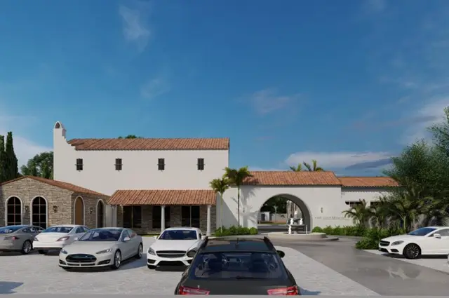
Yasheela Retreat
MAYURI PRIME HOMES PRIVATE LIMITED · Rangareddy · RERA P02400010750
YASHEELA RETREAT is a plotted development in Nedunoor, Kandukur Mandal, Ranga Reddy District, developed by registered promoter MAYURI PRIME HOMES PRIVATE LIMITED. The project records a total area of 206340.17 sq.m and net area of 201172.70 sq.m, with 515 plots; the drawing schedule gives plot sizes of 181.48–493.23 sq.m. It is registered with TG-RERA under P02400010750, and the proposed completion date is 10/04/2029.
More from Mayuri Prime Homes Pvt. Ltd · 3 projects →
01What we found
Read from TG-RERA filings, approvals, land and registration records and court records. A court case is counted only when the court record states this project's survey number with its village, or names the project.
02Check before you pay
9 items to check before you pay, 4 high - from the title chain, court records and approvals, each with what to ask the builder or your advocate. An item may not be a problem with the project: records can be incomplete.
1. Project at a glance
Project identity
| Item | Record |
|---|---|
| Registered project name | YASHEELA RETREAT RERA record |
| Project type | Plotted development / open-plot layout RERA record |
| Phase or registered portion | A single TG-RERA registration is identified; a separate phase name or phase number is not disclosed. Approvals record |
| TG-RERA registration number | P02400010750 Approvals record |
| Registration validity | 10 December 2025 to 10 December 2028, stated as three years, unless extended by the Authority. This is registration validity, not the project completion deadline. Approvals record |
| Registered promoter | MAYURI PRIME HOMES PRIVATE LIMITED, a company/private limited company. RERA record Corporate record |
| RERA status | Registered; the certificate records the conditions applicable to the promoter. Approvals record |
Land and geographic identity
| Item | Record |
|---|---|
| Locality / revenue village | Nednoor / Nedunoor Village (also rendered “Nednur” in some supplied records); the RERA certificate states Nedunoor. RERA record RERA filing |
| Mandal | Kandukur RERA record RERA filing |
| District | Ranga Reddy RERA record |
| PIN | 501359 RERA record |
| Project survey numbers and subdivisions | 132/P, 133/P, 136/P, 155/P, 156/P, 157/P, 190/P, 191/P, 193/P and 194/P. The layout drawing writes these as 132 (P), 133 (P), 136 (P), 155 (P), 156 (P), 157 (P), 190 (P), 191 (P), 193 (P) and 194 (P). Land records |
| Site area recorded in project details | Total Area: 206340.17 sq.m; net area: 201172.70 sq.m. RERA filing |
| Layout-drawing area statement | Drawing and draft-permission records state Total Layout Area: 206340.17 sq.m and Net Layout Area: 201172.70 sq.m. The drawing also labels road widening and other affected areas. |
| Boundaries recorded | East: Road; West, North and South: Neighbours Land. RERA filing |
Development identity
| Item | Record |
|---|---|
| Sanctioning authority | Hyderabad Metropolitan Development Authority (HMDA); the draft layout letter is addressed through Nednoor Gram Panchayat. Approvals record |
| Principal layout reference | TG-RERA filing lists 004319/HMDA/01269/SWDL/SHZ/2025. The draft layout letter identifies Layout Permit No. 1196/HMDA/SWDL/2025. Approvals record |
| Date shown on supplied layout-permission records | 10/12/2025. Approvals record |
| Approved built-up area | Not disclosed as a building measure; this is a plotted-layout project. The RERA filing records 125926.85 sq.m as “Approved Built up Area”; the layout drawing labels 125926.85 sq.m as plotted area. RERA filing |
| Buildings, floors and parking levels | Not applicable to the plotted offering as described in the supplied record; no building/floor schedule or parking-level count is disclosed. |
| Plot count | The layout drawing states 515 plots. |
| Approved versus RERA-declared plot count | Drawing-derived count: 515. A separate RERA unit inventory count is not supplied. RERA unit table |
Offering and status
| Item | Record |
|---|---|
| Unit type | Open plots; the TG-RERA certificate classifies the project as plotted. |
| Plot size range | The drawing schedule was software-read: 181.48–493.23 sq.m (217.0–589.9 sq.yd); verify against the drawing schedule. Layout record |
| Booked / available counts | Not disclosed in the supplied RERA inventory data. RERA unit table |
| Development stage | RERA filing identifies the project as a New Project. The supplied layout-permission records describe a draft layout and required development works; they do not establish completed works or independently verified site progress. RERA record RERA amenities |
| Completion date | RERA project information states proposed completion 10/04/2029. The Form B affidavit records a promoter undertaking to complete by 10 December 2028. These are distinct entries in the supplied records; the completion schedule is not independently verified here. RERA filing |
| Occupancy / completion certificate | No completion or occupancy certificate is supplied. The draft layout letter is not an occupancy/completion certificate. Approvals record |
2. The project story
YASHEELA RETREAT is registered as a plotted development on land identified in the RERA record as lying in Nedunoor Village, Kandukur Mandal, Ranga Reddy District. Its registered parcel schedule covers ten survey subdivisions: 132/P, 133/P, 136/P, 155/P, 156/P, 157/P, 190/P, 191/P, 193/P and 194/P. The layout drawing presents an open-plot scheme with 515 scheduled plots, internal roads, open spaces, social-infrastructure land and utility land. RERA record Land records
The supplied project records include HMDA draft layout-permission documents and a layout plan, as well as the TG-RERA registration certificate. The draft letter describes technical approval and sets out works and further steps associated with development and release of the final layout. It calls for roads, drainage, water-supply infrastructure, electrical works, parks and rainwater-harvesting pits, among other works. These are approval-document requirements and descriptions, not evidence that the works have been completed. The supplied RERA progress data reports some infrastructure categories with percentages, but no independent site verification is provided. RERA amenities
The promoter’s project filing states a proposed completion date of 10/04/2029. The project’s RERA registration is valid through 10 December 2028 unless extended; registration validity and the stated project completion date are separate records. No occupancy or completion certificate is supplied. RERA filing Approvals record
3. Master plan, architecture & building design
This is a plotted layout rather than a multi-storey residential building scheme. The project land record states a total area of 206340.17 sq.m and net area of 201172.70 sq.m. The drawing describes the plan as an open-plot layout and states 515 plots; its plot schedule and size readings are software-extracted and should be checked against the drawing. RERA filing Layout record
The draft layout permission’s land-use statement records the following allocation for the net layout area:
| Layout component | Area | Share |
|---|---|---|
| Plotted area | 125926.85 sq.m | 62.6% |
| Road area | 53582.70 sq.m | 26.64% |
| Open space area | 15182.14 sq.m | 7.55% |
| Buffer area | 686.2 sq.m | 0.34% |
| Social infrastructure area | 5128.58 sq.m | 2.55% |
| Utilities area | 661.55 sq.m | 0.33% |
| Common parking area | 0.0 sq.m | 0.0% |
| Amenities area | 0 sq.m | 0.0% |
| Green belt area | 0 sq.m | 0.0% |
| Total net layout | 201172.7 sq.m | 100.0% |
The layout drawing labels internal and connecting roads, including an 18.29m Main Internal Approach Road, 12.19m, 9.14m and 9m internal roads, and a 6.0M cart track widened to 9.0 M. It also shows 18.0m existing-road and 30.0m proposed-road references. These are drawing labels, not a statement that every road has been completed.
No building footprints, dwelling-building count, floor configuration, building height or residential/commercial building distribution are disclosed for this plotted project. The draft permission identifies utility, social-infrastructure and open-space areas, and specifies layout infrastructure works.
4. Homes, configurations & floor plans
The offering shown in the project record is open plots. No RERA-filed plot inventory table with plot-by-plot booked and available counts is included in the supplied data.
| Configuration | Units | Booked | Available | RERA saleable area | Measured carpet area | Loading |
|---|---|---|---|---|---|---|
| Open plots | 515 stated on layout drawing | Not disclosed | Not disclosed | Not disclosed | Not applicable | Not disclosed |
RERA unit table Floor plans
Software extraction from the drawing’s plot schedule identified 515 plots, with sizes ranging from 181.48 sq.m (217.0 sq.yd) to 493.23 sq.m (589.9 sq.yd); the median is 228.74 sq.m (273.6 sq.yd). Size bands read from the schedule are: 32 plots in 200–250 sq.yd, 296 in 250–300 sq.yd, 176 in 300–400 sq.yd, 8 in 400–500 sq.yd and 3 in 500–1000 sq.yd. These are software-measured drawing readings, not a substitute for checking the approved plot schedule and the specific plot’s registered documents. Layout record
The supplied floor-plan review says both drawing sheets are layout sheets and contain no flats; no dwelling-unit floor plans or measured carpet areas are available. Floor plans
5. Parking & vehicle circulation
The draft layout land-use statement records 0.0 sq.m as “Common Parking Area”; the supplied data does not establish a separate sanctioned count of car or two-wheeler spaces, visitor parking, accessible spaces, EV charging spaces or plot-specific parking allocations. Do not treat a drawn area or a general layout feature as exclusive parking ownership.
The layout drawing identifies internal roads and road widths, including the 18.29m main internal approach road and other internal-road labels. The draft permission requires road formation and associated works, but the supplied evidence does not establish their completion or provide a detailed vehicle-entry, exit, ramp or pedestrian-separation plan.
6. Amenities, recreation & open spaces
The following table distinguishes layout-permission requirements and RERA progress declarations from independently verified delivery. The available evidence does not include independent completion verification.
| Description / size | Draft permission records open space of 15182.14 sq.m (7.55%). |
|---|---|
| Declared progress / verified status | Open-space allocation is recorded; completion and handover are not independently verified. |
| Description / size | RERA amenity record lists “Green Strip/TOT LOT/Park”; layout drawing labels tot-lot and open-space areas. |
|---|---|
| Evidence source | RERA amenities |
| Declared progress / verified status | RERA record shows 6% progress for “Green Strip/TOT LOT/Park”; no independent completion verification. |
| Description / size | 5128.58 sq.m (2.55%) in the draft permission’s land-use statement. |
|---|---|
| Declared progress / verified status | Area is identified; the particular community facility or its delivered condition is not established. |
| Description / size | Required in the draft permission and labelled in layout records. |
|---|---|
| Declared progress / verified status | Requirement/drawing label only; no verified completion status supplied. |
The RERA amenity progress record also lists internal roads and footpaths at 10%, water supply at 8%, sewerage at 12%, storm-water drains at 15%, and street lighting at 0%. These are reported progress values in the supplied RERA data, not independently verified site measurements. RERA amenities
7. Utilities, building services & safety
The draft layout permission describes the infrastructure to be provided, including internal water-supply pipes and an overhead tank, an assured water-supply source, underground drainage and a common septic tank/STP, storm-water drains and nala channelization, rainwater-harvesting pits, a transformer yard, electrical lines and street lighting, and underground ducting for utility services. It also calls for solid-waste disposal space, source segregation, paved footpaths, avenue planting and cycle tracks. These are stated requirements or proposed provisions; supplied evidence does not confirm completion or disclose capacities.
The RERA amenity record reports water supply at 8%, sewerage at 12%, storm-water drains at 15%, and street lighting at 0%. The record marks several infrastructure categories as available/“YES,” but the supplied data does not provide independent verification or system capacities. RERA amenities
The draft permission states that a protected water-supply arrangement and independent sewerage-disposal system are to be provided, and that layouts over 10 acres are to provide an STP area in addition to mandatory open space. It also specifies transformer-yard provision and LED street lighting. No water-treatment capacity, STP capacity, storage volume, power-backup capacity, security system or project-specific fire-safety installation details are supplied.
No lifts or building fire-safety systems are applicable as described for the plotted offering; the evidence does not provide plot-level accessibility or safety-design details.
8. Location, access & connectivity
The registered project location is Nedunoor, Kandukur, Ranga Reddy, Telangana 501359, across the ten survey subdivisions listed above. The locality is also written as Nednoor in project details. RERA record Land records
The layout plan identifies existing and proposed roads and internal road widths, including an 18.29m main internal approach road, 12.19m, 9.14m and 9m internal roads, and a 6.0M cart track widened to 9.0 M. A supplied location record gives the nearest sampled Outer Ring Road interchange as approximately 21.5 km. No public-transport details or other measured landmark distances are supplied. Location record
9. Developer & development status
The registered promoter is MAYURI PRIME HOMES PRIVATE LIMITED, a private limited company. Its supplied GSTIN is 36AAICM5996N1ZH. The registration certificate lists a promoter address at Attapur, Rajendranagar, Ranga Reddy, PIN 500048; the project filing separately gives the promoter address as BPR Towers, Attapur, Nednoor, Kandukur, Ranga Reddy, PIN 501359. The supplied records do not provide an official website or project contact details. Corporate record RERA filing
The RERA filing identifies the project as a new project and states a proposed completion date of 10/04/2029. The promoter’s Form B affidavit states a completion undertaking of 10th December 2028. The supplied record does not provide a verified construction-progress inspection or a completion/occupancy certificate. RERA record RERA filing Approvals record
The promoter’s affidavit with the landowner group states that supplementary/allocation documentation remains to be executed and undertakes not to book or offer units for sale until that documentation is executed. This is a promoter/declarant statement in the supplied filing.
10. Approvals, official records & documents
| Record | Supplied evidence and scope |
|---|---|
| TG-RERA registration | Form C certificate for YASHEELA RETREAT, registration P02400010750, valid 10 December 2025–10 December 2028 unless extended. |
| HMDA layout reference filed with RERA | 004319/HMDA/01269/SWDL/SHZ/2025, recorded in project approvals. Approvals record |
| HMDA draft layout permission | Draft Layout Letter identifies 1196/HMDA/SWDL/2025, the applicant, the survey schedule, land-use allocation, development requirements and mortgage in favour of the Metropolitan Commissioner, HMDA. |
| Layout plan | Proposed open-plot layout drawing for the ten listed survey subdivisions, showing 515 plots, roads and land-use areas. |
| Road-affected land gift deed | Draft-permission record states road-affected area of 2277.31 sq.m was handed to the local body by Gift Deed 21652/2025, dated 05/12/2025. |
| HMDA mortgage | Draft-permission record states 19097.76 sq.m was mortgaged in favour of the Metropolitan Commissioner, HMDA, under Document No. 21651/2025, dated 05/12/2025. |
| Promoter declaration | Form B affidavit by authorized signatory Beravolu Dayaker Reddy, including the promoter’s title and completion declarations. |
| Completion / occupancy record | No completion or occupancy certificate is included in the supplied evidence. Approvals record |
1. Project at a glance
Project identity
Registered project name: YASHEELA RETREAT
Project type: Plotted development / open-plot layout
Phase or registered portion: A single TG-RERA registration is identified; a separate phase name or phase number is not disclosed.
TG-RERA registration number: P02400010750
Registration validity: 10 December 2025 to 10 December 2028, stated as three years, unless extended by the Authority. This is registration validity, not the project completion deadline.
Registered promoter: MAYURI PRIME HOMES PRIVATE LIMITED, a company/private limited company.
RERA status: Registered; the certificate records the conditions applicable to the promoter.
Land and geographic identity
Locality / revenue village: Nednoor / Nedunoor Village (also rendered “Nednur” in some supplied records); the RERA certificate states Nedunoor.
Mandal: Kandukur
District: Ranga Reddy
PIN: 501359
Project survey numbers and subdivisions: 132/P, 133/P, 136/P, 155/P, 156/P, 157/P, 190/P, 191/P, 193/P and 194/P. The layout drawing writes these as 132 (P), 133 (P), 136 (P), 155 (P), 156 (P), 157 (P), 190 (P), 191 (P), 193 (P) and 194 (P).
Site area recorded in project details: Total Area: 206340.17 sq.m; net area: 201172.70 sq.m.
Layout-drawing area statement: Drawing and draft-permission records state Total Layout Area: 206340.17 sq.m and Net Layout Area: 201172.70 sq.m. The drawing also labels road widening and other affected areas.
Boundaries recorded: East: Road; West, North and South: Neighbours Land.
Development identity
Sanctioning authority: Hyderabad Metropolitan Development Authority (HMDA); the draft layout letter is addressed through Nednoor Gram Panchayat.
Principal layout reference: TG-RERA filing lists 004319/HMDA/01269/SWDL/SHZ/2025. The draft layout letter identifies Layout Permit No. 1196/HMDA/SWDL/2025.
Date shown on supplied layout-permission records: 10/12/2025.
Approved built-up area: Not disclosed as a building measure; this is a plotted-layout project. The RERA filing records 125926.85 sq.m as “Approved Built up Area”; the layout drawing labels 125926.85 sq.m as plotted area.
Buildings, floors and parking levels: Not applicable to the plotted offering as described in the supplied record; no building/floor schedule or parking-level count is disclosed.
Plot count: The layout drawing states 515 plots.
Approved versus RERA-declared plot count: Drawing-derived count: 515. A separate RERA unit inventory count is not supplied.
Offering and status
Unit type: Open plots; the TG-RERA certificate classifies the project as plotted.
Plot size range: The drawing schedule was software-read: 181.48–493.23 sq.m (217.0–589.9 sq.yd); verify against the drawing schedule.
Booked / available counts: Not disclosed in the supplied RERA inventory data.
Development stage: RERA filing identifies the project as a New Project. The supplied layout-permission records describe a draft layout and required development works; they do not establish completed works or independently verified site progress.
Completion date: RERA project information states proposed completion 10/04/2029. The Form B affidavit records a promoter undertaking to complete by 10 December 2028. These are distinct entries in the supplied records; the completion schedule is not independently verified here.
Occupancy / completion certificate: No completion or occupancy certificate is supplied. The draft layout letter is not an occupancy/completion certificate.
2. The project story
YASHEELA RETREAT is registered as a plotted development on land identified in the RERA record as lying in Nedunoor Village, Kandukur Mandal, Ranga Reddy District. Its registered parcel schedule covers ten survey subdivisions: 132/P, 133/P, 136/P, 155/P, 156/P, 157/P, 190/P, 191/P, 193/P and 194/P. The layout drawing presents an open-plot scheme with 515 scheduled plots, internal roads, open spaces, social-infrastructure land and utility land.
The supplied project records include HMDA draft layout-permission documents and a layout plan, as well as the TG-RERA registration certificate. The draft letter describes technical approval and sets out works and further steps associated with development and release of the final layout. It calls for roads, drainage, water-supply infrastructure, electrical works, parks and rainwater-harvesting pits, among other works. These are approval-document requirements and descriptions, not evidence that the works have been completed. The supplied RERA progress data reports some infrastructure categories with percentages, but no independent site verification is provided.
The promoter’s project filing states a proposed completion date of 10/04/2029. The project’s RERA registration is valid through 10 December 2028 unless extended; registration validity and the stated project completion date are separate records. No occupancy or completion certificate is supplied.
3. Master plan, architecture & building design
This is a plotted layout rather than a multi-storey residential building scheme. The project land record states a total area of 206340.17 sq.m and net area of 201172.70 sq.m. The drawing describes the plan as an open-plot layout and states 515 plots; its plot schedule and size readings are software-extracted and should be checked against the drawing.
The draft layout permission’s land-use statement records the following allocation for the net layout area:
| Layout component | Area | Share |
|---|---|---|
| Plotted area | 125926.85 sq.m | 62.6% |
| Road area | 53582.70 sq.m | 26.64% |
| Open space area | 15182.14 sq.m | 7.55% |
| Buffer area | 686.2 sq.m | 0.34% |
| Social infrastructure area | 5128.58 sq.m | 2.55% |
| Utilities area | 661.55 sq.m | 0.33% |
| Common parking area | 0.0 sq.m | 0.0% |
| Amenities area | 0 sq.m | 0.0% |
| Green belt area | 0 sq.m | 0.0% |
| Total net layout | 201172.7 sq.m | 100.0% |
The layout drawing labels internal and connecting roads, including an 18.29m Main Internal Approach Road, 12.19m, 9.14m and 9m internal roads, and a 6.0M cart track widened to 9.0 M. It also shows 18.0m existing-road and 30.0m proposed-road references. These are drawing labels, not a statement that every road has been completed.
No building footprints, dwelling-building count, floor configuration, building height or residential/commercial building distribution are disclosed for this plotted project. The draft permission identifies utility, social-infrastructure and open-space areas, and specifies layout infrastructure works.
4. Homes, configurations & floor plans
The offering shown in the project record is open plots. No RERA-filed plot inventory table with plot-by-plot booked and available counts is included in the supplied data.
| Configuration | Units | Booked | Available | RERA saleable area | Measured carpet area | Loading |
|---|---|---|---|---|---|---|
| Open plots | 515 stated on layout drawing | Not disclosed | Not disclosed | Not disclosed | Not applicable | Not disclosed |
Software extraction from the drawing’s plot schedule identified 515 plots, with sizes ranging from 181.48 sq.m (217.0 sq.yd) to 493.23 sq.m (589.9 sq.yd); the median is 228.74 sq.m (273.6 sq.yd). Size bands read from the schedule are: 32 plots in 200–250 sq.yd, 296 in 250–300 sq.yd, 176 in 300–400 sq.yd, 8 in 400–500 sq.yd and 3 in 500–1000 sq.yd. These are software-measured drawing readings, not a substitute for checking the approved plot schedule and the specific plot’s registered documents.
The supplied floor-plan review says both drawing sheets are layout sheets and contain no flats; no dwelling-unit floor plans or measured carpet areas are available.
5. Parking & vehicle circulation
The draft layout land-use statement records 0.0 sq.m as “Common Parking Area”; the supplied data does not establish a separate sanctioned count of car or two-wheeler spaces, visitor parking, accessible spaces, EV charging spaces or plot-specific parking allocations. Do not treat a drawn area or a general layout feature as exclusive parking ownership.
The layout drawing identifies internal roads and road widths, including the 18.29m main internal approach road and other internal-road labels. The draft permission requires road formation and associated works, but the supplied evidence does not establish their completion or provide a detailed vehicle-entry, exit, ramp or pedestrian-separation plan.
6. Amenities, recreation & open spaces
The following table distinguishes layout-permission requirements and RERA progress declarations from independently verified delivery. The available evidence does not include independent completion verification.
| Description / size | Draft permission records open space of 15182.14 sq.m (7.55%). |
|---|---|
| Declared progress / verified status | Open-space allocation is recorded; completion and handover are not independently verified. |
| Description / size | RERA amenity record lists “Green Strip/TOT LOT/Park”; layout drawing labels tot-lot and open-space areas. |
|---|---|
| Declared progress / verified status | RERA record shows 6% progress for “Green Strip/TOT LOT/Park”; no independent completion verification. |
| Description / size | 5128.58 sq.m (2.55%) in the draft permission’s land-use statement. |
|---|---|
| Declared progress / verified status | Area is identified; the particular community facility or its delivered condition is not established. |
| Description / size | Required in the draft permission and labelled in layout records. |
|---|---|
| Declared progress / verified status | Requirement/drawing label only; no verified completion status supplied. |
The RERA amenity progress record also lists internal roads and footpaths at 10%, water supply at 8%, sewerage at 12%, storm-water drains at 15%, and street lighting at 0%. These are reported progress values in the supplied RERA data, not independently verified site measurements.
7. Utilities, building services & safety
The draft layout permission describes the infrastructure to be provided, including internal water-supply pipes and an overhead tank, an assured water-supply source, underground drainage and a common septic tank/STP, storm-water drains and nala channelization, rainwater-harvesting pits, a transformer yard, electrical lines and street lighting, and underground ducting for utility services. It also calls for solid-waste disposal space, source segregation, paved footpaths, avenue planting and cycle tracks. These are stated requirements or proposed provisions; supplied evidence does not confirm completion or disclose capacities.
The RERA amenity record reports water supply at 8%, sewerage at 12%, storm-water drains at 15%, and street lighting at 0%. The record marks several infrastructure categories as available/“YES,” but the supplied data does not provide independent verification or system capacities.
The draft permission states that a protected water-supply arrangement and independent sewerage-disposal system are to be provided, and that layouts over 10 acres are to provide an STP area in addition to mandatory open space. It also specifies transformer-yard provision and LED street lighting. No water-treatment capacity, STP capacity, storage volume, power-backup capacity, security system or project-specific fire-safety installation details are supplied.
No lifts or building fire-safety systems are applicable as described for the plotted offering; the evidence does not provide plot-level accessibility or safety-design details.
8. Location, access & connectivity
The registered project location is Nedunoor, Kandukur, Ranga Reddy, Telangana 501359, across the ten survey subdivisions listed above. The locality is also written as Nednoor in project details.
The layout plan identifies existing and proposed roads and internal road widths, including an 18.29m main internal approach road, 12.19m, 9.14m and 9m internal roads, and a 6.0M cart track widened to 9.0 M. A supplied location record gives the nearest sampled Outer Ring Road interchange as approximately 21.5 km. No public-transport details or other measured landmark distances are supplied.
9. Developer & development status
The registered promoter is MAYURI PRIME HOMES PRIVATE LIMITED, a private limited company. Its supplied GSTIN is 36AAICM5996N1ZH. The registration certificate lists a promoter address at Attapur, Rajendranagar, Ranga Reddy, PIN 500048; the project filing separately gives the promoter address as BPR Towers, Attapur, Nednoor, Kandukur, Ranga Reddy, PIN 501359. The supplied records do not provide an official website or project contact details.
The RERA filing identifies the project as a new project and states a proposed completion date of 10/04/2029. The promoter’s Form B affidavit states a completion undertaking of 10th December 2028. The supplied record does not provide a verified construction-progress inspection or a completion/occupancy certificate.
The promoter’s affidavit with the landowner group states that supplementary/allocation documentation remains to be executed and undertakes not to book or offer units for sale until that documentation is executed. This is a promoter/declarant statement in the supplied filing.
10. Approvals, official records & documents
TG-RERA registration: Form C certificate for YASHEELA RETREAT, registration P02400010750, valid 10 December 2025–10 December 2028 unless extended.
HMDA layout reference filed with RERA: 004319/HMDA/01269/SWDL/SHZ/2025, recorded in project approvals.
HMDA draft layout permission: Draft Layout Letter identifies 1196/HMDA/SWDL/2025, the applicant, the survey schedule, land-use allocation, development requirements and mortgage in favour of the Metropolitan Commissioner, HMDA.
Layout plan: Proposed open-plot layout drawing for the ten listed survey subdivisions, showing 515 plots, roads and land-use areas.
Road-affected land gift deed: Draft-permission record states road-affected area of 2277.31 sq.m was handed to the local body by Gift Deed 21652/2025, dated 05/12/2025.
HMDA mortgage: Draft-permission record states 19097.76 sq.m was mortgaged in favour of the Metropolitan Commissioner, HMDA, under Document No. 21651/2025, dated 05/12/2025.
Promoter declaration: Form B affidavit by authorized signatory Beravolu Dayaker Reddy, including the promoter’s title and completion declarations.
Completion / occupancy record: No completion or occupancy certificate is included in the supplied evidence.
Frequently asked questions
Is YASHEELA RETREAT registered with Telangana RERA?
Yes. YASHEELA RETREAT is registered with the Telangana Real Estate Regulatory Authority as P02400010750; the registration status is New Project.
Who is the developer of YASHEELA RETREAT?
The promoter named in the RERA registration is MAYURI PRIME HOMES PRIVATE LIMITED.
Where is YASHEELA RETREAT located?
YASHEELA RETREAT is in Nednoor, Nedunoor, Kandukur, Rangareddy, Telangana (501359).
When will YASHEELA RETREAT be completed?
The promoter's proposed date of completion filed with RERA is 10/04/2029. This is the promoter's declaration, not a guarantee.
More projects in Kandukur