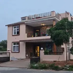
Bharath Chandra Enclave
VAARAAHI INFRA AND DEVELOPERS · Siddipet · RERA P01300009516
BHARATH CHANDRA ENCLAVE is a residential plotted layout in GAJWEL A, GAJWEL Mandal, Siddipet District. It is being developed by the registered promoter VAARAAHI INFRA AND DEVELOPERS on a registered site extent of 17,602.84 sq.mts, with 57 residential plots; no building or floor configuration is stated. The plots are recorded as ranging from 105.86 sq.m to 264.71 sq.m. The project is registered with TG-RERA as P01300009516, valid 17/10/2024 to 17/10/2026, and the promoter’s stated completion date is 17th OCTOBER, 2026.
01What we found
Read from TG-RERA filings, approvals, land and registration records and court records. A court case is counted only when the court record states this project's survey number with its village, or names the project.
02Check before you pay
5 items to check before you pay, 3 high - from the title chain, court records and approvals, each with what to ask the builder or your advocate. An item may not be a problem with the project: records can be incomplete.
1. Project at a glance
Project identity
| Item | Record |
|---|---|
| Registered project name | BHARATH CHANDRA ENCLAVE RERA record |
| Project type | Plotted development / residential plotted layout RERA record RERA filing |
| Phase / registered portion | The record identifies one registered plotted layout; no phase number or separate phase description is disclosed. RERA record |
| TG-RERA registration | P01300009516, valid 17/10/2024 to 17/10/2026. This is the registration validity period, not a completion-certificate statement. RERA record Approvals record |
| Registered promoter | VAARAAHI INFRA AND DEVELOPERS RERA record Corporate record |
| RERA status | New project; registration certificate filed. The pack does not state that the registration has been extended. RERA filing |
Land and geographic identity
| Item | Record |
|---|---|
| Locality / revenue village | Project records use GAJWEL A and GAJWEL Revenue Village / Gajwel Village. RERA record RERA filing |
| Mandal / district / PIN | GAJWEL Mandal, Siddipet District, 502311 RERA record |
| Project survey number(s) | Survey No. 747/1; no further project subdivision is identified in the supplied records. RERA record Land records |
| Registered site extent | The RERA filing records 17,602.84 sq.mts total area and 9,071.91 sq.mts net area. RERA filing |
| Layout-plan area statement | The filed layout drawing states 17,602.39 sq.mt total/net layout area; its area table totals 17,602.26 sq.mt. |
| Boundaries | North: Road; South, East and West: Neighbours Land. RERA filing |
Development identity
| Item | Record |
|---|---|
| Sanctioning authority / principal layout approval | Tentative layout approval 0010/LO/3052/2024, dated 17 October, 2024, issued by Gajwel-Pragnapur Municipality/Municipal Corporation; the drawing records TS-DTCP approval arrangements delegated to Gajwel Municipality. Approvals record |
| Final layout record | Final Layout Permit 2524/HMDA/SWFL/2026, approved 22/09/2026, with final layout order issued by Gajwel Municipality and technical approval by HMDA. Approvals record |
| Application / plan identifiers | 004604/LO/DTCP/3052/0011/2024; final-layout application 021663/HMDA/04942/SWFL/MDL2/2026. Approvals record |
| Plots | 57 stated in the layout drawing and final-layout records. Layout record |
| Approved built-up area | The tentative layout record states 0.00 proposed built-up area, excluding and including parking. This is a plotted layout; no building-level floor configuration is supplied. |
| Building / floor / parking configuration | No buildings, floors, parking levels or common parking spaces are specified in the supplied layout records. |
Offering and status
| Item | Record |
|---|---|
| Offered property type | Residential plots; final-layout conditions provide for residential dwelling houses on the plots. |
| Plot count and sizes | 57 plots. Drawing-derived plot sizes range from 105.86 sq.m to 264.71 sq.m; median 147.99 sq.m. These are software-measured from the drawing schedule, not RERA-filed saleable areas. Layout record |
| Booked / available counts | Not disclosed in the supplied evidence. RERA filing |
| Completion dates | The Form B promoter declaration states completion within two years of permission, by 17th OCTOBER, 2026. The tentative-layout conditions also set infrastructure and amenities completion within two years of approval, 17 October, 2026. |
| Construction / development stage | The final-layout records dated 22/09/2026 document final layout approval and record handover of specified layout land to the local authority. No independently verified on-site construction progress is supplied. |
| Occupancy / completion certificate | No building occupancy certificate is identified. The documents supplied include a final layout order/letter, not a building-level OC. Document index |
2. The project story
BHARATH CHANDRA ENCLAVE is registered with TG-RERA as a residential plotted development on Survey No. 747/1, in the Gajwel area of Siddipet District. The RERA registration identifies the project location as GAJWEL A, GAJWEL; the layout documents describe it as Gajwel Village, Gajwel Mandal.
The filed layout drawing shows 57 residential plots, along with internal roads, open space/park land, social-infrastructure land, utility land and a buffer zone. The final-layout record states that the layout is for residential dwelling use. The project is therefore a land-and-layout offering; the supplied records do not describe apartment buildings, villas, or completed homes. Layout record
The promoter’s Form B declaration gives 17th OCTOBER, 2026 as the project completion date, and the tentative approval similarly sets that date for completion of layout infrastructure and amenities. The records establish a final layout approval dated 22/09/2026, but do not provide independent inspection evidence of the physical completion of infrastructure across the site.
3. Master plan, architecture & building design
The filed layout plan is a plotted subdivision, not a building plan. It shows 57 plots and a land-use schedule including 9.41% organized open space/park, 28.84% roads, 2.59% social infrastructure, 1.01% utilities and 6.62% buffer-zone area. The same drawing records 51.53% as plotted area. Layout record
The drawing identifies internal roads of 12.19 mt. and 9.14 mt. widths, and depicts an 18.00 MT WIDE EXISTING ROAD and an 18.00 MT WIDE PROPOSED ROAD. It also contains a 60'-0" road-width label.
The tentative layout approval names a tot-lot, social infrastructure and utility land, and lists layout works including road formation, storm-water drains, underground drainage, internal water-supply pipelines, an overhead tank, electrical lines and street lights, avenue planting, park development and rainwater-harvesting pits. These are specified works and facilities in the approval record; the pack does not independently establish their completed condition.
No building footprints, heights, floor arrangements, dwelling designs, or building-level approved built-up area are provided. The layout record states 0.00 total proposed built-up area, both excluding and including parking.
4. Homes, configurations & floor plans
This is a plotted layout, so apartment configuration, carpet-area and apartment loading figures do not apply. The layout drawing records 57 plots; software analysis of the drawing’s plot schedule identifies sizes from 105.86 sq.m (126.6 sq.yd) to 264.71 sq.m (316.6 sq.yd), with a median of 147.99 sq.m (177.0 sq.yd). These are drawing-measured values, not RERA-filed saleable areas. Layout record
The drawing-based size bands are:
| Plot size band | Number of plots |
|---|---|
| 100–150 sq.yd (84–125 sq.m) | 2 |
| 150–200 sq.yd (125–167 sq.m) | 33 |
| 200–250 sq.yd (167–209 sq.m) | 15 |
| 250–300 sq.yd (209–251 sq.m) | 5 |
| 300–400 sq.yd (251–334 sq.m) | 2 |
The most frequently identified printed plot sizes are 125.42 sq.m (19 plots), 153.29 sq.m (5 plots) and 183.95 sq.m (2 plots). Plot numbers and sizes should be checked against the sanctioned drawing and the individual sale documents. Layout record
5. Parking & vehicle circulation
The final-layout land-use schedule records 0.0 common parking area. The supplied records do not specify individual plot parking spaces, visitor or accessible parking, parking allotments, or a separate parking facility.
The tentative approval requires the layout roads to remain open for access to neighbouring sites and states that the layout owner/developer shall not construct a compound wall or fencing around the site. The drawing also identifies internal road widths of 12.19 mt. and 9.14 mt.
6. Amenities, recreation & open spaces
| Description / size | 1,656.28 sq.m, 9.41% in the filed layout area table; the final layout record states 1,656.35 sq.m, also 9.41%. |
|---|---|
| Evidence source | Layout record |
| Declared progress / verified status | The tentative approval requires handover; the final-layout order records roads, open spaces, social infrastructure and utilities as handed over by registered gift deed. No independent site inspection is supplied. |
| Description / size | Identified in the layout and RERA amenity list; no separate size is stated. |
|---|---|
| Evidence source | RERA amenities |
| Declared progress / verified status | Listed as available in the RERA amenity data, but reported progress is 0%; completion is not independently verified. |
| Description / size | 455.36 sq.m, 2.59%. |
|---|---|
| Evidence source | Layout record |
| Declared progress / verified status | Final-layout order records social infrastructure as handed over by registered gift deed; physical development is not independently verified. |
| Description / size | 177.71 sq.m, 1.01%. |
|---|---|
| Evidence source | Layout record |
| Declared progress / verified status | Final-layout order records utilities as handed over; physical utility installations are not independently verified. |
| Description / size | Road area 5,076.44 sq.m, 28.84% in the filed layout drawing; internal road widths include 12.19 mt. and 9.14 mt. |
|---|---|
| Evidence source | Layout record |
| Declared progress / verified status | Listed in the RERA amenity data; final-layout order records roads as handed over. No independent verification of completed road works is supplied. |
| Description / size | Listed as a layout facility. |
|---|---|
| Evidence source | RERA amenities |
| Declared progress / verified status | RERA amenity data marks it available, with 0% progress; actual installation is not independently verified. |
No clubhouse, indoor recreation facility or separately sized community building is described in the supplied project evidence. The RERA amenity list also includes water supply, sewerage, storm-water drains, sewage/sullage treatment and disposal, solid-waste management and rainwater harvesting; those site services are addressed below. RERA amenities
7. Utilities, building services & safety
The tentative layout approval specifies internal water-supply pipelines, an assured water-supply source, a water reservoir and overhead tank; underground drainage and a common septic tank/STP; storm-water drains; electrical supply lines, a transformer and street lighting; solid-waste management; and rainwater-harvesting pits. These are approval-listed layout works, not independently verified completed services.
The final-layout records list water supply, sewerage, drainage disposal, street lighting and rainwater-harvesting structures as civic amenities. The RERA amenity data lists these utility categories but records 0% progress; the pack does not provide capacities, commissioning certificates or independent operational testing. RERA amenities
The final-layout conditions require a minimum 3m (10’0”) safety distance, vertically and horizontally, between a building and high-tension electricity lines when residential building permissions are considered. No project-specific fire systems, building escape stairs, lifts, accessibility provisions or building-level safety clearances are described.
8. Location, access & connectivity
The registered location is GAJWEL A, GAJWEL, Siddipet, 502311, with the project identified in the land and layout records as Survey No. 747/1, Gajwel Village, Gajwel Mandal. The cadastral parcel centroid supplied for the survey is 17.85867417440026, 78.66764858239169. RERA record Cadastral map
The location data supplies these approximate distances from the project-area reference point:
| Place / transport reference | Supplied distance |
|---|---|
| Gajwel railway station | 0.1 km |
| TGSRTC New Bus Station, Gajwel | 2.0 km |
| Community Health Centre, GAJWEL | 2.1 km |
| (unnamed park) | 2.1 km |
| GDR High School | 2.4 km |
| Outer Ring Road (nearest sampled interchange, approx) | 32.3 km |
These are supplied connectivity measurements; no travel times are provided. Location record
9. Developer & development status
The registered promoter is VAARAAHI INFRA AND DEVELOPERS, identified in the project records as a partnership. The RERA certificate gives the promoter address as Village: Chanda Nagar, Mandal: Serilingampally, District: Ranga Reddy, Pin: 500050. The project filing separately lists an authorized signatory, LAKSHMI NARAYANA BELDARI. Corporate record Parties record
The promoter’s Form B declaration, dated MARCH, 2025, states that the project would be completed within two years of permission, by 17th OCTOBER, 2026. That is a promoter declaration; it does not itself demonstrate completion. The final-layout records document approval on 22/09/2026, but no independent physical-progress assessment is supplied.
The supplied records do not provide an official promoter website or project contact details beyond the identified promoter address and signatory. Corporate record Parties record
10. Approvals, official records & documents
| Identifier / date | P01300009516; 17/10/2024–17/10/2026 |
|---|---|
| What it records | Registration of BHARATH CHANDRA ENCLAVE with VAARAAHI INFRA AND DEVELOPERS as promoter. |
| Identifier / date | 0010/LO/3052/2024, dated 17 October, 2024; application 004604/LO/DTCP/3052/0011/2024 |
|---|---|
| What it records | Tentative approval for a 57-plot residential layout on Survey No. 747/1, with development conditions and infrastructure requirements. |
| Identifier / date | LTP licence TS/035294/2024; file details P/16/LTP/SUDA/2022, dated 04-07-2024 |
|---|---|
| What it records | Layout drawing and land-use schedule, including plots, roads, parks/open space, social infrastructure, utilities and buffer zone. |
| Identifier / date | 2524/HMDA/SWFL/2026, dated 22/09/2026; application 021663/HMDA/04942/SWFL/MDL2/2026 |
|---|---|
| What it records | Final layout record for 57 plots on Survey No. 747/1; includes stated layout conditions and handover records. |
| Identifier / date | 2524/HMDA/SWFL/2026, dated 22/09/2026 |
|---|---|
| What it records | HMDA technical approval letter, delegated to Gajwel Municipality, recording a final 57-plot layout. |
| Identifier / date | Dated MARCH, 2025 |
|---|---|
| What it records | Promoter’s declarations on title, encumbrances, fund handling, approvals and completion date. |
The supplied project records do not include a building-level commencement certificate or occupancy certificate. The final layout order and letter are layout approvals; they should not be read as building occupancy certificates. Document index
1. Project at a glance
Project identity
Registered project name: BHARATH CHANDRA ENCLAVE
Project type: Plotted development / residential plotted layout
Phase / registered portion: The record identifies one registered plotted layout; no phase number or separate phase description is disclosed.
TG-RERA registration: P01300009516, valid 17/10/2024 to 17/10/2026. This is the registration validity period, not a completion-certificate statement.
Registered promoter: VAARAAHI INFRA AND DEVELOPERS
RERA status: New project; registration certificate filed. The pack does not state that the registration has been extended.
Land and geographic identity
Locality / revenue village: Project records use GAJWEL A and GAJWEL Revenue Village / Gajwel Village.
Mandal / district / PIN: GAJWEL Mandal, Siddipet District, 502311
Project survey number(s): Survey No. 747/1; no further project subdivision is identified in the supplied records.
Registered site extent: The RERA filing records 17,602.84 sq.mts total area and 9,071.91 sq.mts net area.
Layout-plan area statement: The filed layout drawing states 17,602.39 sq.mt total/net layout area; its area table totals 17,602.26 sq.mt.
Boundaries: North: Road; South, East and West: Neighbours Land.
Development identity
Sanctioning authority / principal layout approval: Tentative layout approval 0010/LO/3052/2024, dated 17 October, 2024, issued by Gajwel-Pragnapur Municipality/Municipal Corporation; the drawing records TS-DTCP approval arrangements delegated to Gajwel Municipality.
Final layout record: Final Layout Permit 2524/HMDA/SWFL/2026, approved 22/09/2026, with final layout order issued by Gajwel Municipality and technical approval by HMDA.
Application / plan identifiers: 004604/LO/DTCP/3052/0011/2024; final-layout application 021663/HMDA/04942/SWFL/MDL2/2026.
Plots: 57 stated in the layout drawing and final-layout records.
Approved built-up area: The tentative layout record states 0.00 proposed built-up area, excluding and including parking. This is a plotted layout; no building-level floor configuration is supplied.
Building / floor / parking configuration: No buildings, floors, parking levels or common parking spaces are specified in the supplied layout records.
Offering and status
Offered property type: Residential plots; final-layout conditions provide for residential dwelling houses on the plots.
Plot count and sizes: 57 plots. Drawing-derived plot sizes range from 105.86 sq.m to 264.71 sq.m; median 147.99 sq.m. These are software-measured from the drawing schedule, not RERA-filed saleable areas.
Booked / available counts: Not disclosed in the supplied evidence.
Completion dates: The Form B promoter declaration states completion within two years of permission, by 17th OCTOBER, 2026. The tentative-layout conditions also set infrastructure and amenities completion within two years of approval, 17 October, 2026.
Construction / development stage: The final-layout records dated 22/09/2026 document final layout approval and record handover of specified layout land to the local authority. No independently verified on-site construction progress is supplied.
Occupancy / completion certificate: No building occupancy certificate is identified. The documents supplied include a final layout order/letter, not a building-level OC.
2. The project story
BHARATH CHANDRA ENCLAVE is registered with TG-RERA as a residential plotted development on Survey No. 747/1, in the Gajwel area of Siddipet District. The RERA registration identifies the project location as GAJWEL A, GAJWEL; the layout documents describe it as Gajwel Village, Gajwel Mandal.
The filed layout drawing shows 57 residential plots, along with internal roads, open space/park land, social-infrastructure land, utility land and a buffer zone. The final-layout record states that the layout is for residential dwelling use. The project is therefore a land-and-layout offering; the supplied records do not describe apartment buildings, villas, or completed homes.
The promoter’s Form B declaration gives 17th OCTOBER, 2026 as the project completion date, and the tentative approval similarly sets that date for completion of layout infrastructure and amenities. The records establish a final layout approval dated 22/09/2026, but do not provide independent inspection evidence of the physical completion of infrastructure across the site.
3. Master plan, architecture & building design
The filed layout plan is a plotted subdivision, not a building plan. It shows 57 plots and a land-use schedule including 9.41% organized open space/park, 28.84% roads, 2.59% social infrastructure, 1.01% utilities and 6.62% buffer-zone area. The same drawing records 51.53% as plotted area.
The drawing identifies internal roads of 12.19 mt. and 9.14 mt. widths, and depicts an 18.00 MT WIDE EXISTING ROAD and an 18.00 MT WIDE PROPOSED ROAD. It also contains a 60'-0" road-width label.
The tentative layout approval names a tot-lot, social infrastructure and utility land, and lists layout works including road formation, storm-water drains, underground drainage, internal water-supply pipelines, an overhead tank, electrical lines and street lights, avenue planting, park development and rainwater-harvesting pits. These are specified works and facilities in the approval record; the pack does not independently establish their completed condition.
No building footprints, heights, floor arrangements, dwelling designs, or building-level approved built-up area are provided. The layout record states 0.00 total proposed built-up area, both excluding and including parking.
4. Homes, configurations & floor plans
This is a plotted layout, so apartment configuration, carpet-area and apartment loading figures do not apply. The layout drawing records 57 plots; software analysis of the drawing’s plot schedule identifies sizes from 105.86 sq.m (126.6 sq.yd) to 264.71 sq.m (316.6 sq.yd), with a median of 147.99 sq.m (177.0 sq.yd). These are drawing-measured values, not RERA-filed saleable areas.
The drawing-based size bands are:
100–150 sq.yd (84–125 sq.m): 2
150–200 sq.yd (125–167 sq.m): 33
200–250 sq.yd (167–209 sq.m): 15
250–300 sq.yd (209–251 sq.m): 5
300–400 sq.yd (251–334 sq.m): 2
The most frequently identified printed plot sizes are 125.42 sq.m (19 plots), 153.29 sq.m (5 plots) and 183.95 sq.m (2 plots). Plot numbers and sizes should be checked against the sanctioned drawing and the individual sale documents.
5. Parking & vehicle circulation
The final-layout land-use schedule records 0.0 common parking area. The supplied records do not specify individual plot parking spaces, visitor or accessible parking, parking allotments, or a separate parking facility.
The tentative approval requires the layout roads to remain open for access to neighbouring sites and states that the layout owner/developer shall not construct a compound wall or fencing around the site. The drawing also identifies internal road widths of 12.19 mt. and 9.14 mt.
6. Amenities, recreation & open spaces
| Description / size | 1,656.28 sq.m, 9.41% in the filed layout area table; the final layout record states 1,656.35 sq.m, also 9.41%. |
|---|---|
| Declared progress / verified status | The tentative approval requires handover; the final-layout order records roads, open spaces, social infrastructure and utilities as handed over by registered gift deed. No independent site inspection is supplied. |
| Description / size | Identified in the layout and RERA amenity list; no separate size is stated. |
|---|---|
| Declared progress / verified status | Listed as available in the RERA amenity data, but reported progress is 0%; completion is not independently verified. |
| Description / size | 455.36 sq.m, 2.59%. |
|---|---|
| Declared progress / verified status | Final-layout order records social infrastructure as handed over by registered gift deed; physical development is not independently verified. |
| Description / size | 177.71 sq.m, 1.01%. |
|---|---|
| Declared progress / verified status | Final-layout order records utilities as handed over; physical utility installations are not independently verified. |
| Description / size | Road area 5,076.44 sq.m, 28.84% in the filed layout drawing; internal road widths include 12.19 mt. and 9.14 mt. |
|---|---|
| Declared progress / verified status | Listed in the RERA amenity data; final-layout order records roads as handed over. No independent verification of completed road works is supplied. |
| Description / size | Listed as a layout facility. |
|---|---|
| Declared progress / verified status | RERA amenity data marks it available, with 0% progress; actual installation is not independently verified. |
No clubhouse, indoor recreation facility or separately sized community building is described in the supplied project evidence. The RERA amenity list also includes water supply, sewerage, storm-water drains, sewage/sullage treatment and disposal, solid-waste management and rainwater harvesting; those site services are addressed below.
7. Utilities, building services & safety
The tentative layout approval specifies internal water-supply pipelines, an assured water-supply source, a water reservoir and overhead tank; underground drainage and a common septic tank/STP; storm-water drains; electrical supply lines, a transformer and street lighting; solid-waste management; and rainwater-harvesting pits. These are approval-listed layout works, not independently verified completed services.
The final-layout records list water supply, sewerage, drainage disposal, street lighting and rainwater-harvesting structures as civic amenities. The RERA amenity data lists these utility categories but records 0% progress; the pack does not provide capacities, commissioning certificates or independent operational testing.
The final-layout conditions require a minimum 3m (10’0”) safety distance, vertically and horizontally, between a building and high-tension electricity lines when residential building permissions are considered. No project-specific fire systems, building escape stairs, lifts, accessibility provisions or building-level safety clearances are described.
8. Location, access & connectivity
The registered location is GAJWEL A, GAJWEL, Siddipet, 502311, with the project identified in the land and layout records as Survey No. 747/1, Gajwel Village, Gajwel Mandal. The cadastral parcel centroid supplied for the survey is 17.85867417440026, 78.66764858239169.
The location data supplies these approximate distances from the project-area reference point:
Gajwel railway station: 0.1 km
TGSRTC New Bus Station, Gajwel: 2.0 km
Community Health Centre, GAJWEL: 2.1 km
(unnamed park): 2.1 km
GDR High School: 2.4 km
Outer Ring Road (nearest sampled interchange, approx): 32.3 km
These are supplied connectivity measurements; no travel times are provided.
9. Developer & development status
The registered promoter is VAARAAHI INFRA AND DEVELOPERS, identified in the project records as a partnership. The RERA certificate gives the promoter address as Village: Chanda Nagar, Mandal: Serilingampally, District: Ranga Reddy, Pin: 500050. The project filing separately lists an authorized signatory, LAKSHMI NARAYANA BELDARI.
The promoter’s Form B declaration, dated MARCH, 2025, states that the project would be completed within two years of permission, by 17th OCTOBER, 2026. That is a promoter declaration; it does not itself demonstrate completion. The final-layout records document approval on 22/09/2026, but no independent physical-progress assessment is supplied.
The supplied records do not provide an official promoter website or project contact details beyond the identified promoter address and signatory.
10. Approvals, official records & documents
| Identifier / date | P01300009516; 17/10/2024–17/10/2026 |
|---|---|
| What it records | Registration of BHARATH CHANDRA ENCLAVE with VAARAAHI INFRA AND DEVELOPERS as promoter. |
| Identifier / date | 0010/LO/3052/2024, dated 17 October, 2024; application 004604/LO/DTCP/3052/0011/2024 |
|---|---|
| What it records | Tentative approval for a 57-plot residential layout on Survey No. 747/1, with development conditions and infrastructure requirements. |
| Identifier / date | LTP licence TS/035294/2024; file details P/16/LTP/SUDA/2022, dated 04-07-2024 |
|---|---|
| What it records | Layout drawing and land-use schedule, including plots, roads, parks/open space, social infrastructure, utilities and buffer zone. |
| Identifier / date | 2524/HMDA/SWFL/2026, dated 22/09/2026; application 021663/HMDA/04942/SWFL/MDL2/2026 |
|---|---|
| What it records | Final layout record for 57 plots on Survey No. 747/1; includes stated layout conditions and handover records. |
| Identifier / date | 2524/HMDA/SWFL/2026, dated 22/09/2026 |
|---|---|
| What it records | HMDA technical approval letter, delegated to Gajwel Municipality, recording a final 57-plot layout. |
| Identifier / date | Dated MARCH, 2025 |
|---|---|
| What it records | Promoter’s declarations on title, encumbrances, fund handling, approvals and completion date. |
The supplied project records do not include a building-level commencement certificate or occupancy certificate. The final layout order and letter are layout approvals; they should not be read as building occupancy certificates.
Frequently asked questions
Is BHARATH CHANDRA ENCLAVE registered with Telangana RERA?
Yes. BHARATH CHANDRA ENCLAVE is registered with the Telangana Real Estate Regulatory Authority as P01300009516; the registration status is New Project.
Who is the developer of BHARATH CHANDRA ENCLAVE?
The promoter named in the RERA registration is VAARAAHI INFRA AND DEVELOPERS.
Where is BHARATH CHANDRA ENCLAVE located?
BHARATH CHANDRA ENCLAVE is in GAJWEL, GAJWEL A, Siddipet, Telangana (502311).
When will BHARATH CHANDRA ENCLAVE be completed?
The promoter's proposed date of completion filed with RERA is 17/02/2027. This is the promoter's declaration, not a guarantee.
More projects in Gajwel A