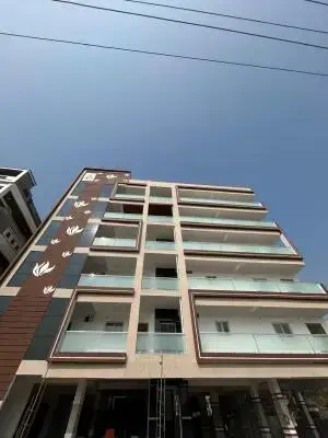
Msv Gardens
Sri. MATTA PULLAIAH, Sri. SHAIK VALI AND Sri.SAMINENI NARESH · Suryapet · RERA P01900010638
MSV GARDENS is an open-plots layout in Thammarabandapalem, Kodad Mandal, Suryapet District. It is being developed by Sri. MATTA PULLAIAH, Sri. SHAIK VALI and Sri.SAMINENI NARESH. The layout covers 27512.64 sq.m and contains 90 plots; plot sizes are reported as 89.54–321.36 sq.m. The project is registered under TG-RERA registration P01900010638, and the promoter’s Form B states completion by 2nd February 2028.
01What we found
Read from TG-RERA filings, approvals, land and registration records and court records. A court case is counted only when the court record states this project's survey number with its village, or names the project.
02Check before you pay
7 items to check before you pay, 3 high - from the title chain, court records and approvals, each with what to ask the builder or your advocate. An item may not be a problem with the project: records can be incomplete.
1. Project at a glance
Project identity
| Item | Project record |
|---|---|
| Registered name | MSV GARDENS |
| Project type / phase | Plotted development: open-plots layout. RERA registration is for the project; a separate phase or registered portion is not identified in the supplied record. |
| TG-RERA registration | P01900010638; registered from 02/02/2026 to 02/02/2028. |
| Registered promoters | Sri. MATTA PULLAIAH, Sri. SHAIK VALI and Sri.SAMINENI NARESH. |
| RERA status | The project is registered. Registration validity is distinct from the promoter’s completion undertaking: the filed Form B says completion by 2nd February 2028. |
Land and geographic identity
| Item | Project record |
|---|---|
| Locality / revenue village | Locality: Thammarabandapalem. The RERA certificate identifies Thammarabanda Pallem; the layout-plan record uses THAMMARABANDA PALEM (R.Vill). |
| Mandal / district / PIN | Kodad, Suryapet, 508206. |
| Project survey numbers | The RERA certificate identifies 464 & 468. The layout-plan drawing specifies 464/2/2, 464/2/1/2, 464/2/1/1 and 468. |
| Registered layout area | Total layout area 27512.64 sq.m; net layout area 27494.23 sq.m; road widening area 18.41 sq.m. |
| Boundaries | East: Road; west and north: Others Land; south: The Thammara-I Minor Canal. RERA filing |
Development identity
| Item | Project record |
|---|---|
| Principal layout approval | Tentative Layout Plan No. 0017/KODD/SWDL/2026, issued by Kodada Municipality on 02/02/2026; application/file reference 006669/KODD/00014/SWDL/2025. The RERA filing also identifies DTCP in connection with that file. |
| Layout category | The drawing labels the layout Draft Layout; the municipal record describes approval of a Tentative Layout Plan. |
| Plots | 90 plots are stated in the layout records. |
| Built-up area / buildings / floors | Not applicable as a disclosed housing configuration for this open-plots layout; no building count, floor configuration or approved residential built-up area for homes is established by the supplied overview records. |
| Mortgage area | 2337.75 sq.m is identified as mortgage area in the RERA-filed layout information. RERA filing |
Offering and status
| Item | Project record |
|---|---|
| Offering | Open residential plots; the layout records 90 plots. Individual plot inventory, booked/available counts and RERA-filed saleable-area schedule are not supplied here. |
| Plot-size range | The drawing-derived software schedule reports 89.54–321.36 sq.m (approximately 107.1–384.3 sq.yd); this is software-measured from the drawing and should be checked against it. Layout record |
| Construction / development stage | The available evidence establishes a tentative layout approval and filed project registration, but does not provide independently verified site progress. |
| Completion date | Promoter-declared in Form B as 2nd February 2028. |
| Occupancy / completion certificate | No occupancy or completion certificate for this plotted layout is supplied. The layout conditions refer to development works, final layout and applicable building-level requirements; they do not establish an issued OC. |
2. The project story
MSV GARDENS is registered as a plotted development in the Thammarabandapalem locality of Kodad Mandal, Suryapet District. Its RERA certificate identifies Survey Nos. 464 & 468, while the layout drawing further identifies 464/2/2, 464/2/1/2, 464/2/1/1 and 468.
The filed layout is for 90 open plots. The plan allocates land to plots, roads, open space, social infrastructure and utilities; it does not describe an apartment or villa scheme. The Municipality’s record is for tentative layout approval, and the drawing labels the layout as draft. No supplied record establishes completed infrastructure, plot-by-plot sales, or independently verified construction progress.
The promoter’s Form B states a completion undertaking of 2nd February 2028. This is a declared deadline, not evidence that the layout works are complete or that a completion certificate has been issued.
3. Master plan, architecture & building design
The approved-layout drawing records a total layout area of 27512.64 sq.m, net layout area of 27494.23 sq.m, and road-widening area of 18.41 sq.m. Its land-use schedule is based on the net layout area.
| Layout use | Area | Share shown on drawing |
|---|---|---|
| Plotted area | 15438.09 sq.m | 56.15% |
| Road area | 8584.72 sq.m | 31.22% |
| Open space area | 2475.21 sq.m | 9.00% |
| Social infrastructure area | 720.20 sq.m | 2.62% |
| Utility area | 275.03 sq.m | 1.00% |
| Buffer area | 0.00 sq.m | 0% |
| Common parking area | 0.00 sq.m | 0% |
| Facilities area | 0.00 sq.m | 0% |
| Green belt area | 0.00 sq.m | 0% |
The plan is an open-plots layout, not a building design: tower arrangement, building footprints, floors, lifts, stairs and apartment circulation are not provided. The layout record lists road widths including 10.0, 18.0, 18.29m, 11.44m, 9.14m, 6.71 MT, 22 FT, 40'-0", 100'-0", 30'-0" and 18 mt.
The Municipality’s tentative-layout record identifies infrastructure and amenities to be completed as part of development, including roads, open space, utilities and social infrastructure. It also says infrastructure and amenities are to be completed within two years from the tentative layout plan, subject to the stated possibility of an extension. This is an approval condition, not confirmation of completion.
4. Homes, configurations & floor plans
There are no apartment or villa configurations in the supplied records. The project offers plotted units, with 90 plots shown in the layout records.
| Plot information | Supplied figure |
|---|---|
| Plot count | 90 |
| Smallest plot | 89.54 sq.m (107.1 sq.yd) |
| Median plot | 167.23 sq.m (200.0 sq.yd) |
| Largest plot | 321.36 sq.m (384.3 sq.yd) |
Plot sizes are software-measured from the drawing, not RERA-filed saleable-area figures. A plot-by-plot RERA inventory, booked and available counts, and individual plot allocation details are not supplied. Layout record
The drawing-derived size bands are: 14 plots of 100–150 sq.yd; 6 of 150–200 sq.yd; 63 of 200–250 sq.yd; 5 of 250–300 sq.yd; and 2 of 300–400 sq.yd. These bands are software-read from the drawing schedule and should be verified against the source drawing. Layout record
Floor-plan carpet-area measurements do not apply: the supplied plan records are layout sheets and contain no measured homes. Floor plans
5. Parking & vehicle circulation
The layout drawing records 0.00 sq.m for common parking area. The supplied material does not establish a count of private or visitor parking spaces, plot-specific parking rights, or a parking-allotment arrangement.
The drawing identifies internal roads and lists several road-width values, but the available information does not establish a specific vehicle-entry/exit arrangement, ramps, pedestrian separation or EV-charging provision for this plotted layout.
6. Amenities, recreation & open spaces
The layout drawing allocates 2475.21 sq.m to open space (9.00%), 720.20 sq.m to social infrastructure and 275.03 sq.m to utilities. These are plan allocations, not evidence that the facilities have been delivered.
| Facility | Open space |
|---|---|
| Description / size | 2475.21 sq.m; 9.00% as shown on the drawing |
| Declared progress / verified status | Allocated in layout; completion not established |
| Facility | Tot-lot |
|---|---|
| Description / size | No size or equipment details supplied; drawing conditions require it to be fenced and maintained as greenery before issue of OC |
| Declared progress / verified status | Required by drawing conditions; completion not established |
| Facility | Social infrastructure |
|---|---|
| Description / size | 720.20 sq.m; 2.62% as shown on the drawing |
| Declared progress / verified status | Land allocation shown; facility type and completion not established |
| Facility | Public utility area |
|---|---|
| Description / size | 275.03 sq.m; 1.00% as shown on the drawing |
| Declared progress / verified status | Land allocation shown; completion not established |
The RERA-filed amenities list marks internal roads and footpaths, water supply, sewerage, storm-water drains, green strip/tot-lot/park, street lighting, sewage and sullage treatment/disposal, solid-waste management, rainwater harvesting and electrical meter room/sub-station/receiving station as available in the project information; each supplied progress value is 0. This is a filing status, not independent confirmation that those works are complete. RERA amenities
7. Utilities, building services & safety
The layout records identify proposed utility infrastructure including a water reservoir, septic tank, sewerage treatment plant, electric transformer, solid-waste management, overhead tank, storm-water drains, underground drainage lines, street lights and rainwater-harvesting pits. Their inclusion in the approval record does not establish installation, capacity or operation.
The drawing’s conditions also refer to a rainwater-harvesting structure, space for a transformer and a garbage house. The RERA amenities data lists water supply, sewerage, storm-water drains, sewage treatment/disposal, solid-waste management, rainwater harvesting and electrical meter room/sub-station/receiving station, with progress values of 0. No capacities, water source, treatment specifications, drainage outfall, power-backup arrangement or operational status are supplied.
The supplied records do not establish a project-specific fire-safety installation, emergency-access design, accessibility arrangements, CCTV or other security system. The layout approval conditions contain general construction and safety requirements, but those conditions alone do not demonstrate completed provision or statutory clearance.
8. Location, access & connectivity
The registered project location is Thammarabanda Pallem, Kodad, Suryapet, 508206. The locality is also recorded as Thammarabandapalem; the layout drawing names THAMMARABANDA PALEM as the revenue village.
The layout boundaries identify a road to the east, other land to the west and north, and The Thammara-I Minor Canal to the south. The drawing contains multiple road-width labels, but the supplied records do not identify a named approach road or a specific public-transport service. RERA filing
A location record gives the nearest sampled Outer Ring Road interchange distance as approximately 146.6 km. No travel time is supplied. Location record
9. Developer & development status
The TG-RERA certificate names SRI. MATTA PULLAIAH, SRI. SHAIK VALI and SRI.SAMINENI NARESH as promoters and gives a promoter address in Komarabanda, Kodad, Suryapet, PIN 508206. The supplied record describes the organization type as “Others” and the project arrangement as “Joint Development”; it does not provide a company registration number or separate legal-entity name.
The RERA-filed Form B is a promoter declaration: it states that completion is undertaken by 2nd February 2028 and describes the promoters’ title basis. The supplied records establish registration and tentative layout approval, but do not establish independently verified site progress, completed infrastructure or an issued occupancy/completion certificate.
10. Approvals, official records & documents
| Identifier / date | P01900010638; valid 02/02/2026–02/02/2028 |
|---|---|
| Scope and note | Form C registration certificate for MSV GARDENS and the named promoters. |
| Identifier / date | File 006669/KODD/00014/SWDL/2025; dated 02/02/2026 |
|---|---|
| Scope and note | Open-plots layout drawing identifying survey subdivisions, land-use allocation and 90 plots; labels the layout “Draft Layout.” |
| Identifier / date | 0017/KODD/SWDL/2026; dated 02/02/2026 |
|---|---|
| Scope and note | Kodada Municipality record for a tentative layout plan, with development conditions. |
| Identifier / date | February 2026 |
|---|---|
| Scope and note | Promoter-signed declaration including the completion undertaking of 2nd February 2028. |
| Identifier / date | Mortgage Deed 657/2026, dated 30/01/2026 |
|---|---|
| Scope and note | The layout record identifies mortgage area of 2337.75 sq.m; details of the mortgage instrument are addressed in the land/title review. |
| Identifier / date | Gift Deed 656/2026, dated 30/01/2026 |
|---|---|
| Scope and note | Referenced in the municipal tentative-layout record. |
The supplied records do not include an issued completion certificate or occupancy certificate for the layout or any individual building. The project is a plotted layout, and no building-level OC scope is identified in the available evidence.
1. Project at a glance
Project identity
Registered name: MSV GARDENS
Project type / phase: Plotted development: open-plots layout. RERA registration is for the project; a separate phase or registered portion is not identified in the supplied record.
TG-RERA registration: P01900010638; registered from 02/02/2026 to 02/02/2028.
Registered promoters: Sri. MATTA PULLAIAH, Sri. SHAIK VALI and Sri.SAMINENI NARESH.
RERA status: The project is registered. Registration validity is distinct from the promoter’s completion undertaking: the filed Form B says completion by 2nd February 2028.
Land and geographic identity
Locality / revenue village: Locality: Thammarabandapalem. The RERA certificate identifies Thammarabanda Pallem; the layout-plan record uses THAMMARABANDA PALEM (R.Vill).
Mandal / district / PIN: Kodad, Suryapet, 508206.
Project survey numbers: The RERA certificate identifies 464 & 468. The layout-plan drawing specifies 464/2/2, 464/2/1/2, 464/2/1/1 and 468.
Registered layout area: Total layout area 27512.64 sq.m; net layout area 27494.23 sq.m; road widening area 18.41 sq.m.
Boundaries: East: Road; west and north: Others Land; south: The Thammara-I Minor Canal.
Development identity
Principal layout approval: Tentative Layout Plan No. 0017/KODD/SWDL/2026, issued by Kodada Municipality on 02/02/2026; application/file reference 006669/KODD/00014/SWDL/2025. The RERA filing also identifies DTCP in connection with that file.
Layout category: The drawing labels the layout Draft Layout; the municipal record describes approval of a Tentative Layout Plan.
Plots: 90 plots are stated in the layout records.
Built-up area / buildings / floors: Not applicable as a disclosed housing configuration for this open-plots layout; no building count, floor configuration or approved residential built-up area for homes is established by the supplied overview records.
Mortgage area: 2337.75 sq.m is identified as mortgage area in the RERA-filed layout information.
Offering and status
Offering: Open residential plots; the layout records 90 plots. Individual plot inventory, booked/available counts and RERA-filed saleable-area schedule are not supplied here.
Plot-size range: The drawing-derived software schedule reports 89.54–321.36 sq.m (approximately 107.1–384.3 sq.yd); this is software-measured from the drawing and should be checked against it.
Construction / development stage: The available evidence establishes a tentative layout approval and filed project registration, but does not provide independently verified site progress.
Completion date: Promoter-declared in Form B as 2nd February 2028.
Occupancy / completion certificate: No occupancy or completion certificate for this plotted layout is supplied. The layout conditions refer to development works, final layout and applicable building-level requirements; they do not establish an issued OC.
2. The project story
MSV GARDENS is registered as a plotted development in the Thammarabandapalem locality of Kodad Mandal, Suryapet District. Its RERA certificate identifies Survey Nos. 464 & 468, while the layout drawing further identifies 464/2/2, 464/2/1/2, 464/2/1/1 and 468.
The filed layout is for 90 open plots. The plan allocates land to plots, roads, open space, social infrastructure and utilities; it does not describe an apartment or villa scheme. The Municipality’s record is for tentative layout approval, and the drawing labels the layout as draft. No supplied record establishes completed infrastructure, plot-by-plot sales, or independently verified construction progress.
The promoter’s Form B states a completion undertaking of 2nd February 2028. This is a declared deadline, not evidence that the layout works are complete or that a completion certificate has been issued.
3. Master plan, architecture & building design
The approved-layout drawing records a total layout area of 27512.64 sq.m, net layout area of 27494.23 sq.m, and road-widening area of 18.41 sq.m. Its land-use schedule is based on the net layout area.
| Layout use | Area | Share shown on drawing |
|---|---|---|
| Plotted area | 15438.09 sq.m | 56.15% |
| Road area | 8584.72 sq.m | 31.22% |
| Open space area | 2475.21 sq.m | 9.00% |
| Social infrastructure area | 720.20 sq.m | 2.62% |
| Utility area | 275.03 sq.m | 1.00% |
| Buffer area | 0.00 sq.m | 0% |
| Common parking area | 0.00 sq.m | 0% |
| Facilities area | 0.00 sq.m | 0% |
| Green belt area | 0.00 sq.m | 0% |
The plan is an open-plots layout, not a building design: tower arrangement, building footprints, floors, lifts, stairs and apartment circulation are not provided. The layout record lists road widths including 10.0, 18.0, 18.29m, 11.44m, 9.14m, 6.71 MT, 22 FT, 40'-0", 100'-0", 30'-0" and 18 mt.
The Municipality’s tentative-layout record identifies infrastructure and amenities to be completed as part of development, including roads, open space, utilities and social infrastructure. It also says infrastructure and amenities are to be completed within two years from the tentative layout plan, subject to the stated possibility of an extension. This is an approval condition, not confirmation of completion.
4. Homes, configurations & floor plans
There are no apartment or villa configurations in the supplied records. The project offers plotted units, with 90 plots shown in the layout records.
Plot count: 90
Smallest plot: 89.54 sq.m (107.1 sq.yd)
Median plot: 167.23 sq.m (200.0 sq.yd)
Largest plot: 321.36 sq.m (384.3 sq.yd)
Plot sizes are software-measured from the drawing, not RERA-filed saleable-area figures. A plot-by-plot RERA inventory, booked and available counts, and individual plot allocation details are not supplied.
The drawing-derived size bands are: 14 plots of 100–150 sq.yd; 6 of 150–200 sq.yd; 63 of 200–250 sq.yd; 5 of 250–300 sq.yd; and 2 of 300–400 sq.yd. These bands are software-read from the drawing schedule and should be verified against the source drawing.
Floor-plan carpet-area measurements do not apply: the supplied plan records are layout sheets and contain no measured homes.
5. Parking & vehicle circulation
The layout drawing records 0.00 sq.m for common parking area. The supplied material does not establish a count of private or visitor parking spaces, plot-specific parking rights, or a parking-allotment arrangement.
The drawing identifies internal roads and lists several road-width values, but the available information does not establish a specific vehicle-entry/exit arrangement, ramps, pedestrian separation or EV-charging provision for this plotted layout.
6. Amenities, recreation & open spaces
The layout drawing allocates 2475.21 sq.m to open space (9.00%), 720.20 sq.m to social infrastructure and 275.03 sq.m to utilities. These are plan allocations, not evidence that the facilities have been delivered.
| Facility | Open space |
|---|---|
| Description / size | 2475.21 sq.m; 9.00% as shown on the drawing |
| Declared progress / verified status | Allocated in layout; completion not established |
| Facility | Tot-lot |
|---|---|
| Description / size | No size or equipment details supplied; drawing conditions require it to be fenced and maintained as greenery before issue of OC |
| Declared progress / verified status | Required by drawing conditions; completion not established |
| Facility | Social infrastructure |
|---|---|
| Description / size | 720.20 sq.m; 2.62% as shown on the drawing |
| Declared progress / verified status | Land allocation shown; facility type and completion not established |
| Facility | Public utility area |
|---|---|
| Description / size | 275.03 sq.m; 1.00% as shown on the drawing |
| Declared progress / verified status | Land allocation shown; completion not established |
The RERA-filed amenities list marks internal roads and footpaths, water supply, sewerage, storm-water drains, green strip/tot-lot/park, street lighting, sewage and sullage treatment/disposal, solid-waste management, rainwater harvesting and electrical meter room/sub-station/receiving station as available in the project information; each supplied progress value is 0. This is a filing status, not independent confirmation that those works are complete.
7. Utilities, building services & safety
The layout records identify proposed utility infrastructure including a water reservoir, septic tank, sewerage treatment plant, electric transformer, solid-waste management, overhead tank, storm-water drains, underground drainage lines, street lights and rainwater-harvesting pits. Their inclusion in the approval record does not establish installation, capacity or operation.
The drawing’s conditions also refer to a rainwater-harvesting structure, space for a transformer and a garbage house. The RERA amenities data lists water supply, sewerage, storm-water drains, sewage treatment/disposal, solid-waste management, rainwater harvesting and electrical meter room/sub-station/receiving station, with progress values of 0. No capacities, water source, treatment specifications, drainage outfall, power-backup arrangement or operational status are supplied.
The supplied records do not establish a project-specific fire-safety installation, emergency-access design, accessibility arrangements, CCTV or other security system. The layout approval conditions contain general construction and safety requirements, but those conditions alone do not demonstrate completed provision or statutory clearance.
8. Location, access & connectivity
The registered project location is Thammarabanda Pallem, Kodad, Suryapet, 508206. The locality is also recorded as Thammarabandapalem; the layout drawing names THAMMARABANDA PALEM as the revenue village.
The layout boundaries identify a road to the east, other land to the west and north, and The Thammara-I Minor Canal to the south. The drawing contains multiple road-width labels, but the supplied records do not identify a named approach road or a specific public-transport service.
A location record gives the nearest sampled Outer Ring Road interchange distance as approximately 146.6 km. No travel time is supplied.
9. Developer & development status
The TG-RERA certificate names SRI. MATTA PULLAIAH, SRI. SHAIK VALI and SRI.SAMINENI NARESH as promoters and gives a promoter address in Komarabanda, Kodad, Suryapet, PIN 508206. The supplied record describes the organization type as “Others” and the project arrangement as “Joint Development”; it does not provide a company registration number or separate legal-entity name.
The RERA-filed Form B is a promoter declaration: it states that completion is undertaken by 2nd February 2028 and describes the promoters’ title basis. The supplied records establish registration and tentative layout approval, but do not establish independently verified site progress, completed infrastructure or an issued occupancy/completion certificate.
10. Approvals, official records & documents
| Identifier / date | P01900010638; valid 02/02/2026–02/02/2028 |
|---|---|
| Scope and note | Form C registration certificate for MSV GARDENS and the named promoters. |
| Identifier / date | File 006669/KODD/00014/SWDL/2025; dated 02/02/2026 |
|---|---|
| Scope and note | Open-plots layout drawing identifying survey subdivisions, land-use allocation and 90 plots; labels the layout “Draft Layout.” |
| Identifier / date | 0017/KODD/SWDL/2026; dated 02/02/2026 |
|---|---|
| Scope and note | Kodada Municipality record for a tentative layout plan, with development conditions. |
| Identifier / date | February 2026 |
|---|---|
| Scope and note | Promoter-signed declaration including the completion undertaking of 2nd February 2028. |
| Identifier / date | Mortgage Deed 657/2026, dated 30/01/2026 |
|---|---|
| Scope and note | The layout record identifies mortgage area of 2337.75 sq.m; details of the mortgage instrument are addressed in the land/title review. |
| Identifier / date | Gift Deed 656/2026, dated 30/01/2026 |
|---|---|
| Scope and note | Referenced in the municipal tentative-layout record. |
The supplied records do not include an issued completion certificate or occupancy certificate for the layout or any individual building. The project is a plotted layout, and no building-level OC scope is identified in the available evidence.
Frequently asked questions
Is MSV GARDENS registered with Telangana RERA?
Yes. MSV GARDENS is registered with the Telangana Real Estate Regulatory Authority as P01900010638; the registration status is New Project.
Who is the developer of MSV GARDENS?
The promoter named in the RERA registration is Sri. MATTA PULLAIAH, Sri. SHAIK VALI AND Sri.SAMINENI NARESH.
Where is MSV GARDENS located?
MSV GARDENS is in Thammarabandapalem, Thammarabanda Pallem, Kodad, Suryapet, Telangana (508206).
When will MSV GARDENS be completed?
The promoter's proposed date of completion filed with RERA is 02/06/2028. This is the promoter's declaration, not a guarantee.
More projects in Thammarabanda Pallem