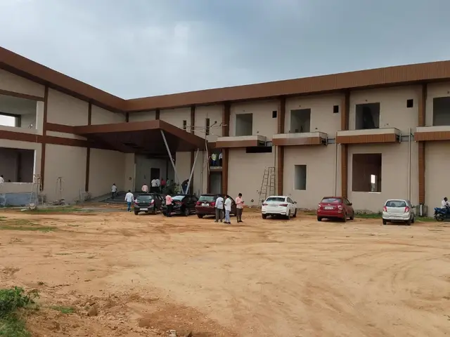
JBs NATURE VALLEY PHASE-II
SRI VENKATESWARA PROJECTS · Nalgonda · RERA P01800002831
JBs NATURE VALLEY PHASE-II is a plotted development in NAGOLE, Chityal mandal, Nalgonda district. It is being developed by the registered promoter Sri Venkateshwara Projects. The registered land area is 338762.35 sq. m., and the DTCP final-layout record states 794 plots across Ac. 83.71 cts; tower or floor configurations and plot-size bands are not stated. Its TG-RERA registration is P01800002831, and its proposed completion date is 02/11/2026.
01What we found
Read from TG-RERA filings, approvals, land and registration records and court records. A court case is counted only when the court record states this project's survey number with its village, or names the project.
02Check before you pay
9 items to check before you pay, 3 high - from the title chain, court records and approvals, each with what to ask the builder or your advocate. An item may not be a problem with the project: records can be incomplete.
1. Project at a glance
Project identity
| Item | Project record |
|---|---|
| Registered project name | JBs NATURE VALLEY PHASE-II RERA record |
| Project type | Plotted development RERA record RERA filing |
| Phase / registered portion | Phase-II, registered under P01800002831. The registered portion is identified by the survey numbers listed below; a separate phase boundary plan is not included in the supplied material. RERA record |
| TG-RERA registration and validity | P01800002831; issued 30/04/2021; valid from 30/04/2021 to 02/11/2026, stated as five years. Registration validity is distinct from project completion and occupancy status. |
| Registered promoter | Sri Venkateshwara Projects (also rendered in project records as SRI VENKATESWARA PROJECTS). RERA record Corporate record |
| RERA status | Registration certificate records a grant under section 5; no extension is recorded in the supplied certificate. |
Land and geographic identity
| Item | Project record |
|---|---|
| Locality | NAGOLE in the RERA filing; the filed approval documents identify Gundrampally / Gundram Palle. RERA record RERA filing |
| Revenue village | Gundram Palle in the project header and registration certificate; approval documents use Gundrampally. RERA record |
| Mandal | Chityal in the project identity and approval records. The registration certificate instead states Abdullapurmet; the registered site location should be confirmed against the title and sanctioned records. RERA record RERA filing |
| District / PIN | Nalgonda / 508114 in project and registration records. RERA record |
| Project survey numbers | 196, 200, 201, 202/P, 221/P, 222, 223/P, 224/P, 225/P, 299/P, 300, 301. The filing does not identify the subdivisions held within the base surveys; cadastral subdivision-level scope is therefore not established by these survey labels alone. RERA record |
| Registered site extent | 338762.35 sq. m. in the RERA land details. RERA filing |
| Net / total area | Total area 338762.35 sq. m.; net area 338762.35 sq. m.; reported affected area 00 sq. m. RERA filing |
| Boundaries | East: ROAD WIDTH; West: ROAD WIDTH; North: ROAD WIDTH; South: ROAD WIDTH. RERA filing |
Development identity
| Item | Project record |
|---|---|
| Sanctioning authority | Director of Town and Country Planning (DTCP); the layout approval records delegation to Gundrampally Gram Panchayat. |
| Principal layout approval | T.L.P. No. 251/2020/H; final layout release dated 29-06-2022. The earlier draft technical layout approval is dated 9-11-2020. Approvals record |
| Approved layout area in DTCP final-layout record | Ac. 83.71 cts. |
| Approved built-up area | RERA project information states 338762.35 sq. m. as approved built-up area. For this plotted project, that filing figure should not be read as a count or size of houses; individual dwelling permissions are separately addressed in the layout conditions. RERA filing |
| Plots and layout allocation | Final-layout record states 794 plots. It allocates 10% / Ac. 8.371 cts; 40515.64 Syds to open space (park), 29.42% / Ac. 24.63 cts; 119209.20 Syds to roads and 60.58% / Ac. 50.709 cts; 245431.56 Syds to plotted area. It also identifies school, nursery-school and convenient-shopping areas. |
| Buildings / floor configuration | Not disclosed in the supplied project record. The project is registered as a plotted layout, not as a specified multi-storey building scheme. RERA record |
| Mortgage area | RERA land details report 31363 sq. m. as mortgage area. The draft layout record describes Ac. 7.75 cts; 37510.00 Syds in favour of the Gram Panchayat; the final-layout extraction does not repeat that mortgage allocation. RERA filing |
Offering and status
| Item | Project record |
|---|---|
| Offering | Plots; the supplied RERA material does not provide plot-size bands, plot-by-plot inventory or unit configuration counts. RERA record |
| Booked / available | Not disclosed in the supplied project records. Document index |
| Construction / development stage | The project documents include an architect’s completion certificate and a DTCP final-layout release dated 29-06-2022. No independent site inspection record is supplied. |
| Completion deadline | Project filing states proposed completion 02/11/2026. This is separate from TG-RERA registration validity, which ends 02/11/2026. RERA record RERA filing |
| Occupancy / completion certificate | Architect’s certificate identifies DTCP certificate 10421/1040/2020/H, dated 29-06-2022, and states the registered project is complete. The supplied extraction does not specify a tower or individual-plot scope; the certificate is presented for the registered plotted project. |
2. The project story
JBs NATURE VALLEY PHASE-II is registered as a plotted development in the Gundram Palle/Gundrampally area of Nalgonda district. Its RERA-identified land covers surveys 196, 200, 201, 202/P, 221/P, 222, 223/P, 224/P, 225/P, 299/P, 300 and 301. The DTCP final-layout record describes a layout of Ac. 83.71 cts and 794 plots, with land allocated to plots, roads, parks and specified community uses. RERA record
The supplied record contains an architect’s certificate stating that the project is complete and identifies a DTCP certificate dated 29-06-2022. This is a filed certification, not an independent inspection of present on-site condition. No plot-level inventory, sales status or current construction-progress evidence is supplied.
3. Master plan, architecture & building design
The development is documented as a plotted layout rather than a building-by-building or tower scheme. The DTCP final-layout record identifies 794 plots across an approved layout area of Ac. 83.71 cts. Its stated land-use allocation includes 10% open space (park), 29.42% roads and 60.58% plotted area. It separately lists Ac. 1.26 cts; 6098.40 Syds for a primary school, Ac. 0.35 cts; 1694.0 Syds for a nursery school and Ac. 0.596 cts; 2884.64 Syds for convenient shopping (plots 205 to 212). These are the filed layout allocations, not evidence that each facility has been constructed or is operating.
The draft layout record identifies a Gram Panchayat mortgage area of Ac. 7.75 cts; 37510.00 Syds, described as plots 327 to 467, 470 to 489, 492 to 501 and 514 to 522. The RERA filing separately reports a mortgage area of 31363 sq. m. RERA filing
The approved layout conditions describe residential dwelling use, with individual building permissions to be considered under applicable building rules. They also refer to roads, open spaces, water supply, sewerage, drainage, street lighting and rainwater harvesting. No dwelling designs, building footprints, height or floor schedules, internal plot-size schedule, or apartment-style carpet/saleable-area information is supplied.
4. Homes, configurations & floor plans
This is a plotted project; the supplied material does not include RERA plot-size bands, plot-level configuration counts, booked or available plot counts, or a plot-wise sales inventory. Accordingly, a configuration table with unit counts and areas cannot be completed from the supplied record. RERA record Document index
Two drawing sheets are recorded, but both are scans pending measurement; no measured floor-plan or carpet-area result is available. The project’s plotted offering should not be assigned apartment carpet-area or loading figures. Floor plans
5. Parking & vehicle circulation
The supplied project documents do not establish a sanctioned parking count, visitor or accessible parking provision, parking arrangement for individual plots, or legally documented parking allocation. The layout approval records roads and road-area allocation but does not provide a detailed circulation or parking schedule in the supplied extraction.
6. Amenities, recreation & open spaces
The RERA amenity record lists the following facilities. Its progress fields show 0 where supplied; these entries do not establish that a facility is complete or independently verified. The final-layout document also specifies land allocations for parks, schools and convenient shopping. RERA amenities
| Facility | Description / size | Evidence source | Declared progress / verified status |
|---|---|---|---|
| Open space (park) | 10%; Ac. 8.371 cts; 40515.64 Syds | DTCP final layout | Approved allocation; no completion verification supplied |
| Primary school | Ac. 1.26 cts; 6098.40 Syds | DTCP final layout | Allocated land; no completion verification supplied |
| Nursery school | Ac. 0.35 cts; 1694.0 Syds | DTCP final layout | Allocated land; no completion verification supplied |
| Convenient shopping (205 to 212) | Ac. 0.596 cts; 2884.64 Syds | DTCP final layout | Allocated land; no completion verification supplied |
| Green strip / tot lot / park | Size not stated in the RERA amenity entry | TG-RERA amenities RERA amenities | Marked “YES”; progress shown as 0; no independent completion verification |
| Community buildings | Size and facility details not stated | TG-RERA amenities RERA amenities | Listed; no progress or completion verification supplied |
7. Utilities, building services & safety
The DTCP final-layout conditions describe the layout as provided with water supply, sewerage and drainage-disposal systems, street lighting, rainwater-harvesting structure and other civic amenities; they also refer to local-body maintenance. These are approval-document statements, not independent confirmation of current operation or capacity.
| Evidence in supplied record | Water supply is listed in the RERA amenities and DTCP layout conditions. No source, storage, treatment process or capacity is stated. RERA amenities |
|---|---|
| Status limitation | Filed / approval-document description; operating status not independently verified |
| Evidence in supplied record | RERA amenities list sewerage (chambers, lines, septic tank, STP); the DTCP conditions refer to sewerage and drainage-disposal systems. No capacity or commissioning evidence is supplied. RERA amenities |
|---|---|
| Status limitation | Facilities are described in the records; current operation not independently verified |
| Evidence in supplied record | RERA amenities list storm-water drains and water conservation/rainwater harvesting; DTCP conditions refer to rainwater-harvesting structures. No design capacity or completion evidence is supplied. RERA amenities |
|---|---|
| Status limitation | Listed / approval condition; independent verification unavailable |
| Evidence in supplied record | RERA amenities list an electrical meter room, sub-station and receiving station, and street lighting. No supply capacity or backup specification is supplied. RERA amenities |
|---|---|
| Status limitation | Listed; operational status not independently verified |
| Evidence in supplied record | RERA amenities mark fire protection and fire-safety requirements “YES.” No system details, capacity or separate clearance document is supplied. RERA amenities |
|---|---|
| Status limitation | Filing entry only; statutory compliance is not established by this entry |
| Evidence in supplied record | Solid-waste management and disposal appears in the RERA amenity list; no process or operating evidence is supplied. RERA amenities |
|---|---|
| Status limitation | Listed; completion and operation not independently verified |
| Evidence in supplied record | Listed as “YES” in RERA amenities; no system details are supplied. RERA amenities |
|---|---|
| Status limitation | Filing entry only |
8. Location, access & connectivity
The project records place the site in revenue village Gundram Palle/Gundrampally, Chityal mandal, Nalgonda district, PIN 508114. The RERA header also records locality NAGOLE. The RERA-filed layout approval identifies Gundrampally G.P. and the project survey numbers. RERA record RERA filing
The supplied location data gives an approximate distance of 40.8 km to the nearest sampled Outer Ring Road interchange. No other independently measured road, public-transport or landmark distances are supplied. Location record The project’s cadastral parcel-centroid coordinates are 17.25949, 79.00833 (rounded as displayed in the supplied location record). Location record
9. Developer & development status
The registered legal promoter is Sri Venkateshwara Projects, identified in the project filing as a partnership. The GSTIN supplied is 32ADZFS6777LZZZ. The project filing lists B Manohar Reddy as authorized signatory. Corporate record Parties record RERA filing
The registration certificate gives the promoter office as Village: PEDDAAMBERPET, Mandal: Abdullapurmet, District: Ranga Reddy, Pin: 500079. The project record separately lists a promoter address at Pedda aamberpet, Gundram Palle, NAGOLE, Chityal, Nalgonda, 508114. Parties record These are the addresses stated in the supplied records; a separate official website or contact number is not provided.
The registered project completion date is 02/11/2026. The architect’s filed completion certificate states that the project is complete and identifies the DTCP certificate dated 29-06-2022. No current independent site verification or plot-by-plot completion record is supplied. RERA filing
10. Approvals, official records & documents
| Record | Supplied evidence |
|---|---|
| TG-RERA registration | Form C registration certificate for JBs NATURE VALLEY PHASE-II, P01800002831, issued 30/04/2021 and valid through 02/11/2026. |
| Draft layout approval | DTCP Draft Technical Layout Pattern, Draft-TLP No. 251/2020/H, dated 9-11-2020; records 794 plots and draft conditions. |
| Final layout release | DTCP final technical layout approval, T.L.P. No. 251/2020/H, dated 29-06-2022; records Ac. 83.71 cts, 794 plots, land-use allocations and conditions. |
| Occupancy / completion record | Architect’s Form-1A identifies DTCP certificate 10421/1040/2020/H, dated 29-06-2022, and states the project is complete. |
| Title / promoter declaration | Filed Form B affidavit by SRI VENKATESWARA PROJECTS; the supplied extraction records the promoter’s title and encumbrance assertions. |
| Drawing review | Two drawing sheets are recorded; both are scans pending measurement, with no software-measured floor-plan results. Floor plans |
1. Project at a glance
Project identity
Registered project name: JBs NATURE VALLEY PHASE-II
Project type: Plotted development
Phase / registered portion: Phase-II, registered under P01800002831. The registered portion is identified by the survey numbers listed below; a separate phase boundary plan is not included in the supplied material.
TG-RERA registration and validity: P01800002831; issued 30/04/2021; valid from 30/04/2021 to 02/11/2026, stated as five years. Registration validity is distinct from project completion and occupancy status.
Registered promoter: Sri Venkateshwara Projects (also rendered in project records as SRI VENKATESWARA PROJECTS).
RERA status: Registration certificate records a grant under section 5; no extension is recorded in the supplied certificate.
Land and geographic identity
Locality: NAGOLE in the RERA filing; the filed approval documents identify Gundrampally / Gundram Palle.
Revenue village: Gundram Palle in the project header and registration certificate; approval documents use Gundrampally.
Mandal: Chityal in the project identity and approval records. The registration certificate instead states Abdullapurmet; the registered site location should be confirmed against the title and sanctioned records.
District / PIN: Nalgonda / 508114 in project and registration records.
Project survey numbers: 196, 200, 201, 202/P, 221/P, 222, 223/P, 224/P, 225/P, 299/P, 300, 301. The filing does not identify the subdivisions held within the base surveys; cadastral subdivision-level scope is therefore not established by these survey labels alone.
Registered site extent: 338762.35 sq. m. in the RERA land details.
Net / total area: Total area 338762.35 sq. m.; net area 338762.35 sq. m.; reported affected area 00 sq. m.
Boundaries: East: ROAD WIDTH; West: ROAD WIDTH; North: ROAD WIDTH; South: ROAD WIDTH.
Development identity
Sanctioning authority: Director of Town and Country Planning (DTCP); the layout approval records delegation to Gundrampally Gram Panchayat.
Principal layout approval: T.L.P. No. 251/2020/H; final layout release dated 29-06-2022. The earlier draft technical layout approval is dated 9-11-2020.
Approved layout area in DTCP final-layout record: Ac. 83.71 cts.
Approved built-up area: RERA project information states 338762.35 sq. m. as approved built-up area. For this plotted project, that filing figure should not be read as a count or size of houses; individual dwelling permissions are separately addressed in the layout conditions.
Plots and layout allocation: Final-layout record states 794 plots. It allocates 10% / Ac. 8.371 cts; 40515.64 Syds to open space (park), 29.42% / Ac. 24.63 cts; 119209.20 Syds to roads and 60.58% / Ac. 50.709 cts; 245431.56 Syds to plotted area. It also identifies school, nursery-school and convenient-shopping areas.
Buildings / floor configuration: Not disclosed in the supplied project record. The project is registered as a plotted layout, not as a specified multi-storey building scheme.
Mortgage area: RERA land details report 31363 sq. m. as mortgage area. The draft layout record describes Ac. 7.75 cts; 37510.00 Syds in favour of the Gram Panchayat; the final-layout extraction does not repeat that mortgage allocation.
Offering and status
Offering: Plots; the supplied RERA material does not provide plot-size bands, plot-by-plot inventory or unit configuration counts.
Booked / available: Not disclosed in the supplied project records.
Construction / development stage: The project documents include an architect’s completion certificate and a DTCP final-layout release dated 29-06-2022. No independent site inspection record is supplied.
Completion deadline: Project filing states proposed completion 02/11/2026. This is separate from TG-RERA registration validity, which ends 02/11/2026.
Occupancy / completion certificate: Architect’s certificate identifies DTCP certificate 10421/1040/2020/H, dated 29-06-2022, and states the registered project is complete. The supplied extraction does not specify a tower or individual-plot scope; the certificate is presented for the registered plotted project.
2. The project story
JBs NATURE VALLEY PHASE-II is registered as a plotted development in the Gundram Palle/Gundrampally area of Nalgonda district. Its RERA-identified land covers surveys 196, 200, 201, 202/P, 221/P, 222, 223/P, 224/P, 225/P, 299/P, 300 and 301. The DTCP final-layout record describes a layout of Ac. 83.71 cts and 794 plots, with land allocated to plots, roads, parks and specified community uses.
The supplied record contains an architect’s certificate stating that the project is complete and identifies a DTCP certificate dated 29-06-2022. This is a filed certification, not an independent inspection of present on-site condition. No plot-level inventory, sales status or current construction-progress evidence is supplied.
3. Master plan, architecture & building design
The development is documented as a plotted layout rather than a building-by-building or tower scheme. The DTCP final-layout record identifies 794 plots across an approved layout area of Ac. 83.71 cts. Its stated land-use allocation includes 10% open space (park), 29.42% roads and 60.58% plotted area. It separately lists Ac. 1.26 cts; 6098.40 Syds for a primary school, Ac. 0.35 cts; 1694.0 Syds for a nursery school and Ac. 0.596 cts; 2884.64 Syds for convenient shopping (plots 205 to 212). These are the filed layout allocations, not evidence that each facility has been constructed or is operating.
The draft layout record identifies a Gram Panchayat mortgage area of Ac. 7.75 cts; 37510.00 Syds, described as plots 327 to 467, 470 to 489, 492 to 501 and 514 to 522. The RERA filing separately reports a mortgage area of 31363 sq. m.
The approved layout conditions describe residential dwelling use, with individual building permissions to be considered under applicable building rules. They also refer to roads, open spaces, water supply, sewerage, drainage, street lighting and rainwater harvesting. No dwelling designs, building footprints, height or floor schedules, internal plot-size schedule, or apartment-style carpet/saleable-area information is supplied.
4. Homes, configurations & floor plans
This is a plotted project; the supplied material does not include RERA plot-size bands, plot-level configuration counts, booked or available plot counts, or a plot-wise sales inventory. Accordingly, a configuration table with unit counts and areas cannot be completed from the supplied record.
Two drawing sheets are recorded, but both are scans pending measurement; no measured floor-plan or carpet-area result is available. The project’s plotted offering should not be assigned apartment carpet-area or loading figures.
5. Parking & vehicle circulation
The supplied project documents do not establish a sanctioned parking count, visitor or accessible parking provision, parking arrangement for individual plots, or legally documented parking allocation. The layout approval records roads and road-area allocation but does not provide a detailed circulation or parking schedule in the supplied extraction.
6. Amenities, recreation & open spaces
The RERA amenity record lists the following facilities. Its progress fields show 0 where supplied; these entries do not establish that a facility is complete or independently verified. The final-layout document also specifies land allocations for parks, schools and convenient shopping.
| Facility | Description / size | Evidence source | Declared progress / verified status |
|---|---|---|---|
| Open space (park) | 10%; Ac. 8.371 cts; 40515.64 Syds | DTCP final layout | Approved allocation; no completion verification supplied |
| Primary school | Ac. 1.26 cts; 6098.40 Syds | DTCP final layout | Allocated land; no completion verification supplied |
| Nursery school | Ac. 0.35 cts; 1694.0 Syds | DTCP final layout | Allocated land; no completion verification supplied |
| Convenient shopping (205 to 212) | Ac. 0.596 cts; 2884.64 Syds | DTCP final layout | Allocated land; no completion verification supplied |
| Green strip / tot lot / park | Size not stated in the RERA amenity entry | TG-RERA amenities | Marked “YES”; progress shown as 0; no independent completion verification |
| Community buildings | Size and facility details not stated | TG-RERA amenities | Listed; no progress or completion verification supplied |
7. Utilities, building services & safety
The DTCP final-layout conditions describe the layout as provided with water supply, sewerage and drainage-disposal systems, street lighting, rainwater-harvesting structure and other civic amenities; they also refer to local-body maintenance. These are approval-document statements, not independent confirmation of current operation or capacity.
| Evidence in supplied record | Water supply is listed in the RERA amenities and DTCP layout conditions. No source, storage, treatment process or capacity is stated. |
|---|---|
| Status limitation | Filed / approval-document description; operating status not independently verified |
| Evidence in supplied record | RERA amenities list sewerage (chambers, lines, septic tank, STP); the DTCP conditions refer to sewerage and drainage-disposal systems. No capacity or commissioning evidence is supplied. |
|---|---|
| Status limitation | Facilities are described in the records; current operation not independently verified |
| Evidence in supplied record | RERA amenities list storm-water drains and water conservation/rainwater harvesting; DTCP conditions refer to rainwater-harvesting structures. No design capacity or completion evidence is supplied. |
|---|---|
| Status limitation | Listed / approval condition; independent verification unavailable |
| Evidence in supplied record | RERA amenities list an electrical meter room, sub-station and receiving station, and street lighting. No supply capacity or backup specification is supplied. |
|---|---|
| Status limitation | Listed; operational status not independently verified |
| Evidence in supplied record | RERA amenities mark fire protection and fire-safety requirements “YES.” No system details, capacity or separate clearance document is supplied. |
|---|---|
| Status limitation | Filing entry only; statutory compliance is not established by this entry |
| Evidence in supplied record | Solid-waste management and disposal appears in the RERA amenity list; no process or operating evidence is supplied. |
|---|---|
| Status limitation | Listed; completion and operation not independently verified |
| Evidence in supplied record | Listed as “YES” in RERA amenities; no system details are supplied. |
|---|---|
| Status limitation | Filing entry only |
8. Location, access & connectivity
The project records place the site in revenue village Gundram Palle/Gundrampally, Chityal mandal, Nalgonda district, PIN 508114. The RERA header also records locality NAGOLE. The RERA-filed layout approval identifies Gundrampally G.P. and the project survey numbers.
The supplied location data gives an approximate distance of 40.8 km to the nearest sampled Outer Ring Road interchange. No other independently measured road, public-transport or landmark distances are supplied. The project’s cadastral parcel-centroid coordinates are 17.25949, 79.00833 (rounded as displayed in the supplied location record).
9. Developer & development status
The registered legal promoter is Sri Venkateshwara Projects, identified in the project filing as a partnership. The GSTIN supplied is 32ADZFS6777LZZZ. The project filing lists B Manohar Reddy as authorized signatory.
The registration certificate gives the promoter office as Village: PEDDAAMBERPET, Mandal: Abdullapurmet, District: Ranga Reddy, Pin: 500079. The project record separately lists a promoter address at Pedda aamberpet, Gundram Palle, NAGOLE, Chityal, Nalgonda, 508114. These are the addresses stated in the supplied records; a separate official website or contact number is not provided.
The registered project completion date is 02/11/2026. The architect’s filed completion certificate states that the project is complete and identifies the DTCP certificate dated 29-06-2022. No current independent site verification or plot-by-plot completion record is supplied.
10. Approvals, official records & documents
TG-RERA registration: Form C registration certificate for JBs NATURE VALLEY PHASE-II, P01800002831, issued 30/04/2021 and valid through 02/11/2026.
Draft layout approval: DTCP Draft Technical Layout Pattern, Draft-TLP No. 251/2020/H, dated 9-11-2020; records 794 plots and draft conditions.
Final layout release: DTCP final technical layout approval, T.L.P. No. 251/2020/H, dated 29-06-2022; records Ac. 83.71 cts, 794 plots, land-use allocations and conditions.
Occupancy / completion record: Architect’s Form-1A identifies DTCP certificate 10421/1040/2020/H, dated 29-06-2022, and states the project is complete.
Title / promoter declaration: Filed Form B affidavit by SRI VENKATESWARA PROJECTS; the supplied extraction records the promoter’s title and encumbrance assertions.
Drawing review: Two drawing sheets are recorded; both are scans pending measurement, with no software-measured floor-plan results.
Frequently asked questions
Is JBs NATURE VALLEY PHASE-II registered with Telangana RERA?
Yes. JBs NATURE VALLEY PHASE-II is registered with the Telangana Real Estate Regulatory Authority as P01800002831; the registration status is New Project.
Who is the developer of JBs NATURE VALLEY PHASE-II?
The promoter named in the RERA registration is SRI VENKATESWARA PROJECTS.
Where is JBs NATURE VALLEY PHASE-II located?
JBs NATURE VALLEY PHASE-II is in NAGOLE, Gundram Palle, Chityal, Nalgonda, Telangana (508114).
When will JBs NATURE VALLEY PHASE-II be completed?
The promoter's proposed date of completion filed with RERA is 02/11/2026. This is the promoter's declaration, not a guarantee.
More projects in Gundram Palle