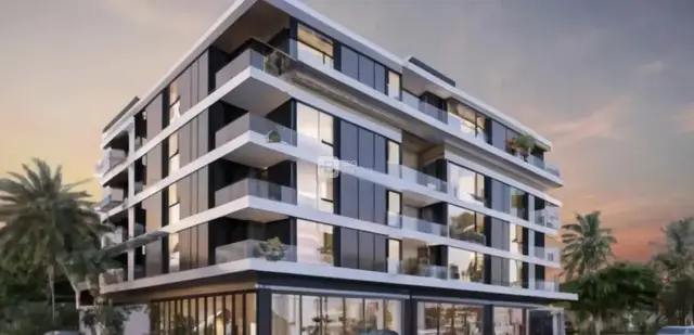
Ananta Hills
MADAS · Yadadri Bhuvanagiri · RERA P02000007653
ANANTA HILLS is a plotted development at Gundlapalli, Yadagirigutta Mandal, Yadadri Bhuvanagiri District. The registered promoter is Madas Shivanand. The project covers 40,305.37 sq. m and the filed draft technical layout records 60 plots; building or floor configurations are not disclosed. Its TG-RERA registration number is P02000007653, and the promoter’s completion undertaking states 19-09-2026.
01What we found
Read from TG-RERA filings, approvals, land and registration records and court records. A court case is counted only when the court record states this project's survey number with its village, or names the project.
02Check before you pay
9 items to check before you pay, 5 high - from the title chain, court records and approvals, each with what to ask the builder or your advocate. An item may not be a problem with the project: records can be incomplete.
1. Project at a glance
Project identity
| Item | Project record |
|---|---|
| Registered project name | ANANTA HILLS RERA record |
| Project type | Plotted development RERA record RERA filing |
| Phase / registered portion | New Project; the registration record identifies the project land as Survey Nos. 163/P and 164/P. A phase designation is not disclosed. RERA record |
| TG-RERA registration | P02000007653 RERA record |
| Registration validity | 31 January 2024 to 19 September 2026, subject to extension by the Authority under the Act and rules. This is the registration-validity period, not a statement of completion or occupancy. RERA record |
| Registered promoter | The TG-RERA certificate names Madas Shivanand as promoter; the project header records the promoter as MADAS. RERA record |
| RERA status | New Project; the registration record is captured as valid through 19 September 2026. No extension is shown in the supplied evidence. RERA record Approvals record |
Land and geographic identity
| Item | Project record |
|---|---|
| Locality / address | YADAGIRIUTTA; project address identifies Gundlapalli, Yadagirigutta, Yadadri Bhuvanagiri, Telangana, PIN 508115. RERA record RERA filing |
| Revenue village | Gundlapalli (also written “Gundlapally” in filed approval documents). RERA record |
| Mandal / district / PIN | Yadagirigutta Mandal; Yadadri Bhuvanagiri District; 508115. RERA record RERA filing |
| Project survey numbers and subdivisions | 163/P and 164/P. RERA record |
| Registered site extent | 40,305.37 sq. m (RERA land-details record). RERA filing |
| Total / net area | RERA land details state total area 40,305.37 sq. m, affected area 0, and net area 40,305.37 sq. m. RERA filing |
| Boundaries | North: OPEN AREA; South: OPEN AREA; East: OPEN AREA; West: OPEN AREA. RERA filing |
Development identity
| Item | Project record |
|---|---|
| Sanctioning authority | Yadagirigutta Municipality (Y.T.D.A.); the RERA project-information record lists DTCP as the authority. RERA filing |
| Principal layout approval | Draft TLP.No.01/2023/YTDA; approved 29-09-2023. The filed order also cites Proc.Roc.No.1975/2019/MCY/2023-24 and DTCP reference Ir.Roc.No. 1975/2019/YTDA dated 19.09.2023. Approvals record |
| Development form | Residential plotted layout. |
| Approved built-up area | RERA record: 30,056.40 sq. m. RERA filing |
| Plot count | The filed draft technical layout records 60 Nos.; this is a layout-plan count, not a separately supplied RERA inventory or availability statement. |
| Building / floor configuration | Not disclosed for this plotted development. Building-floor-plan records contain layout-plan material, not a residential building floor schedule. Document index |
| Parking | Parking counts, types and allocation are not established in the supplied project records. Document index RERA amenities |
Offering and status
| Item | Project record |
|---|---|
| Unit type | Plots; no RERA-filed plot-size range or plot-wise inventory is supplied. RERA record Document index |
| Booked / available counts | Not disclosed in the supplied evidence. The layout record states 60 plots, but does not establish booked or available counts. |
| RERA completion undertaking | The Form B declaration states completion by 19-09-2026. |
| Project-information completion date | 19/01/2027 is recorded in the project-information fields; its basis or whether it is a revised deadline is not supplied. RERA filing |
| Construction / development stage | No quantified construction or infrastructure progress is supplied. The RERA amenity entries report 0% progress for listed items. RERA amenities |
| Occupancy / completion certificate | No occupancy or completion certificate is identified in the supplied documents. The record concerns a plotted layout; no phase-wise or plot-wise OC status is supplied. Document index |
2. The project story
ANANTA HILLS is registered as a residential plotted development at Gundlapalli village, Yadagirigutta Mandal, Yadadri Bhuvanagiri District. The registered land is identified as Survey Nos. 163/P and 164/P, with a recorded site and net area of 40,305.37 sq. m. RERA record RERA filing
The filed draft technical layout describes a 60-plot layout, with internal roads, open-space, social-infrastructure and utility land. It also lists infrastructure and landscape works, including water-supply facilities, drainage, sewerage, street lighting, park development and avenue planting. These are plan or approval records; the supplied material does not establish which works have been completed or independently inspected.
The RERA filing includes a promoter’s completion undertaking of 19-09-2026, while the project-information fields record 19/01/2027. No construction-progress percentage, plot-wise sale status, or completion/occupancy certificate is supplied. The available evidence therefore does not establish the current physical stage or the status of individual plots. RERA filing RERA amenities Document index
3. Master plan, architecture & building design
This is a plotted layout rather than a multi-storey residential building project. The filed draft technical layout records 60 Nos. plots and a total area of 40,305.37 sq. m. Its land-use schedule records regular plotted area as 25,130.16 sq. m (62.35%), open space as 3,022.90 sq. m (7.50%), social infrastructure as 1,007.63 sq. m (2.50%), roads as 10,642.88 sq. m (26.41%), and utility land as 501.80 sq. m (1.24%).
The draft layout materials show proposed road widths including 50' wide road, 40'-0" wide road, and 20' wide road; the approval extraction separately describes road widths as 18 mts and above. The supplied records do not include a verified as-built survey or evidence of completed roads and open-space works.
The municipal draft-layout order identifies infrastructure and handover obligations for the layout, including open-space, social-infrastructure, road and utility areas. It also lists park development and avenue plantation, and calls for water supply, sewerage, drainage, rainwater harvesting and electrical works.
No residential building count, floor configuration, tower arrangement, building footprint, apartment distribution or building-height information is supplied. Document index
4. Homes, configurations & floor plans
The registered offering is plotted development. The supplied RERA records do not provide plot-wise unit counts, plot-size bands, booked/available inventory, or RERA saleable areas, so these cannot be reliably tabulated here. The filed draft layout states a total of 60 Nos. plots. RERA record
| Configuration | Units | Booked | Available | RERA saleable area | Measured carpet area | Loading (if supplied) |
|---|---|---|---|---|---|---|
| Plots | 60 Nos. in filed draft layout | Not disclosed | Not disclosed | Not disclosed | Not applicable / not supplied | Not supplied |
Two plan drawings are recorded, but both remain pending scan review; no software-measured areas are available. The vendor record lists plot sizes of 2700 and 5111 sq. ft., but these are third-party/vendor claims, not RERA-filed plot-area figures, and are not used as the registered offering here. Floor plans Promoter website
5. Parking & vehicle circulation
The supplied records do not establish a sanctioned parking count, visitor or accessible parking, parking allocation to individual plots, or a dedicated parking facility. The draft layout identifies internal roads and proposed road widths, but does not document a complete vehicle-circulation or pedestrian-separation scheme. Document index
6. Amenities, recreation & open spaces
The following facilities appear in the filed draft-layout approval or RERA amenity disclosures. The RERA amenity entries show 0% progress; completion is not independently verified. RERA amenities
| Description / size | Open-space area AC.0.747 cents (7.5%) in the approval order; draft technical layout also records 3,022.90 sq. m (7.50%). |
|---|---|
| Declared progress / verified status | Layout provision recorded; handover and completion not verified. RERA amenity progress: 0%. |
| Description / size | AC.0.249 cents (2.50%) in the approval order; draft technical layout records 1,007.63 sq. m (2.50%). |
|---|---|
| Declared progress / verified status | Layout provision recorded; delivery not verified. |
| Description / size | Avenue plantation and park development listed. |
|---|---|
| Declared progress / verified status | Proposed/listed; completion not verified. |
| Description / size | Internal roads and footpaths are listed; draft layout specifies road widths including 50', 40'-0" and 20'. |
|---|---|
| Evidence source | RERA amenities |
| Declared progress / verified status | RERA amenity progress: 0%; completion not verified. |
| Description / size | No specific clubhouse or indoor-recreation facility is established by the supplied project records. |
|---|---|
| Evidence source | RERA amenities Document index |
| Declared progress / verified status | Not established. |
| Description / size | No specific sports facility or children’s play area is established by the supplied RERA and approval records. |
|---|---|
| Evidence source | RERA amenities Document index |
| Declared progress / verified status | Not established. |
7. Utilities, building services & safety
The draft-layout approval lists internal water-supply pipelines, an overhead tank, an assured water-supply source, protected water supply including OHT and sumps, common septic tank/STP, independent sewerage disposal, underground drainage, storm-water drains, rainwater-harvesting pits, electrical supply lines, a transformer and street lights. These are filed plan/approval provisions; the supplied evidence does not establish capacities, commissioning or completed operation.
| Evidence in the project record | Internal water-supply pipelines, overhead tank, assured water-supply source, protected supply and sumps are listed. |
|---|---|
| Status evidenced | Proposed/listed; capacity and completion not supplied. |
| Evidence in the project record | Common septic tank/STP, independent sewerage disposal, underground drainage and storm-water drains are listed. |
|---|---|
| Status evidenced | Proposed/listed; treatment capacity and completion not supplied. RERA amenities |
| Evidence in the project record | Rainwater-harvesting pits and drainage/channelization of nalas for storm-water runoff are noted. |
|---|---|
| Status evidenced | Proposed/listed; completion not verified. |
| Evidence in the project record | Electrical supply lines, a transformer, meter room/sub-station/receiving station and street lighting appear in the records. |
|---|---|
| Status evidenced | Listed; capacity and completion not supplied. RERA amenities |
| Evidence in the project record | No project-specific fire system or safety-clearance evidence is supplied for the plotted layout. |
|---|---|
| Status evidenced | Not established. RERA amenities Document index |
| Evidence in the project record | Project-specific evidence for waste handling, CCTV, staffed access control, accessible circulation or ramps is not supplied. |
|---|---|
| Status evidenced | Not established. RERA amenities Document index |
8. Location, access & connectivity
The official project location is Gundlapalli village, Yadagirigutta Mandal, Yadadri Bhuvanagiri District, Telangana, PIN 508115. The cadastral parcel-centroid coordinate supplied for the project is 17.58516, 78.93414. RERA record RERA filing Location record Cadastral map
The location dataset records the nearest sampled Outer Ring Road interchange at approximately 30.9 km. No project-specific public-transport service, approach-road condition, or further verified landmark distances are supplied. Location record
9. Developer & development status
The TG-RERA registration certificate identifies Madas Shivanand as the promoter. The project header records the promoter as MADAS; legal entity type and corporate identifiers are not established in the supplied evidence. The certificate gives the promoter address as House No. 8-2-293/82/A/223, Hyderabad, Telangana, PIN 500033. RERA record Corporate record
The Form B affidavit, dated 29-01-2024, is a promoter declaration that the project will be completed by 19-09-2026. The project-information fields separately record 19/01/2027. The supplied evidence does not identify a revised completion order or establish current physical progress. RERA filing
The layout approval records infrastructure and plot-development obligations and states a three-year period for completing the development works. No separate evidence of final layout release, completed infrastructure or an occupancy/completion certificate is supplied. Document index
10. Approvals, official records & documents
| Record | Evidence and scope |
|---|---|
| TG-RERA registration certificate | Form C certificate for ANANTA HILLS, registration P02000007653, naming Madas Shivanand and identifying Survey Nos. 163/P and 164/P, Gundlapalli. The certificate records validity through 19 September 2026 and promoter obligations concerning agreements for sale, conveyances, project-account deposits and quarterly updates. |
| Draft layout approval | Yadagirigutta Municipality order approving Draft TLP.No.01/2023/YTDA, dated 29-09-2023, for the plotted layout at Gundlapalli in Survey Nos. 163/P and 164/P; includes layout conditions and infrastructure provisions. |
| Draft technical layout material | Plan records a residential plotted layout, 60 plots and land-use allocation, filed under layout-plan material. |
| Promoter declaration | Form B affidavit by M Shivanand, dated 29-01-2024, including title and encumbrance declarations, project-account undertakings and completion undertaking. |
| Completion / occupancy record | No completion certificate or occupancy certificate is identified in the supplied documents. Document index |
| Building plans | No residential building floor plan or building-level configuration is established by the supplied records; the relevant filed plan material concerns the plotted layout. Document index |
1. Project at a glance
Project identity
Registered project name: ANANTA HILLS
Project type: Plotted development
Phase / registered portion: New Project; the registration record identifies the project land as Survey Nos. 163/P and 164/P. A phase designation is not disclosed.
TG-RERA registration: P02000007653
Registration validity: 31 January 2024 to 19 September 2026, subject to extension by the Authority under the Act and rules. This is the registration-validity period, not a statement of completion or occupancy.
Registered promoter: The TG-RERA certificate names Madas Shivanand as promoter; the project header records the promoter as MADAS.
RERA status: New Project; the registration record is captured as valid through 19 September 2026. No extension is shown in the supplied evidence.
Land and geographic identity
Locality / address: YADAGIRIUTTA; project address identifies Gundlapalli, Yadagirigutta, Yadadri Bhuvanagiri, Telangana, PIN 508115.
Revenue village: Gundlapalli (also written “Gundlapally” in filed approval documents).
Mandal / district / PIN: Yadagirigutta Mandal; Yadadri Bhuvanagiri District; 508115.
Project survey numbers and subdivisions: 163/P and 164/P.
Registered site extent: 40,305.37 sq. m (RERA land-details record).
Total / net area: RERA land details state total area 40,305.37 sq. m, affected area 0, and net area 40,305.37 sq. m.
Boundaries: North: OPEN AREA; South: OPEN AREA; East: OPEN AREA; West: OPEN AREA.
Development identity
Sanctioning authority: Yadagirigutta Municipality (Y.T.D.A.); the RERA project-information record lists DTCP as the authority.
Principal layout approval: Draft TLP.No.01/2023/YTDA; approved 29-09-2023. The filed order also cites Proc.Roc.No.1975/2019/MCY/2023-24 and DTCP reference Ir.Roc.No. 1975/2019/YTDA dated 19.09.2023.
Development form: Residential plotted layout.
Approved built-up area: RERA record: 30,056.40 sq. m.
Plot count: The filed draft technical layout records 60 Nos.; this is a layout-plan count, not a separately supplied RERA inventory or availability statement.
Building / floor configuration: Not disclosed for this plotted development. Building-floor-plan records contain layout-plan material, not a residential building floor schedule.
Parking: Parking counts, types and allocation are not established in the supplied project records.
Offering and status
Unit type: Plots; no RERA-filed plot-size range or plot-wise inventory is supplied.
Booked / available counts: Not disclosed in the supplied evidence. The layout record states 60 plots, but does not establish booked or available counts.
RERA completion undertaking: The Form B declaration states completion by 19-09-2026.
Project-information completion date: 19/01/2027 is recorded in the project-information fields; its basis or whether it is a revised deadline is not supplied.
Construction / development stage: No quantified construction or infrastructure progress is supplied. The RERA amenity entries report 0% progress for listed items.
Occupancy / completion certificate: No occupancy or completion certificate is identified in the supplied documents. The record concerns a plotted layout; no phase-wise or plot-wise OC status is supplied.
2. The project story
ANANTA HILLS is registered as a residential plotted development at Gundlapalli village, Yadagirigutta Mandal, Yadadri Bhuvanagiri District. The registered land is identified as Survey Nos. 163/P and 164/P, with a recorded site and net area of 40,305.37 sq. m.
The filed draft technical layout describes a 60-plot layout, with internal roads, open-space, social-infrastructure and utility land. It also lists infrastructure and landscape works, including water-supply facilities, drainage, sewerage, street lighting, park development and avenue planting. These are plan or approval records; the supplied material does not establish which works have been completed or independently inspected.
The RERA filing includes a promoter’s completion undertaking of 19-09-2026, while the project-information fields record 19/01/2027. No construction-progress percentage, plot-wise sale status, or completion/occupancy certificate is supplied. The available evidence therefore does not establish the current physical stage or the status of individual plots.
3. Master plan, architecture & building design
This is a plotted layout rather than a multi-storey residential building project. The filed draft technical layout records 60 Nos. plots and a total area of 40,305.37 sq. m. Its land-use schedule records regular plotted area as 25,130.16 sq. m (62.35%), open space as 3,022.90 sq. m (7.50%), social infrastructure as 1,007.63 sq. m (2.50%), roads as 10,642.88 sq. m (26.41%), and utility land as 501.80 sq. m (1.24%).
The draft layout materials show proposed road widths including 50' wide road, 40'-0" wide road, and 20' wide road; the approval extraction separately describes road widths as 18 mts and above. The supplied records do not include a verified as-built survey or evidence of completed roads and open-space works.
The municipal draft-layout order identifies infrastructure and handover obligations for the layout, including open-space, social-infrastructure, road and utility areas. It also lists park development and avenue plantation, and calls for water supply, sewerage, drainage, rainwater harvesting and electrical works.
No residential building count, floor configuration, tower arrangement, building footprint, apartment distribution or building-height information is supplied.
4. Homes, configurations & floor plans
The registered offering is plotted development. The supplied RERA records do not provide plot-wise unit counts, plot-size bands, booked/available inventory, or RERA saleable areas, so these cannot be reliably tabulated here. The filed draft layout states a total of 60 Nos. plots.
| Configuration | Units | Booked | Available | RERA saleable area | Measured carpet area | Loading (if supplied) |
|---|---|---|---|---|---|---|
| Plots | 60 Nos. in filed draft layout | Not disclosed | Not disclosed | Not disclosed | Not applicable / not supplied | Not supplied |
Two plan drawings are recorded, but both remain pending scan review; no software-measured areas are available. The vendor record lists plot sizes of 2700 and 5111 sq. ft., but these are third-party/vendor claims, not RERA-filed plot-area figures, and are not used as the registered offering here.
5. Parking & vehicle circulation
The supplied records do not establish a sanctioned parking count, visitor or accessible parking, parking allocation to individual plots, or a dedicated parking facility. The draft layout identifies internal roads and proposed road widths, but does not document a complete vehicle-circulation or pedestrian-separation scheme.
6. Amenities, recreation & open spaces
The following facilities appear in the filed draft-layout approval or RERA amenity disclosures. The RERA amenity entries show 0% progress; completion is not independently verified.
| Description / size | Open-space area AC.0.747 cents (7.5%) in the approval order; draft technical layout also records 3,022.90 sq. m (7.50%). |
|---|---|
| Declared progress / verified status | Layout provision recorded; handover and completion not verified. RERA amenity progress: 0%. |
| Description / size | AC.0.249 cents (2.50%) in the approval order; draft technical layout records 1,007.63 sq. m (2.50%). |
|---|---|
| Declared progress / verified status | Layout provision recorded; delivery not verified. |
| Description / size | Avenue plantation and park development listed. |
|---|---|
| Declared progress / verified status | Proposed/listed; completion not verified. |
| Description / size | Internal roads and footpaths are listed; draft layout specifies road widths including 50', 40'-0" and 20'. |
|---|---|
| Declared progress / verified status | RERA amenity progress: 0%; completion not verified. |
| Description / size | No specific clubhouse or indoor-recreation facility is established by the supplied project records. |
|---|---|
| Declared progress / verified status | Not established. |
| Description / size | No specific sports facility or children’s play area is established by the supplied RERA and approval records. |
|---|---|
| Declared progress / verified status | Not established. |
7. Utilities, building services & safety
The draft-layout approval lists internal water-supply pipelines, an overhead tank, an assured water-supply source, protected water supply including OHT and sumps, common septic tank/STP, independent sewerage disposal, underground drainage, storm-water drains, rainwater-harvesting pits, electrical supply lines, a transformer and street lights. These are filed plan/approval provisions; the supplied evidence does not establish capacities, commissioning or completed operation.
| Evidence in the project record | Internal water-supply pipelines, overhead tank, assured water-supply source, protected supply and sumps are listed. |
|---|---|
| Status evidenced | Proposed/listed; capacity and completion not supplied. |
| Evidence in the project record | Common septic tank/STP, independent sewerage disposal, underground drainage and storm-water drains are listed. |
|---|---|
| Status evidenced | Proposed/listed; treatment capacity and completion not supplied. |
| Evidence in the project record | Rainwater-harvesting pits and drainage/channelization of nalas for storm-water runoff are noted. |
|---|---|
| Status evidenced | Proposed/listed; completion not verified. |
| Evidence in the project record | Electrical supply lines, a transformer, meter room/sub-station/receiving station and street lighting appear in the records. |
|---|---|
| Status evidenced | Listed; capacity and completion not supplied. |
| Evidence in the project record | No project-specific fire system or safety-clearance evidence is supplied for the plotted layout. |
|---|---|
| Status evidenced | Not established. |
| Evidence in the project record | Project-specific evidence for waste handling, CCTV, staffed access control, accessible circulation or ramps is not supplied. |
|---|---|
| Status evidenced | Not established. |
8. Location, access & connectivity
The official project location is Gundlapalli village, Yadagirigutta Mandal, Yadadri Bhuvanagiri District, Telangana, PIN 508115. The cadastral parcel-centroid coordinate supplied for the project is 17.58516, 78.93414.
The location dataset records the nearest sampled Outer Ring Road interchange at approximately 30.9 km. No project-specific public-transport service, approach-road condition, or further verified landmark distances are supplied.
9. Developer & development status
The TG-RERA registration certificate identifies Madas Shivanand as the promoter. The project header records the promoter as MADAS; legal entity type and corporate identifiers are not established in the supplied evidence. The certificate gives the promoter address as House No. 8-2-293/82/A/223, Hyderabad, Telangana, PIN 500033.
The Form B affidavit, dated 29-01-2024, is a promoter declaration that the project will be completed by 19-09-2026. The project-information fields separately record 19/01/2027. The supplied evidence does not identify a revised completion order or establish current physical progress.
The layout approval records infrastructure and plot-development obligations and states a three-year period for completing the development works. No separate evidence of final layout release, completed infrastructure or an occupancy/completion certificate is supplied.
10. Approvals, official records & documents
TG-RERA registration certificate: Form C certificate for ANANTA HILLS, registration P02000007653, naming Madas Shivanand and identifying Survey Nos. 163/P and 164/P, Gundlapalli. The certificate records validity through 19 September 2026 and promoter obligations concerning agreements for sale, conveyances, project-account deposits and quarterly updates.
Draft layout approval: Yadagirigutta Municipality order approving Draft TLP.No.01/2023/YTDA, dated 29-09-2023, for the plotted layout at Gundlapalli in Survey Nos. 163/P and 164/P; includes layout conditions and infrastructure provisions.
Draft technical layout material: Plan records a residential plotted layout, 60 plots and land-use allocation, filed under layout-plan material.
Promoter declaration: Form B affidavit by M Shivanand, dated 29-01-2024, including title and encumbrance declarations, project-account undertakings and completion undertaking.
Completion / occupancy record: No completion certificate or occupancy certificate is identified in the supplied documents.
Building plans: No residential building floor plan or building-level configuration is established by the supplied records; the relevant filed plan material concerns the plotted layout.
Frequently asked questions
Is ANANTA HILLS registered with Telangana RERA?
Yes. ANANTA HILLS is registered with the Telangana Real Estate Regulatory Authority as P02000007653; the registration status is New Project.
Who is the developer of ANANTA HILLS?
The promoter named in the RERA registration is MADAS.
Where is ANANTA HILLS located?
ANANTA HILLS is in YADAGIRIUTTA, Gundlapalli, Yadagirigutta, Yadadri Bhuvanagiri, Telangana (508115).
When will ANANTA HILLS be completed?
The promoter's proposed date of completion filed with RERA is 19/01/2027. This is the promoter's declaration, not a guarantee.
More projects in Gundlapalli