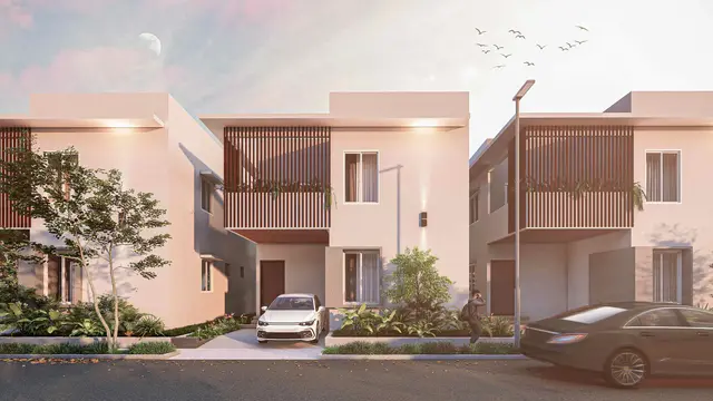
City Grande
M/s.NAVABHOOMI DEVELOPERS · Rangareddy · RERA P02400005945
CITY GRANDE is a plotted development in Kongarakhurd (A), Maheshwaram Mandal, Ranga Reddy District, developed by the registered promoter M/S.Navabhoomi Developers. The RERA land record gives a total area of 168717.59 sq.m and a net area of 151800.57 sq.m; the final layout letter records 442 plots, with no tower or floor configuration disclosed. The project is registered with TG-RERA as P02400005945, and the promoter’s declared completion date is 28th day of FEBRUARY 2026.
More from Navabhoomi Developers · 2 projects →
01What we found
Read from TG-RERA filings, approvals, land and registration records and court records. A court case is counted only when the court record states this project's survey number with its village, or names the project.
02Check before you pay
12 items to check before you pay, 4 high - from the title chain, court records and approvals, each with what to ask the builder or your advocate. An item may not be a problem with the project: records can be incomplete.
1. Project at a glance
Project identity
| Field | Project record |
|---|---|
| Registered project name | CITY GRANDE RERA record |
| Project type / phase | Plotted development; the registration identifies the project as a new project. No separate phase name or phase number is disclosed. RERA record RERA filing |
| TG-RERA registration | P02400005945 |
| Registration validity | 01/04/2023 to 28/02/2026; certificate states two years, subject to extension by the Authority. The supplied record does not show an extension. Approvals record |
| Registered promoter | M/S.Navabhoomi Developers |
| RERA status in the supplied record | Registered; the recorded validity ended on 28/02/2026. The evidence pack does not establish the project’s current registration status after that date. |
Land and geographic identity
| Field | Project record |
|---|---|
| Locality / revenue village | Kongarakhurd / Kongarakhurd (A); the layout approval also uses “KongaraKhurd-ORRGC Village” and “Kongarkhurd-A.” RERA record Land records |
| Mandal | Maheshwaram (also rendered “Maheswaram” in approval records). RERA record |
| District / PIN | Ranga Reddy / 501510. RERA record |
| Project survey numbers | OLD 86, OLD 87, OLD 88, OLD 89; NEW 460, 461, 462, 463. RERA record |
| Site area | RERA land record: total 168717.59 sq.m, area affected by road widening/FTL/Nala widening 16917.02 sq.m, and net area 151800.57 sq.m. Land records RERA filing |
| Boundaries | East: ROAD; West, North and South: OTHERS LAND. Land records |
| Layout approval’s site-area figures | Draft approval records 1,51,800.57 sq.m; final layout letter records total site area 168717.6 sq.m and net site area 151800.58 sq.m. |
Development identity
| Field | Project record |
|---|---|
| Sanctioning authority | Hyderabad Metropolitan Development Authority (HMDA); final layout issued through the Thukkuguda Municipal Corporation/Municipality. Approvals record |
| Principal draft layout approval | Draft residential open-plotted layout permit 10 /LO/Plg/HMDA/2023, dated 28-02-2023. |
| Final layout permission | Final layout permission 006670/FLT/HMDA/1565/SMD/2024, dated 12 September, 2025. |
| Approved plotted area and land-use split (draft approval) | Plotted area 99235.59 sq.m (65.37%); roads 35881.51 sq.m (23.64%); open space 11394.22 sq.m (07.51%); social infrastructure 3796.63 sq.m (02.50%); utility area 1492.62 sq.m (00.98%); total 151800.57 sq.m (100.00%). |
| Built-up area / building configuration | The final layout letter records Total Built up Area: 0. This is an open-plot layout; no tower, block, floor, basement, stilt, podium or parking-level configuration is disclosed. |
| Plot count | Final layout letter: 442 plots. |
| Mortgage area disclosed in RERA record | 20271.42 sq.m. The draft permit identifies Plot Nos. 229 to 237 and 388 to 428, admeasuring 24244.41 Sq.yds or 20271.42 Sq.mts, as mortgaged in favour of the Metropolitan Commissioner, HMDA. RERA filing |
Offering and status
| Field | Project record |
|---|---|
| Unit type | Plots; the final HMDA record identifies 442 plots. Plot-size bands, RERA inventory totals, booked counts and available counts are not supplied in the project records provided here. RERA record |
| RERA saleable area | No project-wide RERA plot-area range is supplied here. RERA unit table |
| Construction / development stage | An architect’s Form 1A dated 12-09-2025 certifies completion of construction work for the open layout and records an HMDA occupancy certificate for the open layout. This is a document-based certification, not an independent site inspection in this report. |
| Completion timeline | The promoter’s Form-B declaration undertakes completion by 28th day of FEBRUARY 2026. |
| Occupancy / completion record | The architect’s certificate records HMDA occupancy certificate / approval 006670/FLT/HMDA/1565/SMD/2024, dated 12-09-2025, for an Open Layout. |
| Registration deadline versus completion | RERA registration validity ended 28/02/2026; the promoter’s declared completion date was also 28th day of FEBRUARY 2026. These are separate recorded dates. |
2. The project story
- CITY GRANDE is a residential open-plot layout registered with TG-RERA as P02400005945, on land identified as old survey numbers 86, 87, 88 and 89 and new survey numbers 460, 461, 462 and 463 in Kongarakhurd (A), Maheshwaram Mandal, Ranga Reddy District.
- HMDA’s 2023 draft layout permit describes a 1,51,800.57 sq.m layout area divided among plots, roads, open space, social infrastructure and utility land. The 2025 final layout letter records 442 plots and a total site area of 168717.6 sq.m. The final letter restricts plots to residential dwelling-house use; no commercial plot offering is established by that record.
- The supplied architect’s Form 1A certifies completion of construction work for the open layout and records an HMDA occupancy certificate dated 12-09-2025. The RERA registration certificate, however, records validity only through 28/02/2026 and the supplied materials do not establish its status after expiry.
3. Master plan, architecture & building design
- This is a plotted layout rather than a multi-storey building project. The final layout letter identifies 442 plots and records no built-up area; building count, plot-by-plot dimensions, house designs and building floor configurations are not provided.
- The 2023 draft approval allocates 99235.59 sq.m to plotted area, 35881.51 sq.m to roads, 11394.22 sq.m to open space, 3796.63 sq.m to social infrastructure and 1492.62 sq.m to utilities, within a total layout area of 151800.57 sq.m. The final layout letter records an organized open-space/park area of 11394.21 sq.m (7.51%), social infrastructure of 3796.63 sq.m (2.50%), layout roads of 35882.09 sq.m (23.64%), utility area of 1492.64 sq.m (0.98%), plotted area of 99235.05 sq.m (65.37%), and amenity area 0.00.
- The draft permit names roads of “18 mts and above” and “60 feet and above”; the final layout letter lists road widths of 7.62, 9.14m, 12.0m, 18.0m, 24.00 MT and 30.00 MT. The layout drawings themselves were not available for measurement in the supplied drawing data: two drawings are recorded, both pending scan, with no measured plans. Floor plans
4. Homes, configurations & floor plans
The registered offering is a plotted development, and the final layout letter records 442 plots. The supplied records do not provide RERA inventory counts by plot size, booked or available counts, or a RERA-filed saleable-area range. RERA unit table
| Configuration | Units | Booked | Available | RERA saleable area | Measured carpet area | Loading (if supplied) |
|---|---|---|---|---|---|---|
| Plots | 442 in final layout letter | Not supplied | Not supplied | Not supplied | Not applicable | Not supplied |
The drawing review has no measured plans: two drawings are listed and both are scans pending. No software-measured plot or room dimensions are available. Floor plans
5. Parking & vehicle circulation
- The final layout letter records Common Parking Area 0.00. The supplied material does not establish dedicated resident or visitor parking counts, two-wheeler spaces, accessible spaces, parking allocation to individual plots, or EV charging. RERA amenities
- Internal roads form 35881.51 sq.m of the draft layout allocation; the final layout letter lists road widths from 7.62 to 30.00 MT. The draft permit requires roads to be opened for accessibility to neighbouring sites, and the final layout letter states that roads are to remain open for free public access.
6. Amenities, recreation & open spaces
The RERA amenity record marks the following infrastructure/facility categories as available, but records 0% progress for each listed item. The source does not independently verify completion. RERA amenities
| Facility | Description / size | Evidence source | Declared progress / verified status |
|---|---|---|---|
| Internal roads and footpaths | Internal roads; footpaths | RERA amenity record RERA amenities; layout permit | Listed “YES”; 0% recorded; not independently verified |
| Green strip / tot-lot / park | Open-space / park allocation: 11394.22 sq.m (07.51%) in draft approval | RERA amenities | Listed “YES”; 0% recorded; not independently verified |
| Community buildings | Size and facility details not supplied | RERA amenities | Listed “YES”; 0% recorded; not independently verified |
| Social infrastructure | 3796.63 sq.m (02.50%) | Allocated in draft layout; delivery status not independently verified | |
| Open space / park | Final letter records organized open space/park area 11394.21 sq.m | Approved layout allocation; completion not independently verified | |
| Other recreation facilities | No further project-specific size, quantity or capacity supplied | RERA amenities | Not established beyond the listed categories |
7. Utilities, building services & safety
- HMDA’s draft permit lists storm-water drains, underground drainage lines, a common septic tank/STP, internal water-supply pipelines, an overhead tank, electrical supply lines, streetlights, a transformer, avenue plantation, park development, rainwater-harvesting pits, solid-waste disposal/dumping space and a bio-compost unit. These are approval-document descriptions of planned layout infrastructure; no capacities or independent completion verification are supplied.
- The draft permit also requires arrangements for portable/drinking-water supply, underground ducting of utilities and service lines, a space for solid-waste disposal, paved footpaths and LED street lighting. The final layout letter says the layout has been provided with water supply, sewerage and drainage disposal systems, street lighting, rainwater-harvesting structure and other civic amenities, and states that roads, open spaces, social infrastructure and utilities have been taken over by the Local Authority. These statements are in the approval record; the supplied pack does not include separate operational tests or capacity records.
- No project-specific fire-system design, emergency access details, CCTV or security system, electrical backup, lift, or accessibility specification is established by the supplied RERA/layout records. The RERA amenity list marks fire protection and fire-safety requirements as “YES” but records 0% progress; this does not itself establish installed systems or statutory compliance. RERA amenities
8. Location, access & connectivity
- The registered project location is Kongarakhurd (A), Maheshwaram Mandal, Ranga Reddy District, PIN 501510, on the old and new survey numbers listed above. The layout approval records the site in KongaraKhurd-ORRGC Village and identifies its eastern boundary as a road in the RERA land record. RERA record Land records
- The supplied location data identifies Financial District (Nanakramguda), 1.2 km from a cadastral parcel centroid at 17.41528, 78.35459; this is a software/geocode-based location measure, not a verified travel route. The available records do not provide public-transport details or a measured approach-road route. Location record
9. Developer & development status
- The registered promoter is M/S.Navabhoomi Developers. Its entity type is recorded in the RERA profile as “Others,” described as a partnership; the project record gives GSTIN 36AATFN8036A1Z5. RERA record Corporate record RERA filing
- The RERA registration certificate gives the promoter office as “Village: Mandal: District: Hyderabad, Pin: 500030”; the supplied record does not provide a complete registered-office address or official contact details.
- A Form-B declaration dated 04.03.2023, signed by authorised signatory Mr. MD ABDUL ZAHID OSMANI, declares the land free from encumbrances and undertakes completion by 28th day of FEBRUARY 2026. These are promoter declarations.
- The architect’s Form 1A records completion of the open layout and an HMDA occupancy certificate dated 12-09-2025. The RERA registration certificate states validity through 28/02/2026; the supplied evidence does not show an extension or confirm current registration status after that date.
10. Approvals, official records & documents
| Identifier / date | P02400005945; issued 01/04/2023; recorded validity to 28/02/2026 |
|---|---|
| What the supplied record establishes | Registration of CITY GRANDE under section 5; certificate conditions include agreement-for-sale, conveyance and separate-account requirements. |
| Identifier / date | 10 /LO/Plg/HMDA/2023; 28-02-2023; file 052297/SMD/LT/U6/H/2022 |
|---|---|
| What the supplied record establishes | Draft residential open-plotted layout approval covering the listed old and new survey numbers and setting out land-use allocations and layout conditions. |
| Identifier / date | File TGMC/1286/2022-23; application date 31-12-2022 |
|---|---|
| What the supplied record establishes | Reports a gift settlement deed for 16917.01 SqMtr of road area in survey numbers 460, 461, 462 and 463; it is not an approval or permit. |
| Identifier / date | 006670/FLT/HMDA/1565/SMD/2024; 12 September, 2025 |
|---|---|
| What the supplied record establishes | Final residential open-plot layout permission; records 442 plots and associated road, open-space, social-infrastructure and utility allocations. |
| Identifier / date | 12-09-2025 |
|---|---|
| What the supplied record establishes | Certifies completion of construction work for the open layout and records HMDA occupancy certificate/approval 006670/FLT/HMDA/1565/SMD/2024 dated 12-09-2025. |
| Identifier / date | Mortgage deed 23438/2022, dated 27.12.2022; road-affected-area gift deed 23437/2022, dated 28.12.2022 |
|---|---|
| What the supplied record establishes | The draft permit identifies plots mortgaged in favour of the Metropolitan Commissioner, HMDA, and road-affected area gifted to the Local Body. |
| Identifier / date | Gift Deed 23438/2022; relinquishment deed 16263/2025, dated 12 September, 2025 |
|---|---|
| What the supplied record establishes | The final layout letter states that roads, open spaces, social infrastructure and utilities were taken over by the Local Authority and that HMDA executed a deed of relinquishment concerning mortgaged plots. |
| Identifier / date | 04.03.2023 |
|---|---|
| What the supplied record establishes | Promoter’s declaration of title, encumbrance position, completion undertaking and project-account obligations. |
The HMDA final layout letter states that plot building permission is to be considered under Building Rules - 2012 and amended rules, and that the layout permission itself is for an open-plot layout.
1. Project at a glance
Project identity
Registered project name: CITY GRANDE
Project type / phase: Plotted development; the registration identifies the project as a new project. No separate phase name or phase number is disclosed.
TG-RERA registration: P02400005945
Registration validity: 01/04/2023 to 28/02/2026; certificate states two years, subject to extension by the Authority. The supplied record does not show an extension.
Registered promoter: M/S.Navabhoomi Developers
RERA status in the supplied record: Registered; the recorded validity ended on 28/02/2026. The evidence pack does not establish the project’s current registration status after that date.
Land and geographic identity
Locality / revenue village: Kongarakhurd / Kongarakhurd (A); the layout approval also uses “KongaraKhurd-ORRGC Village” and “Kongarkhurd-A.”
Mandal: Maheshwaram (also rendered “Maheswaram” in approval records).
District / PIN: Ranga Reddy / 501510.
Project survey numbers: OLD 86, OLD 87, OLD 88, OLD 89; NEW 460, 461, 462, 463.
Site area: RERA land record: total 168717.59 sq.m, area affected by road widening/FTL/Nala widening 16917.02 sq.m, and net area 151800.57 sq.m.
Boundaries: East: ROAD; West, North and South: OTHERS LAND.
Layout approval’s site-area figures: Draft approval records 1,51,800.57 sq.m; final layout letter records total site area 168717.6 sq.m and net site area 151800.58 sq.m.
Development identity
Sanctioning authority: Hyderabad Metropolitan Development Authority (HMDA); final layout issued through the Thukkuguda Municipal Corporation/Municipality.
Principal draft layout approval: Draft residential open-plotted layout permit 10 /LO/Plg/HMDA/2023, dated 28-02-2023.
Final layout permission: Final layout permission 006670/FLT/HMDA/1565/SMD/2024, dated 12 September, 2025.
Approved plotted area and land-use split (draft approval): Plotted area 99235.59 sq.m (65.37%); roads 35881.51 sq.m (23.64%); open space 11394.22 sq.m (07.51%); social infrastructure 3796.63 sq.m (02.50%); utility area 1492.62 sq.m (00.98%); total 151800.57 sq.m (100.00%).
Built-up area / building configuration: The final layout letter records Total Built up Area: 0. This is an open-plot layout; no tower, block, floor, basement, stilt, podium or parking-level configuration is disclosed.
Plot count: Final layout letter: 442 plots.
Mortgage area disclosed in RERA record: 20271.42 sq.m. The draft permit identifies Plot Nos. 229 to 237 and 388 to 428, admeasuring 24244.41 Sq.yds or 20271.42 Sq.mts, as mortgaged in favour of the Metropolitan Commissioner, HMDA.
Offering and status
Unit type: Plots; the final HMDA record identifies 442 plots. Plot-size bands, RERA inventory totals, booked counts and available counts are not supplied in the project records provided here.
RERA saleable area: No project-wide RERA plot-area range is supplied here.
Construction / development stage: An architect’s Form 1A dated 12-09-2025 certifies completion of construction work for the open layout and records an HMDA occupancy certificate for the open layout. This is a document-based certification, not an independent site inspection in this report.
Completion timeline: The promoter’s Form-B declaration undertakes completion by 28th day of FEBRUARY 2026.
Occupancy / completion record: The architect’s certificate records HMDA occupancy certificate / approval 006670/FLT/HMDA/1565/SMD/2024, dated 12-09-2025, for an Open Layout.
Registration deadline versus completion: RERA registration validity ended 28/02/2026; the promoter’s declared completion date was also 28th day of FEBRUARY 2026. These are separate recorded dates.
2. The project story
- CITY GRANDE is a residential open-plot layout registered with TG-RERA as P02400005945, on land identified as old survey numbers 86, 87, 88 and 89 and new survey numbers 460, 461, 462 and 463 in Kongarakhurd (A), Maheshwaram Mandal, Ranga Reddy District.
- HMDA’s 2023 draft layout permit describes a 1,51,800.57 sq.m layout area divided among plots, roads, open space, social infrastructure and utility land. The 2025 final layout letter records 442 plots and a total site area of 168717.6 sq.m. The final letter restricts plots to residential dwelling-house use; no commercial plot offering is established by that record.
- The supplied architect’s Form 1A certifies completion of construction work for the open layout and records an HMDA occupancy certificate dated 12-09-2025. The RERA registration certificate, however, records validity only through 28/02/2026 and the supplied materials do not establish its status after expiry.
3. Master plan, architecture & building design
- This is a plotted layout rather than a multi-storey building project. The final layout letter identifies 442 plots and records no built-up area; building count, plot-by-plot dimensions, house designs and building floor configurations are not provided.
- The 2023 draft approval allocates 99235.59 sq.m to plotted area, 35881.51 sq.m to roads, 11394.22 sq.m to open space, 3796.63 sq.m to social infrastructure and 1492.62 sq.m to utilities, within a total layout area of 151800.57 sq.m. The final layout letter records an organized open-space/park area of 11394.21 sq.m (7.51%), social infrastructure of 3796.63 sq.m (2.50%), layout roads of 35882.09 sq.m (23.64%), utility area of 1492.64 sq.m (0.98%), plotted area of 99235.05 sq.m (65.37%), and amenity area 0.00.
- The draft permit names roads of “18 mts and above” and “60 feet and above”; the final layout letter lists road widths of 7.62, 9.14m, 12.0m, 18.0m, 24.00 MT and 30.00 MT. The layout drawings themselves were not available for measurement in the supplied drawing data: two drawings are recorded, both pending scan, with no measured plans.
4. Homes, configurations & floor plans
The registered offering is a plotted development, and the final layout letter records 442 plots. The supplied records do not provide RERA inventory counts by plot size, booked or available counts, or a RERA-filed saleable-area range.
| Configuration | Units | Booked | Available | RERA saleable area | Measured carpet area | Loading (if supplied) |
|---|---|---|---|---|---|---|
| Plots | 442 in final layout letter | Not supplied | Not supplied | Not supplied | Not applicable | Not supplied |
The drawing review has no measured plans: two drawings are listed and both are scans pending. No software-measured plot or room dimensions are available.
5. Parking & vehicle circulation
- The final layout letter records Common Parking Area 0.00. The supplied material does not establish dedicated resident or visitor parking counts, two-wheeler spaces, accessible spaces, parking allocation to individual plots, or EV charging.
- Internal roads form 35881.51 sq.m of the draft layout allocation; the final layout letter lists road widths from 7.62 to 30.00 MT. The draft permit requires roads to be opened for accessibility to neighbouring sites, and the final layout letter states that roads are to remain open for free public access.
6. Amenities, recreation & open spaces
The RERA amenity record marks the following infrastructure/facility categories as available, but records 0% progress for each listed item. The source does not independently verify completion.
| Facility | Description / size | Evidence source | Declared progress / verified status |
|---|---|---|---|
| Internal roads and footpaths | Internal roads; footpaths | RERA amenity record; layout permit | Listed “YES”; 0% recorded; not independently verified |
| Green strip / tot-lot / park | Open-space / park allocation: 11394.22 sq.m (07.51%) in draft approval | Listed “YES”; 0% recorded; not independently verified | |
| Community buildings | Size and facility details not supplied | Listed “YES”; 0% recorded; not independently verified | |
| Social infrastructure | 3796.63 sq.m (02.50%) | Allocated in draft layout; delivery status not independently verified | |
| Open space / park | Final letter records organized open space/park area 11394.21 sq.m | Approved layout allocation; completion not independently verified | |
| Other recreation facilities | No further project-specific size, quantity or capacity supplied | Not established beyond the listed categories |
7. Utilities, building services & safety
- HMDA’s draft permit lists storm-water drains, underground drainage lines, a common septic tank/STP, internal water-supply pipelines, an overhead tank, electrical supply lines, streetlights, a transformer, avenue plantation, park development, rainwater-harvesting pits, solid-waste disposal/dumping space and a bio-compost unit. These are approval-document descriptions of planned layout infrastructure; no capacities or independent completion verification are supplied.
- The draft permit also requires arrangements for portable/drinking-water supply, underground ducting of utilities and service lines, a space for solid-waste disposal, paved footpaths and LED street lighting. The final layout letter says the layout has been provided with water supply, sewerage and drainage disposal systems, street lighting, rainwater-harvesting structure and other civic amenities, and states that roads, open spaces, social infrastructure and utilities have been taken over by the Local Authority. These statements are in the approval record; the supplied pack does not include separate operational tests or capacity records.
- No project-specific fire-system design, emergency access details, CCTV or security system, electrical backup, lift, or accessibility specification is established by the supplied RERA/layout records. The RERA amenity list marks fire protection and fire-safety requirements as “YES” but records 0% progress; this does not itself establish installed systems or statutory compliance.
8. Location, access & connectivity
- The registered project location is Kongarakhurd (A), Maheshwaram Mandal, Ranga Reddy District, PIN 501510, on the old and new survey numbers listed above. The layout approval records the site in KongaraKhurd-ORRGC Village and identifies its eastern boundary as a road in the RERA land record.
- The supplied location data identifies Financial District (Nanakramguda), 1.2 km from a cadastral parcel centroid at 17.41528, 78.35459; this is a software/geocode-based location measure, not a verified travel route. The available records do not provide public-transport details or a measured approach-road route.
9. Developer & development status
- The registered promoter is M/S.Navabhoomi Developers. Its entity type is recorded in the RERA profile as “Others,” described as a partnership; the project record gives GSTIN 36AATFN8036A1Z5.
- The RERA registration certificate gives the promoter office as “Village: Mandal: District: Hyderabad, Pin: 500030”; the supplied record does not provide a complete registered-office address or official contact details.
- A Form-B declaration dated 04.03.2023, signed by authorised signatory Mr. MD ABDUL ZAHID OSMANI, declares the land free from encumbrances and undertakes completion by 28th day of FEBRUARY 2026. These are promoter declarations.
- The architect’s Form 1A records completion of the open layout and an HMDA occupancy certificate dated 12-09-2025. The RERA registration certificate states validity through 28/02/2026; the supplied evidence does not show an extension or confirm current registration status after that date.
10. Approvals, official records & documents
| Identifier / date | P02400005945; issued 01/04/2023; recorded validity to 28/02/2026 |
|---|---|
| What the supplied record establishes | Registration of CITY GRANDE under section 5; certificate conditions include agreement-for-sale, conveyance and separate-account requirements. |
| Identifier / date | 10 /LO/Plg/HMDA/2023; 28-02-2023; file 052297/SMD/LT/U6/H/2022 |
|---|---|
| What the supplied record establishes | Draft residential open-plotted layout approval covering the listed old and new survey numbers and setting out land-use allocations and layout conditions. |
| Identifier / date | File TGMC/1286/2022-23; application date 31-12-2022 |
|---|---|
| What the supplied record establishes | Reports a gift settlement deed for 16917.01 SqMtr of road area in survey numbers 460, 461, 462 and 463; it is not an approval or permit. |
| Identifier / date | 006670/FLT/HMDA/1565/SMD/2024; 12 September, 2025 |
|---|---|
| What the supplied record establishes | Final residential open-plot layout permission; records 442 plots and associated road, open-space, social-infrastructure and utility allocations. |
| Identifier / date | 12-09-2025 |
|---|---|
| What the supplied record establishes | Certifies completion of construction work for the open layout and records HMDA occupancy certificate/approval 006670/FLT/HMDA/1565/SMD/2024 dated 12-09-2025. |
| Identifier / date | Mortgage deed 23438/2022, dated 27.12.2022; road-affected-area gift deed 23437/2022, dated 28.12.2022 |
|---|---|
| What the supplied record establishes | The draft permit identifies plots mortgaged in favour of the Metropolitan Commissioner, HMDA, and road-affected area gifted to the Local Body. |
| Identifier / date | Gift Deed 23438/2022; relinquishment deed 16263/2025, dated 12 September, 2025 |
|---|---|
| What the supplied record establishes | The final layout letter states that roads, open spaces, social infrastructure and utilities were taken over by the Local Authority and that HMDA executed a deed of relinquishment concerning mortgaged plots. |
| Identifier / date | 04.03.2023 |
|---|---|
| What the supplied record establishes | Promoter’s declaration of title, encumbrance position, completion undertaking and project-account obligations. |
The HMDA final layout letter states that plot building permission is to be considered under Building Rules - 2012 and amended rules, and that the layout permission itself is for an open-plot layout.
Frequently asked questions
Is CITY GRANDE registered with Telangana RERA?
Yes. CITY GRANDE is registered with the Telangana Real Estate Regulatory Authority as P02400005945; the registration status is New Project.
Who is the developer of CITY GRANDE?
The promoter named in the RERA registration is M/s.NAVABHOOMI DEVELOPERS.
Where is CITY GRANDE located?
CITY GRANDE is in Kongarakhurd, Maheshwaram, Rangareddy, Telangana (501510).
When will CITY GRANDE be completed?
The promoter's proposed date of completion filed with RERA is 28/02/2026. This is the promoter's declaration, not a guarantee.
More projects in Kongarakurdu