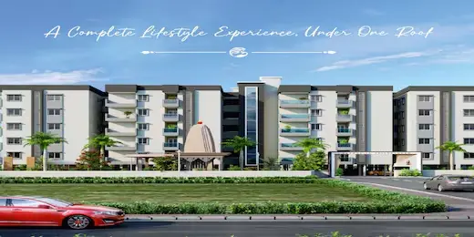
Emerald County
VM VISION INFRALLP · Rangareddy · RERA P02400007365
EMERALD COUNTY is a plotted development in Kothur, Kothur mandal, Ranga Reddy district, developed by registered promoter VM VISION INFRALLP. The project has a total site area of 21,043.48 sq. m and comprises 82 residential open plots, with drawing-derived plot sizes ranging from 101.29 sq. m to 286.09 sq. m; no towers or floors are specified. Its TG-RERA registration number is P02400007365, and the promoter-declared completion date is 12/06/2026.
01What we found
Read from TG-RERA filings, approvals, land and registration records and court records. A court case is counted only when the court record states this project's survey number with its village, or names the project.
02Check before you pay
9 items to check before you pay, 3 high - from the title chain, court records and approvals, each with what to ask the builder or your advocate. An item may not be a problem with the project: records can be incomplete.
1. Project at a glance
Project identity
| Item | Project record |
|---|---|
| Registered project name | EMERALD COUNTY RERA record |
| Project type | Plotted development / open plotted layout RERA filing |
| Phase or registered portion | No phase designation is stated; the registration is for the project identified as EMERALD COUNTY RERA record |
| TG-RERA registration | P02400007365 |
| Registration validity | 12/06/2023–12/06/2026; certificate states a three-year term. This is the registration period, not a statement that the project was completed or received an occupancy certificate |
| Registered promoter | VM VISION INFRALLP, an LLP RERA record Corporate record |
| RERA status | The supplied certificate records registration under section 5. No extension is recorded in the supplied certificate |
Land and geographic identity
| Item | Project record |
|---|---|
| Locality / revenue village | Kothur (also rendered “Kottur” in title materials); village identity in the project record: Kothur RERA record RERA filing |
| Mandal | Kothur RERA record RERA filing |
| District | Ranga Reddy RERA record RERA filing |
| PIN | 509228 RERA record RERA filing |
| Project survey number and subdivision | Sy. No. 227/PART RERA filing |
| Registered site extent | 21,043.48 sq. m total site area; 1,319.55 sq. m road-affected area; 19,723.93 sq. m net area in the project record RERA filing |
| Layout drawing area statement | 19,323.30 sq. m net layout area, as shown in the filed drawing extraction |
| Boundaries in RERA record | East: Sy. No. 227; West: other land; North: Chegur Shivaru; South: land RERA filing |
Development identity
| Item | Project record |
|---|---|
| Sanctioning authority | Hyderabad Metropolitan Development Authority (HMDA) Approvals record |
| Principal approval on file | Draft layout letter 001806/LO/HMDA/0382/SMD/2023, dated 12 June 2023 Approvals record |
| Drawing / permit reference | TS/018605/2023 appears on the filed layout drawing |
| Final layout approval identified in architect’s certificate | 009330/FLT/HMDA/2393/SMD/2024, dated 26.08.2025 |
| Development form and count | 82 open plots in the layout; no residential buildings, towers or floors are specified in the supplied layout approval material |
| Approved built-up area | The layout drawing records proposed built-up area as 0.00; this is a plotted layout, not an apartment-building plan |
| Parking | The layout drawing records 0 proposed parking and 0.00 common parking area |
Offering and status
| Item | Project record |
|---|---|
| Offering | Plots; the filed layout describes 82 residential open plots |
| Plot size range / individual sizes | The drawing-derived layout dataset lists 82 plots with sizes from 101.29 sq. m to 286.09 sq. m; software-read drawing measurements, not RERA-filed saleable-area figures Layout record |
| Booked / available plots | Not disclosed in the supplied project data RERA filing |
| Construction / development stage | An architect’s certificate dated 30.08.2025 states that the project is completed in all aspects; this is a filed professional certification, not an independent site inspection in this review |
| Promoter-declared completion date | 12/06/2026 RERA filing |
| Occupancy / completion certificate status | The supplied material includes the architect’s completion certificate and identifies a final HMDA layout approval; no separate occupancy certificate is identified. The project is a plotted layout |
2. The project story
- EMERALD COUNTY is registered as a plotted development on Sy. No. 227/PART, in Kothur village and mandal, Ranga Reddy district. The filed layout material presents an open layout of 82 plots, with internal roads, open space/park land, social-infrastructure land, utility land and a buffer area. It does not describe apartment blocks, villas under construction, or building floors. RERA record RERA filing
- The project record gives a total site area of 21,043.48 sq. m, of which 1,319.55 sq. m is identified as affected by road widening. The layout drawing separately states a net layout area of 19,323.30 sq. m. RERA filing
- A filed architect’s certificate dated 30.08.2025 certifies completion in all aspects and cites final HMDA layout approval 009330/FLT/HMDA/2393/SMD/2024, dated 26.08.2025. These are document-based certifications; the supplied evidence does not provide an independent site inspection or plot-by-plot handover status.
3. Master plan, architecture & building design
The filed drawing is for a plotted layout, not a building plan. It shows 82 plots and the following layout land-use figures:
| Layout component | Area | Share shown on drawing |
|---|---|---|
| Plotted area | 11,512.53 sq. m | 59.58% |
| Road area | 5,195.49 sq. m | 26.89% |
| Organized open space / park | 1,466.23 sq. m | 7.59% |
| Social infrastructure | 489.77 sq. m | 2.53% |
| Utility area | 127.21 sq. m | 0.66% |
| Buffer zone | 532.07 sq. m | 2.75% |
| Total net layout | 19,323.30 sq. m | 100.00% |
- The layout drawing records proposed built-up area as 0.00, proposed parking as 0, and common parking area as 0.00. It identifies a 9.14 m wide road on the drawing; the draft layout letter also refers to roads of 18 mts and above and a 45 mtrs wide Master plan road.
- The draft layout letter describes infrastructure works including road formation, storm-water drains, underground drainage lines and a common septic tank / STP, along with internal water-supply pipelines and an overhead tank. The drawing extraction also identifies rainwater-harvesting pits and a septic tank. These are approval-document descriptions; the supplied evidence does not independently verify their present condition.
4. Homes, configurations & floor plans
- This is a plotted project. The filed layout identifies 82 plots; no apartment configuration, RERA-filed plot saleable-area schedule, or booked/available inventory is supplied. RERA filing
- The drawing-derived dataset reports the following plot-size distribution. These figures are software-measured/read from the layout drawing and are not RERA-filed unit saleable-area figures. Layout record
| Drawing-derived plot size band | Number of plots |
|---|---|
| 100–150 sq. yd (84–125 sq. m) | 13 |
| 150–200 sq. yd (125–167 sq. m) | 62 |
| 200–250 sq. yd (167–209 sq. m) | 4 |
| 250–300 sq. yd (209–251 sq. m) | 1 |
| 300–400 sq. yd (251–334 sq. m) | 2 |
The software-read drawing dataset gives a smallest plot size of 101.29 sq. m, median of 136.57 sq. m, and largest of 286.09 sq. m. No carpet-area measure applies to the plotted offering. Layout record
5. Parking & vehicle circulation
The layout drawing records 0 proposed parking, 0.00 common parking area, and no parking allocation schedule. The available material does not establish dedicated, visitor, accessible or plot-specific parking arrangements.
The layout includes internal roads; the drawing identifies a 9.14 m wide road, while the draft letter refers to roads of 18 mts and above. The supplied documents do not specify vehicle-entry and exit locations, pedestrian separation, EV charging, or a parking-allotment arrangement.
6. Amenities, recreation & open spaces
| Facility / land use | Organized open space / park |
|---|---|
| Description / size | 1,466.23 sq. m; 7.59% of net layout area |
| Declared progress / verified status | Shown in the layout drawing; no independent completion verification supplied |
| Facility / land use | Buffer zone |
|---|---|
| Description / size | 532.07 sq. m; 2.75% |
| Declared progress / verified status | Shown in the layout drawing; no independent completion verification supplied |
| Facility / land use | Social infrastructure area |
|---|---|
| Description / size | 489.77 sq. m; 2.53% |
| Declared progress / verified status | Land allocation shown; specific facility or delivered building is not identified |
| Facility / land use | Utility area |
|---|---|
| Description / size | 127.21 sq. m; 0.66% |
| Declared progress / verified status | Land allocation shown; completion not independently verified |
| Facility / land use | Children’s park |
|---|---|
| Description / size | No size stated |
| Declared progress / verified status | Promotional brochure claim; not evidence of delivery |
| Facility / land use | Avenue plantation and footpath tiles |
|---|---|
| Description / size | No quantity or size stated |
| Declared progress / verified status | Promotional brochure claim; not evidence of delivery |
The layout drawing records 0.00 amenity area. The supplied evidence does not identify a clubhouse or indoor recreational facility.
7. Utilities, building services & safety
- The draft layout letter lists internal water-supply pipelines, an overhead tank, transformer, rainwater-harvesting pits, and common septic tank / STP. It also specifies road formation, storm-water drains and underground drainage lines as development works. These are document-stated provisions; capacities, operating status and independent completion verification are not supplied.
- The layout drawing identifies a utility area of 127.21 sq. m and a septic tank and rainwater-harvesting pit. It does not establish water source or storage capacity, sewage-treatment capacity or reuse arrangements, electrical-backup capacity, security systems, accessibility provisions, or fire-safety systems.
- The brochure also lists underground electricity, transformer and street lights, underground drainage, and an overhead tank; these are promotional claims, not independently verified service status.
8. Location, access & connectivity
- The registered location is Kothur, Kothur mandal, Ranga Reddy district, Telangana, PIN 509228. The project parcel centroid supplied in the cadastral data is 17.18369047592021, 78.28350798036664. RERA record RERA filing Cadastral map
- The location dataset lists the nearest sampled Outer Ring Road interchange at approximately 16.4 km. No other measured distances or travel times are supplied in the project location data. Location record
- The layout documents refer to a 45 mtrs wide Master plan road affecting the site and to internal layout roads; they do not provide a verified access route, public-transport information, or journey-time estimate.
9. Developer & development status
- The registered legal promoter is VM VISION INFRALLP, an LLP. The supplied corporate identifier is GSTIN 36AAVFV5360K1ZD. The recorded promoter address is AMARON, FIRST FLOOR, SRT COLONY, KOTHUR, KOTHUR, Kothur, Ranga Reddy, 509228. RERA record Corporate record Parties record
- The RERA-filed Form B declaration by authorised signatory VEERAPALLI REDDY PRASAD states a project completion undertaking of 12/06/2026. The registration certificate is valid through 12/06/2026; that registration validity is distinct from the completion undertaking.
- An architect’s certificate dated 30.08.2025 records completion in all aspects and cites final HMDA layout approval dated 26.08.2025. The supplied material does not establish plot-wise possession, sales, or handover status.
10. Approvals, official records & documents
| Identifier / date | P02400007365; valid 12/06/2023–12/06/2026 |
|---|---|
| What the supplied record establishes | Form C registration certificate for EMERALD COUNTY; records a three-year registration period |
| Identifier / date | 001806/LO/HMDA/0382/SMD/2023; 12 June 2023 |
|---|---|
| What the supplied record establishes | Draft layout letter for Sy. No. 227/Part, Kothur, describing an 82-plot layout and conditions |
| Identifier / date | TS/018605/2023 |
|---|---|
| What the supplied record establishes | Drawing-derived layout plan for Sy. No. 227/PART, showing 82 plots and land-use allocations |
| Identifier / date | 30.08.2025 |
|---|---|
| What the supplied record establishes | Certifies completion in all aspects and identifies final layout approval |
| Identifier / date | 009330/FLT/HMDA/2393/SMD/2024; 26.08.2025 |
|---|---|
| What the supplied record establishes | Approval identifier and date stated in the architect’s certificate |
| Identifier / date | 28.02.2024 |
|---|---|
| What the supplied record establishes | Promoter’s filed declaration, including the completion undertaking of 12 June 2026 |
| Identifier / date | Draft/proposed layout-plan material |
|---|---|
| What the supplied record establishes | Shows the 82-plot arrangement and associated land allocations; the document describes draft/proposed plan content |
| Identifier / date | Project brochure |
|---|---|
| What the supplied record establishes | Marketing material; not an approval instrument |
1. Project at a glance
Project identity
Registered project name: EMERALD COUNTY
Project type: Plotted development / open plotted layout
Phase or registered portion: No phase designation is stated; the registration is for the project identified as EMERALD COUNTY
TG-RERA registration: P02400007365
Registration validity: 12/06/2023–12/06/2026; certificate states a three-year term. This is the registration period, not a statement that the project was completed or received an occupancy certificate
Registered promoter: VM VISION INFRALLP, an LLP
RERA status: The supplied certificate records registration under section 5. No extension is recorded in the supplied certificate
Land and geographic identity
Locality / revenue village: Kothur (also rendered “Kottur” in title materials); village identity in the project record: Kothur
Mandal: Kothur
District: Ranga Reddy
PIN: 509228
Project survey number and subdivision: Sy. No. 227/PART
Registered site extent: 21,043.48 sq. m total site area; 1,319.55 sq. m road-affected area; 19,723.93 sq. m net area in the project record
Layout drawing area statement: 19,323.30 sq. m net layout area, as shown in the filed drawing extraction
Boundaries in RERA record: East: Sy. No. 227; West: other land; North: Chegur Shivaru; South: land
Development identity
Sanctioning authority: Hyderabad Metropolitan Development Authority (HMDA)
Principal approval on file: Draft layout letter 001806/LO/HMDA/0382/SMD/2023, dated 12 June 2023
Drawing / permit reference: TS/018605/2023 appears on the filed layout drawing
Final layout approval identified in architect’s certificate: 009330/FLT/HMDA/2393/SMD/2024, dated 26.08.2025
Development form and count: 82 open plots in the layout; no residential buildings, towers or floors are specified in the supplied layout approval material
Approved built-up area: The layout drawing records proposed built-up area as 0.00; this is a plotted layout, not an apartment-building plan
Parking: The layout drawing records 0 proposed parking and 0.00 common parking area
Offering and status
Offering: Plots; the filed layout describes 82 residential open plots
Plot size range / individual sizes: The drawing-derived layout dataset lists 82 plots with sizes from 101.29 sq. m to 286.09 sq. m; software-read drawing measurements, not RERA-filed saleable-area figures
Booked / available plots: Not disclosed in the supplied project data
Construction / development stage: An architect’s certificate dated 30.08.2025 states that the project is completed in all aspects; this is a filed professional certification, not an independent site inspection in this review
Promoter-declared completion date: 12/06/2026
Occupancy / completion certificate status: The supplied material includes the architect’s completion certificate and identifies a final HMDA layout approval; no separate occupancy certificate is identified. The project is a plotted layout
2. The project story
- EMERALD COUNTY is registered as a plotted development on Sy. No. 227/PART, in Kothur village and mandal, Ranga Reddy district. The filed layout material presents an open layout of 82 plots, with internal roads, open space/park land, social-infrastructure land, utility land and a buffer area. It does not describe apartment blocks, villas under construction, or building floors.
- The project record gives a total site area of 21,043.48 sq. m, of which 1,319.55 sq. m is identified as affected by road widening. The layout drawing separately states a net layout area of 19,323.30 sq. m.
- A filed architect’s certificate dated 30.08.2025 certifies completion in all aspects and cites final HMDA layout approval 009330/FLT/HMDA/2393/SMD/2024, dated 26.08.2025. These are document-based certifications; the supplied evidence does not provide an independent site inspection or plot-by-plot handover status.
3. Master plan, architecture & building design
The filed drawing is for a plotted layout, not a building plan. It shows 82 plots and the following layout land-use figures:
| Layout component | Area | Share shown on drawing |
|---|---|---|
| Plotted area | 11,512.53 sq. m | 59.58% |
| Road area | 5,195.49 sq. m | 26.89% |
| Organized open space / park | 1,466.23 sq. m | 7.59% |
| Social infrastructure | 489.77 sq. m | 2.53% |
| Utility area | 127.21 sq. m | 0.66% |
| Buffer zone | 532.07 sq. m | 2.75% |
| Total net layout | 19,323.30 sq. m | 100.00% |
- The layout drawing records proposed built-up area as 0.00, proposed parking as 0, and common parking area as 0.00. It identifies a 9.14 m wide road on the drawing; the draft layout letter also refers to roads of 18 mts and above and a 45 mtrs wide Master plan road.
- The draft layout letter describes infrastructure works including road formation, storm-water drains, underground drainage lines and a common septic tank / STP, along with internal water-supply pipelines and an overhead tank. The drawing extraction also identifies rainwater-harvesting pits and a septic tank. These are approval-document descriptions; the supplied evidence does not independently verify their present condition.
4. Homes, configurations & floor plans
- This is a plotted project. The filed layout identifies 82 plots; no apartment configuration, RERA-filed plot saleable-area schedule, or booked/available inventory is supplied.
- The drawing-derived dataset reports the following plot-size distribution. These figures are software-measured/read from the layout drawing and are not RERA-filed unit saleable-area figures.
100–150 sq. yd (84–125 sq. m): 13
150–200 sq. yd (125–167 sq. m): 62
200–250 sq. yd (167–209 sq. m): 4
250–300 sq. yd (209–251 sq. m): 1
300–400 sq. yd (251–334 sq. m): 2
The software-read drawing dataset gives a smallest plot size of 101.29 sq. m, median of 136.57 sq. m, and largest of 286.09 sq. m. No carpet-area measure applies to the plotted offering.
5. Parking & vehicle circulation
The layout drawing records 0 proposed parking, 0.00 common parking area, and no parking allocation schedule. The available material does not establish dedicated, visitor, accessible or plot-specific parking arrangements.
The layout includes internal roads; the drawing identifies a 9.14 m wide road, while the draft letter refers to roads of 18 mts and above. The supplied documents do not specify vehicle-entry and exit locations, pedestrian separation, EV charging, or a parking-allotment arrangement.
6. Amenities, recreation & open spaces
| Facility / land use | Organized open space / park |
|---|---|
| Description / size | 1,466.23 sq. m; 7.59% of net layout area |
| Declared progress / verified status | Shown in the layout drawing; no independent completion verification supplied |
| Facility / land use | Buffer zone |
|---|---|
| Description / size | 532.07 sq. m; 2.75% |
| Declared progress / verified status | Shown in the layout drawing; no independent completion verification supplied |
| Facility / land use | Social infrastructure area |
|---|---|
| Description / size | 489.77 sq. m; 2.53% |
| Declared progress / verified status | Land allocation shown; specific facility or delivered building is not identified |
| Facility / land use | Utility area |
|---|---|
| Description / size | 127.21 sq. m; 0.66% |
| Declared progress / verified status | Land allocation shown; completion not independently verified |
| Facility / land use | Children’s park |
|---|---|
| Description / size | No size stated |
| Declared progress / verified status | Promotional brochure claim; not evidence of delivery |
| Facility / land use | Avenue plantation and footpath tiles |
|---|---|
| Description / size | No quantity or size stated |
| Declared progress / verified status | Promotional brochure claim; not evidence of delivery |
The layout drawing records 0.00 amenity area. The supplied evidence does not identify a clubhouse or indoor recreational facility.
7. Utilities, building services & safety
- The draft layout letter lists internal water-supply pipelines, an overhead tank, transformer, rainwater-harvesting pits, and common septic tank / STP. It also specifies road formation, storm-water drains and underground drainage lines as development works. These are document-stated provisions; capacities, operating status and independent completion verification are not supplied.
- The layout drawing identifies a utility area of 127.21 sq. m and a septic tank and rainwater-harvesting pit. It does not establish water source or storage capacity, sewage-treatment capacity or reuse arrangements, electrical-backup capacity, security systems, accessibility provisions, or fire-safety systems.
- The brochure also lists underground electricity, transformer and street lights, underground drainage, and an overhead tank; these are promotional claims, not independently verified service status.
8. Location, access & connectivity
- The registered location is Kothur, Kothur mandal, Ranga Reddy district, Telangana, PIN 509228. The project parcel centroid supplied in the cadastral data is 17.18369047592021, 78.28350798036664.
- The location dataset lists the nearest sampled Outer Ring Road interchange at approximately 16.4 km. No other measured distances or travel times are supplied in the project location data.
- The layout documents refer to a 45 mtrs wide Master plan road affecting the site and to internal layout roads; they do not provide a verified access route, public-transport information, or journey-time estimate.
9. Developer & development status
- The registered legal promoter is VM VISION INFRALLP, an LLP. The supplied corporate identifier is GSTIN 36AAVFV5360K1ZD. The recorded promoter address is AMARON, FIRST FLOOR, SRT COLONY, KOTHUR, KOTHUR, Kothur, Ranga Reddy, 509228.
- The RERA-filed Form B declaration by authorised signatory VEERAPALLI REDDY PRASAD states a project completion undertaking of 12/06/2026. The registration certificate is valid through 12/06/2026; that registration validity is distinct from the completion undertaking.
- An architect’s certificate dated 30.08.2025 records completion in all aspects and cites final HMDA layout approval dated 26.08.2025. The supplied material does not establish plot-wise possession, sales, or handover status.
10. Approvals, official records & documents
| Identifier / date | P02400007365; valid 12/06/2023–12/06/2026 |
|---|---|
| What the supplied record establishes | Form C registration certificate for EMERALD COUNTY; records a three-year registration period |
| Identifier / date | 001806/LO/HMDA/0382/SMD/2023; 12 June 2023 |
|---|---|
| What the supplied record establishes | Draft layout letter for Sy. No. 227/Part, Kothur, describing an 82-plot layout and conditions |
| Identifier / date | TS/018605/2023 |
|---|---|
| What the supplied record establishes | Drawing-derived layout plan for Sy. No. 227/PART, showing 82 plots and land-use allocations |
| Identifier / date | 30.08.2025 |
|---|---|
| What the supplied record establishes | Certifies completion in all aspects and identifies final layout approval |
| Identifier / date | 009330/FLT/HMDA/2393/SMD/2024; 26.08.2025 |
|---|---|
| What the supplied record establishes | Approval identifier and date stated in the architect’s certificate |
| Identifier / date | 28.02.2024 |
|---|---|
| What the supplied record establishes | Promoter’s filed declaration, including the completion undertaking of 12 June 2026 |
| Identifier / date | Draft/proposed layout-plan material |
|---|---|
| What the supplied record establishes | Shows the 82-plot arrangement and associated land allocations; the document describes draft/proposed plan content |
| Identifier / date | Project brochure |
|---|---|
| What the supplied record establishes | Marketing material; not an approval instrument |
Frequently asked questions
Is EMERALD COUNTY registered with Telangana RERA?
Yes. EMERALD COUNTY is registered with the Telangana Real Estate Regulatory Authority as P02400007365; the registration status is New Project.
Who is the developer of EMERALD COUNTY?
The promoter named in the RERA registration is VM VISION INFRALLP.
Where is EMERALD COUNTY located?
EMERALD COUNTY is in KOTHUR, Rangareddy, Telangana (509228).
When will EMERALD COUNTY be completed?
The promoter's proposed date of completion filed with RERA is 12/06/2026. This is the promoter's declaration, not a guarantee.
More projects in Kothur