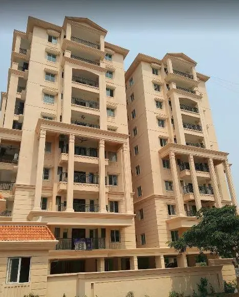
Shrushti Estates 1
RAPELLI MALLAIAH AND OTHERS · Peddapalli · RERA P02900009779
SHRUSHTI ESTATES 1 is a plotted development at KALVACHERLA, Ramagiri Mandal, Peddapalli District, developed by the registered promoter RAPELLI MALLAIAH AND OTHERS. The registered site extent is 6,171.45 sq. m, and the confirmed layout records 22 residential plots across 7,381.00 sq. yds.; building floors and individual plot configurations are not stated. The project is registered with TG-RERA under P02900009779, and the promoter’s stated completion date is 25th NOVEMBER 2026.
01What we found
Read from TG-RERA filings, approvals, land and registration records and court records. A court case is counted only when the court record states this project's survey number with its village, or names the project.
02Check before you pay
5 items to check before you pay, 3 high - from the title chain, court records and approvals, each with what to ask the builder or your advocate. An item may not be a problem with the project: records can be incomplete.
Project at a glance
Project identity
| Field | Record |
|---|---|
| Registered project name | SHRUSHTI ESTATES 1 RERA record |
| Project type | Plotted development RERA record |
| Phase / registered portion | New project; the registration identifies the project land in the listed survey numbers. A separate phase designation is not disclosed. RERA record |
| TG-RERA registration number | P02900009779 RERA record |
| Registration validity | 25 November 2024 to 25 November 2026; registration validity is distinct from the completion undertaking and from layout-completion evidence. RERA record |
| Registered promoter | RAPELLI MALLAIAH AND OTHERS RERA record |
| RERA status in supplied record | Registration certificate issued; the certificate states a two-year registration period, subject to its conditions. |
Land and geographic identity
| Field | Record |
|---|---|
| Locality / revenue village | KALVACHERLA; the layout documents identify KALVACHERLA (REVENUE VILLAGE). RERA record |
| Mandal | Ramagiri RERA record |
| District | Peddapalli RERA record |
| PIN | 505212 RERA record |
| Project survey numbers / subdivisions | 207/1, 207/3 and 207/4 RERA record |
| Registered site extent | The registration record lists 6,171.45 sq. m as total and net area. The layout records a layout extent of 7,381.00 sq. yds. RERA filing |
| Boundaries in the RERA project record | East: open land of others; West: open land of others; North: built-up and open land of others; South: existing 33 feet wide road. RERA filing |
Development identity
| Field | Record |
|---|---|
| Sanctioning authority | District Town & Country Planning Officer, Peddapalli; the layout was released by Gram Panchayat Kalvacherla. Approvals record |
| Principal layout approval | Confirmed TLP No.01/2024/DTCPO/PDPL, dated 20.05.2026. Approvals record |
| Earlier layout record | Draft technical layout approval Draft TLP No. 01/2024/DTCPO/PDPL, dated 25-11-2024; the Gram Panchayat release order is also dated 25-11-2024. Approvals record |
| Approved built-up area | 3,923.95 sq. m is recorded in the RERA project information; this is not a plot-area figure. RERA filing |
| Layout scale and arrangement | 22 plots on a layout recorded as 7,381.00 sq. yds. |
| Building / floor configuration | Not disclosed in the supplied project record; this is a plotted layout rather than a multi-storey apartment schedule. RERA record Document index |
| Parking provision | Plot-specific parking counts or an overall parking allocation are not established in the supplied evidence. Document index RERA amenities |
| Approved versus RERA-declared plot count | The confirmed layout records 22 plots. A separate RERA inventory count is not supplied. |
Offering and status
| Field | Record |
|---|---|
| Unit type | Residential plots; individual plot sizes and plot-number inventory are not supplied here. |
| Booked / available counts | Not disclosed in the supplied evidence. Document index |
| Construction / development stage | The project file includes an architect’s Form 1A certifying completion in all aspects and a confirmed final layout approval; these are document assertions, not an independent site inspection. |
| Completion date stated by promoter | 25th NOVEMBER 2026 in the Form B undertaking. |
| Occupancy certificate status | The supplied completion evidence concerns a plotted layout; no separate building occupancy certificate is identified. Document index |
The project story
- SHRUSHTI ESTATES 1 is registered as a plotted residential development at Kalvacherla Revenue Village, Ramagiri Mandal, Peddapalli District, on Survey Nos. 207/1, 207/3 and 207/4. The layout documents describe 22 residential plots and a total layout area of 7,381.00 sq. yds. RERA record
- The confirmed layout approval is dated 20 May 2026. The project file also contains an architect’s Form 1A certificate stating that construction work is complete in all aspects, alongside the final layout document. These records support a reported completion status in the project file; they do not amount to an independent on-site verification in this review.
- The promoter’s Form B declares a completion period ending 25th NOVEMBER 2026. That declared date is separate from the TG-RERA registration validity period, which runs to 25 November 2026.
Master plan, architecture & building design
- The confirmed plan is a residential plotted layout, not an apartment-building plan. It records 22 plots within 7,381.00 sq. yds. The confirmed layout’s land-use schedule allocates 4,693.01 sq. yds. (63.58%) to plotted area, 1,949.33 sq. yds. (26.41%) to roads, and 738.66 sq. yds. (10.01%) to open space.
- The earlier draft layout also identifies 774.00 sq. yds. as mortgage area, comprising Plot Nos. 11, 12, 13 and 14. That mortgage area is a separate layout designation, not an additional land-use share to add to the confirmed schedule.
- The layout documents refer to internal roads, open space and civic infrastructure. A road-width entry of 33'-0" appears in the confirmed layout record. No building footprints, floor configurations, tower heights, apartment circulation, or approved residential-building designs are provided.
Homes, configurations & floor plans
- The RERA record identifies a plotted development with 22 plots in the confirmed layout. Individual plot areas, plot-number-by-plot inventory, and booked or available counts are not disclosed in the supplied evidence. RERA record
| Configuration | Units | Booked | Available | RERA saleable area | Measured carpet area | Loading (if supplied) |
|---|---|---|---|---|---|---|
| Residential plots | 22 in confirmed layout | Not disclosed | Not disclosed | Individual plot areas not disclosed | Not applicable / not supplied | Not supplied |
- The supplied floor-plan review records two drawings, with 0 measured, 2 scans pending, 0 no-flats, 0 failed, and 0 layout sheets. No software-measured plot or home areas are therefore available. Floor plans
Parking & vehicle circulation
- The supplied evidence does not establish a total parking-space count, visitor or accessible parking provision, or an allotment of parking to individual purchasers.
- The draft layout identifies Plot Nos. 11, 12, 13 and 14, measuring 774.00 sq. yds., as the mortgage area; this should not be read as a buyer parking allocation.
- The layout records roads covering 1,949.33 sq. yds. (26.41%) and an internal-road width of 33'-0" in the confirmed layout record. Specific vehicle entrances, turning arrangements, pedestrian separation and EV charging are not detailed in the supplied evidence.
Amenities, recreation & open spaces
- The layout records 738.66 sq. yds. (10.01%) of open space and 1,949.33 sq. yds. (26.41%) of road area. The amenities register marks several infrastructure and site-facility categories as available, but the supplied material does not provide independent verification of their physical completion. RERA amenities
| Description / size | Size not stated |
|---|---|
| Evidence source | RERA amenities |
| Declared progress / verified status | Marked “YES”, 100% in the RERA amenities data; independent completion not verified. |
| Description / size | Road area: 1,949.33 sq. yds. (26.41%); confirmed layout lists a 33'-0" road width |
|---|---|
| Evidence source | RERA amenities |
| Declared progress / verified status | Marked “YES”, 100%; confirmed layout records roads and states roads and open spaces were taken over by registered deed. Physical condition not independently inspected. |
| Description / size | 738.66 sq. yds. (10.01%) |
|---|---|
| Evidence source | RERA amenities |
| Declared progress / verified status | Area is recorded in the confirmed layout; physical condition and maintenance not independently verified. |
| Description / size | Size and facilities not stated |
|---|---|
| Evidence source | RERA amenities |
| Declared progress / verified status | No provision indicated in the amenities data (0%). |
| Description / size | No quantity or specification stated |
|---|---|
| Evidence source | RERA amenities |
| Declared progress / verified status | Marked “YES”, 100%; independent operation not verified. |
Utilities, building services & safety
- The confirmed layout document lists water supply, sewerage, drainage disposal, street lighting and rainwater-harvesting structures among the site provisions. It also states that the layout has been provided with water supply, sewerage and drainage disposal systems, street lighting and rainwater-harvesting structure. These are document statements; capacities, technical specifications and independent operational checks are not supplied.
| Evidence in project record | Water supply is listed in the confirmed layout and marked “YES”, 100% in the RERA amenities data. RERA amenities |
|---|---|
| Limitation | Source, storage capacity and treatment arrangements are not specified. |
| Evidence in project record | Sewerage and drainage disposal systems are listed; storm-water drains and sewage/sullage treatment and disposal are marked “YES”, 100% in the amenities data. RERA amenities |
|---|---|
| Limitation | System design, treatment capacity, reuse arrangements and independent operational status are not supplied. |
| Evidence in project record | Rainwater-harvesting structure is listed in the confirmed layout; water conservation/rainwater harvesting is marked “YES”, 100%. RERA amenities |
|---|---|
| Limitation | Number, capacity and implementation details are not supplied. |
| Evidence in project record | An electrical meter room/sub-station/receiving-station category is marked “YES”, 100% in the amenities data. RERA amenities |
|---|---|
| Limitation | Equipment details, supply capacity and backup are not stated. |
| Evidence in project record | Solid-waste management and disposal is marked “YES”, 100% in the amenities data. RERA amenities |
|---|---|
| Limitation | Collection, segregation and processing details are not supplied. |
| Evidence in project record | Fire-protection/fire-safety category is recorded at 0% in the amenities data. RERA amenities |
|---|---|
| Limitation | The supplied record does not describe fire systems, access provisions or building-specific fire approvals. |
| Evidence in project record | Not described in the supplied evidence. Document index RERA amenities |
|---|---|
| Limitation | Ramps, accessible circulation, CCTV and access-control details are not supplied. |
Location, access & connectivity
- The registered location is KALVACHERLA, Ramagiri Mandal, Peddapalli District, Telangana 505212. The layout identifies KALVACHERLA as the revenue village and describes the land as lying in Survey Nos. 207/1, 207/3 and 207/4. RERA record
- The project-record boundary description identifies an existing 33 feet wide road along the south side. A supplied geocoding record labels the coordinates 18.63269, 79.53727 as the cadastral parcel centroid, not a surveyed project entrance. The nearest sampled Outer Ring Road interchange is listed at 157.8 km. RERA filing Cadastral map Location record
- No local public-transport routes, nearby landmarks or travel-time estimates are provided in the supplied evidence. Location record
Developer & development status
- The registered promoter is RAPELLI MALLAIAH AND OTHERS, described in the project record as an “Others” organization with the description “JOINT DEVELOPMENT.” The legal entity type and a separate corporate registration identifier are not established in the supplied data. RERA record RERA filing Corporate record
- The RERA certificate gives the promoter’s address as Kalvacherla, Ramagiri Mandal, Peddapalli District, PIN 505212. Mr. Rapelli Mallaiah is identified in the filed Form B as an authorised representative of the joint promoters. The supplied evidence does not provide an official website or project contact details.
- The project file includes a promoter completion undertaking dated April 2025, an architect’s Form 1A completion certificate, and a confirmed final layout approval. The promoter’s undertaking and the architect’s certificate are their respective filed assertions; no independent site inspection is included in this evidence set.
Approvals, official records & documents
| Record | Supplied evidence |
|---|---|
| TG-RERA registration | Form C certificate for SHRUSHTI ESTATES 1, registration P02900009779, valid from 25/11/2024 to 25/11/2026. |
| Draft technical layout | Draft residential layout approval for Survey Nos. 207/1, 207/3 and 207/4, 22 plots, extent 7,381.00 sq. yds.; dated 25-11-2024. |
| Gram Panchayat release order | Gram Panchayat Kalvacherla order releasing the draft technical layout, dated 25-11-2024, under LP.No.01/2024/DTCPO/PDPL. |
| Confirmed final layout | Confirmed TLP No.01/2024/DTCPO/PDPL, dated 20.05.2026, issued by the District Town & Country Planning Officer, Peddapalli; records 22 plots and the layout land-use schedule. |
| Architect’s completion certificate | Form 1A for the registered project, identifying Final Layout Certificate No. 07/2026/DTCPO/PDPL and certifying completion in all aspects. |
| Promoter declaration | Form B by Mr. Rapelli Mallaiah as authorised representative of the joint promoters; includes the promoter’s completion undertaking of 25th NOVEMBER 2026. |
| Project information and amenities | RERA-filed project information records site area, approved built-up area and amenities status. RERA filing RERA filing RERA amenities |
- The supplied completion evidence is for the plotted layout and its final layout approval; no separate building occupancy certificate is identified in the documents provided.
Project at a glance
Project identity
Registered project name: SHRUSHTI ESTATES 1
Project type: Plotted development
Phase / registered portion: New project; the registration identifies the project land in the listed survey numbers. A separate phase designation is not disclosed.
TG-RERA registration number: P02900009779
Registration validity: 25 November 2024 to 25 November 2026; registration validity is distinct from the completion undertaking and from layout-completion evidence.
Registered promoter: RAPELLI MALLAIAH AND OTHERS
RERA status in supplied record: Registration certificate issued; the certificate states a two-year registration period, subject to its conditions.
Land and geographic identity
Locality / revenue village: KALVACHERLA; the layout documents identify KALVACHERLA (REVENUE VILLAGE).
Mandal: Ramagiri
District: Peddapalli
PIN: 505212
Project survey numbers / subdivisions: 207/1, 207/3 and 207/4
Registered site extent: The registration record lists 6,171.45 sq. m as total and net area. The layout records a layout extent of 7,381.00 sq. yds.
Boundaries in the RERA project record: East: open land of others; West: open land of others; North: built-up and open land of others; South: existing 33 feet wide road.
Development identity
Sanctioning authority: District Town & Country Planning Officer, Peddapalli; the layout was released by Gram Panchayat Kalvacherla.
Principal layout approval: Confirmed TLP No.01/2024/DTCPO/PDPL, dated 20.05.2026.
Earlier layout record: Draft technical layout approval Draft TLP No. 01/2024/DTCPO/PDPL, dated 25-11-2024; the Gram Panchayat release order is also dated 25-11-2024.
Approved built-up area: 3,923.95 sq. m is recorded in the RERA project information; this is not a plot-area figure.
Layout scale and arrangement: 22 plots on a layout recorded as 7,381.00 sq. yds.
Building / floor configuration: Not disclosed in the supplied project record; this is a plotted layout rather than a multi-storey apartment schedule.
Parking provision: Plot-specific parking counts or an overall parking allocation are not established in the supplied evidence.
Approved versus RERA-declared plot count: The confirmed layout records 22 plots. A separate RERA inventory count is not supplied.
Offering and status
Unit type: Residential plots; individual plot sizes and plot-number inventory are not supplied here.
Booked / available counts: Not disclosed in the supplied evidence.
Construction / development stage: The project file includes an architect’s Form 1A certifying completion in all aspects and a confirmed final layout approval; these are document assertions, not an independent site inspection.
Completion date stated by promoter: 25th NOVEMBER 2026 in the Form B undertaking.
Occupancy certificate status: The supplied completion evidence concerns a plotted layout; no separate building occupancy certificate is identified.
The project story
- SHRUSHTI ESTATES 1 is registered as a plotted residential development at Kalvacherla Revenue Village, Ramagiri Mandal, Peddapalli District, on Survey Nos. 207/1, 207/3 and 207/4. The layout documents describe 22 residential plots and a total layout area of 7,381.00 sq. yds.
- The confirmed layout approval is dated 20 May 2026. The project file also contains an architect’s Form 1A certificate stating that construction work is complete in all aspects, alongside the final layout document. These records support a reported completion status in the project file; they do not amount to an independent on-site verification in this review.
- The promoter’s Form B declares a completion period ending 25th NOVEMBER 2026. That declared date is separate from the TG-RERA registration validity period, which runs to 25 November 2026.
Master plan, architecture & building design
- The confirmed plan is a residential plotted layout, not an apartment-building plan. It records 22 plots within 7,381.00 sq. yds. The confirmed layout’s land-use schedule allocates 4,693.01 sq. yds. (63.58%) to plotted area, 1,949.33 sq. yds. (26.41%) to roads, and 738.66 sq. yds. (10.01%) to open space.
- The earlier draft layout also identifies 774.00 sq. yds. as mortgage area, comprising Plot Nos. 11, 12, 13 and 14. That mortgage area is a separate layout designation, not an additional land-use share to add to the confirmed schedule.
- The layout documents refer to internal roads, open space and civic infrastructure. A road-width entry of 33'-0" appears in the confirmed layout record. No building footprints, floor configurations, tower heights, apartment circulation, or approved residential-building designs are provided.
Homes, configurations & floor plans
- The RERA record identifies a plotted development with 22 plots in the confirmed layout. Individual plot areas, plot-number-by-plot inventory, and booked or available counts are not disclosed in the supplied evidence.
| Configuration | Units | Booked | Available | RERA saleable area | Measured carpet area | Loading (if supplied) |
|---|---|---|---|---|---|---|
| Residential plots | 22 in confirmed layout | Not disclosed | Not disclosed | Individual plot areas not disclosed | Not applicable / not supplied | Not supplied |
- The supplied floor-plan review records two drawings, with 0 measured, 2 scans pending, 0 no-flats, 0 failed, and 0 layout sheets. No software-measured plot or home areas are therefore available.
Parking & vehicle circulation
- The supplied evidence does not establish a total parking-space count, visitor or accessible parking provision, or an allotment of parking to individual purchasers.
- The draft layout identifies Plot Nos. 11, 12, 13 and 14, measuring 774.00 sq. yds., as the mortgage area; this should not be read as a buyer parking allocation.
- The layout records roads covering 1,949.33 sq. yds. (26.41%) and an internal-road width of 33'-0" in the confirmed layout record. Specific vehicle entrances, turning arrangements, pedestrian separation and EV charging are not detailed in the supplied evidence.
Amenities, recreation & open spaces
- The layout records 738.66 sq. yds. (10.01%) of open space and 1,949.33 sq. yds. (26.41%) of road area. The amenities register marks several infrastructure and site-facility categories as available, but the supplied material does not provide independent verification of their physical completion.
| Facility | Description / size | Evidence source | Declared progress / verified status |
|---|---|---|---|
| Green strip / tot lot / park | Size not stated | Marked “YES”, 100% in the RERA amenities data; independent completion not verified. | |
| Internal roads and footpaths | Road area: 1,949.33 sq. yds. (26.41%); confirmed layout lists a 33'-0" road width | Marked “YES”, 100%; confirmed layout records roads and states roads and open spaces were taken over by registered deed. Physical condition not independently inspected. | |
| Open space | 738.66 sq. yds. (10.01%) | Area is recorded in the confirmed layout; physical condition and maintenance not independently verified. | |
| Community buildings | Size and facilities not stated | No provision indicated in the amenities data (0%). | |
| Street lighting | No quantity or specification stated | Marked “YES”, 100%; independent operation not verified. |
Utilities, building services & safety
- The confirmed layout document lists water supply, sewerage, drainage disposal, street lighting and rainwater-harvesting structures among the site provisions. It also states that the layout has been provided with water supply, sewerage and drainage disposal systems, street lighting and rainwater-harvesting structure. These are document statements; capacities, technical specifications and independent operational checks are not supplied.
| Evidence in project record | Water supply is listed in the confirmed layout and marked “YES”, 100% in the RERA amenities data. |
|---|---|
| Limitation | Source, storage capacity and treatment arrangements are not specified. |
| Evidence in project record | Sewerage and drainage disposal systems are listed; storm-water drains and sewage/sullage treatment and disposal are marked “YES”, 100% in the amenities data. |
|---|---|
| Limitation | System design, treatment capacity, reuse arrangements and independent operational status are not supplied. |
| Evidence in project record | Rainwater-harvesting structure is listed in the confirmed layout; water conservation/rainwater harvesting is marked “YES”, 100%. |
|---|---|
| Limitation | Number, capacity and implementation details are not supplied. |
| Evidence in project record | An electrical meter room/sub-station/receiving-station category is marked “YES”, 100% in the amenities data. |
|---|---|
| Limitation | Equipment details, supply capacity and backup are not stated. |
| Evidence in project record | Solid-waste management and disposal is marked “YES”, 100% in the amenities data. |
|---|---|
| Limitation | Collection, segregation and processing details are not supplied. |
| Evidence in project record | Fire-protection/fire-safety category is recorded at 0% in the amenities data. |
|---|---|
| Limitation | The supplied record does not describe fire systems, access provisions or building-specific fire approvals. |
| Evidence in project record | Not described in the supplied evidence. |
|---|---|
| Limitation | Ramps, accessible circulation, CCTV and access-control details are not supplied. |
Location, access & connectivity
- The registered location is KALVACHERLA, Ramagiri Mandal, Peddapalli District, Telangana 505212. The layout identifies KALVACHERLA as the revenue village and describes the land as lying in Survey Nos. 207/1, 207/3 and 207/4.
- The project-record boundary description identifies an existing 33 feet wide road along the south side. A supplied geocoding record labels the coordinates 18.63269, 79.53727 as the cadastral parcel centroid, not a surveyed project entrance. The nearest sampled Outer Ring Road interchange is listed at 157.8 km.
- No local public-transport routes, nearby landmarks or travel-time estimates are provided in the supplied evidence.
Developer & development status
- The registered promoter is RAPELLI MALLAIAH AND OTHERS, described in the project record as an “Others” organization with the description “JOINT DEVELOPMENT.” The legal entity type and a separate corporate registration identifier are not established in the supplied data.
- The RERA certificate gives the promoter’s address as Kalvacherla, Ramagiri Mandal, Peddapalli District, PIN 505212. Mr. Rapelli Mallaiah is identified in the filed Form B as an authorised representative of the joint promoters. The supplied evidence does not provide an official website or project contact details.
- The project file includes a promoter completion undertaking dated April 2025, an architect’s Form 1A completion certificate, and a confirmed final layout approval. The promoter’s undertaking and the architect’s certificate are their respective filed assertions; no independent site inspection is included in this evidence set.
Approvals, official records & documents
TG-RERA registration: Form C certificate for SHRUSHTI ESTATES 1, registration P02900009779, valid from 25/11/2024 to 25/11/2026.
Draft technical layout: Draft residential layout approval for Survey Nos. 207/1, 207/3 and 207/4, 22 plots, extent 7,381.00 sq. yds.; dated 25-11-2024.
Gram Panchayat release order: Gram Panchayat Kalvacherla order releasing the draft technical layout, dated 25-11-2024, under LP.No.01/2024/DTCPO/PDPL.
Confirmed final layout: Confirmed TLP No.01/2024/DTCPO/PDPL, dated 20.05.2026, issued by the District Town & Country Planning Officer, Peddapalli; records 22 plots and the layout land-use schedule.
Architect’s completion certificate: Form 1A for the registered project, identifying Final Layout Certificate No. 07/2026/DTCPO/PDPL and certifying completion in all aspects.
Promoter declaration: Form B by Mr. Rapelli Mallaiah as authorised representative of the joint promoters; includes the promoter’s completion undertaking of 25th NOVEMBER 2026.
Project information and amenities: RERA-filed project information records site area, approved built-up area and amenities status.
- The supplied completion evidence is for the plotted layout and its final layout approval; no separate building occupancy certificate is identified in the documents provided.
Frequently asked questions
Is SHRUSHTI ESTATES 1 registered with Telangana RERA?
Yes. SHRUSHTI ESTATES 1 is registered with the Telangana Real Estate Regulatory Authority as P02900009779; the registration status is New Project.
Who is the developer of SHRUSHTI ESTATES 1?
The promoter named in the RERA registration is RAPELLI MALLAIAH AND OTHERS.
Where is SHRUSHTI ESTATES 1 located?
SHRUSHTI ESTATES 1 is in KALVACHERLA, Ramagiri, Peddapalli, Telangana (505212).
When will SHRUSHTI ESTATES 1 be completed?
The promoter's proposed date of completion filed with RERA is 25/11/2026. This is the promoter's declaration, not a guarantee.
More projects in Kalvacherla