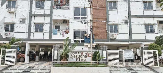
Ms Srirasthu Nagar
Sri. MATTA PULLAIAH AND OTHERS · Suryapet · RERA P01900009172
MS SRIRASTHU NAGAR is a plotted development in Akupamula Revenue Village, Munagala Mandal, Suryapet District. The registered promoter is Sri. MATTA PULLAIAH AND OTHERS. The project has a RERA-filed total/net land area of 13,030.87 sq. m and comprises 46 plots; plot configurations are not stated. It is registered with TG-RERA under P01900009172, with a promoter-declared completion date of 05TH OCTOBER 2025.
01What we found
Read from TG-RERA filings, approvals, land and registration records and court records. A court case is counted only when the court record states this project's survey number with its village, or names the project.
02Check before you pay
7 items to check before you pay, 3 high - from the title chain, court records and approvals, each with what to ask the builder or your advocate. An item may not be a problem with the project: records can be incomplete.
1. Project at a glance
Project identity
| Item | Project record |
|---|---|
| Registered project name | MS SRIRASTHU NAGAR RERA record |
| Project type | Plotted development RERA record RERA filing |
| Phase / registered portion | Not separately identified; registration is for the plotted project RERA record |
| TG-RERA registration | P01900009172; granted under section 5 |
| Registration validity | 05/10/2023 to 05/10/2025, stated as two years; the certificate says it may be extended by the Authority. An extension is not evidenced in the supplied record. |
| Registered promoter | Sri. MATTA PULLAIAH AND OTHERS RERA record |
| RERA status in supplied record | New Project; the registration period shown in the certificate has ended, and no extension is recorded in the supplied material. This is separate from the project’s completion date and occupancy/completion certificate status. RERA record |
Land and geographic identity
| Item | Project record |
|---|---|
| Locality / revenue village | Akupamula / Akupamula Revenue Village RERA record |
| Mandal | Munagala RERA record |
| District | Suryapet RERA record |
| PIN | 508233 in the project identity and RERA certificate RERA record |
| Project survey numbers and subdivisions | 207/4, 207/3, 205/4/2, 205/4/1, 207/4/1, 207/3/1 RERA record |
| RERA-filed total / net land area | 13,030.87 sq. m; the filing shows affected area as 0 and net area as 13,030.87 sq. m. RERA filing |
| Layout approval document area | Ac 3-08.8 Gts; 15,584.8 Sq. Yds. (“Layout area (As per Document)”) and Ac.2-38.90 Gts; 14,386.90 Sq. Yds (“Layout area (As on Ground)”) |
| Boundaries filed with RERA | East: OTHERS LAND; West: OTHERS LAND; North: OTHERS LAND; South: EXISTING 100 WIDE ROAD RERA filing |
Development identity
| Item | Project record |
|---|---|
| Sanctioning authority | DT&CP; the document records draft technical layout pattern approval delegated to Akupamula Gram Panchayat Approvals record |
| Principal approval identifier | Draft - TLP. No. 65/2024/HRO/H1; file Lr.Roc.No795/2024/HRO/H1; application E. Panchayath No. 15289/311 Approvals record |
| Approval date recorded | 05.10.2023 in the project approvals record Approvals record; the document also identifies the draft technical layout pattern as 65/2024/HRO/H1 |
| Approved built-up area | 8,138.2 sq. m in the RERA project fields RERA filing |
| Plot count | 46 plots stated in the draft technical layout document |
| Building / floor configuration | Not applicable as a residential building configuration for this plotted development; no building-level floor schedule is supplied. |
| Parking | No parking-space count or parking layout is established in the supplied records. |
| Land-use areas in layout document | Park: Ac.0.11.90 Gts; 1,438.69 Sq. Yds. (10.00%); roads: Ac.0-26.56 Gts; 3,214.97 Sq. Yds (22.35%); plotted area: Ac.2-00.44 Gts; 9,733.24 Sa Yds. (67.65%); mortgage area: 1,640.00 Sq Yds. (16.84%), identified as Plot Nos. 13 to 20. |
Offering and status
| Item | Project record |
|---|---|
| Offering | Plots; plot count stated as 46 in the layout document |
| Plot-size range / individual plot schedule | Not disclosed in the supplied extracted records. |
| Booked / available plots | Counts not supplied. |
| Construction stage | No independently verified site progress or completion stage is supplied. |
| Completion date | Promoter-declared completion date: 05TH OCTOBER 2025 |
| Occupancy / completion certificate | No occupancy or completion certificate is included in the supplied evidence. |
2. The project story
MS SRIRASTHU NAGAR is registered with TG-RERA as a plotted development in Akupamula Revenue Village, Munagala Mandal, Suryapet District. The registration identifies six survey numbers/subdivisions: 207/4, 207/3, 205/4/2, 205/4/1, 207/4/1 and 207/3/1. RERA record
The filed layout document describes a 46-plot layout and identifies park, road and plotted land-use areas. It also identifies Plot Nos. 13 to 20, totalling 1,640.00 Sq. Yards, as mortgage area in favour of Akupamula Gram Panchayat; the document says these plots are not to be sold while mortgaged. The project filing gives a total/net land area of 13,030.87 sq. m, while the layout document separately states its document and on-ground layout areas. RERA filing
The promoter’s Form-B declaration states a completion date of 05TH OCTOBER 2025. The supplied evidence does not establish current construction or infrastructure progress, plot-wise booking or availability, or an occupancy/completion certificate.
3. Master plan, architecture & building design
This is a plotted layout, not a building scheme in the supplied records. The layout document identifies 46 plots and records these land-use components:
| Layout component | Area / share stated in the document |
|---|---|
| Layout area (as per document) | Ac 3-08.8 Gts; 15,584.8 Sq. Yds. |
| Layout area (as on ground) | Ac.2-38.90 Gts; 14,386.90 Sq. Yds |
| Park / open space | Ac.0.11.90 Gts; 1,438.69 Sq. Yds. (10.00%) |
| Roads | Ac.0-26.56 Gts; 3,214.97 Sq. Yds (22.35%) |
| Plotted area | Ac.2-00.44 Gts; 9,733.24 Sa Yds. (67.65%) |
| Mortgage area | 1,640.00 Sq Yds. (16.84%); Plot Nos. 13 to 20 |
The RERA fields state 8,138.2 sq. m as approved built-up area, but the supplied material does not explain how that figure applies to the plotted layout. No plot-by-plot dimensions, detailed layout drawing extraction, building footprints, floor plans, or building configurations are available here. RERA filing Document index
4. Homes, configurations & floor plans
The offering is plots, not apartments. The layout document states a total of 46 plots, but the supplied records do not provide a plot schedule, plot-size bands, plot-wise saleable areas, booked/available counts, or a RERA-filed plot-area breakdown.
| Configuration | Units | Booked | Available | RERA saleable area | Measured carpet area | Loading (if supplied) |
|---|---|---|---|---|---|---|
| Plots | 46 stated in layout document | Not disclosed | Not disclosed | Not disclosed by plot | Not applicable / not supplied | Not supplied |
Two drawings are recorded, but both are pending scan processing; no software-measured areas or drawing-based plot measurements are available. Floor plans
5. Parking & vehicle circulation
The supplied records do not establish parking-space counts, visitor or accessible parking, vehicle entrances, internal driveway dimensions, or parking allocation to individual plots. The draft layout document identifies road area of Ac.0-26.56 Gts; 3,214.97 Sq. Yds (22.35%) and requires roads to be opened for access to neighbouring sites; it does not provide a parking schedule.
6. Amenities, recreation & open spaces
The following facilities are stated in the draft layout document or RERA amenity list. The available record describes proposed or filed facilities; it does not establish that they are completed or independently verified.
| Facility | Description / size | Evidence source | Declared progress / verified status |
|---|---|---|---|
| Park / open space | Ac.0.11.90 Gts; 1,438.69 Sq. Yds. (10.00%) | Included in layout land-use schedule; completion not verified. | |
| Internal roads and footpaths | Road area stated as Ac.0-26.56 Gts; 3,214.97 Sq. Yds (22.35%) | RERA amenities | Listed in filed amenity records; completion not verified. |
| Avenue plantation / green strip | No size supplied | RERA amenities | Listed; completion not verified. |
| Community buildings | No size supplied | RERA amenities | No progress or completion evidence supplied. |
7. Utilities, building services & safety
The RERA amenity record marks several site infrastructure items “YES”; this is a filed availability entry, not independent evidence of installation or operation. RERA amenities
| Service | Supplied evidence |
|---|---|
| Water | “Water Supply” is marked “YES” in the RERA amenity record. The layout document lists a protected water supply system; source, storage and capacity are not stated. RERA amenities |
| Sewerage and drainage | RERA lists sewerage (chambers, lines, septic tank, STP), storm-water drains, and treatment and disposal of sewage and sullage water. The layout document also lists a sewerage disposal system and side drains; capacities and completion status are not supplied. RERA amenities |
| Rainwater management | Water conservation/rainwater harvesting is listed in the RERA record; rainwater harvesting pits are listed in the layout document. RERA amenities |
| Electricity and lighting | RERA lists an electrical meter room/sub-station/receiving station and street lighting; the layout document lists electricity facilities and street lighting. No capacity or installation status is supplied. RERA amenities |
| Waste | Solid-waste management and disposal appears in the RERA amenity list without a “YES” entry or further details. RERA amenities |
| Fire safety, lifts and accessibility | No project-specific fire system, lift, accessible circulation or ramp details are supplied. RERA amenities |
8. Location, access & connectivity
The registered location is Akupamula Revenue Village, Munagala Mandal, Suryapet District, PIN 508233. The project’s RERA-filed southern boundary is EXISTING 100 WIDE ROAD; the other listed boundaries are “OTHERS LAND.” RERA record RERA filing The layout document identifies Akupamula Gram Panchayat and states that roads are to be opened for access to neighbouring sites.
A location record provides an approximate sampled distance of 138.6 km to the nearest sampled Outer Ring Road interchange. Location record No additional verified road, public-transport or landmark distances are supplied.
9. Developer & development status
The TG-RERA registered promoter is Sri. MATTA PULLAIAH AND OTHERS. The filing identifies the organization type as “Others” and describes it as “JOINT DEVELOPERS”; a more specific legal-entity type and corporate registration identifier are not supplied. RERA record RERA filing The RERA certificate lists the promoter office as “Village: Mandal: Kodad, District: Suryapet, Pin: 508206.”
The draft layout application names Sri. Matta Pullaiah and Sri. Sriram Lingaiah as applicants. The Form-B declaration names both as joint promoters and identifies Matta Pullaiah as authorized signatory. The promoter-declared completion date is 05TH OCTOBER 2025; the supplied record does not provide verified construction progress, plot bookings, or evidence that the project has been completed.
10. Approvals, official records & documents
| Identifier / contents | FORM ‘C’; registration P01900009172; valid from 05/10/2023 to 05/10/2025 as stated in the certificate |
|---|
| Identifier / contents | Draft - TLP. No. 65/2024/HRO/H1; file Lr.Roc.No795/2024/HRO/H1; application E. Panchayath No. 15289/311; 46 plots; conditional layout approval recorded by DT&CP and delegated to Akupamula Gram Panchayat |
|---|
| Identifier / contents | Lr. No. EE / IRR.DIV.NO. 4/ KDD/ AEE (T) /NOC/ 28, dated 30.09.2024, listed in the approval document |
|---|
| Identifier / contents | Joint-promoter affidavit/declaration; includes promoter-declared completion date and declarations concerning title, encumbrances and project funds |
|---|
| Identifier / contents | Filed under document ID 509557, but not extracted in the supplied records |
|---|---|
| Evidence | Document index |
| Identifier / contents | Not present in the supplied evidence |
|---|---|
| Evidence | Document index |
1. Project at a glance
Project identity
Registered project name: MS SRIRASTHU NAGAR
Project type: Plotted development
Phase / registered portion: Not separately identified; registration is for the plotted project
TG-RERA registration: P01900009172; granted under section 5
Registration validity: 05/10/2023 to 05/10/2025, stated as two years; the certificate says it may be extended by the Authority. An extension is not evidenced in the supplied record.
Registered promoter: Sri. MATTA PULLAIAH AND OTHERS
RERA status in supplied record: New Project; the registration period shown in the certificate has ended, and no extension is recorded in the supplied material. This is separate from the project’s completion date and occupancy/completion certificate status.
Land and geographic identity
Locality / revenue village: Akupamula / Akupamula Revenue Village
Mandal: Munagala
District: Suryapet
PIN: 508233 in the project identity and RERA certificate
Project survey numbers and subdivisions: 207/4, 207/3, 205/4/2, 205/4/1, 207/4/1, 207/3/1
RERA-filed total / net land area: 13,030.87 sq. m; the filing shows affected area as 0 and net area as 13,030.87 sq. m.
Layout approval document area: Ac 3-08.8 Gts; 15,584.8 Sq. Yds. (“Layout area (As per Document)”) and Ac.2-38.90 Gts; 14,386.90 Sq. Yds (“Layout area (As on Ground)”)
Boundaries filed with RERA: East: OTHERS LAND; West: OTHERS LAND; North: OTHERS LAND; South: EXISTING 100 WIDE ROAD
Development identity
Sanctioning authority: DT&CP; the document records draft technical layout pattern approval delegated to Akupamula Gram Panchayat
Principal approval identifier: Draft - TLP. No. 65/2024/HRO/H1; file Lr.Roc.No795/2024/HRO/H1; application E. Panchayath No. 15289/311
Approval date recorded: 05.10.2023 in the project approvals record; the document also identifies the draft technical layout pattern as 65/2024/HRO/H1
Approved built-up area: 8,138.2 sq. m in the RERA project fields
Plot count: 46 plots stated in the draft technical layout document
Building / floor configuration: Not applicable as a residential building configuration for this plotted development; no building-level floor schedule is supplied.
Parking: No parking-space count or parking layout is established in the supplied records.
Land-use areas in layout document: Park: Ac.0.11.90 Gts; 1,438.69 Sq. Yds. (10.00%); roads: Ac.0-26.56 Gts; 3,214.97 Sq. Yds (22.35%); plotted area: Ac.2-00.44 Gts; 9,733.24 Sa Yds. (67.65%); mortgage area: 1,640.00 Sq Yds. (16.84%), identified as Plot Nos. 13 to 20.
Offering and status
Offering: Plots; plot count stated as 46 in the layout document
Plot-size range / individual plot schedule: Not disclosed in the supplied extracted records.
Booked / available plots: Counts not supplied.
Construction stage: No independently verified site progress or completion stage is supplied.
Completion date: Promoter-declared completion date: 05TH OCTOBER 2025
Occupancy / completion certificate: No occupancy or completion certificate is included in the supplied evidence.
2. The project story
MS SRIRASTHU NAGAR is registered with TG-RERA as a plotted development in Akupamula Revenue Village, Munagala Mandal, Suryapet District. The registration identifies six survey numbers/subdivisions: 207/4, 207/3, 205/4/2, 205/4/1, 207/4/1 and 207/3/1.
The filed layout document describes a 46-plot layout and identifies park, road and plotted land-use areas. It also identifies Plot Nos. 13 to 20, totalling 1,640.00 Sq. Yards, as mortgage area in favour of Akupamula Gram Panchayat; the document says these plots are not to be sold while mortgaged. The project filing gives a total/net land area of 13,030.87 sq. m, while the layout document separately states its document and on-ground layout areas.
The promoter’s Form-B declaration states a completion date of 05TH OCTOBER 2025. The supplied evidence does not establish current construction or infrastructure progress, plot-wise booking or availability, or an occupancy/completion certificate.
3. Master plan, architecture & building design
This is a plotted layout, not a building scheme in the supplied records. The layout document identifies 46 plots and records these land-use components:
Layout area (as per document): Ac 3-08.8 Gts; 15,584.8 Sq. Yds.
Layout area (as on ground): Ac.2-38.90 Gts; 14,386.90 Sq. Yds
Park / open space: Ac.0.11.90 Gts; 1,438.69 Sq. Yds. (10.00%)
Roads: Ac.0-26.56 Gts; 3,214.97 Sq. Yds (22.35%)
Plotted area: Ac.2-00.44 Gts; 9,733.24 Sa Yds. (67.65%)
Mortgage area: 1,640.00 Sq Yds. (16.84%); Plot Nos. 13 to 20
The RERA fields state 8,138.2 sq. m as approved built-up area, but the supplied material does not explain how that figure applies to the plotted layout. No plot-by-plot dimensions, detailed layout drawing extraction, building footprints, floor plans, or building configurations are available here.
4. Homes, configurations & floor plans
The offering is plots, not apartments. The layout document states a total of 46 plots, but the supplied records do not provide a plot schedule, plot-size bands, plot-wise saleable areas, booked/available counts, or a RERA-filed plot-area breakdown.
| Configuration | Units | Booked | Available | RERA saleable area | Measured carpet area | Loading (if supplied) |
|---|---|---|---|---|---|---|
| Plots | 46 stated in layout document | Not disclosed | Not disclosed | Not disclosed by plot | Not applicable / not supplied | Not supplied |
Two drawings are recorded, but both are pending scan processing; no software-measured areas or drawing-based plot measurements are available.
5. Parking & vehicle circulation
The supplied records do not establish parking-space counts, visitor or accessible parking, vehicle entrances, internal driveway dimensions, or parking allocation to individual plots. The draft layout document identifies road area of Ac.0-26.56 Gts; 3,214.97 Sq. Yds (22.35%) and requires roads to be opened for access to neighbouring sites; it does not provide a parking schedule.
6. Amenities, recreation & open spaces
The following facilities are stated in the draft layout document or RERA amenity list. The available record describes proposed or filed facilities; it does not establish that they are completed or independently verified.
| Facility | Description / size | Evidence source | Declared progress / verified status |
|---|---|---|---|
| Park / open space | Ac.0.11.90 Gts; 1,438.69 Sq. Yds. (10.00%) | Included in layout land-use schedule; completion not verified. | |
| Internal roads and footpaths | Road area stated as Ac.0-26.56 Gts; 3,214.97 Sq. Yds (22.35%) | Listed in filed amenity records; completion not verified. | |
| Avenue plantation / green strip | No size supplied | Listed; completion not verified. | |
| Community buildings | No size supplied | No progress or completion evidence supplied. |
7. Utilities, building services & safety
The RERA amenity record marks several site infrastructure items “YES”; this is a filed availability entry, not independent evidence of installation or operation.
Water: “Water Supply” is marked “YES” in the RERA amenity record. The layout document lists a protected water supply system; source, storage and capacity are not stated.
Sewerage and drainage: RERA lists sewerage (chambers, lines, septic tank, STP), storm-water drains, and treatment and disposal of sewage and sullage water. The layout document also lists a sewerage disposal system and side drains; capacities and completion status are not supplied.
Rainwater management: Water conservation/rainwater harvesting is listed in the RERA record; rainwater harvesting pits are listed in the layout document.
Electricity and lighting: RERA lists an electrical meter room/sub-station/receiving station and street lighting; the layout document lists electricity facilities and street lighting. No capacity or installation status is supplied.
Waste: Solid-waste management and disposal appears in the RERA amenity list without a “YES” entry or further details.
Fire safety, lifts and accessibility: No project-specific fire system, lift, accessible circulation or ramp details are supplied.
8. Location, access & connectivity
The registered location is Akupamula Revenue Village, Munagala Mandal, Suryapet District, PIN 508233. The project’s RERA-filed southern boundary is EXISTING 100 WIDE ROAD; the other listed boundaries are “OTHERS LAND.” The layout document identifies Akupamula Gram Panchayat and states that roads are to be opened for access to neighbouring sites.
A location record provides an approximate sampled distance of 138.6 km to the nearest sampled Outer Ring Road interchange. No additional verified road, public-transport or landmark distances are supplied.
9. Developer & development status
The TG-RERA registered promoter is Sri. MATTA PULLAIAH AND OTHERS. The filing identifies the organization type as “Others” and describes it as “JOINT DEVELOPERS”; a more specific legal-entity type and corporate registration identifier are not supplied. The RERA certificate lists the promoter office as “Village: Mandal: Kodad, District: Suryapet, Pin: 508206.”
The draft layout application names Sri. Matta Pullaiah and Sri. Sriram Lingaiah as applicants. The Form-B declaration names both as joint promoters and identifies Matta Pullaiah as authorized signatory. The promoter-declared completion date is 05TH OCTOBER 2025; the supplied record does not provide verified construction progress, plot bookings, or evidence that the project has been completed.
10. Approvals, official records & documents
| Identifier / contents | FORM ‘C’; registration P01900009172; valid from 05/10/2023 to 05/10/2025 as stated in the certificate |
|---|
| Identifier / contents | Draft - TLP. No. 65/2024/HRO/H1; file Lr.Roc.No795/2024/HRO/H1; application E. Panchayath No. 15289/311; 46 plots; conditional layout approval recorded by DT&CP and delegated to Akupamula Gram Panchayat |
|---|
| Identifier / contents | Lr. No. EE / IRR.DIV.NO. 4/ KDD/ AEE (T) /NOC/ 28, dated 30.09.2024, listed in the approval document |
|---|
| Identifier / contents | Joint-promoter affidavit/declaration; includes promoter-declared completion date and declarations concerning title, encumbrances and project funds |
|---|
| Identifier / contents | Filed under document ID 509557, but not extracted in the supplied records |
|---|
| Identifier / contents | Not present in the supplied evidence |
|---|
Frequently asked questions
Is MS SRIRASTHU NAGAR registered with Telangana RERA?
Yes. MS SRIRASTHU NAGAR is registered with the Telangana Real Estate Regulatory Authority as P01900009172; the registration status is New Project.
Who is the developer of MS SRIRASTHU NAGAR?
The promoter named in the RERA registration is Sri. MATTA PULLAIAH AND OTHERS.
Where is MS SRIRASTHU NAGAR located?
MS SRIRASTHU NAGAR is in AKUPAMULA, Munagala, Suryapet, Telangana (508233).
When will MS SRIRASTHU NAGAR be completed?
The promoter's proposed date of completion filed with RERA is 05/10/2025. This is the promoter's declaration, not a guarantee.
More projects in Munagala