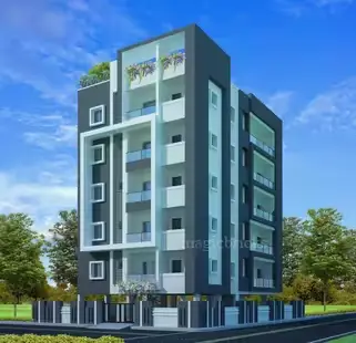
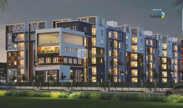
Navya The Royal
NAVYA DEVELOPERS · Sangareddy · RERA P01100000473
NAVYA THE ROYAL is a plotted development in Indresham Village, PATANCHERU, Sangareddy, Telangana. The registered promoter is Navya Developers. The project covers **54846.88 sqmts** and the layout drawing states **195 plots**; the supplied record does not specify towers, blocks, floors or plot configurations. Its TG-RERA registration is **P01100000473**, with proposed completion **23/11/2021**.
More from Navya Developers · 19 projects →
01What we found
Read from TG-RERA filings, approvals, land and registration records and court records. A court case is counted only when the court record states this project's survey number with its village, or names the project.
02Check before you pay
7 items to check before you pay, 4 high - from the title chain, court records and approvals, each with what to ask the builder or your advocate. An item may not be a problem with the project: records can be incomplete.
1. Project at a glance
Project identity
| Field | Project record |
|---|---|
| Registered name | NAVYA THE ROYAL RERA record |
| Project type | Plotted development / plotted layout RERA record RERA filing |
| Phase / registered portion | Phase not separately identified in the supplied record; the registration is for this plotted project. RERA record |
| TG-RERA registration | P01100000473 RERA record Approvals record |
| Registration validity | 14/03/2019 to 23/11/2021; certificate states two years and no extension is recorded in the supplied certificate. Registration validity is distinct from the project completion date and from an occupancy/completion certificate. Approvals record |
| Registered promoter | Navya Developers (also shown in project documents as M/s. NAVYA DEVELOPERS); partnership RERA record RERA filing Corporate record |
| RERA status | The project is recorded as a New Project. The supplied registration certificate’s stated validity ended 23/11/2021; this is not, by itself, evidence of current registration status. RERA filing |
Land and geographic identity
| Field | Project record |
|---|---|
| Locality / revenue village | Indresham Village RERA record RERA filing |
| Mandal / district / PIN | PATANCHERU, Sangareddy, Telangana 502319 RERA record RERA filing |
| Project survey numbers as filed | SY NO 240 245 RERA record RERA filing |
| Subdivisions named in the land-conversion order | 240/AA, 245/AA, 245/EE, 240/E, 245/E, 240/A1, 245/A; the order identifies these lands in Indresham, Patancheru, Sangareddy. |
| Site extent | Total area 54846.88 sqmts; area affected in road widening/FTL of tanks/nala widening 5578.36 sqmts; net area 49268.52 sqmts. RERA filing |
| Layout drawing area statement | Total site area 54846.88 sqmts; net layout area 49268.53 sqmts (drawing-derived figure). Layout record |
| Boundaries as filed | East: SY NO240 PART; West: BACHUGUDA VILLAGE; North: SY NO 244 AND 246; South: ROAD. RERA filing |
Development identity
| Field | Project record |
|---|---|
| Sanctioning authority | HMDA RERA filing Approvals record |
| Principal layout approval | LPNo. 000244/LO/Plg/HMDA/2018, dated 24.11.2018 Approvals record |
| Later final layout reference | 041567/LT/SKP/FLT/U6/HMDA/31122020, dated 26.03.2021, listed in the architect’s completion certificate. Approvals record |
| Approved built-up area | 30572.30 sqmts is recorded as approved built-up area in the project fields. The supplied evidence does not describe building floors or towers; this is a plotted layout. RERA filing |
| Layout organization | Drawing states 195 plots. Drawing-derived land-use areas: plots 30572.26 sqm; roads 13411.68 sqm; parks/open space 3696.13 sqm; utilities 345.09 sqm; social infrastructure 1243.37 sqm. Layout record |
| Mortgage-area entry | 4661.51 sqmts is recorded as mortgage area in the project fields. The layout drawing identifies 25 plots—117-128, 182-194—as mortgaged to the approving authority until specified layout works are completed. RERA filing Layout record |
Offering and status
| Field | Project record |
|---|---|
| Unit type | Residential plots; plot-by-plot RERA inventory, plot sizes and booking/availability counts are not supplied. RERA record RERA filing |
| RERA plot count | 195 is stated on the layout drawing. The drawing’s plot-by-plot extraction is incomplete, so no complete size schedule is available. Layout record |
| RERA saleable-size range | Not disclosed in the supplied project inventory. The drawing-based plot count is not a RERA-filed size schedule. Layout record |
| Booking / availability | Not disclosed in the supplied evidence. RERA record Layout record |
| Construction / development stage | RERA fields report 80% completeness; this is a declared record, not an independent site inspection. RERA record |
| Completion dates | RERA header gives proposed completion 23/11/2021; Form B declares completion before 2 November, 2021; the architect’s certificate records completion date 31/03/2021. RERA record |
| Completion / occupancy status | An architect’s Form-1A certifies completion of development work for the registered plotted project. No separate occupancy certificate is supplied; the supplied completion certificate concerns a plotted layout. |
2. The project story
NAVYA THE ROYAL is a residential plotted layout registered with TG-RERA as project P01100000473, at Indresham Village, Patancheru Mandal, Sangareddy District. The project filing identifies survey numbers 240 and 245; the land-conversion order further names subdivisions 240/AA, 245/AA, 245/EE, 240/E, 245/E, 240/A1 and 245/A. RERA record RERA filing
The approved-layout record identifies 195 plots and an area allocation for plots, roads, parks/open space, utilities and social infrastructure. Plot-specific sizes, inventory availability and allotment status are not established in the supplied RERA material. Layout record Document index
A Form-1A architect’s certificate identifies the project as completed in all aspects and records a completion date of 31/03/2021. Separately, the project header reports 80% completeness. The latter is a filed status figure, not an independently verified site assessment; the supplied materials do not establish a current physical-condition inspection or provide a separate occupancy certificate. RERA record
3. Master plan, architecture & building design
This is a plotted layout rather than a tower or apartment development. The layout drawing states 195 plots on a net layout area of 49268.53 sqm and gives the following land-use allocation. The layout count and areas are drawing-derived; the project filing separately records net area 49268.52 sqmts. Layout record RERA filing
| Layout use | Area shown on drawing |
|---|---|
| Plots | 30572.26 sqm |
| Roads | 13411.68 sqm |
| Parks / open space | 3696.13 sqm |
| Utilities | 345.09 sqm |
| Social infrastructure | 1243.37 sqm |
HMDA is the named sanctioning authority, with layout approval LPNo. 000244/LO/Plg/HMDA/2018, dated 24.11.2018. A later final layout reference, 041567/LT/SKP/FLT/U6/HMDA/31122020, dated 26.03.2021, is listed in the architect’s certificate. The available project record does not specify plot dimensions as a complete schedule, building arrangement, floor configuration or building count. Approvals record Layout record
The layout drawing identifies 25 authority-mortgaged plots: 117-128 and 182-194. The drawing describes these as security until roads, drains and open spaces are completed. Layout record
4. Homes, configurations & floor plans
The RERA record identifies a plotted development, but the supplied evidence does not include a complete RERA plot inventory with plot-by-plot sizes, bookings or availability. The layout drawing states 195 plots; its extraction does not provide a complete plot schedule. The available floor-plan record concerns drawings that are not usable for measured home configurations. RERA record Layout record Floor plans
| Configuration | Units | Booked | Available | RERA saleable area | Measured carpet area | Loading (if supplied) |
|---|---|---|---|---|---|---|
| Residential plots | 195 stated on layout drawing; plot-by-plot schedule unavailable | Not disclosed | Not disclosed | Not disclosed | Not applicable / not supplied | Not supplied |
A third-party vendor listing gives plot-area figures, but they are not used here as RERA-filed inventory or as a complete project plot schedule. Promoter website
5. Parking & vehicle circulation
The layout drawing provides an internal-road area of 13411.68 sqm. The supplied RERA records do not establish a sanctioned parking count, visitor or accessible parking provision, parking allotments to individual plots, or vehicle-entry and exit arrangements. A third-party vendor listing mentions reserved and open car parking; this is not treated as a verified RERA or sanctioned provision. Layout record RERA amenities Promoter website
6. Amenities, recreation & open spaces
The layout drawing allocates 3696.13 sqm to parks/open space and 1243.37 sqm to social infrastructure. The RERA amenities record marks internal roads and footpaths, water supply, green strip/tot lot/park, street lighting, and water conservation/rainwater harvesting as available at 100%. These are RERA-recorded declarations; the supplied materials do not independently verify present-day condition or completion. Layout record RERA amenities
| Facility | Parks / open space |
|---|---|
| Description / size | 3696.13 sqm in the layout drawing |
| Evidence source | Layout record |
| Declared progress / verified status | Drawing allocation; current completion not independently verified |
| Facility | Green strip / tot lot / park |
|---|---|
| Description / size | Size not supplied |
| Evidence source | RERA amenities |
| Declared progress / verified status | RERA record: available, 100% |
| Facility | No specific facility established in the supplied RERA record |
|---|---|
| Description / size | Not disclosed |
| Evidence source | RERA amenities |
| Declared progress / verified status | Not established |
| Facility | Social infrastructure |
|---|---|
| Description / size | 1243.37 sqm in the layout drawing |
| Evidence source | Layout record |
| Declared progress / verified status | Land-use allocation; facility and delivery status not specified |
| Facility | Community buildings |
|---|---|
| Description / size | Size and facilities not supplied |
| Evidence source | RERA amenities |
| Declared progress / verified status | RERA record: 0% |
| Facility | Internal roads and footpaths |
|---|---|
| Description / size | Layout roads total 13411.68 sqm |
| Evidence source | Layout record RERA amenities |
| Declared progress / verified status | RERA record: available, 100% |
| Facility | Street lighting |
|---|---|
| Description / size | Size / quantity not supplied |
| Evidence source | RERA amenities |
| Declared progress / verified status | RERA record: available, 100% |
A third-party listing mentions a clubhouse, fitness zones and children’s play area, among other facilities; these are not established as RERA-declared or delivered project facilities in the supplied evidence. Promoter website
7. Utilities, building services & safety
The RERA amenities record marks Water Supply and Water Conservation, Rain water Harvesting as available at 100%. It records 0% for sewerage (chambers, lines, septic tank, STP), storm-water drains, treatment and disposal of sewage and sullage water, solid-waste management and disposal, energy management, fire protection and fire-safety requirements, and electrical meter room/sub-station/receiving station. These entries are project-record declarations; the supplied material does not provide system capacities, technical specifications or independent commissioning evidence. RERA amenities
The layout drawing allocates 345.09 sqm to utilities. The available record does not specify water source or storage, sewerage treatment capacity, reuse arrangements, electrical supply or backup, fire systems, security systems, accessibility provisions, or service capacities. Layout record RERA amenities
8. Location, access & connectivity
The registered location is Indresham Village, Patancheru Mandal, Sangareddy District, Telangana, PIN 502319. The project fields give the boundary on the west as BACHUGUDA VILLAGE and on the south as ROAD. RERA record RERA filing RERA filing
The supplied project evidence does not establish named approach roads, public-transport links or measured distances to landmarks. A third-party listing supplies connectivity and locality claims, which are not used here as verified project-location facts. Location record Promoter website
9. Developer & development status
The registered promoter is NAVYA DEVELOPERS, identified in the project fields as a partnership. The supplied corporate identifier is GSTIN 36AAIFN5015G1ZF. The promoter address shown in the RERA project fields is BLOCK 4, NAVYA NAGAR COLONY, INDRESHAM, INDRESHAM VILLAGE, PATANCHERU, Sangareddy, 502319. The registration certificate separately lists the promoter office as Village: BHEERAMGUDA, Mandal: AMEENPUR, District: Sangareddy, Pin: 502032. Corporate record RERA filing RERA filing
Form B is a promoter-signed declaration that the landowners under the development agreements have legal title, that the project land is free from encumbrances, and that the promoter would complete the project before 2 November, 2021. These are promoter declarations in that filing. The project header gives proposed completion 23/11/2021; the architect’s Form-1A certificate records completion date 31/03/2021. The supplied materials do not include a separate occupancy certificate. RERA record
10. Approvals, official records & documents
| Record | Supplied evidence |
|---|---|
| TG-RERA registration | Form C registration certificate for NAVYA THE ROYAL, number P01100000473, issued 14/03/2019, stated validity through 23/11/2021. |
| Principal layout approval | HMDA layout approval LPNo. 000244/LO/Plg/HMDA/2018, dated 24.11.2018. The extracted text does not itself provide land, applicant or layout particulars. |
| Final layout reference | 041567/LT/SKP/FLT/U6/HMDA/31122020, dated 26.03.2021, cited in the architect’s certificate. |
| Land-conversion order | Revenue Divisional Officer, Sangareddy Division, Proc.No.A2/4994/2018, dated as transcribed (3.07.2018, for conversion of Ac 13.36 gts, naming survey subdivisions 240/AA, 245/AA, 245/EE, 240/E, 245/E, 240/A1, 245/A. |
| Completion certificate | Architect’s Form-1A certificate for the registered plotted project; records completion date 31/03/2021 and the final layout reference above. No separate occupancy certificate is supplied. |
| Land-use information | HMDA letter states Survey No. 240 in Indresham is in Residential use zone (R1) and refers to a proposed 30 mts road through the survey number; the letter states it is not development permission. |
| Promoter declaration | Form B affidavit-cum-declaration by P Siva Sridhara Reddy, Managing Partner, including the promoter’s land-title, encumbrance and completion declarations. |
1. Project at a glance
Project identity
Registered name: NAVYA THE ROYAL
Project type: Plotted development / plotted layout
Phase / registered portion: Phase not separately identified in the supplied record; the registration is for this plotted project.
TG-RERA registration: P01100000473
Registration validity: 14/03/2019 to 23/11/2021; certificate states two years and no extension is recorded in the supplied certificate. Registration validity is distinct from the project completion date and from an occupancy/completion certificate.
Registered promoter: Navya Developers (also shown in project documents as M/s. NAVYA DEVELOPERS); partnership
RERA status: The project is recorded as a New Project. The supplied registration certificate’s stated validity ended 23/11/2021; this is not, by itself, evidence of current registration status.
Land and geographic identity
Locality / revenue village: Indresham Village
Mandal / district / PIN: PATANCHERU, Sangareddy, Telangana 502319
Project survey numbers as filed: SY NO 240 245
Subdivisions named in the land-conversion order: 240/AA, 245/AA, 245/EE, 240/E, 245/E, 240/A1, 245/A; the order identifies these lands in Indresham, Patancheru, Sangareddy.
Site extent: Total area 54846.88 sqmts; area affected in road widening/FTL of tanks/nala widening 5578.36 sqmts; net area 49268.52 sqmts.
Layout drawing area statement: Total site area 54846.88 sqmts; net layout area 49268.53 sqmts (drawing-derived figure).
Boundaries as filed: East: SY NO240 PART; West: BACHUGUDA VILLAGE; North: SY NO 244 AND 246; South: ROAD.
Development identity
Sanctioning authority: HMDA
Principal layout approval: LPNo. 000244/LO/Plg/HMDA/2018, dated 24.11.2018
Later final layout reference: 041567/LT/SKP/FLT/U6/HMDA/31122020, dated 26.03.2021, listed in the architect’s completion certificate.
Approved built-up area: 30572.30 sqmts is recorded as approved built-up area in the project fields. The supplied evidence does not describe building floors or towers; this is a plotted layout.
Layout organization: Drawing states 195 plots. Drawing-derived land-use areas: plots 30572.26 sqm; roads 13411.68 sqm; parks/open space 3696.13 sqm; utilities 345.09 sqm; social infrastructure 1243.37 sqm.
Mortgage-area entry: 4661.51 sqmts is recorded as mortgage area in the project fields. The layout drawing identifies 25 plots—117-128, 182-194—as mortgaged to the approving authority until specified layout works are completed.
Offering and status
Unit type: Residential plots; plot-by-plot RERA inventory, plot sizes and booking/availability counts are not supplied.
RERA plot count: 195 is stated on the layout drawing. The drawing’s plot-by-plot extraction is incomplete, so no complete size schedule is available.
RERA saleable-size range: Not disclosed in the supplied project inventory. The drawing-based plot count is not a RERA-filed size schedule.
Booking / availability: Not disclosed in the supplied evidence.
Construction / development stage: RERA fields report 80% completeness; this is a declared record, not an independent site inspection.
Completion dates: RERA header gives proposed completion 23/11/2021; Form B declares completion before 2 November, 2021; the architect’s certificate records completion date 31/03/2021.
Completion / occupancy status: An architect’s Form-1A certifies completion of development work for the registered plotted project. No separate occupancy certificate is supplied; the supplied completion certificate concerns a plotted layout.
2. The project story
NAVYA THE ROYAL is a residential plotted layout registered with TG-RERA as project P01100000473, at Indresham Village, Patancheru Mandal, Sangareddy District. The project filing identifies survey numbers 240 and 245; the land-conversion order further names subdivisions 240/AA, 245/AA, 245/EE, 240/E, 245/E, 240/A1 and 245/A.
The approved-layout record identifies 195 plots and an area allocation for plots, roads, parks/open space, utilities and social infrastructure. Plot-specific sizes, inventory availability and allotment status are not established in the supplied RERA material.
A Form-1A architect’s certificate identifies the project as completed in all aspects and records a completion date of 31/03/2021. Separately, the project header reports 80% completeness. The latter is a filed status figure, not an independently verified site assessment; the supplied materials do not establish a current physical-condition inspection or provide a separate occupancy certificate.
3. Master plan, architecture & building design
This is a plotted layout rather than a tower or apartment development. The layout drawing states 195 plots on a net layout area of 49268.53 sqm and gives the following land-use allocation. The layout count and areas are drawing-derived; the project filing separately records net area 49268.52 sqmts.
Plots: 30572.26 sqm
Roads: 13411.68 sqm
Parks / open space: 3696.13 sqm
Utilities: 345.09 sqm
Social infrastructure: 1243.37 sqm
HMDA is the named sanctioning authority, with layout approval LPNo. 000244/LO/Plg/HMDA/2018, dated 24.11.2018. A later final layout reference, 041567/LT/SKP/FLT/U6/HMDA/31122020, dated 26.03.2021, is listed in the architect’s certificate. The available project record does not specify plot dimensions as a complete schedule, building arrangement, floor configuration or building count.
The layout drawing identifies 25 authority-mortgaged plots: 117-128 and 182-194. The drawing describes these as security until roads, drains and open spaces are completed.
4. Homes, configurations & floor plans
The RERA record identifies a plotted development, but the supplied evidence does not include a complete RERA plot inventory with plot-by-plot sizes, bookings or availability. The layout drawing states 195 plots; its extraction does not provide a complete plot schedule. The available floor-plan record concerns drawings that are not usable for measured home configurations.
| Configuration | Units | Booked | Available | RERA saleable area | Measured carpet area | Loading (if supplied) |
|---|---|---|---|---|---|---|
| Residential plots | 195 stated on layout drawing; plot-by-plot schedule unavailable | Not disclosed | Not disclosed | Not disclosed | Not applicable / not supplied | Not supplied |
A third-party vendor listing gives plot-area figures, but they are not used here as RERA-filed inventory or as a complete project plot schedule.
5. Parking & vehicle circulation
The layout drawing provides an internal-road area of 13411.68 sqm. The supplied RERA records do not establish a sanctioned parking count, visitor or accessible parking provision, parking allotments to individual plots, or vehicle-entry and exit arrangements. A third-party vendor listing mentions reserved and open car parking; this is not treated as a verified RERA or sanctioned provision.
6. Amenities, recreation & open spaces
The layout drawing allocates 3696.13 sqm to parks/open space and 1243.37 sqm to social infrastructure. The RERA amenities record marks internal roads and footpaths, water supply, green strip/tot lot/park, street lighting, and water conservation/rainwater harvesting as available at 100%. These are RERA-recorded declarations; the supplied materials do not independently verify present-day condition or completion.
| Category | Facility | Description / size | Evidence source | Declared progress / verified status |
|---|---|---|---|---|
| Landscape / open space | Parks / open space | 3696.13 sqm in the layout drawing | Drawing allocation; current completion not independently verified | |
| Landscape / open space | Green strip / tot lot / park | Size not supplied | RERA record: available, 100% | |
| Sports / recreation | No specific facility established in the supplied RERA record | Not disclosed | Not established | |
| Convenience / community | Social infrastructure | 1243.37 sqm in the layout drawing | Land-use allocation; facility and delivery status not specified | |
| Convenience / community | Community buildings | Size and facilities not supplied | RERA record: 0% | |
| Convenience / community | Internal roads and footpaths | Layout roads total 13411.68 sqm | RERA record: available, 100% | |
| Convenience / community | Street lighting | Size / quantity not supplied | RERA record: available, 100% |
A third-party listing mentions a clubhouse, fitness zones and children’s play area, among other facilities; these are not established as RERA-declared or delivered project facilities in the supplied evidence.
7. Utilities, building services & safety
The RERA amenities record marks Water Supply and Water Conservation, Rain water Harvesting as available at 100%. It records 0% for sewerage (chambers, lines, septic tank, STP), storm-water drains, treatment and disposal of sewage and sullage water, solid-waste management and disposal, energy management, fire protection and fire-safety requirements, and electrical meter room/sub-station/receiving station. These entries are project-record declarations; the supplied material does not provide system capacities, technical specifications or independent commissioning evidence.
The layout drawing allocates 345.09 sqm to utilities. The available record does not specify water source or storage, sewerage treatment capacity, reuse arrangements, electrical supply or backup, fire systems, security systems, accessibility provisions, or service capacities.
8. Location, access & connectivity
The registered location is Indresham Village, Patancheru Mandal, Sangareddy District, Telangana, PIN 502319. The project fields give the boundary on the west as BACHUGUDA VILLAGE and on the south as ROAD.
The supplied project evidence does not establish named approach roads, public-transport links or measured distances to landmarks. A third-party listing supplies connectivity and locality claims, which are not used here as verified project-location facts.
9. Developer & development status
The registered promoter is NAVYA DEVELOPERS, identified in the project fields as a partnership. The supplied corporate identifier is GSTIN 36AAIFN5015G1ZF. The promoter address shown in the RERA project fields is BLOCK 4, NAVYA NAGAR COLONY, INDRESHAM, INDRESHAM VILLAGE, PATANCHERU, Sangareddy, 502319. The registration certificate separately lists the promoter office as Village: BHEERAMGUDA, Mandal: AMEENPUR, District: Sangareddy, Pin: 502032.
Form B is a promoter-signed declaration that the landowners under the development agreements have legal title, that the project land is free from encumbrances, and that the promoter would complete the project before 2 November, 2021. These are promoter declarations in that filing. The project header gives proposed completion 23/11/2021; the architect’s Form-1A certificate records completion date 31/03/2021. The supplied materials do not include a separate occupancy certificate.
10. Approvals, official records & documents
TG-RERA registration: Form C registration certificate for NAVYA THE ROYAL, number P01100000473, issued 14/03/2019, stated validity through 23/11/2021.
Principal layout approval: HMDA layout approval LPNo. 000244/LO/Plg/HMDA/2018, dated 24.11.2018. The extracted text does not itself provide land, applicant or layout particulars.
Final layout reference: 041567/LT/SKP/FLT/U6/HMDA/31122020, dated 26.03.2021, cited in the architect’s certificate.
Land-conversion order: Revenue Divisional Officer, Sangareddy Division, Proc.No.A2/4994/2018, dated as transcribed (3.07.2018, for conversion of Ac 13.36 gts, naming survey subdivisions 240/AA, 245/AA, 245/EE, 240/E, 245/E, 240/A1, 245/A.
Completion certificate: Architect’s Form-1A certificate for the registered plotted project; records completion date 31/03/2021 and the final layout reference above. No separate occupancy certificate is supplied.
Land-use information: HMDA letter states Survey No. 240 in Indresham is in Residential use zone (R1) and refers to a proposed 30 mts road through the survey number; the letter states it is not development permission.
Promoter declaration: Form B affidavit-cum-declaration by P Siva Sridhara Reddy, Managing Partner, including the promoter’s land-title, encumbrance and completion declarations.
Frequently asked questions
Is NAVYA THE ROYAL registered with Telangana RERA?
Yes. NAVYA THE ROYAL is registered with the Telangana Real Estate Regulatory Authority as P01100000473; the registration status is New Project.
Who is the developer of NAVYA THE ROYAL?
The promoter named in the RERA registration is NAVYA DEVELOPERS.
Where is NAVYA THE ROYAL located?
NAVYA THE ROYAL is in INDRESHAM VILLAGE, PATANCHERU, Sangareddy, Telangana (502319).
When will NAVYA THE ROYAL be completed?
The promoter's proposed date of completion filed with RERA is 23/11/2021. This is the promoter's declaration, not a guarantee.
More projects in Indresham