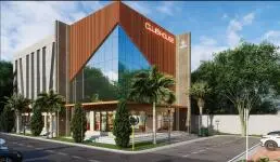
Mythri Enclave Phase I
MEGHAA INFRA · Hanamkonda · RERA P00300010078
MYTHRI ENCLAVE PHASE I is a plotted residential layout at Rampur, Khazipet, Warangal Urban. It is being developed by the registered promoter MEGHAA INFRA, a partnership. The project covers **7078.65 sq. mts.** and comprises **17 plots**; plot-wise sizes are not disclosed, and no towers or floors are stated. Its TG-RERA registration is **P00300010078**, and the Form B completion undertaking is **07/09/2024**.
More from Meghaa Infra · 2 projects →
01What we found
Read from TG-RERA filings, approvals, land and registration records and court records. A court case is counted only when the court record states this project's survey number with its village, or names the project.
02Check before you pay
9 items to check before you pay, 3 high - from the title chain, court records and approvals, each with what to ask the builder or your advocate. An item may not be a problem with the project: records can be incomplete.
1. Project at a glance
Project identity
| Item | Record |
|---|---|
| Registered project name | MYTHRI ENCLAVE PHASE I RERA record |
| Project type | Plotted development; the tentative layout approval describes a residential layout. RERA record |
| Phase / registered portion | Phase I; the registration record is for this named phase. RERA record |
| TG-RERA registration | P00300010078 RERA record |
| Registration validity | 08/09/2022–07/09/2024; the certificate records that it was not extended. This is the registration-validity period, not a completion certificate. |
| Registered promoter | MEGHAA INFRA, a partnership. RERA record RERA filing |
| RERA status | Recorded as On-Going Project in the project information; the registration certificate’s stated validity has ended. RERA record RERA filing |
Land and geographic identity
| Item | Record |
|---|---|
| Locality / revenue village | Rampur; the approval identifies Rampur Revenue Village. RERA record |
| Mandal | Khazipet in the project identity; the layout approval says GWMC Mandal. RERA record |
| District | Warangal Urban in the project identity and project-location record. RERA record RERA filing |
| PIN | 506151 in the project identity and RERA certificate. RERA record |
| Project survey identity | 27/A1/A/1/1/1 RERA record RERA filing |
| Survey-number variants in filed title materials | The title-report extraction also uses 27/A1e/A/1/1/1, 27/A1A/A/1/1/1, 27/A1A/A/A/1/1/1/2, 27/A1/A/A/1/1/1/2, and 27/A1e9/A/1/1/1 for associated deed descriptions. |
| RERA-filed site extent | 7078.65 sq. mts. RERA filing |
| Layout-drawing area statement | 7078.15 sq. m. net layout area; the drawing’s stated total site area is also 7078.15 sq. m. Layout record |
| Approval-document extent | The tentative-layout approval states 1 Acer 29.96 Gts 8466 Sq. Yds. |
| Boundaries filed for the parcel | East: EXISTING 200 WIDE ROAD; South: 18 MT WIDE EXISTING ROAD; West: AGGRICULTURE LAND OF KARRE BHULAXMI; North: AGGRICULTURE LAND OF D MANOHAR. RERA filing |
Development identity
| Item | Record |
|---|---|
| Sanctioning authority | GWMC Municipality/Municipal Corporation in the tentative-layout approval. The RERA filing also identifies DTCP as the authority and lists application/plan number 004255/LO/DTCP/3006/0156/2022. RERA filing Approvals record |
| Principal layout approval | Tentative Layout Plan 0205/LO/3006/2022, dated 08 September, 2022; application number 004255/LO/DTCP/3006/0156/2022. |
| Layout scale | 17 plots stated on the approval and layout drawing. Layout record |
| Approved built-up area | 3730.08 sq. mts. is listed in the RERA filing. RERA filing |
| Buildings / floors | Not disclosed in the supplied project records; this is a plotted layout rather than a disclosed multi-storey building scheme. RERA record Document index |
| Parking | The RERA filing lists 728.26 sq. mts. as mortgage area; no parking-space count or allocation is established in the supplied records. RERA filing |
| Unit count | 17 plots stated on the tentative-layout approval and drawing; plot-wise sizes are not available in the supplied extracted layout data. Layout record |
Offering and status
| Item | Record |
|---|---|
| Unit type | Plots; the project is registered as a plotted development. RERA record |
| RERA-filed saleable area / size range | No plot-wise size range is available in the supplied records. The RERA land extent is 7078.65 sq. mts.; this is not a plot-size range. RERA filing Layout record |
| Booked / available plots | Not disclosed in the supplied evidence. Document index |
| Construction / development stage | Project status is recorded as On-Going Project. The supplied data gives a completeness figure of 70%, but no site-inspection basis is supplied; it is not independently verified here. RERA record |
| Completion date | Form B states a completion undertaking of 07/09/2024; the RERA certificate also states its registration validity ended on 07/09/2024. |
| OC / completion certificate | No project occupancy or completion certificate is included in the supplied evidence. The cited approval is a tentative layout approval. Document index |
2. The project story
MYTHRI ENCLAVE PHASE I is a 17-plot residential layout at Rampur Revenue Village, in the Khazipet area of Warangal Urban. The filed layout drawing divides the site into plots, roads, park/open space, utility land and social-infrastructure land; the approval conditions require the developer to carry out the layout’s infrastructure works. RERA record Layout record
The RERA record describes the project as ongoing and carries a Form B completion undertaking of 07/09/2024. A supplied completeness figure of 70% has no accompanying inspection report or measurement methodology in this evidence, so it should be read as a recorded figure rather than independently verified physical progress. No occupancy or completion certificate is supplied. RERA record Document index
3. Master plan, architecture & building design
This is a plotted layout, not a disclosed apartment or tower plan. The layout drawing states a net layout area of 7078.15 sq. m. and identifies 17 plots; the RERA filing separately lists 7078.65 sq. mts. as total/net parcel area. Layout record RERA filing
The drawing’s land-use statement is: 3730.56 sq. m. plotted area (52.71%); 2442.78 sq. m. roads (34.51%); 650.95 sq. m. parks/open space (9.20%); 74.79 sq. m. utilities (1.06%); 179.09 sq. m. social infrastructure (2.53%); and 0.00 sq. m. amenities (0.00%). These are drawing-derived figures, and plot sizes could not be extracted from the drawing. Layout record
The tentative-layout approval also records land-use allocations in its own area statement: plotted area 52.71%, roads 34.51%, open space (park) 9.2%, social infrastructure 2.53%, utilities 1.06%, and mortgage area 19.23 % of plotted area. It identifies Plots 15, 16 and 17 as mortgaged to the Municipality/Municipal Corporation pending development works and release of the final layout.
The approval calls for road formation with black top, storm-water drains, underground drainage lines and a common septic tank/STP, internal water-supply pipelines and overhead tank, an assured water-supply source, electrical supply lines and street lights, a transformer, avenue plantation, park development and rainwater-harvesting pits. These are approval conditions and stated development requirements; the evidence does not independently establish their completion.
4. Homes, configurations & floor plans
The registered offering is plots, not apartments. The layout drawing states 17 plots, but the supplied extraction reports no plot sizes, and the records do not establish plot-wise booked or available counts. RERA record Layout record Document index
| Configuration | Units | Booked | Available | RERA saleable area | Measured carpet area | Loading (if supplied) |
|---|---|---|---|---|---|---|
| Plots | 17 stated on layout drawing | Not disclosed | Not disclosed | Plot-wise area not disclosed | Not applicable | Not supplied |
Two layout sheets are recorded, but plot measurements were not extracted; no apartment floor plans or software-measured carpet areas are available. Layout record Floor plans
5. Parking & vehicle circulation
The supplied records do not establish a parking-space count, visitor or accessible parking provision, parking allocation to individual plots, or a separate parking area. The RERA filing lists 728.26 sq. mts. as mortgage area; the layout approval identifies Plots 15–17, measuring 0 Acer 7.19 Gts 871 Sq. Yds, as mortgaged to the Municipality/Municipal Corporation. That is an approval-condition mortgage, not evidence of parking provision. RERA filing
The approval requires roads to be opened for access to neighbouring sites and prohibits a compound wall or fencing around the site. The filed boundaries include an existing 200 wide road to the east and an 18 MT WIDE EXISTING ROAD to the south. No driveway, pedestrian-separation, ramp, EV-charging or parking-allotment details are supplied. RERA filing
6. Amenities, recreation & open spaces
| Description / size | Drawing area 650.95 sq. m.; approval area 0 Acer 6.43 Gts 779 Sq. Yds (9.2%). |
|---|---|
| Evidence source | Layout record |
| Declared progress / verified status | Approval requires the open space to be handed over by registered gift deed; completion or handover is not established. |
| Description / size | Drawing area 2442.78 sq. m. (34.51%). |
|---|---|
| Evidence source | Layout record |
| Declared progress / verified status | Approval requires roads to be formed and opened for access; completed status is not independently verified. |
| Description / size | Drawing area 74.79 sq. m. (1.06%). |
|---|---|
| Evidence source | Layout record |
| Declared progress / verified status | Approval specifies utility provision and handover; completion or handover is not established. |
| Description / size | Drawing area 179.09 sq. m. (2.53%). |
|---|---|
| Evidence source | Layout record |
| Declared progress / verified status | The area is shown in the drawing; a specific facility or delivered building is not identified. |
| Description / size | No size or facility detail supplied. |
|---|---|
| Evidence source | RERA amenities |
| Declared progress / verified status | Not recorded as available in the supplied amenity data. |
The RERA amenity data marks internal roads and footpaths, water supply, sewerage, storm-water drains, green strip/park, street lighting, rainwater harvesting, and electrical meter room/sub-station/receiving station as available at 100%. These are recorded amenity percentages, not independent verification of completion. Community buildings, sewage/sullage treatment and disposal, solid-waste management, energy management, fire protection and recreational open-space aggregate are recorded at 0% in that data. RERA amenities
7. Utilities, building services & safety
The tentative-layout approval requires internal water-supply pipelines, an overhead tank, an assured water source, storm-water drains, underground drainage lines and a common septic tank/STP, as well as rainwater-harvesting pits. It also lists an electric transformer, electrical supply lines, street lights and solid-waste-management facilities. These are approval conditions; the supplied evidence does not provide capacities or independently verify delivery.
The RERA amenity data records water supply, sewerage, storm-water drains, rainwater harvesting and an electrical meter room/sub-station/receiving station as available at 100%, while sewage/sullage treatment and disposal and solid-waste management are recorded at 0%. The approval refers to a common septic tank/STP and solid-waste management, but completion status is not established by the supplied materials. RERA amenities
No specific fire-protection system, security/CCTV arrangements, accessibility features, backup-power capacity, lift provision or service equipment capacity is disclosed. RERA amenities Document index
8. Location, access & connectivity
The project is identified as MYTHRI ENCLAVE PHASE I, at Rampur, Khazipet, Warangal Urban, PIN 506151. The tentative-layout approval names Rampur Revenue Village and GWMC Mandal. RERA record
The parcel boundaries identify an existing 200 wide road on the east and an 18 MT WIDE EXISTING ROAD on the south. A location record gives the nearest sampled Outer Ring Road interchange as approximately 113.1 km away; this is a sampled distance, not a travel-time claim. No public-transport details or further verified nearby landmarks are supplied. RERA filing Location record
9. Developer & development status
The registered promoter is MEGHAA INFRA, recorded as a partnership, with GSTIN 36ABQFM1971K1ZO. The project filing names KYATHAM TEJASWI as authorized signatory and POLAMPALLY SHOBHAN BABU as partner. The listed promoter address is KYATHAM TEJASWI, P GADDA, BALASAMUDRAM, RAMPUR, GWMC MANDAL, Khazipet, Warangal Urban, 506151. RERA filing Corporate record Parties record
Form B, signed by KYATHAM TEJASWI as authorized signatory, states a completion undertaking of 07/09/2024 and declares that the land is free from encumbrances. The affidavit’s completion date and place are incomplete in the supplied OCR extraction. The RERA record labels the project ongoing; the supplied 70% completeness figure has no independent site-verification evidence. RERA record
10. Approvals, official records & documents
| Record | Evidence in the supplied file |
|---|---|
| TG-RERA registration | Form C certificate for MYTHRI ENCLAVE PHASE I, registration P00300010078, valid 08/09/2022–07/09/2024. |
| Tentative layout approval | 0205/LO/3006/2022, issued by GWMC Municipality/Municipal Corporation on 08 September, 2022; 17 plots. The RERA filing also lists application/plan number 004255/LO/DTCP/3006/0156/2022. Approvals record |
| Filed title and layout documents | Legal-title-report materials include the development agreement/GPA, supplementary deed, gift deeds and mortgage deed; the title report is dated 25-10-2024. The layout drawing is recorded as document 494527. Layout record |
| Mortgage record | Mortgage Deed 22108/2022, dated 30 August, 2022, over Plots 15–17 in favour of the Municipality/Municipal Corporation, as recorded in the tentative-layout approval. |
| Occupancy/completion certificate | No project OC or completion certificate is included in the supplied documents. Document index |
The approval is expressly a tentative layout plan and sets out conditions for infrastructure development, gift of specified public-use land, mortgage release and final layout release. The supplied file does not include a final layout-release certificate.
1. Project at a glance
Project identity
Registered project name: MYTHRI ENCLAVE PHASE I
Project type: Plotted development; the tentative layout approval describes a residential layout.
Phase / registered portion: Phase I; the registration record is for this named phase.
TG-RERA registration: P00300010078
Registration validity: 08/09/2022–07/09/2024; the certificate records that it was not extended. This is the registration-validity period, not a completion certificate.
Registered promoter: MEGHAA INFRA, a partnership.
RERA status: Recorded as On-Going Project in the project information; the registration certificate’s stated validity has ended.
Land and geographic identity
Locality / revenue village: Rampur; the approval identifies Rampur Revenue Village.
Mandal: Khazipet in the project identity; the layout approval says GWMC Mandal.
District: Warangal Urban in the project identity and project-location record.
PIN: 506151 in the project identity and RERA certificate.
Project survey identity: 27/A1/A/1/1/1
Survey-number variants in filed title materials: The title-report extraction also uses 27/A1e/A/1/1/1, 27/A1A/A/1/1/1, 27/A1A/A/A/1/1/1/2, 27/A1/A/A/1/1/1/2, and 27/A1e9/A/1/1/1 for associated deed descriptions.
RERA-filed site extent: 7078.65 sq. mts.
Layout-drawing area statement: 7078.15 sq. m. net layout area; the drawing’s stated total site area is also 7078.15 sq. m.
Approval-document extent: The tentative-layout approval states 1 Acer 29.96 Gts 8466 Sq. Yds.
Boundaries filed for the parcel: East: EXISTING 200 WIDE ROAD; South: 18 MT WIDE EXISTING ROAD; West: AGGRICULTURE LAND OF KARRE BHULAXMI; North: AGGRICULTURE LAND OF D MANOHAR.
Development identity
Sanctioning authority: GWMC Municipality/Municipal Corporation in the tentative-layout approval. The RERA filing also identifies DTCP as the authority and lists application/plan number 004255/LO/DTCP/3006/0156/2022.
Principal layout approval: Tentative Layout Plan 0205/LO/3006/2022, dated 08 September, 2022; application number 004255/LO/DTCP/3006/0156/2022.
Layout scale: 17 plots stated on the approval and layout drawing.
Approved built-up area: 3730.08 sq. mts. is listed in the RERA filing.
Buildings / floors: Not disclosed in the supplied project records; this is a plotted layout rather than a disclosed multi-storey building scheme.
Parking: The RERA filing lists 728.26 sq. mts. as mortgage area; no parking-space count or allocation is established in the supplied records.
Unit count: 17 plots stated on the tentative-layout approval and drawing; plot-wise sizes are not available in the supplied extracted layout data.
Offering and status
Unit type: Plots; the project is registered as a plotted development.
RERA-filed saleable area / size range: No plot-wise size range is available in the supplied records. The RERA land extent is 7078.65 sq. mts.; this is not a plot-size range.
Booked / available plots: Not disclosed in the supplied evidence.
Construction / development stage: Project status is recorded as On-Going Project. The supplied data gives a completeness figure of 70%, but no site-inspection basis is supplied; it is not independently verified here.
Completion date: Form B states a completion undertaking of 07/09/2024; the RERA certificate also states its registration validity ended on 07/09/2024.
OC / completion certificate: No project occupancy or completion certificate is included in the supplied evidence. The cited approval is a tentative layout approval.
2. The project story
MYTHRI ENCLAVE PHASE I is a 17-plot residential layout at Rampur Revenue Village, in the Khazipet area of Warangal Urban. The filed layout drawing divides the site into plots, roads, park/open space, utility land and social-infrastructure land; the approval conditions require the developer to carry out the layout’s infrastructure works.
The RERA record describes the project as ongoing and carries a Form B completion undertaking of 07/09/2024. A supplied completeness figure of 70% has no accompanying inspection report or measurement methodology in this evidence, so it should be read as a recorded figure rather than independently verified physical progress. No occupancy or completion certificate is supplied.
3. Master plan, architecture & building design
This is a plotted layout, not a disclosed apartment or tower plan. The layout drawing states a net layout area of 7078.15 sq. m. and identifies 17 plots; the RERA filing separately lists 7078.65 sq. mts. as total/net parcel area.
The drawing’s land-use statement is: 3730.56 sq. m. plotted area (52.71%); 2442.78 sq. m. roads (34.51%); 650.95 sq. m. parks/open space (9.20%); 74.79 sq. m. utilities (1.06%); 179.09 sq. m. social infrastructure (2.53%); and 0.00 sq. m. amenities (0.00%). These are drawing-derived figures, and plot sizes could not be extracted from the drawing.
The tentative-layout approval also records land-use allocations in its own area statement: plotted area 52.71%, roads 34.51%, open space (park) 9.2%, social infrastructure 2.53%, utilities 1.06%, and mortgage area 19.23 % of plotted area. It identifies Plots 15, 16 and 17 as mortgaged to the Municipality/Municipal Corporation pending development works and release of the final layout.
The approval calls for road formation with black top, storm-water drains, underground drainage lines and a common septic tank/STP, internal water-supply pipelines and overhead tank, an assured water-supply source, electrical supply lines and street lights, a transformer, avenue plantation, park development and rainwater-harvesting pits. These are approval conditions and stated development requirements; the evidence does not independently establish their completion.
4. Homes, configurations & floor plans
The registered offering is plots, not apartments. The layout drawing states 17 plots, but the supplied extraction reports no plot sizes, and the records do not establish plot-wise booked or available counts.
| Configuration | Units | Booked | Available | RERA saleable area | Measured carpet area | Loading (if supplied) |
|---|---|---|---|---|---|---|
| Plots | 17 stated on layout drawing | Not disclosed | Not disclosed | Plot-wise area not disclosed | Not applicable | Not supplied |
Two layout sheets are recorded, but plot measurements were not extracted; no apartment floor plans or software-measured carpet areas are available.
5. Parking & vehicle circulation
The supplied records do not establish a parking-space count, visitor or accessible parking provision, parking allocation to individual plots, or a separate parking area. The RERA filing lists 728.26 sq. mts. as mortgage area; the layout approval identifies Plots 15–17, measuring 0 Acer 7.19 Gts 871 Sq. Yds, as mortgaged to the Municipality/Municipal Corporation. That is an approval-condition mortgage, not evidence of parking provision.
The approval requires roads to be opened for access to neighbouring sites and prohibits a compound wall or fencing around the site. The filed boundaries include an existing 200 wide road to the east and an 18 MT WIDE EXISTING ROAD to the south. No driveway, pedestrian-separation, ramp, EV-charging or parking-allotment details are supplied.
6. Amenities, recreation & open spaces
| Facility | Description / size | Evidence source | Declared progress / verified status |
|---|---|---|---|
| Park / open space | Drawing area 650.95 sq. m.; approval area 0 Acer 6.43 Gts 779 Sq. Yds (9.2%). | Approval requires the open space to be handed over by registered gift deed; completion or handover is not established. | |
| Roads | Drawing area 2442.78 sq. m. (34.51%). | Approval requires roads to be formed and opened for access; completed status is not independently verified. | |
| Utility land | Drawing area 74.79 sq. m. (1.06%). | Approval specifies utility provision and handover; completion or handover is not established. | |
| Social infrastructure | Drawing area 179.09 sq. m. (2.53%). | The area is shown in the drawing; a specific facility or delivered building is not identified. | |
| Community buildings | No size or facility detail supplied. | Not recorded as available in the supplied amenity data. |
The RERA amenity data marks internal roads and footpaths, water supply, sewerage, storm-water drains, green strip/park, street lighting, rainwater harvesting, and electrical meter room/sub-station/receiving station as available at 100%. These are recorded amenity percentages, not independent verification of completion. Community buildings, sewage/sullage treatment and disposal, solid-waste management, energy management, fire protection and recreational open-space aggregate are recorded at 0% in that data.
7. Utilities, building services & safety
The tentative-layout approval requires internal water-supply pipelines, an overhead tank, an assured water source, storm-water drains, underground drainage lines and a common septic tank/STP, as well as rainwater-harvesting pits. It also lists an electric transformer, electrical supply lines, street lights and solid-waste-management facilities. These are approval conditions; the supplied evidence does not provide capacities or independently verify delivery.
The RERA amenity data records water supply, sewerage, storm-water drains, rainwater harvesting and an electrical meter room/sub-station/receiving station as available at 100%, while sewage/sullage treatment and disposal and solid-waste management are recorded at 0%. The approval refers to a common septic tank/STP and solid-waste management, but completion status is not established by the supplied materials.
No specific fire-protection system, security/CCTV arrangements, accessibility features, backup-power capacity, lift provision or service equipment capacity is disclosed.
8. Location, access & connectivity
The project is identified as MYTHRI ENCLAVE PHASE I, at Rampur, Khazipet, Warangal Urban, PIN 506151. The tentative-layout approval names Rampur Revenue Village and GWMC Mandal.
The parcel boundaries identify an existing 200 wide road on the east and an 18 MT WIDE EXISTING ROAD on the south. A location record gives the nearest sampled Outer Ring Road interchange as approximately 113.1 km away; this is a sampled distance, not a travel-time claim. No public-transport details or further verified nearby landmarks are supplied.
9. Developer & development status
The registered promoter is MEGHAA INFRA, recorded as a partnership, with GSTIN 36ABQFM1971K1ZO. The project filing names KYATHAM TEJASWI as authorized signatory and POLAMPALLY SHOBHAN BABU as partner. The listed promoter address is KYATHAM TEJASWI, P GADDA, BALASAMUDRAM, RAMPUR, GWMC MANDAL, Khazipet, Warangal Urban, 506151.
Form B, signed by KYATHAM TEJASWI as authorized signatory, states a completion undertaking of 07/09/2024 and declares that the land is free from encumbrances. The affidavit’s completion date and place are incomplete in the supplied OCR extraction. The RERA record labels the project ongoing; the supplied 70% completeness figure has no independent site-verification evidence.
10. Approvals, official records & documents
TG-RERA registration: Form C certificate for MYTHRI ENCLAVE PHASE I, registration P00300010078, valid 08/09/2022–07/09/2024.
Tentative layout approval: 0205/LO/3006/2022, issued by GWMC Municipality/Municipal Corporation on 08 September, 2022; 17 plots. The RERA filing also lists application/plan number 004255/LO/DTCP/3006/0156/2022.
Filed title and layout documents: Legal-title-report materials include the development agreement/GPA, supplementary deed, gift deeds and mortgage deed; the title report is dated 25-10-2024. The layout drawing is recorded as document 494527.
Mortgage record: Mortgage Deed 22108/2022, dated 30 August, 2022, over Plots 15–17 in favour of the Municipality/Municipal Corporation, as recorded in the tentative-layout approval.
Occupancy/completion certificate: No project OC or completion certificate is included in the supplied documents.
The approval is expressly a tentative layout plan and sets out conditions for infrastructure development, gift of specified public-use land, mortgage release and final layout release. The supplied file does not include a final layout-release certificate.
Other registrations of Mythri Enclave
Frequently asked questions
Is MYTHRI ENCLAVE PHASE I registered with Telangana RERA?
Yes. MYTHRI ENCLAVE PHASE I is registered with the Telangana Real Estate Regulatory Authority as P00300010078; the registration status is On-Going Project.
Who is the developer of MYTHRI ENCLAVE PHASE I?
The promoter named in the RERA registration is MEGHAA INFRA.
Where is MYTHRI ENCLAVE PHASE I located?
MYTHRI ENCLAVE PHASE I is in GWMC MANDAL, Rampur, Khazipet, Hanamkonda, Telangana (506151).
When will MYTHRI ENCLAVE PHASE I be completed?
The promoter's proposed date of completion filed with RERA is 07/09/2024. This is the promoter's declaration, not a guarantee.
More projects in Rampur