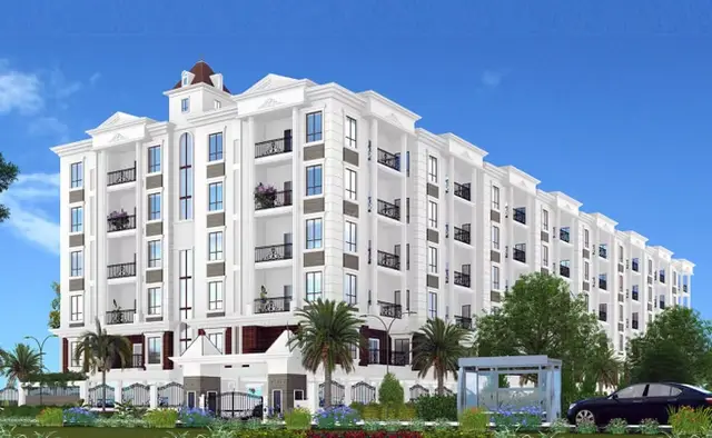
Green Rich County
GVR INFRA · Medchal-Malkajgiri · RERA P02200002350
GREEN RICH COUNTY is a plotted development in Bahadurpalle, Dundigal Gandimaisamma mandal, Medchal-Malkajgiri district, developed by registered promoter GVR INFRA. The registered net site extent is 23863.2 Sq.m; the project is a plotted layout, and the supplied record does not establish a reliable total plot count or plot-size configurations. Its TG-RERA registration number is P02200002350, and the registration record gives proposed completion as 29/11/2022.
More from Gvr Infra · 2 projects →
01What we found
Read from TG-RERA filings, approvals, land and registration records and court records. A court case is counted only when the court record states this project's survey number with its village, or names the project.
02Check before you pay
9 items to check before you pay, 4 high - from the title chain, court records and approvals, each with what to ask the builder or your advocate. An item may not be a problem with the project: records can be incomplete.
1. Project at a glance
Project identity
| Item | Record |
|---|---|
| Registered project name | GREEN RICH COUNTY RERA record |
| Project type / category | Plotted development; the TG-RERA filing identifies the project as a plotted layout. RERA record RERA filing |
| Phase / registered portion | The registration record identifies GREEN RICH COUNTY; a separate phase name or phase number is not disclosed. |
| TG-RERA registration number | P02200002350 RERA record |
| Registration validity | 20/11/2020–29/11/2022; the supplied certificate records a two-year validity and no extension. This is the registration period, not a statement of completion or occupancy status. |
| Registered promoter | GVR INFRA (also styled “Gvr Infra” in the certificate). RERA record |
| RERA status in supplied record | The registration certificate records the project’s registration and original validity dates. A current registration status beyond those dates is not established by the supplied record. |
Land and geographic identity
| Item | Record |
|---|---|
| Locality / revenue village | Bahadurpalle (also rendered Bahadurpally in title documents); revenue village: Bahadurpalle. RERA record Land records |
| Mandal | Dundigal Gandimaisamma (approval document: “Dundigal/Gandimaisamma”). RERA record Land records |
| District | Medchal-Malkajgiri RERA record Land records |
| PIN | 500043 RERA record |
| Project survey numbers / subdivisions | 138/P, 139/P, 140/P and 145/P; the draft approval spells these as 138/PART, 139/PART, 140/PART and 145PART. RERA record |
| Registered site extent | 23863.2 Sq.m (net site area in the approval drawing/extraction). RERA filing |
| Total site area / road-affected area | The approval extraction states total site area 24336.27 and master-plan road affected area 0; it states net site area 23863.2. The supplied record does not explain the difference between total and net figures. |
| Boundaries | RERA filing fields give the boundary entries as “NORTH,” “SOUTH,” “EAST,” and “WEST,” without adjoining-owner or feature descriptions. RERA filing |
Development identity
| Item | Record |
|---|---|
| Sanctioning authority | Hyderabad Metropolitan Development Authority (HMDA) Approvals record |
| Principal approval | HMDA approval no. 000353/LO/Plg/HMDA/2019, dated 30 November, 2019; application no. 019416/MED/LT/U6/HMDA/22012019. Approvals record |
| Approval status described by document | The submitted instrument is described as a Draft layout Letter for an open-plot layout; it states that final layout release follows development and handover conditions. |
| Approved built-up area | RERA filing records 13137.86 sq.m as approved built-up area. The project is a plotted layout; no building-by-building built-up schedule is supplied here. RERA filing |
| Building / tower count and floor configuration | Not disclosed in the supplied TG-RERA project records. Document index |
| Plot count | The approval extraction contains the text “73 AND 86 no of plots,” which does not establish a reliable total plot count. |
| Mortgage provision in approval | The approval records mortgage security for Plot Nos. 73 to 86 (14 plots; 2132.37 Sq.mts) and additional mortgage Plot Nos. 1 to 5 (5 plots; 691.45 Sq.mts). These are approval-related mortgage provisions, not a count of plots available for purchase. |
| Approved versus RERA-declared unit counts | A verified total plot/unit count is not established by the supplied records. |
Offering and status
| Item | Record |
|---|---|
| Unit type in TG-RERA project record | Plots; plot-wise inventory, plot count and RERA-filed plot-size schedule are not supplied in the available extracted project data. RERA record RERA filing |
| Plot-size range | Not established from the available TG-RERA records. The separate third-party/vendor listing gives a plot saleable range, but it is not used here as a RERA-filed figure. Promoter website |
| Booked / available counts | Not disclosed in the supplied project data. Document index |
| Construction / development stage | The registration filing records 80% completeness; this is a filed progress figure, not an independent site inspection. RERA record |
| Completion dates | The registration record gives proposed completion 29/11/2022. The Form-B declaration dated 11", November, 2020 states a completion undertaking of 29th November, 2025. These are reported separately as the filed project date and promoter-declared undertaking. RERA record |
| Occupancy / completion certificate | No occupancy or completion certificate is identified in the supplied documents. For this plotted layout, final layout release is referred to in the HMDA draft approval; its issuance is not established in the supplied record. Document index |
2. The project story
GREEN RICH COUNTY is registered with TG-RERA as a plotted-development project in revenue village Bahadurpalle, Dundigal Gandimaisamma mandal, Medchal-Malkajgiri district. The project land is identified in the filing as 138/P, 139/P, 140/P and 145/P, with a registered net site extent of 23863.2 Sq.m. RERA record Land records
The filed HMDA instrument is a draft layout approval for an open-plot layout. It describes layout roads, open space and social infrastructure land, and sets out development works including road formation, drainage, internal water supply, electrical services, park development and rainwater-harvesting pits. Its stated conditions make final layout release dependent on specified works and handovers; the supplied materials do not establish that these works are complete or that final layout plans have been released.
The RERA filing’s 80% completeness is a declared progress figure. No independent site-progress verification, plot-wise inventory, booking status or completion/occupancy certification is included in the supplied material. RERA record Document index
3. Master plan, architecture & building design
This is a plotted layout rather than a documented apartment or tower scheme. The TG-RERA-filed land area is 23863.2 Sq.m net; the HMDA draft approval extraction separately records total site area 24336.27, road-affected area 0, and net site area 23863.2. RERA filing
The HMDA draft approval extraction identifies the following land-use figures:
| Layout component | Area / share stated in approval extraction |
|---|---|
| Plotted area | 13137.86 |
| Layout roads | 7939.91 Sq.mtrs (33.27%) |
| Open space / park | 2188.30 Sq.mtrs (9.17 %) |
| Social infrastructure | 597.12.mtrs (2.50%) |
| Master-plan road affected area | 0 |
| Amenities area | 0 |
The approval calls for roads 18 mts and above and states that roads, open space and social-infrastructure areas are to be handed to the local body by registered gift deed before final layout-plan release. The layout drawing extraction also identifies a park and social-infrastructure area; it does not provide a complete, reliable plot schedule or plot-size bands.
The supplied drawing data covers two layout sheets, but the plot extraction is incomplete and records no plot sizes. There is no evidenced building footprint, floor configuration, building height, apartment circulation or tower organization for this plotted project. Layout record Floor plans
4. Homes, configurations & floor plans
The TG-RERA record identifies the offering as plots, but the supplied data does not include a complete RERA-filed plot inventory, plot-wise area schedule, or booked/available counts. Accordingly, a configuration table with verified counts and area bands cannot be populated from the available project records. RERA record RERA filing Document index
The layout extraction reports a plotted area of 13137.86, but does not provide the individual plot areas or a reliable total plot count. The two supplied layout sheets have no software-measured plot areas. Layout record Floor plans
5. Parking & vehicle circulation
The supplied TG-RERA and approval extracts do not establish parking-space counts, visitor or accessible parking, parking allocation to particular plots, or a parking allotment arrangement. Document index
For circulation, the HMDA draft approval specifies layout roads 18 mts and above, requires roads to be opened for access to neighbouring sites, and includes road formation and storm-water drainage among the stated development works. No verified road-by-road width schedule, vehicle-entry arrangement or pedestrian-separation detail is supplied.
6. Amenities, recreation & open spaces
The table below separates approval-recorded items from RERA amenity declarations. The RERA amenity extract reports “YES” for certain categories but gives 0 progress for the listed items; this is not evidence that construction or delivery is complete. RERA amenities
| Facility | Park / open space |
|---|---|
| Description / size | 2188.30 Sq.mtrs (9.17 %) in the HMDA approval extraction. |
| Evidence source | HMDA draft layout approval |
| Declared progress / verified status | Area stated in the draft approval; completed status not established. |
| Facility | Green strip / tot lot / park |
|---|---|
| Description / size | Listed as “YES” in RERA amenity data. RERA amenities |
| Evidence source | TG-RERA amenity extract |
| Declared progress / verified status | Progress 0; no independent completion verification. |
| Facility | Community buildings |
|---|---|
| Description / size | Listed as “YES” in RERA amenity data. RERA amenities |
| Evidence source | TG-RERA amenity extract |
| Declared progress / verified status | Progress 0; no specific building, size or completion evidence supplied. |
| Facility | Social infrastructure area |
|---|---|
| Description / size | 597.12.mtrs (2.50%) in the HMDA approval extraction. |
| Evidence source | HMDA draft layout approval |
| Declared progress / verified status | Area stated; facility type and completion status not specified. |
| Facility | Cycling track |
|---|---|
| Description / size | Required by the draft approval. |
| Evidence source | HMDA draft layout approval |
| Declared progress / verified status | Required feature; completed status not established. |
| Facility | Avenue plantation |
|---|---|
| Description / size | Included among the approval’s layout-development works. |
| Evidence source | HMDA draft layout approval |
| Declared progress / verified status | Required work; progress not established. |
Third-party listings describe additional facilities, but they are not treated here as TG-RERA-filed or approval-verified project facilities. Promoter website
7. Utilities, building services & safety
The HMDA draft approval lists required layout-development works, including road formation with black top, storm-water drains, underground drainage lines and a common septic tank / STP, internal water-supply pipelines, an overhead tank, an assured water-supply source, electrical supply lines, streetlights, a transformer, avenue plantation, park development and rainwater-harvesting pits. These are approval conditions or proposed works in the supplied document; completion is not established.
The approval also specifies underground ducting of utilities and service lines, underground storm-water drainage, a transformer yard, LED street lighting, space for solid-waste disposal and a bio-compost unit. For layouts below 10 acres, it calls for a septage-treatment mechanism under the Telangana State FSSM Policy and connection of treated sewerage to the existing public sewerage system at the specified point. The supplied record does not provide capacities, engineering completion certificates or independent verification for these services.
The RERA amenity extract lists water supply; sewerage (chambers, lines, septic tank/STP); storm-water drains; sewage and sullage treatment/disposal; solid-waste management; rainwater harvesting; energy management; fire protection and safety; and electrical meter room/sub-station/receiving station. It does not provide capacities or establish that these facilities are complete. RERA amenities
8. Location, access & connectivity
The official project identity places the site in Bahadurpalle revenue village, Dundigal Gandimaisamma mandal, Medchal-Malkajgiri district, PIN 500043, on survey numbers 138/P, 139/P, 140/P and 145/P. RERA record Land records
The HMDA draft approval requires layout roads to be opened for access to neighbouring sites and refers to roads 18 mts and above. The supplied project record does not identify a named approach road, public-transport route or measured distance to a landmark.
9. Developer & development status
The registered promoter is GVR INFRA. The RERA filing identifies its organization type as Company, while the supplied corporate entity-type field is “unknown”; the entity’s corporate registration number and registered-office details are not established in the available material. The registration certificate gives a promoter-office address of Village: Jeedimetla-Village, Mandal: Qutballapur, District: Medchal-Malkajgiri, Pin: 500014. RERA record RERA filing Corporate record
The Form-B declaration is made by Raja Reddy Yaram as authorized signatory for M/s GVR INFRA. It declares a completion undertaking of 29th November, 2025 and includes declarations concerning title basis, encumbrances, project funds, audit and pending approvals. These are promoter declarations, not independent verification of the underlying matters.
The project record states 80% completeness, but does not specify the measurement date or provide independent site verification. The TG-RERA certificate records registration validity through 29/11/2022; the supplied record does not establish a subsequent extension or a current completion/occupancy certificate. RERA record
10. Approvals, official records & documents
| Details | Form “C”; GREEN RICH COUNTY; registration no. P02200002350; issued 20/11/2020; valid through 29/11/2022. The supplied certificate records no extension. |
|---|
| Details | Draft layout Letter; approval no. 000353/LO/Plg/HMDA/2019; dated 30 November, 2019; application no. 019416/MED/LT/U6/HMDA/22012019; survey references 138/PART, 139/PART, 140/PART and 145PART. |
|---|
| Details | Plan approval number recorded in the project filing: 019416/MED/LT/U6/HMD. |
|---|---|
| Source | RERA record RERA filing |
| Details | Declaration by M/s GVR INFRA, represented by Raja Reddy Yaram; completion undertaking stated as 29th November, 2025. |
|---|
| Details | Two layout sheets are identified; software extraction is incomplete, with no measured plot areas or complete plot schedule in the supplied data. |
|---|---|
| Source | Layout record |
| Details | No completion or occupancy certificate, or final layout release record, is identified in the supplied documents. |
|---|---|
| Source | Document index |
1. Project at a glance
Project identity
Registered project name: GREEN RICH COUNTY
Project type / category: Plotted development; the TG-RERA filing identifies the project as a plotted layout.
Phase / registered portion: The registration record identifies GREEN RICH COUNTY; a separate phase name or phase number is not disclosed.
TG-RERA registration number: P02200002350
Registration validity: 20/11/2020–29/11/2022; the supplied certificate records a two-year validity and no extension. This is the registration period, not a statement of completion or occupancy status.
Registered promoter: GVR INFRA (also styled “Gvr Infra” in the certificate).
RERA status in supplied record: The registration certificate records the project’s registration and original validity dates. A current registration status beyond those dates is not established by the supplied record.
Land and geographic identity
Locality / revenue village: Bahadurpalle (also rendered Bahadurpally in title documents); revenue village: Bahadurpalle.
Mandal: Dundigal Gandimaisamma (approval document: “Dundigal/Gandimaisamma”).
District: Medchal-Malkajgiri
PIN: 500043
Project survey numbers / subdivisions: 138/P, 139/P, 140/P and 145/P; the draft approval spells these as 138/PART, 139/PART, 140/PART and 145PART.
Registered site extent: 23863.2 Sq.m (net site area in the approval drawing/extraction).
Total site area / road-affected area: The approval extraction states total site area 24336.27 and master-plan road affected area 0; it states net site area 23863.2. The supplied record does not explain the difference between total and net figures.
Boundaries: RERA filing fields give the boundary entries as “NORTH,” “SOUTH,” “EAST,” and “WEST,” without adjoining-owner or feature descriptions.
Development identity
Sanctioning authority: Hyderabad Metropolitan Development Authority (HMDA)
Principal approval: HMDA approval no. 000353/LO/Plg/HMDA/2019, dated 30 November, 2019; application no. 019416/MED/LT/U6/HMDA/22012019.
Approval status described by document: The submitted instrument is described as a Draft layout Letter for an open-plot layout; it states that final layout release follows development and handover conditions.
Approved built-up area: RERA filing records 13137.86 sq.m as approved built-up area. The project is a plotted layout; no building-by-building built-up schedule is supplied here.
Building / tower count and floor configuration: Not disclosed in the supplied TG-RERA project records.
Plot count: The approval extraction contains the text “73 AND 86 no of plots,” which does not establish a reliable total plot count.
Mortgage provision in approval: The approval records mortgage security for Plot Nos. 73 to 86 (14 plots; 2132.37 Sq.mts) and additional mortgage Plot Nos. 1 to 5 (5 plots; 691.45 Sq.mts). These are approval-related mortgage provisions, not a count of plots available for purchase.
Approved versus RERA-declared unit counts: A verified total plot/unit count is not established by the supplied records.
Offering and status
Unit type in TG-RERA project record: Plots; plot-wise inventory, plot count and RERA-filed plot-size schedule are not supplied in the available extracted project data.
Plot-size range: Not established from the available TG-RERA records. The separate third-party/vendor listing gives a plot saleable range, but it is not used here as a RERA-filed figure.
Booked / available counts: Not disclosed in the supplied project data.
Construction / development stage: The registration filing records 80% completeness; this is a filed progress figure, not an independent site inspection.
Completion dates: The registration record gives proposed completion 29/11/2022. The Form-B declaration dated 11", November, 2020 states a completion undertaking of 29th November, 2025. These are reported separately as the filed project date and promoter-declared undertaking.
Occupancy / completion certificate: No occupancy or completion certificate is identified in the supplied documents. For this plotted layout, final layout release is referred to in the HMDA draft approval; its issuance is not established in the supplied record.
2. The project story
GREEN RICH COUNTY is registered with TG-RERA as a plotted-development project in revenue village Bahadurpalle, Dundigal Gandimaisamma mandal, Medchal-Malkajgiri district. The project land is identified in the filing as 138/P, 139/P, 140/P and 145/P, with a registered net site extent of 23863.2 Sq.m.
The filed HMDA instrument is a draft layout approval for an open-plot layout. It describes layout roads, open space and social infrastructure land, and sets out development works including road formation, drainage, internal water supply, electrical services, park development and rainwater-harvesting pits. Its stated conditions make final layout release dependent on specified works and handovers; the supplied materials do not establish that these works are complete or that final layout plans have been released.
The RERA filing’s 80% completeness is a declared progress figure. No independent site-progress verification, plot-wise inventory, booking status or completion/occupancy certification is included in the supplied material.
3. Master plan, architecture & building design
This is a plotted layout rather than a documented apartment or tower scheme. The TG-RERA-filed land area is 23863.2 Sq.m net; the HMDA draft approval extraction separately records total site area 24336.27, road-affected area 0, and net site area 23863.2.
The HMDA draft approval extraction identifies the following land-use figures:
Plotted area: 13137.86
Layout roads: 7939.91 Sq.mtrs (33.27%)
Open space / park: 2188.30 Sq.mtrs (9.17 %)
Social infrastructure: 597.12.mtrs (2.50%)
Master-plan road affected area: 0
Amenities area: 0
The approval calls for roads 18 mts and above and states that roads, open space and social-infrastructure areas are to be handed to the local body by registered gift deed before final layout-plan release. The layout drawing extraction also identifies a park and social-infrastructure area; it does not provide a complete, reliable plot schedule or plot-size bands.
The supplied drawing data covers two layout sheets, but the plot extraction is incomplete and records no plot sizes. There is no evidenced building footprint, floor configuration, building height, apartment circulation or tower organization for this plotted project.
4. Homes, configurations & floor plans
The TG-RERA record identifies the offering as plots, but the supplied data does not include a complete RERA-filed plot inventory, plot-wise area schedule, or booked/available counts. Accordingly, a configuration table with verified counts and area bands cannot be populated from the available project records.
The layout extraction reports a plotted area of 13137.86, but does not provide the individual plot areas or a reliable total plot count. The two supplied layout sheets have no software-measured plot areas.
5. Parking & vehicle circulation
The supplied TG-RERA and approval extracts do not establish parking-space counts, visitor or accessible parking, parking allocation to particular plots, or a parking allotment arrangement.
For circulation, the HMDA draft approval specifies layout roads 18 mts and above, requires roads to be opened for access to neighbouring sites, and includes road formation and storm-water drainage among the stated development works. No verified road-by-road width schedule, vehicle-entry arrangement or pedestrian-separation detail is supplied.
6. Amenities, recreation & open spaces
The table below separates approval-recorded items from RERA amenity declarations. The RERA amenity extract reports “YES” for certain categories but gives 0 progress for the listed items; this is not evidence that construction or delivery is complete.
| Facility | Park / open space |
|---|---|
| Description / size | 2188.30 Sq.mtrs (9.17 %) in the HMDA approval extraction. |
| Evidence source | HMDA draft layout approval |
| Declared progress / verified status | Area stated in the draft approval; completed status not established. |
| Facility | Green strip / tot lot / park |
|---|---|
| Description / size | Listed as “YES” in RERA amenity data. |
| Evidence source | TG-RERA amenity extract |
| Declared progress / verified status | Progress 0; no independent completion verification. |
| Facility | Community buildings |
|---|---|
| Description / size | Listed as “YES” in RERA amenity data. |
| Evidence source | TG-RERA amenity extract |
| Declared progress / verified status | Progress 0; no specific building, size or completion evidence supplied. |
| Facility | Social infrastructure area |
|---|---|
| Description / size | 597.12.mtrs (2.50%) in the HMDA approval extraction. |
| Evidence source | HMDA draft layout approval |
| Declared progress / verified status | Area stated; facility type and completion status not specified. |
| Facility | Cycling track |
|---|---|
| Description / size | Required by the draft approval. |
| Evidence source | HMDA draft layout approval |
| Declared progress / verified status | Required feature; completed status not established. |
| Facility | Avenue plantation |
|---|---|
| Description / size | Included among the approval’s layout-development works. |
| Evidence source | HMDA draft layout approval |
| Declared progress / verified status | Required work; progress not established. |
Third-party listings describe additional facilities, but they are not treated here as TG-RERA-filed or approval-verified project facilities.
7. Utilities, building services & safety
The HMDA draft approval lists required layout-development works, including road formation with black top, storm-water drains, underground drainage lines and a common septic tank / STP, internal water-supply pipelines, an overhead tank, an assured water-supply source, electrical supply lines, streetlights, a transformer, avenue plantation, park development and rainwater-harvesting pits. These are approval conditions or proposed works in the supplied document; completion is not established.
The approval also specifies underground ducting of utilities and service lines, underground storm-water drainage, a transformer yard, LED street lighting, space for solid-waste disposal and a bio-compost unit. For layouts below 10 acres, it calls for a septage-treatment mechanism under the Telangana State FSSM Policy and connection of treated sewerage to the existing public sewerage system at the specified point. The supplied record does not provide capacities, engineering completion certificates or independent verification for these services.
The RERA amenity extract lists water supply; sewerage (chambers, lines, septic tank/STP); storm-water drains; sewage and sullage treatment/disposal; solid-waste management; rainwater harvesting; energy management; fire protection and safety; and electrical meter room/sub-station/receiving station. It does not provide capacities or establish that these facilities are complete.
8. Location, access & connectivity
The official project identity places the site in Bahadurpalle revenue village, Dundigal Gandimaisamma mandal, Medchal-Malkajgiri district, PIN 500043, on survey numbers 138/P, 139/P, 140/P and 145/P.
The HMDA draft approval requires layout roads to be opened for access to neighbouring sites and refers to roads 18 mts and above. The supplied project record does not identify a named approach road, public-transport route or measured distance to a landmark.
9. Developer & development status
The registered promoter is GVR INFRA. The RERA filing identifies its organization type as Company, while the supplied corporate entity-type field is “unknown”; the entity’s corporate registration number and registered-office details are not established in the available material. The registration certificate gives a promoter-office address of Village: Jeedimetla-Village, Mandal: Qutballapur, District: Medchal-Malkajgiri, Pin: 500014.
The Form-B declaration is made by Raja Reddy Yaram as authorized signatory for M/s GVR INFRA. It declares a completion undertaking of 29th November, 2025 and includes declarations concerning title basis, encumbrances, project funds, audit and pending approvals. These are promoter declarations, not independent verification of the underlying matters.
The project record states 80% completeness, but does not specify the measurement date or provide independent site verification. The TG-RERA certificate records registration validity through 29/11/2022; the supplied record does not establish a subsequent extension or a current completion/occupancy certificate.
10. Approvals, official records & documents
| Details | Form “C”; GREEN RICH COUNTY; registration no. P02200002350; issued 20/11/2020; valid through 29/11/2022. The supplied certificate records no extension. |
|---|
| Details | Draft layout Letter; approval no. 000353/LO/Plg/HMDA/2019; dated 30 November, 2019; application no. 019416/MED/LT/U6/HMDA/22012019; survey references 138/PART, 139/PART, 140/PART and 145PART. |
|---|
| Details | Plan approval number recorded in the project filing: 019416/MED/LT/U6/HMD. |
|---|
| Details | Declaration by M/s GVR INFRA, represented by Raja Reddy Yaram; completion undertaking stated as 29th November, 2025. |
|---|
| Details | Two layout sheets are identified; software extraction is incomplete, with no measured plot areas or complete plot schedule in the supplied data. |
|---|
| Details | No completion or occupancy certificate, or final layout release record, is identified in the supplied documents. |
|---|
Frequently asked questions
Is GREEN RICH COUNTY registered with Telangana RERA?
Yes. GREEN RICH COUNTY is registered with the Telangana Real Estate Regulatory Authority as P02200002350; the registration status is New Project.
Who is the developer of GREEN RICH COUNTY?
The promoter named in the RERA registration is GVR INFRA.
Where is GREEN RICH COUNTY located?
GREEN RICH COUNTY is in Bahadurpalle, Dundigal Gandimaisamma, Medchal-Malkajgiri, Telangana (500043).
When will GREEN RICH COUNTY be completed?
The promoter's proposed date of completion filed with RERA is 29/11/2022. This is the promoter's declaration, not a guarantee.
More projects in Bahadurpally