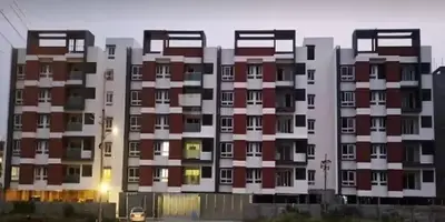
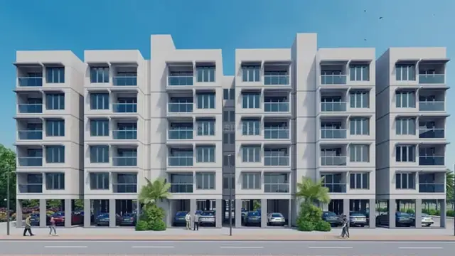
Gulmohar Homes
Nature Home Projects · Rangareddy · RERA P02400010201
GULMOHAR HOMES is a plotted development in Edulapally Village and Gram Panchayat, Nandigama Mandal, Ranga Reddy District. The registered promoter is Nature Home Projects, identified in the filing as a partnership. The layout covers a total area of 41251.51 sq.m, including a net layout area of 40874.56 sq.m, and has 110 residential plots ranging from 193.47–824.19 sq.m (231.4–985.7 sq.yd). It is registered with TG-RERA under P02400010201, with a proposed completion date of 09/02/2029.
More from Nature Home Projects · 16 projects →
01What we found
Read from TG-RERA filings, approvals, land and registration records and court records. A court case is counted only when the court record states this project's survey number with its village, or names the project.
02Check before you pay
8 items to check before you pay, 3 high - from the title chain, court records and approvals, each with what to ask the builder or your advocate. An item may not be a problem with the project: records can be incomplete.
1. Project at a glance
Project identity
| Field | Record |
|---|---|
| Registered project name | GULMOHAR HOMES |
| Project type | Plotted development / residential open plotted layout RERA record |
| Phase or registered portion | Not separately identified in the supplied registration record RERA record |
| TG-RERA registration number | P02400010201 |
| Registration validity | 09/10/2025–09/10/2028; the certificate states three years, unless extended under the Act and Rules |
| Registered promoter | Nature Home Projects, identified in the filing as a partnership RERA filing Corporate record |
| RERA status | New Project; registration certificate supplied RERA record |
Land and geographic identity
| Field | Record |
|---|---|
| Locality | Edulapally Village and Gram Panchayat; the registration record also gives the locality as Edulapally, Nandigama, Ranga Reddy, 509228 |
| Revenue village | Edulapally (also rendered Edulapally/Edulapalle in the supplied records) RERA record |
| Mandal / district / PIN | Nandigama / Ranga Reddy / 509228 RERA record |
| Project survey numbers and subdivisions | 159/PART and 161/PART |
| Site and layout areas | Total layout area 41251.51 sq.m; net layout area 40874.56 sq.m; road widening/affected area recorded as 376.95 sq.m |
| Boundaries filed with RERA | North: road and other land; South: other land; East: road and other plots of approved layout; West: other land RERA filing |
| Cadastral location reference | Parcel-centroid coordinates 17.625294168397353, 80.00119812197775; this is a geocoded centroid, not a surveyed boundary description Location record |
Development identity
| Field | Record |
|---|---|
| Planning / sanctioning authority | Hyderabad Metropolitan Development Authority (HMDA); the draft layout letter is conveyed through Edulapalle Gram Panchayat |
| Principal layout permit | 0764/HMDA/SWDL/2025, dated 09/10/2025; filed material identifies application/file no. 006363/HMDA/01922/SWDL/SKP1/2025 |
| Layout approval status in the supplied document | The document describes a draft layout and makes final layout release subject to development works, handovers and release of mortgaged plots |
| Approved built-up area | Not disclosed in the supplied plotted-layout records; the layout area is reported separately above RERA record |
| Buildings, floors and parking levels | Not applicable to the plotted-layout offering as described in the supplied records; no building/floor schedule is supplied |
| Plot count | 110, read from the layout plan’s plot schedule Layout record |
| Permitted saleable plot inventory/count | RERA unit-level booked and available counts are not supplied. The plan extract identifies 110 plots; it does not establish which plots are currently available for sale Layout record |
Offering and status
| Field | Record |
|---|---|
| Offered unit type | Residential plots Layout record |
| Plot area range | Software-read from the approved-layout drawing: 193.47–824.19 sq.m ( 231.4–985.7 sq.yd); drawing-derived figures should be checked against the plan Layout record |
| Common plot sizes read from drawing | 200.67 sq.m (240.0 sq.yd): 52 plots; 217.39 sq.m (260.0 sq.yd): 20 plots; 301.01 sq.m (360.0 sq.yd): 6 plots Layout record |
| Declared construction progress | The project header records 70% completeness; this is a supplied project-record figure, not an independent site inspection RERA record |
| Promoter’s completion undertaking | Form B declares completion by 09TH-10-2028 |
| RERA proposed completion date | 09/02/2029 RERA record |
| Occupancy/completion certificate | No occupancy or completion certificate is supplied. The approval material refers to a draft layout and final layout release conditions; building-level OC status is not applicable to the plots as such RERA record |
2. The project story
GULMOHAR HOMES is registered with TG-RERA as a plotted residential development in Edulapally, Nandigama Mandal, Ranga Reddy District, on Survey Nos. 159/PART and 161/PART. The layout drawing records 110 plots across a net layout area of 40874.56 sq.m, within a total layout area of 41251.51 sq.m. The drawing-derived plot schedule includes a range of plot sizes; the listed counts and sizes are software-read from the plan, not RERA-filed unit-level inventory data. Layout record
The supplied HMDA/Gram Panchayat letter is expressly a draft layout permission. It describes infrastructure and handover requirements before final layout release, including roads, open space, social infrastructure and utility land. The promoter’s RERA filing records 70% completeness, but no independent site inspection or completion certificate is included here. The registration certificate remains valid through 09/10/2028 unless extended; that validity is distinct from the completion dates stated in the project records. RERA record
3. Master plan, architecture & building design
The submitted plan is for an open plotted layout, rather than a tower or apartment scheme. Its land-use schedule records 26287.74 sq.m as plotted area (64.31%), 10321.58 sq.m as roads (25.25%), 3069.24 sq.m as organized open space/park (7.51%), 1022.41 sq.m as social infrastructure (2.50%) and 173.46 sq.m as utilities (0.42%). The total of those listed areas is the net layout area of 40874.56 sq.m. The plan also records 376.95 sq.m as road-affected area.
The drawing lists road widths including 15.24m, 12.19m, 9.14m, 9.13m, 10.06m existing road width, 30m proposed road width, 100'0" wide road, and 18 mt. The draft layout letter requires completion of development works and transfer of roads, open spaces, social infrastructure and utilities by registered gift deed before release of final layout plans. It also states that plots under mortgage to HMDA are not to be sold until released, and restricts building permissions in mortgaged land until the specified works are completed and the final layout is released.
No building count, floor configuration, approved built-up area, apartment schedule or building floor plan is supplied for this plotted development. The layout record reports 0.00 for buffer area, common parking area and facilities area; these are plan-schedule entries, not evidence that all possible site constraints or later facilities have been independently checked.
4. Homes, configurations & floor plans
The registered offering is residential plots, not apartment configurations. The filing extract does not provide a unit-by-unit RERA schedule of booked and available plots or a RERA-filed plot-size range. The plan’s plot schedule was read by software and records 110 plots with sizes from 193.47 sq.m (231.4 sq.yd) to 824.19 sq.m (985.7 sq.yd). Layout record
| Plot-size information | Count | Measurement basis |
|---|---|---|
| Overall size range: 193.47–824.19 sq.m (231.4–985.7 sq.yd) | 110 plots in layout schedule | Software-read from layout drawing; verify against drawing Layout record |
| 200.67 sq.m (240.0 sq.yd) | 52 | Software-read from layout drawing Layout record |
| 217.39 sq.m (260.0 sq.yd) | 20 | Software-read from layout drawing Layout record |
| 301.01 sq.m (360.0 sq.yd) | 6 | Software-read from layout drawing Layout record |
The supplied floor-plan dataset reports two layout sheets and no measured floor plans or flats. Carpet area, apartment saleable area, loading and room dimensions therefore are not applicable or established for the plots from this evidence. Floor plans
5. Parking & vehicle circulation
The layout plan’s land-use schedule records 0.00 sq.m as common parking area. The supplied records do not establish a sanctioned count of parking spaces, visitor or accessible parking, plot-specific parking allocations, or EV charging installations. The plan includes internal road areas and road widths, but the supplied evidence does not describe vehicle-entry arrangements, ramps or pedestrian separation.
6. Amenities, recreation & open spaces
The layout plan identifies open space/park, social infrastructure and utility areas. The draft layout letter lists infrastructure and amenity works, but the supplied records do not establish that any of these facilities are complete or independently verified.
| Facility | Description / size | Evidence source | Declared progress / verified status |
|---|---|---|---|
| Organized open space / park | 3069.24 sq.m (7.51%) | Draft layout land-use schedule | Required as part of layout; completion not independently verified |
| Social infrastructure area | 1022.41 sq.m (2.50%) | Draft layout land-use schedule | Land allocation shown; specific facility and completion status not supplied |
| Tot-lot | Size not disclosed; plan conditions refer to fencing and maintaining it as greenery | Layout-plan conditions | Required condition; completion not independently verified |
| Park development | Size not separately stated beyond the open-space allocation | Draft layout letter | Listed as proposed development work; completion not independently verified |
7. Utilities, building services & safety
The draft layout letter lists common septic tank/STP, internal water-supply pipelines and an overhead tank, transformer/transformer yard, rainwater-harvesting pits, park development and a bio-compost unit. These are recorded as layout infrastructure or development requirements; no capacities, commissioning records or independent completion verification are supplied.
The layout conditions also refer to a garbage house, transformer space, street-level greenery, service roads where required, and safe clearances from high- and low-tension electrical lines. The records do not establish the current operating status of water, sewage, drainage, electrical or waste systems. Building-level lifts, fire systems and accessible circulation are not described for this plotted project.
8. Location, access & connectivity
The registered location is Edulapally Village, Nandigama Mandal, Ranga Reddy District, Telangana, PIN 509228, on Survey Nos. 159/PART and 161/PART. The layout material identifies Edulapally Village and Gram Panchayat as the locality. It records road areas and widths within or adjoining the layout, including a 10.06m existing road width and 30m proposed road width; these are plan-recorded road details, not a travel-time assessment. RERA record
The supplied location dataset gives the nearest sampled Outer Ring Road interchange at approximately 141.4 km. No public-transport details or other verified landmark distances are supplied. Location record
9. Developer & development status
The registered promoter is Nature Home Projects, identified in the RERA project information as a partnership, with GSTIN 36AAKFN3023G2ZG. The filing names Momula Basappa as partner and Vemana Chenchu Murali as authorized signatory. The supplied records identify the project location but do not provide a verified official contact number, promoter website or separate verified registered-office address for this overview. RERA filing Corporate record Parties record
The RERA header records 70% completeness. This figure is not an independent site verification. The promoter’s Form B undertaking states a completion date of 09TH-10-2028, while the project header records 09/02/2029 as the proposed completion date. Registration validity is separately stated as 09/10/2025 to 09/10/2028, unless extended. No completion or occupancy certificate is supplied. RERA record
10. Approvals, official records & documents
| Record | What the supplied evidence establishes |
|---|---|
| TG-RERA registration certificate, P02400010201 | Form C registration for GULMOHAR HOMES; validity stated as 09/10/2025–09/10/2028, unless extended. |
| HMDA layout plan, 0764/HMDA/SWDL/2025 | Plan filed with RERA for an open plotted layout on Survey Nos. 159/PART and 161/PART; the extracted plan identifies 110 plots and land-use areas. |
| HMDA / Edulapalle Gram Panchayat draft layout letter | Draft layout permission dated 09/10/2025, application/file no. 006363/HMDA/01922/SWDL/SKP1/2025; final layout release is subject to specified development works, land handovers and mortgage-release conditions. |
| Form B affidavit-cum-declaration | Promoter declaration dated 17-09-2025, including the completion undertaking and separate-account declarations. These are promoter assertions in the filed affidavit. |
| Completion / occupancy certificate | Not supplied in the reviewed project documents. Document index |
The draft layout letter expressly says that the permission is not proof of land title. The full approval conditions and title evidence are addressed in the relevant due-diligence sections.
1. Project at a glance
Project identity
Registered project name: GULMOHAR HOMES
Project type: Plotted development / residential open plotted layout
Phase or registered portion: Not separately identified in the supplied registration record
TG-RERA registration number: P02400010201
Registration validity: 09/10/2025–09/10/2028; the certificate states three years, unless extended under the Act and Rules
Registered promoter: Nature Home Projects, identified in the filing as a partnership
RERA status: New Project; registration certificate supplied
Land and geographic identity
Locality: Edulapally Village and Gram Panchayat; the registration record also gives the locality as Edulapally, Nandigama, Ranga Reddy, 509228
Revenue village: Edulapally (also rendered Edulapally/Edulapalle in the supplied records)
Mandal / district / PIN: Nandigama / Ranga Reddy / 509228
Project survey numbers and subdivisions: 159/PART and 161/PART
Site and layout areas: Total layout area 41251.51 sq.m; net layout area 40874.56 sq.m; road widening/affected area recorded as 376.95 sq.m
Boundaries filed with RERA: North: road and other land; South: other land; East: road and other plots of approved layout; West: other land
Cadastral location reference: Parcel-centroid coordinates 17.625294168397353, 80.00119812197775; this is a geocoded centroid, not a surveyed boundary description
Development identity
Planning / sanctioning authority: Hyderabad Metropolitan Development Authority (HMDA); the draft layout letter is conveyed through Edulapalle Gram Panchayat
Principal layout permit: 0764/HMDA/SWDL/2025, dated 09/10/2025; filed material identifies application/file no. 006363/HMDA/01922/SWDL/SKP1/2025
Layout approval status in the supplied document: The document describes a draft layout and makes final layout release subject to development works, handovers and release of mortgaged plots
Approved built-up area: Not disclosed in the supplied plotted-layout records; the layout area is reported separately above
Buildings, floors and parking levels: Not applicable to the plotted-layout offering as described in the supplied records; no building/floor schedule is supplied
Plot count: 110, read from the layout plan’s plot schedule
Permitted saleable plot inventory/count: RERA unit-level booked and available counts are not supplied. The plan extract identifies 110 plots; it does not establish which plots are currently available for sale
Offering and status
Offered unit type: Residential plots
Plot area range: Software-read from the approved-layout drawing: 193.47–824.19 sq.m ( 231.4–985.7 sq.yd); drawing-derived figures should be checked against the plan
Common plot sizes read from drawing: 200.67 sq.m (240.0 sq.yd): 52 plots; 217.39 sq.m (260.0 sq.yd): 20 plots; 301.01 sq.m (360.0 sq.yd): 6 plots
Declared construction progress: The project header records 70% completeness; this is a supplied project-record figure, not an independent site inspection
Promoter’s completion undertaking: Form B declares completion by 09TH-10-2028
RERA proposed completion date: 09/02/2029
Occupancy/completion certificate: No occupancy or completion certificate is supplied. The approval material refers to a draft layout and final layout release conditions; building-level OC status is not applicable to the plots as such
2. The project story
GULMOHAR HOMES is registered with TG-RERA as a plotted residential development in Edulapally, Nandigama Mandal, Ranga Reddy District, on Survey Nos. 159/PART and 161/PART. The layout drawing records 110 plots across a net layout area of 40874.56 sq.m, within a total layout area of 41251.51 sq.m. The drawing-derived plot schedule includes a range of plot sizes; the listed counts and sizes are software-read from the plan, not RERA-filed unit-level inventory data.
The supplied HMDA/Gram Panchayat letter is expressly a draft layout permission. It describes infrastructure and handover requirements before final layout release, including roads, open space, social infrastructure and utility land. The promoter’s RERA filing records 70% completeness, but no independent site inspection or completion certificate is included here. The registration certificate remains valid through 09/10/2028 unless extended; that validity is distinct from the completion dates stated in the project records.
3. Master plan, architecture & building design
The submitted plan is for an open plotted layout, rather than a tower or apartment scheme. Its land-use schedule records 26287.74 sq.m as plotted area (64.31%), 10321.58 sq.m as roads (25.25%), 3069.24 sq.m as organized open space/park (7.51%), 1022.41 sq.m as social infrastructure (2.50%) and 173.46 sq.m as utilities (0.42%). The total of those listed areas is the net layout area of 40874.56 sq.m. The plan also records 376.95 sq.m as road-affected area.
The drawing lists road widths including 15.24m, 12.19m, 9.14m, 9.13m, 10.06m existing road width, 30m proposed road width, 100'0" wide road, and 18 mt. The draft layout letter requires completion of development works and transfer of roads, open spaces, social infrastructure and utilities by registered gift deed before release of final layout plans. It also states that plots under mortgage to HMDA are not to be sold until released, and restricts building permissions in mortgaged land until the specified works are completed and the final layout is released.
No building count, floor configuration, approved built-up area, apartment schedule or building floor plan is supplied for this plotted development. The layout record reports 0.00 for buffer area, common parking area and facilities area; these are plan-schedule entries, not evidence that all possible site constraints or later facilities have been independently checked.
4. Homes, configurations & floor plans
The registered offering is residential plots, not apartment configurations. The filing extract does not provide a unit-by-unit RERA schedule of booked and available plots or a RERA-filed plot-size range. The plan’s plot schedule was read by software and records 110 plots with sizes from 193.47 sq.m (231.4 sq.yd) to 824.19 sq.m (985.7 sq.yd).
| Plot-size information | Count | Measurement basis |
|---|---|---|
| Overall size range: 193.47–824.19 sq.m (231.4–985.7 sq.yd) | 110 plots in layout schedule | Software-read from layout drawing; verify against drawing |
| 200.67 sq.m (240.0 sq.yd) | 52 | Software-read from layout drawing |
| 217.39 sq.m (260.0 sq.yd) | 20 | Software-read from layout drawing |
| 301.01 sq.m (360.0 sq.yd) | 6 | Software-read from layout drawing |
The supplied floor-plan dataset reports two layout sheets and no measured floor plans or flats. Carpet area, apartment saleable area, loading and room dimensions therefore are not applicable or established for the plots from this evidence.
5. Parking & vehicle circulation
The layout plan’s land-use schedule records 0.00 sq.m as common parking area. The supplied records do not establish a sanctioned count of parking spaces, visitor or accessible parking, plot-specific parking allocations, or EV charging installations. The plan includes internal road areas and road widths, but the supplied evidence does not describe vehicle-entry arrangements, ramps or pedestrian separation.
6. Amenities, recreation & open spaces
The layout plan identifies open space/park, social infrastructure and utility areas. The draft layout letter lists infrastructure and amenity works, but the supplied records do not establish that any of these facilities are complete or independently verified.
| Facility | Description / size | Evidence source | Declared progress / verified status |
|---|---|---|---|
| Organized open space / park | 3069.24 sq.m (7.51%) | Draft layout land-use schedule | Required as part of layout; completion not independently verified |
| Social infrastructure area | 1022.41 sq.m (2.50%) | Draft layout land-use schedule | Land allocation shown; specific facility and completion status not supplied |
| Tot-lot | Size not disclosed; plan conditions refer to fencing and maintaining it as greenery | Layout-plan conditions | Required condition; completion not independently verified |
| Park development | Size not separately stated beyond the open-space allocation | Draft layout letter | Listed as proposed development work; completion not independently verified |
7. Utilities, building services & safety
The draft layout letter lists common septic tank/STP, internal water-supply pipelines and an overhead tank, transformer/transformer yard, rainwater-harvesting pits, park development and a bio-compost unit. These are recorded as layout infrastructure or development requirements; no capacities, commissioning records or independent completion verification are supplied.
The layout conditions also refer to a garbage house, transformer space, street-level greenery, service roads where required, and safe clearances from high- and low-tension electrical lines. The records do not establish the current operating status of water, sewage, drainage, electrical or waste systems. Building-level lifts, fire systems and accessible circulation are not described for this plotted project.
8. Location, access & connectivity
The registered location is Edulapally Village, Nandigama Mandal, Ranga Reddy District, Telangana, PIN 509228, on Survey Nos. 159/PART and 161/PART. The layout material identifies Edulapally Village and Gram Panchayat as the locality. It records road areas and widths within or adjoining the layout, including a 10.06m existing road width and 30m proposed road width; these are plan-recorded road details, not a travel-time assessment.
The supplied location dataset gives the nearest sampled Outer Ring Road interchange at approximately 141.4 km. No public-transport details or other verified landmark distances are supplied.
9. Developer & development status
The registered promoter is Nature Home Projects, identified in the RERA project information as a partnership, with GSTIN 36AAKFN3023G2ZG. The filing names Momula Basappa as partner and Vemana Chenchu Murali as authorized signatory. The supplied records identify the project location but do not provide a verified official contact number, promoter website or separate verified registered-office address for this overview.
The RERA header records 70% completeness. This figure is not an independent site verification. The promoter’s Form B undertaking states a completion date of 09TH-10-2028, while the project header records 09/02/2029 as the proposed completion date. Registration validity is separately stated as 09/10/2025 to 09/10/2028, unless extended. No completion or occupancy certificate is supplied.
10. Approvals, official records & documents
TG-RERA registration certificate, P02400010201: Form C registration for GULMOHAR HOMES; validity stated as 09/10/2025–09/10/2028, unless extended.
HMDA layout plan, 0764/HMDA/SWDL/2025: Plan filed with RERA for an open plotted layout on Survey Nos. 159/PART and 161/PART; the extracted plan identifies 110 plots and land-use areas.
HMDA / Edulapalle Gram Panchayat draft layout letter: Draft layout permission dated 09/10/2025, application/file no. 006363/HMDA/01922/SWDL/SKP1/2025; final layout release is subject to specified development works, land handovers and mortgage-release conditions.
Form B affidavit-cum-declaration: Promoter declaration dated 17-09-2025, including the completion undertaking and separate-account declarations. These are promoter assertions in the filed affidavit.
Completion / occupancy certificate: Not supplied in the reviewed project documents.
The draft layout letter expressly says that the permission is not proof of land title. The full approval conditions and title evidence are addressed in the relevant due-diligence sections.
Frequently asked questions
Is GULMOHAR HOMES registered with Telangana RERA?
Yes. GULMOHAR HOMES is registered with the Telangana Real Estate Regulatory Authority as P02400010201; the registration status is New Project.
Who is the developer of GULMOHAR HOMES?
The promoter named in the RERA registration is Nature Home Projects.
Where is GULMOHAR HOMES located?
GULMOHAR HOMES is in HYDERABAD METROPOLITAN DEVELOPMENT AUTHORITY - Planning Department - use in Plot No , Survey.No. 159/PARTand161/PART of , Edulapally, Nandigama, Rangareddy, Telangana (509228).
When will GULMOHAR HOMES be completed?
The promoter's proposed date of completion filed with RERA is 09/02/2029. This is the promoter's declaration, not a guarantee.
More projects in Nandigama