Nysa Villas
RICHER LANDS PRIVATE LIMITED AND OTHERS · Sangareddy · RERA P01100011179
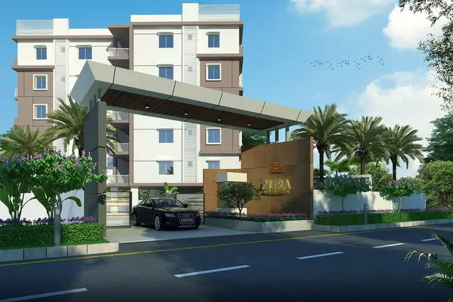
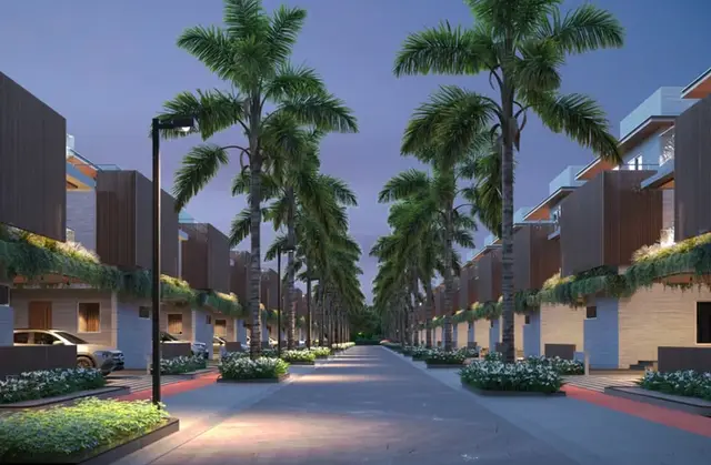
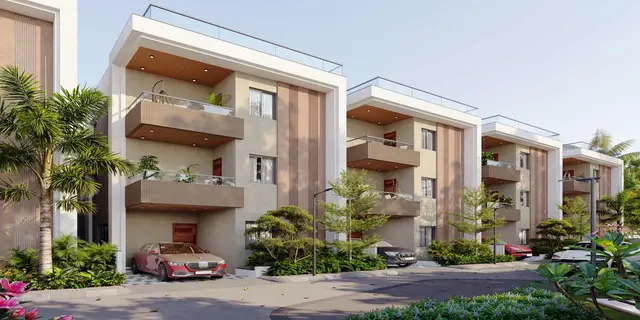
NYSA VILLAS is a residential gated-community housing project in NANDIGAON, PATANCHERU, Sangareddy. The registered promoter is RICHER LANDS PRIVATE LIMITED AND OTHERS. The RERA land details state an area of 27105.12 sq.m; the project includes 79 villa buildings, each Ground Floor + 2 Upper Floors, and a non-residential amenities block, with 79 4BHK homes of 186.31 sq.m saleable area per unit. It is registered with TG-RERA as P01100011179, with proposed completion by 22 July 2031.
01What we found
Read from TG-RERA filings, approvals, land and registration records and court records. A court case is counted only when the court record states this project's survey number with its village, or names the project.
02Check before you pay
7 items to check before you pay, 2 high - from the title chain, court records and approvals, each with what to ask the builder or your advocate. An item may not be a problem with the project: records can be incomplete.
1. Project at a glance
Project identity
| Item | Project record |
|---|---|
| Registered project name | NYSA VILLAS RERA record |
| Project type | Residential; the filed HMDA permission describes a gated-community layout with housing. RERA record |
| Phase / registered portion | Registered portion is identified as 421 PART. A separate phase name or phase number is not disclosed. RERA record |
| TG-RERA registration | P01100011179, issued under section 5; certificate issue date 05/09/2026. |
| Registration validity | 23/07/2026 to 22/11/2031. This is the registration-validity period, not a statement that construction is complete. RERA record |
| Registered promoter | RICHER LANDS PRIVATE LIMITED AND OTHERS. The filing describes the arrangement as a joint development. RERA record RERA filing |
| RERA status | Recorded as a new project; certificate is issued. RERA record |
Land and geographic identity
| Item | Project record |
|---|---|
| Registered locality / revenue village | NANDIGAON (also rendered as Nandigaon in the filed approval documents). RERA record RERA filing |
| Mandal / district / PIN | PATANCHERU, Sangareddy, 502300. RERA record RERA filing |
| Project survey reference | 421 PART; the registered certificate identifies 421 PART and the RERA land details give 421 PART. The approved drawing also identifies Sy.No. 420 (Bhaskar Land) within the drawing; the supplied record does not identify it as a project parcel. RERA record RERA filing |
| Total / registered site extent | RERA land details state 27105.12 sq.m. The approved drawing’s site-area statement gives 27105.11 sq.m. RERA filing |
| Net area | RERA land details state 25567.36 sq.m. The approved layout statements give net layout area 25465.65 sq.m. RERA filing |
| Land affected / excluded area | RERA land details record 1537.76 sq.m affected in road widening/FTL of tanks/nala widening. The HMDA permission separately records 101.71 sq.m NALA affected area and 1537.75 sq.m peripheral-road area. RERA filing |
| Boundaries in RERA filing | North: 12M WIDE MAIN ROAD; south, east and west: OTHERS LAND. RERA filing |
Development identity
| Item | Project record |
|---|---|
| Sanctioning authority / principal permit | Hyderabad Metropolitan Development Authority (HMDA); Layout Permit 2334/HMDA/SWDL/2026, approved 23/07/2026. The revised permission records release of plans through Nandigaon Gram Panchayat. Approvals record |
| Other approval file references | 007166/HMDA/02143/SWDL/SKP2/2025-ADD and 062226/SKP/LT/U6/HMDA/24122023 appear in the filed approval material. Approvals record |
| Approved built-up area | HMDA revised permission states 25721.72 sq.m total sanctioned built-up area. |
| Building arrangement / floors | The revised permission identifies 79 dwelling units, arranged as villa buildings labelled V-1 through V-79, and records Ground Floor + 2 Upper Floors and building height 8.85 m. A separate non-residential amenities block is identified as V-80 in the drawing. |
| Parking levels | Specific basement, stilt or podium parking-level count is not established in the supplied summary. The HMDA permission states that approved cellar/stilt areas, where shown, are to be used for parking; unit-level parking allocation is not supplied. |
| Unit count | HMDA revised permission: 79 dwelling units. TG-RERA filing: 80 total building units, including 79 homes and one Club House/common-area entry. RERA filing RERA unit table |
| Mortgage recorded in approval | HMDA documents record mortgage of villas V-1, V-2, V-3 and V-5, extent 880.68 sq.m, in favour of the Metropolitan Commissioner, HMDA. |
Offering and status
| Item | Project record |
|---|---|
| RERA-filed home type | 4BHK, 79 units; saleable area 186.31 sq.m per unit in the filing. RERA unit table RERA unit details |
| Booking / availability snapshot | TG-RERA portal data records 0 booked and 79 available for the 4BHK homes; no as-of date is supplied, so this is an undated portal snapshot, not a live availability confirmation. RERA unit table RERA unit details |
| RERA completion undertaking | Form B states completion by 22 July 2031. |
| HMDA completion deadline | Revised permission states construction to be completed before 22/07/2031. |
| Registration expiry | 22/11/2031; distinct from the stated construction-completion deadline. |
| Construction stage | The available material establishes approvals and proposed development, but does not provide a quantified construction-progress report or independent site verification. |
| Occupancy / completion certificate | No occupancy certificate or completion certificate is included in the supplied project documents. The project is not presented here as completed or occupancy-certified. Document index |
2. The project story
NYSA VILLAS is filed as a gated residential housing development on part of Survey No. 421 at Nandigaon, Patancheru Mandal, Sangareddy District. Its approved organization is a group of 79 individual villa buildings, labelled V-1 to V-79, each shown as Ground Floor plus two upper floors; the plan also identifies V-80 as a non-residential amenities block. The project is registered with TG-RERA as P01100011179. RERA record
The approval documents describe development to include roads, open spaces, utility areas and common infrastructure. They also set out development and handover conditions for roads, parks/open space and utilities, and require completion and an occupancy certificate before occupation. These are approval conditions and intended provisions, not evidence that the works have been completed. The supplied records contain no independently verified construction-stage report.
3. Master plan, architecture & building design
The approved layout drawing gives a total layout area of 27105.11 sq.m and a net layout area of 25465.65 sq.m. Its land-use schedule records 14718.24 sq.m (57.80%) as plotted area, 6572.30 sq.m (25.81%) as roads, 2562.95 sq.m (10.06%) as organized open space, 275.56 sq.m (1.08%) as utility area and 1336.55 sq.m (5.25%) as amenities plot area.
The HMDA revised permission records 25721.72 sq.m total sanctioned built-up area. The villa buildings are shown as Ground Floor + 2 Upper Floors, with a stated building height of 8.85 m. The layout drawing identifies the amenities building as V-80 and describes it as non-residential; the drawing extraction gives an amenities area of 1336.55 sq.m.
The plan includes internal roads and an approach-road network; the extracted drawing identifies 9.14 m and 12 m road widths, among other road labels. The submitted material does not provide a verified building-by-building circulation or access analysis.
4. Homes, configurations & floor plans
The TG-RERA unit record lists 79 homes in the 4BHK configuration, with filed saleable area of 186.31 sq.m per unit. It records 0 booked and 79 available, but supplies no as-of date for that snapshot. RERA unit table RERA unit details
| Configuration | Units | Booked | Available | RERA saleable area | Measured carpet area | Loading (if supplied) |
|---|---|---|---|---|---|---|
| 4BHK | 79 | 0 | 79 | 186.31 sq.m per unit | Not measured in the supplied drawing extraction | Not supplied |
A floor-plan drawing was measured by software, but the extraction identifies three 1BHK drawing designs and reports carpet-area measurements of 78.9–102.5 sq.m, median 100.1 sq.m. The 1BHK configuration is not the configuration listed in the TG-RERA home-unit record, so those drawing measurements are not used as the project’s RERA-filed home configuration. Software measurements are drawing-derived, not RERA disclosures, and require checking against the original drawing. Floor plans RERA unit details
The RERA saleable area should not be treated as carpet area: the supplied material does not give a measured carpet area for the filed 4BHK homes or a loading figure. RERA unit details RERA unit table
5. Parking & vehicle circulation
HMDA’s approval conditions state that cellar and stilt areas approved for parking must be used exclusively for vehicle parking and not converted to another use. The supplied records do not establish the total sanctioned parking-space count, visitor or accessible-space numbers, parking allocation to individual villas, or the number and location of parking levels.
The plan extraction identifies parking provisions in villa-building schedules, including net parking-area figures for some individual buildings, but it does not establish a complete project-wide parking inventory or exclusive ownership/allocation to a buyer. The approval also includes a condition for electric-vehicle charging infrastructure in parking places; the supplied record does not evidence installation or operational status.
6. Amenities, recreation & open spaces
The approved-plan extraction identifies an amenities plot and open-space and utility allocations. The layout conditions describe facilities and works to be provided; the supplied documents do not certify that these have been completed.
| Facility | Description / size | Evidence source | Declared progress / verified status |
|---|---|---|---|
| Amenities block / plot | 1336.55 sq.m; drawing labels V-80 as a non-residential amenities block | Approved layout drawing | Shown in plan; completion not verified |
| Tot-lot / organized open space | 2562.95 sq.m open-space allocation | Approved layout drawing and permission | Allocated in plan; development and handover remain approval conditions |
| Internal roads | 6572.30 sq.m in the layout area statement | Approved layout drawing | Planned; road formation and handover are conditions, not verified completion |
| Utility area | 275.56 sq.m | Approved layout drawing | Earmarked in plan; completion not verified |
| Community / non-residential facility | V-80 identified as the amenities block | Approved layout drawing | Proposed; no completion evidence supplied |
7. Utilities, building services & safety
HMDA’s permission describes proposed infrastructure including internal water-supply pipelines, an overhead tank and sumps, an assured water-supply source, storm-water drains, underground drainage lines, a common septic tank/STP, electrical supply lines, street lighting, transformer provision, rainwater-harvesting pits and solid-waste facilities. It also specifies development of roads, parks and avenue planting. These are approval requirements or plan provisions; the supplied documents do not report installed capacity or independently verified completion.
| What the record says | Internal supply pipelines, sump/overhead tank and an assured source are specified; the approval calls for arrangements to connect potable-water supply to an approved trunk/connecting pipeline. |
|---|---|
| Status evidenced | Required/planned; source capacity and completion not documented. |
| What the record says | Common septic tank/STP, underground drainage and storm-water drainage are specified; the approval includes sewage-treatment and drainage conditions. |
|---|---|
| Status evidenced | Required/planned; operating status and capacity not documented. |
| What the record says | Rainwater-harvesting pits are specified; one approval extraction states 5 pits. |
|---|---|
| Status evidenced | Required/planned; completion not documented. |
| What the record says | Electrical supply lines, street lighting and transformer/transformer-yard provision are identified. |
|---|---|
| Status evidenced | Required/planned; supply capacity and completion not documented. |
| What the record says | The approval conditions assign responsibility for fire-safety installations and require an Occupancy Fire NOC before issue of an occupancy certificate. |
|---|---|
| Status evidenced | Conditions recorded; no fire NOC or completion evidence supplied. |
| What the record says | The permission specifies space for solid-waste disposal and a bio-compost unit, with source segregation. |
|---|---|
| Status evidenced | Required/planned; completion not documented. |
| What the record says | The approval includes conditions for applicable accessibility provisions and common digital-connectivity infrastructure. |
|---|---|
| Status evidenced | Conditions recorded; completed provision is not evidenced. |
| What the record says | A lift is listed in the extracted plan-feature data; the supplied record does not state lift count, capacity or operational status. |
|---|---|
| Status evidenced | Not independently verified. |
8. Location, access & connectivity
The registered site is in NANDIGAON, Patancheru Mandal, Sangareddy District, PIN 502300, on Survey No. 421 PART. The RERA filing gives a north boundary of 12M WIDE MAIN ROAD. The approved drawing also identifies internal road widths including 9.14 m and 12 m. RERA record RERA filing
The supplied location data records the nearest sampled Outer Ring Road interchange at approximately 6.7 km. No other measured distances, travel times, public-transport links or landmark distances are established by the supplied project records. Location record
9. Developer & development status
The registered promoter is RICHER LANDS PRIVATE LIMITED AND OTHERS. The RERA filing describes the organization as “Others” with the description “Joint Development.” The supplied certificate gives the promoter’s office as Village: Miyapur, Mandal: Serilingampally, District: Ranga Reddy, PIN: 500049; the project address is separately recorded at Nandigaon. RERA record RERA filing
The authorized signatory, Veepanagandla Ravi Kumar, signed the Form B declaration dated 22nd August, 2026. That declaration undertakes completion by 22 July 2031 and records project-fund, audit and approval commitments. It is a promoter declaration, not independent evidence of progress.
The HMDA permission states construction is to commence before 19/01/2027 and be completed before 22/07/2031. The TG-RERA registration remains valid through 22/11/2031. No site-verified progress percentage or occupancy certificate is included in the supplied records.
10. Approvals, official records & documents
| Record | What it establishes in the supplied file |
|---|---|
| TG-RERA Form C certificate, P01100011179 | Registration of NYSA VILLAS from 23/07/2026 to 22/11/2031; issued 05/09/2026. |
| HMDA revised layout-with-housing permission, 2334/HMDA/SWDL/2026 | Revised permission dated 23/07/2026 for the gated residential development; records 79 dwelling units, land and built-up-area information, conditions and HMDA mortgage provisions. |
| HMDA approved layout drawing | Drawing for the addition and alteration of a residential layout with gated community on Sy.No. 421 PART; includes the layout area statement, land-use allocations and building/amenity labels. |
| Nandigaon Gram Panchayat revised permission | Records release of plans/proceedings under HMDA technical approval for the layout with housing. |
| HMDA draft layout letter | Draft layout permission material forwarded for release of proceedings and plans through Nandigaon Gram Panchayat. |
| RERA Form B declaration | Promoter declaration dated 22nd August, 2026, including the completion undertaking and stated project obligations. |
The supplied documents do not include an occupancy/completion certificate. The HMDA permission makes submission of completion notice and obtaining an occupancy certificate a condition before occupation. Document index
1. Project at a glance
Project identity
Registered project name: NYSA VILLAS
Project type: Residential; the filed HMDA permission describes a gated-community layout with housing.
Phase / registered portion: Registered portion is identified as 421 PART. A separate phase name or phase number is not disclosed.
TG-RERA registration: P01100011179, issued under section 5; certificate issue date 05/09/2026.
Registration validity: 23/07/2026 to 22/11/2031. This is the registration-validity period, not a statement that construction is complete.
Registered promoter: RICHER LANDS PRIVATE LIMITED AND OTHERS. The filing describes the arrangement as a joint development.
RERA status: Recorded as a new project; certificate is issued.
Land and geographic identity
Registered locality / revenue village: NANDIGAON (also rendered as Nandigaon in the filed approval documents).
Mandal / district / PIN: PATANCHERU, Sangareddy, 502300.
Project survey reference: 421 PART; the registered certificate identifies 421 PART and the RERA land details give 421 PART. The approved drawing also identifies Sy.No. 420 (Bhaskar Land) within the drawing; the supplied record does not identify it as a project parcel.
Total / registered site extent: RERA land details state 27105.12 sq.m. The approved drawing’s site-area statement gives 27105.11 sq.m.
Net area: RERA land details state 25567.36 sq.m. The approved layout statements give net layout area 25465.65 sq.m.
Land affected / excluded area: RERA land details record 1537.76 sq.m affected in road widening/FTL of tanks/nala widening. The HMDA permission separately records 101.71 sq.m NALA affected area and 1537.75 sq.m peripheral-road area.
Boundaries in RERA filing: North: 12M WIDE MAIN ROAD; south, east and west: OTHERS LAND.
Development identity
Sanctioning authority / principal permit: Hyderabad Metropolitan Development Authority (HMDA); Layout Permit 2334/HMDA/SWDL/2026, approved 23/07/2026. The revised permission records release of plans through Nandigaon Gram Panchayat.
Other approval file references: 007166/HMDA/02143/SWDL/SKP2/2025-ADD and 062226/SKP/LT/U6/HMDA/24122023 appear in the filed approval material.
Approved built-up area: HMDA revised permission states 25721.72 sq.m total sanctioned built-up area.
Building arrangement / floors: The revised permission identifies 79 dwelling units, arranged as villa buildings labelled V-1 through V-79, and records Ground Floor + 2 Upper Floors and building height 8.85 m. A separate non-residential amenities block is identified as V-80 in the drawing.
Parking levels: Specific basement, stilt or podium parking-level count is not established in the supplied summary. The HMDA permission states that approved cellar/stilt areas, where shown, are to be used for parking; unit-level parking allocation is not supplied.
Unit count: HMDA revised permission: 79 dwelling units. TG-RERA filing: 80 total building units, including 79 homes and one Club House/common-area entry.
Mortgage recorded in approval: HMDA documents record mortgage of villas V-1, V-2, V-3 and V-5, extent 880.68 sq.m, in favour of the Metropolitan Commissioner, HMDA.
Offering and status
RERA-filed home type: 4BHK, 79 units; saleable area 186.31 sq.m per unit in the filing.
Booking / availability snapshot: TG-RERA portal data records 0 booked and 79 available for the 4BHK homes; no as-of date is supplied, so this is an undated portal snapshot, not a live availability confirmation.
RERA completion undertaking: Form B states completion by 22 July 2031.
HMDA completion deadline: Revised permission states construction to be completed before 22/07/2031.
Registration expiry: 22/11/2031; distinct from the stated construction-completion deadline.
Construction stage: The available material establishes approvals and proposed development, but does not provide a quantified construction-progress report or independent site verification.
Occupancy / completion certificate: No occupancy certificate or completion certificate is included in the supplied project documents. The project is not presented here as completed or occupancy-certified.
2. The project story
NYSA VILLAS is filed as a gated residential housing development on part of Survey No. 421 at Nandigaon, Patancheru Mandal, Sangareddy District. Its approved organization is a group of 79 individual villa buildings, labelled V-1 to V-79, each shown as Ground Floor plus two upper floors; the plan also identifies V-80 as a non-residential amenities block. The project is registered with TG-RERA as P01100011179.
The approval documents describe development to include roads, open spaces, utility areas and common infrastructure. They also set out development and handover conditions for roads, parks/open space and utilities, and require completion and an occupancy certificate before occupation. These are approval conditions and intended provisions, not evidence that the works have been completed. The supplied records contain no independently verified construction-stage report.
3. Master plan, architecture & building design
The approved layout drawing gives a total layout area of 27105.11 sq.m and a net layout area of 25465.65 sq.m. Its land-use schedule records 14718.24 sq.m (57.80%) as plotted area, 6572.30 sq.m (25.81%) as roads, 2562.95 sq.m (10.06%) as organized open space, 275.56 sq.m (1.08%) as utility area and 1336.55 sq.m (5.25%) as amenities plot area.
The HMDA revised permission records 25721.72 sq.m total sanctioned built-up area. The villa buildings are shown as Ground Floor + 2 Upper Floors, with a stated building height of 8.85 m. The layout drawing identifies the amenities building as V-80 and describes it as non-residential; the drawing extraction gives an amenities area of 1336.55 sq.m.
The plan includes internal roads and an approach-road network; the extracted drawing identifies 9.14 m and 12 m road widths, among other road labels. The submitted material does not provide a verified building-by-building circulation or access analysis.
4. Homes, configurations & floor plans
The TG-RERA unit record lists 79 homes in the 4BHK configuration, with filed saleable area of 186.31 sq.m per unit. It records 0 booked and 79 available, but supplies no as-of date for that snapshot.
| Configuration | Units | Booked | Available | RERA saleable area | Measured carpet area | Loading (if supplied) |
|---|---|---|---|---|---|---|
| 4BHK | 79 | 0 | 79 | 186.31 sq.m per unit | Not measured in the supplied drawing extraction | Not supplied |
A floor-plan drawing was measured by software, but the extraction identifies three 1BHK drawing designs and reports carpet-area measurements of 78.9–102.5 sq.m, median 100.1 sq.m. The 1BHK configuration is not the configuration listed in the TG-RERA home-unit record, so those drawing measurements are not used as the project’s RERA-filed home configuration. Software measurements are drawing-derived, not RERA disclosures, and require checking against the original drawing.
The RERA saleable area should not be treated as carpet area: the supplied material does not give a measured carpet area for the filed 4BHK homes or a loading figure.
5. Parking & vehicle circulation
HMDA’s approval conditions state that cellar and stilt areas approved for parking must be used exclusively for vehicle parking and not converted to another use. The supplied records do not establish the total sanctioned parking-space count, visitor or accessible-space numbers, parking allocation to individual villas, or the number and location of parking levels.
The plan extraction identifies parking provisions in villa-building schedules, including net parking-area figures for some individual buildings, but it does not establish a complete project-wide parking inventory or exclusive ownership/allocation to a buyer. The approval also includes a condition for electric-vehicle charging infrastructure in parking places; the supplied record does not evidence installation or operational status.
6. Amenities, recreation & open spaces
The approved-plan extraction identifies an amenities plot and open-space and utility allocations. The layout conditions describe facilities and works to be provided; the supplied documents do not certify that these have been completed.
| Facility | Description / size | Evidence source | Declared progress / verified status |
|---|---|---|---|
| Amenities block / plot | 1336.55 sq.m; drawing labels V-80 as a non-residential amenities block | Approved layout drawing | Shown in plan; completion not verified |
| Tot-lot / organized open space | 2562.95 sq.m open-space allocation | Approved layout drawing and permission | Allocated in plan; development and handover remain approval conditions |
| Internal roads | 6572.30 sq.m in the layout area statement | Approved layout drawing | Planned; road formation and handover are conditions, not verified completion |
| Utility area | 275.56 sq.m | Approved layout drawing | Earmarked in plan; completion not verified |
| Community / non-residential facility | V-80 identified as the amenities block | Approved layout drawing | Proposed; no completion evidence supplied |
7. Utilities, building services & safety
HMDA’s permission describes proposed infrastructure including internal water-supply pipelines, an overhead tank and sumps, an assured water-supply source, storm-water drains, underground drainage lines, a common septic tank/STP, electrical supply lines, street lighting, transformer provision, rainwater-harvesting pits and solid-waste facilities. It also specifies development of roads, parks and avenue planting. These are approval requirements or plan provisions; the supplied documents do not report installed capacity or independently verified completion.
| What the record says | Internal supply pipelines, sump/overhead tank and an assured source are specified; the approval calls for arrangements to connect potable-water supply to an approved trunk/connecting pipeline. |
|---|---|
| Status evidenced | Required/planned; source capacity and completion not documented. |
| What the record says | Common septic tank/STP, underground drainage and storm-water drainage are specified; the approval includes sewage-treatment and drainage conditions. |
|---|---|
| Status evidenced | Required/planned; operating status and capacity not documented. |
| What the record says | Rainwater-harvesting pits are specified; one approval extraction states 5 pits. |
|---|---|
| Status evidenced | Required/planned; completion not documented. |
| What the record says | Electrical supply lines, street lighting and transformer/transformer-yard provision are identified. |
|---|---|
| Status evidenced | Required/planned; supply capacity and completion not documented. |
| What the record says | The approval conditions assign responsibility for fire-safety installations and require an Occupancy Fire NOC before issue of an occupancy certificate. |
|---|---|
| Status evidenced | Conditions recorded; no fire NOC or completion evidence supplied. |
| What the record says | The permission specifies space for solid-waste disposal and a bio-compost unit, with source segregation. |
|---|---|
| Status evidenced | Required/planned; completion not documented. |
| What the record says | The approval includes conditions for applicable accessibility provisions and common digital-connectivity infrastructure. |
|---|---|
| Status evidenced | Conditions recorded; completed provision is not evidenced. |
| What the record says | A lift is listed in the extracted plan-feature data; the supplied record does not state lift count, capacity or operational status. |
|---|---|
| Status evidenced | Not independently verified. |
8. Location, access & connectivity
The registered site is in NANDIGAON, Patancheru Mandal, Sangareddy District, PIN 502300, on Survey No. 421 PART. The RERA filing gives a north boundary of 12M WIDE MAIN ROAD. The approved drawing also identifies internal road widths including 9.14 m and 12 m.
The supplied location data records the nearest sampled Outer Ring Road interchange at approximately 6.7 km. No other measured distances, travel times, public-transport links or landmark distances are established by the supplied project records.
9. Developer & development status
The registered promoter is RICHER LANDS PRIVATE LIMITED AND OTHERS. The RERA filing describes the organization as “Others” with the description “Joint Development.” The supplied certificate gives the promoter’s office as Village: Miyapur, Mandal: Serilingampally, District: Ranga Reddy, PIN: 500049; the project address is separately recorded at Nandigaon.
The authorized signatory, Veepanagandla Ravi Kumar, signed the Form B declaration dated 22nd August, 2026. That declaration undertakes completion by 22 July 2031 and records project-fund, audit and approval commitments. It is a promoter declaration, not independent evidence of progress.
The HMDA permission states construction is to commence before 19/01/2027 and be completed before 22/07/2031. The TG-RERA registration remains valid through 22/11/2031. No site-verified progress percentage or occupancy certificate is included in the supplied records.
10. Approvals, official records & documents
TG-RERA Form C certificate, P01100011179: Registration of NYSA VILLAS from 23/07/2026 to 22/11/2031; issued 05/09/2026.
HMDA revised layout-with-housing permission, 2334/HMDA/SWDL/2026: Revised permission dated 23/07/2026 for the gated residential development; records 79 dwelling units, land and built-up-area information, conditions and HMDA mortgage provisions.
HMDA approved layout drawing: Drawing for the addition and alteration of a residential layout with gated community on Sy.No. 421 PART; includes the layout area statement, land-use allocations and building/amenity labels.
Nandigaon Gram Panchayat revised permission: Records release of plans/proceedings under HMDA technical approval for the layout with housing.
HMDA draft layout letter: Draft layout permission material forwarded for release of proceedings and plans through Nandigaon Gram Panchayat.
RERA Form B declaration: Promoter declaration dated 22nd August, 2026, including the completion undertaking and stated project obligations.
The supplied documents do not include an occupancy/completion certificate. The HMDA permission makes submission of completion notice and obtaining an occupancy certificate a condition before occupation.
Frequently asked questions
Is NYSA VILLAS registered with Telangana RERA?
Yes. NYSA VILLAS is registered with the Telangana Real Estate Regulatory Authority as P01100011179; the registration status is New Project.
Who is the developer of NYSA VILLAS?
The promoter named in the RERA registration is RICHER LANDS PRIVATE LIMITED AND OTHERS.
Where is NYSA VILLAS located?
NYSA VILLAS is in Nandigaon, PATANCHERU, Sangareddy, Telangana (502300).
When will NYSA VILLAS be completed?
The promoter's proposed date of completion filed with RERA is 22/11/2031. This is the promoter's declaration, not a guarantee.
More projects in Nandigaon