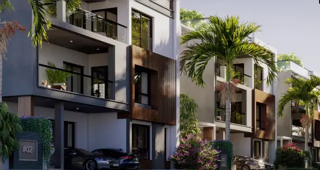
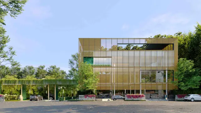
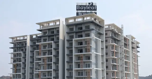
Aditya Sanctum
SRI ADITYA HOUSING PROJECTS LLP · Rangareddy · RERA P02400004265
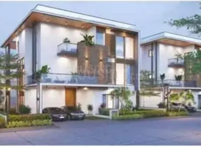
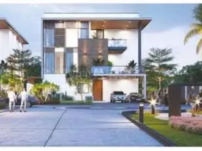
ADITYA SANCTUM is a residential villa project in Manchirevula, Gandipet, Ranga Reddy. The registered promoter is Sri Aditya Housing Projects LLP. The project covers a total land area of 19,348.4 sq. m and comprises 23 villas in G+2 housing, with saleable areas of 737.64–901.62 sq. m. It is registered under TG-RERA number P02400004265, issued 14/03/2022, with proposed completion by 27.10.2027.
01What we found
Read from TG-RERA filings, approvals, land and registration records and court records. A court case is counted only when the court record states this project's survey number with its village, or names the project.
02Check before you pay
10 items to check before you pay, 3 high - from the title chain, court records and approvals, each with what to ask the builder or your advocate. An item may not be a problem with the project: records can be incomplete.
1. Project at a glance
Project identity
| Item | Record |
|---|---|
| Registered project name | ADITYA SANCTUM RERA record |
| Project type | Residential villa project; the filed unit schedule lists 23 villas. RERA record RERA unit table |
| Phase / registered portion | No phase name is disclosed. The registration identifies the land as Survey Nos. 381/Part and 382/Part, Manchirevula. |
| TG-RERA registration | P02400004265, issued 14/03/2022; stated validity through 27/10/2027. Registration validity is separate from the completion date and occupancy-certificate status. |
| Registered promoter | Sri Aditya Housing Projects LLP, an LLP. RERA record Corporate record |
| RERA status | The supplied certificate records registration; no extension is recorded in that certificate. The project is identified in the RERA record as “New Project.” RERA record |
Land and geographic identity
| Item | Record |
|---|---|
| Locality / revenue village | Manchirevula; the approval records also refer to Manchirevula Village. RERA record RERA filing |
| Mandal / district / PIN | Gandipet, Ranga Reddy, 500089. RERA record |
| Project survey numbers | 381/Part and 382/Part. The HMDA land-use letter refers to Survey Nos. 381 and 382 without the project-part subdivision. |
| Site extent | RERA/identity record: total 19,348.4 sq. m, affected area 328.175 sq. m, net area 19,020.23 sq. m. RERA filing |
| Boundary descriptions in the RERA record | East: 12 Mtr Layout Road in Approval No100606-MP2-Plg-HM; west: Layout Covered under Approval No 100606-MP2-Plg-HM; north: 12 Mtr Wide Layout Road; south: 18 Mtr Wide Existing Road. RERA filing |
Development identity
| Item | Record |
|---|---|
| Sanctioning / planning authority | HMDA is the authority named for Draft Layout Permit 23/LO/Plg/HMDA/2021; the building-permit document is issued by Narsingi Municipality. Approvals record |
| Principal layout approval | Draft layout approval 23/LO/Plg/HMDA/2021, dated 28.10.2021, for housing (G+2) under a gated community. Approvals record |
| Building permission | Narsingi Municipality Building Permit Order BA.NO:35 /2021-22; the document records a G+2 gated-community housing proposal. Approvals record |
| Approved built-up area | 17,667.54 sq. m is recorded as the approved built-up area in the RERA fields. RERA filing |
| Building / block count | The RERA record lists 23 proposed building units; the filed unit schedule identifies them as villas. The supplied building-permit extraction separately records 24 units. RERA filing RERA unit table |
| Sanctioned floor configuration | The extracted approvals describe G+2 housing. Basement, stilt, podium, parking levels, and a more detailed floor-by-floor configuration are not disclosed in the supplied extracts. |
| Parking | Counts, parking levels and unit-specific parking allocations are not established by the supplied information. |
Offering and status
| Item | Record |
|---|---|
| RERA-filed offering | 23 villas, listed individually as VILLA NO.1–VILLA NO.23. RERA unit table RERA unit details |
| RERA saleable area | 737.64–901.62 sq. m across the filed villa schedule. RERA unit table RERA unit details |
| Booked / available | RERA portal data reads 0 booked / 23 available; the portal extract supplies no as-of date, so counts are indicative rather than a dated live inventory. RERA unit table |
| Completion deadline | Promoter’s Form B declaration states completion by 27.10.2027. |
| Occupancy certificate | Architect’s Form 1A identifies HMDA occupancy certificate 006970/FLT/HMDA/SKP/2025, dated 03 June, 2025, for Sy. No. 381 Part and 382 Part; the certificate extraction describes overall project completion. |
| Construction stage | The supplied record includes an architect’s completion certificate and the identified occupancy certificate; it does not provide an independent site inspection or current physical-progress measurement. |
2. The project story
ADITYA SANCTUM is a gated-community residential villa development registered at Manchirevula, Gandipet Mandal, Ranga Reddy District, on portions of Survey Nos. 381/Part and 382/Part. The RERA filing lists 23 villas, with saleable areas from 737.64 to 901.62 sq. m. The filed inventory reads 0 booked and 23 available, but has no stated snapshot date. RERA record RERA unit table
The supplied approvals describe G+2 housing under a gated-community layout. The HMDA architect’s certificate and identified occupancy certificate concern the project land in Sy. No. 381 Part and 382 Part and record completion/occupancy certification dated 03 June 2025. This is documentary certification, not an independent physical inspection. The promoter’s Form B separately undertakes completion by 27.10.2027; the RERA registration remains stated as valid through that date.
3. Master plan, architecture & building design
The HMDA draft layout approval describes a G+2 gated-community housing development with a compound wall. Its extracted land-use schedule records a net site area of 19,348.4 sq. m, plotted area of 12,247.25 sq. m, park/open space of 1,945.39 sq. m, layout roads of 4,451.66 sq. m, and amenities area of 703.86 sq. m.
The Narsingi Municipality building-permit extraction also describes G+2 housing and records site and land-use components, including 12,246.86 sq mts plotted area, 704.04 sq mts amenities area, 4,120.93 sq mts road area and 1,939.54 sq mts open park area. It names Survey Nos. 381/Part and 382/part.
The RERA fields record approved built-up area of 17,667.54 sq. m. Detailed drawings sufficient to describe villa footprints, individual floor layouts, floor-by-floor arrangement, circulation, entries, stairs or other architectural features are not available in the supplied extracts. The plan extracts do not establish basement, stilt or podium levels. RERA filing Document index
4. Homes, configurations & floor plans
| Configuration | Units | Booked | Available | RERA saleable area | Measured carpet area | Loading (if supplied) |
|---|---|---|---|---|---|---|
| Villa | 23 | 0 | 23 | 737.64–901.62 sq. m | Not measured | Not supplied |
The RERA filing lists the villas individually, with saleable areas from 737.64 sq. m to 901.62 sq. m. These are filed saleable areas, not carpet-area measurements. The supplied floor-plan set contains 14 drawings, all recorded as scans pending measurement; no software-measured carpet area or room dimensions are available. RERA unit table RERA unit details Floor plans
Saleable area and carpet area are distinct measures: the supplied measurement guidance notes that RERA saleable area may include a home’s proportionate share of common areas, whereas carpet area is smaller. No project-specific loading figure or verified drawing measurement is supplied. Floor plans
5. Parking & vehicle circulation
The supplied approval extracts do not establish the total number of car or two-wheeler spaces, visitor or accessible parking, parking levels, ramps, or unit-specific parking allocations. The HMDA draft layout approval identifies Villas/units 13 and 14 as mortgaged to HMDA; it does not establish a buyer’s parking entitlement.
6. Amenities, recreation & open spaces
The following facilities appear in the RERA-filed amenities schedule. Its percentages are portal-recorded figures, not independently verified completion measurements. The HMDA layout approval also specifies layout areas and required facilities. RERA amenities
| Description / size | HMDA draft layout records 1,945.39 sq. m open space (park); the municipality permit extraction records 1,939.54 sq mts open park area. |
|---|---|
| Declared progress / verified status | RERA amenities schedule marks Green Strip/TOT LOT/Park 100%; not independently verified. RERA amenities |
| Description / size | No size or facility detail supplied. |
|---|---|
| Evidence source | RERA amenities |
| Declared progress / verified status | RERA amenities schedule marks 100%; not independently verified. |
| Description / size | No dimensions beyond the layout road area. |
|---|---|
| Evidence source | RERA amenities |
| Declared progress / verified status | RERA amenities schedule marks 100%; not independently verified. |
| Description / size | HMDA draft layout records 703.86 sq. m amenities area. |
|---|---|
| Declared progress / verified status | No facility-specific completion evidence supplied. |
| Description / size | No project-specific sanctioned or RERA-filed facility detail supplied. |
|---|---|
| Evidence source | RERA amenities Document index |
| Declared progress / verified status | Not established by the supplied project records. |
The RERA amenities schedule also marks water supply, sewerage, storm-water drains, street lighting, sewage/sullage treatment and disposal, water conservation/rainwater harvesting, and electrical meter room/sub-station/receiving station at 100%. Solid-waste management, energy management and fire-protection requirements are recorded at 0%; aggregate recreational open space is recorded at 0% in that schedule. These are schedule entries, not independent site verification. RERA amenities
7. Utilities, building services & safety
The HMDA layout approval lists an STP, common septic tank, underground drainage lines, internal water-supply pipelines, a hydro-pneumatic water-supply system, electrical supply lines, street lights, a transformer, rainwater-harvesting pits, an independent sewerage-disposal system, protected water supply, and underground ducting for utilities and services. These are approval-record descriptions; the supplied extracts do not provide capacities or independent evidence of operation or completion.
The municipality building-permit conditions require a rainwater-harvesting percolation pit and state that an occupancy certificate is required before occupation; they also specify separation distances from high- and low-tension electrical lines. The RERA amenities schedule records fire protection and fire-safety requirements at 0%. Detailed fire systems, lifts, backup power, waste-handling arrangements, security systems, accessibility features and service capacities are not established in the supplied project records. RERA amenities
8. Location, access & connectivity
The registered location is Manchirevula, Gandipet Mandal, Ranga Reddy District, PIN 500089. The project record describes road boundaries as a 12 Mtr layout road to the east, a 12 Mtr wide layout road to the north, an 18 Mtr wide existing road to the south, and a layout to the west. RERA record RERA filing
The HMDA land-use information letter identifies Survey No. 381 as a multiple-use zone affected by a proposed 30 mtrs wide road, and Survey No. 382 as a multiple-use zone; the letter states that it is for information and is not development permission.
A supplied location record gives the Financial District (Nanakramguda) at 6.1 km from the cadastral parcel centroid. The evidence provides no public-transport detail or other independently sourced route distances. Location record Cadastral map
9. Developer & development status
The registered promoter is SRI ADITYA HOUSING PROJECTS LLP, an LLP, with GSTIN 36AEMFS1992P1Z1. The supplied promoter address is Aditya House, Road No. 3, Srinagar, Manchirevula, Gandipet, Ranga Reddy, 500089. The record identifies VEERAPAREDDY ADITYA REDDY as an authorized signatory and also lists partners VEERAPAREDDY SUPRAJA, VEERAPAREDDY ADITYA REDDY and DONTHENENI NARMADA. Corporate record Parties record
The promoter’s Form B declares completion by 27.10.2027. Separately, the architect’s Form 1A records completion certification and identifies the HMDA occupancy certificate dated 03 June, 2025 for Survey Nos. 381 Part and 382 Part. These are documentary statements; no independent site inspection is supplied.
10. Approvals, official records & documents
| Identifier / date | P02400004265, issued 14/03/2022; valid through 27/10/2027 |
|---|---|
| Scope shown in supplied evidence | ADITYA SANCTUM; Survey Nos. 381/Part and 382/Part. |
| Identifier / date | 23/LO/Plg/HMDA/2021, 28.10.2021 |
|---|---|
| Scope shown in supplied evidence | G+2 gated-community housing layout at Manchirevula, portions of Survey Nos. 381 and 382. |
| Identifier / date | BA.NO:35 /2021-22 |
|---|---|
| Scope shown in supplied evidence | G+2 gated-community housing proposal at Sy. Nos. 381/Part and 382/part; conditions include obtaining an occupancy certificate before occupation. |
| Identifier / date | HMDA 006970/FLT/HMDA/SKP/2025, dated 03 June, 2025 |
|---|---|
| Scope shown in supplied evidence | Architect’s certificate describes overall completion and identifies the occupancy certificate for Sy. No. 381 Part and 382 Part. |
| Identifier / date | Survey Nos. 381 and 382 |
|---|---|
| Scope shown in supplied evidence | Identifies land use and notes the proposed road affecting Survey No. 381; expressly informational, not title proof or development permission. |
| Identifier / date | Dated 22 January 2022 |
|---|---|
| Scope shown in supplied evidence | Promoter-declared project completion date 27.10.2027 and other statutory undertakings. |
1. Project at a glance
Project identity
Registered project name: ADITYA SANCTUM
Project type: Residential villa project; the filed unit schedule lists 23 villas.
Phase / registered portion: No phase name is disclosed. The registration identifies the land as Survey Nos. 381/Part and 382/Part, Manchirevula.
TG-RERA registration: P02400004265, issued 14/03/2022; stated validity through 27/10/2027. Registration validity is separate from the completion date and occupancy-certificate status.
Registered promoter: Sri Aditya Housing Projects LLP, an LLP.
RERA status: The supplied certificate records registration; no extension is recorded in that certificate. The project is identified in the RERA record as “New Project.”
Land and geographic identity
Locality / revenue village: Manchirevula; the approval records also refer to Manchirevula Village.
Mandal / district / PIN: Gandipet, Ranga Reddy, 500089.
Project survey numbers: 381/Part and 382/Part. The HMDA land-use letter refers to Survey Nos. 381 and 382 without the project-part subdivision.
Site extent: RERA/identity record: total 19,348.4 sq. m, affected area 328.175 sq. m, net area 19,020.23 sq. m.
Boundary descriptions in the RERA record: East: 12 Mtr Layout Road in Approval No100606-MP2-Plg-HM; west: Layout Covered under Approval No 100606-MP2-Plg-HM; north: 12 Mtr Wide Layout Road; south: 18 Mtr Wide Existing Road.
Development identity
Sanctioning / planning authority: HMDA is the authority named for Draft Layout Permit 23/LO/Plg/HMDA/2021; the building-permit document is issued by Narsingi Municipality.
Principal layout approval: Draft layout approval 23/LO/Plg/HMDA/2021, dated 28.10.2021, for housing (G+2) under a gated community.
Building permission: Narsingi Municipality Building Permit Order BA.NO:35 /2021-22; the document records a G+2 gated-community housing proposal.
Approved built-up area: 17,667.54 sq. m is recorded as the approved built-up area in the RERA fields.
Building / block count: The RERA record lists 23 proposed building units; the filed unit schedule identifies them as villas. The supplied building-permit extraction separately records 24 units.
Sanctioned floor configuration: The extracted approvals describe G+2 housing. Basement, stilt, podium, parking levels, and a more detailed floor-by-floor configuration are not disclosed in the supplied extracts.
Parking: Counts, parking levels and unit-specific parking allocations are not established by the supplied information.
Offering and status
RERA-filed offering: 23 villas, listed individually as VILLA NO.1–VILLA NO.23.
RERA saleable area: 737.64–901.62 sq. m across the filed villa schedule.
Booked / available: RERA portal data reads 0 booked / 23 available; the portal extract supplies no as-of date, so counts are indicative rather than a dated live inventory.
Completion deadline: Promoter’s Form B declaration states completion by 27.10.2027.
Occupancy certificate: Architect’s Form 1A identifies HMDA occupancy certificate 006970/FLT/HMDA/SKP/2025, dated 03 June, 2025, for Sy. No. 381 Part and 382 Part; the certificate extraction describes overall project completion.
Construction stage: The supplied record includes an architect’s completion certificate and the identified occupancy certificate; it does not provide an independent site inspection or current physical-progress measurement.
2. The project story
ADITYA SANCTUM is a gated-community residential villa development registered at Manchirevula, Gandipet Mandal, Ranga Reddy District, on portions of Survey Nos. 381/Part and 382/Part. The RERA filing lists 23 villas, with saleable areas from 737.64 to 901.62 sq. m. The filed inventory reads 0 booked and 23 available, but has no stated snapshot date.
The supplied approvals describe G+2 housing under a gated-community layout. The HMDA architect’s certificate and identified occupancy certificate concern the project land in Sy. No. 381 Part and 382 Part and record completion/occupancy certification dated 03 June 2025. This is documentary certification, not an independent physical inspection. The promoter’s Form B separately undertakes completion by 27.10.2027; the RERA registration remains stated as valid through that date.
3. Master plan, architecture & building design
The HMDA draft layout approval describes a G+2 gated-community housing development with a compound wall. Its extracted land-use schedule records a net site area of 19,348.4 sq. m, plotted area of 12,247.25 sq. m, park/open space of 1,945.39 sq. m, layout roads of 4,451.66 sq. m, and amenities area of 703.86 sq. m.
The Narsingi Municipality building-permit extraction also describes G+2 housing and records site and land-use components, including 12,246.86 sq mts plotted area, 704.04 sq mts amenities area, 4,120.93 sq mts road area and 1,939.54 sq mts open park area. It names Survey Nos. 381/Part and 382/part.
The RERA fields record approved built-up area of 17,667.54 sq. m. Detailed drawings sufficient to describe villa footprints, individual floor layouts, floor-by-floor arrangement, circulation, entries, stairs or other architectural features are not available in the supplied extracts. The plan extracts do not establish basement, stilt or podium levels.
4. Homes, configurations & floor plans
| Configuration | Units | Booked | Available | RERA saleable area | Measured carpet area | Loading (if supplied) |
|---|---|---|---|---|---|---|
| Villa | 23 | 0 | 23 | 737.64–901.62 sq. m | Not measured | Not supplied |
The RERA filing lists the villas individually, with saleable areas from 737.64 sq. m to 901.62 sq. m. These are filed saleable areas, not carpet-area measurements. The supplied floor-plan set contains 14 drawings, all recorded as scans pending measurement; no software-measured carpet area or room dimensions are available.
Saleable area and carpet area are distinct measures: the supplied measurement guidance notes that RERA saleable area may include a home’s proportionate share of common areas, whereas carpet area is smaller. No project-specific loading figure or verified drawing measurement is supplied.
5. Parking & vehicle circulation
The supplied approval extracts do not establish the total number of car or two-wheeler spaces, visitor or accessible parking, parking levels, ramps, or unit-specific parking allocations. The HMDA draft layout approval identifies Villas/units 13 and 14 as mortgaged to HMDA; it does not establish a buyer’s parking entitlement.
6. Amenities, recreation & open spaces
The following facilities appear in the RERA-filed amenities schedule. Its percentages are portal-recorded figures, not independently verified completion measurements. The HMDA layout approval also specifies layout areas and required facilities.
| Facility | Description / size | Evidence source | Declared progress / verified status |
|---|---|---|---|
| Park / open space | HMDA draft layout records 1,945.39 sq. m open space (park); the municipality permit extraction records 1,939.54 sq mts open park area. | RERA amenities schedule marks Green Strip/TOT LOT/Park 100%; not independently verified. | |
| Community buildings | No size or facility detail supplied. | RERA amenities schedule marks 100%; not independently verified. | |
| Internal roads and footpaths | No dimensions beyond the layout road area. | RERA amenities schedule marks 100%; not independently verified. | |
| Recreation / amenity area | HMDA draft layout records 703.86 sq. m amenities area. | No facility-specific completion evidence supplied. | |
| Sports, indoor recreation and clubhouse facilities | No project-specific sanctioned or RERA-filed facility detail supplied. | Not established by the supplied project records. |
The RERA amenities schedule also marks water supply, sewerage, storm-water drains, street lighting, sewage/sullage treatment and disposal, water conservation/rainwater harvesting, and electrical meter room/sub-station/receiving station at 100%. Solid-waste management, energy management and fire-protection requirements are recorded at 0%; aggregate recreational open space is recorded at 0% in that schedule. These are schedule entries, not independent site verification.
7. Utilities, building services & safety
The HMDA layout approval lists an STP, common septic tank, underground drainage lines, internal water-supply pipelines, a hydro-pneumatic water-supply system, electrical supply lines, street lights, a transformer, rainwater-harvesting pits, an independent sewerage-disposal system, protected water supply, and underground ducting for utilities and services. These are approval-record descriptions; the supplied extracts do not provide capacities or independent evidence of operation or completion.
The municipality building-permit conditions require a rainwater-harvesting percolation pit and state that an occupancy certificate is required before occupation; they also specify separation distances from high- and low-tension electrical lines. The RERA amenities schedule records fire protection and fire-safety requirements at 0%. Detailed fire systems, lifts, backup power, waste-handling arrangements, security systems, accessibility features and service capacities are not established in the supplied project records.
8. Location, access & connectivity
The registered location is Manchirevula, Gandipet Mandal, Ranga Reddy District, PIN 500089. The project record describes road boundaries as a 12 Mtr layout road to the east, a 12 Mtr wide layout road to the north, an 18 Mtr wide existing road to the south, and a layout to the west.
The HMDA land-use information letter identifies Survey No. 381 as a multiple-use zone affected by a proposed 30 mtrs wide road, and Survey No. 382 as a multiple-use zone; the letter states that it is for information and is not development permission.
A supplied location record gives the Financial District (Nanakramguda) at 6.1 km from the cadastral parcel centroid. The evidence provides no public-transport detail or other independently sourced route distances.
9. Developer & development status
The registered promoter is SRI ADITYA HOUSING PROJECTS LLP, an LLP, with GSTIN 36AEMFS1992P1Z1. The supplied promoter address is Aditya House, Road No. 3, Srinagar, Manchirevula, Gandipet, Ranga Reddy, 500089. The record identifies VEERAPAREDDY ADITYA REDDY as an authorized signatory and also lists partners VEERAPAREDDY SUPRAJA, VEERAPAREDDY ADITYA REDDY and DONTHENENI NARMADA.
The promoter’s Form B declares completion by 27.10.2027. Separately, the architect’s Form 1A records completion certification and identifies the HMDA occupancy certificate dated 03 June, 2025 for Survey Nos. 381 Part and 382 Part. These are documentary statements; no independent site inspection is supplied.
10. Approvals, official records & documents
| Identifier / date | P02400004265, issued 14/03/2022; valid through 27/10/2027 |
|---|---|
| Scope shown in supplied evidence | ADITYA SANCTUM; Survey Nos. 381/Part and 382/Part. |
| Identifier / date | 23/LO/Plg/HMDA/2021, 28.10.2021 |
|---|---|
| Scope shown in supplied evidence | G+2 gated-community housing layout at Manchirevula, portions of Survey Nos. 381 and 382. |
| Identifier / date | BA.NO:35 /2021-22 |
|---|---|
| Scope shown in supplied evidence | G+2 gated-community housing proposal at Sy. Nos. 381/Part and 382/part; conditions include obtaining an occupancy certificate before occupation. |
| Identifier / date | HMDA 006970/FLT/HMDA/SKP/2025, dated 03 June, 2025 |
|---|---|
| Scope shown in supplied evidence | Architect’s certificate describes overall completion and identifies the occupancy certificate for Sy. No. 381 Part and 382 Part. |
| Identifier / date | Survey Nos. 381 and 382 |
|---|---|
| Scope shown in supplied evidence | Identifies land use and notes the proposed road affecting Survey No. 381; expressly informational, not title proof or development permission. |
| Identifier / date | Dated 22 January 2022 |
|---|---|
| Scope shown in supplied evidence | Promoter-declared project completion date 27.10.2027 and other statutory undertakings. |
Frequently asked questions
Is ADITYA SANCTUM registered with Telangana RERA?
Yes. ADITYA SANCTUM is registered with the Telangana Real Estate Regulatory Authority as P02400004265; the registration status is New Project.
Who is the developer of ADITYA SANCTUM?
The promoter named in the RERA registration is SRI ADITYA HOUSING PROJECTS LLP.
Where is ADITYA SANCTUM located?
ADITYA SANCTUM is in Manchirevula, Gandipet, Rangareddy, Telangana (500089).
When will ADITYA SANCTUM be completed?
The promoter's proposed date of completion filed with RERA is 27/10/2027. This is the promoter's declaration, not a guarantee.
More projects in Manchirevula