Aika
LEAGUE ETANIA VILLAS LLP · Rangareddy · RERA P02400008538
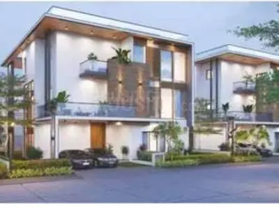
Aika is a residential gated-community layout with villas at Manchirevula Village, Gandipet Mandal, Ranga Reddy District. The registered promoter is LEAGUE ETANIA VILLAS LLP. The site area is 176928.43 sq. m, and the HMDA permit records 195 dwelling units, generally planned as Ground Floor + 2 Floors; the supplied RERA-normalized configuration data does not disclose villa configurations. The project is registered with TG-RERA under P02400008538, with proposed completion stated as 24/10/2030.
01What we found
Read from TG-RERA filings, approvals, land and registration records and court records. A court case is counted only when the court record states this project's survey number with its village, or names the project.
02Check before you pay
9 items to check before you pay, 3 high - from the title chain, court records and approvals, each with what to ask the builder or your advocate. An item may not be a problem with the project: records can be incomplete.
1. Project at a glance
Project identity
| Field | Record |
|---|---|
| Registered project name | Aika. RERA record |
| Project type | Residential; the filed material and approvals describe a gated community/layout with villas. RERA record RERA filing |
| Phase / registered portion | A registered project portion is not separately identified in the supplied registration record. RERA record |
| TG-RERA registration | P02400008538. RERA record |
| Registration validity | 29/06/2024 to 24/06/2030; the certificate states 5 Years, 11 Months, 26 Day period. This is registration validity, not an occupancy certificate or evidence of completion. |
| Registered promoter | LEAGUE ETANIA VILLAS LLP, an LLP; GSTIN 36ACEFA5424C1ZV. RERA record Corporate record RERA filing |
| RERA status | Registration certificate on file. The supplied certificate is not marked extended. |
Land and geographic identity
| Field | Record |
|---|---|
| Locality | Manchirevula Village, Gandipet Mandal. RERA record RERA filing |
| Revenue village | Manchirevula. RERA record Land records |
| Mandal / district / PIN | Gandipet / Ranga Reddy / 500075. RERA record |
| Project survey numbers and subdivisions, as identified in the RERA record | 362/P, 375, 376, 378/P, 369/P, 372, 373/P, 374/P, 377, 380/P, 381/P, 382/P. RERA record |
| Site extent | Total area 176928.43 sq. m; net area 135779.00 sq. m in the RERA land details. The HMDA revised permit separately records site and net area as 176928.43 Sq. Mt. RERA filing |
| Boundaries filed | East: Neighbours Land; West: Road to Gandipet Lake; North: Neighbours Land; South: Road to Manchirevula Village. RERA filing |
Development identity
| Field | Record |
|---|---|
| Sanctioning authority | Hyderabad Metropolitan Development Authority (HMDA); the supplied record also includes a Narsingi Municipality building-permit order. Approvals record |
| Principal HMDA permit | Layout Permit 1682/HMDA/SWDL/2026, dated 11/02/2026, for a layout with housing. Approvals record |
| RERA-recorded earlier permit reference | Revised Draft Layout Permit 26/LO/Plg/HMDA/2016, shown with date 29/06/2024 in the filed drawing. |
| Approved built-up area | HMDA revised permit records Total Sanctioned Built Up Area 51666.18. A separate environmental clearance document records a built-up area of 46,714.1 Sq.m. |
| Building / villa count | HMDA permit records 195 dwelling units; the RERA project fields record 195 total building units as per approved plan. RERA filing |
| Sanctioned configuration | The revised plans show villas generally as Ground Floor + 2 Floors; specified plan entries describe individual villa buildings and the amenity building. |
| Parking levels / provision | The HMDA permit refers to cellar and stilts approved for parking, but the supplied extracts do not establish a total parking-space count for the entire registered project. |
| Unit count | RERA fields show 195 total building units as per approved plan and 146 proposed building units as per agreement. The HMDA revised permit records 195 dwelling units. RERA filing |
Offering and status
| Field | Record |
|---|---|
| Unit type | Villas in a residential gated-community layout. RERA record |
| RERA booking / availability | The portal-derived unit data shows 773 available and 0 booked, but the record carries no as-of date and includes rows filed as floors/common-area labels rather than confirmed sale homes. Treat this count as indicative, not a verified count of saleable villas. RERA unit table |
| RERA-filed unit labels | The submitted table includes “FIRST FLOOR,” “GROUND FLOOR,” “SECOND FLOOR,” “LIFT” and variants of “LIFT ST HEAD ROOM”; the supplied normalized record classifies these as floors/common areas rather than sale configurations. RERA unit table RERA unit details |
| Construction stage | No independently verified site progress is supplied. The RERA amenity/progress schedule records internal roads and footpaths at 30% and community buildings at 25%; listed percentages for several other infrastructure items are 0%. RERA amenities |
| Completion date | The RERA project fields state proposed completion 24/10/2030. The registration certificate is valid through 24/06/2030; these are distinct dates recorded in separate fields. RERA record |
| Occupancy / completion certificate | No project-wide completion or occupancy certificate is recorded in the supplied project materials. The HMDA revised permit requires completion/occupancy certification before occupation. |
2. The project story
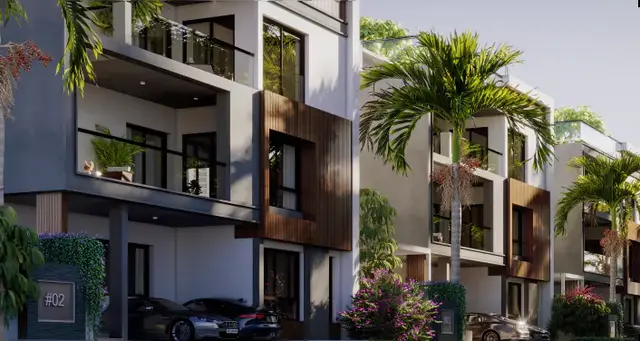
Aika is recorded with TG-RERA as a residential project at Manchirevula Village, Gandipet Mandal, Ranga Reddy District. Its filed plans describe a gated-community layout with housing, arranged as individual villas rather than a conventional apartment tower scheme. The HMDA revised permit identifies 195 dwelling units and plans for Ground Floor + 2 Floors. RERA record
The site plan presents plots, internal roads, open spaces, utility areas and villa structures. It labels the broader layout as a draft layout with housing and identifies some structures as permitted, proposed or altered; those drawing labels describe plan status, not independently verified construction completion.
No independent construction inspection or site-progress verification is included. The RERA progress schedule reports some infrastructure progress, including 30% for internal roads and footpaths and 25% for community buildings; those are recorded progress figures, not an independent site assessment. RERA amenities
3. Master plan, architecture & building design
The HMDA revised permit records a site and net layout area of 176928.43 Sq. Mt., with 0 road-affected area and 0 nala-affected area in that permit’s area statement. Its land-use table allocates 104831.74 sq.m to plotted area (59.25%), 5395.27 sq.m to amenities plots (3.05%), 46679.63 sq.m to roads (26.38%), 17972.89 sq.m to organized open space (10.16%) and 2048.80 sq.m to utilities (1.16%).
The site drawing depicts a network of internal roads, green strips, tot-lots, amenity areas and villa sites. The plan extract lists road widths including 12.0 m, 15.0 m and 18.00 m; the HMDA permit also describes 18-metre-and-above roads in its conditions.
The HMDA permit names 195 dwelling units and an approved built-up area of 51666.18. The supplied plan entries describe villas principally as Ground Floor + 2 Floors, with individual designs and areas; these figures are plan-record particulars, not a single project-wide saleable or carpet-area measure.
The HMDA permit also records an amenities building and utility plots. It does not establish that all proposed or planned facilities have been completed.
4. Homes, configurations & floor plans
The RERA-filed unit table does not provide recognizable villa configurations in the supplied normalized record. It contains floor labels and lift/head-room entries; these should not be treated as homes for sale. The portal-derived counts are indicative and lack an as-of date. RERA unit table RERA unit details
| Units | Not disclosed in the supplied RERA-normalized configuration data |
|---|---|
| Booked | Not established |
| Available | Not established |
| RERA saleable area | Not disclosed as a villa configuration |
| Measured carpet area | Not measured in the supplied villa drawings |
| Loading (if supplied) | Not supplied |
The HMDA drawing schedules contain villa-specific built-up-area and floor information, including Ground Floor + 2 Floors entries. These are drawing/approval particulars; they are not RERA-filed saleable-area or carpet-area figures. The supplied software-measured 1BHK and 2BHK figures relate to drawing-derived configurations that are not matched to the RERA villa filing and are therefore not used here as the project’s offered home types. RERA unit details Floor plans
5. Parking & vehicle circulation
The HMDA permit refers to cellar and stilt areas approved for parking and states they are to be used exclusively for vehicle parking. The plan extracts also name “STACK PARKING,” “Parking” and “Visitors Parking,” but the supplied materials do not establish the number of spaces, the number designated for visitors or accessible use, or unit-specific parking allocations.
The environmental clearance states that each villa is provided with 2 parking spaces; this is a project document’s stated provision, not evidence that those spaces have been individually allocated or delivered.
The HMDA permit requires electric-vehicle charging infrastructure in building parking places. The supplied evidence does not verify that charging equipment has been installed.
6. Amenities, recreation & open spaces
The site and permit drawings identify amenity areas and open-space elements. The figures below describe the plans or RERA progress schedule; they do not establish independent completion or current availability. RERA amenities
| Description / size | HMDA plan identifies an amenities building; the site plan labels a club house and amenities block. No single project-wide clubhouse area is established by these entries. |
|---|---|
| Declared progress / verified status | RERA schedule reports community buildings at 25%; independent completion not verified. RERA amenities |
| Description / size | Organized open space 17972.89 sq.m (10.16%) in the HMDA site-area statement. |
|---|---|
| Declared progress / verified status | Planned; no independent completion verification. |
| Description / size | 46679.63 sq mts (26.38%) in the HMDA permit’s land-use statement. |
|---|---|
| Declared progress / verified status | RERA schedule reports internal roads and footpaths at 30%; independent verification not supplied. RERA amenities |
| Description / size | HMDA permit records 17972.89 for “Tot Lot (m2)” in its area table; the site plan labels multiple tot-lots. |
|---|---|
| Declared progress / verified status | Planned; RERA progress schedule reports green strip/tot lot/park at 0%. RERA amenities |
| Description / size | 2048.80 (1.16%) in the HMDA permit’s land-use statement. |
|---|---|
| Declared progress / verified status | Planned; independent completion not verified. |
The HMDA plan also labels indoor and community uses including banquet, badminton, clinic, convenience, yoga, cafeteria, mini-theatres, snooker, gym, table tennis and spa/salon. These are plan labels; the supplied records do not confirm that each is sanctioned as a delivered facility or operational.
7. Utilities, building services & safety
The HMDA permit and drawings identify utility land, an STP, treated-water and raw-water sumps, a municipal-water sump, a transformer/transformer yard, garbage house, rainwater-harvesting structures and utility ducting. The plan labels include STP and sump areas, including 1112 SQM for “UTILITY -4 STP,” 240 SQM for an underground sump and 100SQM for another underground sump. These are plan particulars; installed capacity and commissioned status are not established by those labels.
The project-specific environmental clearance records water demand of 38.5 KLD, comprising 25 KLD fresh water and 13.5 KLD recycled water; wastewater generation of 30.8 KLD; and an STP - 40 KLD. It states that treated effluent is to be recycled/reused and that no treated water is proposed to be discharged into a municipal drain. These are clearance-document specifications and conditions, not verified operational performance.
The environmental clearance also specifies rainwater-harvesting pits, with at least one pit for each villa, and says groundwater is not to be used during construction. HMDA plan conditions refer to storm-water drainage, water supply, sewerage, street lighting and transformer provision.
HMDA plan conditions require EV charging infrastructure in parking places, dual piping for specified construction/group-housing thresholds, fire-safety requirements and completion/occupancy certification before occupation. The supplied record does not establish installation, commissioning or completed fire/life-safety approvals.
8. Location, access & connectivity
The registered location is Manchirevula Village, Gandipet Mandal, Ranga Reddy District, Telangana, PIN 500075. The RERA-filed boundary descriptions identify neighbours’ land to the east and north, a road to Gandipet Lake to the west, and a road to Manchirevula Village to the south. RERA record RERA filing RERA filing
The supplied location record lists the Financial District (Nanakramguda) at 4.6 km, ICICI Bank at 2.5 km, Holy Mary College at 1.5 km, Urban Primary Health Centre Narsingi at 1.3 km, an unnamed park at 1.1 km, and Rishi Public School at 1.7 km. These are recorded distances; no travel times are supplied in the official project record. Location record
9. Developer & development status
The registered legal promoter is LEAGUE ETANIA VILLAS LLP, an LLP, GSTIN 36ACEFA5424C1ZV. The promoter’s recorded address is Manchiruvella, Gandipet, Manchirevula Village, Gandipet Mandal, Ranga Reddy, 500075. The supplied materials do not identify an official website or contact number for the registered promoter. Corporate record Parties record RERA filing
The RERA Form B declaration in the supplied record is made by DUKES SAI VILLAS LLP and states a completion undertaking of on or before 24.06.2030. The current project fields state proposed completion of 24/10/2030. These are recorded in separate project materials; the overview reports each as filed and does not treat either as proof of construction progress. RERA record
The project’s RERA progress schedule records internal roads and footpaths at 30% and community buildings at 25%; it does not provide an independently verified construction-stage assessment. RERA amenities
10. Approvals, official records & documents
| Record | What the supplied document establishes |
|---|---|
| TG-RERA registration certificate | Form C registration for Aika, P02400008538, valid 29/06/2024–24/06/2030. |
| HMDA revised permit | Layout-with-housing revised permit 1682/HMDA/SWDL/2026, dated 11/02/2026; records the site area, 195 dwelling units, sanctioned built-up area and permit conditions. |
| HMDA revised drawing / site plan | File 007367/HMDA/02195/SWDL/SKP1/2025-REV, with site plan, villa entries, internal roads, open spaces and utilities. |
| Earlier HMDA permit reference | Revised Draft Layout Permit 26/LO/Plg/HMDA/2016, referenced in the filed drawings. |
| Narsingi Municipality building permit | Building Permit Order BA.NO:01/2024-25, covering a revised draft residential layout with housing and club house; the order states that occupancy certification is required before occupation. |
| Environmental clearance | SEIAA Telangana EC EC25C3801TG5151395N, dated 04/09/2025, for a residential villas project; records the covered survey numbers, environmental conditions and specified project services. |
| Irrigation & C.A.D. undertaking / clarification material | Project undertaking concerning Ac. 09-07.15 Gts. in the listed survey numbers and conditions relating to Osman Sagar FTL/buffer and natural flow. |
| HMDA draft layout letter | Records HMDA technical approval and forwarding for release of proceedings and plans; the document itself says those proceedings and plans are to be released by the municipal commissioner. |
| Project allotment and agreement forms | Partially filled allotment and agreement-for-sale materials are on file; the supplied extracts do not establish an executed buyer-specific agreement. |
The supplied materials do not include a project-wide occupancy certificate or completion certificate. The registered project identity and approved survey list are stated above; the HMDA permit and drawing documents provide the principal approval references for tracing the development.
1. Project at a glance
Project identity
Registered project name: Aika.
Project type: Residential; the filed material and approvals describe a gated community/layout with villas.
Phase / registered portion: A registered project portion is not separately identified in the supplied registration record.
TG-RERA registration: P02400008538.
Registration validity: 29/06/2024 to 24/06/2030; the certificate states 5 Years, 11 Months, 26 Day period. This is registration validity, not an occupancy certificate or evidence of completion.
Registered promoter: LEAGUE ETANIA VILLAS LLP, an LLP; GSTIN 36ACEFA5424C1ZV.
RERA status: Registration certificate on file. The supplied certificate is not marked extended.
Land and geographic identity
Locality: Manchirevula Village, Gandipet Mandal.
Revenue village: Manchirevula.
Mandal / district / PIN: Gandipet / Ranga Reddy / 500075.
Project survey numbers and subdivisions, as identified in the RERA record: 362/P, 375, 376, 378/P, 369/P, 372, 373/P, 374/P, 377, 380/P, 381/P, 382/P.
Site extent: Total area 176928.43 sq. m; net area 135779.00 sq. m in the RERA land details. The HMDA revised permit separately records site and net area as 176928.43 Sq. Mt.
Boundaries filed: East: Neighbours Land; West: Road to Gandipet Lake; North: Neighbours Land; South: Road to Manchirevula Village.
Development identity
Sanctioning authority: Hyderabad Metropolitan Development Authority (HMDA); the supplied record also includes a Narsingi Municipality building-permit order.
Principal HMDA permit: Layout Permit 1682/HMDA/SWDL/2026, dated 11/02/2026, for a layout with housing.
RERA-recorded earlier permit reference: Revised Draft Layout Permit 26/LO/Plg/HMDA/2016, shown with date 29/06/2024 in the filed drawing.
Approved built-up area: HMDA revised permit records Total Sanctioned Built Up Area 51666.18. A separate environmental clearance document records a built-up area of 46,714.1 Sq.m.
Building / villa count: HMDA permit records 195 dwelling units; the RERA project fields record 195 total building units as per approved plan.
Sanctioned configuration: The revised plans show villas generally as Ground Floor + 2 Floors; specified plan entries describe individual villa buildings and the amenity building.
Parking levels / provision: The HMDA permit refers to cellar and stilts approved for parking, but the supplied extracts do not establish a total parking-space count for the entire registered project.
Unit count: RERA fields show 195 total building units as per approved plan and 146 proposed building units as per agreement. The HMDA revised permit records 195 dwelling units.
Offering and status
Unit type: Villas in a residential gated-community layout.
RERA booking / availability: The portal-derived unit data shows 773 available and 0 booked, but the record carries no as-of date and includes rows filed as floors/common-area labels rather than confirmed sale homes. Treat this count as indicative, not a verified count of saleable villas.
RERA-filed unit labels: The submitted table includes “FIRST FLOOR,” “GROUND FLOOR,” “SECOND FLOOR,” “LIFT” and variants of “LIFT ST HEAD ROOM”; the supplied normalized record classifies these as floors/common areas rather than sale configurations.
Construction stage: No independently verified site progress is supplied. The RERA amenity/progress schedule records internal roads and footpaths at 30% and community buildings at 25%; listed percentages for several other infrastructure items are 0%.
Completion date: The RERA project fields state proposed completion 24/10/2030. The registration certificate is valid through 24/06/2030; these are distinct dates recorded in separate fields.
Occupancy / completion certificate: No project-wide completion or occupancy certificate is recorded in the supplied project materials. The HMDA revised permit requires completion/occupancy certification before occupation.
2. The project story
Aika is recorded with TG-RERA as a residential project at Manchirevula Village, Gandipet Mandal, Ranga Reddy District. Its filed plans describe a gated-community layout with housing, arranged as individual villas rather than a conventional apartment tower scheme. The HMDA revised permit identifies 195 dwelling units and plans for Ground Floor + 2 Floors.
The site plan presents plots, internal roads, open spaces, utility areas and villa structures. It labels the broader layout as a draft layout with housing and identifies some structures as permitted, proposed or altered; those drawing labels describe plan status, not independently verified construction completion.
No independent construction inspection or site-progress verification is included. The RERA progress schedule reports some infrastructure progress, including 30% for internal roads and footpaths and 25% for community buildings; those are recorded progress figures, not an independent site assessment.
3. Master plan, architecture & building design
The HMDA revised permit records a site and net layout area of 176928.43 Sq. Mt., with 0 road-affected area and 0 nala-affected area in that permit’s area statement. Its land-use table allocates 104831.74 sq.m to plotted area (59.25%), 5395.27 sq.m to amenities plots (3.05%), 46679.63 sq.m to roads (26.38%), 17972.89 sq.m to organized open space (10.16%) and 2048.80 sq.m to utilities (1.16%).
The site drawing depicts a network of internal roads, green strips, tot-lots, amenity areas and villa sites. The plan extract lists road widths including 12.0 m, 15.0 m and 18.00 m; the HMDA permit also describes 18-metre-and-above roads in its conditions.
The HMDA permit names 195 dwelling units and an approved built-up area of 51666.18. The supplied plan entries describe villas principally as Ground Floor + 2 Floors, with individual designs and areas; these figures are plan-record particulars, not a single project-wide saleable or carpet-area measure.
The HMDA permit also records an amenities building and utility plots. It does not establish that all proposed or planned facilities have been completed.
4. Homes, configurations & floor plans
The RERA-filed unit table does not provide recognizable villa configurations in the supplied normalized record. It contains floor labels and lift/head-room entries; these should not be treated as homes for sale. The portal-derived counts are indicative and lack an as-of date.
| Units | Not disclosed in the supplied RERA-normalized configuration data |
|---|---|
| Booked | Not established |
| Available | Not established |
| RERA saleable area | Not disclosed as a villa configuration |
| Measured carpet area | Not measured in the supplied villa drawings |
| Loading (if supplied) | Not supplied |
The HMDA drawing schedules contain villa-specific built-up-area and floor information, including Ground Floor + 2 Floors entries. These are drawing/approval particulars; they are not RERA-filed saleable-area or carpet-area figures. The supplied software-measured 1BHK and 2BHK figures relate to drawing-derived configurations that are not matched to the RERA villa filing and are therefore not used here as the project’s offered home types.
5. Parking & vehicle circulation
The HMDA permit refers to cellar and stilt areas approved for parking and states they are to be used exclusively for vehicle parking. The plan extracts also name “STACK PARKING,” “Parking” and “Visitors Parking,” but the supplied materials do not establish the number of spaces, the number designated for visitors or accessible use, or unit-specific parking allocations.
The environmental clearance states that each villa is provided with 2 parking spaces; this is a project document’s stated provision, not evidence that those spaces have been individually allocated or delivered.
The HMDA permit requires electric-vehicle charging infrastructure in building parking places. The supplied evidence does not verify that charging equipment has been installed.
6. Amenities, recreation & open spaces
The site and permit drawings identify amenity areas and open-space elements. The figures below describe the plans or RERA progress schedule; they do not establish independent completion or current availability.
| Description / size | HMDA plan identifies an amenities building; the site plan labels a club house and amenities block. No single project-wide clubhouse area is established by these entries. |
|---|---|
| Declared progress / verified status | RERA schedule reports community buildings at 25%; independent completion not verified. |
| Description / size | Organized open space 17972.89 sq.m (10.16%) in the HMDA site-area statement. |
|---|---|
| Declared progress / verified status | Planned; no independent completion verification. |
| Description / size | 46679.63 sq mts (26.38%) in the HMDA permit’s land-use statement. |
|---|---|
| Declared progress / verified status | RERA schedule reports internal roads and footpaths at 30%; independent verification not supplied. |
| Description / size | HMDA permit records 17972.89 for “Tot Lot (m2)” in its area table; the site plan labels multiple tot-lots. |
|---|---|
| Declared progress / verified status | Planned; RERA progress schedule reports green strip/tot lot/park at 0%. |
| Description / size | 2048.80 (1.16%) in the HMDA permit’s land-use statement. |
|---|---|
| Declared progress / verified status | Planned; independent completion not verified. |
The HMDA plan also labels indoor and community uses including banquet, badminton, clinic, convenience, yoga, cafeteria, mini-theatres, snooker, gym, table tennis and spa/salon. These are plan labels; the supplied records do not confirm that each is sanctioned as a delivered facility or operational.
7. Utilities, building services & safety
The HMDA permit and drawings identify utility land, an STP, treated-water and raw-water sumps, a municipal-water sump, a transformer/transformer yard, garbage house, rainwater-harvesting structures and utility ducting. The plan labels include STP and sump areas, including 1112 SQM for “UTILITY -4 STP,” 240 SQM for an underground sump and 100SQM for another underground sump. These are plan particulars; installed capacity and commissioned status are not established by those labels.
The project-specific environmental clearance records water demand of 38.5 KLD, comprising 25 KLD fresh water and 13.5 KLD recycled water; wastewater generation of 30.8 KLD; and an STP - 40 KLD. It states that treated effluent is to be recycled/reused and that no treated water is proposed to be discharged into a municipal drain. These are clearance-document specifications and conditions, not verified operational performance.
The environmental clearance also specifies rainwater-harvesting pits, with at least one pit for each villa, and says groundwater is not to be used during construction. HMDA plan conditions refer to storm-water drainage, water supply, sewerage, street lighting and transformer provision.
HMDA plan conditions require EV charging infrastructure in parking places, dual piping for specified construction/group-housing thresholds, fire-safety requirements and completion/occupancy certification before occupation. The supplied record does not establish installation, commissioning or completed fire/life-safety approvals.
8. Location, access & connectivity
The registered location is Manchirevula Village, Gandipet Mandal, Ranga Reddy District, Telangana, PIN 500075. The RERA-filed boundary descriptions identify neighbours’ land to the east and north, a road to Gandipet Lake to the west, and a road to Manchirevula Village to the south.
The supplied location record lists the Financial District (Nanakramguda) at 4.6 km, ICICI Bank at 2.5 km, Holy Mary College at 1.5 km, Urban Primary Health Centre Narsingi at 1.3 km, an unnamed park at 1.1 km, and Rishi Public School at 1.7 km. These are recorded distances; no travel times are supplied in the official project record.
9. Developer & development status
The registered legal promoter is LEAGUE ETANIA VILLAS LLP, an LLP, GSTIN 36ACEFA5424C1ZV. The promoter’s recorded address is Manchiruvella, Gandipet, Manchirevula Village, Gandipet Mandal, Ranga Reddy, 500075. The supplied materials do not identify an official website or contact number for the registered promoter.
The RERA Form B declaration in the supplied record is made by DUKES SAI VILLAS LLP and states a completion undertaking of on or before 24.06.2030. The current project fields state proposed completion of 24/10/2030. These are recorded in separate project materials; the overview reports each as filed and does not treat either as proof of construction progress.
The project’s RERA progress schedule records internal roads and footpaths at 30% and community buildings at 25%; it does not provide an independently verified construction-stage assessment.
10. Approvals, official records & documents
TG-RERA registration certificate: Form C registration for Aika, P02400008538, valid 29/06/2024–24/06/2030.
HMDA revised permit: Layout-with-housing revised permit 1682/HMDA/SWDL/2026, dated 11/02/2026; records the site area, 195 dwelling units, sanctioned built-up area and permit conditions.
HMDA revised drawing / site plan: File 007367/HMDA/02195/SWDL/SKP1/2025-REV, with site plan, villa entries, internal roads, open spaces and utilities.
Earlier HMDA permit reference: Revised Draft Layout Permit 26/LO/Plg/HMDA/2016, referenced in the filed drawings.
Narsingi Municipality building permit: Building Permit Order BA.NO:01/2024-25, covering a revised draft residential layout with housing and club house; the order states that occupancy certification is required before occupation.
Environmental clearance: SEIAA Telangana EC EC25C3801TG5151395N, dated 04/09/2025, for a residential villas project; records the covered survey numbers, environmental conditions and specified project services.
Irrigation & C.A.D. undertaking / clarification material: Project undertaking concerning Ac. 09-07.15 Gts. in the listed survey numbers and conditions relating to Osman Sagar FTL/buffer and natural flow.
HMDA draft layout letter: Records HMDA technical approval and forwarding for release of proceedings and plans; the document itself says those proceedings and plans are to be released by the municipal commissioner.
Project allotment and agreement forms: Partially filled allotment and agreement-for-sale materials are on file; the supplied extracts do not establish an executed buyer-specific agreement.
The supplied materials do not include a project-wide occupancy certificate or completion certificate. The registered project identity and approved survey list are stated above; the HMDA permit and drawing documents provide the principal approval references for tracing the development.
Frequently asked questions
Is Aika registered with Telangana RERA?
Yes. Aika is registered with the Telangana Real Estate Regulatory Authority as P02400008538; the registration status is New Project.
Who is the developer of Aika?
The promoter named in the RERA registration is LEAGUE ETANIA VILLAS LLP.
Where is Aika located?
Aika is in Manchirevula Village, Gandipet Mandal, Manchirevula, Gandipet, Rangareddy, Telangana (500075).
When will Aika be completed?
The promoter's proposed date of completion filed with RERA is 24/10/2030. This is the promoter's declaration, not a guarantee.
More projects in Manchirevula