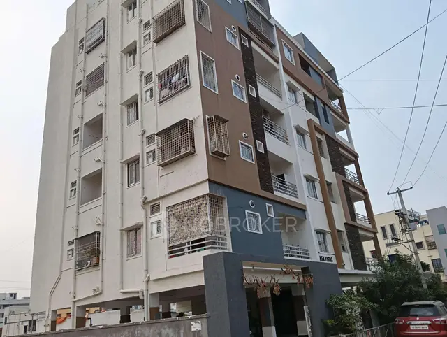
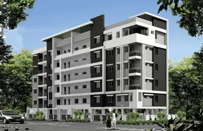
Sri Sai Enclave.
SRI VENKATESHWARA CONSTRUCTIONS · Rangareddy · RERA P02400002571
SRI SAI ENCLAVE. is a residential apartment project in Sama Nagar, Hayathnagar Mandal, Ranga Reddy District. It is being developed by the registered promoter SRI VENKATESHWARA CONSTRUCTIONS on a site of 502.24 sq. m., with one building comprising 1 Stilt + 5 Upper floors and 10 3BHK apartments. The project is registered with TG-RERA as P02400002571, with proposed completion on 25/06/2025.
More from Sri Venkateshwara Constructions · 7 projects →
01What we found
Read from TG-RERA filings, approvals, land and registration records and court records. A court case is counted only when the court record states this project's survey number with its village, or names the project.
02Check before you pay
11 items to check before you pay, 3 high - from the title chain, court records and approvals, each with what to ask the builder or your advocate. An item may not be a problem with the project: records can be incomplete.
1. Project at a glance
Project identity
| Item | Project record |
|---|---|
| Registered name | SRI SAI ENCLAVE. RERA record |
| Project type / phase | Residential apartment project; the supplied record identifies one registered project, but does not separately state a phase name. RERA record RERA filing |
| TG-RERA registration | P02400002571, granted 23/02/2021; registration certificate states validity through 25/06/2025. No extension is recorded in the supplied certificate. RERA record Approvals record |
| Registered promoter | SRI VENKATESHWARA CONSTRUCTIONS (also written “Sri Venkateshwara Constructions” in the registration certificate). RERA record Corporate record |
| RERA record status | The project is listed as “New Project” in the supplied project record. Registration validity and building occupancy certification are separate matters; see the sections below. RERA record RERA filing |
Land and geographic identity
| Item | Project record |
|---|---|
| Locality / plot | Sama Nagar; Plot No. 4 (Bit No. C-2). RERA record RERA filing |
| Revenue village | Kalvancha is stated in the approval and occupancy records. The RERA header separately identifies Sama Nagar as the village; the mandal is not disclosed in the project land identity fields. RERA record RERA filing |
| Mandal / district / PIN | Hayathnagar Mandal and Ranga Reddy District are stated in building and occupancy records; project PIN is 500070. |
| Survey number(s) | Survey No. 3; no subdivision is stated in the supplied project identity. RERA record Land records |
| Site area | 502.24 sq. m. Total area and net area are each recorded as 502.24 sq. m.; road-widening/FTL/nala-widening affected area is recorded as 0. RERA filing Land records |
| Boundaries | East: neighbours’ land; West: road; North: Plot No. 9; South: Plot No. 3. RERA filing |
| Parcel limitations | The project record does not disclose a mandal in its land identity fields. Official land-use and prohibited-property checks are unresolved in the supplied record; see Land & Title for parcel verification. Land records HMDA |
Development identity
| Item | Project record |
|---|---|
| Sanctioning authority | HMDA technical approval, with building permission recorded from Pedda Amberpet Municipality. Approvals record |
| Principal approval | Building permit 021686/GHT/R1/U6/HMDA/18032019, dated 15/06/2020; local building permission NO.G1/1274/PAM/2020, dated 01.10.2020. Approvals record |
| Approved building form | One residential building, 1 Stilt + 5 Upper floors. The local building-permission extraction lists stilt parking and first through fifth floors. |
| Built-up area | Approval records state Total Built Up Area 1403.22 Sq.mt. and Built up area 1169.35; the completion record lists floor area as 1169.35 m². These are the document labels, not interchangeable area measures. |
| Units | RERA filing and drawing record identify 10 residential units; the supplied approved plan extraction also describes a ten-unit building. RERA unit table |
| Other plan details | The plan extraction lists proposed coverage area 233.87 m² and building height 20.85 m; the local permission extraction separately records height 15.00 m. |
Offering and status
| Item | Project record |
|---|---|
| Configuration | 3BHK apartments. RERA unit table RERA unit details |
| RERA-filed saleable area | 153.29 m² per unit. RERA unit table RERA unit details |
| Booked / available | 0 booked and 10 available in the portal data supplied; no as-of date is attached, so these counts are indicative. RERA unit table |
| Completion date | The RERA project record gives proposed completion as 25/06/2025. RERA record RERA filing |
| Occupancy status | An HMDA Occupancy Certificate is recorded for the STILT + 5 building, proceeding 002680/OC/HMDA/GHT/2023, dated 15 April 2023. Its stated building scope is the residential building at Plot No. 4, Survey No. 3, Kalvancha; it is not evidence of registration validity or a TG-RERA extension. Approvals record |
| Construction stage | The supplied record describes the building as completed and occupancy-certified; no current independent site inspection or current construction-progress measurement is supplied. |
2. The project story
SRI SAI ENCLAVE. is recorded as a single-building residential apartment project on Plot No. 4 (Bit No. C-2), Survey No. 3, at Kalvancha, Hayathnagar Mandal, Ranga Reddy District. The recorded site area is 502.24 sq. m. and the building form is stilt plus five upper floors, with 10 apartments. RERA record Land records
The project was registered with TG-RERA as P02400002571, with a proposed completion date of 25/06/2025. The supplied HMDA occupancy records certify the identified STILT + 5 building as fit for occupation and record completion date as 20 December 2021. Those records establish the certificate’s stated scope; they do not establish the current TG-RERA registration status or any registration extension. RERA record
The project portal data lists all 10 apartments as available and none booked, but the booking snapshot has no stated as-of date. It should therefore be treated as indicative rather than a current inventory confirmation. RERA unit table
3. Master plan, architecture & building design
The RERA-filed project is a single residential building on a 502.24 sq. m. site, with a stilt level and five upper floors. The extracted plan records 10 units and identifies a lift, parking and percolation pit. It does not provide a supported account of flats per floor, number of lifts or stairs, building footprint dimensions, internal circulation details, or a quantified open-space area.
The approval-plan extraction reports Total Built Up Area 1403.22 Sq.mt., Residential Net BUA 1169.36, Proposed Net BUA Area 1169.35 Sq.mt., and Total Proposed Net BUA Area 1184.36. The local building-permission extraction separately records built-up area of 1169.35 m². These labels are retained as stated in the documents; no conversion or reconciliation is made here.
The local permission records stilt parking and five upper floor levels. The HMDA occupancy record identifies the building as STILT + 5 and reports a 4.29% deviation; it also lists completed-building height as 15.5 m against 15 m in the sanctioned-plan column. The certificate records floor area of 1169.35 m² in both sanctioned and completed-plan columns.
The extracted plan shows road-width entries of 11.73 and 9.14; HMDA’s technical approval extraction separately refers to 18 mt. road widths. The drawing and approval materials supplied do not establish detailed pedestrian routes, internal roads, landscaping extent or common-area distribution.
4. Homes, configurations & floor plans
The RERA filing lists 10 3BHK units, each with a saleable area of 153.29 m². The units record shows 0 booked and 10 available, without an as-of date. RERA unit table RERA unit details
| Configuration | Units | Booked | Available | RERA saleable area | Measured carpet area | Loading (if supplied) |
|---|---|---|---|---|---|---|
| 3BHK | 10 | 0 | 10 | 153.29 m² | Software-measured median 86.6 m²; range 82.4–90.8 m² | 43% |
The carpet-area figures are software measurements from the approved floor-plan drawing geometry, not RERA-filed carpet-area disclosures; two flat designs were measured and both measurements need review against the drawing. The drawing labels three bedrooms, a kitchen, two toilets and two 1.00 m balconies for the illustrated flat. The balconies are excluded from the software-measured carpet area. Floor plans RERA unit details
Saleable area and measured carpet area are distinct measures. The supplied floor-plan data notes that the RERA saleable figure includes the home’s share of common areas, while the software-measured carpet figure is derived from drawing geometry. No separate utility-area measurement is provided. Floor plans RERA unit details
5. Parking & vehicle circulation
The local building permission identifies the stilt floor as parking, and HMDA’s technical-approval conditions state that the stilt is to be used exclusively for vehicle parking. The drawing extraction also lists parking, but no sanctioned count of car or two-wheeler spaces is provided in the supplied data.
The documents do not establish resident-versus-visitor allocation, accessible spaces, mechanical parking, parking allotment to individual units, a spaces-per-home ratio, or detailed vehicle entry, exit and ramp arrangements. A parking area shown in a plan does not by itself establish exclusive ownership or allocation.
6. Amenities, recreation & open spaces
The amenities record reports the following project-level entries. It does not provide independent site-verification evidence, and the percentages are reproduced as supplied.
| Description / size | Number and capacity not stated |
|---|---|
| Evidence source | Approved-plan extraction |
| Declared progress / verified status | Shown/listed; completion not independently verified |
| Description / size | Stilt parking; spaces not counted |
|---|---|
| Evidence source | Plan and building-permission extracts |
| Declared progress / verified status | Plan/permission records parking; delivered allocation not verified |
| Description / size | Size and capacity not stated |
|---|---|
| Evidence source | Plan and permission records |
| Declared progress / verified status | Listed in documents; amenities record reports water conservation/rainwater harvesting at 100% |
| Description / size | Size not stated |
|---|---|
| Evidence source | Permission and amenities record RERA amenities |
| Declared progress / verified status | Permission requires a tot-lot to be fenced and maintained as greenery; amenities record reports 100% |
| Description / size | Source, storage and capacity not stated |
|---|---|
| Evidence source | Amenities record RERA amenities |
| Declared progress / verified status | Reported at 100%; no independent verification supplied |
| Description / size | System capacities not stated |
|---|---|
| Evidence source | Amenities record; HMDA intimation lists STP and septic tank RERA amenities |
| Declared progress / verified status | Amenities record reports 100%; independent completion not verified |
| Description / size | Dimensions not stated |
|---|---|
| Evidence source | Amenities record RERA amenities |
| Declared progress / verified status | Reported at 100%; independent verification not supplied |
| Description / size | Details not stated |
|---|---|
| Evidence source | Amenities record RERA amenities |
| Declared progress / verified status | Reported at 100%; independent verification not supplied |
| Description / size | Equipment capacity not stated |
|---|---|
| Evidence source | Amenities record; HMDA technical approval requires transformer space RERA amenities |
| Declared progress / verified status | Reported at 100%; independent verification not supplied |
The amenities data records 0% for storm-water drains, street lighting, community buildings, treatment and disposal of sewage and sullage water, solid-waste management and disposal, fire-protection/fire-safety requirements, and aggregate recreational open space. No size or facility-level completion certificate for these items is included in the supplied data. RERA amenities
7. Utilities, building services & safety
Water and drainage: The amenities record reports water supply at 100%. The HMDA intimation lists STP and septic tank, while the plan and local permission records identify a percolation pit/rainwater-harvesting structure. Water sources, storage, treatment capacity, sewage-treatment capacity, reuse arrangements and storm-water drainage details are not supplied. The amenities record shows storm-water drains at 0%. RERA amenities
Electrical and vertical transport: The amenities record reports an electrical meter room/sub-station/receiving station at 100%; the HMDA technical approval requires transformer space. The plan lists a lift, but lift count, capacity, backup power and service-lift provision are not stated. RERA amenities
Safety and access: The local building permission requires an Occupancy Certificate before occupation. HMDA’s technical-approval conditions include a garbage house, rainwater-harvesting structures and a tot-lot, and require construction to follow the sanctioned plan. The amenities record reports 0% for fire-protection/fire-safety requirements. No fire-system details, fire NOC particulars, escape-stair details, CCTV/access-control provision or accessibility features are established by the supplied extracts. RERA amenities
8. Location, access & connectivity
The registered project identity places the development in Sama Nagar, Ranga Reddy District, PIN 500070. Building and occupancy documents identify Plot No. 4 (Bit No. C-2), Survey No. 3, Kalvancha, Hayathnagar Mandal. The supplied record does not establish an approach-road name or a public-transport route. RERA record RERA filing
The location dataset supplies these point-to-point distances; it does not specify routes or travel times:
| Place / feature | Distance shown |
|---|---|
| Financial District (Nanakramguda) | 1.2 km |
| IndusInd Bank | 0.4 km |
| Unnamed bus station | 2.2 km |
| MANUU Polytechnic Hyderabad | 1.6 km |
| Sankaraya Eye Hospital | 1.6 km |
| ADP | 0.0 km |
| South India Shopping Mall | 2.6 km |
| Unnamed park | 1.2 km |
| Nanakramguda Government Primary School | 0.5 km |
These are location-dataset distances, not stated travel times. Location record
9. Developer & development status
The registered legal promoter is SRI VENKATESHWARA CONSTRUCTIONS, identified in the project record as a partnership. The supplied corporate identifier is GSTIN 36ADNFS0292E1ZY. The listed partners are Artham Narsimulu, Musuku Mamatha and Artham Vijayalakshmi; Musuku Chandrashaker Reddy is listed as authorised signatory. Corporate record Parties record
The project record gives the promoter address as 0, Chanukyapuri Colony, Sama Nagar, Sama Nagar, Ranga Reddy, 500070. The registration certificate separately lists the promoter office as Nagole Village, Uppal Mandal, Medchal-Malkajgiri District, PIN 500068. No official website or project contact details are supplied. Parties record
The promoter’s Form B declaration states that the project was to be completed by a date printed as “29/tte/W)25”; that text is not reliably legible in the extraction. The project identity record separately states proposed completion as 25/06/2025. The supplied HMDA occupancy record identifies the building as completed and fit for occupation, with certificate dated 15 April 2023. RERA record
10. Approvals, official records & documents
| Record | What the supplied record identifies |
|---|---|
| TG-RERA registration certificate | FORM C registration P02400002571, issued 23/02/2021; states validity from 23/02/2021 through 25/06/2025. |
| HMDA building plan / technical approval | Building permit 021686/GHT/R1/U6/HMDA/18032019, dated 15/06/2020, for the residential building at Plot No. 4, Survey No. 3. |
| Pedda Amberpet Municipality building permission | NO.G1/1274/PAM/2020, dated 01.10.2020; records a stilt-plus-five-floor residential building. |
| HMDA Occupancy Certificate | Proceedings 002680/OC/HMDA/GHT/2023, dated 15 April 2023; identifies the STILT + 5 residential building at Plot No. 4, Survey No. 3, Kalvancha, as fit for occupation. |
| Completion / architect certificate record | Document 399121 is titled “Form–1A Architects certificate Overall completion of registered project” and its extracted content describes the same HMDA Occupancy Certificate and building. |
| Project plan | Document 146584 is the extracted building plan for a stilt-plus-five-floor, 10-unit residential building; the OCR does not state a permit or approval number on that plan. |
| Promoter declaration | Form B, verified at Hyderabad on 11 January 2021; includes the promoter’s title, encumbrance and project-fund declarations. |
| HMDA application-stage intimation | Document 146586 concerns processing of the proposal and expressly states it is not approval of the proposal or permission for development. |
| Title and encumbrance materials | The filed title report, title deeds, mortgage and mortgage-release documents are reviewed in Land & Title; their complete scope is not repeated here. Document index |
The HMDA occupancy record states completion date as 20 December 2021 and identifies the building as fit for occupation. The supplied materials do not include a current TG-RERA extension certificate.
1. Project at a glance
Project identity
Registered name: SRI SAI ENCLAVE.
Project type / phase: Residential apartment project; the supplied record identifies one registered project, but does not separately state a phase name.
TG-RERA registration: P02400002571, granted 23/02/2021; registration certificate states validity through 25/06/2025. No extension is recorded in the supplied certificate.
Registered promoter: SRI VENKATESHWARA CONSTRUCTIONS (also written “Sri Venkateshwara Constructions” in the registration certificate).
RERA record status: The project is listed as “New Project” in the supplied project record. Registration validity and building occupancy certification are separate matters; see the sections below.
Land and geographic identity
Locality / plot: Sama Nagar; Plot No. 4 (Bit No. C-2).
Revenue village: Kalvancha is stated in the approval and occupancy records. The RERA header separately identifies Sama Nagar as the village; the mandal is not disclosed in the project land identity fields.
Mandal / district / PIN: Hayathnagar Mandal and Ranga Reddy District are stated in building and occupancy records; project PIN is 500070.
Survey number(s): Survey No. 3; no subdivision is stated in the supplied project identity.
Site area: 502.24 sq. m. Total area and net area are each recorded as 502.24 sq. m.; road-widening/FTL/nala-widening affected area is recorded as 0.
Boundaries: East: neighbours’ land; West: road; North: Plot No. 9; South: Plot No. 3.
Parcel limitations: The project record does not disclose a mandal in its land identity fields. Official land-use and prohibited-property checks are unresolved in the supplied record; see Land & Title for parcel verification.
Development identity
Sanctioning authority: HMDA technical approval, with building permission recorded from Pedda Amberpet Municipality.
Principal approval: Building permit 021686/GHT/R1/U6/HMDA/18032019, dated 15/06/2020; local building permission NO.G1/1274/PAM/2020, dated 01.10.2020.
Approved building form: One residential building, 1 Stilt + 5 Upper floors. The local building-permission extraction lists stilt parking and first through fifth floors.
Built-up area: Approval records state Total Built Up Area 1403.22 Sq.mt. and Built up area 1169.35; the completion record lists floor area as 1169.35 m². These are the document labels, not interchangeable area measures.
Units: RERA filing and drawing record identify 10 residential units; the supplied approved plan extraction also describes a ten-unit building.
Other plan details: The plan extraction lists proposed coverage area 233.87 m² and building height 20.85 m; the local permission extraction separately records height 15.00 m.
Offering and status
Configuration: 3BHK apartments.
RERA-filed saleable area: 153.29 m² per unit.
Booked / available: 0 booked and 10 available in the portal data supplied; no as-of date is attached, so these counts are indicative.
Completion date: The RERA project record gives proposed completion as 25/06/2025.
Occupancy status: An HMDA Occupancy Certificate is recorded for the STILT + 5 building, proceeding 002680/OC/HMDA/GHT/2023, dated 15 April 2023. Its stated building scope is the residential building at Plot No. 4, Survey No. 3, Kalvancha; it is not evidence of registration validity or a TG-RERA extension.
Construction stage: The supplied record describes the building as completed and occupancy-certified; no current independent site inspection or current construction-progress measurement is supplied.
2. The project story
SRI SAI ENCLAVE. is recorded as a single-building residential apartment project on Plot No. 4 (Bit No. C-2), Survey No. 3, at Kalvancha, Hayathnagar Mandal, Ranga Reddy District. The recorded site area is 502.24 sq. m. and the building form is stilt plus five upper floors, with 10 apartments.
The project was registered with TG-RERA as P02400002571, with a proposed completion date of 25/06/2025. The supplied HMDA occupancy records certify the identified STILT + 5 building as fit for occupation and record completion date as 20 December 2021. Those records establish the certificate’s stated scope; they do not establish the current TG-RERA registration status or any registration extension.
The project portal data lists all 10 apartments as available and none booked, but the booking snapshot has no stated as-of date. It should therefore be treated as indicative rather than a current inventory confirmation.
3. Master plan, architecture & building design
The RERA-filed project is a single residential building on a 502.24 sq. m. site, with a stilt level and five upper floors. The extracted plan records 10 units and identifies a lift, parking and percolation pit. It does not provide a supported account of flats per floor, number of lifts or stairs, building footprint dimensions, internal circulation details, or a quantified open-space area.
The approval-plan extraction reports Total Built Up Area 1403.22 Sq.mt., Residential Net BUA 1169.36, Proposed Net BUA Area 1169.35 Sq.mt., and Total Proposed Net BUA Area 1184.36. The local building-permission extraction separately records built-up area of 1169.35 m². These labels are retained as stated in the documents; no conversion or reconciliation is made here.
The local permission records stilt parking and five upper floor levels. The HMDA occupancy record identifies the building as STILT + 5 and reports a 4.29% deviation; it also lists completed-building height as 15.5 m against 15 m in the sanctioned-plan column. The certificate records floor area of 1169.35 m² in both sanctioned and completed-plan columns.
The extracted plan shows road-width entries of 11.73 and 9.14; HMDA’s technical approval extraction separately refers to 18 mt. road widths. The drawing and approval materials supplied do not establish detailed pedestrian routes, internal roads, landscaping extent or common-area distribution.
4. Homes, configurations & floor plans
The RERA filing lists 10 3BHK units, each with a saleable area of 153.29 m². The units record shows 0 booked and 10 available, without an as-of date.
| Configuration | Units | Booked | Available | RERA saleable area | Measured carpet area | Loading (if supplied) |
|---|---|---|---|---|---|---|
| 3BHK | 10 | 0 | 10 | 153.29 m² | Software-measured median 86.6 m²; range 82.4–90.8 m² | 43% |
The carpet-area figures are software measurements from the approved floor-plan drawing geometry, not RERA-filed carpet-area disclosures; two flat designs were measured and both measurements need review against the drawing. The drawing labels three bedrooms, a kitchen, two toilets and two 1.00 m balconies for the illustrated flat. The balconies are excluded from the software-measured carpet area.
Saleable area and measured carpet area are distinct measures. The supplied floor-plan data notes that the RERA saleable figure includes the home’s share of common areas, while the software-measured carpet figure is derived from drawing geometry. No separate utility-area measurement is provided.
5. Parking & vehicle circulation
The local building permission identifies the stilt floor as parking, and HMDA’s technical-approval conditions state that the stilt is to be used exclusively for vehicle parking. The drawing extraction also lists parking, but no sanctioned count of car or two-wheeler spaces is provided in the supplied data.
The documents do not establish resident-versus-visitor allocation, accessible spaces, mechanical parking, parking allotment to individual units, a spaces-per-home ratio, or detailed vehicle entry, exit and ramp arrangements. A parking area shown in a plan does not by itself establish exclusive ownership or allocation.
6. Amenities, recreation & open spaces
The amenities record reports the following project-level entries. It does not provide independent site-verification evidence, and the percentages are reproduced as supplied.
| Facility | Description / size | Evidence source | Declared progress / verified status |
|---|---|---|---|
| Lift | Number and capacity not stated | Approved-plan extraction | Shown/listed; completion not independently verified |
| Parking | Stilt parking; spaces not counted | Plan and building-permission extracts | Plan/permission records parking; delivered allocation not verified |
| Percolation pit / rainwater harvesting | Size and capacity not stated | Plan and permission records | Listed in documents; amenities record reports water conservation/rainwater harvesting at 100% |
| Green strip / tot lot / park | Size not stated | Permission and amenities record | Permission requires a tot-lot to be fenced and maintained as greenery; amenities record reports 100% |
| Water supply | Source, storage and capacity not stated | Amenities record | Reported at 100%; no independent verification supplied |
| Sewerage (chambers, lines, septic tank, STP) | System capacities not stated | Amenities record; HMDA intimation lists STP and septic tank | Amenities record reports 100%; independent completion not verified |
| Internal roads and footpaths | Dimensions not stated | Amenities record | Reported at 100%; independent verification not supplied |
| Energy management | Details not stated | Amenities record | Reported at 100%; independent verification not supplied |
| Electrical meter room / sub-station / receiving station | Equipment capacity not stated | Amenities record; HMDA technical approval requires transformer space | Reported at 100%; independent verification not supplied |
The amenities data records 0% for storm-water drains, street lighting, community buildings, treatment and disposal of sewage and sullage water, solid-waste management and disposal, fire-protection/fire-safety requirements, and aggregate recreational open space. No size or facility-level completion certificate for these items is included in the supplied data.
7. Utilities, building services & safety
Water and drainage: The amenities record reports water supply at 100%. The HMDA intimation lists STP and septic tank, while the plan and local permission records identify a percolation pit/rainwater-harvesting structure. Water sources, storage, treatment capacity, sewage-treatment capacity, reuse arrangements and storm-water drainage details are not supplied. The amenities record shows storm-water drains at 0%.
Electrical and vertical transport: The amenities record reports an electrical meter room/sub-station/receiving station at 100%; the HMDA technical approval requires transformer space. The plan lists a lift, but lift count, capacity, backup power and service-lift provision are not stated.
Safety and access: The local building permission requires an Occupancy Certificate before occupation. HMDA’s technical-approval conditions include a garbage house, rainwater-harvesting structures and a tot-lot, and require construction to follow the sanctioned plan. The amenities record reports 0% for fire-protection/fire-safety requirements. No fire-system details, fire NOC particulars, escape-stair details, CCTV/access-control provision or accessibility features are established by the supplied extracts.
8. Location, access & connectivity
The registered project identity places the development in Sama Nagar, Ranga Reddy District, PIN 500070. Building and occupancy documents identify Plot No. 4 (Bit No. C-2), Survey No. 3, Kalvancha, Hayathnagar Mandal. The supplied record does not establish an approach-road name or a public-transport route.
The location dataset supplies these point-to-point distances; it does not specify routes or travel times:
Financial District (Nanakramguda): 1.2 km
IndusInd Bank: 0.4 km
Unnamed bus station: 2.2 km
MANUU Polytechnic Hyderabad: 1.6 km
Sankaraya Eye Hospital: 1.6 km
ADP: 0.0 km
South India Shopping Mall: 2.6 km
Unnamed park: 1.2 km
Nanakramguda Government Primary School: 0.5 km
These are location-dataset distances, not stated travel times.
9. Developer & development status
The registered legal promoter is SRI VENKATESHWARA CONSTRUCTIONS, identified in the project record as a partnership. The supplied corporate identifier is GSTIN 36ADNFS0292E1ZY. The listed partners are Artham Narsimulu, Musuku Mamatha and Artham Vijayalakshmi; Musuku Chandrashaker Reddy is listed as authorised signatory.
The project record gives the promoter address as 0, Chanukyapuri Colony, Sama Nagar, Sama Nagar, Ranga Reddy, 500070. The registration certificate separately lists the promoter office as Nagole Village, Uppal Mandal, Medchal-Malkajgiri District, PIN 500068. No official website or project contact details are supplied.
The promoter’s Form B declaration states that the project was to be completed by a date printed as “29/tte/W)25”; that text is not reliably legible in the extraction. The project identity record separately states proposed completion as 25/06/2025. The supplied HMDA occupancy record identifies the building as completed and fit for occupation, with certificate dated 15 April 2023.
10. Approvals, official records & documents
TG-RERA registration certificate: FORM C registration P02400002571, issued 23/02/2021; states validity from 23/02/2021 through 25/06/2025.
HMDA building plan / technical approval: Building permit 021686/GHT/R1/U6/HMDA/18032019, dated 15/06/2020, for the residential building at Plot No. 4, Survey No. 3.
Pedda Amberpet Municipality building permission: NO.G1/1274/PAM/2020, dated 01.10.2020; records a stilt-plus-five-floor residential building.
HMDA Occupancy Certificate: Proceedings 002680/OC/HMDA/GHT/2023, dated 15 April 2023; identifies the STILT + 5 residential building at Plot No. 4, Survey No. 3, Kalvancha, as fit for occupation.
Completion / architect certificate record: Document 399121 is titled “Form–1A Architects certificate Overall completion of registered project” and its extracted content describes the same HMDA Occupancy Certificate and building.
Project plan: Document 146584 is the extracted building plan for a stilt-plus-five-floor, 10-unit residential building; the OCR does not state a permit or approval number on that plan.
Promoter declaration: Form B, verified at Hyderabad on 11 January 2021; includes the promoter’s title, encumbrance and project-fund declarations.
HMDA application-stage intimation: Document 146586 concerns processing of the proposal and expressly states it is not approval of the proposal or permission for development.
Title and encumbrance materials: The filed title report, title deeds, mortgage and mortgage-release documents are reviewed in Land & Title; their complete scope is not repeated here.
The HMDA occupancy record states completion date as 20 December 2021 and identifies the building as fit for occupation. The supplied materials do not include a current TG-RERA extension certificate.
Frequently asked questions
Is SRI SAI ENCLAVE. registered with Telangana RERA?
Yes. SRI SAI ENCLAVE. is registered with the Telangana Real Estate Regulatory Authority as P02400002571; the registration status is New Project.
Who is the developer of SRI SAI ENCLAVE.?
The promoter named in the RERA registration is SRI VENKATESHWARA CONSTRUCTIONS.
Where is SRI SAI ENCLAVE. located?
SRI SAI ENCLAVE. is in SAMA NAGAR, Rangareddy, Telangana (500070).
When will SRI SAI ENCLAVE. be completed?
The promoter's proposed date of completion filed with RERA is 25/06/2025. This is the promoter's declaration, not a guarantee.
More projects in Rangareddy