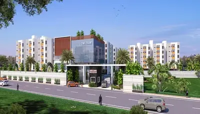
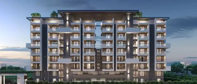
Sanjanas Water Front
SAHITI SUHARIKA ESTATES PVT.LTD · Medchal-Malkajgiri · RERA P02200001727
SANJANAS WATER FRONT is a plotted development at Kandlakoi, Medchal Mandal, Medchal-Malkajgiri District. The registered promoter is SAHITI SUHARIKA ESTATES PVT.LTD. The site area is 14931.46 sq. m.; the supplied records do not state a tower or block count, floor configuration, number of plots, or plot-size configurations. The project is registered under TG-RERA P02200001727, with proposed completion on 31/12/2020.
More from Sahiti Suharika Estates Pvt.ltd · 2 projects →
01What we found
Read from TG-RERA filings, approvals, land and registration records and court records. A court case is counted only when the court record states this project's survey number with its village, or names the project.
02Check before you pay
9 items to check before you pay, 5 high - from the title chain, court records and approvals, each with what to ask the builder or your advocate. An item may not be a problem with the project: records can be incomplete.
1. Project at a glance
Project identity
| Item | Record |
|---|---|
| Registered project name | SANJANAS WATER FRONT RERA record |
| Project type | Plotted development / open-plot layout RERA record RERA filing |
| Phase or registered portion | Phase not separately identified; the registration is for the project named above. RERA record |
| TG-RERA registration | P02200001727; Form ‘C’ records registration under section 5, valid 18/02/2020–31/12/2020. The certificate says the registration may be extended by the Authority in accordance with the Act and Rules; no extension is recorded in the supplied registration record. RERA record |
| Registered promoter / RERA certificate name | SAHITI SUHARIKA ESTATES PVT.LTD in the project record; the Form ‘C’ certificate names Mr./Ms. Tummala Sujana Reddy as promoter. RERA record RERA filing |
| RERA status in supplied record | The registration certificate establishes registration and its stated validity period. Current registration status is not established by the supplied records. |
Land and geographic identity
| Item | Record |
|---|---|
| Locality / revenue village | Kandlakoi; the approval documents also spell the village as Kandlakoya. RERA record |
| Mandal | Medchal. RERA record |
| District | Medchal-Malkajgiri. RERA record |
| PIN | 501401. RERA record |
| Project survey numbers | 175, 176, 177, 178, 179, 180, 181 and 182 in the layout approval records. The RERA land-details field itself does not disclose survey numbers. RERA filing |
| Registered site extent | 14931.46 sq. m.; the approval extraction gives both total site area and net site area as 14931.46. RERA filing |
| RERA land-area fields | Total area 14931.46 sqmts; area affected in road widening/FTL of tanks/nala widening 6267.43 sqmts; net area 8664.03 sqmts. RERA filing |
| Boundaries as filed | East: Survey No-173 and 174; West: Survey No-184; North: Survey No-4 and 5; South: 40 Feet Road. RERA filing |
Development identity
| Item | Record |
|---|---|
| Sanctioning authority / principal layout approval | Hyderabad Metropolitan Development Authority (HMDA), layout approval 000027/LO/Plg/HMDA/2019, dated 30 January 2019. Approvals record |
| Related local-body proceedings | Gundlapochampally Municipality proceedings Proc.Roc. No. G1/L0/29/2018, dated 30.01.2019, refer to the same LP number and survey numbers. Approvals record |
| Approved built-up area | Not disclosed in the supplied records; this is a plotted layout, not a building scheme in the materials reviewed. RERA filing |
| Building / tower count and floor configuration | Not disclosed in the supplied records. The layout documents concern plots and do not provide a building or apartment-floor schedule. |
| Layout land-use figures in the HMDA draft-layout extraction | Plotted area 8664.23 sq. m.; layout road area 4510.04 sq. m.; park 1377.6 sq. m.; social infrastructure 379.60 sq. m.; amenities area 0. |
| HMDA-mortgaged plots | Plot Nos. 47, 48, 53 and 54, stated extent 1356.82 Sq.m., in favour of HMDA. |
Offering and status
| Item | Record |
|---|---|
| RERA-filed offering | Plotted development; plot count, individual plot numbers for sale, plot-size range, and booked/available counts are not supplied in the reviewed RERA fields. RERA filing RERA filing |
| Completion timeline | RERA project information states proposed completion 31/12/2020. Form B declares completion within 3 years, without a start date specified in that extracted statement. RERA filing |
| Approval completion requirement | The HMDA draft-layout letter directs completion of layout development works within THREE (3) YEARS. |
| Construction / development stage | RERA amenity data records internal roads and footpaths at 80%, water supply at 10%, and sewerage at 90%. These are recorded progress figures, not independent site verification. RERA amenities |
| Occupancy / completion certificate | No occupancy or completion certificate is included in the supplied project records. The approval materials describe draft-layout approval and conditions for final layout release; the supplied documents do not establish that final layout release occurred. Document index |
2. The project story
- SANJANAS WATER FRONT is registered as a plotted development at Kandlakoi, Medchal Mandal, Medchal-Malkajgiri District. The layout approval documents cover Survey Nos. 175–182 and describe a site extent of 14931.46 Sq. m. RERA record
- The principal project offering evidenced in the RERA record is plots, rather than apartments or multi-storey buildings. The supplied RERA fields do not provide a plot inventory, plot-size range, or booked and available plot counts. RERA filing RERA filing
- HMDA’s document is identified as a Draft layout Letter. It sets conditions concerning layout infrastructure, the HMDA mortgage over four plots, and handover of roads and open spaces before final layout release. The municipal proceedings likewise refer to development and infrastructure conditions. No supplied document confirms final layout release, completed development, or an occupancy/completion certificate.
- The RERA amenity record gives selected development-progress figures—80% for internal roads and footpaths, 10% for water supply and 90% for sewerage. These are record entries; they do not independently verify present site condition or completion. RERA amenities
3. Master plan, architecture & building design
- The supplied design evidence relates to an open-plot layout. HMDA’s approval extraction records 14931.46 as total site area and net site area, with 8664.23 for plotted area, 4510.04 for layout roads, 1377.6 for park, and 379.60 sq.m for social infrastructure. It also records amenities area as 0.
- The same approval document identifies Plot Nos. 47, 48, 53 and 54 as the four plots mortgaged to HMDA, to an extent of 1356.82 Sq.m. It states that the applicant should not sell those mortgaged plots and that roads, open-space area and social-infrastructure area are to be handed over to the local body by registered gift deed before final layout release.
- No building count, footprint, floors, parking levels, apartment arrangements, or building-specific architectural drawings are established in the supplied materials. The available drawing record is described as two layout sheets; no plot sizes were software-measured in the supplied layout analysis. Layout record Floor plans
4. Homes, configurations & floor plans
This is a plotted project. The supplied RERA record does not state the number of plots for sale, plot-size bands, or booked and available plot counts; no plot-wise RERA saleable-area schedule is provided. RERA filing RERA filing
| Configuration | Units | Booked | Available | RERA saleable area | Measured carpet area | Loading (if supplied) |
|---|---|---|---|---|---|---|
| Plots | Not disclosed | Not disclosed | Not disclosed | Not disclosed | Not applicable / not supplied | Not supplied |
- The supplied drawing analysis records two layout sheets and no software-measured plot sizes. The vendor data includes a “2 BHK Apartment” configuration with a stated saleable area of 956 sq.ft, but this is not an apartment configuration established by the supplied RERA project fields and is not used here as the project’s RERA-filed offering. Floor plans Promoter website
5. Parking & vehicle circulation
- The supplied records do not establish parking counts, visitor or accessible parking, vehicle bays, or an exclusive parking allocation to any purchaser. The layout approval specifies roads of 18 mts and above and directs that all roads be opened for access to neighbouring sites. It also states that no compound wall or fencing is to be constructed around the site.
- HMDA’s four mortgaged plots—Nos. 47, 48, 53 and 54, extent 1356.82 Sq.m.—are not identified as purchaser parking; the approval describes them as plots mortgaged to the authority.
6. Amenities, recreation & open spaces
The layout approval lists proposed layout infrastructure and land uses. RERA amenity entries show recorded availability and progress percentages where supplied; those percentages are not independent verification of delivery. RERA amenities
| Facility | Description / size | Evidence source | Declared progress / verified status |
|---|---|---|---|
| Park / open space | Park 1377.6 sq. m.; the approval condition refers to open-space area 1377.60 sq.m for handover to the local body by registered gift deed before final layout release. | RERA “Green Strip/TOT LOT/Park”: 0%; completion not independently verified. RERA amenities | |
| Social infrastructure | 379.60 sq. m.; approval condition calls for handover to the local body by registered gift deed before final layout release. | No delivered status supplied. | |
| Internal roads and footpaths | Layout road area 4510.04 sq. m.; approval records road widths of 18 mts and above. | RERA progress 80%; not independently verified. RERA amenities | |
| Avenue plantation | Listed as a layout development item. | No completed status supplied. | |
| Community buildings | RERA amenity field listed; no facility description or size supplied. | RERA amenities | 0% recorded. |
| Amenities area | HMDA extraction records 0. | No amenity-area delivery status supplied. |
7. Utilities, building services & safety
The HMDA draft-layout extraction lists storm-water drains, underground drainage lines, a common septic tank/STP, internal water-supply pipelines, an overhead tank/sump, electrical supply lines, street lights, a transformer, avenue plantation, park development and rainwater-harvesting pits as layout infrastructure. The related municipal proceedings also list a common septic tank/STP, overhead tank, transformer, street lighting, underground drainage, protected water-supply system and rainwater-harvesting pits. These are document-listed provisions, not confirmation of completed or operational services.
| Evidence in the supplied record | Internal water-supply pipelines and overhead tank/sump are listed in the HMDA document; protected water supply is listed in municipal proceedings. |
|---|---|
| Status limitation | RERA records water supply at 10%. No source, storage capacity, or operational verification is supplied. RERA amenities |
| Evidence in the supplied record | Underground drainage, common septic tank/STP and storm-water drains are listed. |
|---|---|
| Status limitation | RERA records sewerage at 90% and storm-water drains at 0%. Treatment capacity and operation are not supplied or independently verified. RERA amenities |
| Evidence in the supplied record | Rainwater-harvesting pits are listed in the approval documents. |
|---|---|
| Status limitation | RERA water-conservation/rainwater-harvesting progress is 0%. RERA amenities |
| Evidence in the supplied record | Electrical supply lines, transformer and street lights are listed. |
|---|---|
| Status limitation | RERA electrical meter room/sub-station/receiving station progress is 0%; no capacity or operational status is supplied. RERA amenities |
| Evidence in the supplied record | RERA lists fire protection and fire-safety requirements. |
|---|---|
| Status limitation | Progress is recorded as 0%; no fire-system design, clearance, or completed status is supplied. RERA amenities |
| Evidence in the supplied record | Solid-waste management and disposal appears in the RERA amenity list. |
|---|---|
| Status limitation | Progress is recorded as 0%; no system details are supplied. RERA amenities |
| Evidence in the supplied record | No project-specific lift, accessible-circulation, CCTV, or access-control details are supplied. |
|---|---|
| Status limitation | Not established by the reviewed records. |
8. Location, access & connectivity
- The registered project location is Kandlakoi, Medchal Mandal, Medchal-Malkajgiri District, Telangana, PIN 501401. The location record provides a cadastral parcel centroid at 17.59371, 78.49134 and identifies the nearest sampled Outer Ring Road interchange at approximately 4.2 km. RERA record Location record
- The layout approval records a 40 Feet Road on the southern boundary and layout roads of 18 mts and above; it also requires roads to be opened for neighbouring-site access. No public-transport routes, measured distances to other landmarks, or verified travel times are supplied. RERA filing
9. Developer & development status
- The project record identifies SAHITI SUHARIKA ESTATES PVT.LTD as the registered promoter and lists the entity type as a company. The supplied promoter address is MILLENIUM HOUSE, ROAD NO.10, Kandlakoi, Kandlakoi, Medchal, Medchal-Malkajgiri, 501401. The company identifier is masked in the record as xxxxxx824K. RERA record Corporate record Parties record
- The TG-RERA certificate names Mr./Ms. Tummala Sujana Reddy as promoter. A separate Form B affidavit is by T.SUJANA REDDY, identified there as promoter and proprietor; it declares legal title, states that the land is free from encumbrances, and undertakes completion within 3 years. These are declarations recorded in that document.
- The project’s stated proposed completion date is 31/12/2020. The RERA amenity record gives progress of 80% for internal roads and footpaths, 10% for water supply and 90% for sewerage. No supplied record establishes present completion, final layout release, or an occupancy/completion certificate. RERA filing RERA amenities
10. Approvals, official records & documents
| Record | Supplied evidence |
|---|---|
| TG-RERA registration | Form ‘C’ certificate for SANJANAS WATER FRONT, registration P02200001727, dated 18/02/2020, valid through 31/12/2020. |
| Principal layout approval | HMDA draft layout letter, 000027/LO/Plg/HMDA/2019, approved 30 January 2019, for Survey Nos. 175–182, Kandlakoi. |
| Related local-body proceedings | Gundlapochampally Municipality proceedings Proc.Roc. No. G1/L0/29/2018, dated 30.01.2019, referring to the same layout number. |
| Encumbrance document filed with RERA | Project encumbrance statement, document 92077; the supplied summary records a search period of 01-01-1990 to 24-01-2019. |
| Title report | C. Manohar title opinion concerning properties at Kandlakoya and deeds identified in the report; the report is subject to production of the latest encumbrance record. |
| Promoter declaration | Form B affidavit-cum-declaration by T.SUJANA REDDY, including project, title, encumbrance, funds and completion declarations. |
| Occupancy/completion certificate or final layout release | No such certificate or final layout release is established in the supplied documents. Document index |
1. Project at a glance
Project identity
Registered project name: SANJANAS WATER FRONT
Project type: Plotted development / open-plot layout
Phase or registered portion: Phase not separately identified; the registration is for the project named above.
TG-RERA registration: P02200001727; Form ‘C’ records registration under section 5, valid 18/02/2020–31/12/2020. The certificate says the registration may be extended by the Authority in accordance with the Act and Rules; no extension is recorded in the supplied registration record.
Registered promoter / RERA certificate name: SAHITI SUHARIKA ESTATES PVT.LTD in the project record; the Form ‘C’ certificate names Mr./Ms. Tummala Sujana Reddy as promoter.
RERA status in supplied record: The registration certificate establishes registration and its stated validity period. Current registration status is not established by the supplied records.
Land and geographic identity
Locality / revenue village: Kandlakoi; the approval documents also spell the village as Kandlakoya.
Mandal: Medchal.
District: Medchal-Malkajgiri.
PIN: 501401.
Project survey numbers: 175, 176, 177, 178, 179, 180, 181 and 182 in the layout approval records. The RERA land-details field itself does not disclose survey numbers.
Registered site extent: 14931.46 sq. m.; the approval extraction gives both total site area and net site area as 14931.46.
RERA land-area fields: Total area 14931.46 sqmts; area affected in road widening/FTL of tanks/nala widening 6267.43 sqmts; net area 8664.03 sqmts.
Boundaries as filed: East: Survey No-173 and 174; West: Survey No-184; North: Survey No-4 and 5; South: 40 Feet Road.
Development identity
Sanctioning authority / principal layout approval: Hyderabad Metropolitan Development Authority (HMDA), layout approval 000027/LO/Plg/HMDA/2019, dated 30 January 2019.
Related local-body proceedings: Gundlapochampally Municipality proceedings Proc.Roc. No. G1/L0/29/2018, dated 30.01.2019, refer to the same LP number and survey numbers.
Approved built-up area: Not disclosed in the supplied records; this is a plotted layout, not a building scheme in the materials reviewed.
Building / tower count and floor configuration: Not disclosed in the supplied records. The layout documents concern plots and do not provide a building or apartment-floor schedule.
Layout land-use figures in the HMDA draft-layout extraction: Plotted area 8664.23 sq. m.; layout road area 4510.04 sq. m.; park 1377.6 sq. m.; social infrastructure 379.60 sq. m.; amenities area 0.
HMDA-mortgaged plots: Plot Nos. 47, 48, 53 and 54, stated extent 1356.82 Sq.m., in favour of HMDA.
Offering and status
RERA-filed offering: Plotted development; plot count, individual plot numbers for sale, plot-size range, and booked/available counts are not supplied in the reviewed RERA fields.
Completion timeline: RERA project information states proposed completion 31/12/2020. Form B declares completion within 3 years, without a start date specified in that extracted statement.
Approval completion requirement: The HMDA draft-layout letter directs completion of layout development works within THREE (3) YEARS.
Construction / development stage: RERA amenity data records internal roads and footpaths at 80%, water supply at 10%, and sewerage at 90%. These are recorded progress figures, not independent site verification.
Occupancy / completion certificate: No occupancy or completion certificate is included in the supplied project records. The approval materials describe draft-layout approval and conditions for final layout release; the supplied documents do not establish that final layout release occurred.
2. The project story
- SANJANAS WATER FRONT is registered as a plotted development at Kandlakoi, Medchal Mandal, Medchal-Malkajgiri District. The layout approval documents cover Survey Nos. 175–182 and describe a site extent of 14931.46 Sq. m.
- The principal project offering evidenced in the RERA record is plots, rather than apartments or multi-storey buildings. The supplied RERA fields do not provide a plot inventory, plot-size range, or booked and available plot counts.
- HMDA’s document is identified as a Draft layout Letter. It sets conditions concerning layout infrastructure, the HMDA mortgage over four plots, and handover of roads and open spaces before final layout release. The municipal proceedings likewise refer to development and infrastructure conditions. No supplied document confirms final layout release, completed development, or an occupancy/completion certificate.
- The RERA amenity record gives selected development-progress figures—80% for internal roads and footpaths, 10% for water supply and 90% for sewerage. These are record entries; they do not independently verify present site condition or completion.
3. Master plan, architecture & building design
- The supplied design evidence relates to an open-plot layout. HMDA’s approval extraction records 14931.46 as total site area and net site area, with 8664.23 for plotted area, 4510.04 for layout roads, 1377.6 for park, and 379.60 sq.m for social infrastructure. It also records amenities area as 0.
- The same approval document identifies Plot Nos. 47, 48, 53 and 54 as the four plots mortgaged to HMDA, to an extent of 1356.82 Sq.m. It states that the applicant should not sell those mortgaged plots and that roads, open-space area and social-infrastructure area are to be handed over to the local body by registered gift deed before final layout release.
- No building count, footprint, floors, parking levels, apartment arrangements, or building-specific architectural drawings are established in the supplied materials. The available drawing record is described as two layout sheets; no plot sizes were software-measured in the supplied layout analysis.
4. Homes, configurations & floor plans
This is a plotted project. The supplied RERA record does not state the number of plots for sale, plot-size bands, or booked and available plot counts; no plot-wise RERA saleable-area schedule is provided.
| Configuration | Units | Booked | Available | RERA saleable area | Measured carpet area | Loading (if supplied) |
|---|---|---|---|---|---|---|
| Plots | Not disclosed | Not disclosed | Not disclosed | Not disclosed | Not applicable / not supplied | Not supplied |
- The supplied drawing analysis records two layout sheets and no software-measured plot sizes. The vendor data includes a “2 BHK Apartment” configuration with a stated saleable area of 956 sq.ft, but this is not an apartment configuration established by the supplied RERA project fields and is not used here as the project’s RERA-filed offering.
5. Parking & vehicle circulation
- The supplied records do not establish parking counts, visitor or accessible parking, vehicle bays, or an exclusive parking allocation to any purchaser. The layout approval specifies roads of 18 mts and above and directs that all roads be opened for access to neighbouring sites. It also states that no compound wall or fencing is to be constructed around the site.
- HMDA’s four mortgaged plots—Nos. 47, 48, 53 and 54, extent 1356.82 Sq.m.—are not identified as purchaser parking; the approval describes them as plots mortgaged to the authority.
6. Amenities, recreation & open spaces
The layout approval lists proposed layout infrastructure and land uses. RERA amenity entries show recorded availability and progress percentages where supplied; those percentages are not independent verification of delivery.
| Facility | Description / size | Evidence source | Declared progress / verified status |
|---|---|---|---|
| Park / open space | Park 1377.6 sq. m.; the approval condition refers to open-space area 1377.60 sq.m for handover to the local body by registered gift deed before final layout release. | RERA “Green Strip/TOT LOT/Park”: 0%; completion not independently verified. | |
| Social infrastructure | 379.60 sq. m.; approval condition calls for handover to the local body by registered gift deed before final layout release. | No delivered status supplied. | |
| Internal roads and footpaths | Layout road area 4510.04 sq. m.; approval records road widths of 18 mts and above. | RERA progress 80%; not independently verified. | |
| Avenue plantation | Listed as a layout development item. | No completed status supplied. | |
| Community buildings | RERA amenity field listed; no facility description or size supplied. | 0% recorded. | |
| Amenities area | HMDA extraction records 0. | No amenity-area delivery status supplied. |
7. Utilities, building services & safety
The HMDA draft-layout extraction lists storm-water drains, underground drainage lines, a common septic tank/STP, internal water-supply pipelines, an overhead tank/sump, electrical supply lines, street lights, a transformer, avenue plantation, park development and rainwater-harvesting pits as layout infrastructure. The related municipal proceedings also list a common septic tank/STP, overhead tank, transformer, street lighting, underground drainage, protected water-supply system and rainwater-harvesting pits. These are document-listed provisions, not confirmation of completed or operational services.
| Evidence in the supplied record | Internal water-supply pipelines and overhead tank/sump are listed in the HMDA document; protected water supply is listed in municipal proceedings. |
|---|---|
| Status limitation | RERA records water supply at 10%. No source, storage capacity, or operational verification is supplied. |
| Evidence in the supplied record | Underground drainage, common septic tank/STP and storm-water drains are listed. |
|---|---|
| Status limitation | RERA records sewerage at 90% and storm-water drains at 0%. Treatment capacity and operation are not supplied or independently verified. |
| Evidence in the supplied record | Rainwater-harvesting pits are listed in the approval documents. |
|---|---|
| Status limitation | RERA water-conservation/rainwater-harvesting progress is 0%. |
| Evidence in the supplied record | Electrical supply lines, transformer and street lights are listed. |
|---|---|
| Status limitation | RERA electrical meter room/sub-station/receiving station progress is 0%; no capacity or operational status is supplied. |
| Evidence in the supplied record | RERA lists fire protection and fire-safety requirements. |
|---|---|
| Status limitation | Progress is recorded as 0%; no fire-system design, clearance, or completed status is supplied. |
| Evidence in the supplied record | Solid-waste management and disposal appears in the RERA amenity list. |
|---|---|
| Status limitation | Progress is recorded as 0%; no system details are supplied. |
| Evidence in the supplied record | No project-specific lift, accessible-circulation, CCTV, or access-control details are supplied. |
|---|---|
| Status limitation | Not established by the reviewed records. |
8. Location, access & connectivity
- The registered project location is Kandlakoi, Medchal Mandal, Medchal-Malkajgiri District, Telangana, PIN 501401. The location record provides a cadastral parcel centroid at 17.59371, 78.49134 and identifies the nearest sampled Outer Ring Road interchange at approximately 4.2 km.
- The layout approval records a 40 Feet Road on the southern boundary and layout roads of 18 mts and above; it also requires roads to be opened for neighbouring-site access. No public-transport routes, measured distances to other landmarks, or verified travel times are supplied.
9. Developer & development status
- The project record identifies SAHITI SUHARIKA ESTATES PVT.LTD as the registered promoter and lists the entity type as a company. The supplied promoter address is MILLENIUM HOUSE, ROAD NO.10, Kandlakoi, Kandlakoi, Medchal, Medchal-Malkajgiri, 501401. The company identifier is masked in the record as xxxxxx824K.
- The TG-RERA certificate names Mr./Ms. Tummala Sujana Reddy as promoter. A separate Form B affidavit is by T.SUJANA REDDY, identified there as promoter and proprietor; it declares legal title, states that the land is free from encumbrances, and undertakes completion within 3 years. These are declarations recorded in that document.
- The project’s stated proposed completion date is 31/12/2020. The RERA amenity record gives progress of 80% for internal roads and footpaths, 10% for water supply and 90% for sewerage. No supplied record establishes present completion, final layout release, or an occupancy/completion certificate.
10. Approvals, official records & documents
TG-RERA registration: Form ‘C’ certificate for SANJANAS WATER FRONT, registration P02200001727, dated 18/02/2020, valid through 31/12/2020.
Principal layout approval: HMDA draft layout letter, 000027/LO/Plg/HMDA/2019, approved 30 January 2019, for Survey Nos. 175–182, Kandlakoi.
Related local-body proceedings: Gundlapochampally Municipality proceedings Proc.Roc. No. G1/L0/29/2018, dated 30.01.2019, referring to the same layout number.
Encumbrance document filed with RERA: Project encumbrance statement, document 92077; the supplied summary records a search period of 01-01-1990 to 24-01-2019.
Title report: C. Manohar title opinion concerning properties at Kandlakoya and deeds identified in the report; the report is subject to production of the latest encumbrance record.
Promoter declaration: Form B affidavit-cum-declaration by T.SUJANA REDDY, including project, title, encumbrance, funds and completion declarations.
Occupancy/completion certificate or final layout release: No such certificate or final layout release is established in the supplied documents.
Frequently asked questions
Is SANJANAS WATER FRONT registered with Telangana RERA?
Yes. SANJANAS WATER FRONT is registered with the Telangana Real Estate Regulatory Authority as P02200001727; the registration status is New Project.
Who is the developer of SANJANAS WATER FRONT?
The promoter named in the RERA registration is SAHITI SUHARIKA ESTATES PVT.LTD.
Where is SANJANAS WATER FRONT located?
SANJANAS WATER FRONT is in Kandlakoi, Medchal, Medchal-Malkajgiri, Telangana (501401).
When will SANJANAS WATER FRONT be completed?
The promoter's proposed date of completion filed with RERA is 31/12/2020. This is the promoter's declaration, not a guarantee.
More projects in Kandlakoi