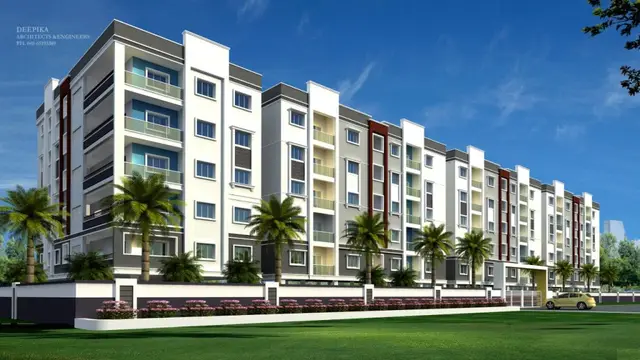
Villa Atulya
M/S PUTTY INFRA DEVELOPERS · Rangareddy · RERA P02400006353
VILLA ATULYA is a residential project in Mansanpalle Village, Maheshwaram Mandal, Ranga Reddy District, developed by registered promoter M/S Putty Infra Developers. The site area is 22555.89, with a net site area of 21613.27 Sq.m; HMDA describes a gated-community layout with housing and an apartment block, but the supplied overview does not state a total number of towers or blocks or a complete floor count. The RERA unit schedule lists 100 2BHK homes of 134.66 sq.m saleable area each and 5 4BHK homes of 414.4 sq.m saleable area each. The project is registered under TG-RERA number P02400006353, and its proposed completion date is 31-05-2028.
01What we found
Read from TG-RERA filings, approvals, land and registration records and court records. A court case is counted only when the court record states this project's survey number with its village, or names the project.
02Check before you pay
8 items to check before you pay, 4 high - from the title chain, court records and approvals, each with what to ask the builder or your advocate. An item may not be a problem with the project: records can be incomplete.
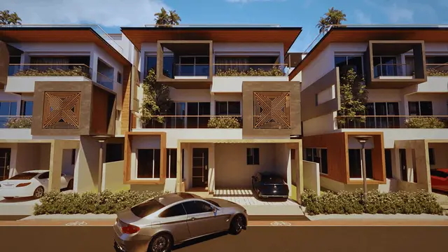
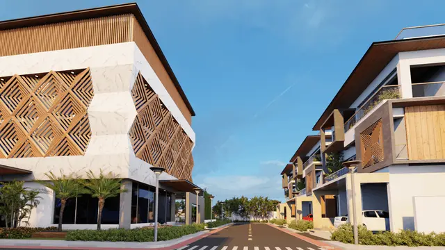
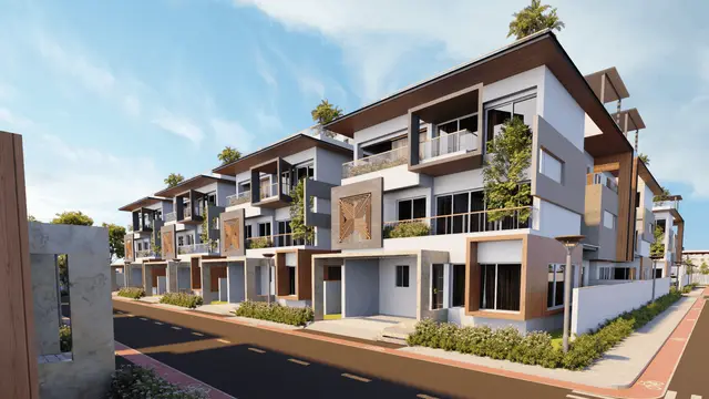
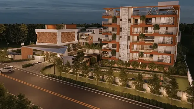
Project at a glance
Project identity
| Field | Record |
|---|---|
| Registered project name | VILLA ATULYA RERA record |
| Project type | TG-RERA classifies it as Residential; the HMDA approval describes a gated-community layout with housing and an apartment block. RERA record |
| Phase / registered portion | Phase designation is not disclosed. Registration covers the listed project lands and is recorded under one TG-RERA number. |
| TG-RERA registration | P02400006353; issued 07/07/2023, valid through 31/05/2028. The certificate states a four-year validity period and says extension would require Authority action. |
| Registered promoter | M/S Putty Infra Developers; the promoter’s entity type is recorded as a partnership. Corporate record |
| RERA status | Registered; the supplied certificate is not marked as extended. |
Land and geographic identity
| Field | Record |
|---|---|
| Locality / revenue village | Mansanpalle / Mansanpalle Village. RERA record |
| Mandal / district / PIN | Maheshwaram / Ranga Reddy / 501359. RERA record |
| Project survey numbers and subdivisions | 63/AA/1, 63/U/2, 63/AA/2, 63/E/2/1/1, 63/E/2/2, 63/E/2/1/2, 63/EE2/1/2, 63/U/1, 82/U1, 63/EE1 and 63/EE2/1/3. |
| Site area | HMDA approval records 22555.89 total site area, 942.62 master-plan road-affected area and 21613.27 Sq.m net site area. |
| RERA land-area fields | RERA land details state 21613.27 sqmts total area, 942.62 sqmts affected area and 20670.65 sqmts net area. RERA filing |
| Boundaries | East: vacant land; West: “ROAD WIDTH 12 19”; North: vacant land; South: vacant land. RERA filing |
Development identity
| Field | Record |
|---|---|
| Sanctioning authority and principal approval | Hyderabad Metropolitan Development Authority (HMDA), Layout Permit 000018/LO/Plg/HMDA/2023, approved 17 January 2023. Approvals record |
| Approved built-up area | 22838.64 sqmts is recorded in the RERA project fields. RERA filing |
| Building organization / floors | The supplied approval extract identifies an apartment block and refers to its first floor. It does not provide a complete floor schedule, total building count, tower height, parking-level configuration or floor-by-floor unit count. |
| Approved versus RERA-declared units | RERA fields state 51 total building units as per approved plan and 51 proposed building units as per agreement; the unit schedule separately lists 105 residential units. The supplied documents do not reconcile these counts. RERA filing RERA unit table |
Offering and status
| Field | Record |
|---|---|
| RERA-filed configurations | 2BHK: 100 units, saleable area 134.66 sq.m each; 4BHK: 5 units, saleable area 414.4 sq.m each. RERA unit table RERA unit details |
| Booked / available | Portal-derived counts show 0 booked and 100 available 2BHK units, and 0 booked and 5 available 4BHK units. These counts are indicative: the portal record supplied has no as-of date. RERA unit table |
| Completion date | The Form B declaration undertakes completion by 31-05-2028. |
| Registration validity versus completion | The RERA certificate is valid through 31/05/2028; the declaration’s completion undertaking is 31-05-2028. These are separate recorded dates. |
| Construction stage / OC | A declaration dated 29-05-2023 says the project had not started and no sales had been booked as of that declaration. No later construction-stage update or occupancy/completion certificate is supplied; the current physical progress and OC status are therefore not established by this evidence. |
The project story
VILLA ATULYA is registered with TG-RERA as a residential project in Mansanpalle Village, Maheshwaram Mandal. HMDA’s approval describes a gated-community layout with housing, including an apartment block; the available RERA unit schedule lists 100 2BHK and five 4BHK homes. The record supports a residential layout and apartment offering, but does not establish a complete building-by-building or phase-by-phase construction description. RERA record RERA unit table
The promoter’s Form B declaration sets a completion undertaking of 31-05-2028. A separate declaration says the project had not started and had no booked sales as of 29-05-2023; the supplied evidence does not include a later progress report or independent site verification. No occupancy or completion certificate is included in the available project documents. Document index
Master plan, architecture & building design
HMDA’s approval records a net site area of 21613.27 Sq.m after a stated master-plan road-affected area of 942.62 from the total site area of 22555.89. Its area statement records 12527.89 as plotted area, 6139.57 as layout road area and 2338.53 as park area. The approval extract separately lists 607.06 as “Open space”; the supplied extract does not clarify how that figure relates to the park entry.
The HMDA letter describes a gated-community layout with an apartment block and identifies its first floor, but the supplied material does not give a full approved floor schedule, building footprint, height, apartment-per-floor arrangement, lift/stair details, circulation plan or phase breakdown. The RERA record lists 22838.64 sqmts as approved built-up area; no FSI-counted area, gross-built-up breakdown or complete floor-plan set is supplied for this overview. RERA filing
The approval records reserved mortgage security over plots 21, 22, 23, 24, 46 and 47, and apartment-block first-floor areas; these are approval conditions, not evidence of buyer allocation. HMDA also requires development works and later release of the final layout, with conditions including road access, park/open-space handover and infrastructure works.
Homes, configurations & floor plans
RERA-filed saleable areas and unit counts are shown below. Drawing-based carpet measurements are available only for the 4BHK configuration and are software-measured from the supplied plan drawing, not RERA-filed; the measurements are flagged as needing review. RERA saleable area and carpet area are different measures: the supplied drawing analysis describes saleable area as including a home’s share of common areas. RERA unit table Floor plans
| Configuration | Units | Booked | Available | RERA saleable area | Measured carpet area | Loading (if supplied) |
|---|---|---|---|---|---|---|
| 2BHK | 100 | 0 | 100 | 134.66 sq.m | Not supplied | Not supplied |
| 4BHK | 5 | 0 | 5 | 414.4 sq.m | 293.1–307.6 sq.m; median 300.4 sq.m (software-measured) | 28% (drawing analysis) |
For the measured 4BHK plan, the supplied drawing extraction identifies living, dining, bedrooms, dress areas, toilets, foyer and entrance lobby. Some room dimensions are absent from the extraction; the available dimensions and measured areas are not a complete room schedule. The plan-analysis record covers two measured 4BHK designs and notes that four of six drawings remain unmeasured. Verify drawing-based measurements against the approved drawing. RERA unit details Floor plans
Parking & vehicle circulation
The HMDA approval requires roads to be opened for access to neighbouring sites and records layout-road areas; the available extract does not establish a complete internal driveway or pedestrian-circulation design.
No reliable sanctioned parking count, visitor or accessible parking provision, parking levels, ramps, EV charging provision or unit-specific parking allocation is supplied. The approval identifies mortgaged plot areas and apartment-block areas, but these do not establish parking rights or exclusive allocation. Document index
Amenities, recreation & open spaces
The RERA amenity register marks several infrastructure and community categories as available, but reports 0% progress for each listed item. This is a portal declaration, not independent confirmation of delivery. HMDA’s approval also lists required layout works and facilities; the supplied records do not establish their completion. RERA amenities
| Facility | Description / size | Evidence source | Declared progress / verified status |
|---|---|---|---|
| Clubhouse / indoor | |||
| Community buildings | RERA register marks “Community Buildings” available; no size or facility schedule supplied. | RERA amenities | 0% recorded; completion not independently verified. |
| Sports / recreation | |||
| Park / organized open space | HMDA area statement records 2338.53 as Park; layout analysis records the same figure as parks/open space. | Layout record | 0% progress in the RERA amenity register for aggregate recreational open space; delivery not independently verified. |
| Landscape / open space | |||
| Green strip / tot lot / park | RERA register marks this category available; no separate size or planting schedule supplied. | RERA amenities | 0% recorded; completion not independently verified. |
| Avenue plantation | Listed as an HMDA approval requirement. | Required by approval; completion not established. | |
| Convenience / community | |||
| Internal roads and footpaths | RERA register marks available. HMDA area statement records 6139.57 as layout road area and requires road access and paved footpaths. | RERA amenities | 0% recorded in the RERA register; completion not independently verified. |
| Street lighting | RERA register marks available; HMDA approval calls for street lighting with LED lighting. | RERA amenities | 0% recorded; completion not independently verified. |
| Community buildings | Also listed in the RERA register as available; the record gives no size or capacity. | RERA amenities | 0% recorded; completion not independently verified. |
Utilities, building services & safety
The HMDA approval lists proposed or required infrastructure including a common septic tank/STP, internal water-supply pipelines, overhead tank, electrical supply lines, street lights, transformer, rainwater-harvesting pits, utilities area, solid-waste disposal and dumping space, and a bio-compost unit. It also requires a mechanism for septage treatment and source segregation of garbage. These are approval-document provisions; the supplied evidence does not verify installation, capacity or operation.
The RERA amenity register marks water supply, sewerage/sewage treatment and disposal, water conservation/rainwater harvesting, energy management, fire protection, and electrical meter room/sub-station/receiving station as available, while recording 0% progress for the listed categories. No capacities, equipment schedules, fire-clearance record, backup-power specification, lift details, CCTV/access-control details or accessibility design are supplied in the project evidence. RERA amenities
Location, access & connectivity
The registered project location is Mansanpalle Village, Maheshwaram Mandal, Ranga Reddy District, Telangana, PIN 501359. The supplied location record gives a cadastral parcel centroid of 17.15478868544306, 78.40156887896597. RERA record Location record
The nearest sampled Outer Ring Road interchange is recorded at approximately 8.9 km. HMDA’s approval refers to a proposed 100 ft wide Masterplan road affecting part of the site and to layout roads, but no further measured access distances, public-transport information or travel times are established in the supplied records. Location record
Developer & development status
The registered legal promoter is M/S PUTTY INFRA DEVELOPERS, recorded as a Partnership. Its GSTIN is 36ABDFP2674F1Z7. The RERA record lists its address as GOLDEN WINGS, KONDAPUR, MANSANPALLE, MANSANPALLE, Maheshwaram, Ranga Reddy, 501359; the registration certificate separately states the promoter office as Village: A G COLONY, Mandal: Shaikpet, District: Hyderabad, Pin: 500084. Corporate record Parties record
The RERA filing lists an area-share arrangement and identifies PUTTY INFRA DEVELOPERS as the landowner/promoter entry. The Form B declaration names Mrs. Putty Rama Krishna Rao as promoter and undertakes completion by 31-05-2028. A declaration dated 29-05-2023 says the project had not started and no sales had been booked at that time; later construction progress is not established by the supplied evidence. Parties record
Approvals, official records & documents
| Record | What the supplied evidence establishes |
|---|---|
| TG-RERA registration certificate P02400006353 | Form C records VILLA ATULYA, M/S Putty Infra Developers, registration from 07/07/2023 through 31/05/2028, and standard registration conditions. |
| HMDA Layout Permit 000018/LO/Plg/HMDA/2023 | HMDA draft layout approval communication dated 17 January 2023 for a gated-community layout with housing at Mansanpalle; it includes area statements, mortgage provisions and development conditions. |
| Form B declaration | Promoter affidavit dated 27 February 2023, including a completion undertaking of 31-05-2028 and declarations concerning title, encumbrances and project obligations. |
| NALA order 2100981382 | Government of Telangana record dated 01/11/2021, described as permission for conversion to non-agricultural use; the supplied extraction states that the permission itself does not confer title or ownership. Its extracted survey-number text is OCR-corrupted and does not establish a complete parcel match in this overview. |
| Layout drawing / plan material | Drawing-derived layout information is available under document 328001; the supplied evidence does not include a complete extracted building and floor schedule. |
| Occupancy / completion certificate | No occupancy or completion certificate is included in the supplied project documents. Document index |
Project at a glance
Project identity
Registered project name: VILLA ATULYA
Project type: TG-RERA classifies it as Residential; the HMDA approval describes a gated-community layout with housing and an apartment block.
Phase / registered portion: Phase designation is not disclosed. Registration covers the listed project lands and is recorded under one TG-RERA number.
TG-RERA registration: P02400006353; issued 07/07/2023, valid through 31/05/2028. The certificate states a four-year validity period and says extension would require Authority action.
Registered promoter: M/S Putty Infra Developers; the promoter’s entity type is recorded as a partnership.
RERA status: Registered; the supplied certificate is not marked as extended.
Land and geographic identity
Locality / revenue village: Mansanpalle / Mansanpalle Village.
Mandal / district / PIN: Maheshwaram / Ranga Reddy / 501359.
Project survey numbers and subdivisions: 63/AA/1, 63/U/2, 63/AA/2, 63/E/2/1/1, 63/E/2/2, 63/E/2/1/2, 63/EE2/1/2, 63/U/1, 82/U1, 63/EE1 and 63/EE2/1/3.
Site area: HMDA approval records 22555.89 total site area, 942.62 master-plan road-affected area and 21613.27 Sq.m net site area.
RERA land-area fields: RERA land details state 21613.27 sqmts total area, 942.62 sqmts affected area and 20670.65 sqmts net area.
Boundaries: East: vacant land; West: “ROAD WIDTH 12 19”; North: vacant land; South: vacant land.
Development identity
Sanctioning authority and principal approval: Hyderabad Metropolitan Development Authority (HMDA), Layout Permit 000018/LO/Plg/HMDA/2023, approved 17 January 2023.
Approved built-up area: 22838.64 sqmts is recorded in the RERA project fields.
Building organization / floors: The supplied approval extract identifies an apartment block and refers to its first floor. It does not provide a complete floor schedule, total building count, tower height, parking-level configuration or floor-by-floor unit count.
Approved versus RERA-declared units: RERA fields state 51 total building units as per approved plan and 51 proposed building units as per agreement; the unit schedule separately lists 105 residential units. The supplied documents do not reconcile these counts.
Offering and status
RERA-filed configurations: 2BHK: 100 units, saleable area 134.66 sq.m each; 4BHK: 5 units, saleable area 414.4 sq.m each.
Booked / available: Portal-derived counts show 0 booked and 100 available 2BHK units, and 0 booked and 5 available 4BHK units. These counts are indicative: the portal record supplied has no as-of date.
Completion date: The Form B declaration undertakes completion by 31-05-2028.
Registration validity versus completion: The RERA certificate is valid through 31/05/2028; the declaration’s completion undertaking is 31-05-2028. These are separate recorded dates.
Construction stage / OC: A declaration dated 29-05-2023 says the project had not started and no sales had been booked as of that declaration. No later construction-stage update or occupancy/completion certificate is supplied; the current physical progress and OC status are therefore not established by this evidence.
The project story
VILLA ATULYA is registered with TG-RERA as a residential project in Mansanpalle Village, Maheshwaram Mandal. HMDA’s approval describes a gated-community layout with housing, including an apartment block; the available RERA unit schedule lists 100 2BHK and five 4BHK homes. The record supports a residential layout and apartment offering, but does not establish a complete building-by-building or phase-by-phase construction description.
The promoter’s Form B declaration sets a completion undertaking of 31-05-2028. A separate declaration says the project had not started and had no booked sales as of 29-05-2023; the supplied evidence does not include a later progress report or independent site verification. No occupancy or completion certificate is included in the available project documents.
Master plan, architecture & building design
HMDA’s approval records a net site area of 21613.27 Sq.m after a stated master-plan road-affected area of 942.62 from the total site area of 22555.89. Its area statement records 12527.89 as plotted area, 6139.57 as layout road area and 2338.53 as park area. The approval extract separately lists 607.06 as “Open space”; the supplied extract does not clarify how that figure relates to the park entry.
The HMDA letter describes a gated-community layout with an apartment block and identifies its first floor, but the supplied material does not give a full approved floor schedule, building footprint, height, apartment-per-floor arrangement, lift/stair details, circulation plan or phase breakdown. The RERA record lists 22838.64 sqmts as approved built-up area; no FSI-counted area, gross-built-up breakdown or complete floor-plan set is supplied for this overview.
The approval records reserved mortgage security over plots 21, 22, 23, 24, 46 and 47, and apartment-block first-floor areas; these are approval conditions, not evidence of buyer allocation. HMDA also requires development works and later release of the final layout, with conditions including road access, park/open-space handover and infrastructure works.
Homes, configurations & floor plans
RERA-filed saleable areas and unit counts are shown below. Drawing-based carpet measurements are available only for the 4BHK configuration and are software-measured from the supplied plan drawing, not RERA-filed; the measurements are flagged as needing review. RERA saleable area and carpet area are different measures: the supplied drawing analysis describes saleable area as including a home’s share of common areas.
| Configuration | Units | Booked | Available | RERA saleable area | Measured carpet area | Loading (if supplied) |
|---|---|---|---|---|---|---|
| 2BHK | 100 | 0 | 100 | 134.66 sq.m | Not supplied | Not supplied |
| 4BHK | 5 | 0 | 5 | 414.4 sq.m | 293.1–307.6 sq.m; median 300.4 sq.m (software-measured) | 28% (drawing analysis) |
For the measured 4BHK plan, the supplied drawing extraction identifies living, dining, bedrooms, dress areas, toilets, foyer and entrance lobby. Some room dimensions are absent from the extraction; the available dimensions and measured areas are not a complete room schedule. The plan-analysis record covers two measured 4BHK designs and notes that four of six drawings remain unmeasured. Verify drawing-based measurements against the approved drawing.
Parking & vehicle circulation
The HMDA approval requires roads to be opened for access to neighbouring sites and records layout-road areas; the available extract does not establish a complete internal driveway or pedestrian-circulation design.
No reliable sanctioned parking count, visitor or accessible parking provision, parking levels, ramps, EV charging provision or unit-specific parking allocation is supplied. The approval identifies mortgaged plot areas and apartment-block areas, but these do not establish parking rights or exclusive allocation.
Amenities, recreation & open spaces
The RERA amenity register marks several infrastructure and community categories as available, but reports 0% progress for each listed item. This is a portal declaration, not independent confirmation of delivery. HMDA’s approval also lists required layout works and facilities; the supplied records do not establish their completion.
| Facility | Description / size | Evidence source | Declared progress / verified status |
|---|---|---|---|
| Clubhouse / indoor | |||
| Community buildings | RERA register marks “Community Buildings” available; no size or facility schedule supplied. | 0% recorded; completion not independently verified. | |
| Sports / recreation | |||
| Park / organized open space | HMDA area statement records 2338.53 as Park; layout analysis records the same figure as parks/open space. | 0% progress in the RERA amenity register for aggregate recreational open space; delivery not independently verified. | |
| Landscape / open space | |||
| Green strip / tot lot / park | RERA register marks this category available; no separate size or planting schedule supplied. | 0% recorded; completion not independently verified. | |
| Avenue plantation | Listed as an HMDA approval requirement. | Required by approval; completion not established. | |
| Convenience / community | |||
| Internal roads and footpaths | RERA register marks available. HMDA area statement records 6139.57 as layout road area and requires road access and paved footpaths. | 0% recorded in the RERA register; completion not independently verified. | |
| Street lighting | RERA register marks available; HMDA approval calls for street lighting with LED lighting. | 0% recorded; completion not independently verified. | |
| Community buildings | Also listed in the RERA register as available; the record gives no size or capacity. | 0% recorded; completion not independently verified. |
Utilities, building services & safety
The HMDA approval lists proposed or required infrastructure including a common septic tank/STP, internal water-supply pipelines, overhead tank, electrical supply lines, street lights, transformer, rainwater-harvesting pits, utilities area, solid-waste disposal and dumping space, and a bio-compost unit. It also requires a mechanism for septage treatment and source segregation of garbage. These are approval-document provisions; the supplied evidence does not verify installation, capacity or operation.
The RERA amenity register marks water supply, sewerage/sewage treatment and disposal, water conservation/rainwater harvesting, energy management, fire protection, and electrical meter room/sub-station/receiving station as available, while recording 0% progress for the listed categories. No capacities, equipment schedules, fire-clearance record, backup-power specification, lift details, CCTV/access-control details or accessibility design are supplied in the project evidence.
Location, access & connectivity
The registered project location is Mansanpalle Village, Maheshwaram Mandal, Ranga Reddy District, Telangana, PIN 501359. The supplied location record gives a cadastral parcel centroid of 17.15478868544306, 78.40156887896597.
The nearest sampled Outer Ring Road interchange is recorded at approximately 8.9 km. HMDA’s approval refers to a proposed 100 ft wide Masterplan road affecting part of the site and to layout roads, but no further measured access distances, public-transport information or travel times are established in the supplied records.
Developer & development status
The registered legal promoter is M/S PUTTY INFRA DEVELOPERS, recorded as a Partnership. Its GSTIN is 36ABDFP2674F1Z7. The RERA record lists its address as GOLDEN WINGS, KONDAPUR, MANSANPALLE, MANSANPALLE, Maheshwaram, Ranga Reddy, 501359; the registration certificate separately states the promoter office as Village: A G COLONY, Mandal: Shaikpet, District: Hyderabad, Pin: 500084.
The RERA filing lists an area-share arrangement and identifies PUTTY INFRA DEVELOPERS as the landowner/promoter entry. The Form B declaration names Mrs. Putty Rama Krishna Rao as promoter and undertakes completion by 31-05-2028. A declaration dated 29-05-2023 says the project had not started and no sales had been booked at that time; later construction progress is not established by the supplied evidence.
Approvals, official records & documents
TG-RERA registration certificate P02400006353: Form C records VILLA ATULYA, M/S Putty Infra Developers, registration from 07/07/2023 through 31/05/2028, and standard registration conditions.
HMDA Layout Permit 000018/LO/Plg/HMDA/2023: HMDA draft layout approval communication dated 17 January 2023 for a gated-community layout with housing at Mansanpalle; it includes area statements, mortgage provisions and development conditions.
Form B declaration: Promoter affidavit dated 27 February 2023, including a completion undertaking of 31-05-2028 and declarations concerning title, encumbrances and project obligations.
NALA order 2100981382: Government of Telangana record dated 01/11/2021, described as permission for conversion to non-agricultural use; the supplied extraction states that the permission itself does not confer title or ownership. Its extracted survey-number text is OCR-corrupted and does not establish a complete parcel match in this overview.
Layout drawing / plan material: Drawing-derived layout information is available under document 328001; the supplied evidence does not include a complete extracted building and floor schedule.
Occupancy / completion certificate: No occupancy or completion certificate is included in the supplied project documents.
Frequently asked questions
Is VILLA ATULYA registered with Telangana RERA?
Yes. VILLA ATULYA is registered with the Telangana Real Estate Regulatory Authority as P02400006353; the registration status is New Project.
Who is the developer of VILLA ATULYA?
The promoter named in the RERA registration is M/S PUTTY INFRA DEVELOPERS.
Where is VILLA ATULYA located?
VILLA ATULYA is in MANSANPALLE, Maheshwaram, Rangareddy, Telangana (501359).
When will VILLA ATULYA be completed?
The promoter's proposed date of completion filed with RERA is 30/09/2028. This is the promoter's declaration, not a guarantee.
More projects in Mansanpally