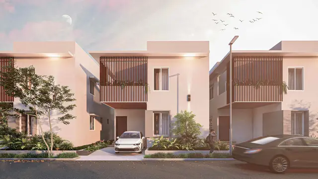
Wonder Front
NAVABHOOMI DEVELOPERS · Rangareddy · RERA P02400005646
WONDER FRONT is a plotted development at KONGARAKURDU, Maheshwaram, Ranga Reddy. It is being developed by NAVABHOOMI DEVELOPERS. The site area is 11232.75 sq.mtrs, and the final-layout record identifies 39 open plots; tower and floor counts are not disclosed. The TG-RERA registration is P02400005646, and the promoter’s completion undertaking specifies 18th day of NOVEMBER 2025.
More from Navabhoomi Developers · 2 projects →
01What we found
Read from TG-RERA filings, approvals, land and registration records and court records. A court case is counted only when the court record states this project's survey number with its village, or names the project.
02Check before you pay
10 items to check before you pay, 4 high - from the title chain, court records and approvals, each with what to ask the builder or your advocate. An item may not be a problem with the project: records can be incomplete.
1. Project at a glance
Project identity
| Item | Project record |
|---|---|
| Registered name | WONDER FRONT RERA record |
| Project type | Plotted development / open-plot residential layout RERA record |
| Registered portion / phase | The record identifies one registered project; a separate phase name or phase number is not disclosed. RERA record |
| TG-RERA registration | P02400005646, issued 06/01/2023; the certificate states validity through 22/11/2025 and does not record an extension. Registration validity is distinct from the completion deadline and from occupancy certification. RERA record |
| Registered promoter | NAVABHOOMI DEVELOPERS RERA record RERA filing |
| RERA status in supplied record | Registered project; the certificate’s stated validity ended 22/11/2025. The supplied record does not establish a current extension. |
Land and geographic identity
| Item | Project record |
|---|---|
| Locality | KONGARAKURDU RERA record RERA filing |
| Revenue village | Kongarakurdu; the approval documents identify Kongarkhurd (A) / Kongarakurdu (A). RERA record |
| Mandal / district / PIN | Maheshwaram / Ranga Reddy / 501510 RERA record |
| Project survey identity | Survey No. 420 (Old Survey No. 83); the filed registration certificate gives 420(OLD SY NO 83). RERA record |
| Site extent | Total site area 11232.75 sq.mtrs; the final-layout record states master-plan road-affected area 1012.72 sq.m and net site area 10220.11 sq.m. |
| Boundaries | East, west, north and south are each recorded as “OTHERS LAND”; adjoining owners or specific boundary features are not disclosed. RERA filing |
Development identity
| Item | Project record |
|---|---|
| Sanctioning authority | Hyderabad Metropolitan Development Authority (HMDA) Approvals record |
| Principal draft approval | Draft layout permit 000231/LO/Plg/HMDA/2022, approved 18 November 2022 Approvals record |
| Final-layout permission | 010609/FLT/HMDA/2772/SMD/2024, dated 27 December 2024 Approvals record |
| Approved land-use schedule | Final-layout record: plotted area 7108.22; road area 2023.31; organized open space/park 772.03; social infrastructure 257.16; utility area 59.64; total site 11232.75 (all areas as stated in the filed schedule). |
| Approved built-up area | 0 in the final-layout schedule; the approval is for an open-plot layout, not a building plan. |
| Buildings / floors | No project building count or floor configuration is disclosed in the supplied layout record. |
| Plot count | Final-layout record: 39 plots. |
Offering and status
| Item | Project record |
|---|---|
| Unit type | Open plots; plot-wise sizes, configuration counts and RERA-filed saleable-area range are not available in the supplied data. RERA unit table |
| Booked / available | Not disclosed in the supplied data. RERA unit table |
| Construction / development stage | The RERA amenities record reports progress for infrastructure items, but these are declared progress percentages, not independent site verification. RERA amenities |
| Completion undertaking | Form B, dated 12.12.2022, records the promoter’s undertaking to complete by 18th day of NOVEMBER 2025. |
| RERA certificate completion/validity date | 22/11/2025 is the registration-validity end date, not an occupancy-certificate date. |
| Occupancy / completion evidence | HMDA final-layout permission is dated 27 December 2024. A separate architect’s Form–1A dated 22-05-2026 certifies overall completion of the open layout and identifies HMDA record 010609/FLT/HMDA/2772/SMD/2024, dated 27-12-2024. This is layout-level evidence, not a building or apartment OC. |
2. The project story
WONDER FRONT is registered with TG-RERA as a plotted development at Kongarakurdu, in Maheshwaram Mandal, Ranga Reddy District. The registered land identity is Survey No. 420 (Old Survey No. 83). The final-layout record describes 39 open plots, with land also allocated to roads, organized open space/park, social infrastructure and utilities. RERA record
The development is a layout rather than a multi-storey residential building project: the final-layout schedule records a total built-up area of 0 and 39 plots. The approval provides for residential use of the plots; it states that plots are to be used for residential dwelling houses. The supplied materials do not give plot-wise areas, a construction schedule for individual homes, or the number of plots already sold.
The approval documents describe infrastructure including roads, open spaces, social infrastructure and utilities being handed over to the local authority. An architect’s Form–1A dated 22-05-2026 certifies completion of the open layout. Separately, the TG-RERA certificate’s stated registration validity ended 22/11/2025, and the Form B completion undertaking specifies 18 November 2025; those dates and the layout completion certificate are distinct records and do not establish the completion status of any future individual dwelling.
3. Master plan, architecture & building design
This is a plotted layout, so the relevant approved design is the land-use and road layout rather than a tower or apartment floor plan. The final-layout schedule identifies 39 plots, 7108.22 of plotted area, 2023.31 of road area, 772.03 of organized open space/park, 257.16 of social infrastructure and 59.64 of utility area. It records total site area 11232.75 and master-plan road-affected area 1012.72.
The final-layout document lists road widths of 9.14 M (30'-0"), 9M (30'-0"), 12.19 m (40'-0") for an existing road, and 30.00 M (100'-0") for a proposed road. It also requires roads to remain open for public access.
The earlier HMDA draft-layout letter describes a different land-use schedule, including plotted area 7107.67, park 767.01, social infrastructure 321.62 and layout road area 2023.64. It is identified as a draft layout letter and expressly states that it is not proof of title or approval of the proposal. The final-layout record, rather than this draft, is the approval evidence summarized above.
No building footprint, floors, apartment configuration, building-height, internal plot dimensions or plot-wise arrangement is available in the supplied extracted records. The three listed drawing sheets are scans pending measurement; no layout sheets were software-measured. Floor plans
4. Homes, configurations & floor plans
This project’s filed offering is open plots, not apartments. The supplied data does not provide a RERA plot-type count, booked or available inventory, plot-size bands, or plot-wise saleable areas. The final-layout permission records 39 plots. RERA unit table
| Configuration | Units | Booked | Available | RERA saleable area | Measured carpet area | Loading (if supplied) |
|---|---|---|---|---|---|---|
| Open plots | 39 in final-layout record | Not disclosed | Not disclosed | Not disclosed plot-wise | Not measured | Not disclosed |
The vendor material lists a “Residential Plot” at 3253 sqft as a marketing detail; it is not a RERA-filed plot-area schedule and is not used here as the project’s verified plot size. Promoter website The drawing-measurement record says the three drawings are scans pending measurement; no software-measured area or room measurements are available. Floor plans
5. Parking & vehicle circulation
No sanctioned common parking area is recorded in the final-layout schedule: it lists Common Parking Area 0.00. The supplied record does not establish visitor, accessible, resident or plot-specific parking counts, parking facilities, parking allocation terms, or a designated vehicle-entry arrangement.
The final-layout record identifies internal roads and states that roads are to remain open for public access. It also identifies road widths, including 9.14 M (30'-0"), 9M (30'-0"), 12.19 m (40'-0") existing road and 30.00 M (100'-0") proposed road. These are layout-road provisions, not evidence of parking spaces or an exclusive parking allocation to a purchaser.
6. Amenities, recreation & open spaces
The final-layout record provides for organized open space/park, social infrastructure and utility land. The separate RERA amenities record reports progress percentages for common infrastructure items; these percentages are filing data and are not independent verification of completion. RERA amenities
| Facility | Description / size | Evidence source | Declared progress / verified status |
|---|---|---|---|
| Park / organized open space | 772.03 in final-layout schedule | Final-layout record | RERA amenities record reports “Green Strip/TOT LOT/Park” at 75%; independently verified completion not stated. RERA amenities |
| Social infrastructure | 257.16 in final-layout schedule | Final-layout record | No completion percentage for the land area is supplied. |
| Internal roads and footpaths | Road area 2023.31 in final-layout schedule; road widths recorded in the approval | Final-layout record | RERA amenities record reports 95%. RERA amenities |
| Street lighting | No quantity or specification supplied | RERA amenities record RERA amenities | 70% reported; independently verified completion not stated. |
| Community buildings | No building or size specified | RERA amenities record RERA amenities | 0% reported; no community building is identified in the final-layout land-use schedule. |
| Kids’ play / tot-lot | The final-layout record lists “Tot-lot”; no separate size is stated | Final-layout record | No distinct progress figure supplied for the tot-lot. |
| Utilities area | 59.64 in final-layout schedule | Final-layout record | No separate completion percentage supplied. |
7. Utilities, building services & safety
The final-layout record lists utility-related provisions including OHT, BIOCOMPOST, GARBAGE and Septic. It also states that the layout is provided with water supply, sewerage and drainage disposal systems, street lighting, rain-water-harvesting structure and other civic amenities, which are to be maintained. No capacities, system specifications or independently verified operational status are supplied.
The HMDA draft-layout letter additionally lists STP, common septic tank, overhead tank, transformer, rain-water-harvesting pits, solid-waste disposal and dumping space, bio-compost unit and cycling tracks, and includes conditions for underground utility ducting, underground storm-water drainage, waste segregation, LED street lighting and a transformer yard. These appear in the draft-layout document’s stated provisions and conditions; they are not independently verified as completed facilities.
The RERA amenities record reports water supply 80%, sewerage 80%, storm-water drains 80%, treatment and disposal of sewage and sullage water 60%, solid-waste management and disposal 60%, water conservation/rain-water harvesting 60%, fire protection and fire-safety requirements 50%, and electrical meter room/sub-station/receiving station 50%. These are declared progress figures. The supplied data does not specify fire-system equipment, electrical capacity, backup power, water source or storage capacity, or accessibility arrangements. RERA amenities
8. Location, access & connectivity
The registered location is Kongarakurdu, Kongarakurdu (A) revenue village, Maheshwaram Mandal, Ranga Reddy District, PIN 501510. The supplied cadastral parcel centroid is 17.21083, 78.55633. RERA record Location record
The nearest sampled Outer Ring Road interchange is reported at approximately 3.3 km. Location record The final-layout record identifies a 12.19 m (40'-0") existing road, a 30.00 M (100'-0") proposed road and internal roads of 9.14 M (30'-0") and 9M (30'-0"). It requires roads to remain open for public access.
The supplied project records do not identify public-transport services or measured distances to other landmarks. No travel times are stated here.
9. Developer & development status
The registered promoter is NAVABHOOMI DEVELOPERS. The RERA filing describes its organization type as “Others” and its description as “PARTNERSHIP”; the supplied data does not identify a more specific registered legal form beyond that filing. Its GSTIN is 36AATFN8036A1Z5. RERA filing Corporate record
The RERA record lists the promoter’s address as FLAT NO 105, ZINETH CASTLE,DAIRY FARM, KONGARKHURD, KONGARAKURDU, Maheshwaram, Ranga Reddy, 501510. Parties record The Form B affidavit dated 12.12.2022 was made by Mohammed Rayees as authorized signatory and records the promoter’s undertaking to complete the project by 18th day of NOVEMBER 2025. This is a promoter declaration.
The project has final-layout permission dated 27 December 2024 for 39 plots and an architect’s Form–1A dated 22-05-2026 certifying completion of the open layout. The supplied materials do not give plot-wise sales, construction progress for individual dwellings, or a current registration extension.
10. Approvals, official records & documents
| Identifier / date | P02400005646, issued 06/01/2023; valid through 22/11/2025 as stated in the certificate |
|---|---|
| What the supplied record establishes | Form C registration for WONDER FRONT, with the stated validity period and registration conditions. |
| Identifier / date | 000231/LO/Plg/HMDA/2022, approved 18 November 2022 |
|---|---|
| What the supplied record establishes | Draft layout letter for the proposed open-plot layout; the document states it is not proof of land title or approval of the proposal. |
| Identifier / date | 010609/FLT/HMDA/2772/SMD/2024, dated 27 December 2024 |
|---|---|
| What the supplied record establishes | Final residential layout permission for 39 open plots in Survey No. 420 (Old Survey No. 83), Kongarkhurd (A), Maheshwaram Mandal, Ranga Reddy District. |
| Identifier / date | Included in final-layout record dated 27 December 2024 |
|---|---|
| What the supplied record establishes | Records land-use schedule, roads, open space, social infrastructure and utilities, and conditions for residential use and public access. |
| Identifier / date | Form–1A dated 22-05-2026 |
|---|---|
| What the supplied record establishes | Architect certifies completion of the open layout and identifies HMDA record 010609/FLT/HMDA/2772/SMD/2024, dated 27-12-2024. |
| Identifier / date | Dated 12.12.2022 |
|---|---|
| What the supplied record establishes | Records the promoter’s stated completion undertaking, fund-deposit and audit commitments, and declaration concerning title and encumbrances. |
1. Project at a glance
Project identity
Registered name: WONDER FRONT
Project type: Plotted development / open-plot residential layout
Registered portion / phase: The record identifies one registered project; a separate phase name or phase number is not disclosed.
TG-RERA registration: P02400005646, issued 06/01/2023; the certificate states validity through 22/11/2025 and does not record an extension. Registration validity is distinct from the completion deadline and from occupancy certification.
Registered promoter: NAVABHOOMI DEVELOPERS
RERA status in supplied record: Registered project; the certificate’s stated validity ended 22/11/2025. The supplied record does not establish a current extension.
Land and geographic identity
Locality: KONGARAKURDU
Revenue village: Kongarakurdu; the approval documents identify Kongarkhurd (A) / Kongarakurdu (A).
Mandal / district / PIN: Maheshwaram / Ranga Reddy / 501510
Project survey identity: Survey No. 420 (Old Survey No. 83); the filed registration certificate gives 420(OLD SY NO 83).
Site extent: Total site area 11232.75 sq.mtrs; the final-layout record states master-plan road-affected area 1012.72 sq.m and net site area 10220.11 sq.m.
Boundaries: East, west, north and south are each recorded as “OTHERS LAND”; adjoining owners or specific boundary features are not disclosed.
Development identity
Sanctioning authority: Hyderabad Metropolitan Development Authority (HMDA)
Principal draft approval: Draft layout permit 000231/LO/Plg/HMDA/2022, approved 18 November 2022
Final-layout permission: 010609/FLT/HMDA/2772/SMD/2024, dated 27 December 2024
Approved land-use schedule: Final-layout record: plotted area 7108.22; road area 2023.31; organized open space/park 772.03; social infrastructure 257.16; utility area 59.64; total site 11232.75 (all areas as stated in the filed schedule).
Approved built-up area: 0 in the final-layout schedule; the approval is for an open-plot layout, not a building plan.
Buildings / floors: No project building count or floor configuration is disclosed in the supplied layout record.
Plot count: Final-layout record: 39 plots.
Offering and status
Unit type: Open plots; plot-wise sizes, configuration counts and RERA-filed saleable-area range are not available in the supplied data.
Booked / available: Not disclosed in the supplied data.
Construction / development stage: The RERA amenities record reports progress for infrastructure items, but these are declared progress percentages, not independent site verification.
Completion undertaking: Form B, dated 12.12.2022, records the promoter’s undertaking to complete by 18th day of NOVEMBER 2025.
RERA certificate completion/validity date: 22/11/2025 is the registration-validity end date, not an occupancy-certificate date.
Occupancy / completion evidence: HMDA final-layout permission is dated 27 December 2024. A separate architect’s Form–1A dated 22-05-2026 certifies overall completion of the open layout and identifies HMDA record 010609/FLT/HMDA/2772/SMD/2024, dated 27-12-2024. This is layout-level evidence, not a building or apartment OC.
2. The project story
WONDER FRONT is registered with TG-RERA as a plotted development at Kongarakurdu, in Maheshwaram Mandal, Ranga Reddy District. The registered land identity is Survey No. 420 (Old Survey No. 83). The final-layout record describes 39 open plots, with land also allocated to roads, organized open space/park, social infrastructure and utilities.
The development is a layout rather than a multi-storey residential building project: the final-layout schedule records a total built-up area of 0 and 39 plots. The approval provides for residential use of the plots; it states that plots are to be used for residential dwelling houses. The supplied materials do not give plot-wise areas, a construction schedule for individual homes, or the number of plots already sold.
The approval documents describe infrastructure including roads, open spaces, social infrastructure and utilities being handed over to the local authority. An architect’s Form–1A dated 22-05-2026 certifies completion of the open layout. Separately, the TG-RERA certificate’s stated registration validity ended 22/11/2025, and the Form B completion undertaking specifies 18 November 2025; those dates and the layout completion certificate are distinct records and do not establish the completion status of any future individual dwelling.
3. Master plan, architecture & building design
This is a plotted layout, so the relevant approved design is the land-use and road layout rather than a tower or apartment floor plan. The final-layout schedule identifies 39 plots, 7108.22 of plotted area, 2023.31 of road area, 772.03 of organized open space/park, 257.16 of social infrastructure and 59.64 of utility area. It records total site area 11232.75 and master-plan road-affected area 1012.72.
The final-layout document lists road widths of 9.14 M (30'-0"), 9M (30'-0"), 12.19 m (40'-0") for an existing road, and 30.00 M (100'-0") for a proposed road. It also requires roads to remain open for public access.
The earlier HMDA draft-layout letter describes a different land-use schedule, including plotted area 7107.67, park 767.01, social infrastructure 321.62 and layout road area 2023.64. It is identified as a draft layout letter and expressly states that it is not proof of title or approval of the proposal. The final-layout record, rather than this draft, is the approval evidence summarized above.
No building footprint, floors, apartment configuration, building-height, internal plot dimensions or plot-wise arrangement is available in the supplied extracted records. The three listed drawing sheets are scans pending measurement; no layout sheets were software-measured.
4. Homes, configurations & floor plans
This project’s filed offering is open plots, not apartments. The supplied data does not provide a RERA plot-type count, booked or available inventory, plot-size bands, or plot-wise saleable areas. The final-layout permission records 39 plots.
| Configuration | Units | Booked | Available | RERA saleable area | Measured carpet area | Loading (if supplied) |
|---|---|---|---|---|---|---|
| Open plots | 39 in final-layout record | Not disclosed | Not disclosed | Not disclosed plot-wise | Not measured | Not disclosed |
The vendor material lists a “Residential Plot” at 3253 sqft as a marketing detail; it is not a RERA-filed plot-area schedule and is not used here as the project’s verified plot size. The drawing-measurement record says the three drawings are scans pending measurement; no software-measured area or room measurements are available.
5. Parking & vehicle circulation
No sanctioned common parking area is recorded in the final-layout schedule: it lists Common Parking Area 0.00. The supplied record does not establish visitor, accessible, resident or plot-specific parking counts, parking facilities, parking allocation terms, or a designated vehicle-entry arrangement.
The final-layout record identifies internal roads and states that roads are to remain open for public access. It also identifies road widths, including 9.14 M (30'-0"), 9M (30'-0"), 12.19 m (40'-0") existing road and 30.00 M (100'-0") proposed road. These are layout-road provisions, not evidence of parking spaces or an exclusive parking allocation to a purchaser.
6. Amenities, recreation & open spaces
The final-layout record provides for organized open space/park, social infrastructure and utility land. The separate RERA amenities record reports progress percentages for common infrastructure items; these percentages are filing data and are not independent verification of completion.
| Facility | Description / size | Evidence source | Declared progress / verified status |
|---|---|---|---|
| Park / organized open space | 772.03 in final-layout schedule | Final-layout record | RERA amenities record reports “Green Strip/TOT LOT/Park” at 75%; independently verified completion not stated. |
| Social infrastructure | 257.16 in final-layout schedule | Final-layout record | No completion percentage for the land area is supplied. |
| Internal roads and footpaths | Road area 2023.31 in final-layout schedule; road widths recorded in the approval | Final-layout record | RERA amenities record reports 95%. |
| Street lighting | No quantity or specification supplied | RERA amenities record | 70% reported; independently verified completion not stated. |
| Community buildings | No building or size specified | RERA amenities record | 0% reported; no community building is identified in the final-layout land-use schedule. |
| Kids’ play / tot-lot | The final-layout record lists “Tot-lot”; no separate size is stated | Final-layout record | No distinct progress figure supplied for the tot-lot. |
| Utilities area | 59.64 in final-layout schedule | Final-layout record | No separate completion percentage supplied. |
7. Utilities, building services & safety
The final-layout record lists utility-related provisions including OHT, BIOCOMPOST, GARBAGE and Septic. It also states that the layout is provided with water supply, sewerage and drainage disposal systems, street lighting, rain-water-harvesting structure and other civic amenities, which are to be maintained. No capacities, system specifications or independently verified operational status are supplied.
The HMDA draft-layout letter additionally lists STP, common septic tank, overhead tank, transformer, rain-water-harvesting pits, solid-waste disposal and dumping space, bio-compost unit and cycling tracks, and includes conditions for underground utility ducting, underground storm-water drainage, waste segregation, LED street lighting and a transformer yard. These appear in the draft-layout document’s stated provisions and conditions; they are not independently verified as completed facilities.
The RERA amenities record reports water supply 80%, sewerage 80%, storm-water drains 80%, treatment and disposal of sewage and sullage water 60%, solid-waste management and disposal 60%, water conservation/rain-water harvesting 60%, fire protection and fire-safety requirements 50%, and electrical meter room/sub-station/receiving station 50%. These are declared progress figures. The supplied data does not specify fire-system equipment, electrical capacity, backup power, water source or storage capacity, or accessibility arrangements.
8. Location, access & connectivity
The registered location is Kongarakurdu, Kongarakurdu (A) revenue village, Maheshwaram Mandal, Ranga Reddy District, PIN 501510. The supplied cadastral parcel centroid is 17.21083, 78.55633.
The nearest sampled Outer Ring Road interchange is reported at approximately 3.3 km. The final-layout record identifies a 12.19 m (40'-0") existing road, a 30.00 M (100'-0") proposed road and internal roads of 9.14 M (30'-0") and 9M (30'-0"). It requires roads to remain open for public access.
The supplied project records do not identify public-transport services or measured distances to other landmarks. No travel times are stated here.
9. Developer & development status
The registered promoter is NAVABHOOMI DEVELOPERS. The RERA filing describes its organization type as “Others” and its description as “PARTNERSHIP”; the supplied data does not identify a more specific registered legal form beyond that filing. Its GSTIN is 36AATFN8036A1Z5.
The RERA record lists the promoter’s address as FLAT NO 105, ZINETH CASTLE,DAIRY FARM, KONGARKHURD, KONGARAKURDU, Maheshwaram, Ranga Reddy, 501510. The Form B affidavit dated 12.12.2022 was made by Mohammed Rayees as authorized signatory and records the promoter’s undertaking to complete the project by 18th day of NOVEMBER 2025. This is a promoter declaration.
The project has final-layout permission dated 27 December 2024 for 39 plots and an architect’s Form–1A dated 22-05-2026 certifying completion of the open layout. The supplied materials do not give plot-wise sales, construction progress for individual dwellings, or a current registration extension.
10. Approvals, official records & documents
| Identifier / date | P02400005646, issued 06/01/2023; valid through 22/11/2025 as stated in the certificate |
|---|---|
| What the supplied record establishes | Form C registration for WONDER FRONT, with the stated validity period and registration conditions. |
| Identifier / date | 000231/LO/Plg/HMDA/2022, approved 18 November 2022 |
|---|---|
| What the supplied record establishes | Draft layout letter for the proposed open-plot layout; the document states it is not proof of land title or approval of the proposal. |
| Identifier / date | 010609/FLT/HMDA/2772/SMD/2024, dated 27 December 2024 |
|---|---|
| What the supplied record establishes | Final residential layout permission for 39 open plots in Survey No. 420 (Old Survey No. 83), Kongarkhurd (A), Maheshwaram Mandal, Ranga Reddy District. |
| Identifier / date | Included in final-layout record dated 27 December 2024 |
|---|---|
| What the supplied record establishes | Records land-use schedule, roads, open space, social infrastructure and utilities, and conditions for residential use and public access. |
| Identifier / date | Form–1A dated 22-05-2026 |
|---|---|
| What the supplied record establishes | Architect certifies completion of the open layout and identifies HMDA record 010609/FLT/HMDA/2772/SMD/2024, dated 27-12-2024. |
| Identifier / date | Dated 12.12.2022 |
|---|---|
| What the supplied record establishes | Records the promoter’s stated completion undertaking, fund-deposit and audit commitments, and declaration concerning title and encumbrances. |
Frequently asked questions
Is WONDER FRONT registered with Telangana RERA?
Yes. WONDER FRONT is registered with the Telangana Real Estate Regulatory Authority as P02400005646; the registration status is New Project.
Who is the developer of WONDER FRONT?
The promoter named in the RERA registration is NAVABHOOMI DEVELOPERS.
Where is WONDER FRONT located?
WONDER FRONT is in KONGARAKURDU, Maheshwaram, Rangareddy, Telangana (501510).
When will WONDER FRONT be completed?
The promoter's proposed date of completion filed with RERA is 22/11/2025. This is the promoter's declaration, not a guarantee.
More projects in Kongarakurdu