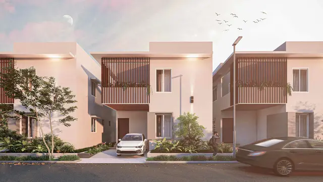
Wonder Greens
DRISHTI HOMES · Rangareddy · RERA P02400007489
WONDER GREENS is a residential plotted development in Kongarkhurd, Maheshwaram Mandal, Ranga Reddy District, developed by registered promoter DRISHTI HOMES. The RERA land details record a total area of 48450.59 sqmts and a net area of 23787.33 sqmts; the final-layout record lists 175 residential plots, with no towers, blocks, floors or plot-size configurations disclosed. The project is registered under TG-RERA number P02400007489, with a proposed completion date of 26/09/2026.
More from Drishti Homes · 2 projects →
01What we found
Read from TG-RERA filings, approvals, land and registration records and court records. A court case is counted only when the court record states this project's survey number with its village, or names the project.
02Check before you pay
7 items to check before you pay, 4 high - from the title chain, court records and approvals, each with what to ask the builder or your advocate. An item may not be a problem with the project: records can be incomplete.
Project at a glance
Project identity
| Item | Project record |
|---|---|
| Registered project name | WONDER GREENS RERA record |
| Project type | Plotted development / open-plot layout RERA record |
| Phase or registered portion | Phase not separately identified; registration is for the project associated with the survey parcels below RERA record |
| TG-RERA registration | P02400007489 |
| Registration validity | 26/09/2023 to 26/09/2026; the certificate states a three-year period unless extended by the Authority |
| Registered promoter | DRISHTI HOMES RERA record |
| RERA status | The project record describes it as “On-Going Project.” Registration validity is separate from completion and occupancy status. RERA record RERA filing |
Land and geographic identity
| Item | Project record |
|---|---|
| Locality | Kongarkhurd / Kongarkhurd (A) RERA record |
| Revenue village | Kongarakurdu; approval documents identify Kongarkhurd (A) Village RERA record |
| Mandal | Maheshwaram RERA record |
| District | Ranga Reddy RERA record |
| PIN | 501510 RERA record |
| Project survey numbers and subdivisions | 536/PART (OLD 356/PART) and 537/PART (357/PART) RERA record |
| Site extent recorded in RERA land details | Total area 48450.59 sqmts; net area 23787.33 sqmts; road widening/FTL/Nala-affected area 380.78 sqmts RERA filing |
| Approval-area figures | Draft-layout record: total site area 24168.11, road-affected area 380.78, net site area 23787.33. Final-layout record: total site area 48450.59 Sq.mtrs. and total net layout 47819.43 |
| Boundaries in RERA land details | East: PART OF OWNERS LAND; West: PART OF OWNERS LAND; North: OTHERS LAND; South: ROAD RERA filing |
Development identity
| Item | Project record |
|---|---|
| Principal sanctioning authority | Hyderabad Metropolitan Development Authority (HMDA) Approvals record |
| Principal layout approval | 000187/LO/Plg/HMDA/2023, dated 26 September, 2023; draft layout approval |
| Final layout record | TG-bPASS Final Layout Letter, permit 001596/FLT/HMDA/0449/SMD/2025, dated 26 March, 2025 |
| Approved built-up area | Not established as a building-area figure in the supplied project record. The final-layout record lists Total Built up Area 730.58 under its utility-area details; this is not presented as residential building area. RERA filing |
| Plot count | Final-layout record: 175 plots. The RERA-drawing-based software record counts plots numbered 1 to 87; it is not a complete or independently verified plot inventory. Layout record |
| Buildings, floors and parking levels | Not applicable to the registered plotted-layout description, or not disclosed in the supplied project record. RERA record |
Offering and status
| Item | Project record |
|---|---|
| Unit type | Residential plots; the final-layout condition says plots are for residential dwelling-house use |
| Plot sizes / RERA saleable-area range | Not disclosed in the supplied RERA unit data. The layout drawing has incomplete plot-size extraction. RERA unit table Layout record |
| Booked and available counts | Not disclosed in the supplied project data. RERA unit table |
| Construction stage | RERA records a 70% completeness figure; this is a filed/project-record value, not an independent site inspection. RERA record |
| Completion dates | Original and revised proposed completion dates: 26/09/2026 RERA filing |
| Occupancy / completion status | A Form–1A architect’s certificate records HMDA occupancy certificate number 001596/FLT/HMDA/0449/SMD/2025, dated 26-03-2025, and certifies the open layout complete. This is an open-layout certificate, not a building- or individual-plot-home occupancy certificate. |
The project story
- WONDER GREENS is registered as a residential open-plot layout on land in revenue village Kongarakurdu (also described in approvals as Kongarkhurd (A)), Maheshwaram Mandal, Ranga Reddy District. The registered survey identity is 536/PART (OLD 356/PART) and 537/PART (357/PART). RERA record
- The project record includes a draft HMDA layout approval dated 26 September 2023 and a later final-layout letter dated 26 March 2025. The final-layout document describes 175 plots and residential dwelling-house use. It records roads, organized open space/park, social infrastructure and utility land, and notes that roads, open spaces, social infrastructure and utilities were taken over by the local authority; it also records relinquishment deeds relating to mortgaged plots.
- The RERA project record gives a 70% completeness figure and a proposed completion date of 26/09/2026. The available Form–1A certificate, dated 26-03-2025, certifies completion of the open layout. These are different status records: the certificate concerns the layout, while the RERA completion figure and deadline are project registration fields. No supplied record establishes construction or occupancy certification for homes on the plots. RERA record RERA filing
Master plan, architecture & building design
- This is a plotted layout, not a multi-storey residential building project in the supplied approval records. The final-layout letter records 175 plots, residential use, layout roads, organized open space/park, social infrastructure and utility area. It also specifies that roads are to remain open for public access and that plots are for residential dwelling-house construction.
- The final-layout area statement records: plotted area 28286.59; road area 13985.86; organized open space/park area 3616.43; social infrastructure area 1199.97; utility area 730.58; amenity area 0.00; and total net layout 47819.43. The same document lists master-plan road-affected area 630.84 and net site area 47727.63 in its sanctioned parameters.
- For context, the earlier draft-layout records an area statement of total site area 24168.11, road-affected area 380.78, net site area 23787.33, plotted area 14119.11, open space 2206.96, and internal roads 6865.11. These are figures stated in the draft-layout document; this overview does not reconcile the different approval-stage area statements.
- The layout drawing’s software extraction identifies plots numbered 1–87 and reports plot-size extraction as incomplete. Treat that count and drawing-derived readings as software-measured, not as the complete RERA-filed plot inventory. Layout record
Homes, configurations & floor plans
- The registered offering is residential plots, rather than apartments. The supplied RERA unit data does not disclose plot-wise booked or available counts, plot-size bands, or RERA saleable area. RERA record RERA unit table
| Configuration | Units | Booked | Available | RERA saleable area | Measured carpet area | Loading (if supplied) |
|---|---|---|---|---|---|---|
| Residential plots | Not disclosed | Not disclosed | Not disclosed | Not disclosed | Not applicable | Not supplied |
- The layout drawing’s software extraction reports plots numbered 1 to 87, but plot-size extraction is incomplete and this drawing-derived count is not a substitute for the final-layout record’s plot schedule. No apartment floor plans or software-measured home areas are supplied. Layout record Floor plans
Parking & vehicle circulation
- No project-wide parking count, visitor or accessible parking provision, parking allocation arrangement, or vehicle-bay schedule is established in the supplied project data. The approved-layout documents describe internal roads and road access, but do not provide a buyer-specific parking entitlement.
- The final-layout letter requires roads to remain open for free access to the public and interior lands, and does not permit a compound wall. The draft-layout record also specifies roads of 18 mts and above and requires access to neighbouring sites.
Amenities, recreation & open spaces
| Description / size | 3616.43 in the final-layout area statement |
|---|---|
| Evidence source | Final-layout record |
| Declared progress / verified status | Record says open spaces were taken over by the local authority; no independent site-condition verification supplied. |
| Description / size | 1199.97 in the final-layout area statement |
|---|---|
| Evidence source | Final-layout record |
| Declared progress / verified status | Record says social infrastructure was taken over by the local authority; no independent site-condition verification supplied. |
| Description / size | 730.58 |
|---|---|
| Evidence source | Final-layout record |
| Declared progress / verified status | Listed in the sanctioned area statement; current delivered condition not independently verified. |
| Description / size | Listed as a layout feature |
|---|---|
| Evidence source | Final-layout record |
| Declared progress / verified status | No size, capacity or completion verification supplied. |
| Description / size | Listed in the draft and final layout records |
|---|---|
| Evidence source | Approval records |
| Declared progress / verified status | No size or completion verification supplied. |
| Description / size | Listed in the draft-layout record; final-layout conditions refer to plantation and greenery along roads and open spaces |
|---|---|
| Evidence source | Approval records |
| Declared progress / verified status | No independent completion verification supplied. |
- The earlier draft-layout area statement records open space 2206.96 and social infrastructure/utility area 596.16. The final-layout statement is set out above as its own approval record; no comparison of approval-stage figures is made here.
Utilities, building services & safety
- The approval documents list layout infrastructure including water-supply pipelines, an overhead tank, underground drainage, a common septic tank/STP, storm-water drains, electrical supply lines, street lighting, a transformer and rainwater-harvesting pits. The final-layout letter also lists water supply, sewerage and drainage disposal systems, street lighting and rainwater-harvesting structures. These are approval-record descriptions; the supplied material does not independently verify current operation, capacity or completion.
- The final-layout record lists a utility area of 730.58 and utility features including a septic tank, garbage, B.Compost, sump and transformer. It also requires a minimum safety distance of 3m (10’0”) between buildings and high-tension electricity lines when residential building permissions are considered. This is a layout condition, not evidence that a particular future house has been approved or built.
- No building-specific fire systems, lifts, backup power, CCTV, access-control systems, accessibility facilities or service capacities are established in the supplied RERA and approval documents. Document index
Location, access & connectivity
- The registered location is Kongarkhurd, Maheshwaram Mandal, Ranga Reddy District, Telangana, PIN 501510; approval records identify the revenue village as Kongarkhurd (A). The project land is recorded in survey subdivisions 536/PART (OLD 356/PART) and 537/PART (357/PART). RERA record
- The layout records require internal roads to remain open and provide access to neighbouring sites and interior lands. The supplied location data gives the nearest sampled Outer Ring Road interchange as approximately 3.3 km. No project-specific public-transport routes, measured distances to other landmarks, or travel times are supplied. Location record
Developer & development status
- The registered promoter is DRISHTI HOMES, identified in the project record as an “Others” organization and described there as a partnership. Its GSTIN is 36AAVFD2991C1Z5. The supplied promoter address is ZEBA BAGH, ASIF NAGAR ROAD, Kongarkhurd(a), Kongarkhurd, Maheshwaram, Ranga Reddy, 501510. RERA record RERA filing Corporate record RERA filing
- See The project story above for the RERA completion-date and completeness disclosures and the Form–1A open-layout certification. RERA filing RERA record
Approvals, official records & documents
| Record | Reference and scope |
|---|---|
| TG-RERA registration certificate | Form C; P02400007489; validity 26/09/2023–26/09/2026; project name WONDER GREENS and promoter Drishti Homes. |
| HMDA draft-layout approval | 000187/LO/Plg/HMDA/2023, dated 26 September, 2023; draft open-plot layout for the registered survey subdivisions. |
| Thukkuguda Municipality order | Proc.No.G1/1950/TGM/RR/2023; release of draft open plotted layout following HMDA draft approval. |
| Final-layout letter | TG-bPASS Final Layout Letter, permit 001596/FLT/HMDA/0449/SMD/2025, dated 26 March, 2025; final residential open-plot layout record. |
| Architect’s completion certificate | Form–1A dated 26-03-2025; records HMDA occupancy certificate number 001596/FLT/HMDA/0449/SMD/2025 and certifies completion of the open layout. |
| Promoter’s Form B declaration | Signed by authorized signatory Shaik Hamed Ullah for M/s. Drishti Homes, dated 23.10.2023; declares a completion date of 26th day of September, 2026 and includes promoter undertakings. |
| Layout and land-use drawing | Approved-layout drawing record, document 369953; software-derived plot count and area readings are incomplete and require drawing-level verification. |
| HMDA master-plan zoning | Master Plan 2031 Maheshwaram sheet is available as an image; the supplied record does not determine the exact zone at the project survey parcels. HMDA |
Project at a glance
Project identity
Registered project name: WONDER GREENS
Project type: Plotted development / open-plot layout
Phase or registered portion: Phase not separately identified; registration is for the project associated with the survey parcels below
TG-RERA registration: P02400007489
Registration validity: 26/09/2023 to 26/09/2026; the certificate states a three-year period unless extended by the Authority
Registered promoter: DRISHTI HOMES
RERA status: The project record describes it as “On-Going Project.” Registration validity is separate from completion and occupancy status.
Land and geographic identity
Locality: Kongarkhurd / Kongarkhurd (A)
Revenue village: Kongarakurdu; approval documents identify Kongarkhurd (A) Village
Mandal: Maheshwaram
District: Ranga Reddy
PIN: 501510
Project survey numbers and subdivisions: 536/PART (OLD 356/PART) and 537/PART (357/PART)
Site extent recorded in RERA land details: Total area 48450.59 sqmts; net area 23787.33 sqmts; road widening/FTL/Nala-affected area 380.78 sqmts
Approval-area figures: Draft-layout record: total site area 24168.11, road-affected area 380.78, net site area 23787.33. Final-layout record: total site area 48450.59 Sq.mtrs. and total net layout 47819.43
Boundaries in RERA land details: East: PART OF OWNERS LAND; West: PART OF OWNERS LAND; North: OTHERS LAND; South: ROAD
Development identity
Principal sanctioning authority: Hyderabad Metropolitan Development Authority (HMDA)
Principal layout approval: 000187/LO/Plg/HMDA/2023, dated 26 September, 2023; draft layout approval
Final layout record: TG-bPASS Final Layout Letter, permit 001596/FLT/HMDA/0449/SMD/2025, dated 26 March, 2025
Approved built-up area: Not established as a building-area figure in the supplied project record. The final-layout record lists Total Built up Area 730.58 under its utility-area details; this is not presented as residential building area.
Plot count: Final-layout record: 175 plots. The RERA-drawing-based software record counts plots numbered 1 to 87; it is not a complete or independently verified plot inventory.
Buildings, floors and parking levels: Not applicable to the registered plotted-layout description, or not disclosed in the supplied project record.
Offering and status
Unit type: Residential plots; the final-layout condition says plots are for residential dwelling-house use
Plot sizes / RERA saleable-area range: Not disclosed in the supplied RERA unit data. The layout drawing has incomplete plot-size extraction.
Booked and available counts: Not disclosed in the supplied project data.
Construction stage: RERA records a 70% completeness figure; this is a filed/project-record value, not an independent site inspection.
Completion dates: Original and revised proposed completion dates: 26/09/2026
Occupancy / completion status: A Form–1A architect’s certificate records HMDA occupancy certificate number 001596/FLT/HMDA/0449/SMD/2025, dated 26-03-2025, and certifies the open layout complete. This is an open-layout certificate, not a building- or individual-plot-home occupancy certificate.
The project story
- WONDER GREENS is registered as a residential open-plot layout on land in revenue village Kongarakurdu (also described in approvals as Kongarkhurd (A)), Maheshwaram Mandal, Ranga Reddy District. The registered survey identity is 536/PART (OLD 356/PART) and 537/PART (357/PART).
- The project record includes a draft HMDA layout approval dated 26 September 2023 and a later final-layout letter dated 26 March 2025. The final-layout document describes 175 plots and residential dwelling-house use. It records roads, organized open space/park, social infrastructure and utility land, and notes that roads, open spaces, social infrastructure and utilities were taken over by the local authority; it also records relinquishment deeds relating to mortgaged plots.
- The RERA project record gives a 70% completeness figure and a proposed completion date of 26/09/2026. The available Form–1A certificate, dated 26-03-2025, certifies completion of the open layout. These are different status records: the certificate concerns the layout, while the RERA completion figure and deadline are project registration fields. No supplied record establishes construction or occupancy certification for homes on the plots.
Master plan, architecture & building design
- This is a plotted layout, not a multi-storey residential building project in the supplied approval records. The final-layout letter records 175 plots, residential use, layout roads, organized open space/park, social infrastructure and utility area. It also specifies that roads are to remain open for public access and that plots are for residential dwelling-house construction.
- The final-layout area statement records: plotted area 28286.59; road area 13985.86; organized open space/park area 3616.43; social infrastructure area 1199.97; utility area 730.58; amenity area 0.00; and total net layout 47819.43. The same document lists master-plan road-affected area 630.84 and net site area 47727.63 in its sanctioned parameters.
- For context, the earlier draft-layout records an area statement of total site area 24168.11, road-affected area 380.78, net site area 23787.33, plotted area 14119.11, open space 2206.96, and internal roads 6865.11. These are figures stated in the draft-layout document; this overview does not reconcile the different approval-stage area statements.
- The layout drawing’s software extraction identifies plots numbered 1–87 and reports plot-size extraction as incomplete. Treat that count and drawing-derived readings as software-measured, not as the complete RERA-filed plot inventory.
Homes, configurations & floor plans
- The registered offering is residential plots, rather than apartments. The supplied RERA unit data does not disclose plot-wise booked or available counts, plot-size bands, or RERA saleable area.
| Configuration | Units | Booked | Available | RERA saleable area | Measured carpet area | Loading (if supplied) |
|---|---|---|---|---|---|---|
| Residential plots | Not disclosed | Not disclosed | Not disclosed | Not disclosed | Not applicable | Not supplied |
- The layout drawing’s software extraction reports plots numbered 1 to 87, but plot-size extraction is incomplete and this drawing-derived count is not a substitute for the final-layout record’s plot schedule. No apartment floor plans or software-measured home areas are supplied.
Parking & vehicle circulation
- No project-wide parking count, visitor or accessible parking provision, parking allocation arrangement, or vehicle-bay schedule is established in the supplied project data. The approved-layout documents describe internal roads and road access, but do not provide a buyer-specific parking entitlement.
- The final-layout letter requires roads to remain open for free access to the public and interior lands, and does not permit a compound wall. The draft-layout record also specifies roads of 18 mts and above and requires access to neighbouring sites.
Amenities, recreation & open spaces
| Description / size | 3616.43 in the final-layout area statement |
|---|---|
| Evidence source | Final-layout record |
| Declared progress / verified status | Record says open spaces were taken over by the local authority; no independent site-condition verification supplied. |
| Description / size | 1199.97 in the final-layout area statement |
|---|---|
| Evidence source | Final-layout record |
| Declared progress / verified status | Record says social infrastructure was taken over by the local authority; no independent site-condition verification supplied. |
| Description / size | 730.58 |
|---|---|
| Evidence source | Final-layout record |
| Declared progress / verified status | Listed in the sanctioned area statement; current delivered condition not independently verified. |
| Description / size | Listed as a layout feature |
|---|---|
| Evidence source | Final-layout record |
| Declared progress / verified status | No size, capacity or completion verification supplied. |
| Description / size | Listed in the draft and final layout records |
|---|---|
| Evidence source | Approval records |
| Declared progress / verified status | No size or completion verification supplied. |
| Description / size | Listed in the draft-layout record; final-layout conditions refer to plantation and greenery along roads and open spaces |
|---|---|
| Evidence source | Approval records |
| Declared progress / verified status | No independent completion verification supplied. |
- The earlier draft-layout area statement records open space 2206.96 and social infrastructure/utility area 596.16. The final-layout statement is set out above as its own approval record; no comparison of approval-stage figures is made here.
Utilities, building services & safety
- The approval documents list layout infrastructure including water-supply pipelines, an overhead tank, underground drainage, a common septic tank/STP, storm-water drains, electrical supply lines, street lighting, a transformer and rainwater-harvesting pits. The final-layout letter also lists water supply, sewerage and drainage disposal systems, street lighting and rainwater-harvesting structures. These are approval-record descriptions; the supplied material does not independently verify current operation, capacity or completion.
- The final-layout record lists a utility area of 730.58 and utility features including a septic tank, garbage, B.Compost, sump and transformer. It also requires a minimum safety distance of 3m (10’0”) between buildings and high-tension electricity lines when residential building permissions are considered. This is a layout condition, not evidence that a particular future house has been approved or built.
- No building-specific fire systems, lifts, backup power, CCTV, access-control systems, accessibility facilities or service capacities are established in the supplied RERA and approval documents.
Location, access & connectivity
- The registered location is Kongarkhurd, Maheshwaram Mandal, Ranga Reddy District, Telangana, PIN 501510; approval records identify the revenue village as Kongarkhurd (A). The project land is recorded in survey subdivisions 536/PART (OLD 356/PART) and 537/PART (357/PART).
- The layout records require internal roads to remain open and provide access to neighbouring sites and interior lands. The supplied location data gives the nearest sampled Outer Ring Road interchange as approximately 3.3 km. No project-specific public-transport routes, measured distances to other landmarks, or travel times are supplied.
Developer & development status
- The registered promoter is DRISHTI HOMES, identified in the project record as an “Others” organization and described there as a partnership. Its GSTIN is 36AAVFD2991C1Z5. The supplied promoter address is ZEBA BAGH, ASIF NAGAR ROAD, Kongarkhurd(a), Kongarkhurd, Maheshwaram, Ranga Reddy, 501510.
- See The project story above for the RERA completion-date and completeness disclosures and the Form–1A open-layout certification.
Approvals, official records & documents
TG-RERA registration certificate: Form C; P02400007489; validity 26/09/2023–26/09/2026; project name WONDER GREENS and promoter Drishti Homes.
HMDA draft-layout approval: 000187/LO/Plg/HMDA/2023, dated 26 September, 2023; draft open-plot layout for the registered survey subdivisions.
Thukkuguda Municipality order: Proc.No.G1/1950/TGM/RR/2023; release of draft open plotted layout following HMDA draft approval.
Final-layout letter: TG-bPASS Final Layout Letter, permit 001596/FLT/HMDA/0449/SMD/2025, dated 26 March, 2025; final residential open-plot layout record.
Architect’s completion certificate: Form–1A dated 26-03-2025; records HMDA occupancy certificate number 001596/FLT/HMDA/0449/SMD/2025 and certifies completion of the open layout.
Promoter’s Form B declaration: Signed by authorized signatory Shaik Hamed Ullah for M/s. Drishti Homes, dated 23.10.2023; declares a completion date of 26th day of September, 2026 and includes promoter undertakings.
Layout and land-use drawing: Approved-layout drawing record, document 369953; software-derived plot count and area readings are incomplete and require drawing-level verification.
HMDA master-plan zoning: Master Plan 2031 Maheshwaram sheet is available as an image; the supplied record does not determine the exact zone at the project survey parcels.
Frequently asked questions
Is WONDER GREENS registered with Telangana RERA?
Yes. WONDER GREENS is registered with the Telangana Real Estate Regulatory Authority as P02400007489; the registration status is On-Going Project.
Who is the developer of WONDER GREENS?
The promoter named in the RERA registration is DRISHTI HOMES.
Where is WONDER GREENS located?
WONDER GREENS is in kongarkhurd, Kongarakurdu, Maheshwaram, Rangareddy, Telangana (501510).
When will WONDER GREENS be completed?
The promoter's proposed date of completion filed with RERA is 26/09/2026. This is the promoter's declaration, not a guarantee.
More projects in Kongarakurdu