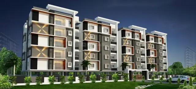
Peram Signature Park And Others
GGR INFRA LLP · Medchal-Malkajgiri · RERA P02200001661
PERAM SIGNATURE PARK AND OTHERS is a residential open-plot layout at Girmapur village, Medchal mandal, Medchal-Malkajgiri district. The registered promoter developing it is GGR INFRA LLP. The site area is 86,297.70 sq.m, with a net layout area of 86,215.31 sq.m; the layout drawing identifies 325 plot numbers, and no tower, floor or plot-configuration schedule is disclosed. The project is registered under TG-RERA number P02200001661, and the promoter’s Form B declaration states a completion undertaking of 19-01-2025.
More from Ggr Infra LLP · 4 projects →
01What we found
Read from TG-RERA filings, approvals, land and registration records and court records. A court case is counted only when the court record states this project's survey number with its village, or names the project.
02Check before you pay
9 items to check before you pay, 5 high - from the title chain, court records and approvals, each with what to ask the builder or your advocate. An item may not be a problem with the project: records can be incomplete.
1. Project at a glance
Project identity
| Item | Project record |
|---|---|
| Registered name | PERAM SIGNATURE PARK AND OTHERS RERA record |
| Project type | Plotted development / residential open-plot layout RERA record |
| Phase / registered portion | Identified in the registration and layout records as the project covering the listed Girmapur survey lands; no separate phase number is disclosed RERA record |
| TG-RERA registration | P02200001661 RERA record |
| Registration validity | Certificate records validity from 18/02/2020 to 19/01/2025, subject to extension by the Authority. The supplied certificate does not record an extension. This is registration validity, not a current-status confirmation. |
| Registered legal promoter | GGR INFRA LLP; entity type: LLP RERA record Corporate record |
| RERA status | Project identity lists status as New Project. A current TG-RERA status beyond the supplied certificate is not established here. RERA record |
Land and geographic identity
| Item | Project record |
|---|---|
| Locality / revenue village | Girmapur; the filed records identify Girmapur village RERA record |
| Mandal / district / PIN | Medchal / Medchal-Malkajgiri / 501401 RERA record |
| Project survey numbers | 234, 237, 266, 267, 268, 269, 271, 272, 273/P, 280/P, 301. The layout documents print the last two partial entries as “273 part” and “280 part.” RERA record |
| Total site area | 86,297.70 sq.m RERA filing |
| Net layout/site area | 86,215.31 sq.m RERA filing |
| Road-widening / master-plan-road affected area | 82.39 sq.m RERA filing |
| Boundaries (RERA-filed) | East: 263 264 265 238 239 231; West: 236 273P 278; North: 278 279 282 281 299 300 301P; South: 233 264 265 RERA filing |
Development identity
| Item | Project record |
|---|---|
| Sanctioning authority | Hyderabad Metropolitan Development Authority (HMDA) Approvals record |
| Principal layout approval | Final Layout Permit 000008/LO/Plg/HMDA/2020, dated 23 February, 2022 Approvals record |
| Approved built-up area | 56,997.84 sq.m is recorded in the RERA land details as “Approved Built up Area”; it corresponds to the layout drawing’s plotted-area figure, not a building floor-area schedule. RERA filing Layout record |
| Development form / building count | Open-plot residential layout. No tower or apartment-building count or floor configuration is established in the supplied project records. |
| Layout land-use figures | Plotted area: 56,997.84 sq.m; roads: 20,181.55 sq.m; organized open space/park/utility area: 6,878.08 sq.m; social infrastructure: 2,157.88 sq.m. The final drawing identifies 325 plot numbers (1–325), with the drawing-derived count not independently verified. Layout record |
| Mortgage area / plots | RERA records mortgage area of 8,654.3 sq.m. The layout letter identifies 56 plots: Nos. 252 to 270 and 283 to 319, mortgaged to HMDA pending development conditions. RERA filing |
Offering and status
| Item | Project record |
|---|---|
| Offering type | Residential plots; no RERA unit schedule or plot-size schedule is supplied in the reviewed overview data. RERA record Layout record |
| Plot count | 325 plot numbers appear on the layout drawing; the count is software/read-from-drawing evidence, not a verified RERA inventory count. Layout record |
| Booked / available | Not disclosed in the supplied records used for this overview. |
| Construction / development stage | Current site progress is not established by the supplied records; the layout approval describes development works and conditions, not independently verified completion. |
| Completion date | Promoter’s Form B declaration states 19-01-2025 as the project completion undertaking. |
| Occupancy / completion certificate | No project completion or occupancy certificate is identified in the supplied documents. The records concern a plotted layout and do not establish an OC for the layout or individual plots. Document index |
2. The project story
PERAM SIGNATURE PARK AND OTHERS is presented in TG-RERA records as a residential open-plot layout at Girmapur village, Medchal mandal, in Medchal-Malkajgiri district. The registered land identity comprises survey numbers 234, 237, 266, 267, 268, 269, 271, 272, 273/P, 280/P and 301. The final HMDA layout record covers a net area of 86,215.31 sq.m and approves a plotted residential arrangement rather than a multi-storey apartment scheme. RERA record
The final layout drawing shows plot numbers 1 to 325 and allocates land to plots, roads, open space/park/utility, and social infrastructure. The supplied records do not establish which plots are currently offered, booked, or available. They also do not provide independently verified on-site progress. HMDA’s final layout letter is dated 23 February 2022; the promoter’s RERA Form B separately declared a completion undertaking of 19-01-2025. Neither document, by itself, verifies that the layout development works were completed. Layout record
3. Master plan, architecture & building design
The approved plan is a plotted layout, so apartment-building features such as tower heights, floor counts, flats per floor, lifts, and building footprints are not established by the supplied records. The final layout drawing records a total site area of 86,297.70 sq.m, a net area of 86,215.31 sq.m, and 82.39 sq.m affected by the proposed master-plan road.
| Layout component | Area |
|---|---|
| Plotted area | 56,997.84 sq.m Layout record |
| Internal road area | 20,181.55 sq.m Layout record |
| Organized open space / park / utility area | 6,878.08 sq.m Layout record |
| Social infrastructure area | 2,157.88 sq.m Layout record |
| Master-plan-road affected area | 82.39 sq.m |
The final drawing identifies 325 plot numbers, but the count is read from the drawing and is not independently verified as the RERA-registered sale inventory. The 56 plots identified as Nos. 252–270 and 283–319 are recorded as mortgaged to HMDA; the final layout letter also refers to later relinquishment documentation for mortgaged plots. Layout record
The approved layout record describes internal roads, open spaces, utility areas and social infrastructure. It does not provide a complete plot-by-plot size schedule in the supplied material. The layout drawing’s scale is stated as 1:800.
4. Homes, configurations & floor plans
This is a plotted development, not an apartment configuration schedule. No RERA-filed plot-by-plot saleable-area schedule, booked/available inventory, or plot-size bands are supplied here. The layout drawing identifies 325 plot numbers; that drawing-derived count is not a substitute for a current RERA inventory. Layout record
The approved floor-plan drawing set supplied for review contains four drawings, all identified as layout sheets, with no measured residential-unit plans. Consequently, there are no software-measured carpet areas or room dimensions to report. Floor plans
5. Parking & vehicle circulation
The reviewed records do not establish a sanctioned project-wide parking count, visitor or accessible parking provision, or plot-specific parking allocation. This is a plotted layout; the supplied final layout records internal roads, but not a verified parking-allocation schedule.
6. Amenities, recreation & open spaces
The layout approval and RERA amenity data identify the following provisions. These are approval or filing records; the supplied evidence does not independently verify that the facilities have been constructed or are operational. RERA amenities
| Description / size | 6,878.08 sq.m |
|---|---|
| Evidence source | Final layout drawing Layout record |
| Declared progress / verified status | Shown in the approved layout; completion not independently verified |
| Description / size | 2,157.88 sq.m |
|---|---|
| Evidence source | Final layout drawing Layout record |
| Declared progress / verified status | Shown in the approved layout; facility type and completion not established |
| Description / size | Listed as available in the RERA amenity data |
|---|---|
| Evidence source | RERA amenity record RERA amenities |
| Declared progress / verified status | Filed as available; independent completion status not established |
| Description / size | Roads total 20,181.55 sq.m; layout approval includes road and footpath development conditions |
|---|---|
| Evidence source | RERA amenity record and final layout RERA amenities |
| Declared progress / verified status | Approval / filing evidence; site completion not independently verified |
| Description / size | No area or quantity established; RERA amenity data records 0% |
|---|---|
| Evidence source | RERA amenity record RERA amenities |
| Declared progress / verified status | Not shown as progressed in the supplied record |
| Description / size | Mentioned only in third-party vendor material |
|---|---|
| Evidence source | Promoter website |
| Declared progress / verified status | Not a TG-RERA-established or independently verified facility |
7. Utilities, building services & safety
The layout records refer to utility infrastructure and development requirements. They do not establish current construction or operational status, and no capacities are supplied.
| What the supplied records state | Final layout approval refers to protected water supply, OHT and sumps; the RERA amenity data lists water supply. A vendor specification separately says “Borewell,” but this is not established in the supplied TG-RERA documents. |
|---|---|
| Evidence / status | Approved-layout provisions / RERA amenity listing; delivery and source not independently verified RERA amenities Promoter website |
| What the supplied records state | Layout materials identify STP and sewerage/septic arrangements; the 2020 draft conditions specify sewerage treatment and reuse for gardening. |
|---|---|
| Evidence / status | Approval conditions and drawing labels; construction and operation not independently verified |
| What the supplied records state | Layout approval refers to drainage/channelization, storm-water drainage and rainwater-harvesting structures/pits. |
|---|---|
| Evidence / status | Approval conditions and drawing labels; completion not independently verified |
| What the supplied records state | Approval conditions refer to electrical supply lines, transformer yard, street lighting and LED streetlights. |
|---|---|
| Evidence / status | Approval conditions; completion not independently verified |
| What the supplied records state | Draft conditions refer to designated waste-disposal space, source segregation and a bio-compost unit. |
|---|---|
| Evidence / status | Approval conditions; operation not independently verified |
| What the supplied records state | No project-specific fire-system details or fire-clearance evidence are supplied. |
|---|---|
| Evidence / status | Not established in reviewed records RERA amenities |
| What the supplied records state | Not established in the supplied TG-RERA layout documents. |
|---|---|
| Evidence / status | Not established |
| What the supplied records state | No project-specific accessible-route or parking details are supplied. |
|---|---|
| Evidence / status | Not established |
8. Location, access & connectivity
The registered location is Girmapur village, Medchal mandal, Medchal-Malkajgiri district, PIN 501401. RERA record
The supplied location dataset gives these measured distances: Outer Ring Road (nearest sampled interchange, approximate) 2.7 km; Community Health Center Medchal 2.1 km; and Medchal railway station 2.3 km. These are location-data distances, not RERA-filed travel times. Location record
The final layout conditions refer to forming a 40 ft wide BT approach and internal roads; the final layout drawing also records a 9.15 road-width entry. These are approval-document details, not a statement of current road condition.
9. Developer & development status
The registered promoter is GGR INFRA LLP, an LLP. The supplied corporate record lists its address as KPHB Colony, JNTU Road, Girmapur, Medchal, Medchal-Malkajgiri, PIN 501401; a separate RERA certificate prints the promoter office as “Village: Mandal: District: Ranga Reddy, Pin: 500085.” The available material does not establish an official project website or contact details for the promoter. Corporate record
Form B is a promoter declaration stating that the project land is free from encumbrances and undertaking completion by 19-01-2025. These are the promoter’s filed declarations, not independent verification of title or completion.
The RERA certificate records registration ending on 19/01/2025, subject to extension, but no extension is recorded on the supplied certificate. Current registration status and current development progress are not established by the supplied records.
10. Approvals, official records & documents
| Identifier / date | P02200001661; issued 18/02/2020; validity shown through 19/01/2025 |
|---|---|
| Scope and relevance | Form C certificate for PERAM SIGNATURE PARK AND OTHERS; no extension is recorded on the supplied certificate. |
| Identifier / date | 000008/LO/Plg/HMDA/2020; 23 February, 2022 |
|---|---|
| Scope and relevance | Final residential open-plot layout approval for the listed Girmapur survey lands, subject to conditions. |
| Identifier / date | 046858/LT/MED/FLT/U6/HMDA/04072021 |
|---|---|
| Scope and relevance | Identified in the final layout letter and layout plan. |
| Identifier / date | 000008/LO/Plg/HMDA/2020; 20-01-2020; file 022639/MED/LT/U6/HMDA/15042019 |
|---|---|
| Scope and relevance | Draft/earlier layout material, including proposed development conditions and area statements. |
| Identifier / date | Filed as document 103278 |
|---|---|
| Scope and relevance | Promoter declaration, including the stated completion undertaking and separate-account/audit declarations. |
| Identifier / date | Filed as documents 352346 and 103275 |
|---|---|
| Scope and relevance | Drawing-derived layout and land-use information. |
| Identifier / date | Not identified in the supplied documents |
|---|---|
| Scope and relevance | No project-level OC or completion certificate is established by the reviewed record. |
| Identifier / date | Not publicly reachable in the supplied record |
|---|---|
| Scope and relevance | The HMDA DPMS lookup is reported unavailable from the public internet; this does not establish refusal or non-approval. HMDA |
1. Project at a glance
Project identity
Registered name: PERAM SIGNATURE PARK AND OTHERS
Project type: Plotted development / residential open-plot layout
Phase / registered portion: Identified in the registration and layout records as the project covering the listed Girmapur survey lands; no separate phase number is disclosed
TG-RERA registration: P02200001661
Registration validity: Certificate records validity from 18/02/2020 to 19/01/2025, subject to extension by the Authority. The supplied certificate does not record an extension. This is registration validity, not a current-status confirmation.
Registered legal promoter: GGR INFRA LLP; entity type: LLP
RERA status: Project identity lists status as New Project. A current TG-RERA status beyond the supplied certificate is not established here.
Land and geographic identity
Locality / revenue village: Girmapur; the filed records identify Girmapur village
Mandal / district / PIN: Medchal / Medchal-Malkajgiri / 501401
Project survey numbers: 234, 237, 266, 267, 268, 269, 271, 272, 273/P, 280/P, 301. The layout documents print the last two partial entries as “273 part” and “280 part.”
Total site area: 86,297.70 sq.m
Net layout/site area: 86,215.31 sq.m
Road-widening / master-plan-road affected area: 82.39 sq.m
Boundaries (RERA-filed): East: 263 264 265 238 239 231; West: 236 273P 278; North: 278 279 282 281 299 300 301P; South: 233 264 265
Development identity
Sanctioning authority: Hyderabad Metropolitan Development Authority (HMDA)
Principal layout approval: Final Layout Permit 000008/LO/Plg/HMDA/2020, dated 23 February, 2022
Approved built-up area: 56,997.84 sq.m is recorded in the RERA land details as “Approved Built up Area”; it corresponds to the layout drawing’s plotted-area figure, not a building floor-area schedule.
Development form / building count: Open-plot residential layout. No tower or apartment-building count or floor configuration is established in the supplied project records.
Layout land-use figures: Plotted area: 56,997.84 sq.m; roads: 20,181.55 sq.m; organized open space/park/utility area: 6,878.08 sq.m; social infrastructure: 2,157.88 sq.m. The final drawing identifies 325 plot numbers (1–325), with the drawing-derived count not independently verified.
Mortgage area / plots: RERA records mortgage area of 8,654.3 sq.m. The layout letter identifies 56 plots: Nos. 252 to 270 and 283 to 319, mortgaged to HMDA pending development conditions.
Offering and status
Offering type: Residential plots; no RERA unit schedule or plot-size schedule is supplied in the reviewed overview data.
Plot count: 325 plot numbers appear on the layout drawing; the count is software/read-from-drawing evidence, not a verified RERA inventory count.
Booked / available: Not disclosed in the supplied records used for this overview.
Construction / development stage: Current site progress is not established by the supplied records; the layout approval describes development works and conditions, not independently verified completion.
Completion date: Promoter’s Form B declaration states 19-01-2025 as the project completion undertaking.
Occupancy / completion certificate: No project completion or occupancy certificate is identified in the supplied documents. The records concern a plotted layout and do not establish an OC for the layout or individual plots.
2. The project story
PERAM SIGNATURE PARK AND OTHERS is presented in TG-RERA records as a residential open-plot layout at Girmapur village, Medchal mandal, in Medchal-Malkajgiri district. The registered land identity comprises survey numbers 234, 237, 266, 267, 268, 269, 271, 272, 273/P, 280/P and 301. The final HMDA layout record covers a net area of 86,215.31 sq.m and approves a plotted residential arrangement rather than a multi-storey apartment scheme.
The final layout drawing shows plot numbers 1 to 325 and allocates land to plots, roads, open space/park/utility, and social infrastructure. The supplied records do not establish which plots are currently offered, booked, or available. They also do not provide independently verified on-site progress. HMDA’s final layout letter is dated 23 February 2022; the promoter’s RERA Form B separately declared a completion undertaking of 19-01-2025. Neither document, by itself, verifies that the layout development works were completed.
3. Master plan, architecture & building design
The approved plan is a plotted layout, so apartment-building features such as tower heights, floor counts, flats per floor, lifts, and building footprints are not established by the supplied records. The final layout drawing records a total site area of 86,297.70 sq.m, a net area of 86,215.31 sq.m, and 82.39 sq.m affected by the proposed master-plan road.
Plotted area: 56,997.84 sq.m
Internal road area: 20,181.55 sq.m
Organized open space / park / utility area: 6,878.08 sq.m
Social infrastructure area: 2,157.88 sq.m
Master-plan-road affected area: 82.39 sq.m
The final drawing identifies 325 plot numbers, but the count is read from the drawing and is not independently verified as the RERA-registered sale inventory. The 56 plots identified as Nos. 252–270 and 283–319 are recorded as mortgaged to HMDA; the final layout letter also refers to later relinquishment documentation for mortgaged plots.
The approved layout record describes internal roads, open spaces, utility areas and social infrastructure. It does not provide a complete plot-by-plot size schedule in the supplied material. The layout drawing’s scale is stated as 1:800.
4. Homes, configurations & floor plans
This is a plotted development, not an apartment configuration schedule. No RERA-filed plot-by-plot saleable-area schedule, booked/available inventory, or plot-size bands are supplied here. The layout drawing identifies 325 plot numbers; that drawing-derived count is not a substitute for a current RERA inventory.
The approved floor-plan drawing set supplied for review contains four drawings, all identified as layout sheets, with no measured residential-unit plans. Consequently, there are no software-measured carpet areas or room dimensions to report.
5. Parking & vehicle circulation
The reviewed records do not establish a sanctioned project-wide parking count, visitor or accessible parking provision, or plot-specific parking allocation. This is a plotted layout; the supplied final layout records internal roads, but not a verified parking-allocation schedule.
6. Amenities, recreation & open spaces
The layout approval and RERA amenity data identify the following provisions. These are approval or filing records; the supplied evidence does not independently verify that the facilities have been constructed or are operational.
| Facility | Description / size | Evidence source | Declared progress / verified status |
|---|---|---|---|
| Organized open space / park / utility area | 6,878.08 sq.m | Final layout drawing | Shown in the approved layout; completion not independently verified |
| Social infrastructure area | 2,157.88 sq.m | Final layout drawing | Shown in the approved layout; facility type and completion not established |
| Green strip / tot lot / park | Listed as available in the RERA amenity data | RERA amenity record | Filed as available; independent completion status not established |
| Internal roads and footpaths | Roads total 20,181.55 sq.m; layout approval includes road and footpath development conditions | RERA amenity record and final layout | Approval / filing evidence; site completion not independently verified |
| Community buildings | No area or quantity established; RERA amenity data records 0% | RERA amenity record | Not shown as progressed in the supplied record |
| Swimming pool, gym and clubhouse | Mentioned only in third-party vendor material | Not a TG-RERA-established or independently verified facility |
7. Utilities, building services & safety
The layout records refer to utility infrastructure and development requirements. They do not establish current construction or operational status, and no capacities are supplied.
| What the supplied records state | Final layout approval refers to protected water supply, OHT and sumps; the RERA amenity data lists water supply. A vendor specification separately says “Borewell,” but this is not established in the supplied TG-RERA documents. |
|---|---|
| Evidence / status | Approved-layout provisions / RERA amenity listing; delivery and source not independently verified |
| What the supplied records state | Layout materials identify STP and sewerage/septic arrangements; the 2020 draft conditions specify sewerage treatment and reuse for gardening. |
|---|---|
| Evidence / status | Approval conditions and drawing labels; construction and operation not independently verified |
| What the supplied records state | Layout approval refers to drainage/channelization, storm-water drainage and rainwater-harvesting structures/pits. |
|---|---|
| Evidence / status | Approval conditions and drawing labels; completion not independently verified |
| What the supplied records state | Approval conditions refer to electrical supply lines, transformer yard, street lighting and LED streetlights. |
|---|---|
| Evidence / status | Approval conditions; completion not independently verified |
| What the supplied records state | Draft conditions refer to designated waste-disposal space, source segregation and a bio-compost unit. |
|---|---|
| Evidence / status | Approval conditions; operation not independently verified |
| What the supplied records state | No project-specific fire-system details or fire-clearance evidence are supplied. |
|---|---|
| Evidence / status | Not established in reviewed records |
| What the supplied records state | Not established in the supplied TG-RERA layout documents. |
|---|---|
| Evidence / status | Not established |
| What the supplied records state | No project-specific accessible-route or parking details are supplied. |
|---|---|
| Evidence / status | Not established |
8. Location, access & connectivity
The registered location is Girmapur village, Medchal mandal, Medchal-Malkajgiri district, PIN 501401.
The supplied location dataset gives these measured distances: Outer Ring Road (nearest sampled interchange, approximate) 2.7 km; Community Health Center Medchal 2.1 km; and Medchal railway station 2.3 km. These are location-data distances, not RERA-filed travel times.
The final layout conditions refer to forming a 40 ft wide BT approach and internal roads; the final layout drawing also records a 9.15 road-width entry. These are approval-document details, not a statement of current road condition.
9. Developer & development status
The registered promoter is GGR INFRA LLP, an LLP. The supplied corporate record lists its address as KPHB Colony, JNTU Road, Girmapur, Medchal, Medchal-Malkajgiri, PIN 501401; a separate RERA certificate prints the promoter office as “Village: Mandal: District: Ranga Reddy, Pin: 500085.” The available material does not establish an official project website or contact details for the promoter.
Form B is a promoter declaration stating that the project land is free from encumbrances and undertaking completion by 19-01-2025. These are the promoter’s filed declarations, not independent verification of title or completion.
The RERA certificate records registration ending on 19/01/2025, subject to extension, but no extension is recorded on the supplied certificate. Current registration status and current development progress are not established by the supplied records.
10. Approvals, official records & documents
| Identifier / date | P02200001661; issued 18/02/2020; validity shown through 19/01/2025 |
|---|---|
| Scope and relevance | Form C certificate for PERAM SIGNATURE PARK AND OTHERS; no extension is recorded on the supplied certificate. |
| Identifier / date | 000008/LO/Plg/HMDA/2020; 23 February, 2022 |
|---|---|
| Scope and relevance | Final residential open-plot layout approval for the listed Girmapur survey lands, subject to conditions. |
| Identifier / date | 046858/LT/MED/FLT/U6/HMDA/04072021 |
|---|---|
| Scope and relevance | Identified in the final layout letter and layout plan. |
| Identifier / date | 000008/LO/Plg/HMDA/2020; 20-01-2020; file 022639/MED/LT/U6/HMDA/15042019 |
|---|---|
| Scope and relevance | Draft/earlier layout material, including proposed development conditions and area statements. |
| Identifier / date | Filed as document 103278 |
|---|---|
| Scope and relevance | Promoter declaration, including the stated completion undertaking and separate-account/audit declarations. |
| Identifier / date | Filed as documents 352346 and 103275 |
|---|---|
| Scope and relevance | Drawing-derived layout and land-use information. |
| Identifier / date | Not identified in the supplied documents |
|---|---|
| Scope and relevance | No project-level OC or completion certificate is established by the reviewed record. |
| Identifier / date | Not publicly reachable in the supplied record |
|---|---|
| Scope and relevance | The HMDA DPMS lookup is reported unavailable from the public internet; this does not establish refusal or non-approval. |
Frequently asked questions
Is PERAM SIGNATURE PARK AND OTHERS registered with Telangana RERA?
Yes. PERAM SIGNATURE PARK AND OTHERS is registered with the Telangana Real Estate Regulatory Authority as P02200001661; the registration status is New Project.
Who is the developer of PERAM SIGNATURE PARK AND OTHERS?
The promoter named in the RERA registration is GGR INFRA LLP.
Where is PERAM SIGNATURE PARK AND OTHERS located?
PERAM SIGNATURE PARK AND OTHERS is in GIRMAPUR, Medchal, Medchal-Malkajgiri, Telangana (501401).
When will PERAM SIGNATURE PARK AND OTHERS be completed?
The promoter's proposed date of completion filed with RERA is 19/01/2025. This is the promoter's declaration, not a guarantee.
More projects in Girmapur