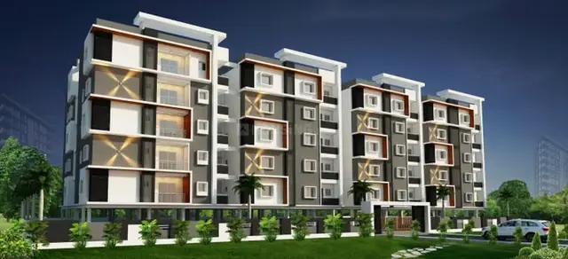
Perams Aditya Signature Park-3
GGR INDIA INFRA STRUCTURE PRIVATE LIMITED · Medchal-Malkajgiri · RERA P02200008268
PERAMS ADITYA SIGNATURE PARK-3 is a proposed residential open-plot layout in Girmapur, Medchal Mandal, Medchal-Malkajgiri District. The registered promoter is GGR INDIA INFRA STRUCTURE PRIVATE LIMITED. The project covers 6228.36 sq.m.; it is a plotted development, with no tower or floor configuration stated, and the supplied plan records 19 plots. Plot-wise sizes and configurations are not stated; the TG-RERA registration number is P02200008268, and the later Form B completion undertaking states 05.01.2027.
01What we found
Read from TG-RERA filings, approvals, land and registration records and court records. A court case is counted only when the court record states this project's survey number with its village, or names the project.
02Check before you pay
9 items to check before you pay, 6 high - from the title chain, court records and approvals, each with what to ask the builder or your advocate. An item may not be a problem with the project: records can be incomplete.
Project at a glance
Project identity
| Field | Record |
|---|---|
| Registered project name | PERAMS ADITYA SIGNATURE PARK-3 RERA record |
| Project type | Plotted development / proposed residential open-plot layout RERA record RERA filing |
| Phase or registered portion | Not separately identified; registration is for the named project. RERA record |
| TG-RERA registration number | P02200008268 RERA record |
| Registration validity | 21 May 2024 to 5 January 2025, according to the registration certificate; any extension is not established in the supplied record. Registration validity is distinct from the completion date. RERA record |
| Registered promoter | GGR INDIA INFRA STRUCTURE PRIVATE LIMITED RERA record Corporate record |
| RERA status in supplied record | Registered project. A later Form B declaration gives 05.01.2027 as the completion undertaking; the supplied record does not establish a registration extension or current registration status. |
Land and geographic identity
| Field | Record |
|---|---|
| Revenue village | Girmapur RERA record Land records |
| Mandal / district / PIN | Medchal / Medchal-Malkajgiri / 501401 RERA record |
| Locality | MEDCHAL MANDAL,MALKAJGIRI DIST (RERA record); no more specific registered locality is established here. RERA filing RERA filing |
| Project survey number(s) and subdivisions | Survey No. 263; no subdivision is specified in the project identity or layout approval. Land records |
| Registered site extent | 6228.36 sq.m.; the RERA land record reports both total and net area as 6228.36 sq.m. RERA filing Land records |
| Boundaries (RERA-filed) | North: EXISTING HMDA LAYOUT; South: OTHERS LAND; East: OTHERS LAND; West: EXISTING HMDA LAYOUT. RERA filing |
| Parcel land-record detail | A Bhu Bharati record retrieved 2026-10-02 lists 263/1, khata 542, extent 1.24 acres/guntas as recorded, filed-as survey 263, with land status “Signed as NALA.” The filing does not identify which subdivision the project holds. Land records |
Development identity
| Field | Record |
|---|---|
| Sanctioning authority | Hyderabad Metropolitan Development Authority (HMDA); the draft layout letter forwards the plan to Girmapur Gram Panchayath for further action. Approvals record |
| Principal approval | 000004/LO/Plg/HMDA/2022, dated 05-01-2022; application/file reference 049277/MED/LT/U6/HMDA/30092021. Approvals record |
| Approval character | The supplied plan is described as a draft layout letter/permission, with conditions relating to development works, handover of roads and open spaces, and final layout approval. |
| Approved built-up area | 4041.22 sq.m. is recorded as plotted area, not building built-up area. No approved building built-up area is disclosed. RERA filing |
| Plots shown / count | The plan extraction records 19 plots; a separate software reading of the drawing identifies plot numbers 1–21. The supplied record does not reconcile these counts. Layout record |
| Building count / floors / parking levels | Not applicable to the project as recorded: this is a plotted layout, and no building-floor or parking-level schedule is supplied. RERA record |
| Mortgage area | 670.96 sq.m., covering Plot Nos. 8 to 12 (total 05 plots), recorded as mortgaged to HMDA pending layout development conditions. RERA filing Layout record |
Offering and status
| Field | Record |
|---|---|
| RERA-recorded offering | Residential plots; plot-wise sizes and a complete plot schedule are not available in the supplied evidence. RERA record |
| RERA booked / available counts | Not disclosed in the supplied project evidence. RERA record |
| Construction / development stage | No independently verified site-progress evidence is supplied. RERA amenity-field percentages report partial progress for several layout works; these are filed progress figures, not an independent inspection. RERA amenities |
| Completion dates | Registration certificate validity ends 5 January 2025. Form B filings include a completion undertaking of 05.01.2025 and later Form B filings state 05.01.2027; the supplied evidence does not establish an approved extension. |
| Occupancy / completion certificate | No occupancy or completion certificate is supplied. The offering is a plotted layout, and no tower- or building-specific OC status is established. Document index |
The project story
PERAMS ADITYA SIGNATURE PARK-3 is registered as a residential plotted-development project at Girmapur village, Medchal Mandal, on Survey No. 263. The RERA filing identifies a site of 6228.36 sq.m.; the HMDA-filed plan presents it as an open-plot layout rather than a multi-building residential scheme. RERA record Land records
The plan records 4041.22 sq.m. of plotted area, 1502.53 sq.m. of roads, 529.42 sq.m. of organized open space/park/utility area and 155.20 sq.m. of social-infrastructure area. The layout drawing also labels utility and open-space elements. Five plots, Nos. 8–12, are identified as mortgaged to HMDA; the draft-layout conditions state that these plots are not to be sold until released, subject to the stated development and approval conditions. Layout record
The available materials establish a draft layout approval and RERA registration, but do not establish final layout release, completed infrastructure, plot-wise availability, or independent on-site progress. The project’s RERA amenity record reports percentages for several works, which should be read as filed progress indicators rather than verified completion. RERA amenities
Master plan, architecture & building design
The approved-plan material concerns a residential open layout in Survey No. 263, not a building design. It records a total and net site area of 6228.36 sq.m. and plotted area of 4041.22 sq.m.; no building footprint, tower arrangement, floor configuration or approved building built-up area is supplied.
| Layout component | Area / plan record |
|---|---|
| Plotted area | 4041.22 sq.m. |
| Roads | 1502.53 sq.m. |
| Organized open space / park / utility area | 529.42 sq.m. |
| Social infrastructure area | 155.20 sq.m. |
| Mortgage area, Plot Nos. 8–12 | 670.96 sq.m. |
A software-derived reading of the layout drawing reports 21 numbered plots (1–21), while the plan extraction states 19 plots; the plot count and individual plot sizes require verification against the complete stamped drawing. No plot-size schedule can be presented from the supplied data. Layout record
The plan identifies 9.14 m roads, including a road noted as an existing 9 m road to be widened to a 30 m master-plan road. These are drawing/approval notations; the supplied evidence does not establish the current physical road condition or completion of widening.
Homes, configurations & floor plans
This is a plotted development, not a filed apartment configuration schedule. The supplied RERA record does not provide plot-wise sizes, booked counts or available counts. The layout drawing is not a plot schedule: its software reading identifies plot numbers 1–21, but the extraction separately records 19 plots, and plot sizes are not available for reporting. RERA record Layout record
The supplied floor-plan review reports three layout sheets and no measured home floor plans. Accordingly, no carpet-area, room-dimension or apartment-configuration figures can be established from these materials. Floor plans
Parking & vehicle circulation
No sanctioned parking-space count, visitor or accessible-parking provision, or plot-specific parking allocation is established in the supplied record. The layout is an open-plot project, and no building parking levels, ramps or mechanically operated parking are documented. Document index
The plan shows internal road area of 1502.53 sq.m. and identifies roads including 9.14 m roads. The draft-layout conditions refer to keeping roads open for access to neighbouring sites; they do not establish that the roads are complete or handed over.
Amenities, recreation & open spaces
The RERA amenity record provides filed progress percentages for layout infrastructure. These are not independent completion certifications. The plan and draft-layout letter also list proposed infrastructure elements; no supplied evidence independently verifies that any item is complete. RERA amenities
| Facility | Description / size | Evidence source | Declared progress / verified status |
|---|---|---|---|
| Internal roads and footpaths | Road area: 1502.53 sq.m. | RERA amenities | RERA amenity record: 50%; completion not independently verified. |
| Green strip / tot lot / park | Organized open space/park/utility area: 529.42 sq.m. | RERA amenities | RERA amenity record: 45%; completion not independently verified. |
| Community buildings | No size or facility description supplied | RERA amenities | RERA amenity record: 0%. |
| Social infrastructure area | 155.20 sq.m. | Area recorded in plan; delivered condition not verified. | |
| Utility area | 62.29 sq.m. in plan extraction | No separate progress figure supplied. | |
| Water supply | Layout water infrastructure; draft letter also lists an overhead tank and internal water-supply pipelines | RERA amenities | RERA amenity record: 40%; completion not independently verified. |
| Sewerage / sewage treatment | Sewerage (chamber, lines, septic tank, STP); draft letter lists common septic tank / STP | RERA amenities | RERA amenity record: 35%; completion not independently verified. |
| Storm-water drains | Listed as layout infrastructure | RERA amenities | RERA amenity record: 60%; completion not independently verified. |
| Street lighting | Listed as layout infrastructure | RERA amenities | RERA amenity record: 35%; completion not independently verified. |
| Water conservation / rainwater harvesting | Listed in the layout permission material | RERA amenities | RERA amenity record: 20%; completion not independently verified. |
The supplied vendor record lists a clubhouse, swimming pool, gym, children’s play area and covered car parking. These are vendor-listed facilities, not established as RERA-filed or delivered amenities, so they are not treated as approved or completed project facilities here. Promoter website
Utilities, building services & safety
The HMDA draft-layout material lists storm-water drains, underground drainage lines, a common septic tank / STP, internal water-supply pipelines, an overhead tank, electrical supply lines, street lights, a transformer, avenue plantation, park development and rainwater measures. These are listed layout provisions; the supplied materials do not provide capacities or independently verify commissioning or completion.
The RERA amenity record reports progress for water supply, sewerage, storm-water drains, street lighting and water conservation/rainwater harvesting. It records 0% for treatment and disposal of sewage and sullage water, solid-waste management and disposal, energy management, fire protection and fire-safety requirements, and electrical meter room/sub-station/receiving station. These are reported field values, not an independent inspection or a determination of statutory compliance. RERA amenities
No project-specific evidence establishes water source or storage capacity, electrical backup, EV charging, firefighting equipment, security/CCTV, accessibility features, or commissioned utility services. Document index RERA amenities
Location, access & connectivity
The official project location in the supplied RERA record is Girmapur village, Medchal Mandal, Medchal-Malkajgiri District, Telangana 501401. The project is identified by Survey No. 263. RERA record
The approved-plan material refers to 9.14 m roads and an existing 9 m road noted for widening to a 30 m master-plan road. The supplied location data identifies the nearest sampled Outer Ring Road interchange at approximately 3.2 km from the cadastral parcel centroid; this is a supplied mapped distance, not a travel-time estimate. Location record
No project-specific public-transport schedule or verified travel-time information is supplied. Location record
Developer & development status
The registered promoter is GGR INDIA INFRA STRUCTURE PRIVATE LIMITED, a private limited company. The supplied corporate identifier is GSTIN 36AAICG7128G1ZI. RERA record Corporate record
The RERA address record gives 706, Manjeera Majestic Commercial Complex, JNTU Road, KPHB Colony, with the project-location fields also present in the address entry. The registration certificate lists the promoter address as Village: Mandal: District: Hyderabad, Pin: 500072. No official website or contact details are established in the supplied project evidence. RERA filing
The RERA registration certificate states validity from 21 May 2024 through 5 January 2025. Form B material includes a completion undertaking of 05.01.2025 and later Form B material states 05.01.2027; no supplied extension order establishes a revised registration-validity period. No independently verified construction or infrastructure completion status is available. RERA amenities
Approvals, official records & documents
| Record | What the supplied evidence establishes |
|---|---|
| TG-RERA registration certificate | Form C for PERAMS ADITYA SIGNATURE PARK-3, registration P02200008268, naming Ggr India Infra Structure Private Limited as promoter; states validity from 21/05/2024 to 05/01/2025. |
| HMDA layout approval material | Plan/approval 000004/LO/Plg/HMDA/2022, dated 05-01-2022, application/file reference 049277/MED/LT/U6/HMDA/30092021, for Survey No. 263, Girmapur; the supplied letter describes draft layout permission and conditions. |
| Mortgage record in layout material | HMDA mortgage deed identified as 17991/2021, dated 10/12/2021, for Plot Nos. 8–12, extent 670.964 sq.m. |
| Form B declarations | Promoter declarations concerning title basis, encumbrance disclosure, project-fund arrangements and completion undertaking; one supplied declaration states 05.01.2025, while later declarations state 05.01.2027. |
| Completion / occupancy certificates | No project completion or occupancy certificate is included in the supplied materials. Document index |
| HMDA layout lookup | Public HMDA DPMS approved-layout lookup is reported unavailable for public access in the supplied record; this does not establish refusal or approval status beyond the documents listed above. HMDA |
Project at a glance
Project identity
Registered project name: PERAMS ADITYA SIGNATURE PARK-3
Project type: Plotted development / proposed residential open-plot layout
Phase or registered portion: Not separately identified; registration is for the named project.
TG-RERA registration number: P02200008268
Registration validity: 21 May 2024 to 5 January 2025, according to the registration certificate; any extension is not established in the supplied record. Registration validity is distinct from the completion date.
Registered promoter: GGR INDIA INFRA STRUCTURE PRIVATE LIMITED
RERA status in supplied record: Registered project. A later Form B declaration gives 05.01.2027 as the completion undertaking; the supplied record does not establish a registration extension or current registration status.
Land and geographic identity
Revenue village: Girmapur
Mandal / district / PIN: Medchal / Medchal-Malkajgiri / 501401
Locality: MEDCHAL MANDAL,MALKAJGIRI DIST (RERA record); no more specific registered locality is established here.
Project survey number(s) and subdivisions: Survey No. 263; no subdivision is specified in the project identity or layout approval.
Registered site extent: 6228.36 sq.m.; the RERA land record reports both total and net area as 6228.36 sq.m.
Boundaries (RERA-filed): North: EXISTING HMDA LAYOUT; South: OTHERS LAND; East: OTHERS LAND; West: EXISTING HMDA LAYOUT.
Parcel land-record detail: A Bhu Bharati record retrieved 2026-10-02 lists 263/1, khata 542, extent 1.24 acres/guntas as recorded, filed-as survey 263, with land status “Signed as NALA.” The filing does not identify which subdivision the project holds.
Development identity
Sanctioning authority: Hyderabad Metropolitan Development Authority (HMDA); the draft layout letter forwards the plan to Girmapur Gram Panchayath for further action.
Principal approval: 000004/LO/Plg/HMDA/2022, dated 05-01-2022; application/file reference 049277/MED/LT/U6/HMDA/30092021.
Approval character: The supplied plan is described as a draft layout letter/permission, with conditions relating to development works, handover of roads and open spaces, and final layout approval.
Approved built-up area: 4041.22 sq.m. is recorded as plotted area, not building built-up area. No approved building built-up area is disclosed.
Plots shown / count: The plan extraction records 19 plots; a separate software reading of the drawing identifies plot numbers 1–21. The supplied record does not reconcile these counts.
Building count / floors / parking levels: Not applicable to the project as recorded: this is a plotted layout, and no building-floor or parking-level schedule is supplied.
Mortgage area: 670.96 sq.m., covering Plot Nos. 8 to 12 (total 05 plots), recorded as mortgaged to HMDA pending layout development conditions.
Offering and status
RERA-recorded offering: Residential plots; plot-wise sizes and a complete plot schedule are not available in the supplied evidence.
RERA booked / available counts: Not disclosed in the supplied project evidence.
Construction / development stage: No independently verified site-progress evidence is supplied. RERA amenity-field percentages report partial progress for several layout works; these are filed progress figures, not an independent inspection.
Completion dates: Registration certificate validity ends 5 January 2025. Form B filings include a completion undertaking of 05.01.2025 and later Form B filings state 05.01.2027; the supplied evidence does not establish an approved extension.
Occupancy / completion certificate: No occupancy or completion certificate is supplied. The offering is a plotted layout, and no tower- or building-specific OC status is established.
The project story
PERAMS ADITYA SIGNATURE PARK-3 is registered as a residential plotted-development project at Girmapur village, Medchal Mandal, on Survey No. 263. The RERA filing identifies a site of 6228.36 sq.m.; the HMDA-filed plan presents it as an open-plot layout rather than a multi-building residential scheme.
The plan records 4041.22 sq.m. of plotted area, 1502.53 sq.m. of roads, 529.42 sq.m. of organized open space/park/utility area and 155.20 sq.m. of social-infrastructure area. The layout drawing also labels utility and open-space elements. Five plots, Nos. 8–12, are identified as mortgaged to HMDA; the draft-layout conditions state that these plots are not to be sold until released, subject to the stated development and approval conditions.
The available materials establish a draft layout approval and RERA registration, but do not establish final layout release, completed infrastructure, plot-wise availability, or independent on-site progress. The project’s RERA amenity record reports percentages for several works, which should be read as filed progress indicators rather than verified completion.
Master plan, architecture & building design
The approved-plan material concerns a residential open layout in Survey No. 263, not a building design. It records a total and net site area of 6228.36 sq.m. and plotted area of 4041.22 sq.m.; no building footprint, tower arrangement, floor configuration or approved building built-up area is supplied.
Plotted area: 4041.22 sq.m.
Roads: 1502.53 sq.m.
Organized open space / park / utility area: 529.42 sq.m.
Social infrastructure area: 155.20 sq.m.
Mortgage area, Plot Nos. 8–12: 670.96 sq.m.
A software-derived reading of the layout drawing reports 21 numbered plots (1–21), while the plan extraction states 19 plots; the plot count and individual plot sizes require verification against the complete stamped drawing. No plot-size schedule can be presented from the supplied data.
The plan identifies 9.14 m roads, including a road noted as an existing 9 m road to be widened to a 30 m master-plan road. These are drawing/approval notations; the supplied evidence does not establish the current physical road condition or completion of widening.
Homes, configurations & floor plans
This is a plotted development, not a filed apartment configuration schedule. The supplied RERA record does not provide plot-wise sizes, booked counts or available counts. The layout drawing is not a plot schedule: its software reading identifies plot numbers 1–21, but the extraction separately records 19 plots, and plot sizes are not available for reporting.
The supplied floor-plan review reports three layout sheets and no measured home floor plans. Accordingly, no carpet-area, room-dimension or apartment-configuration figures can be established from these materials.
Parking & vehicle circulation
No sanctioned parking-space count, visitor or accessible-parking provision, or plot-specific parking allocation is established in the supplied record. The layout is an open-plot project, and no building parking levels, ramps or mechanically operated parking are documented.
The plan shows internal road area of 1502.53 sq.m. and identifies roads including 9.14 m roads. The draft-layout conditions refer to keeping roads open for access to neighbouring sites; they do not establish that the roads are complete or handed over.
Amenities, recreation & open spaces
The RERA amenity record provides filed progress percentages for layout infrastructure. These are not independent completion certifications. The plan and draft-layout letter also list proposed infrastructure elements; no supplied evidence independently verifies that any item is complete.
| Facility | Description / size | Evidence source | Declared progress / verified status |
|---|---|---|---|
| Internal roads and footpaths | Road area: 1502.53 sq.m. | RERA amenity record: 50%; completion not independently verified. | |
| Green strip / tot lot / park | Organized open space/park/utility area: 529.42 sq.m. | RERA amenity record: 45%; completion not independently verified. | |
| Community buildings | No size or facility description supplied | RERA amenity record: 0%. | |
| Social infrastructure area | 155.20 sq.m. | Area recorded in plan; delivered condition not verified. | |
| Utility area | 62.29 sq.m. in plan extraction | No separate progress figure supplied. | |
| Water supply | Layout water infrastructure; draft letter also lists an overhead tank and internal water-supply pipelines | RERA amenity record: 40%; completion not independently verified. | |
| Sewerage / sewage treatment | Sewerage (chamber, lines, septic tank, STP); draft letter lists common septic tank / STP | RERA amenity record: 35%; completion not independently verified. | |
| Storm-water drains | Listed as layout infrastructure | RERA amenity record: 60%; completion not independently verified. | |
| Street lighting | Listed as layout infrastructure | RERA amenity record: 35%; completion not independently verified. | |
| Water conservation / rainwater harvesting | Listed in the layout permission material | RERA amenity record: 20%; completion not independently verified. |
The supplied vendor record lists a clubhouse, swimming pool, gym, children’s play area and covered car parking. These are vendor-listed facilities, not established as RERA-filed or delivered amenities, so they are not treated as approved or completed project facilities here.
Utilities, building services & safety
The HMDA draft-layout material lists storm-water drains, underground drainage lines, a common septic tank / STP, internal water-supply pipelines, an overhead tank, electrical supply lines, street lights, a transformer, avenue plantation, park development and rainwater measures. These are listed layout provisions; the supplied materials do not provide capacities or independently verify commissioning or completion.
The RERA amenity record reports progress for water supply, sewerage, storm-water drains, street lighting and water conservation/rainwater harvesting. It records 0% for treatment and disposal of sewage and sullage water, solid-waste management and disposal, energy management, fire protection and fire-safety requirements, and electrical meter room/sub-station/receiving station. These are reported field values, not an independent inspection or a determination of statutory compliance.
No project-specific evidence establishes water source or storage capacity, electrical backup, EV charging, firefighting equipment, security/CCTV, accessibility features, or commissioned utility services.
Location, access & connectivity
The official project location in the supplied RERA record is Girmapur village, Medchal Mandal, Medchal-Malkajgiri District, Telangana 501401. The project is identified by Survey No. 263.
The approved-plan material refers to 9.14 m roads and an existing 9 m road noted for widening to a 30 m master-plan road. The supplied location data identifies the nearest sampled Outer Ring Road interchange at approximately 3.2 km from the cadastral parcel centroid; this is a supplied mapped distance, not a travel-time estimate.
No project-specific public-transport schedule or verified travel-time information is supplied.
Developer & development status
The registered promoter is GGR INDIA INFRA STRUCTURE PRIVATE LIMITED, a private limited company. The supplied corporate identifier is GSTIN 36AAICG7128G1ZI.
The RERA address record gives 706, Manjeera Majestic Commercial Complex, JNTU Road, KPHB Colony, with the project-location fields also present in the address entry. The registration certificate lists the promoter address as Village: Mandal: District: Hyderabad, Pin: 500072. No official website or contact details are established in the supplied project evidence.
The RERA registration certificate states validity from 21 May 2024 through 5 January 2025. Form B material includes a completion undertaking of 05.01.2025 and later Form B material states 05.01.2027; no supplied extension order establishes a revised registration-validity period. No independently verified construction or infrastructure completion status is available.
Approvals, official records & documents
TG-RERA registration certificate: Form C for PERAMS ADITYA SIGNATURE PARK-3, registration P02200008268, naming Ggr India Infra Structure Private Limited as promoter; states validity from 21/05/2024 to 05/01/2025.
HMDA layout approval material: Plan/approval 000004/LO/Plg/HMDA/2022, dated 05-01-2022, application/file reference 049277/MED/LT/U6/HMDA/30092021, for Survey No. 263, Girmapur; the supplied letter describes draft layout permission and conditions.
Mortgage record in layout material: HMDA mortgage deed identified as 17991/2021, dated 10/12/2021, for Plot Nos. 8–12, extent 670.964 sq.m.
Form B declarations: Promoter declarations concerning title basis, encumbrance disclosure, project-fund arrangements and completion undertaking; one supplied declaration states 05.01.2025, while later declarations state 05.01.2027.
Completion / occupancy certificates: No project completion or occupancy certificate is included in the supplied materials.
HMDA layout lookup: Public HMDA DPMS approved-layout lookup is reported unavailable for public access in the supplied record; this does not establish refusal or approval status beyond the documents listed above.
Frequently asked questions
Is PERAMS ADITYA SIGNATURE PARK-3 registered with Telangana RERA?
Yes. PERAMS ADITYA SIGNATURE PARK-3 is registered with the Telangana Real Estate Regulatory Authority as P02200008268; the registration status is New Project.
Who is the developer of PERAMS ADITYA SIGNATURE PARK-3?
The promoter named in the RERA registration is GGR INDIA INFRA STRUCTURE PRIVATE LIMITED.
Where is PERAMS ADITYA SIGNATURE PARK-3 located?
PERAMS ADITYA SIGNATURE PARK-3 is in MEDCHAL MANDAL,MALKAJGIRI DIST, Girmapur, Medchal, Medchal-Malkajgiri, Telangana (501401).
When will PERAMS ADITYA SIGNATURE PARK-3 be completed?
The promoter's proposed date of completion filed with RERA is 05/01/2025. This is the promoter's declaration, not a guarantee.
More projects in Girmapur