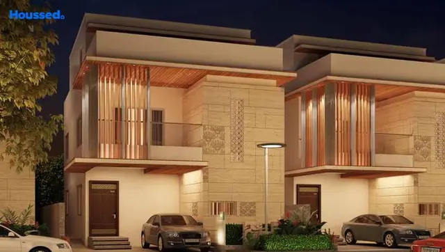
Gowri hills
SUVARNA LAKSHMI DEVELOPERS · Rangareddy · RERA P02400002936
Gowri hills is a plotted development in Pasmamla, Abdullapurmet Mandal, Ranga Reddy District, developed by the registered promoter Suvarna Lakshmi Developers. The registered site extent is 10926.54 Sq.m in Survey Nos. 91/p and 96/p; the HMDA-filed layout identifies 6198.39 as plotted area, but a complete plot count and plot-size schedule are not established in the supplied records. TG-RERA registration number P02400002936 was issued 14/05/2021, and the promoter’s Form-B declaration undertakes completion by 5th January, 2024.
More from Suvarna Lakshmi Developers · 2 projects →
01What we found
Read from TG-RERA filings, approvals, land and registration records and court records. A court case is counted only when the court record states this project's survey number with its village, or names the project.
02Check before you pay
10 items to check before you pay, 5 high - from the title chain, court records and approvals, each with what to ask the builder or your advocate. An item may not be a problem with the project: records can be incomplete.
Project at a glance
Project identity
| Field | Project record |
|---|---|
| Registered project name | Gowri hills |
| Project type | Plotted development / open-plot layout; the registration and HMDA-filed layout describe a plotted project. RERA record |
| Phase / registered portion | Phase not separately identified; the registered project is described as the plotted layout in Survey Nos. 91/P and 96/P. |
| TG-RERA registration | P02400002936; issued 14/05/2021; certificate states validity from 14/05/2021 to 05/01/2024 and no extension is recorded in the supplied certificate data. |
| RERA status | Registration validity ended on 05/01/2024; current registration status is not independently verified in the supplied material. Approvals record |
| Registered promoter | Suvarna Lakshmi Developers; entity type is identified as a partnership in the RERA filing. RERA filing |
Land and geographic identity
| Field | Project record |
|---|---|
| Locality / revenue village | Pasmamla, also identified in the filed HMDA layout material as Pasmamla-ORRGC Village. RERA record |
| Mandal | Abdullapurmet; the layout document uses “Abdullapurmet-ORRGC Mandal.” RERA record |
| District / PIN | Ranga Reddy; PIN 501505. RERA record |
| Project survey numbers | 91/p and 96/p (the HMDA layout documents print 91/P and 96/P). No further project subdivision is identified in the filed layout description. RERA record |
| Registered site extent | 10926.54 Sq.m in the registration and filed approval records. RERA filing |
| Total / net area | Total site area 10926.54; net site area 10926.54. |
| Boundaries recorded in RERA filing | East: Renuka ring road venture; West: Survey no 91 part; North: Manarupa Venture; South: Survey no 96 part. RERA filing |
Development identity
| Field | Project record |
|---|---|
| Sanctioning authority | Hyderabad Metropolitan Development Authority (HMDA). |
| Principal layout approval | Draft layout permit 000012/LO/Plg/HMDA/2021, dated 05 January, 2021. |
| Approved built-up area | Not disclosed in the supplied layout approval records; the project is a plotted layout, not a building approval record. |
| Buildings / floors | Building, tower and floor configuration are not disclosed in the supplied project records. |
| Plots | The layout drawing’s area statement identifies 6198.39 as plotted area; a complete plot count and plot-size schedule are not established by the supplied data. Layout record |
| Roads and open-space allocation | Layout records identify 3548.03 road area, 906.47 organized open space/park/utility area and 273.22 social infrastructure area. Layout record |
| Mortgage plots | Plots 1 to 6, stated as 952.47 Sq.Mt, are identified as mortgaged to HMDA under registered mortgage deed 4123/2020 dated 14/8/2020. |
Offering and status
| Field | Project record |
|---|---|
| RERA-filed offering | Plotted development; unit-level plot numbers, sizes, booked/available counts and saleable-area schedule are not established in the supplied records. RERA record |
| Marketing description | The promoter’s website/vendor material describes villas, but the supplied TG-RERA registration and HMDA documents identify an open-plot layout. The marketing claim is not treated here as the RERA-filed offering. Promoter website |
| Construction / development stage | The RERA filing records 80% completeness; this is a filing-derived progress figure, not independent site verification. RERA record |
| Completion deadline | The promoter’s Form-B declaration undertakes completion by 5th January, 2024. This is separate from the TG-RERA registration validity date. |
| OC / completion certificate | No occupancy or completion certificate is identified in the supplied project documents; the project is a plotted layout. Final layout release status is not established by the supplied material. Document index |
The project story
Gowri hills is registered with TG-RERA as a plotted development in Pasmamla, Abdullapurmet Mandal, Ranga Reddy District. The RERA-filed project extent is 10926.54 Sq.m, covering Survey Nos. 91/p and 96/p. The HMDA-filed drawing describes an open layout rather than a multi-storey residential building.
The layout area statement allocates land to plots, internal roads, open space/park/utility use and social infrastructure. HMDA’s draft-layout records also state that roads and open spaces are to be handed over to the local body before release of final layout plans, and that plots 1 to 6 are mortgaged pending completion of specified layout works. The supplied material does not establish the final layout-release status or provide a complete plot inventory.
The RERA filing reports 80% completeness. That figure is a filed progress value, not an independently verified site assessment. The promoter’s Form-B declaration sets a completion undertaking of 5th January, 2024; the supplied records do not establish actual completion or an occupancy/completion certificate. RERA record Document index
Master plan, architecture & building design
The project is an open-plot layout; the supplied approved-layout drawing does not document residential building architecture, tower or block arrangements, floor plans, building heights, or building footprints. The drawing records a total and net site area of 10926.54 and gives the following land-use areas: Layout record
| Layout component | Area shown | Evidence |
|---|---|---|
| Plotted area | 6198.39 | HMDA-filed layout drawing / extracted area statement Layout record |
| Road area | 3548.03 | HMDA-filed layout drawing Layout record |
| Organized open space/park/utility area | 906.47 | HMDA-filed layout drawing Layout record |
| Social infrastructure area | 273.22 | HMDA-filed layout drawing Layout record |
| Amenity area | 0.00 | HMDA technical-approval extract |
The drawing identifies road widths as 12.00 and 40'; a separate technical-approval extract states an abutting road width of 12.00.
The project’s area statement is layout land-use information, not building built-up, saleable or carpet area. The supplied software-derived layout data does not provide a complete plot schedule; plot count and individual plot sizes therefore remain unverified. Layout record
Homes, configurations & floor plans
| Configuration | Units | Booked | Available | RERA saleable area | Measured carpet area | Loading (if supplied) |
|---|---|---|---|---|---|---|
| Plots | Not established | Not established | Not established | Not established | Not applicable / not supplied | Not supplied |
The supplied RERA records do not establish plot-wise sizes, inventory or bookings. The approved-layout drawing identifies 6198.39 as the plotted area, but the software-extracted plot schedule is incomplete and has no plot sizes available. Layout record
The floor-plan review contains two layout sheets and reports no building floor plans or measured homes. The vendor’s villa configurations and size claims are marketing material, not RERA-filed plot or unit measurements. Floor plans Promoter website
Parking & vehicle circulation
The HMDA-filed layout identifies internal roads and records road widths of 12.00 and 40'. The available material does not establish parking-space counts, visitor or accessible parking, vehicle entry/exit locations, parking allocation to purchasers, or EV charging.
The draft layout reserves Plots 1 to 6 (stated area 952.47 Sq.Mt) as mortgage plots in favour of HMDA; they are not identified as purchaser parking.
Amenities, recreation & open spaces
| Description / size | 906.47; the layout record describes organized open space/park/utility area. |
|---|---|
| Evidence source | HMDA-filed layout Layout record |
| Declared progress / verified status | Included in draft-layout area statement; completion not independently verified. |
| Description / size | 273.22. |
|---|---|
| Evidence source | HMDA-filed layout Layout record |
| Declared progress / verified status | Area is identified in the drawing; facility type, fit-out and completion status are not established. |
| Description / size | 0.00 in the technical-approval extract. |
|---|---|
| Evidence source | HMDA technical approval |
| Declared progress / verified status | Filed area statement; not evidence of delivered amenities. |
| Description / size | Listed among layout utilities/works. |
|---|---|
| Evidence source | HMDA draft layout |
| Declared progress / verified status | Required/proposed work in the approval record; completion not independently verified. |
| Description / size | The draft-layout conditions state that cycling tracks should be developed within the layout. |
|---|---|
| Evidence source | HMDA draft layout |
| Declared progress / verified status | Condition in the approval record; completion not independently verified. |
| Description / size | Promoter/vendor marketing claims. |
|---|---|
| Evidence source | Vendor Promoter website |
| Declared progress / verified status | Not established as sanctioned or delivered by the supplied RERA-filed records. |
Utilities, building services & safety
The HMDA draft-layout record lists proposed or required layout infrastructure including internal water-supply pipelines, an overhead tank, an assured water-supply source, electrical supply lines, a transformer, LED street lighting, underground storm-water drainage, underground drainage lines, rainwater-harvesting pits, and a common septic tank/STP. It also directs the applicant to arrange potable-water connectivity to an approved trunk or connecting pipeline and to place utility services underground. These are approval-record requirements or listed works; the supplied evidence does not independently verify installation, capacity or operation.
The RERA amenity schedule marks water supply, sewerage, green strip/park, street lighting, water conservation/rainwater harvesting, energy management and aggregate recreational open space as available, but records 0% progress for the listed items. The schedule does not provide capacities or operational verification. RERA amenities
The supplied documents do not establish fire-protection systems, accessibility features, waste-management arrangements, CCTV or access-control systems. Vendor material mentions security, waste management and power backup, but these are marketing claims rather than independently verified or established as sanctioned project facilities. RERA amenities Promoter website
Location, access & connectivity
The registered location is Pasmamla, Abdullapurmet Mandal, Ranga Reddy District, PIN 501505, in the ORR Growth Corridor locality. The RERA-filed boundary descriptions name Renuka ring road venture to the east, Survey no 91 part to the west, Manarupa Venture to the north and Survey no 96 part to the south. RERA record RERA filing
A supplied location record places the nearest sampled Outer Ring Road interchange at approximately 4.5 km. Location record
Developer & development status
The registered promoter is Suvarna Lakshmi Developers, identified in the RERA filing as a partnership. A RERA-filed Form-B affidavit dated 15th, March, 2021 is signed by Dubba Buchi reddy as the promoter’s authorized signatory. RERA filing
The RERA registration certificate lists the promoter office as Village: Hanumanagar, Mandal: Saroornagar, District: Ranga Reddy, PIN: 500060. The project filing separately gives an address in Bargava Enclaves Apts, Hanuman Nagar, ORRGC village, Abdullapurmet, Ranga Reddy, PIN 501505. An official promoter website is listed in the supplied records; contact details are not supplied here. Corporate record
See the RERA completeness, completion undertaking and final layout-release status above.
Approvals, official records & documents
| Record | Supplied evidence |
|---|---|
| TG-RERA registration | Form ‘C’ registration for Gowri hills, registration no. P02400002936, issued 14/05/2021; stated validity through 05/01/2024. |
| HMDA draft layout letter | Draft layout permit 000012/LO/Plg/HMDA/2021, dated 05 January, 2021; application no. 027803/ZOB/LO/U6/HMDA/06092019. The document describes the project location and layout extent and sets out development conditions. |
| HMDA technical approval / layout plan | Technical approval of draft layout for Survey Nos. 91/P and 96/P, extent 10,926.54 Sq.mt., dated 05 January, 2021. |
| Additional technical-approval filing | Technical approval extract identifies the same draft layout permit and survey numbers. |
| HMDA mortgage reference | Registered mortgage deed 4123/2020, dated 14/8/2020, concerning Plot Nos. 1 to 6, stated area 952.47 Sq.Mt, in favour of HMDA. |
| Promoter declaration | Form-B affidavit dated 15th, March, 2021, including the promoter’s completion undertaking and other declarations. |
| Final layout release / completion certificate | Not established in the supplied documents. Document index |
Project at a glance
Project identity
Registered project name: Gowri hills
Project type: Plotted development / open-plot layout; the registration and HMDA-filed layout describe a plotted project.
Phase / registered portion: Phase not separately identified; the registered project is described as the plotted layout in Survey Nos. 91/P and 96/P.
TG-RERA registration: P02400002936; issued 14/05/2021; certificate states validity from 14/05/2021 to 05/01/2024 and no extension is recorded in the supplied certificate data.
RERA status: Registration validity ended on 05/01/2024; current registration status is not independently verified in the supplied material.
Registered promoter: Suvarna Lakshmi Developers; entity type is identified as a partnership in the RERA filing.
Land and geographic identity
Locality / revenue village: Pasmamla, also identified in the filed HMDA layout material as Pasmamla-ORRGC Village.
Mandal: Abdullapurmet; the layout document uses “Abdullapurmet-ORRGC Mandal.”
District / PIN: Ranga Reddy; PIN 501505.
Project survey numbers: 91/p and 96/p (the HMDA layout documents print 91/P and 96/P). No further project subdivision is identified in the filed layout description.
Registered site extent: 10926.54 Sq.m in the registration and filed approval records.
Total / net area: Total site area 10926.54; net site area 10926.54.
Boundaries recorded in RERA filing: East: Renuka ring road venture; West: Survey no 91 part; North: Manarupa Venture; South: Survey no 96 part.
Development identity
Sanctioning authority: Hyderabad Metropolitan Development Authority (HMDA).
Principal layout approval: Draft layout permit 000012/LO/Plg/HMDA/2021, dated 05 January, 2021.
Approved built-up area: Not disclosed in the supplied layout approval records; the project is a plotted layout, not a building approval record.
Buildings / floors: Building, tower and floor configuration are not disclosed in the supplied project records.
Plots: The layout drawing’s area statement identifies 6198.39 as plotted area; a complete plot count and plot-size schedule are not established by the supplied data.
Roads and open-space allocation: Layout records identify 3548.03 road area, 906.47 organized open space/park/utility area and 273.22 social infrastructure area.
Mortgage plots: Plots 1 to 6, stated as 952.47 Sq.Mt, are identified as mortgaged to HMDA under registered mortgage deed 4123/2020 dated 14/8/2020.
Offering and status
RERA-filed offering: Plotted development; unit-level plot numbers, sizes, booked/available counts and saleable-area schedule are not established in the supplied records.
Marketing description: The promoter’s website/vendor material describes villas, but the supplied TG-RERA registration and HMDA documents identify an open-plot layout. The marketing claim is not treated here as the RERA-filed offering.
Construction / development stage: The RERA filing records 80% completeness; this is a filing-derived progress figure, not independent site verification.
Completion deadline: The promoter’s Form-B declaration undertakes completion by 5th January, 2024. This is separate from the TG-RERA registration validity date.
OC / completion certificate: No occupancy or completion certificate is identified in the supplied project documents; the project is a plotted layout. Final layout release status is not established by the supplied material.
The project story
Gowri hills is registered with TG-RERA as a plotted development in Pasmamla, Abdullapurmet Mandal, Ranga Reddy District. The RERA-filed project extent is 10926.54 Sq.m, covering Survey Nos. 91/p and 96/p. The HMDA-filed drawing describes an open layout rather than a multi-storey residential building.
The layout area statement allocates land to plots, internal roads, open space/park/utility use and social infrastructure. HMDA’s draft-layout records also state that roads and open spaces are to be handed over to the local body before release of final layout plans, and that plots 1 to 6 are mortgaged pending completion of specified layout works. The supplied material does not establish the final layout-release status or provide a complete plot inventory.
The RERA filing reports 80% completeness. That figure is a filed progress value, not an independently verified site assessment. The promoter’s Form-B declaration sets a completion undertaking of 5th January, 2024; the supplied records do not establish actual completion or an occupancy/completion certificate.
Master plan, architecture & building design
The project is an open-plot layout; the supplied approved-layout drawing does not document residential building architecture, tower or block arrangements, floor plans, building heights, or building footprints. The drawing records a total and net site area of 10926.54 and gives the following land-use areas:
| Layout component | Area shown | Evidence |
|---|---|---|
| Plotted area | 6198.39 | HMDA-filed layout drawing / extracted area statement |
| Road area | 3548.03 | HMDA-filed layout drawing |
| Organized open space/park/utility area | 906.47 | HMDA-filed layout drawing |
| Social infrastructure area | 273.22 | HMDA-filed layout drawing |
| Amenity area | 0.00 | HMDA technical-approval extract |
The drawing identifies road widths as 12.00 and 40'; a separate technical-approval extract states an abutting road width of 12.00.
The project’s area statement is layout land-use information, not building built-up, saleable or carpet area. The supplied software-derived layout data does not provide a complete plot schedule; plot count and individual plot sizes therefore remain unverified.
Homes, configurations & floor plans
| Configuration | Units | Booked | Available | RERA saleable area | Measured carpet area | Loading (if supplied) |
|---|---|---|---|---|---|---|
| Plots | Not established | Not established | Not established | Not established | Not applicable / not supplied | Not supplied |
The supplied RERA records do not establish plot-wise sizes, inventory or bookings. The approved-layout drawing identifies 6198.39 as the plotted area, but the software-extracted plot schedule is incomplete and has no plot sizes available.
The floor-plan review contains two layout sheets and reports no building floor plans or measured homes. The vendor’s villa configurations and size claims are marketing material, not RERA-filed plot or unit measurements.
Parking & vehicle circulation
The HMDA-filed layout identifies internal roads and records road widths of 12.00 and 40'. The available material does not establish parking-space counts, visitor or accessible parking, vehicle entry/exit locations, parking allocation to purchasers, or EV charging.
The draft layout reserves Plots 1 to 6 (stated area 952.47 Sq.Mt) as mortgage plots in favour of HMDA; they are not identified as purchaser parking.
Amenities, recreation & open spaces
| Description / size | 906.47; the layout record describes organized open space/park/utility area. |
|---|---|
| Evidence source | HMDA-filed layout |
| Declared progress / verified status | Included in draft-layout area statement; completion not independently verified. |
| Description / size | 273.22. |
|---|---|
| Evidence source | HMDA-filed layout |
| Declared progress / verified status | Area is identified in the drawing; facility type, fit-out and completion status are not established. |
| Description / size | 0.00 in the technical-approval extract. |
|---|---|
| Evidence source | HMDA technical approval |
| Declared progress / verified status | Filed area statement; not evidence of delivered amenities. |
| Description / size | Listed among layout utilities/works. |
|---|---|
| Evidence source | HMDA draft layout |
| Declared progress / verified status | Required/proposed work in the approval record; completion not independently verified. |
| Description / size | The draft-layout conditions state that cycling tracks should be developed within the layout. |
|---|---|
| Evidence source | HMDA draft layout |
| Declared progress / verified status | Condition in the approval record; completion not independently verified. |
| Description / size | Promoter/vendor marketing claims. |
|---|---|
| Evidence source | Vendor |
| Declared progress / verified status | Not established as sanctioned or delivered by the supplied RERA-filed records. |
Utilities, building services & safety
The HMDA draft-layout record lists proposed or required layout infrastructure including internal water-supply pipelines, an overhead tank, an assured water-supply source, electrical supply lines, a transformer, LED street lighting, underground storm-water drainage, underground drainage lines, rainwater-harvesting pits, and a common septic tank/STP. It also directs the applicant to arrange potable-water connectivity to an approved trunk or connecting pipeline and to place utility services underground. These are approval-record requirements or listed works; the supplied evidence does not independently verify installation, capacity or operation.
The RERA amenity schedule marks water supply, sewerage, green strip/park, street lighting, water conservation/rainwater harvesting, energy management and aggregate recreational open space as available, but records 0% progress for the listed items. The schedule does not provide capacities or operational verification.
The supplied documents do not establish fire-protection systems, accessibility features, waste-management arrangements, CCTV or access-control systems. Vendor material mentions security, waste management and power backup, but these are marketing claims rather than independently verified or established as sanctioned project facilities.
Location, access & connectivity
The registered location is Pasmamla, Abdullapurmet Mandal, Ranga Reddy District, PIN 501505, in the ORR Growth Corridor locality. The RERA-filed boundary descriptions name Renuka ring road venture to the east, Survey no 91 part to the west, Manarupa Venture to the north and Survey no 96 part to the south.
A supplied location record places the nearest sampled Outer Ring Road interchange at approximately 4.5 km.
Developer & development status
The registered promoter is Suvarna Lakshmi Developers, identified in the RERA filing as a partnership. A RERA-filed Form-B affidavit dated 15th, March, 2021 is signed by Dubba Buchi reddy as the promoter’s authorized signatory.
The RERA registration certificate lists the promoter office as Village: Hanumanagar, Mandal: Saroornagar, District: Ranga Reddy, PIN: 500060. The project filing separately gives an address in Bargava Enclaves Apts, Hanuman Nagar, ORRGC village, Abdullapurmet, Ranga Reddy, PIN 501505. An official promoter website is listed in the supplied records; contact details are not supplied here.
See the RERA completeness, completion undertaking and final layout-release status above.
Approvals, official records & documents
TG-RERA registration: Form ‘C’ registration for Gowri hills, registration no. P02400002936, issued 14/05/2021; stated validity through 05/01/2024.
HMDA draft layout letter: Draft layout permit 000012/LO/Plg/HMDA/2021, dated 05 January, 2021; application no. 027803/ZOB/LO/U6/HMDA/06092019. The document describes the project location and layout extent and sets out development conditions.
HMDA technical approval / layout plan: Technical approval of draft layout for Survey Nos. 91/P and 96/P, extent 10,926.54 Sq.mt., dated 05 January, 2021.
Additional technical-approval filing: Technical approval extract identifies the same draft layout permit and survey numbers.
HMDA mortgage reference: Registered mortgage deed 4123/2020, dated 14/8/2020, concerning Plot Nos. 1 to 6, stated area 952.47 Sq.Mt, in favour of HMDA.
Promoter declaration: Form-B affidavit dated 15th, March, 2021, including the promoter’s completion undertaking and other declarations.
Final layout release / completion certificate: Not established in the supplied documents.
Frequently asked questions
Is Gowri hills registered with Telangana RERA?
Yes. Gowri hills is registered with the Telangana Real Estate Regulatory Authority as P02400002936; the registration status is New Project.
Who is the developer of Gowri hills?
The promoter named in the RERA registration is SUVARNA LAKSHMI DEVELOPERS.
Where is Gowri hills located?
Gowri hills is in ORRGC village, Pasmamla, Abdullapurmet, Rangareddy, Telangana (501505).
When will Gowri hills be completed?
The promoter's proposed date of completion filed with RERA is 05/01/2024. This is the promoter's declaration, not a guarantee.
More projects in Pasmamla