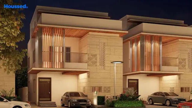
Sri County- IV
PENMATCHA · Rangareddy · RERA P02400004870
SRI COUNTY- IV is a plotted layout in Pasmamla, Abdullapurmet, Ranga Reddy District, developed by SRI PENMATCHA PRANEETH AND CHODARAJU SUPRITHA. The HMDA-approved layout covers 30,513.38 sq.m and describes 88 plots/villas; plot-size configurations are not stated. The project is registered with TG-RERA under P02400004870, and the promoter’s stated completion date is 28 April 2028.
01What we found
Read from TG-RERA filings, approvals, land and registration records and court records. A court case is counted only when the court record states this project's survey number with its village, or names the project.
02Check before you pay
8 items to check before you pay, 4 high - from the title chain, court records and approvals, each with what to ask the builder or your advocate. An item may not be a problem with the project: records can be incomplete.
1. Project at a glance
Project identity
| Field | Project record |
|---|---|
| Registered project name | SRI COUNTY- IV |
| Project type | Plotted layout / plotted development RERA record |
| Phase or registered portion | Not identified as a numbered phase; TG-RERA certificate covers the listed survey numbers |
| TG-RERA registration | P02400004870, granted under section 5 |
| Registration validity | 23/08/2022 to 28/04/2028, as stated in the TG-RERA certificate; this is registration validity, not a statement of construction completion |
| RERA status in supplied record | Registered; certificate states validity for 5 years and does not record an extension |
| Promoter | Certificate names Mr./Ms. Penmatcha Praneeth; the filed Form B names SRI PENMATCHA PRANEETH AND CHODARAJU SUPRITHA as promoter, with Penmatcha Praneeth as authorized signatory |
| Project completion date | The Form B undertaking states 28 April 2028 |
Land and geographic identity
| Field | Project record |
|---|---|
| Locality / revenue village | Pasmamla / Pasumamula (as recorded in the TG-RERA and HMDA documents) |
| Mandal / district / PIN | Abdullapurmet / Ranga Reddy / 501512 |
| Project survey numbers and subdivisions | 119E/1/1/1/2; 119E/1/1/1/1/2; 137/5; 137/5/1/2/1; 137/5/1/2/2 |
| Total site area | 30,513.38 sq.m |
| Area affected by master-plan road | 111.46 sq.m |
| Net site area | 30,401.92 sq.m |
| Boundaries in RERA filing | East: Others Land; West: 40 Ft Wide Road; North: Others Land; South: Others Land RERA filing |
Development identity
| Field | Project record |
|---|---|
| Sanctioning authority | Hyderabad Metropolitan Development Authority (HMDA) |
| Principal layout approval | 001252/LO/HMDA/0197/GHT/2022, approved 28 April 2022 |
| Development approved in the layout permission | 88 plots / villas |
| Approved land-use components | Plotted area 20,203.94 sq.m; open space 2,282.22 sq.m (7.51%); social infrastructure 763.73 sq.m (2.51%); layout road area 6,797.92 sq.m (22.36%); amenities area 352.75 sq.m; utilities area 0; total built-up area 0 |
| Buildings / floors | Not applicable as a multi-storey building description is not supplied for this plotted layout. The permission refers to plots/villas but does not provide a villa count separate from the stated 88 plots/villas or a floor configuration |
| HMDA mortgage recorded in layout permission | Plot/Villa Nos. 1 and 3 in favour of the Commissioner, HMDA; mortgage deed no. 2889/2022 |
Offering and status
| Field | Project record |
|---|---|
| Offering | Plots in an HMDA layout; the approval describes 88 plots/villas |
| Plot count / sale inventory | The layout permission states 88 plots/villas; booked and available counts are not disclosed in the supplied data |
| Plot size range | Not disclosed in the supplied TG-RERA project data |
| Construction / development stage | The supplied RERA amenity record reports varying progress for layout infrastructure; this is a project-reported status, not independently verified site progress RERA amenities |
| Completion date | Form B states 28 April 2028 as the promoter’s completion undertaking |
| Occupancy / completion certificate | No occupancy or completion certificate is identified in the supplied records; the project is registered as a plotted development Document index |
2. The project story
SRI COUNTY- IV is registered as a plotted development in the Pasmamla/Pasumamula revenue location, Abdullapurmet Mandal, Ranga Reddy District. Its registered land identity comprises five survey entries: 119E/1/1/1/2, 119E/1/1/1/1/2, 137/5, 137/5/1/2/1 and 137/5/1/2/2. The HMDA layout permission describes 88 plots/villas and a site area of 30,513.38 sq.m, including 111.46 sq.m affected by a master-plan road and a net site area of 30,401.92 sq.m.
The approved layout allocates land to plots, roads, open space, social infrastructure and an amenities area. The RERA amenity record reports progress against internal roads and footpaths, water supply, storm-water drains, green space and other infrastructure; those percentages are filed progress figures, not an independent inspection or confirmation of completion. The promoter’s Form B undertaking gives 28 April 2028 as the project completion date. RERA amenities
3. Master plan, architecture & building design
The HMDA approval is for an open plotted layout, not a supplied apartment-building plan. It records a total site area of 30,513.38 sq.m, a master-plan road-affected area of 111.46 sq.m, and a net site area of 30,401.92 sq.m. The approved land-use schedule lists 20,203.94 sq.m of plotted area, 2,282.22 sq.m of open space (7.51%), 763.73 sq.m of social infrastructure (2.51%), 6,797.92 sq.m of layout roads (22.36%), 352.75 sq.m of amenities area, and 0 utilities area and 0 total built-up area. These are layout-permission figures; the record does not provide plot-by-plot dimensions or a separate villa-building design schedule.
The approval calls for road formation with blacktop, storm-water drains, underground drainage lines and a common septic tank/STP. It also says roads should be opened for access to neighbouring sites and that roads and open space are to be taken over by the municipality through registered gift deed before final layout release. The document states that the layout permission is not proof of land title.
4. Homes, configurations & floor plans
The project is a plotted layout. The HMDA permission states 88 plots/villas, but the supplied project record does not provide plot-size bands, plot-wise inventory, booked/available counts or RERA-filed plot areas. RERA unit table
| Configuration | Units | Booked | Available | RERA saleable area | Measured carpet area | Loading (if supplied) |
|---|---|---|---|---|---|---|
| Plots / villas, as stated in HMDA layout permission | 88 | Not disclosed | Not disclosed | Not disclosed | Not applicable / not supplied | Not supplied |
Six drawing files are listed as awaiting scan processing; none has been software-measured. Accordingly, there are no drawing-based plot or building measurements available here. Floor plans
5. Parking & vehicle circulation
The supplied layout record does not state a parking-space count, visitor or accessible parking provision, parking allocation by plot, or EV-charging provision. The HMDA schedule records 6,797.92 sq.m of layout road area, and the approval requires roads to be formed and opened for access to neighbouring sites; road-area figures do not establish plot-specific parking rights.
The layout permission records Plot/Villa Nos. 1 and 3 as mortgaged to HMDA under mortgage deed no. 2889/2022. Its condition says those mortgaged plots/villas may not be sold before the required development and release conditions are met.
6. Amenities, recreation & open spaces
The following percentages are filed amenity-progress figures. They are not independent verification of completion. The HMDA approval separately identifies open space, social infrastructure and amenities land in its layout schedule. RERA amenities
| Facility | Description / size | Evidence source | Declared progress / verified status |
|---|---|---|---|
| Green strip / tot lot / park | Open space in approved schedule: 2,282.22 sq.m (7.51%) | RERA amenities | RERA amenity record: 95%; independent completion not verified |
| Community buildings | No size or facility detail supplied | RERA amenities | RERA amenity record: 0% |
| Social infrastructure | 763.73 sq.m (2.51%) in the approved schedule; specific facility not identified | No separate progress figure supplied | |
| Amenities area | 352.75 sq.m in the approved schedule; facility mix and size breakdown not supplied | No separate completion status supplied |
The vendor listing mentions facilities such as a swimming pool and gymnasium, but those are marketing-source claims, not features established as sanctioned or delivered by the supplied TG-RERA layout record. Promoter website
7. Utilities, building services & safety
HMDA’s layout permission calls for underground drainage lines and a common septic tank/STP, storm-water drains, and blacktop roads. It also lists 0 utilities area in the layout land-use schedule. The RERA amenity record reports 95% progress for water supply and storm-water drains, 50% for sewerage (chambers, lines, septic tank, STP), and 100% for water conservation/rainwater harvesting and the electrical meter room/sub-station/receiving-station item. These are recorded progress figures; the supplied data does not provide system capacities, connection details or independent commissioning evidence. RERA amenities
The RERA amenity record shows 0% for treatment and disposal of sewage and sullage water, energy management, and fire protection/fire safety requirements. It does not establish the status or specifications of water storage, backup power, waste-processing equipment, security systems or accessibility features. RERA amenities
8. Location, access & connectivity
The registered project location is Pasmamla/Pasumamula, Abdullapurmet Mandal, Ranga Reddy District, Telangana, PIN 501512. The RERA-filed boundary description identifies a 40 Ft Wide Road on the west and “Others Land” on the east, north and south. RERA filing
The supplied location data lists the nearest sampled Outer Ring Road interchange at 7.7 km, an Urban Primary Health Centre Abdullapur at 1.1 km, a ZPHS School at 0.9 km, Shiva Gardens at 1.2 km, HDFC Bank at 1.5 km, and Brilliant Group of Institutions at 1.5 km. These are supplied location-record distances; no travel times or public-transport details are provided. Location record
9. Developer & development status
The TG-RERA certificate identifies Mr./Ms. Penmatcha Praneeth as promoter. The filed Form B names SRI PENMATCHA PRANEETH AND CHODARAJU SUPRITHA as promoter and Penmatcha Praneeth as authorized signatory. The legal entity type and corporate registration details are not established in the supplied record. Corporate record
The Form B affidavit, dated 09.05.2022, declares a completion period ending 28 April 2028 and includes undertakings concerning approvals and project funds. The supplied progress information is the RERA amenity record; no independent site-progress verification, plot-by-plot sales inventory or occupancy/completion certificate is provided. RERA amenities Document index
10. Approvals, official records & documents
| Record | What it establishes in the supplied material |
|---|---|
| TG-RERA registration certificate P02400004870 | Registration of SRI COUNTY- IV under section 5, valid from 23/08/2022 to 28/04/2028 |
| HMDA layout permission 001252/LO/HMDA/0197/GHT/2022, dated 28 April 2022 | Layout permission covering the five listed survey entries, stating 88 plots/villas and the land-use schedule |
| Form B declaration, dated 09.05.2022 | Promoter declaration and completion undertaking of 28 April 2028 |
| HMDA mortgage reference 2889/2022 | Layout permission records Plot/Villa Nos. 1 and 3 mortgaged in favour of the Commissioner, HMDA |
| Occupancy/completion certificate | Not identified in the supplied documents Document index |
| Detailed layout drawing / plot-wise schedule | Not available in the supplied material; the public HMDA approved-layout lookup is reported unavailable from the supplied HMDA data HMDA |
1. Project at a glance
Project identity
Registered project name: SRI COUNTY- IV
Project type: Plotted layout / plotted development
Phase or registered portion: Not identified as a numbered phase; TG-RERA certificate covers the listed survey numbers
TG-RERA registration: P02400004870, granted under section 5
Registration validity: 23/08/2022 to 28/04/2028, as stated in the TG-RERA certificate; this is registration validity, not a statement of construction completion
RERA status in supplied record: Registered; certificate states validity for 5 years and does not record an extension
Promoter: Certificate names Mr./Ms. Penmatcha Praneeth; the filed Form B names SRI PENMATCHA PRANEETH AND CHODARAJU SUPRITHA as promoter, with Penmatcha Praneeth as authorized signatory
Project completion date: The Form B undertaking states 28 April 2028
Land and geographic identity
Locality / revenue village: Pasmamla / Pasumamula (as recorded in the TG-RERA and HMDA documents)
Mandal / district / PIN: Abdullapurmet / Ranga Reddy / 501512
Project survey numbers and subdivisions: 119E/1/1/1/2; 119E/1/1/1/1/2; 137/5; 137/5/1/2/1; 137/5/1/2/2
Total site area: 30,513.38 sq.m
Area affected by master-plan road: 111.46 sq.m
Net site area: 30,401.92 sq.m
Boundaries in RERA filing: East: Others Land; West: 40 Ft Wide Road; North: Others Land; South: Others Land
Development identity
Sanctioning authority: Hyderabad Metropolitan Development Authority (HMDA)
Principal layout approval: 001252/LO/HMDA/0197/GHT/2022, approved 28 April 2022
Development approved in the layout permission: 88 plots / villas
Approved land-use components: Plotted area 20,203.94 sq.m; open space 2,282.22 sq.m (7.51%); social infrastructure 763.73 sq.m (2.51%); layout road area 6,797.92 sq.m (22.36%); amenities area 352.75 sq.m; utilities area 0; total built-up area 0
Buildings / floors: Not applicable as a multi-storey building description is not supplied for this plotted layout. The permission refers to plots/villas but does not provide a villa count separate from the stated 88 plots/villas or a floor configuration
HMDA mortgage recorded in layout permission: Plot/Villa Nos. 1 and 3 in favour of the Commissioner, HMDA; mortgage deed no. 2889/2022
Offering and status
Offering: Plots in an HMDA layout; the approval describes 88 plots/villas
Plot count / sale inventory: The layout permission states 88 plots/villas; booked and available counts are not disclosed in the supplied data
Plot size range: Not disclosed in the supplied TG-RERA project data
Construction / development stage: The supplied RERA amenity record reports varying progress for layout infrastructure; this is a project-reported status, not independently verified site progress
Completion date: Form B states 28 April 2028 as the promoter’s completion undertaking
Occupancy / completion certificate: No occupancy or completion certificate is identified in the supplied records; the project is registered as a plotted development
2. The project story
SRI COUNTY- IV is registered as a plotted development in the Pasmamla/Pasumamula revenue location, Abdullapurmet Mandal, Ranga Reddy District. Its registered land identity comprises five survey entries: 119E/1/1/1/2, 119E/1/1/1/1/2, 137/5, 137/5/1/2/1 and 137/5/1/2/2. The HMDA layout permission describes 88 plots/villas and a site area of 30,513.38 sq.m, including 111.46 sq.m affected by a master-plan road and a net site area of 30,401.92 sq.m.
The approved layout allocates land to plots, roads, open space, social infrastructure and an amenities area. The RERA amenity record reports progress against internal roads and footpaths, water supply, storm-water drains, green space and other infrastructure; those percentages are filed progress figures, not an independent inspection or confirmation of completion. The promoter’s Form B undertaking gives 28 April 2028 as the project completion date.
3. Master plan, architecture & building design
The HMDA approval is for an open plotted layout, not a supplied apartment-building plan. It records a total site area of 30,513.38 sq.m, a master-plan road-affected area of 111.46 sq.m, and a net site area of 30,401.92 sq.m. The approved land-use schedule lists 20,203.94 sq.m of plotted area, 2,282.22 sq.m of open space (7.51%), 763.73 sq.m of social infrastructure (2.51%), 6,797.92 sq.m of layout roads (22.36%), 352.75 sq.m of amenities area, and 0 utilities area and 0 total built-up area. These are layout-permission figures; the record does not provide plot-by-plot dimensions or a separate villa-building design schedule.
The approval calls for road formation with blacktop, storm-water drains, underground drainage lines and a common septic tank/STP. It also says roads should be opened for access to neighbouring sites and that roads and open space are to be taken over by the municipality through registered gift deed before final layout release. The document states that the layout permission is not proof of land title.
4. Homes, configurations & floor plans
The project is a plotted layout. The HMDA permission states 88 plots/villas, but the supplied project record does not provide plot-size bands, plot-wise inventory, booked/available counts or RERA-filed plot areas.
| Configuration | Units | Booked | Available | RERA saleable area | Measured carpet area | Loading (if supplied) |
|---|---|---|---|---|---|---|
| Plots / villas, as stated in HMDA layout permission | 88 | Not disclosed | Not disclosed | Not disclosed | Not applicable / not supplied | Not supplied |
Six drawing files are listed as awaiting scan processing; none has been software-measured. Accordingly, there are no drawing-based plot or building measurements available here.
5. Parking & vehicle circulation
The supplied layout record does not state a parking-space count, visitor or accessible parking provision, parking allocation by plot, or EV-charging provision. The HMDA schedule records 6,797.92 sq.m of layout road area, and the approval requires roads to be formed and opened for access to neighbouring sites; road-area figures do not establish plot-specific parking rights.
The layout permission records Plot/Villa Nos. 1 and 3 as mortgaged to HMDA under mortgage deed no. 2889/2022. Its condition says those mortgaged plots/villas may not be sold before the required development and release conditions are met.
6. Amenities, recreation & open spaces
The following percentages are filed amenity-progress figures. They are not independent verification of completion. The HMDA approval separately identifies open space, social infrastructure and amenities land in its layout schedule.
| Facility | Description / size | Evidence source | Declared progress / verified status |
|---|---|---|---|
| Green strip / tot lot / park | Open space in approved schedule: 2,282.22 sq.m (7.51%) | RERA amenity record: 95%; independent completion not verified | |
| Community buildings | No size or facility detail supplied | RERA amenity record: 0% | |
| Social infrastructure | 763.73 sq.m (2.51%) in the approved schedule; specific facility not identified | No separate progress figure supplied | |
| Amenities area | 352.75 sq.m in the approved schedule; facility mix and size breakdown not supplied | No separate completion status supplied |
The vendor listing mentions facilities such as a swimming pool and gymnasium, but those are marketing-source claims, not features established as sanctioned or delivered by the supplied TG-RERA layout record.
7. Utilities, building services & safety
HMDA’s layout permission calls for underground drainage lines and a common septic tank/STP, storm-water drains, and blacktop roads. It also lists 0 utilities area in the layout land-use schedule. The RERA amenity record reports 95% progress for water supply and storm-water drains, 50% for sewerage (chambers, lines, septic tank, STP), and 100% for water conservation/rainwater harvesting and the electrical meter room/sub-station/receiving-station item. These are recorded progress figures; the supplied data does not provide system capacities, connection details or independent commissioning evidence.
The RERA amenity record shows 0% for treatment and disposal of sewage and sullage water, energy management, and fire protection/fire safety requirements. It does not establish the status or specifications of water storage, backup power, waste-processing equipment, security systems or accessibility features.
8. Location, access & connectivity
The registered project location is Pasmamla/Pasumamula, Abdullapurmet Mandal, Ranga Reddy District, Telangana, PIN 501512. The RERA-filed boundary description identifies a 40 Ft Wide Road on the west and “Others Land” on the east, north and south.
The supplied location data lists the nearest sampled Outer Ring Road interchange at 7.7 km, an Urban Primary Health Centre Abdullapur at 1.1 km, a ZPHS School at 0.9 km, Shiva Gardens at 1.2 km, HDFC Bank at 1.5 km, and Brilliant Group of Institutions at 1.5 km. These are supplied location-record distances; no travel times or public-transport details are provided.
9. Developer & development status
The TG-RERA certificate identifies Mr./Ms. Penmatcha Praneeth as promoter. The filed Form B names SRI PENMATCHA PRANEETH AND CHODARAJU SUPRITHA as promoter and Penmatcha Praneeth as authorized signatory. The legal entity type and corporate registration details are not established in the supplied record.
The Form B affidavit, dated 09.05.2022, declares a completion period ending 28 April 2028 and includes undertakings concerning approvals and project funds. The supplied progress information is the RERA amenity record; no independent site-progress verification, plot-by-plot sales inventory or occupancy/completion certificate is provided.
10. Approvals, official records & documents
TG-RERA registration certificate P02400004870: Registration of SRI COUNTY- IV under section 5, valid from 23/08/2022 to 28/04/2028
HMDA layout permission 001252/LO/HMDA/0197/GHT/2022, dated 28 April 2022: Layout permission covering the five listed survey entries, stating 88 plots/villas and the land-use schedule
Form B declaration, dated 09.05.2022: Promoter declaration and completion undertaking of 28 April 2028
HMDA mortgage reference 2889/2022: Layout permission records Plot/Villa Nos. 1 and 3 mortgaged in favour of the Commissioner, HMDA
Occupancy/completion certificate: Not identified in the supplied documents
Detailed layout drawing / plot-wise schedule: Not available in the supplied material; the public HMDA approved-layout lookup is reported unavailable from the supplied HMDA data
Frequently asked questions
Is SRI COUNTY- IV registered with Telangana RERA?
Yes. SRI COUNTY- IV is registered with the Telangana Real Estate Regulatory Authority as P02400004870; the registration status is New Project.
Who is the developer of SRI COUNTY- IV?
The promoter named in the RERA registration is PENMATCHA.
Where is SRI COUNTY- IV located?
SRI COUNTY- IV is in Abdullapurmet, Pasmamla, Rangareddy, Telangana (501512).
When will SRI COUNTY- IV be completed?
The promoter's proposed date of completion filed with RERA is 28/08/2028. This is the promoter's declaration, not a guarantee.
More projects in Pasmamla