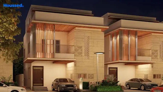
Piddishetty Nirmala
NIRMALA · Rangareddy · RERA P02400003912
PIDDISHETTY NIRMALA is a plotted development and proposed residential layout at PASMAMLA, Pasumamula Village, Abdullapurmet Mandal, Ranga Reddy District. The registered promoter is Nirmala Piddishetty. The layout covers 32,779.16 sq.m. in Survey Nos. 97, 98 and 107; the supplied record does not state a total plot count or plot-size configurations. It is registered under TG-RERA number P02400003912, and Form B declares completion within three years from project registration.
01What we found
Read from TG-RERA filings, approvals, land and registration records and court records. A court case is counted only when the court record states this project's survey number with its village, or names the project.
02Check before you pay
6 items to check before you pay, 3 high - from the title chain, court records and approvals, each with what to ask the builder or your advocate. An item may not be a problem with the project: records can be incomplete.
1. Project at a glance
Project identity
| Field | Record |
|---|---|
| Registered project name | PIDDISHETTY NIRMALA RERA record |
| Project type | Plotted development / proposed residential layout RERA record |
| Phase / registered portion | No phase is identified in the supplied record; the registration covers the layout on Survey Nos. 97, 98 and 107 |
| TG-RERA registration | P02400003912 RERA record |
| Registration validity | 06/01/2022 to 30/09/2024, as stated on the Form C certificate; no extension is recorded in the supplied evidence |
| Registered promoter | Nirmala Piddishetty on the certificate; the project filing and Form B use PIDDISHETTY NIRMALA |
| RERA status | Project is recorded as a registered project; the certificate’s stated validity ended on 30/09/2024. Current registration status is not established by the supplied documents |
Land and geographic identity
| Field | Record |
|---|---|
| Locality | PASMAMLA / Pasumamula (also rendered “Pasumamla” in the registration certificate) RERA record |
| Revenue village | Pasumamula Village; also rendered Pasumamula Revenue Village in the title records Land records |
| Mandal | Abdullapurmet RERA record Land records |
| District | Ranga Reddy RERA record Land records |
| PIN | 501505 RERA record |
| Project survey numbers | 97, 98 and 107; no subdivisions are supplied RERA record |
| Site extent | 32,779.16 sq.m. stated in the RERA project details and layout drawing RERA filing |
| Net / total land area | The RERA filing records total area and net area as 32,779.16 sq.m. RERA filing |
| Boundaries in the RERA filing | East: Survey No. 97 and 99; West: Survey No. 87 and 106; North: road width 9; South: Survey No. 106 RERA filing |
Development identity
| Field | Record |
|---|---|
| Sanctioning authority | Hyderabad Metropolitan Development Authority (HMDA); municipal proceedings also appear from Pedda Amberpet Municipality Approvals record |
| Principal layout approval | HMDA Layout Permit 000015/LO/Plg/HMDA/2021, dated 06-01-2021, shown in the filed layout drawing as a proposed residential draft layout |
| Municipal proceedings | Proc.Roc.No.G1/3358/PAM/2021, dated 10.12.2021 |
| Approved built-up area | Not disclosed in the supplied project record; this is a plotted layout, and no building plan or building configuration is supplied RERA filing |
| Building / tower count and floors | Not disclosed; no residential buildings or floor configuration are evidenced in the supplied project documents Document index |
| Parking | No sanctioned vehicle-parking count or parking-level arrangement is supplied Document index |
| Approved versus RERA-declared plot counts | The drawing and RERA filing refer to a plotted layout; a complete plot schedule or verified total plot count is not supplied. Plots 81–100 are identified as mortgage plots |
Offering and status
| Field | Record |
|---|---|
| Offering | Plots in a proposed residential layout; individual plot numbers, sizes and availability are not established by the supplied RERA data |
| RERA-filed saleable area / plot-size range | Not disclosed in the supplied records Document index |
| Booked / available count | Not disclosed Document index |
| Construction / development stage | The registration certificate and filed materials do not provide a current independently verified site-progress status. The layout drawing is described as a proposed residential draft layout |
| Completion dates | The registration certificate states validity through 30/09/2024. Form B separately declares completion within three years from project registration; no revised completion date is supplied |
| Occupancy / completion certificate | Not supplied. No building-specific OC or completion certificate is evidenced in the supplied material Document index |
2. The project story
PIDDISHETTY NIRMALA is registered as a plotted development at Pasumamula Village in Abdullapurmet Mandal, Ranga Reddy District. The registered land identity covers Survey Nos. 97, 98 and 107. The RERA-filed project extent is 32,779.16 sq.m. RERA record RERA filing
The filed layout plan describes a proposed residential layout, rather than an apartment or tower development. It sets out plots, internal roads, open space/park and social-infrastructure land. The plan and related authority documents identify Plots 81 to 100 as mortgage plots and state that those plots are not to be sold while mortgaged; the records also describe infrastructure and handover conditions linked to release of final layout plans. These are document-recorded conditions, not evidence that the works or final release have since been completed.
The supplied documents do not establish current site progress, which plots are booked or available, or that any part of the layout has received an occupancy or completion certificate. The project’s registration validity end date is distinct from the promoter’s declared completion period.
3. Master plan, architecture & building design
The filed layout drawing states a total and net area of 32,779.16 sq.m. and gives this land-use schedule: Plotted Area 19,349.85 sq.m.; Road Area 9,578.93 sq.m.; Organized open space/park Area/Utility Area 3,023.01 sq.m.; and Social Infrastructure Area 827.21 sq.m. These are drawing-stated areas, not independently surveyed measurements.
The layout is shown at scale 1:400 and includes roads labelled 9.14 mtrs and 12 mtrs; the related authority records also refer to roads of 18 mts and above and 60 feet and above. The available extracts do not provide a complete, verified plot schedule or dimensions for individual sale plots.
The plan and filed approval records identify proposed infrastructure including internal water pipelines, an overhead tank, storm-water drainage, rainwater-harvesting pits, street lighting, a transformer, avenue plantation, park development, solid-waste disposal and cycling tracks. The drawing also labels STP, underground sump, dust bin, transformer, TOTLOT and utility. These are plan/document descriptions; the supplied evidence does not verify their construction or operation. No apartment building arrangement, building footprint, floor configuration, tower height or residential floor plan is supplied.
4. Homes, configurations & floor plans
This is a plotted layout, not a supplied apartment configuration schedule. The RERA material provided does not state the number of saleable plots, plot-size bands, booked or available plots, or plot-wise saleable area. Accordingly, unit-level counts and areas cannot be tabulated from the supplied project record. Document index
The two drawing sheets are layout sheets and are recorded as having no flats; no measured residential floor-plan or carpet-area results are available. The vendor data contains villa configuration claims, but those are not treated here as RERA-filed plot or unit particulars. Floor plans Promoter website
5. Parking & vehicle circulation
No sanctioned count of car or two-wheeler parking spaces, visitor or accessible parking provision, parking levels, or plot-wise parking allocation is disclosed in the supplied project documents. The layout records describe internal roads, but do not establish parking ownership or an allotment arrangement. Document index
6. Amenities, recreation & open spaces
The following facilities appear in the filed layout or related approval records. Listed presence is evidence of a plan or document description, not confirmation of completion.
| Facility | Description / size | Evidence source | Declared progress / verified status |
|---|---|---|---|
| Clubhouse / indoor | No clubhouse or indoor facility is evidenced in the filed layout extracts | Not established | |
| Sports / recreation | Cycling tracks; TOTLOT is labelled on the layout plan | Proposed/documented; completion not verified | |
| Landscape / open space | Organized open space/park Area/Utility Area: 3,023.01 sq.m.; avenue plantation and park development are specified in the records | Proposed/documented; completion not verified | |
| Convenience / community | Social Infrastructure Area: 827.21 sq.m.; drawing labels utility land | Allocated/described in layout records; facility details and completion not established |
7. Utilities, building services & safety
The filed layout and authority proceedings describe proposed potable/drinking-water connectivity, internal water-supply pipelines and an overhead tank; a common septic tank/STP and underground drainage; underground storm-water drainage and rainwater-harvesting pits; electrical supply lines, a transformer and street lighting; and solid-waste disposal and a bio-compost unit. The records also call for underground ducting of utilities, garbage segregation and space for waste disposal. These are documented proposals or conditions, not verified operational services.
The supplied materials do not state water-source details, tank capacity, STP capacity, electrical load or backup capacity, EV charging, lift provision, fire-system specifications, CCTV or access-control arrangements, or accessibility features. No building-level safety or service design is evidenced for this plotted layout. Document index
8. Location, access & connectivity
The registered project location is PASMAMLA, at Pasumamula Village, Abdullapurmet Mandal, Ranga Reddy District, PIN 501505. The filed layout describes access through internal roads and records a northern boundary as “ROAD WIDTH 9”; the drawing also shows road widths of 9.14 mtrs and 12 mtrs. RERA record RERA filing RERA filing
No project-specific measured distances to public transport, services or landmarks are established in the supplied RERA records. The available location dataset includes nearby-place measurements, but the supplied project evidence does not establish them as official project access or travel-time claims; no travel times are stated here. Location record
9. Developer & development status
The registered promoter is identified on the TG-RERA certificate as Nirmala Piddishetty; the filed Form B names PIDDISHETTY NIRMALA as promoter. The supplied evidence does not establish the promoter’s legal entity type, corporate registration identifiers, registered office or official contact details. Corporate record
Form B is a promoter declaration that the project would be completed within three years from the date of registration. The certificate states a registration-validity period from 06/01/2022 to 30/09/2024 and records no extension. These dates describe different matters; the supplied evidence does not establish current site progress, a revised completion date, or a current registration status.
10. Approvals, official records & documents
| Identifier / date | P02400003912; issued 06/01/2022; validity stated to 30/09/2024 |
|---|---|
| What the supplied record establishes | Registration certificate for PIDDISHETTY NIRMALA; identifies Survey Nos. 97, 98 and 107 |
| Identifier / date | 000015/LO/Plg/HMDA/2021; 06-01-2021 |
|---|---|
| What the supplied record establishes | Proposed residential draft layout plan for the project land |
| Identifier / date | Application 017722/GHT/LT/U6/HMDA/27112018; dated 06 January, 2021 |
|---|---|
| What the supplied record establishes | Draft layout letter with recorded conditions and mortgage plots |
| Identifier / date | Proc.Roc.No.G1/3358/PAM/2021; 10.12.2021 |
|---|---|
| What the supplied record establishes | Municipal proceedings concerning release of the draft residential layout plan, subject to stated conditions |
| Identifier / date | Project completion declaration: three years from registration |
|---|---|
| What the supplied record establishes | Promoter declaration concerning title basis, encumbrances, project funds, approvals and completion period |
| Identifier / date | Document 195252; dated 21 January 2021 |
|---|---|
| What the supplied record establishes | Advocate’s title opinion concerning the project land |
| Identifier / date | Document 313178; 29 May 2021 |
|---|---|
| What the supplied record establishes | Agreement between Smt. P. Nirmala and M/S. Vijay Infra Projects concerning development rights over Ac 08-04 Guntas in Survey Nos. 97, 98 and 107 |
| Identifier / date | Document 166793; 19 May 1982 |
|---|---|
| What the supplied record establishes | Sale deed copy concerning Survey Nos. 97, 98 and 107 |
| Identifier / date | Not supplied |
|---|---|
| What the supplied record establishes | No such certificate is established by the documents available for this overview Document index |
1. Project at a glance
Project identity
Registered project name: PIDDISHETTY NIRMALA
Project type: Plotted development / proposed residential layout
Phase / registered portion: No phase is identified in the supplied record; the registration covers the layout on Survey Nos. 97, 98 and 107
TG-RERA registration: P02400003912
Registration validity: 06/01/2022 to 30/09/2024, as stated on the Form C certificate; no extension is recorded in the supplied evidence
Registered promoter: Nirmala Piddishetty on the certificate; the project filing and Form B use PIDDISHETTY NIRMALA
RERA status: Project is recorded as a registered project; the certificate’s stated validity ended on 30/09/2024. Current registration status is not established by the supplied documents
Land and geographic identity
Locality: PASMAMLA / Pasumamula (also rendered “Pasumamla” in the registration certificate)
Revenue village: Pasumamula Village; also rendered Pasumamula Revenue Village in the title records
Mandal: Abdullapurmet
District: Ranga Reddy
PIN: 501505
Project survey numbers: 97, 98 and 107; no subdivisions are supplied
Site extent: 32,779.16 sq.m. stated in the RERA project details and layout drawing
Net / total land area: The RERA filing records total area and net area as 32,779.16 sq.m.
Boundaries in the RERA filing: East: Survey No. 97 and 99; West: Survey No. 87 and 106; North: road width 9; South: Survey No. 106
Development identity
Sanctioning authority: Hyderabad Metropolitan Development Authority (HMDA); municipal proceedings also appear from Pedda Amberpet Municipality
Principal layout approval: HMDA Layout Permit 000015/LO/Plg/HMDA/2021, dated 06-01-2021, shown in the filed layout drawing as a proposed residential draft layout
Municipal proceedings: Proc.Roc.No.G1/3358/PAM/2021, dated 10.12.2021
Approved built-up area: Not disclosed in the supplied project record; this is a plotted layout, and no building plan or building configuration is supplied
Building / tower count and floors: Not disclosed; no residential buildings or floor configuration are evidenced in the supplied project documents
Parking: No sanctioned vehicle-parking count or parking-level arrangement is supplied
Approved versus RERA-declared plot counts: The drawing and RERA filing refer to a plotted layout; a complete plot schedule or verified total plot count is not supplied. Plots 81–100 are identified as mortgage plots
Offering and status
Offering: Plots in a proposed residential layout; individual plot numbers, sizes and availability are not established by the supplied RERA data
RERA-filed saleable area / plot-size range: Not disclosed in the supplied records
Booked / available count: Not disclosed
Construction / development stage: The registration certificate and filed materials do not provide a current independently verified site-progress status. The layout drawing is described as a proposed residential draft layout
Completion dates: The registration certificate states validity through 30/09/2024. Form B separately declares completion within three years from project registration; no revised completion date is supplied
Occupancy / completion certificate: Not supplied. No building-specific OC or completion certificate is evidenced in the supplied material
2. The project story
PIDDISHETTY NIRMALA is registered as a plotted development at Pasumamula Village in Abdullapurmet Mandal, Ranga Reddy District. The registered land identity covers Survey Nos. 97, 98 and 107. The RERA-filed project extent is 32,779.16 sq.m.
The filed layout plan describes a proposed residential layout, rather than an apartment or tower development. It sets out plots, internal roads, open space/park and social-infrastructure land. The plan and related authority documents identify Plots 81 to 100 as mortgage plots and state that those plots are not to be sold while mortgaged; the records also describe infrastructure and handover conditions linked to release of final layout plans. These are document-recorded conditions, not evidence that the works or final release have since been completed.
The supplied documents do not establish current site progress, which plots are booked or available, or that any part of the layout has received an occupancy or completion certificate. The project’s registration validity end date is distinct from the promoter’s declared completion period.
3. Master plan, architecture & building design
The filed layout drawing states a total and net area of 32,779.16 sq.m. and gives this land-use schedule: Plotted Area 19,349.85 sq.m.; Road Area 9,578.93 sq.m.; Organized open space/park Area/Utility Area 3,023.01 sq.m.; and Social Infrastructure Area 827.21 sq.m. These are drawing-stated areas, not independently surveyed measurements.
The layout is shown at scale 1:400 and includes roads labelled 9.14 mtrs and 12 mtrs; the related authority records also refer to roads of 18 mts and above and 60 feet and above. The available extracts do not provide a complete, verified plot schedule or dimensions for individual sale plots.
The plan and filed approval records identify proposed infrastructure including internal water pipelines, an overhead tank, storm-water drainage, rainwater-harvesting pits, street lighting, a transformer, avenue plantation, park development, solid-waste disposal and cycling tracks. The drawing also labels STP, underground sump, dust bin, transformer, TOTLOT and utility. These are plan/document descriptions; the supplied evidence does not verify their construction or operation. No apartment building arrangement, building footprint, floor configuration, tower height or residential floor plan is supplied.
4. Homes, configurations & floor plans
This is a plotted layout, not a supplied apartment configuration schedule. The RERA material provided does not state the number of saleable plots, plot-size bands, booked or available plots, or plot-wise saleable area. Accordingly, unit-level counts and areas cannot be tabulated from the supplied project record.
The two drawing sheets are layout sheets and are recorded as having no flats; no measured residential floor-plan or carpet-area results are available. The vendor data contains villa configuration claims, but those are not treated here as RERA-filed plot or unit particulars.
5. Parking & vehicle circulation
No sanctioned count of car or two-wheeler parking spaces, visitor or accessible parking provision, parking levels, or plot-wise parking allocation is disclosed in the supplied project documents. The layout records describe internal roads, but do not establish parking ownership or an allotment arrangement.
6. Amenities, recreation & open spaces
The following facilities appear in the filed layout or related approval records. Listed presence is evidence of a plan or document description, not confirmation of completion.
| Facility | Description / size | Evidence source | Declared progress / verified status |
|---|---|---|---|
| Clubhouse / indoor | No clubhouse or indoor facility is evidenced in the filed layout extracts | Not established | |
| Sports / recreation | Cycling tracks; TOTLOT is labelled on the layout plan | Proposed/documented; completion not verified | |
| Landscape / open space | Organized open space/park Area/Utility Area: 3,023.01 sq.m.; avenue plantation and park development are specified in the records | Proposed/documented; completion not verified | |
| Convenience / community | Social Infrastructure Area: 827.21 sq.m.; drawing labels utility land | Allocated/described in layout records; facility details and completion not established |
7. Utilities, building services & safety
The filed layout and authority proceedings describe proposed potable/drinking-water connectivity, internal water-supply pipelines and an overhead tank; a common septic tank/STP and underground drainage; underground storm-water drainage and rainwater-harvesting pits; electrical supply lines, a transformer and street lighting; and solid-waste disposal and a bio-compost unit. The records also call for underground ducting of utilities, garbage segregation and space for waste disposal. These are documented proposals or conditions, not verified operational services.
The supplied materials do not state water-source details, tank capacity, STP capacity, electrical load or backup capacity, EV charging, lift provision, fire-system specifications, CCTV or access-control arrangements, or accessibility features. No building-level safety or service design is evidenced for this plotted layout.
8. Location, access & connectivity
The registered project location is PASMAMLA, at Pasumamula Village, Abdullapurmet Mandal, Ranga Reddy District, PIN 501505. The filed layout describes access through internal roads and records a northern boundary as “ROAD WIDTH 9”; the drawing also shows road widths of 9.14 mtrs and 12 mtrs.
No project-specific measured distances to public transport, services or landmarks are established in the supplied RERA records. The available location dataset includes nearby-place measurements, but the supplied project evidence does not establish them as official project access or travel-time claims; no travel times are stated here.
9. Developer & development status
The registered promoter is identified on the TG-RERA certificate as Nirmala Piddishetty; the filed Form B names PIDDISHETTY NIRMALA as promoter. The supplied evidence does not establish the promoter’s legal entity type, corporate registration identifiers, registered office or official contact details.
Form B is a promoter declaration that the project would be completed within three years from the date of registration. The certificate states a registration-validity period from 06/01/2022 to 30/09/2024 and records no extension. These dates describe different matters; the supplied evidence does not establish current site progress, a revised completion date, or a current registration status.
10. Approvals, official records & documents
| Identifier / date | P02400003912; issued 06/01/2022; validity stated to 30/09/2024 |
|---|---|
| What the supplied record establishes | Registration certificate for PIDDISHETTY NIRMALA; identifies Survey Nos. 97, 98 and 107 |
| Identifier / date | 000015/LO/Plg/HMDA/2021; 06-01-2021 |
|---|---|
| What the supplied record establishes | Proposed residential draft layout plan for the project land |
| Identifier / date | Application 017722/GHT/LT/U6/HMDA/27112018; dated 06 January, 2021 |
|---|---|
| What the supplied record establishes | Draft layout letter with recorded conditions and mortgage plots |
| Identifier / date | Proc.Roc.No.G1/3358/PAM/2021; 10.12.2021 |
|---|---|
| What the supplied record establishes | Municipal proceedings concerning release of the draft residential layout plan, subject to stated conditions |
| Identifier / date | Project completion declaration: three years from registration |
|---|---|
| What the supplied record establishes | Promoter declaration concerning title basis, encumbrances, project funds, approvals and completion period |
| Identifier / date | Document 195252; dated 21 January 2021 |
|---|---|
| What the supplied record establishes | Advocate’s title opinion concerning the project land |
| Identifier / date | Document 313178; 29 May 2021 |
|---|---|
| What the supplied record establishes | Agreement between Smt. P. Nirmala and M/S. Vijay Infra Projects concerning development rights over Ac 08-04 Guntas in Survey Nos. 97, 98 and 107 |
| Identifier / date | Document 166793; 19 May 1982 |
|---|---|
| What the supplied record establishes | Sale deed copy concerning Survey Nos. 97, 98 and 107 |
| Identifier / date | Not supplied |
|---|---|
| What the supplied record establishes | No such certificate is established by the documents available for this overview |
Frequently asked questions
Is PIDDISHETTY NIRMALA registered with Telangana RERA?
Yes. PIDDISHETTY NIRMALA is registered with the Telangana Real Estate Regulatory Authority as P02400003912; the registration status is New Project.
Who is the developer of PIDDISHETTY NIRMALA?
The promoter named in the RERA registration is NIRMALA.
Where is PIDDISHETTY NIRMALA located?
PIDDISHETTY NIRMALA is in PASMAMLA, Abdullapurmet, Rangareddy, Telangana (501505).
When will PIDDISHETTY NIRMALA be completed?
The promoter's proposed date of completion filed with RERA is 30/09/2024. This is the promoter's declaration, not a guarantee.
More projects in Pasmamla