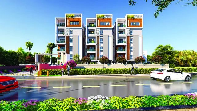
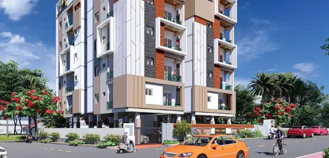
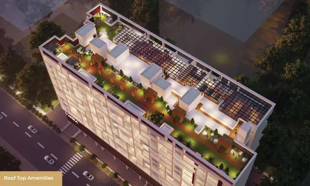
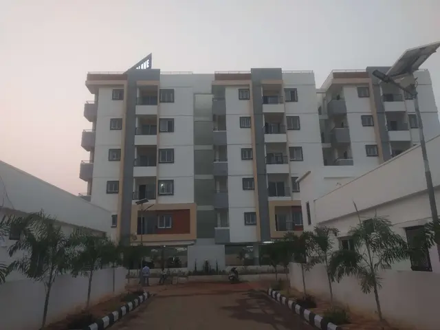
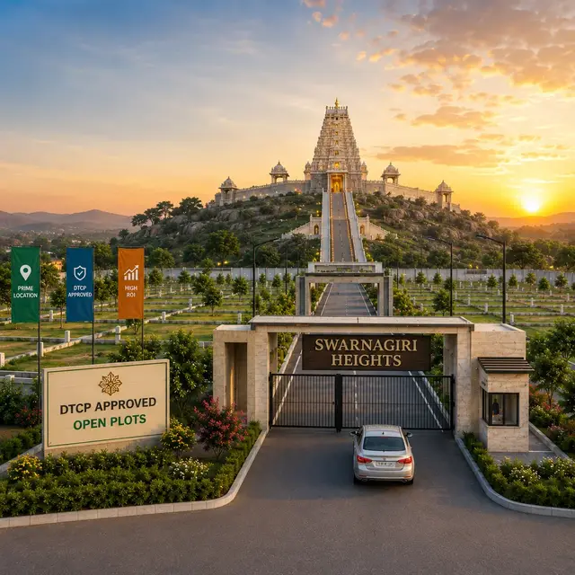
Sr Heights Phase - 1
SADINENI · Yadadri Bhuvanagiri · RERA P02000003113
SR HEIGHTS PHASE - 1 is a residential plotted development in BUVANAGIRI locality, Bhongir Mandal, Yadadri Bhuvanagiri District. The registered promoter is Mr. Sadineni Meghanath. The layout covers 15,477.52 sq.m. and shows 54 residential plots; drawing-derived plot sizes range from 139.0–335.0 sq.m. TG-RERA registration number P02000003113 was issued 24/07/2021, and the proposed completion date is 11/01/2026.
01What we found
Read from TG-RERA filings, approvals, land and registration records and court records. A court case is counted only when the court record states this project's survey number with its village, or names the project.
02Check before you pay
7 items to check before you pay, 4 high - from the title chain, court records and approvals, each with what to ask the builder or your advocate. An item may not be a problem with the project: records can be incomplete.
1. Project at a glance
Project identity
| Item | Evidence-backed record |
|---|---|
| Registered project name | SR HEIGHTS PHASE - 1 RERA record |
| Project type | Plotted development / open layout; the filed layout identifies residential plot use. RERA record RERA filing |
| Phase / registered portion | Phase - 1 is the registered project. The evidence does not identify any other phase or define a wider project beyond this registration. RERA record |
| TG-RERA registration | P02000003113; certificate issued 24/07/2021, valid from 24/07/2021 to 11/01/2026. The supplied certificate says it was not extended; the registration record was captured on 2026-09-10. RERA record Approvals record |
| Registered promoter | Mr. Sadineni Meghanath on the TG-RERA certificate; the project header records promoter SADINENI. Legal entity type is not disclosed in the supplied project identity data. RERA record Corporate record |
| RERA status | Header records the project as New Project. Registration validity is stated separately above; no later extension is shown in the supplied certificate. RERA record |
Land and geographic identity
| Item | Evidence-backed record |
|---|---|
| Locality / street | BUVANAGIRI locality; HANMAPUR street in the project address. RERA record RERA filing |
| Revenue village | Buvanagiri in the project identity fields; the filed layout and approval documents describe Hanmapur Village. Both names are retained as recorded. RERA record RERA filing |
| Mandal | Bhongir in the project identity fields; filed layout documents also use Buvanagiri Mandal. RERA record RERA filing |
| District / PIN | Yadadri Bhuvanagiri; 508117. RERA record RERA filing |
| Project survey number | 54/P. No further project subdivision is disclosed in the project identity or layout record. RERA record Land records |
| Site area | 15,477.52 sq.m. total area shown on the layout drawing; 681.73 sq.m. road-widening area; 14,795.79 sq.m. net layout area. The RERA land fields separately state 14,795.79 sq.m. total area and 9,128.38 sq.m. net area. RERA filing Land records |
| Boundaries | North, south, east and west are each recorded as NEIGHBOURS LAND; adjoining parcels are not further identified. RERA filing |
Development identity
| Item | Evidence-backed record |
|---|---|
| Authority / principal layout record | HMDA; the filed draft layout letter identifies application 035345/GHT/LT/U6/HMDA/13032020 and Layout Permit No. o00029/LO/Pla/HMDA/2021, dated 11 January, 2021. The letter describes technical approval and forwarding to Hanumapur Gram Panchayat for release of draft layout permission after necessary fees. Approvals record |
| Layout drawing | Proposed residential draft layout, scale 1:400, showing 54 plots. |
| Approved built-up area / buildings and floors | Not disclosed for this plotted layout; no building, floor or parking-level schedule is provided. RERA filing |
| RERA-filed area entries | Approved built-up area field: 9,128.38 sq.m.; mortgage area field: 1,434.65 sq.m. These are the labels and figures in the RERA record; the layout drawing describes the 9,128.38 sq.m. figure as plotted area. RERA filing |
Offering and status
| Item | Evidence-backed record |
|---|---|
| Offering | Residential plots; the layout drawing identifies 54 plots and software extraction reads plot numbers and sizes from the drawing. Layout record |
| Plot sizes | Software-measured from the layout drawing: 139.0–335.0 sq.m. (166.2–400.7 sq.yd.); median 153.0 sq.m. (183.0 sq.yd.). These are drawing-derived measurements, not RERA-filed saleable-area figures. Layout record |
| Booked / available counts | Not disclosed in the supplied project evidence. RERA record Layout record |
| Construction / development stage | The header records 80% completeness; this is a recorded project-field figure, not independently verified site progress. RERA record |
| Completion date | Proposed completion in the project header: 11/01/2026. The registration certificate gives the same date as the end of registration validity; these are distinct records of completion deadline and registration validity. RERA record |
| Occupancy / completion certificate | No project occupancy or completion certificate is supplied. The project is a plotted layout; the available approval material concerns draft layout processing. Document index Approvals record |
2. The project story
- SR HEIGHTS PHASE - 1 is a residential plotted-layout project registered with TG-RERA under P02000003113. The filed layout drawing is for Survey No. 54/P and depicts 54 plots, internal roads, open-space/park and utility land, and social-infrastructure land. It identifies residential plot use and a proposed open layout. RERA record
- The project identity places the site in BUVANAGIRI, Bhongir Mandal, Yadadri Bhuvanagiri District, while the layout and approval documents describe Hanmapur Village and Buvanagiri Mandal. The approval letter records HMDA technical approval and forwarding to Hanumapur Gram Panchayat for release of draft layout permission after necessary fees. RERA record
- The header records 80% completeness, but the supplied material does not provide a dated site-progress report or independent site verification. No occupancy/completion certificate or plot-wise booking and availability schedule is included. RERA record Document index
3. Master plan, architecture & building design
- The project is a plotted layout, not a documented multi-storey building development. The drawing-derived layout statement records 15,477.52 sq.m. total site area, 681.73 sq.m. road-widening area and 14,795.79 sq.m. net layout area. Within the layout statement, land use is listed as follows: Layout record
| Layout use | Area | Share of net layout area |
|---|---|---|
| Plotted area | 9,128.38 sq.m. | 61.7% |
| Roads | 3,807.35 sq.m. | 25.7% |
| Parks / open space | 1,486.04 sq.m. | 10.0% |
| Social infrastructure | 374.03 sq.m. | 2.5% |
| Amenities | 0.00 sq.m. | 0.0% |
- The drawing identifies road widths of 45.00, 30 and 9.14m, and shows mortgage plots 01 to 06, with a mortgage area of 1,434.65 sq.m. in favour of the Development Authority. It also marks an overhead tank, septic tank, garbage area and water-harvesting pit.
- The RERA filing includes an approved built-up area field of 9,128.38 sq.m.; the layout drawing labels that same figure as plotted area. No building footprint, floor configuration, building count, parking levels, or apartment floor plans are evidenced. RERA filing Floor plans
4. Homes, configurations & floor plans
- This is a plotted development. The layout drawing records 54 plots; software extraction from the drawing identifies plot numbers and areas for all 54. Plot areas range from 139.0 sq.m. (166.2 sq.yd.) to 335.0 sq.m. (400.7 sq.yd.), with a median of 153.0 sq.m. (183.0 sq.yd.). The measurements are software-measured from the drawing, not RERA-filed saleable-area figures. Layout record
| Plot-size band | Number of plots |
|---|---|
| 150–200 sq.yd. (125–167 sq.m.) | 42 |
| 200–250 sq.yd. (167–209 sq.m.) | 4 |
| 250–300 sq.yd. (209–251 sq.m.) | 1 |
| 300–400 sq.yd. (251–334 sq.m.) | 6 |
| 400–500 sq.yd. (334–418 sq.m.) | 1 |
- No plot-wise booking or availability data is supplied. The vendor record contains “3 & 4 BHK” and size claims, but the RERA evidence identifies a plotted layout and does not provide apartment configurations or apartment floor plans; those vendor details are not used as the project’s registered offering here. Layout record RERA record
5. Parking & vehicle circulation
- The layout drawing shows roads and plot access, but the supplied evidence does not establish parking-space counts, visitor or accessible parking, parking allocation to individual plots, or separate parking facilities. A plot is not evidence of an allocated parking space. The drawing-derived road widths recorded are 45.00, 30 and 9.14m.
6. Amenities, recreation & open spaces
- The layout drawing identifies open-space, social-infrastructure and utility areas, plus several site items. TG-RERA amenity fields list facilities, but their recorded progress values are 0%; the evidence does not establish them as completed or independently verified. RERA amenities
| Category / facility | Description / size | Evidence source | Declared progress / verified status |
|---|---|---|---|
| Landscape/open space — parks / organized open space and utility area | 1,486.04 sq.m. in the layout area statement | Drawing-recorded; completion not independently verified | |
| Landscape/open space — recreational open space | Listed as available in the RERA amenity record; area is not separately quantified there | RERA amenities | Recorded progress 0%; completion not verified |
| Convenience/community — social infrastructure | 374.03 sq.m. | Drawing-recorded; facility type and completion status not specified | |
| Convenience/community — overhead water tank | 100.46 sq.m. | Shown on the draft layout; completion not verified | |
| Convenience/community — garbage area | 50 sq.m. | Shown on the draft layout; completion not verified | |
| Recreation/site feature — water-harvesting pit | Shown; no size stated | Drawing-recorded; completion not verified | |
| Site infrastructure — internal roads and footpaths | Listed in the RERA amenity record | RERA amenities | Recorded progress 0%; completion not verified |
| Site infrastructure — street lighting | Listed in the RERA amenity record | RERA amenities | Recorded progress 0%; completion not verified |
7. Utilities, building services & safety
- The draft layout labels an overhead tank (100.46 sq.m.), a septic tank (100.67 sq.m.), a 50 sq.m. garbage area and a water-harvesting pit. These are drawing labels; the supplied evidence does not establish installed capacity, operational status or completed works.
- The RERA amenity record lists water supply, sewerage (chambers, lines, septic tank/STP), storm-water drains, water conservation/rainwater harvesting, solid-waste management, energy management, fire protection and fire-safety requirements, and an electrical meter room/sub-station/receiving station. Recorded progress is 0% for the listed items; capacities, specific systems and independent completion verification are not supplied. RERA amenities
8. Location, access & connectivity
- The registered project address identifies BUVANAGIRI locality, HANMAPUR street, Bhongir Mandal, Yadadri Bhuvanagiri District, Telangana, PIN 508117. The layout and approval documents identify Hanmapur Village and Survey No. 54/P. RERA record RERA filing
- The layout drawing records an abutting road width of 45.00 and proposed road widths of 30 and 9.14m. No project-specific public-transport route, approach-road description or verified landmark-distance schedule is supplied in the RERA project evidence.
9. Developer & development status
- The TG-RERA certificate names Mr. Sadineni Meghanath as promoter; the project header records SADINENI. The supplied project identity does not establish the promoter’s legal-entity type or provide a confirmed official website or contact details. The certificate gives the promoter office address as House No.: 1-3-107, Village: Mandal: District: Yadadri Bhuvanagiri, Pin: 508116 State of Telangana. RERA record Corporate record
- The promoter’s Form B declaration is dated 26th APRIL, 2021 and includes declarations concerning title, encumbrances, project completion, account withdrawals and pending approvals; these are promoter declarations, not independent verification of those matters.
- The project header records 80% completeness and proposed completion on 11/01/2026. No dated construction-progress certificate, revised completion date or occupancy/completion certificate is supplied. RERA record Document index
10. Approvals, official records & documents
| Record | Details in supplied evidence |
|---|---|
| TG-RERA registration certificate | Form C for SR HEIGHTS PHASE - 1, registration P02000003113, issued 24/07/2021, valid to 11/01/2026; no extension recorded on the supplied certificate. |
| HMDA draft layout drawing | Proposed residential draft layout for Survey No. 54/P, dated 11-01-2021; records 54 plots, land-use areas, road widths and mortgage plots. |
| HMDA draft layout letter | Application 035345/GHT/LT/U6/HMDA/13032020; Layout Permit No. o00029/LO/Pla/HMDA/2021; dated 11 January, 2021. The letter describes technical approval and forwarding to Hanumapur Gram Panchayat for release of draft layout permission after necessary fees. |
| Additional layout-plan document | Proposed draft layout for Survey No. 54/P, with area statement and mortgage plots; it does not state an approval or permit number. |
| Promoter declaration | Form B affidavit-cum-declaration by SADINENI MEGHANATH, verified at Hyderabad on 26th APRIL, 2021. |
| Occupancy/completion certificate | Not supplied in the reviewed project documents. Document index |
1. Project at a glance
Project identity
Registered project name: SR HEIGHTS PHASE - 1
Project type: Plotted development / open layout; the filed layout identifies residential plot use.
Phase / registered portion: Phase - 1 is the registered project. The evidence does not identify any other phase or define a wider project beyond this registration.
TG-RERA registration: P02000003113; certificate issued 24/07/2021, valid from 24/07/2021 to 11/01/2026. The supplied certificate says it was not extended; the registration record was captured on 2026-09-10.
Registered promoter: Mr. Sadineni Meghanath on the TG-RERA certificate; the project header records promoter SADINENI. Legal entity type is not disclosed in the supplied project identity data.
RERA status: Header records the project as New Project. Registration validity is stated separately above; no later extension is shown in the supplied certificate.
Land and geographic identity
Locality / street: BUVANAGIRI locality; HANMAPUR street in the project address.
Revenue village: Buvanagiri in the project identity fields; the filed layout and approval documents describe Hanmapur Village. Both names are retained as recorded.
Mandal: Bhongir in the project identity fields; filed layout documents also use Buvanagiri Mandal.
District / PIN: Yadadri Bhuvanagiri; 508117.
Project survey number: 54/P. No further project subdivision is disclosed in the project identity or layout record.
Site area: 15,477.52 sq.m. total area shown on the layout drawing; 681.73 sq.m. road-widening area; 14,795.79 sq.m. net layout area. The RERA land fields separately state 14,795.79 sq.m. total area and 9,128.38 sq.m. net area.
Boundaries: North, south, east and west are each recorded as NEIGHBOURS LAND; adjoining parcels are not further identified.
Development identity
Authority / principal layout record: HMDA; the filed draft layout letter identifies application 035345/GHT/LT/U6/HMDA/13032020 and Layout Permit No. o00029/LO/Pla/HMDA/2021, dated 11 January, 2021. The letter describes technical approval and forwarding to Hanumapur Gram Panchayat for release of draft layout permission after necessary fees.
Layout drawing: Proposed residential draft layout, scale 1:400, showing 54 plots.
Approved built-up area / buildings and floors: Not disclosed for this plotted layout; no building, floor or parking-level schedule is provided.
RERA-filed area entries: Approved built-up area field: 9,128.38 sq.m.; mortgage area field: 1,434.65 sq.m. These are the labels and figures in the RERA record; the layout drawing describes the 9,128.38 sq.m. figure as plotted area.
Offering and status
Offering: Residential plots; the layout drawing identifies 54 plots and software extraction reads plot numbers and sizes from the drawing.
Plot sizes: Software-measured from the layout drawing: 139.0–335.0 sq.m. (166.2–400.7 sq.yd.); median 153.0 sq.m. (183.0 sq.yd.). These are drawing-derived measurements, not RERA-filed saleable-area figures.
Booked / available counts: Not disclosed in the supplied project evidence.
Construction / development stage: The header records 80% completeness; this is a recorded project-field figure, not independently verified site progress.
Completion date: Proposed completion in the project header: 11/01/2026. The registration certificate gives the same date as the end of registration validity; these are distinct records of completion deadline and registration validity.
Occupancy / completion certificate: No project occupancy or completion certificate is supplied. The project is a plotted layout; the available approval material concerns draft layout processing.
2. The project story
- SR HEIGHTS PHASE - 1 is a residential plotted-layout project registered with TG-RERA under P02000003113. The filed layout drawing is for Survey No. 54/P and depicts 54 plots, internal roads, open-space/park and utility land, and social-infrastructure land. It identifies residential plot use and a proposed open layout.
- The project identity places the site in BUVANAGIRI, Bhongir Mandal, Yadadri Bhuvanagiri District, while the layout and approval documents describe Hanmapur Village and Buvanagiri Mandal. The approval letter records HMDA technical approval and forwarding to Hanumapur Gram Panchayat for release of draft layout permission after necessary fees.
- The header records 80% completeness, but the supplied material does not provide a dated site-progress report or independent site verification. No occupancy/completion certificate or plot-wise booking and availability schedule is included.
3. Master plan, architecture & building design
- The project is a plotted layout, not a documented multi-storey building development. The drawing-derived layout statement records 15,477.52 sq.m. total site area, 681.73 sq.m. road-widening area and 14,795.79 sq.m. net layout area. Within the layout statement, land use is listed as follows:
| Layout use | Area | Share of net layout area |
|---|---|---|
| Plotted area | 9,128.38 sq.m. | 61.7% |
| Roads | 3,807.35 sq.m. | 25.7% |
| Parks / open space | 1,486.04 sq.m. | 10.0% |
| Social infrastructure | 374.03 sq.m. | 2.5% |
| Amenities | 0.00 sq.m. | 0.0% |
- The drawing identifies road widths of 45.00, 30 and 9.14m, and shows mortgage plots 01 to 06, with a mortgage area of 1,434.65 sq.m. in favour of the Development Authority. It also marks an overhead tank, septic tank, garbage area and water-harvesting pit.
- The RERA filing includes an approved built-up area field of 9,128.38 sq.m.; the layout drawing labels that same figure as plotted area. No building footprint, floor configuration, building count, parking levels, or apartment floor plans are evidenced.
4. Homes, configurations & floor plans
- This is a plotted development. The layout drawing records 54 plots; software extraction from the drawing identifies plot numbers and areas for all 54. Plot areas range from 139.0 sq.m. (166.2 sq.yd.) to 335.0 sq.m. (400.7 sq.yd.), with a median of 153.0 sq.m. (183.0 sq.yd.). The measurements are software-measured from the drawing, not RERA-filed saleable-area figures.
150–200 sq.yd. (125–167 sq.m.): 42
200–250 sq.yd. (167–209 sq.m.): 4
250–300 sq.yd. (209–251 sq.m.): 1
300–400 sq.yd. (251–334 sq.m.): 6
400–500 sq.yd. (334–418 sq.m.): 1
- No plot-wise booking or availability data is supplied. The vendor record contains “3 & 4 BHK” and size claims, but the RERA evidence identifies a plotted layout and does not provide apartment configurations or apartment floor plans; those vendor details are not used as the project’s registered offering here.
5. Parking & vehicle circulation
- The layout drawing shows roads and plot access, but the supplied evidence does not establish parking-space counts, visitor or accessible parking, parking allocation to individual plots, or separate parking facilities. A plot is not evidence of an allocated parking space. The drawing-derived road widths recorded are 45.00, 30 and 9.14m.
6. Amenities, recreation & open spaces
- The layout drawing identifies open-space, social-infrastructure and utility areas, plus several site items. TG-RERA amenity fields list facilities, but their recorded progress values are 0%; the evidence does not establish them as completed or independently verified.
| Category / facility | Description / size | Evidence source | Declared progress / verified status |
|---|---|---|---|
| Landscape/open space — parks / organized open space and utility area | 1,486.04 sq.m. in the layout area statement | Drawing-recorded; completion not independently verified | |
| Landscape/open space — recreational open space | Listed as available in the RERA amenity record; area is not separately quantified there | Recorded progress 0%; completion not verified | |
| Convenience/community — social infrastructure | 374.03 sq.m. | Drawing-recorded; facility type and completion status not specified | |
| Convenience/community — overhead water tank | 100.46 sq.m. | Shown on the draft layout; completion not verified | |
| Convenience/community — garbage area | 50 sq.m. | Shown on the draft layout; completion not verified | |
| Recreation/site feature — water-harvesting pit | Shown; no size stated | Drawing-recorded; completion not verified | |
| Site infrastructure — internal roads and footpaths | Listed in the RERA amenity record | Recorded progress 0%; completion not verified | |
| Site infrastructure — street lighting | Listed in the RERA amenity record | Recorded progress 0%; completion not verified |
7. Utilities, building services & safety
- The draft layout labels an overhead tank (100.46 sq.m.), a septic tank (100.67 sq.m.), a 50 sq.m. garbage area and a water-harvesting pit. These are drawing labels; the supplied evidence does not establish installed capacity, operational status or completed works.
- The RERA amenity record lists water supply, sewerage (chambers, lines, septic tank/STP), storm-water drains, water conservation/rainwater harvesting, solid-waste management, energy management, fire protection and fire-safety requirements, and an electrical meter room/sub-station/receiving station. Recorded progress is 0% for the listed items; capacities, specific systems and independent completion verification are not supplied.
8. Location, access & connectivity
- The registered project address identifies BUVANAGIRI locality, HANMAPUR street, Bhongir Mandal, Yadadri Bhuvanagiri District, Telangana, PIN 508117. The layout and approval documents identify Hanmapur Village and Survey No. 54/P.
- The layout drawing records an abutting road width of 45.00 and proposed road widths of 30 and 9.14m. No project-specific public-transport route, approach-road description or verified landmark-distance schedule is supplied in the RERA project evidence.
9. Developer & development status
- The TG-RERA certificate names Mr. Sadineni Meghanath as promoter; the project header records SADINENI. The supplied project identity does not establish the promoter’s legal-entity type or provide a confirmed official website or contact details. The certificate gives the promoter office address as House No.: 1-3-107, Village: Mandal: District: Yadadri Bhuvanagiri, Pin: 508116 State of Telangana.
- The promoter’s Form B declaration is dated 26th APRIL, 2021 and includes declarations concerning title, encumbrances, project completion, account withdrawals and pending approvals; these are promoter declarations, not independent verification of those matters.
- The project header records 80% completeness and proposed completion on 11/01/2026. No dated construction-progress certificate, revised completion date or occupancy/completion certificate is supplied.
10. Approvals, official records & documents
TG-RERA registration certificate: Form C for SR HEIGHTS PHASE - 1, registration P02000003113, issued 24/07/2021, valid to 11/01/2026; no extension recorded on the supplied certificate.
HMDA draft layout drawing: Proposed residential draft layout for Survey No. 54/P, dated 11-01-2021; records 54 plots, land-use areas, road widths and mortgage plots.
HMDA draft layout letter: Application 035345/GHT/LT/U6/HMDA/13032020; Layout Permit No. o00029/LO/Pla/HMDA/2021; dated 11 January, 2021. The letter describes technical approval and forwarding to Hanumapur Gram Panchayat for release of draft layout permission after necessary fees.
Additional layout-plan document: Proposed draft layout for Survey No. 54/P, with area statement and mortgage plots; it does not state an approval or permit number.
Promoter declaration: Form B affidavit-cum-declaration by SADINENI MEGHANATH, verified at Hyderabad on 26th APRIL, 2021.
Occupancy/completion certificate: Not supplied in the reviewed project documents.
Other registrations of Sr Heights
Frequently asked questions
Is SR HEIGHTS PHASE - 1 registered with Telangana RERA?
Yes. SR HEIGHTS PHASE - 1 is registered with the Telangana Real Estate Regulatory Authority as P02000003113; the registration status is New Project.
Who is the developer of SR HEIGHTS PHASE - 1?
The promoter named in the RERA registration is SADINENI.
Where is SR HEIGHTS PHASE - 1 located?
SR HEIGHTS PHASE - 1 is in BUVANAGIRI, Bhongir, Yadadri Bhuvanagiri, Telangana (508117).
When will SR HEIGHTS PHASE - 1 be completed?
The promoter's proposed date of completion filed with RERA is 11/01/2026. This is the promoter's declaration, not a guarantee.
More projects in Buvanagiri