Bliss In The Woods -Biw
M/S.NEST MAKERS · Rangareddy · RERA P02400009958
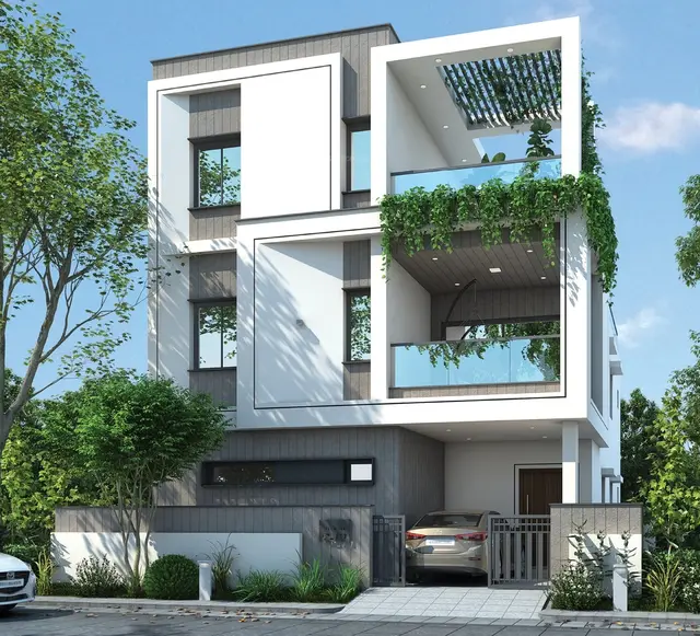
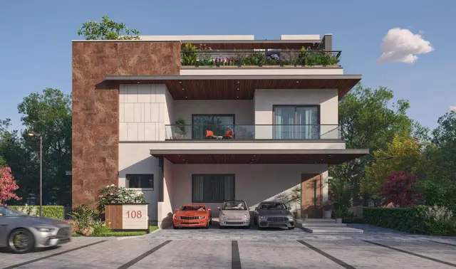
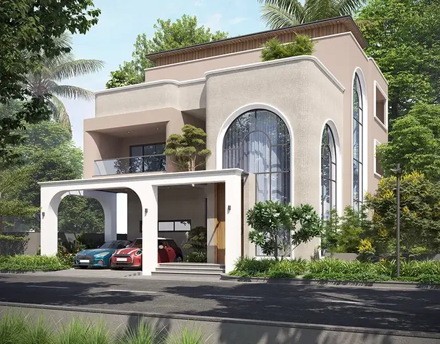
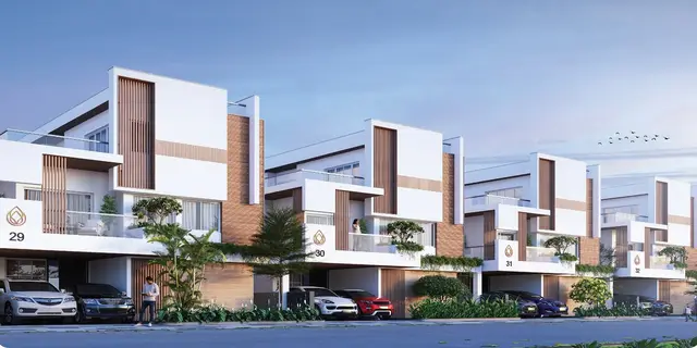
BLISS IN THE WOODS -BIW is a residential villa project in Mankhal (Harshaguda GP) Village, Maheshwaram Mandal, Ranga Reddy District, developed by registered promoter M/S.NEST MAKERS. The project has a total site area of 115618.73 sq. m and comprises 185 dwelling units across 186 buildings, including a proposed amenity building; the villas are described as ground-floor homes, with no reliable villa configuration schedule stated. It is registered under TG-RERA number P02400009958, and the promoter-declared completion date is 21/03/2030.
01What we found
Read from TG-RERA filings, approvals, land and registration records and court records. A court case is counted only when the court record states this project's survey number with its village, or names the project.
02Check before you pay
10 items to check before you pay, 3 high - from the title chain, court records and approvals, each with what to ask the builder or your advocate. An item may not be a problem with the project: records can be incomplete.
1. Project at a glance
Project identity
| Field | Project record |
|---|---|
| Registered project name | BLISS IN THE WOODS -BIW RERA record |
| Project type | Residential; the filed layout and drawings describe a gated community with villa housing and an amenity building. RERA record RERA filing |
| Phase / registered portion | No phase number is disclosed. TG-RERA registration is P02400009958. RERA record |
| Registered promoter | M/S.NEST MAKERS; the filing identifies it as a partnership. RERA record RERA filing |
| TG-RERA status | Registered under section 5; certificate issued 15/08/2025. The certificate states validity from 25/03/2025 through 21/03/2030, unless extended by the Authority. |
| Promoter-declared completion | Form B states completion by 21/03/2030. This is the promoter’s filed undertaking, not evidence of physical completion. |
Land and geographic identity
| Field | Project record |
|---|---|
| Locality / revenue village | Mankhal (Harshaguda GP) Village; the registration record also names the village as Mankal. RERA record RERA filing |
| Mandal | Maheshwaram RERA record RERA filing |
| District | Ranga Reddy RERA record RERA filing |
| PIN | 501359 RERA record |
| Project survey numbers | 684/P, 685/P and 736/P RERA record RERA filing |
| Site area | Total site area 115618.73 sq. m; net area 115467.63 sq. m. The filed plan identifies 151.10 sq. m as reserve-road/road-affected area. RERA filing |
| Boundaries in RERA filing | North: 40 FEET ROAD; east: NEIGHBOURS LAND; west: NEIGH BOURS LAND; south: NEIGH BOURS LAND. RERA filing |
| Cadastral context | Bhu Bharati GIS records are available for whole surveys 684 and 685 Part, but these are not an exact subdivision-by-subdivision match to the filed project parcel. Cadastral map |
Development identity
| Field | Project record |
|---|---|
| Sanctioning authority | Hyderabad Metropolitan Development Authority (HMDA). RERA filing |
| Principal layout approval | Draft layout permit 000031/LO/Plg/HMDA/2025, dated 21 March 2025; HMDA states technical approval was forwarded to the local body for final sanction subject to conditions. Approvals record |
| Approved built-up area | 17323.40 sq. mt. in the filed approval-plan data. RERA filing |
| Development arrangement | The plan shows villa housing on individual plots and a proposed amenity building. It records 185 dwelling units and 186 buildings in total; the filing’s unit table also contains one amenity entry among the building records. Layout record RERA unit table |
| Villa floors | The plan labels residential villa types as ground-floor villas; drawing labels also refer to ground and terrace floors. No basement, stilt or podium level is identified for the villas in the supplied records. |
| Amenity building | Ground, first and second floors, with a terrace floor; the filed drawing data reports 652.15 sq. mt. total built-up area for the amenity building. |
| Parking | The filed approval-plan data states parking required 215.21 sq. mt. and proposed 0.00. No parking-space count or unit-by-unit parking allocation is established by the supplied record. |
Offering and status
| Field | Project record |
|---|---|
| Unit type | Residential villas; the plan records 185 dwelling units. |
| RERA-filed unit-table entries | The table labels 181 entries “GROUND FLOOR” at 92.5 sq. m each, and individual entries “FIRST FLOOR” (197.59 sq. m), “GROUND FLOO” (90.12 sq. m) and “SECOND FLOOR” (215.35 sq. m). These are floor-label rows, not a dependable villa configuration schedule; the unit data cautions that these rows are not homes offered for sale as recorded. RERA unit table RERA unit table |
| Booked / available | Portal-derived counts show 184 available and 0 booked across the listed rows. The portal extract has no as-of date, and the rows are floor labels rather than resolved home configurations; treat the figures as indicative, not a current sales inventory. RERA unit table RERA unit table |
| Construction stage | RERA quarterly progress entries in the supplied amenities schedule record 5% for internal roads/footpaths, water supply and green strip/park; sewerage, storm drains, street lighting and other listed works show 0%. These are filed progress declarations, not independently verified site measurements. RERA amenities |
| Original / revised completion | Form B completion undertaking: 21/03/2030. No revised date or extension is supplied. |
| Occupancy / completion certificate | No occupancy or completion certificate is supplied. The project is registered as a new project; no tower- or phase-specific OC status is stated. RERA record |
2. The project story
BLISS IN THE WOODS -BIW is registered as a residential project on land in Survey Nos. 684/P, 685/P and 736/P, Mankhal (Harshaguda GP) Village, Maheshwaram Mandal, Ranga Reddy District. The HMDA-filed plan depicts a gated-community layout with villa plots, internal roads, open-space/park areas, public utilities and a proposed amenity building. The plan describes 185 dwelling units and villa types arranged at ground level; it also depicts a multi-storey amenity building. The supplied registration data does not provide a reliable villa-by-villa configuration schedule, and the portal’s unit rows are recorded as floor labels rather than clear home types. RERA record RERA unit table RERA unit table
The promoter’s Form B sets a completion target of 21/03/2030. The available RERA progress schedule records low declared completion for some infrastructure items and zero for several others. These percentages are promoter-filed progress information; no independent construction inspection or completion certificate is included here. RERA amenities
3. Master plan, architecture & building design
The HMDA-filed layout plan states a total site area of 115618.73 sq. m and a net plot area of 115467.63 sq. m. Its area statement identifies 66917.67 sq. m as plotted area, 25205.79 sq. m as layout roads, 23344.16 sq. m as organized open-space/park/utility area, and 151.10 sq. m as reserve-road area. The plan’s separate land-use labels also include amenity and public-utility areas; the supplied extraction does not establish a complete, reconciled area schedule for those labels. Layout record
The filed plan describes 186 buildings overall and 185 dwelling units. It shows residential villa types and a proposed amenity building. The villa labels indicate ground-floor homes; the amenity building is shown with ground, first and second floors and a terrace. The approval-plan extraction reports total approved built-up area of 17323.40 sq. mt.; a separate drawing entry reports 652.15 sq. mt. for the amenity building. No basement or podium levels are evidenced in the supplied plans. RERA filing
The layout is divided among plotted residential area, roads and open-space/park/utility land, rather than an apartment-tower arrangement. The plan identifies internal road widths including 12.00, 12.19, 18.29M, 19.20M, 23.32M, 27.43M and 10.0M.
HMDA’s filed draft-layout letter requires infrastructure development and refers to roads, drainage, protected water supply, sewerage disposal, lighting, utility ducting, greenery and park/open-space handover. These are approval conditions or proposed works, not proof that the facilities have been delivered.
4. Homes, configurations & floor plans
The project is described in the filed drawings as a villa development with 185 dwelling units. The RERA unit table does not provide a clear configuration schedule: it lists floor labels and associated areas, including 181 “GROUND FLOOR” rows. The portal-derived booking figures are 0 booked and 184 available, but the source has no as-of date and the rows are not resolved home configurations. RERA unit table RERA unit table
| Units | 184 listed in floor-label rows; plan separately states 185 dwelling units |
|---|---|
| Booked | 0* |
| Available | 184* |
| RERA saleable area | Listed row areas: 90.12–215.35 sq. m; rows include 181 at 92.5 sq. m |
| Measured carpet area | Not established for a reliable RERA villa configuration |
| Loading (if supplied) | Not supplied |
*Portal-derived counts with no stated as-of date; rows are floor labels, not a dependable home-by-home inventory. RERA unit table RERA unit table
The drawing-derived software measurement record identifies a 1BHK configuration from nine measured designs in the uploaded plan, with a reported median carpet area of 70.4 sq. m. This is software-measured from drawing geometry, is not a RERA-filed configuration or area, and is flagged as needing review. The supplied measurement range includes an extreme maximum of 505.2 sq. m, so it should not be treated as a verified typical-home range. Floor plans RERA unit details
The measured example plan labels living, drawing room, dining, kitchen, bedroom and toilet spaces. The drawing measurement is not interchangeable with the RERA-listed areas: carpet area is a drawing-based measurement, while the filed unit-table areas are labelled saleable area. No reliable loading or balcony/utility schedule is supplied. RERA unit details Floor plans RERA unit table
5. Parking & vehicle circulation
The HMDA-filed plan data states 215.21 sq. mt. required parking and 0.00 proposed; it does not state a number of spaces. No resident/visitor/accessibility-space breakdown, parking level, mechanical parking system, EV-charging provision or unit-specific parking allocation is established by the supplied records.
The layout plan identifies internal roads of varying widths, including 10.0M, 12.00, 12.19, 18.29M, 19.20M, 23.32M and 27.43M. The records do not describe a separate pedestrian network or vehicle-entry/exit arrangement in sufficient detail to confirm circulation design.
6. Amenities, recreation & open spaces
Clubhouse / indoor
| Facility | Description / size | Evidence source | Declared progress / verified status |
|---|---|---|---|
| Amenity building | Proposed building shown as ground, first and second floors with terrace; filed drawing data reports 652.15 sq. mt. built-up area. | Proposed on drawing; no completion verification supplied. | |
| Swimming pool | Drawing extraction lists SWIMMING POOL 9.91X4.32. | No progress or completion evidence supplied. | |
| Rest rooms | Listed with the amenity drawing. | No progress or completion evidence supplied. |
Sports / recreation
No additional sports or recreation facilities are identified in the supplied project-specific records.
Landscape / open space
| Facility | Description / size | Evidence source | Declared progress / verified status |
|---|---|---|---|
| Organized open-space/park/utility area | 23344.16 sq. m in the layout area statement. | Layout record | Planned area; no completion verification supplied. |
| Green strip / park | RERA progress schedule records 5%. | RERA amenities | Promoter-filed progress declaration; not independently verified. |
| Rainwater-harvesting pits | Included in HMDA-filed layout development conditions. | Required/proposed work; completion not established. |
Convenience / community
| Description / size | Listed as available in the RERA progress schedule, with 0% progress recorded. |
|---|---|
| Evidence source | RERA amenities |
| Declared progress / verified status | Filed status is not evidence of completion. |
| Description / size | The drawing area statement includes public-utility areas of 885.08 sq. m, 168.53 sq. m and 1250.33 sq. m. |
|---|---|
| Declared progress / verified status | Plan labels; delivered use or completion not established. |
7. Utilities, building services & safety
HMDA’s filed layout conditions require an independent sewerage-disposal system and protected water supply, including an overhead tank and sumps; the conditions also refer to underground utility ducting, storm drainage, street lighting and electricity facilities. The plan’s development description includes a common septic tank/STP, internal water-supply lines, overhead tank, transformer, storm-water drains and rainwater-harvesting pits. These are proposed or conditioned facilities; capacities and completion evidence are not supplied.
The RERA progress schedule records water supply at 5% and sewerage, storm-water drains, street lighting, sewage treatment/disposal, solid-waste management, water conservation/rainwater harvesting and electrical meter-room/substation/receiving-station works at 0%. These are filed progress declarations, not independent verification. RERA amenities
No project-specific capacities are supplied for water storage, treatment, STP, electrical backup, transformers, lifts, fire systems, waste handling, security or accessibility. The supplied records therefore do not establish completed fire-safety or accessibility provisions. RERA amenities
8. Location, access & connectivity
The registered location is Mankhal (Harshaguda GP) Village, Maheshwaram Mandal, Ranga Reddy District, Telangana 501359, on Survey Nos. 684/P, 685/P and 736/P. The RERA filing gives a northern boundary of 40 FEET ROAD. RERA record RERA filing RERA filing
The supplied location record lists the nearest sampled Outer Ring Road interchange at approximately 10.6 km, TGSRTC Bus Station, Maheshwaram at 0.2 km, and Community Health Centre Maheshwaram at 0.2 km. These are location-record distances; no travel times are supplied. Location record
9. Developer & development status
The registered promoter is M/S.NEST MAKERS, identified in the RERA filing as a partnership. Its GSTIN is 36AAPFN7300K1ZZ. The RERA certificate lists the promoter office as Village: Gachi Bowli, Mandal: Serilingampally, District: Ranga Reddy, Pin: 500032. RERA filing Corporate record
KUNDOORI BHUPAL REDDY is identified in the filed project documents as managing partner/promoter representative and authorized signatory. Form B is dated 01 May 2025 and declares a project completion date of 21/03/2030. The certificate validity ends 21/03/2030; this is separate from the physical completion and occupancy status, for which no completion/occupancy certificate is supplied. Parties record
The RERA progress schedule records 5% for internal roads/footpaths, water supply and green strip/park, and 0% for several other listed works. No independent site-progress verification is supplied. RERA amenities
10. Approvals, official records & documents
| Identifier / date | P02400009958; issued 15/08/2025 |
|---|---|
| What the supplied record establishes | Registration under section 5; validity 25/03/2025–21/03/2030, unless extended. |
| Identifier / date | 000031/LO/Plg/HMDA/2025; 21 March 2025 |
|---|---|
| What the supplied record establishes | Draft layout technical approval for the filed land, with development conditions; technical approval was forwarded to the local body for final sanction. |
| Identifier / date | File 062090/SMD/LO/U6/HMDA/10112023; plan dated 25-03-2025 |
|---|---|
| What the supplied record establishes | Proposed gated-community villa layout and amenity building, with area and building schedules. The drawing states the permission is not proof of land title. |
| Identifier / date | 01 May 2025 |
|---|---|
| What the supplied record establishes | Promoter-declared title basis, encumbrance statement, separate-account and other undertakings, and completion target 21/03/2030. |
| Identifier / date | Document 4130 of 2025, dated 13.03.2025 |
|---|---|
| What the supplied record establishes | HMDA filing records the road-affected area as handed to the local body; the draft-layout extraction gives 151.01 sq. m, while the layout drawing lists 151.10 sq. m reserve-road area. |
| Identifier / date | Documents 1565/2025 and 1871/2025 |
|---|---|
| What the supplied record establishes | HMDA approval-plan records identify villas/plots mortgaged in favour of the Metropolitan Commissioner, HMDA. |
The HMDA DPMS approved-layout lookup is reported as unavailable through the public internet; the supplied evidence therefore does not independently confirm a later final-layout release. HMDA
1. Project at a glance
Project identity
Registered project name: BLISS IN THE WOODS -BIW
Project type: Residential; the filed layout and drawings describe a gated community with villa housing and an amenity building.
Phase / registered portion: No phase number is disclosed. TG-RERA registration is P02400009958.
Registered promoter: M/S.NEST MAKERS; the filing identifies it as a partnership.
TG-RERA status: Registered under section 5; certificate issued 15/08/2025. The certificate states validity from 25/03/2025 through 21/03/2030, unless extended by the Authority.
Promoter-declared completion: Form B states completion by 21/03/2030. This is the promoter’s filed undertaking, not evidence of physical completion.
Land and geographic identity
Locality / revenue village: Mankhal (Harshaguda GP) Village; the registration record also names the village as Mankal.
Mandal: Maheshwaram
District: Ranga Reddy
PIN: 501359
Project survey numbers: 684/P, 685/P and 736/P
Site area: Total site area 115618.73 sq. m; net area 115467.63 sq. m. The filed plan identifies 151.10 sq. m as reserve-road/road-affected area.
Boundaries in RERA filing: North: 40 FEET ROAD; east: NEIGHBOURS LAND; west: NEIGH BOURS LAND; south: NEIGH BOURS LAND.
Cadastral context: Bhu Bharati GIS records are available for whole surveys 684 and 685 Part, but these are not an exact subdivision-by-subdivision match to the filed project parcel.
Development identity
Sanctioning authority: Hyderabad Metropolitan Development Authority (HMDA).
Principal layout approval: Draft layout permit 000031/LO/Plg/HMDA/2025, dated 21 March 2025; HMDA states technical approval was forwarded to the local body for final sanction subject to conditions.
Approved built-up area: 17323.40 sq. mt. in the filed approval-plan data.
Development arrangement: The plan shows villa housing on individual plots and a proposed amenity building. It records 185 dwelling units and 186 buildings in total; the filing’s unit table also contains one amenity entry among the building records.
Villa floors: The plan labels residential villa types as ground-floor villas; drawing labels also refer to ground and terrace floors. No basement, stilt or podium level is identified for the villas in the supplied records.
Amenity building: Ground, first and second floors, with a terrace floor; the filed drawing data reports 652.15 sq. mt. total built-up area for the amenity building.
Parking: The filed approval-plan data states parking required 215.21 sq. mt. and proposed 0.00. No parking-space count or unit-by-unit parking allocation is established by the supplied record.
Offering and status
Unit type: Residential villas; the plan records 185 dwelling units.
RERA-filed unit-table entries: The table labels 181 entries “GROUND FLOOR” at 92.5 sq. m each, and individual entries “FIRST FLOOR” (197.59 sq. m), “GROUND FLOO” (90.12 sq. m) and “SECOND FLOOR” (215.35 sq. m). These are floor-label rows, not a dependable villa configuration schedule; the unit data cautions that these rows are not homes offered for sale as recorded.
Booked / available: Portal-derived counts show 184 available and 0 booked across the listed rows. The portal extract has no as-of date, and the rows are floor labels rather than resolved home configurations; treat the figures as indicative, not a current sales inventory.
Construction stage: RERA quarterly progress entries in the supplied amenities schedule record 5% for internal roads/footpaths, water supply and green strip/park; sewerage, storm drains, street lighting and other listed works show 0%. These are filed progress declarations, not independently verified site measurements.
Original / revised completion: Form B completion undertaking: 21/03/2030. No revised date or extension is supplied.
Occupancy / completion certificate: No occupancy or completion certificate is supplied. The project is registered as a new project; no tower- or phase-specific OC status is stated.
2. The project story
BLISS IN THE WOODS -BIW is registered as a residential project on land in Survey Nos. 684/P, 685/P and 736/P, Mankhal (Harshaguda GP) Village, Maheshwaram Mandal, Ranga Reddy District. The HMDA-filed plan depicts a gated-community layout with villa plots, internal roads, open-space/park areas, public utilities and a proposed amenity building. The plan describes 185 dwelling units and villa types arranged at ground level; it also depicts a multi-storey amenity building. The supplied registration data does not provide a reliable villa-by-villa configuration schedule, and the portal’s unit rows are recorded as floor labels rather than clear home types.
The promoter’s Form B sets a completion target of 21/03/2030. The available RERA progress schedule records low declared completion for some infrastructure items and zero for several others. These percentages are promoter-filed progress information; no independent construction inspection or completion certificate is included here.
3. Master plan, architecture & building design
The HMDA-filed layout plan states a total site area of 115618.73 sq. m and a net plot area of 115467.63 sq. m. Its area statement identifies 66917.67 sq. m as plotted area, 25205.79 sq. m as layout roads, 23344.16 sq. m as organized open-space/park/utility area, and 151.10 sq. m as reserve-road area. The plan’s separate land-use labels also include amenity and public-utility areas; the supplied extraction does not establish a complete, reconciled area schedule for those labels.
The filed plan describes 186 buildings overall and 185 dwelling units. It shows residential villa types and a proposed amenity building. The villa labels indicate ground-floor homes; the amenity building is shown with ground, first and second floors and a terrace. The approval-plan extraction reports total approved built-up area of 17323.40 sq. mt.; a separate drawing entry reports 652.15 sq. mt. for the amenity building. No basement or podium levels are evidenced in the supplied plans.
The layout is divided among plotted residential area, roads and open-space/park/utility land, rather than an apartment-tower arrangement. The plan identifies internal road widths including 12.00, 12.19, 18.29M, 19.20M, 23.32M, 27.43M and 10.0M.
HMDA’s filed draft-layout letter requires infrastructure development and refers to roads, drainage, protected water supply, sewerage disposal, lighting, utility ducting, greenery and park/open-space handover. These are approval conditions or proposed works, not proof that the facilities have been delivered.
4. Homes, configurations & floor plans
The project is described in the filed drawings as a villa development with 185 dwelling units. The RERA unit table does not provide a clear configuration schedule: it lists floor labels and associated areas, including 181 “GROUND FLOOR” rows. The portal-derived booking figures are 0 booked and 184 available, but the source has no as-of date and the rows are not resolved home configurations.
| Units | 184 listed in floor-label rows; plan separately states 185 dwelling units |
|---|---|
| Booked | 0* |
| Available | 184* |
| RERA saleable area | Listed row areas: 90.12–215.35 sq. m; rows include 181 at 92.5 sq. m |
| Measured carpet area | Not established for a reliable RERA villa configuration |
| Loading (if supplied) | Not supplied |
*Portal-derived counts with no stated as-of date; rows are floor labels, not a dependable home-by-home inventory.
The drawing-derived software measurement record identifies a 1BHK configuration from nine measured designs in the uploaded plan, with a reported median carpet area of 70.4 sq. m. This is software-measured from drawing geometry, is not a RERA-filed configuration or area, and is flagged as needing review. The supplied measurement range includes an extreme maximum of 505.2 sq. m, so it should not be treated as a verified typical-home range.
The measured example plan labels living, drawing room, dining, kitchen, bedroom and toilet spaces. The drawing measurement is not interchangeable with the RERA-listed areas: carpet area is a drawing-based measurement, while the filed unit-table areas are labelled saleable area. No reliable loading or balcony/utility schedule is supplied.
5. Parking & vehicle circulation
The HMDA-filed plan data states 215.21 sq. mt. required parking and 0.00 proposed; it does not state a number of spaces. No resident/visitor/accessibility-space breakdown, parking level, mechanical parking system, EV-charging provision or unit-specific parking allocation is established by the supplied records.
The layout plan identifies internal roads of varying widths, including 10.0M, 12.00, 12.19, 18.29M, 19.20M, 23.32M and 27.43M. The records do not describe a separate pedestrian network or vehicle-entry/exit arrangement in sufficient detail to confirm circulation design.
6. Amenities, recreation & open spaces
Clubhouse / indoor
| Facility | Description / size | Evidence source | Declared progress / verified status |
|---|---|---|---|
| Amenity building | Proposed building shown as ground, first and second floors with terrace; filed drawing data reports 652.15 sq. mt. built-up area. | Proposed on drawing; no completion verification supplied. | |
| Swimming pool | Drawing extraction lists SWIMMING POOL 9.91X4.32. | No progress or completion evidence supplied. | |
| Rest rooms | Listed with the amenity drawing. | No progress or completion evidence supplied. |
Sports / recreation
No additional sports or recreation facilities are identified in the supplied project-specific records.
Landscape / open space
| Facility | Description / size | Evidence source | Declared progress / verified status |
|---|---|---|---|
| Organized open-space/park/utility area | 23344.16 sq. m in the layout area statement. | Planned area; no completion verification supplied. | |
| Green strip / park | RERA progress schedule records 5%. | Promoter-filed progress declaration; not independently verified. | |
| Rainwater-harvesting pits | Included in HMDA-filed layout development conditions. | Required/proposed work; completion not established. |
Convenience / community
| Facility | Description / size | Evidence source | Declared progress / verified status |
|---|---|---|---|
| Community buildings | Listed as available in the RERA progress schedule, with 0% progress recorded. | Filed status is not evidence of completion. | |
| Public utilities | The drawing area statement includes public-utility areas of 885.08 sq. m, 168.53 sq. m and 1250.33 sq. m. | Plan labels; delivered use or completion not established. |
7. Utilities, building services & safety
HMDA’s filed layout conditions require an independent sewerage-disposal system and protected water supply, including an overhead tank and sumps; the conditions also refer to underground utility ducting, storm drainage, street lighting and electricity facilities. The plan’s development description includes a common septic tank/STP, internal water-supply lines, overhead tank, transformer, storm-water drains and rainwater-harvesting pits. These are proposed or conditioned facilities; capacities and completion evidence are not supplied.
The RERA progress schedule records water supply at 5% and sewerage, storm-water drains, street lighting, sewage treatment/disposal, solid-waste management, water conservation/rainwater harvesting and electrical meter-room/substation/receiving-station works at 0%. These are filed progress declarations, not independent verification.
No project-specific capacities are supplied for water storage, treatment, STP, electrical backup, transformers, lifts, fire systems, waste handling, security or accessibility. The supplied records therefore do not establish completed fire-safety or accessibility provisions.
8. Location, access & connectivity
The registered location is Mankhal (Harshaguda GP) Village, Maheshwaram Mandal, Ranga Reddy District, Telangana 501359, on Survey Nos. 684/P, 685/P and 736/P. The RERA filing gives a northern boundary of 40 FEET ROAD.
The supplied location record lists the nearest sampled Outer Ring Road interchange at approximately 10.6 km, TGSRTC Bus Station, Maheshwaram at 0.2 km, and Community Health Centre Maheshwaram at 0.2 km. These are location-record distances; no travel times are supplied.
9. Developer & development status
The registered promoter is M/S.NEST MAKERS, identified in the RERA filing as a partnership. Its GSTIN is 36AAPFN7300K1ZZ. The RERA certificate lists the promoter office as Village: Gachi Bowli, Mandal: Serilingampally, District: Ranga Reddy, Pin: 500032.
KUNDOORI BHUPAL REDDY is identified in the filed project documents as managing partner/promoter representative and authorized signatory. Form B is dated 01 May 2025 and declares a project completion date of 21/03/2030. The certificate validity ends 21/03/2030; this is separate from the physical completion and occupancy status, for which no completion/occupancy certificate is supplied.
The RERA progress schedule records 5% for internal roads/footpaths, water supply and green strip/park, and 0% for several other listed works. No independent site-progress verification is supplied.
10. Approvals, official records & documents
| Identifier / date | P02400009958; issued 15/08/2025 |
|---|---|
| What the supplied record establishes | Registration under section 5; validity 25/03/2025–21/03/2030, unless extended. |
| Identifier / date | 000031/LO/Plg/HMDA/2025; 21 March 2025 |
|---|---|
| What the supplied record establishes | Draft layout technical approval for the filed land, with development conditions; technical approval was forwarded to the local body for final sanction. |
| Identifier / date | File 062090/SMD/LO/U6/HMDA/10112023; plan dated 25-03-2025 |
|---|---|
| What the supplied record establishes | Proposed gated-community villa layout and amenity building, with area and building schedules. The drawing states the permission is not proof of land title. |
| Identifier / date | 01 May 2025 |
|---|---|
| What the supplied record establishes | Promoter-declared title basis, encumbrance statement, separate-account and other undertakings, and completion target 21/03/2030. |
| Identifier / date | Document 4130 of 2025, dated 13.03.2025 |
|---|---|
| What the supplied record establishes | HMDA filing records the road-affected area as handed to the local body; the draft-layout extraction gives 151.01 sq. m, while the layout drawing lists 151.10 sq. m reserve-road area. |
| Identifier / date | Documents 1565/2025 and 1871/2025 |
|---|---|
| What the supplied record establishes | HMDA approval-plan records identify villas/plots mortgaged in favour of the Metropolitan Commissioner, HMDA. |
The HMDA DPMS approved-layout lookup is reported as unavailable through the public internet; the supplied evidence therefore does not independently confirm a later final-layout release.
Frequently asked questions
Is BLISS IN THE WOODS -BIW registered with Telangana RERA?
Yes. BLISS IN THE WOODS -BIW is registered with the Telangana Real Estate Regulatory Authority as P02400009958; the registration status is New Project.
Who is the developer of BLISS IN THE WOODS -BIW?
The promoter named in the RERA registration is M/S.NEST MAKERS.
Where is BLISS IN THE WOODS -BIW located?
BLISS IN THE WOODS -BIW is in MANKHAL (HARSHAGUDA GP) VILLAGE, MAHESWARAM MANDAL, Mankal, Maheshwaram, Rangareddy, Telangana (501359).
When will BLISS IN THE WOODS -BIW be completed?
The promoter's proposed date of completion filed with RERA is 21/07/2030. This is the promoter's declaration, not a guarantee.
More projects in Mankal