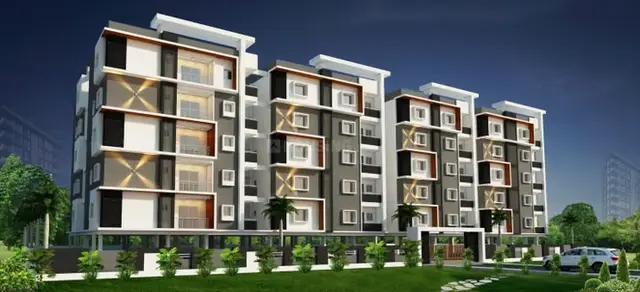
Reverie Avenue
VIPRA VENTURES · Medchal-Malkajgiri · RERA P02200002227
REVERIE AVENUE is a plotted development located at YELLAMPET & ATEVELLE BOUNDRY, Medchal Mandal, Medchal-Malkajgiri District. The registered promoter developing it is VIPRA VENTURES, a partnership. The TG-RERA record states a land area of 107046.69 sqmts; the supplied record does not establish a total plot count or building configuration, and identifies the offering as plots. It is registered under TG-RERA number P02200002227, and the promoter’s Form-B declaration undertakes completion by 29/06/2023.
More from Vipra Ventures · 6 projects →
01What we found
Read from TG-RERA filings, approvals, land and registration records and court records. A court case is counted only when the court record states this project's survey number with its village, or names the project.
02Check before you pay
7 items to check before you pay, 4 high - from the title chain, court records and approvals, each with what to ask the builder or your advocate. An item may not be a problem with the project: records can be incomplete.
1. Project at a glance
Project identity
| Field | Record |
|---|---|
| Registered project name | REVERIE AVENUE RERA record |
| Project type | Plotted development / residential open-plot layout RERA record |
| Phase / registered portion | No phase designation is recorded in the supplied TG-RERA certificate. |
| TG-RERA registration | P02200002227; granted under section 5, issued 30/10/2020. |
| Registration validity | Certificate states validity from 30/10/2020 to 29/06/2023 and that extension would require Authority action. The certificate records no extension. This is the registration period, not a statement about construction completion or occupancy. |
| Registered promoter | VIPRA VENTURES, a partnership. RERA record RERA filing Corporate record |
| RERA status in supplied record | Registered project; the registration certificate’s stated validity ended on 29/06/2023. Current status beyond the supplied record is not established. |
Land and geographic identity
| Field | Record |
|---|---|
| Locality / boundary description | YELLAMPET & ATEVELLE BOUNDRY RERA record |
| Revenue villages | Yellampet and Athvelli (also rendered as Atevelle/Athvelle in filed layout documents). |
| Mandal / district / PIN | Medchal / Medchal-Malkajgiri / 501401 RERA record |
| All project survey numbers and subdivisions | 88, 150/B, 150/B2, 150/B3, 149/C, 149/D, 150/A, 151. The filing presents these numbers as a project set; it does not allocate each listed subdivision to a particular revenue village in the RERA identity fields. RERA record |
| Registered site extent | TG-RERA land details record total area 107046.69 sqmts, affected area 12371.88 sqmts, and net area 94674.81 sqmts. RERA filing |
| Layout-drawing area figures | The HMDA draft-layout material states total site area 107046.83 Sq.MT., road-affected area 12371.88, and net site area 94674.95 Sq.m. |
| Boundaries | North: NEIGHBOURS LAND; south: NEIGHBOURS LAND; east: NEIGHBOURS LAND; west: ROAD. RERA filing |
Development identity
| Field | Record |
|---|---|
| Sanctioning authority | Hyderabad Metropolitan Development Authority (HMDA) |
| Principal layout approval | Draft residential open-plot layout permit 000050/LO/Plg/HMDA/2020, dated 29 May, 2020. |
| Approved built-up area | TG-RERA filing records 66227.99 sqmts as “Approved Built up Area.” For this plotted project, that figure is not identified in the supplied record as a residential building floor-area schedule. RERA filing |
| Buildings / floors / parking levels | Not disclosed as applicable to the plotted layout; no apartment-building count, floor configuration, or parking-level schedule is supplied. RERA record |
| Plot / unit count | The supplied RERA and layout extracts do not provide a complete, reliably verified total plot count or plot-by-plot schedule. The draft-layout material identifies plots 137 to 173 as 37 mortgaged plots, not as the total layout inventory. |
Offering and status
| Field | Record |
|---|---|
| Offered product | Plots; the supplied RERA data does not provide a verified plot-size schedule or complete plot inventory. RERA record |
| RERA-filed saleable-area entries | Not supplied in the project evidence pack. |
| Booked / available counts | Not supplied in the project evidence pack. |
| Construction / infrastructure stage | A RERA amenities status extract records internal roads and footpaths at 60%, water supply at 70%, sewerage at 100%, green strip/tot lot/park at 70%, and street lighting at 60%. These are reported progress figures, not independent site verification. RERA amenities |
| Completion deadline | Promoter’s Form-B declaration undertakes completion by 29/06/2023. |
| Occupancy / completion certificate | No occupancy or completion certificate is supplied. For this plotted layout, the available approval material is a draft layout record; it does not establish an OC or final layout release. |
2. The project story
REVERIE AVENUE is presented in the TG-RERA record as a residential plotted layout spanning land identified in Yellampet and Athvelli villages, Medchal Mandal, Medchal-Malkajgiri District. Its registered survey set is 88, 150/B, 150/B2, 150/B3, 149/C, 149/D, 150/A and 151. RERA record
The filed HMDA material describes a proposed open-plot layout, with a net layout area stated as 94674.95 Sq.m and a plotted area of 66227.99. It also identifies roads, park/open-space and social-infrastructure allocations, together with infrastructure works required as layout conditions. The supplied materials do not establish the total plot count, individual plot sizes, current on-site completion, or final layout release.
The registration certificate and Form-B declaration give a completion date of 29/06/2023; the certificate’s registration validity also ends on that date. Those dates describe separate matters. The supplied record contains reported infrastructure progress percentages but no independent inspection or completion certificate. RERA amenities
3. Master plan, architecture & building design
This is a plotted layout, not a multi-storey apartment scheme in the supplied project record. The HMDA draft-layout plan identifies total site area 107046.83 Sq.MT., road-affected area 12371.88, net site area 94674.95, and plotted area 66227.99. It also records the following land-use figures: layout roads 18502.50 sqm, organized open space/park/utility area 7576.77 sqm, and social-infrastructure area 2369.06 sqm. A separate utility entry states 475.27 Sq.Mts.; the extract does not explain how that utility figure relates to the combined open-space/park/utility line.
The drawing lists roads of 75.00, 30.00, 18.29 M and 15.24 M, and identifies a proposed 75m MP road affecting the site. The draft-layout conditions specify works including road formation and surfacing, storm-water drainage, underground drainage and common septic tank/STP, internal water-supply lines and overhead tank, electricity and street lighting, avenue planting, park development and rainwater-harvesting pits. These are approval-condition descriptions, not evidence that the works have been completed.
No building arrangement, floor configuration, building footprint, apartment circulation, or phase-wise building plan is provided for this plotted development. The layout extract records Amenity Area 00.00 and Amenities area 0; this is distinct from the specified park/open-space, social-infrastructure and utility allocations.
4. Homes, configurations & floor plans
The project is recorded as a plotted development. A complete RERA-filed plot schedule, plot count and plot-size range are not available in the supplied evidence, so individual plot configurations cannot be tabulated reliably. RERA record
| Configuration | Units | Booked | Available | RERA saleable area | Measured carpet area | Loading |
|---|---|---|---|---|---|---|
| Plots | Not established | Not supplied | Not supplied | Not supplied | Not applicable / not supplied | Not supplied |
The layout drawing records a plotted-area allocation of 66227.99. This is an area allocation for the layout, not a verified schedule of individual saleable plots. The drawing-derived extraction notes that plot text is incomplete and plot sizes should be checked against the source drawing. Layout record
5. Parking & vehicle circulation
The supplied record does not establish a parking-space count, visitor or accessible parking provision, parking allocation to individual plots, or a parking-allotment arrangement. The approval material describes internal roads and road widths, but provides no parking plan or vehicle-space schedule. A drawn or layout-level area should not be treated as an exclusive parking entitlement.
6. Amenities, recreation & open spaces
The table below separates layout approval descriptions from reported progress. Progress percentages are RERA amenities-record entries and are not independently verified. RERA amenities
| Description / size | Layout roads include 18502.50 sqm; road widths listed as 75.00, 30.00, 18.29 M and 15.24 M. |
|---|---|
| Evidence source | HMDA draft-layout material; RERA amenities record |
| Declared progress / verified status | 60% reported for internal roads & footpaths; independently verified status not supplied. RERA amenities |
| Description / size | Layout drawing records 7576.77 for organized open space/park/utility area; approval conditions also refer to park development and tot lot. |
|---|---|
| Evidence source | HMDA draft-layout material; RERA amenities record |
| Declared progress / verified status | 70% reported for green strip/tot lot/park; independently verified status not supplied. RERA amenities |
| Description / size | 2369.06 sqm in the layout-area schedule. |
|---|---|
| Evidence source | HMDA draft-layout material |
| Declared progress / verified status | Area allocation is recorded; facility detail and completion status are not supplied. |
| Description / size | No size or facility description supplied. |
|---|---|
| Evidence source | RERA amenities record |
| Declared progress / verified status | 0% reported. RERA amenities |
The layout approval material names STP, rainwater storage tank, tot lot, sump and garbage/disposal space among its amenity/utility descriptions. The available record does not provide dimensions or capacities for these items; their reported status is addressed below under utilities.
7. Utilities, building services & safety
The HMDA draft-layout conditions describe proposed infrastructure, including underground drainage lines and a common septic tank/STP, internal water-supply lines, an overhead tank, a protected water-supply system with OHT and sumps, transformers, street lights, storm-water drainage, rainwater-harvesting pits, utility ducting, and space for solid-waste disposal. The conditions also call for source segregation and a bio-compost unit. These are approval requirements or proposed provisions, not proof of installation or operation.
| Evidence in supplied record | Internal water-supply lines and overhead tank are described in the draft-layout conditions; connection to a potable-water supply network is also required. No source yield, storage capacity or treatment capacity is supplied. |
|---|---|
| Status / limitation | RERA amenities record reports water supply at 70% and overhead water tank at 0%. These are declared progress entries, not independent verification. RERA amenities |
| Evidence in supplied record | Draft conditions describe underground drainage and common septic tank/STP; storm-water drainage is also required. No capacity or commissioning evidence is supplied. |
|---|---|
| Status / limitation | Sewerage (chamber, lines, septic tank, STP) is reported at 100%; storm-water drains at 0%; treatment and disposal of sewage/sullage water at 0%. No independent verification is supplied. RERA amenities |
| Evidence in supplied record | Rainwater-harvesting pits and a rain-water storage tank are named in the layout material. No capacity is stated. |
|---|---|
| Status / limitation | Water conservation/rainwater harvesting is reported at 0% in the amenities record. RERA amenities |
| Evidence in supplied record | Draft conditions call for electrical supply lines, transformer/transformer yard, underground utility ducting and LED street lighting. No supply capacity or backup provision is supplied. |
|---|---|
| Status / limitation | Street lighting is reported at 60%; electrical meter room/sub-station/receiving station and energy management are each reported at 0%. RERA amenities |
| Evidence in supplied record | Layout conditions call for a disposal/dumping area, source segregation and a bio-compost unit. |
|---|---|
| Status / limitation | Solid-waste management and disposal is reported at 0%. RERA amenities |
| Evidence in supplied record | No project-specific fire system or fire-safety installation detail is supplied for this plotted layout. |
|---|---|
| Status / limitation | Fire-protection and fire-safety requirements are reported at 0% in the amenities record; no compliance certificate is supplied. RERA amenities |
| Evidence in supplied record | Approval conditions refer to footpaths, paved footpaths, open roads, and cycling tracks. |
|---|---|
| Status / limitation | No independent completion or accessibility assessment is supplied. |
8. Location, access & connectivity
The registered location is YELLAMPET & ATEVELLE BOUNDRY, Yellampet, Medchal Mandal, Medchal-Malkajgiri District, PIN 501401. RERA record The layout documents also identify Athvelli/Atevelle in the project’s village descriptions.
The layout approval records a road-affected area under a proposed 75m MP road, and identifies layout-road widths of 75.00, 30.00, 18.29 M and 15.24 M. The supplied location dataset lists the nearest sampled Outer Ring Road interchange at approximately 6.0 km, SBI bank at 2.8 km, and UPHC Jangaon at 2.1 km. These are location-data measurements; no travel-time estimates are supplied. Location record
9. Developer & development status
The registered promoter is VIPRA VENTURES, recorded as a partnership, with GSTIN 36AAPFV8114K1ZL. The supplied RERA filing identifies the promoter’s address as S S TOWERS, GACHIBOWLI, YELLAMPET & ATEVELLE BOUNDRY, YELLAMPET & ATEVELLE BOUNDRY, Medchal, Medchal-Malkajgiri, 501401. RERA filing RERA filing Corporate record The registration certificate separately records the promoter office as Village: Gachi Bowli, Mandal: Serilingampally, District: Ranga Reddy, Pin: 500032.
The promoter’s Form-B affidavit, dated 22/09/2020, declares a legal-title basis for the project land and undertakes completion by 29/06/2023. The supplied amenities record reports varying progress for infrastructure works; it does not provide a current physical inspection or independently verified completion percentage for the layout as a whole. RERA amenities
10. Approvals, official records & documents
| Record | What the supplied document establishes |
|---|---|
| TG-RERA certificate P02200002227 | Form “C” registration certificate for REVERIE AVENUE under section 5; issued 30/10/2020, with stated validity to 29/06/2023. |
| HMDA draft layout permit 000050/LO/Plg/HMDA/2020 | Draft technical approval and layout plan dated 29 May, 2020, covering the project’s listed survey numbers and setting out layout areas and conditions. The document says the permit is not proof of title. |
| HMDA draft-layout letter / technical approval | Records draft-layout conditions and required infrastructure, handovers and mortgage of plots 137 to 173. |
| Medchal Municipality intimation G1/954/LO/2020 | Dated 09.06.2020; records HMDA draft-layout approval and requests specified title/conversion documents, charges and fulfilment of referenced conditions for further action. |
| Medchal Municipality draft-layout communications | The supplied documents 133454 and 133455 communicate a draft layout subject to conditions; the extracts do not independently identify the full project land particulars. |
| Yellampet draft-layout permission communication | Document 135384 refers to HMDA proceeding 000050/LO/PLG/HMDA/2020 and says payment is required for release of draft-layout permission; it does not establish final layout release. |
| Promoter Form-B affidavit | Declaration by V. Sleeva Reddy for VIPRA VENTURES, dated 22/09/2020, including the promoter’s completion undertaking and declarations. |
| Occupancy/completion record | No occupancy or completion certificate is present in the supplied evidence. |
1. Project at a glance
Project identity
Registered project name: REVERIE AVENUE
Project type: Plotted development / residential open-plot layout
Phase / registered portion: No phase designation is recorded in the supplied TG-RERA certificate.
TG-RERA registration: P02200002227; granted under section 5, issued 30/10/2020.
Registration validity: Certificate states validity from 30/10/2020 to 29/06/2023 and that extension would require Authority action. The certificate records no extension. This is the registration period, not a statement about construction completion or occupancy.
Registered promoter: VIPRA VENTURES, a partnership.
RERA status in supplied record: Registered project; the registration certificate’s stated validity ended on 29/06/2023. Current status beyond the supplied record is not established.
Land and geographic identity
Locality / boundary description: YELLAMPET & ATEVELLE BOUNDRY
Revenue villages: Yellampet and Athvelli (also rendered as Atevelle/Athvelle in filed layout documents).
Mandal / district / PIN: Medchal / Medchal-Malkajgiri / 501401
All project survey numbers and subdivisions: 88, 150/B, 150/B2, 150/B3, 149/C, 149/D, 150/A, 151. The filing presents these numbers as a project set; it does not allocate each listed subdivision to a particular revenue village in the RERA identity fields.
Registered site extent: TG-RERA land details record total area 107046.69 sqmts, affected area 12371.88 sqmts, and net area 94674.81 sqmts.
Layout-drawing area figures: The HMDA draft-layout material states total site area 107046.83 Sq.MT., road-affected area 12371.88, and net site area 94674.95 Sq.m.
Boundaries: North: NEIGHBOURS LAND; south: NEIGHBOURS LAND; east: NEIGHBOURS LAND; west: ROAD.
Development identity
Sanctioning authority: Hyderabad Metropolitan Development Authority (HMDA)
Principal layout approval: Draft residential open-plot layout permit 000050/LO/Plg/HMDA/2020, dated 29 May, 2020.
Approved built-up area: TG-RERA filing records 66227.99 sqmts as “Approved Built up Area.” For this plotted project, that figure is not identified in the supplied record as a residential building floor-area schedule.
Buildings / floors / parking levels: Not disclosed as applicable to the plotted layout; no apartment-building count, floor configuration, or parking-level schedule is supplied.
Plot / unit count: The supplied RERA and layout extracts do not provide a complete, reliably verified total plot count or plot-by-plot schedule. The draft-layout material identifies plots 137 to 173 as 37 mortgaged plots, not as the total layout inventory.
Offering and status
Offered product: Plots; the supplied RERA data does not provide a verified plot-size schedule or complete plot inventory.
RERA-filed saleable-area entries: Not supplied in the project evidence pack.
Booked / available counts: Not supplied in the project evidence pack.
Construction / infrastructure stage: A RERA amenities status extract records internal roads and footpaths at 60%, water supply at 70%, sewerage at 100%, green strip/tot lot/park at 70%, and street lighting at 60%. These are reported progress figures, not independent site verification.
Completion deadline: Promoter’s Form-B declaration undertakes completion by 29/06/2023.
Occupancy / completion certificate: No occupancy or completion certificate is supplied. For this plotted layout, the available approval material is a draft layout record; it does not establish an OC or final layout release.
2. The project story
REVERIE AVENUE is presented in the TG-RERA record as a residential plotted layout spanning land identified in Yellampet and Athvelli villages, Medchal Mandal, Medchal-Malkajgiri District. Its registered survey set is 88, 150/B, 150/B2, 150/B3, 149/C, 149/D, 150/A and 151.
The filed HMDA material describes a proposed open-plot layout, with a net layout area stated as 94674.95 Sq.m and a plotted area of 66227.99. It also identifies roads, park/open-space and social-infrastructure allocations, together with infrastructure works required as layout conditions. The supplied materials do not establish the total plot count, individual plot sizes, current on-site completion, or final layout release.
The registration certificate and Form-B declaration give a completion date of 29/06/2023; the certificate’s registration validity also ends on that date. Those dates describe separate matters. The supplied record contains reported infrastructure progress percentages but no independent inspection or completion certificate.
3. Master plan, architecture & building design
This is a plotted layout, not a multi-storey apartment scheme in the supplied project record. The HMDA draft-layout plan identifies total site area 107046.83 Sq.MT., road-affected area 12371.88, net site area 94674.95, and plotted area 66227.99. It also records the following land-use figures: layout roads 18502.50 sqm, organized open space/park/utility area 7576.77 sqm, and social-infrastructure area 2369.06 sqm. A separate utility entry states 475.27 Sq.Mts.; the extract does not explain how that utility figure relates to the combined open-space/park/utility line.
The drawing lists roads of 75.00, 30.00, 18.29 M and 15.24 M, and identifies a proposed 75m MP road affecting the site. The draft-layout conditions specify works including road formation and surfacing, storm-water drainage, underground drainage and common septic tank/STP, internal water-supply lines and overhead tank, electricity and street lighting, avenue planting, park development and rainwater-harvesting pits. These are approval-condition descriptions, not evidence that the works have been completed.
No building arrangement, floor configuration, building footprint, apartment circulation, or phase-wise building plan is provided for this plotted development. The layout extract records Amenity Area 00.00 and Amenities area 0; this is distinct from the specified park/open-space, social-infrastructure and utility allocations.
4. Homes, configurations & floor plans
The project is recorded as a plotted development. A complete RERA-filed plot schedule, plot count and plot-size range are not available in the supplied evidence, so individual plot configurations cannot be tabulated reliably.
| Configuration | Units | Booked | Available | RERA saleable area | Measured carpet area | Loading |
|---|---|---|---|---|---|---|
| Plots | Not established | Not supplied | Not supplied | Not supplied | Not applicable / not supplied | Not supplied |
The layout drawing records a plotted-area allocation of 66227.99. This is an area allocation for the layout, not a verified schedule of individual saleable plots. The drawing-derived extraction notes that plot text is incomplete and plot sizes should be checked against the source drawing.
5. Parking & vehicle circulation
The supplied record does not establish a parking-space count, visitor or accessible parking provision, parking allocation to individual plots, or a parking-allotment arrangement. The approval material describes internal roads and road widths, but provides no parking plan or vehicle-space schedule. A drawn or layout-level area should not be treated as an exclusive parking entitlement.
6. Amenities, recreation & open spaces
The table below separates layout approval descriptions from reported progress. Progress percentages are RERA amenities-record entries and are not independently verified.
| Description / size | Layout roads include 18502.50 sqm; road widths listed as 75.00, 30.00, 18.29 M and 15.24 M. |
|---|---|
| Evidence source | HMDA draft-layout material; RERA amenities record |
| Declared progress / verified status | 60% reported for internal roads & footpaths; independently verified status not supplied. |
| Description / size | Layout drawing records 7576.77 for organized open space/park/utility area; approval conditions also refer to park development and tot lot. |
|---|---|
| Evidence source | HMDA draft-layout material; RERA amenities record |
| Declared progress / verified status | 70% reported for green strip/tot lot/park; independently verified status not supplied. |
| Description / size | 2369.06 sqm in the layout-area schedule. |
|---|---|
| Evidence source | HMDA draft-layout material |
| Declared progress / verified status | Area allocation is recorded; facility detail and completion status are not supplied. |
| Description / size | No size or facility description supplied. |
|---|---|
| Evidence source | RERA amenities record |
| Declared progress / verified status | 0% reported. |
The layout approval material names STP, rainwater storage tank, tot lot, sump and garbage/disposal space among its amenity/utility descriptions. The available record does not provide dimensions or capacities for these items; their reported status is addressed below under utilities.
7. Utilities, building services & safety
The HMDA draft-layout conditions describe proposed infrastructure, including underground drainage lines and a common septic tank/STP, internal water-supply lines, an overhead tank, a protected water-supply system with OHT and sumps, transformers, street lights, storm-water drainage, rainwater-harvesting pits, utility ducting, and space for solid-waste disposal. The conditions also call for source segregation and a bio-compost unit. These are approval requirements or proposed provisions, not proof of installation or operation.
| Evidence in supplied record | Internal water-supply lines and overhead tank are described in the draft-layout conditions; connection to a potable-water supply network is also required. No source yield, storage capacity or treatment capacity is supplied. |
|---|---|
| Status / limitation | RERA amenities record reports water supply at 70% and overhead water tank at 0%. These are declared progress entries, not independent verification. |
| Evidence in supplied record | Draft conditions describe underground drainage and common septic tank/STP; storm-water drainage is also required. No capacity or commissioning evidence is supplied. |
|---|---|
| Status / limitation | Sewerage (chamber, lines, septic tank, STP) is reported at 100%; storm-water drains at 0%; treatment and disposal of sewage/sullage water at 0%. No independent verification is supplied. |
| Evidence in supplied record | Rainwater-harvesting pits and a rain-water storage tank are named in the layout material. No capacity is stated. |
|---|---|
| Status / limitation | Water conservation/rainwater harvesting is reported at 0% in the amenities record. |
| Evidence in supplied record | Draft conditions call for electrical supply lines, transformer/transformer yard, underground utility ducting and LED street lighting. No supply capacity or backup provision is supplied. |
|---|---|
| Status / limitation | Street lighting is reported at 60%; electrical meter room/sub-station/receiving station and energy management are each reported at 0%. |
| Evidence in supplied record | Layout conditions call for a disposal/dumping area, source segregation and a bio-compost unit. |
|---|---|
| Status / limitation | Solid-waste management and disposal is reported at 0%. |
| Evidence in supplied record | No project-specific fire system or fire-safety installation detail is supplied for this plotted layout. |
|---|---|
| Status / limitation | Fire-protection and fire-safety requirements are reported at 0% in the amenities record; no compliance certificate is supplied. |
| Evidence in supplied record | Approval conditions refer to footpaths, paved footpaths, open roads, and cycling tracks. |
|---|---|
| Status / limitation | No independent completion or accessibility assessment is supplied. |
8. Location, access & connectivity
The registered location is YELLAMPET & ATEVELLE BOUNDRY, Yellampet, Medchal Mandal, Medchal-Malkajgiri District, PIN 501401. The layout documents also identify Athvelli/Atevelle in the project’s village descriptions.
The layout approval records a road-affected area under a proposed 75m MP road, and identifies layout-road widths of 75.00, 30.00, 18.29 M and 15.24 M. The supplied location dataset lists the nearest sampled Outer Ring Road interchange at approximately 6.0 km, SBI bank at 2.8 km, and UPHC Jangaon at 2.1 km. These are location-data measurements; no travel-time estimates are supplied.
9. Developer & development status
The registered promoter is VIPRA VENTURES, recorded as a partnership, with GSTIN 36AAPFV8114K1ZL. The supplied RERA filing identifies the promoter’s address as S S TOWERS, GACHIBOWLI, YELLAMPET & ATEVELLE BOUNDRY, YELLAMPET & ATEVELLE BOUNDRY, Medchal, Medchal-Malkajgiri, 501401. The registration certificate separately records the promoter office as Village: Gachi Bowli, Mandal: Serilingampally, District: Ranga Reddy, Pin: 500032.
The promoter’s Form-B affidavit, dated 22/09/2020, declares a legal-title basis for the project land and undertakes completion by 29/06/2023. The supplied amenities record reports varying progress for infrastructure works; it does not provide a current physical inspection or independently verified completion percentage for the layout as a whole.
10. Approvals, official records & documents
TG-RERA certificate P02200002227: Form “C” registration certificate for REVERIE AVENUE under section 5; issued 30/10/2020, with stated validity to 29/06/2023.
HMDA draft layout permit 000050/LO/Plg/HMDA/2020: Draft technical approval and layout plan dated 29 May, 2020, covering the project’s listed survey numbers and setting out layout areas and conditions. The document says the permit is not proof of title.
HMDA draft-layout letter / technical approval: Records draft-layout conditions and required infrastructure, handovers and mortgage of plots 137 to 173.
Medchal Municipality intimation G1/954/LO/2020: Dated 09.06.2020; records HMDA draft-layout approval and requests specified title/conversion documents, charges and fulfilment of referenced conditions for further action.
Medchal Municipality draft-layout communications: The supplied documents 133454 and 133455 communicate a draft layout subject to conditions; the extracts do not independently identify the full project land particulars.
Yellampet draft-layout permission communication: Document 135384 refers to HMDA proceeding 000050/LO/PLG/HMDA/2020 and says payment is required for release of draft-layout permission; it does not establish final layout release.
Promoter Form-B affidavit: Declaration by V. Sleeva Reddy for VIPRA VENTURES, dated 22/09/2020, including the promoter’s completion undertaking and declarations.
Occupancy/completion record: No occupancy or completion certificate is present in the supplied evidence.
Frequently asked questions
Is REVERIE AVENUE registered with Telangana RERA?
Yes. REVERIE AVENUE is registered with the Telangana Real Estate Regulatory Authority as P02200002227; the registration status is New Project.
Who is the developer of REVERIE AVENUE?
The promoter named in the RERA registration is VIPRA VENTURES.
Where is REVERIE AVENUE located?
REVERIE AVENUE is in YELLAMPET & ATEVELLE BOUNDRY, Yellampet, Medchal, Medchal-Malkajgiri, Telangana (501401).
When will REVERIE AVENUE be completed?
The promoter's proposed date of completion filed with RERA is 29/06/2023. This is the promoter's declaration, not a guarantee.
More projects in Yellampet