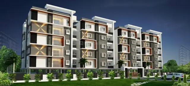
Aparna Urvi
Aparna Farms and Estates LLP · Medchal-Malkajgiri · RERA P02200004599
APARNA URVI is a plotted development of open residential plots in Yellampet, Medchal Mandal, Medchal-Malkajgiri District. The registered promoter is Aparna Farms and Estates LLP. The total site area is 57160.74 sq.m, with a net site area of 55402.60 sq.m; the supplied record does not state a total plot count or building configuration. The project is registered under TG-RERA registration P02200004599, with a proposed completion date of 17/04/2025.
More from Aparna Farms and Estates LLP · 4 projects →
01What we found
Read from TG-RERA filings, approvals, land and registration records and court records. A court case is counted only when the court record states this project's survey number with its village, or names the project.
02Check before you pay
9 items to check before you pay, 4 high - from the title chain, court records and approvals, each with what to ask the builder or your advocate. An item may not be a problem with the project: records can be incomplete.
1. Project at a glance
Project identity
| Field | Project record |
|---|---|
| Registered project name | APARNA URVI RERA record |
| Project type | Plotted development / residential open-plot layout RERA record |
| Phase or registered portion | Not identified as a numbered phase; the registration covers the project land in the listed survey numbers |
| TG-RERA registration | P02200004599 |
| Registration validity | 13 June 2022 to 17 April 2025; the supplied certificate says registration is valid for two years and permits extension by the Authority under the Act and Rules. No extension is recorded in the supplied certificate. |
| Registered promoter | Aparna Farms and Estates LLP RERA record |
| RERA status in supplied record | Registration certificate issued under section 5; certificate validity ended on 17 April 2025. The supplied record does not establish a later extension or current registration status. |
Land and geographic identity
| Field | Project record |
|---|---|
| Locality | Yellampet; the registration certificate describes the location as “Dabeerpur, at Yellampet.” RERA record |
| Revenue villages | Yellampet Village and Dabirpur Village |
| Mandal | Medchal RERA record |
| District | Medchal-Malkajgiri RERA record |
| PIN | 501401 RERA record |
| Project survey numbers | Sy. No. 91(P) (also described in layout documents as Sy.No. 91/1); Sy. Nos. 110(P), 111(P) and 112(P). The supplied layout documents associate 91/1 with Yellampet and 110/P, 111/P and 112/P with Dabirpur. |
| Total site area | 57160.74 sq.m RERA filing |
| Area affected by road | 1758.14 sq.m RERA filing |
| Net site area | 55402.60 sq.m RERA filing |
| Boundaries filed with TG-RERA | East: National Highway-75 M road; West: land in Sy. No. 111(P) and 112(P); North: land in Sy. Nos. 91(P), 110(P) and 112(P); South: land in Sy. No. 112(P). RERA filing |
Development identity
| Field | Project record |
|---|---|
| Sanctioning authority | Hyderabad Metropolitan Development Authority (HMDA) |
| Principal approval | Final Layout Permit 000064/LO/Plg/HMDA/2022, dated 18 July 2023 Approvals record |
| Earlier layout record | Draft layout letter dated 18 April 2022, associated with the same permit number |
| Approved built-up area | Not applicable/disclosed for this plotted layout; individual building permissions are to be considered separately under the applicable building rules. RERA filing |
| Plot count / arrangement | The supplied TG-RERA documents do not provide a clear total saleable-plot count. The draft-layout extraction separately lists plot references “86 & 87, 110 & 111, & 112 to 133” in connection with the mortgage, not as a complete project inventory. |
| Building configuration and parking | No building floors, parking levels, or project-wide residential building count are supplied for this open-plot layout. Individual building permission is separate. |
Offering and status
| Field | Project record |
|---|---|
| Unit type | Open residential plots |
| RERA-filed plot-size range and inventory | Not established by the supplied RERA unit-inventory data. |
| Booked / available counts | Not supplied. |
| Construction / development stage | No independently verified site-progress record is supplied. The final layout letter describes civic services and open spaces as provided and records local-body handover documents; it is not an independent inspection of present condition. |
| Completion undertaking | The promoter’s Form B declares a 3 Years completion period. |
| RERA completion date | The registration record lists 17/04/2025 as the proposed completion date. RERA filing |
| Occupancy / completion certificate | No project-wide occupancy or completion certificate is supplied. The project is a plotted layout; the supplied HMDA record is a final layout approval, not an occupancy certificate for individual buildings. |
2. The project story
APARNA URVI is registered as a residential open-plot project in the Medchal area. Its land is identified across Yellampet and Dabirpur villages, with the RERA filing listing Sy. No. 91(P) and Sy. Nos. 110(P), 111(P) and 112(P). The layout documents further identify Sy.No. 91/1 in Yellampet and the other listed survey portions in Dabirpur.
HMDA’s final layout letter records a residential open-plot layout over 55,402.60 Sqm, under Final Layout Permit 000064/LO/Plg/HMDA/2022, dated 18 July 2023. The registered development is plots rather than a disclosed set of apartments or completed homes. Buyers should therefore distinguish the approved layout and its infrastructure from any future individual home, which requires separate building permission.
The promoter declared a three-year project completion period, and the RERA registration record gives 17 April 2025 as the proposed completion date. The supplied materials do not independently verify current on-site progress, current registration extension, or completion of all layout works.
3. Master plan, architecture & building design
This is a plotted layout, not a multi-storey building project. HMDA’s final layout record identifies a net layout extent of 55,402.60 Sqm. The draft layout documentation separately records the site’s land-use components: 31,376.22 plotted area; 17,666.36 layout road area; 4,972.17 park/open-space/utility area; and 1,387.74 sqm social infrastructure area. It also records 1,758.14 as the area affected by the proposed 75 m wide road. These are layout figures, not building or carpet-area measurements.
The draft-layout record lists road widths of 12.19M, 18.29M, 9.14M and 75 M; the later draft-letter extraction also refers to a 75 m wide road and roads of 18 mts and above. The final layout conditions require roads to remain open for public access and prohibit compound walls that obstruct access.
The final layout letter says the roads and open spaces were taken over by the local authority through registered gift-deed documentation, and refers to a relinquishment deed concerning mortgaged plots. It also states that individual building permissions are to be considered separately. No apartment floor plans, building elevations, or sanctioned floor configurations are supplied.
4. Homes, configurations & floor plans
| Configuration | Units | Booked | Available | RERA saleable area | Measured carpet area | Loading (if supplied) |
|---|---|---|---|---|---|---|
| Open plots | Not supplied | Not supplied | Not supplied | Not established in the supplied RERA inventory | Not applicable | Not supplied |
The supplied RERA materials identify the offering as open plots but do not include a complete plot schedule with plot-by-plot sizes, orientations, or booked/available status. No carpet-area measurement applies to a vacant plot. The drawing review records two drawing files still pending scan review and no software-measured floor-plan areas; there are no supplied floor plans from which room or home measurements can be described. Floor plans
5. Parking & vehicle circulation
The supplied project records do not establish a sanctioned project-wide car- or two-wheeler-parking count, visitor or accessible spaces, parking allocation to individual plots, or a parking structure. The layout documents identify internal roads but do not establish a buyer’s exclusive parking entitlement.
6. Amenities, recreation & open spaces
The layout and RERA amenity records list the following:
| Description / size | 4,972.17; the draft-layout record describes this as park/open-space/utility area and gives 8.97 %. |
|---|---|
| Declared progress / verified status | Included in the layout records; the final letter records open-space handover documentation. Present condition not independently verified. |
| Description / size | 1,387.74sqm; draft record gives 2.50 %. |
|---|---|
| Declared progress / verified status | Layout allocation recorded; no facility-specific completed-building evidence supplied. |
| Description / size | No size or description supplied. |
|---|---|
| Evidence source | RERA amenities |
| Declared progress / verified status | Listed without a reported completion percentage; no independent completion verification supplied. |
| Description / size | No separate size beyond the layout road-area figures. |
|---|---|
| Evidence source | RERA amenities |
| Declared progress / verified status | Listed in the RERA amenity record; current condition not independently verified. |
| Description / size | No quantity or size supplied. |
|---|---|
| Declared progress / verified status | Layout condition refers to plantation and greenery; current maintenance not independently verified. |
The draft layout lists 0 amenities area as a separate land-use component. This does not establish the absence or presence of a built amenity facility; the supplied record does not provide a facility-by-facility schedule with sizes and completion evidence.
7. Utilities, building services & safety
| What the supplied project record says | Internal water-supply pipelines and an overhead tank are listed in the draft-layout document; the final letter refers to a layout provided with water supply. No capacity or present operating status is supplied. |
|---|
| What the supplied project record says | Common septic tank / STP, underground drainage lines, sewage treatment, and storm-water drains are listed. No treatment capacity, reuse quantity, or operating evidence is supplied. |
|---|---|
| Evidence / status | RERA amenities |
| What the supplied project record says | Rainwater-harvesting pits / structures are listed. No number, capacity, or completion verification is supplied. |
|---|
| What the supplied project record says | Electrical supply lines, transformer, street lights, and an electrical meter room/sub-station item appear in the supplied records. No load, backup capacity, or commissioning evidence is supplied. |
|---|---|
| Evidence / status | RERA amenities |
| What the supplied project record says | Solid-waste management and disposal is listed in the RERA amenity record; no system description or operating evidence is supplied. |
|---|---|
| Evidence / status | RERA amenities |
| What the supplied project record says | A fire-protection/fire-safety line appears in the RERA amenity record, but no project-specific system description or clearance is supplied. |
|---|---|
| Evidence / status | RERA amenities |
| What the supplied project record says | Internal roads are recorded; no accessible-route, ramp, or pedestrian-separation details are supplied. |
|---|---|
| Evidence / status | RERA amenities |
The final layout letter states that the local body is to ensure proper and effective maintenance of the layout’s listed civic services. The records describe provisions and conditions; they do not independently establish that each service is currently operating or that a statutory clearance has been issued.
8. Location, access & connectivity
The registered location is Yellampet, Medchal Mandal, Medchal-Malkajgiri District, PIN 501401; the registration certificate describes the project as “Dabeerpur, at Yellampet.” HMDA’s final layout letter identifies land in both Yellampet Village and Dabirpur Village. The RERA-filed eastern boundary is a National Highway-75 M road. RERA record RERA filing
The supplied location record gives an approximate distance of 6.0 km to the nearest sampled Outer Ring Road interchange, 2.8 km to SBI Bank and 2.1 km to UPHC Jangaon. The record does not provide a measured distance to a public-transport stop or a verified travel time. Location record
9. Developer & development status
The registered promoter is Aparna Farms and Estates LLP, an LLP. The supplied corporate identifier is GSTIN 36ABSFA2904Q1ZV. The promoter address in the project filing is 802, 6-2-253/2&3, Astral Heights, Road No 1, Yellampet, with the filing also listing Yellampet, Medchal, Medchal-Malkajgiri, PIN 501401. Corporate record RERA filing RERA filing
The promoter’s Form B, signed by Designated Partner Sannareddy Subramanyam Reddy, declares a 3 Years completion period and makes declarations about title, encumbrances, project funds, approvals and audits. These are promoter declarations in the filed affidavit.
The registration certificate records validity through 17/04/2025. No extension is recorded in the supplied certificate, and no independently verified current construction or infrastructure progress report is provided here. The final layout approval is not an occupancy certificate for individual homes; individual building permissions remain a separate step under the final layout letter.
10. Approvals, official records & documents
| Identifier / date | P02200004599; issued 13 June 2022; valid to 17 April 2025 as stated in the certificate. |
|---|---|
| What it establishes | Registration of APARNA URVI as recorded by TG-RERA; no extension is shown in the supplied certificate. |
| Identifier / date | 000064/LO/Plg/HMDA/2022; dated 18 April 2022; application 052278/MED/LT/U6/HMDA/09022022. |
|---|---|
| What it establishes | Draft layout record and conditions for the open-plot layout. |
| Identifier / date | 000064/LO/Plg/HMDA/2022; dated 18 July 2023; application 061387/LT/MED/FLT/U6/HMDA/27062023. |
|---|---|
| What it establishes | Final residential open-plot layout approval, conditions, and recorded local-authority handover documentation. |
| Identifier / date | Mortgage deed 4561/2022, dated 25 March 2022. |
|---|---|
| What it establishes | Draft-layout material identifies specified plots and 4803.65 Sq.Mt. as mortgaged in favour of HMDA; the final letter later refers to a relinquishment deed concerning mortgaged plots. |
| Identifier / date | Gift deeds 8595/2023 and 8596/2023, dated 9 June 2023; relinquishment deed 10406/2023, dated 14 July 2023. |
|---|---|
| What it establishes | The final layout letter records these documents in connection with local-authority handover and relinquishment. |
| Identifier / date | Declaration dated May 2022 (day appears OCR-truncated as “20t day”). |
|---|---|
| What it establishes | Promoter’s filed declarations, including the three-year completion undertaking. |
No individual building-plan approvals, occupancy certificates, or completion certificates for homes are included in the supplied project documents.
1. Project at a glance
Project identity
Registered project name: APARNA URVI
Project type: Plotted development / residential open-plot layout
Phase or registered portion: Not identified as a numbered phase; the registration covers the project land in the listed survey numbers
TG-RERA registration: P02200004599
Registration validity: 13 June 2022 to 17 April 2025; the supplied certificate says registration is valid for two years and permits extension by the Authority under the Act and Rules. No extension is recorded in the supplied certificate.
Registered promoter: Aparna Farms and Estates LLP
RERA status in supplied record: Registration certificate issued under section 5; certificate validity ended on 17 April 2025. The supplied record does not establish a later extension or current registration status.
Land and geographic identity
Locality: Yellampet; the registration certificate describes the location as “Dabeerpur, at Yellampet.”
Revenue villages: Yellampet Village and Dabirpur Village
Mandal: Medchal
District: Medchal-Malkajgiri
PIN: 501401
Project survey numbers: Sy. No. 91(P) (also described in layout documents as Sy.No. 91/1); Sy. Nos. 110(P), 111(P) and 112(P). The supplied layout documents associate 91/1 with Yellampet and 110/P, 111/P and 112/P with Dabirpur.
Total site area: 57160.74 sq.m
Area affected by road: 1758.14 sq.m
Net site area: 55402.60 sq.m
Boundaries filed with TG-RERA: East: National Highway-75 M road; West: land in Sy. No. 111(P) and 112(P); North: land in Sy. Nos. 91(P), 110(P) and 112(P); South: land in Sy. No. 112(P).
Development identity
Sanctioning authority: Hyderabad Metropolitan Development Authority (HMDA)
Principal approval: Final Layout Permit 000064/LO/Plg/HMDA/2022, dated 18 July 2023
Earlier layout record: Draft layout letter dated 18 April 2022, associated with the same permit number
Approved built-up area: Not applicable/disclosed for this plotted layout; individual building permissions are to be considered separately under the applicable building rules.
Plot count / arrangement: The supplied TG-RERA documents do not provide a clear total saleable-plot count. The draft-layout extraction separately lists plot references “86 & 87, 110 & 111, & 112 to 133” in connection with the mortgage, not as a complete project inventory.
Building configuration and parking: No building floors, parking levels, or project-wide residential building count are supplied for this open-plot layout. Individual building permission is separate.
Offering and status
Unit type: Open residential plots
RERA-filed plot-size range and inventory: Not established by the supplied RERA unit-inventory data.
Booked / available counts: Not supplied.
Construction / development stage: No independently verified site-progress record is supplied. The final layout letter describes civic services and open spaces as provided and records local-body handover documents; it is not an independent inspection of present condition.
Completion undertaking: The promoter’s Form B declares a 3 Years completion period.
RERA completion date: The registration record lists 17/04/2025 as the proposed completion date.
Occupancy / completion certificate: No project-wide occupancy or completion certificate is supplied. The project is a plotted layout; the supplied HMDA record is a final layout approval, not an occupancy certificate for individual buildings.
2. The project story
APARNA URVI is registered as a residential open-plot project in the Medchal area. Its land is identified across Yellampet and Dabirpur villages, with the RERA filing listing Sy. No. 91(P) and Sy. Nos. 110(P), 111(P) and 112(P). The layout documents further identify Sy.No. 91/1 in Yellampet and the other listed survey portions in Dabirpur.
HMDA’s final layout letter records a residential open-plot layout over 55,402.60 Sqm, under Final Layout Permit 000064/LO/Plg/HMDA/2022, dated 18 July 2023. The registered development is plots rather than a disclosed set of apartments or completed homes. Buyers should therefore distinguish the approved layout and its infrastructure from any future individual home, which requires separate building permission.
The promoter declared a three-year project completion period, and the RERA registration record gives 17 April 2025 as the proposed completion date. The supplied materials do not independently verify current on-site progress, current registration extension, or completion of all layout works.
3. Master plan, architecture & building design
This is a plotted layout, not a multi-storey building project. HMDA’s final layout record identifies a net layout extent of 55,402.60 Sqm. The draft layout documentation separately records the site’s land-use components: 31,376.22 plotted area; 17,666.36 layout road area; 4,972.17 park/open-space/utility area; and 1,387.74 sqm social infrastructure area. It also records 1,758.14 as the area affected by the proposed 75 m wide road. These are layout figures, not building or carpet-area measurements.
The draft-layout record lists road widths of 12.19M, 18.29M, 9.14M and 75 M; the later draft-letter extraction also refers to a 75 m wide road and roads of 18 mts and above. The final layout conditions require roads to remain open for public access and prohibit compound walls that obstruct access.
The final layout letter says the roads and open spaces were taken over by the local authority through registered gift-deed documentation, and refers to a relinquishment deed concerning mortgaged plots. It also states that individual building permissions are to be considered separately. No apartment floor plans, building elevations, or sanctioned floor configurations are supplied.
4. Homes, configurations & floor plans
| Configuration | Units | Booked | Available | RERA saleable area | Measured carpet area | Loading (if supplied) |
|---|---|---|---|---|---|---|
| Open plots | Not supplied | Not supplied | Not supplied | Not established in the supplied RERA inventory | Not applicable | Not supplied |
The supplied RERA materials identify the offering as open plots but do not include a complete plot schedule with plot-by-plot sizes, orientations, or booked/available status. No carpet-area measurement applies to a vacant plot. The drawing review records two drawing files still pending scan review and no software-measured floor-plan areas; there are no supplied floor plans from which room or home measurements can be described.
5. Parking & vehicle circulation
The supplied project records do not establish a sanctioned project-wide car- or two-wheeler-parking count, visitor or accessible spaces, parking allocation to individual plots, or a parking structure. The layout documents identify internal roads but do not establish a buyer’s exclusive parking entitlement.
6. Amenities, recreation & open spaces
The layout and RERA amenity records list the following:
| Description / size | 4,972.17; the draft-layout record describes this as park/open-space/utility area and gives 8.97 %. |
|---|---|
| Declared progress / verified status | Included in the layout records; the final letter records open-space handover documentation. Present condition not independently verified. |
| Description / size | 1,387.74sqm; draft record gives 2.50 %. |
|---|---|
| Declared progress / verified status | Layout allocation recorded; no facility-specific completed-building evidence supplied. |
| Description / size | No size or description supplied. |
|---|---|
| Declared progress / verified status | Listed without a reported completion percentage; no independent completion verification supplied. |
| Description / size | No separate size beyond the layout road-area figures. |
|---|---|
| Declared progress / verified status | Listed in the RERA amenity record; current condition not independently verified. |
| Description / size | No quantity or size supplied. |
|---|---|
| Declared progress / verified status | Layout condition refers to plantation and greenery; current maintenance not independently verified. |
The draft layout lists 0 amenities area as a separate land-use component. This does not establish the absence or presence of a built amenity facility; the supplied record does not provide a facility-by-facility schedule with sizes and completion evidence.
7. Utilities, building services & safety
| What the supplied project record says | Internal water-supply pipelines and an overhead tank are listed in the draft-layout document; the final letter refers to a layout provided with water supply. No capacity or present operating status is supplied. |
|---|
| What the supplied project record says | Common septic tank / STP, underground drainage lines, sewage treatment, and storm-water drains are listed. No treatment capacity, reuse quantity, or operating evidence is supplied. |
|---|
| What the supplied project record says | Rainwater-harvesting pits / structures are listed. No number, capacity, or completion verification is supplied. |
|---|
| What the supplied project record says | Electrical supply lines, transformer, street lights, and an electrical meter room/sub-station item appear in the supplied records. No load, backup capacity, or commissioning evidence is supplied. |
|---|
| What the supplied project record says | Solid-waste management and disposal is listed in the RERA amenity record; no system description or operating evidence is supplied. |
|---|
| What the supplied project record says | A fire-protection/fire-safety line appears in the RERA amenity record, but no project-specific system description or clearance is supplied. |
|---|
| What the supplied project record says | Internal roads are recorded; no accessible-route, ramp, or pedestrian-separation details are supplied. |
|---|
The final layout letter states that the local body is to ensure proper and effective maintenance of the layout’s listed civic services. The records describe provisions and conditions; they do not independently establish that each service is currently operating or that a statutory clearance has been issued.
8. Location, access & connectivity
The registered location is Yellampet, Medchal Mandal, Medchal-Malkajgiri District, PIN 501401; the registration certificate describes the project as “Dabeerpur, at Yellampet.” HMDA’s final layout letter identifies land in both Yellampet Village and Dabirpur Village. The RERA-filed eastern boundary is a National Highway-75 M road.
The supplied location record gives an approximate distance of 6.0 km to the nearest sampled Outer Ring Road interchange, 2.8 km to SBI Bank and 2.1 km to UPHC Jangaon. The record does not provide a measured distance to a public-transport stop or a verified travel time.
9. Developer & development status
The registered promoter is Aparna Farms and Estates LLP, an LLP. The supplied corporate identifier is GSTIN 36ABSFA2904Q1ZV. The promoter address in the project filing is 802, 6-2-253/2&3, Astral Heights, Road No 1, Yellampet, with the filing also listing Yellampet, Medchal, Medchal-Malkajgiri, PIN 501401.
The promoter’s Form B, signed by Designated Partner Sannareddy Subramanyam Reddy, declares a 3 Years completion period and makes declarations about title, encumbrances, project funds, approvals and audits. These are promoter declarations in the filed affidavit.
The registration certificate records validity through 17/04/2025. No extension is recorded in the supplied certificate, and no independently verified current construction or infrastructure progress report is provided here. The final layout approval is not an occupancy certificate for individual homes; individual building permissions remain a separate step under the final layout letter.
10. Approvals, official records & documents
| Identifier / date | P02200004599; issued 13 June 2022; valid to 17 April 2025 as stated in the certificate. |
|---|---|
| What it establishes | Registration of APARNA URVI as recorded by TG-RERA; no extension is shown in the supplied certificate. |
| Identifier / date | 000064/LO/Plg/HMDA/2022; dated 18 April 2022; application 052278/MED/LT/U6/HMDA/09022022. |
|---|---|
| What it establishes | Draft layout record and conditions for the open-plot layout. |
| Identifier / date | 000064/LO/Plg/HMDA/2022; dated 18 July 2023; application 061387/LT/MED/FLT/U6/HMDA/27062023. |
|---|---|
| What it establishes | Final residential open-plot layout approval, conditions, and recorded local-authority handover documentation. |
| Identifier / date | Mortgage deed 4561/2022, dated 25 March 2022. |
|---|---|
| What it establishes | Draft-layout material identifies specified plots and 4803.65 Sq.Mt. as mortgaged in favour of HMDA; the final letter later refers to a relinquishment deed concerning mortgaged plots. |
| Identifier / date | Gift deeds 8595/2023 and 8596/2023, dated 9 June 2023; relinquishment deed 10406/2023, dated 14 July 2023. |
|---|---|
| What it establishes | The final layout letter records these documents in connection with local-authority handover and relinquishment. |
| Identifier / date | Declaration dated May 2022 (day appears OCR-truncated as “20t day”). |
|---|---|
| What it establishes | Promoter’s filed declarations, including the three-year completion undertaking. |
No individual building-plan approvals, occupancy certificates, or completion certificates for homes are included in the supplied project documents.
Frequently asked questions
Is APARNA URVI registered with Telangana RERA?
Yes. APARNA URVI is registered with the Telangana Real Estate Regulatory Authority as P02200004599; the registration status is New Project.
Who is the developer of APARNA URVI?
The promoter named in the RERA registration is Aparna Farms and Estates LLP.
Where is APARNA URVI located?
APARNA URVI is in Yellampet, Medchal, Medchal-Malkajgiri, Telangana (501401).
When will APARNA URVI be completed?
The promoter's proposed date of completion filed with RERA is 17/04/2025. This is the promoter's declaration, not a guarantee.
More projects in Yellampet