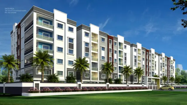
Sree Balaji County-II
JBN INFRA DEVELOPERS · Rangareddy · RERA P02400004648
SREE BALAJI COUNTY-II is a new residential open plotted layout in MAHESHWARAM, Maheshwaram mandal, Ranga Reddy district, developed by registered promoter JBN INFRA DEVELOPERS. The site area is 17,199.14 sq.m, and the filed HMDA drawing records 43 plots; the project is a plotted development, with no building or floor configuration stated. Its TG-RERA registration is P02400004648, registered from 27/06/2022 to 30/04/2025, and the filed Form B dated 23-05-2022 undertakes completion by 30/04/2025.
More from Jbn Infra Developers · 2 projects →
01What we found
Read from TG-RERA filings, approvals, land and registration records and court records. A court case is counted only when the court record states this project's survey number with its village, or names the project.
02Check before you pay
11 items to check before you pay, 5 high - from the title chain, court records and approvals, each with what to ask the builder or your advocate. An item may not be a problem with the project: records can be incomplete.
Project at a glance
Project identity
| Item | Record |
|---|---|
| Registered project name | SREE BALAJI COUNTY-II RERA record |
| Project type | New residential open plotted layout RERA record RERA filing |
| Phase / registered portion | Phase not separately identified; the registration is for SREE BALAJI COUNTY-II RERA record |
| TG-RERA registration | P02400004648; registered from 27/06/2022 to 30/04/2025 RERA record Approvals record |
| RERA status | New Project in the project record. The certificate states its validity period; the supplied evidence does not establish a current extension or current registration status. RERA record |
| Registered promoter | JBN INFRA DEVELOPERS RERA record Corporate record |
Land and geographic identity
| Item | Record |
|---|---|
| Locality | MAHESHWARAM RERA record RERA filing |
| Revenue village | Mansanpally (also rendered “Mansanpalle” in filed approval documents) RERA record |
| Mandal / district / PIN | Maheshwaram / Ranga Reddy / 501359 RERA record RERA filing |
| Project survey numbers | 175/AA and 134/A1 RERA record Land records |
| Site area | 17,199.14 sq.m total site area; 408.18 sq.m affected by master-plan road widening; 16,790.96 sq.m net site area RERA filing |
| Boundaries (RERA-filed) | North: ROAD OF MANSANPALLY TO MAHESHWARAM; South: LAND OF LAMBADI SUKYA AND OTHERS; East: MAHESHWARAM VILLAGE SHIVAR; West: LAND OF CH SURYANARAYANA RAJU RERA filing |
Development identity
| Item | Record |
|---|---|
| Sanctioning authority | Hyderabad Metropolitan Development Authority (HMDA) Approvals record |
| Principal layout approval | HMDA Layout Permit 000073/LO/Plg/HMDA/2022, dated 30 April, 2022; the filed instrument is identified as a draft layout plan Approvals record |
| Approved development | Residential open layout; the drawing records 43 plots |
| Approved built-up area | Not disclosed in the supplied records for this plotted-layout project. |
| Buildings, floors and parking levels | Not applicable to the described plotted layout; no building/floor configuration or parking levels are disclosed. |
| RERA-declared plot count | The supplied registration certificate confirms the project registration; the available extracts do not state a separate RERA-declared plot count. |
Offering and status
| Item | Record |
|---|---|
| Offered property type | Residential plots; plot sizes and individual plot schedule are not established in the supplied RERA extracts. |
| Booked / available counts | Not disclosed in the supplied evidence. |
| Construction / development stage | The project record includes a declared 80% completeness figure, but the supplied evidence does not identify its measurement date or independently verify site progress. RERA record |
| Completion dates | The registration certificate records validity through 30/04/2025. The filed Form B dated 23-05-2022 undertakes completion by 30/04/2025; another filed Form B dated 09-05-2022 states 30/04/2026. These are promoter declarations. |
| Occupancy / completion certificate | No occupancy or completion certificate is identified in the supplied evidence. Registration validity, the declared completion dates and certificate status are separate matters. |
The project story
SREE BALAJI COUNTY-II is presented in its TG-RERA record as a new residential plotted development at Mansanpally village, Maheshwaram mandal, Ranga Reddy district. Its registered land identity is Survey Nos. 175/AA and 134/A1. The HMDA-filed plan describes an open residential layout organized around internal roads, park/open space and social-infrastructure land. RERA record Land records
The filed approval documents identify 16,790.96 sq.m as net site area after 408.18 sq.m of master-plan road-affected area is deducted from the 17,199.14 sq.m total site area. The plan labels 10,397.92 sq.m as plotted area, 4,548.29 sq.m as layout road area, 1,423.79 sq.m as organized open space/park/utility area, and 420.68 sq.m as social-infrastructure area. These are layout-plan figures, not plot-by-plot measurements. Layout record
The project record reports 80% completeness, but does not provide an as-of date or independent site verification for that figure. No occupancy or completion certificate is identified in the supplied documents. The RERA registration certificate states validity through 30/04/2025; this is not, by itself, evidence of project completion. RERA record
Master plan, architecture & building design
The filed HMDA drawing is for an open residential layout, not a multi-storey building scheme. It identifies the land-use zone as residential. The supplied evidence does not provide a complete plot schedule, plot-size breakdown, building footprints, building heights, floor configurations or residential-unit plans.
| Layout component | Area recorded | Evidence |
|---|---|---|
| Total site area | 17,199.14 sq.m | HMDA draft layout letter |
| Master-plan road-affected area | 408.18 sq.m | HMDA draft layout letter and plan |
| Net site area | 16,790.96 sq.m | HMDA draft layout letter and plan |
| Plotted area | 10,397.92 sq.m | HMDA draft layout letter and plan |
| Layout road area | 4,548.29 sq.m | HMDA draft layout letter |
| Organized open space / park / utility area | 1,423.79 sq.m | HMDA draft layout letter and plan |
| Social-infrastructure area | 420.68 sq.m | HMDA draft layout letter and plan |
| Amenity area | 0.00 sq.m in the layout-plan schedule | HMDA draft layout plan |
The filed draft-layout conditions describe internal infrastructure and open-space development, including roads, footpaths, drains, water-supply lines, lighting, park development and cycling tracks. They also record required handover of road, open-space and social-infrastructure areas to the local body by registered gift deed. These are approval conditions or proposed works; the supplied evidence does not establish their completion.
Homes, configurations & floor plans
This is a plotted development, so the available offering is residential plots rather than apartment configurations. The supplied RERA extracts do not provide a plot-by-plot schedule, plot-size bands, booking status or availability.
| Configuration | Units | Booked | Available | RERA saleable area | Measured carpet area | Loading (if supplied) |
|---|---|---|---|---|---|---|
| Residential plots | 43 in the filed HMDA drawing | Not disclosed | Not disclosed | Not disclosed by plot | Not applicable | Not disclosed |
The floor-plan review record indicates that the supplied drawing set contains layout sheets; it does not provide measured home or plot-area results. A third-party listing gives a plot-size range, but no corresponding plot schedule is established in the supplied TG-RERA evidence, so that range is not treated here as the registered offering. Floor plans Promoter website
Parking & vehicle circulation
The supplied records do not establish a count of resident, visitor or accessible parking spaces, nor do they disclose a parking-allotment arrangement. No building parking levels, ramps or mechanical parking are shown for this plotted-layout offering.
The HMDA-filed layout documents identify internal roads and footpaths and include road-width references in the approval extracts. The draft-layout conditions also refer to road accessibility and cycling tracks; the supplied evidence does not independently verify that these works have been completed.
Amenities, recreation & open spaces
The layout documents distinguish park/open-space and social-infrastructure land from the residential plot area. The RERA amenity checklist contains infrastructure and open-space categories, but the supplied entries do not establish completion progress; a listed YES for rainwater harvesting is a filed declaration, not independent verification. RERA amenities
| Facility | Description / size | Evidence source | Declared progress / verified status |
|---|---|---|---|
| Park / organized open space | 1,423.79 sq.m | HMDA draft layout letter and plan | Required by the filed layout; completion not established. |
| Social-infrastructure area | 420.68 sq.m | HMDA draft layout letter and plan | Area identified in the filed plan; facility details and completion not established. |
| Avenue plantation | No size disclosed | HMDA draft layout letter | Listed as a development item; completion not established. |
| Cycling tracks | No size disclosed | HMDA draft layout letter | Listed as a development item; completion not established. |
| Rainwater harvesting | No quantity or capacity disclosed | RERA amenity checklist RERA amenities | Checklist shows “YES”; completion not independently verified. |
No clubhouse or specific indoor, sports or convenience facilities are established by the supplied project records.
Utilities, building services & safety
The HMDA-filed draft-layout letter lists proposed infrastructure including storm-water drains, underground drainage lines, a common septic tank/STP, internal water-supply pipelines, an overhead tank, electrical supply lines, street lights, a transformer, rainwater-harvesting pits, a bio-compost unit and solid-waste arrangements. The document does not give capacities or establish that these systems are complete or operational.
The RERA amenity checklist also names water supply, sewerage, storm-water drainage, solid-waste management, energy management and electrical-meter/sub-station facilities. It does not provide system specifications or completion evidence. No supplied project record establishes water source or storage capacity, sewage-treatment capacity, power-backup capacity, fire-system details, security/CCTV provision, accessibility features or operational status. RERA amenities
Location, access & connectivity
The registered location is MAHESHWARAM, in Mansanpally village, Maheshwaram mandal, Ranga Reddy district, Telangana, PIN 501359. The RERA-filed project boundaries identify the north side as the road from Mansanpally to Maheshwaram; the HMDA layout documents also refer to road access and internal layout roads. RERA record RERA filing RERA filing
A supplied location record places the project geocode at 17.1368136, 78.3932857 and lists the nearest sampled Outer Ring Road interchange at approximately 11.1 km. Location record The evidence does not supply verified public-transport details or measured distances to other landmarks.
Developer & development status
The registered promoter is JBN INFRA DEVELOPERS, identified in the project record as a partnership. The supplied corporate record gives GSTIN 36AAQFJ4238D1ZA and lists the promoter address as B N REDDY NAGAR, MANSANPALLY, MAHESHWARAM, Ranga Reddy, 501359. The registration certificate separately prints a promoter-office line with PIN 500070; the supplied documents do not provide an official contact number, email or website. Corporate record Parties record
The promoter’s Form B declarations give completion undertakings of 30/04/2025 and 30/04/2026 in separate filed documents. These are promoter-declared dates, not evidence of completion. The project record reports 80% completeness, without an identified measurement date or independent verification, and the supplied evidence contains no occupancy or completion certificate. RERA record
Approvals, official records & documents
| Record | What the supplied evidence establishes |
|---|---|
| TG-RERA registration certificate | Form C for SREE BALAJI COUNTY-II, registration P02400004648, issued 27/06/2022, with validity stated through 30/04/2025. The certificate includes the project survey numbers and standard registration conditions. |
| HMDA draft layout letter | HMDA draft-layout approval record for Survey Nos. 175/AA and 134/A1, Mansanpally, with site-area and development-condition details. |
| Gram Panchayat layout-release order | Order of the Office of the Gram Panchayat, Mansanpalle, recording release of a residential draft open-plotted layout after collection of requisite fees. |
| HMDA draft layout plan | Layout Permit 000073/LO/Plg/HMDA/2022, dated 30 April, 2022; the plan identifies 43 plots and specifies residential use. |
| Promoter Form B declarations | Two promoter declarations concerning title, encumbrances, project accounts and completion undertakings, dated 09-05-2022 and 23-05-2022. |
| Completion / occupancy certificate | Not identified in the supplied evidence. |
| Public layout lookup | The HMDA DPMS approved-layout lookup is reported as unavailable through the supplied public-access check; this does not establish refusal or non-approval. HMDA |
Project at a glance
Project identity
Registered project name: SREE BALAJI COUNTY-II
Project type: New residential open plotted layout
Phase / registered portion: Phase not separately identified; the registration is for SREE BALAJI COUNTY-II
TG-RERA registration: P02400004648; registered from 27/06/2022 to 30/04/2025
RERA status: New Project in the project record. The certificate states its validity period; the supplied evidence does not establish a current extension or current registration status.
Registered promoter: JBN INFRA DEVELOPERS
Land and geographic identity
Locality: MAHESHWARAM
Revenue village: Mansanpally (also rendered “Mansanpalle” in filed approval documents)
Mandal / district / PIN: Maheshwaram / Ranga Reddy / 501359
Project survey numbers: 175/AA and 134/A1
Site area: 17,199.14 sq.m total site area; 408.18 sq.m affected by master-plan road widening; 16,790.96 sq.m net site area
Boundaries (RERA-filed): North: ROAD OF MANSANPALLY TO MAHESHWARAM; South: LAND OF LAMBADI SUKYA AND OTHERS; East: MAHESHWARAM VILLAGE SHIVAR; West: LAND OF CH SURYANARAYANA RAJU
Development identity
Sanctioning authority: Hyderabad Metropolitan Development Authority (HMDA)
Principal layout approval: HMDA Layout Permit 000073/LO/Plg/HMDA/2022, dated 30 April, 2022; the filed instrument is identified as a draft layout plan
Approved development: Residential open layout; the drawing records 43 plots
Approved built-up area: Not disclosed in the supplied records for this plotted-layout project.
Buildings, floors and parking levels: Not applicable to the described plotted layout; no building/floor configuration or parking levels are disclosed.
RERA-declared plot count: The supplied registration certificate confirms the project registration; the available extracts do not state a separate RERA-declared plot count.
Offering and status
Offered property type: Residential plots; plot sizes and individual plot schedule are not established in the supplied RERA extracts.
Booked / available counts: Not disclosed in the supplied evidence.
Construction / development stage: The project record includes a declared 80% completeness figure, but the supplied evidence does not identify its measurement date or independently verify site progress.
Completion dates: The registration certificate records validity through 30/04/2025. The filed Form B dated 23-05-2022 undertakes completion by 30/04/2025; another filed Form B dated 09-05-2022 states 30/04/2026. These are promoter declarations.
Occupancy / completion certificate: No occupancy or completion certificate is identified in the supplied evidence. Registration validity, the declared completion dates and certificate status are separate matters.
The project story
SREE BALAJI COUNTY-II is presented in its TG-RERA record as a new residential plotted development at Mansanpally village, Maheshwaram mandal, Ranga Reddy district. Its registered land identity is Survey Nos. 175/AA and 134/A1. The HMDA-filed plan describes an open residential layout organized around internal roads, park/open space and social-infrastructure land.
The filed approval documents identify 16,790.96 sq.m as net site area after 408.18 sq.m of master-plan road-affected area is deducted from the 17,199.14 sq.m total site area. The plan labels 10,397.92 sq.m as plotted area, 4,548.29 sq.m as layout road area, 1,423.79 sq.m as organized open space/park/utility area, and 420.68 sq.m as social-infrastructure area. These are layout-plan figures, not plot-by-plot measurements.
The project record reports 80% completeness, but does not provide an as-of date or independent site verification for that figure. No occupancy or completion certificate is identified in the supplied documents. The RERA registration certificate states validity through 30/04/2025; this is not, by itself, evidence of project completion.
Master plan, architecture & building design
The filed HMDA drawing is for an open residential layout, not a multi-storey building scheme. It identifies the land-use zone as residential. The supplied evidence does not provide a complete plot schedule, plot-size breakdown, building footprints, building heights, floor configurations or residential-unit plans.
| Layout component | Area recorded | Evidence |
|---|---|---|
| Total site area | 17,199.14 sq.m | HMDA draft layout letter |
| Master-plan road-affected area | 408.18 sq.m | HMDA draft layout letter and plan |
| Net site area | 16,790.96 sq.m | HMDA draft layout letter and plan |
| Plotted area | 10,397.92 sq.m | HMDA draft layout letter and plan |
| Layout road area | 4,548.29 sq.m | HMDA draft layout letter |
| Organized open space / park / utility area | 1,423.79 sq.m | HMDA draft layout letter and plan |
| Social-infrastructure area | 420.68 sq.m | HMDA draft layout letter and plan |
| Amenity area | 0.00 sq.m in the layout-plan schedule | HMDA draft layout plan |
The filed draft-layout conditions describe internal infrastructure and open-space development, including roads, footpaths, drains, water-supply lines, lighting, park development and cycling tracks. They also record required handover of road, open-space and social-infrastructure areas to the local body by registered gift deed. These are approval conditions or proposed works; the supplied evidence does not establish their completion.
Homes, configurations & floor plans
This is a plotted development, so the available offering is residential plots rather than apartment configurations. The supplied RERA extracts do not provide a plot-by-plot schedule, plot-size bands, booking status or availability.
| Configuration | Units | Booked | Available | RERA saleable area | Measured carpet area | Loading (if supplied) |
|---|---|---|---|---|---|---|
| Residential plots | 43 in the filed HMDA drawing | Not disclosed | Not disclosed | Not disclosed by plot | Not applicable | Not disclosed |
The floor-plan review record indicates that the supplied drawing set contains layout sheets; it does not provide measured home or plot-area results. A third-party listing gives a plot-size range, but no corresponding plot schedule is established in the supplied TG-RERA evidence, so that range is not treated here as the registered offering.
Parking & vehicle circulation
The supplied records do not establish a count of resident, visitor or accessible parking spaces, nor do they disclose a parking-allotment arrangement. No building parking levels, ramps or mechanical parking are shown for this plotted-layout offering.
The HMDA-filed layout documents identify internal roads and footpaths and include road-width references in the approval extracts. The draft-layout conditions also refer to road accessibility and cycling tracks; the supplied evidence does not independently verify that these works have been completed.
Amenities, recreation & open spaces
The layout documents distinguish park/open-space and social-infrastructure land from the residential plot area. The RERA amenity checklist contains infrastructure and open-space categories, but the supplied entries do not establish completion progress; a listed YES for rainwater harvesting is a filed declaration, not independent verification.
| Facility | Description / size | Evidence source | Declared progress / verified status |
|---|---|---|---|
| Park / organized open space | 1,423.79 sq.m | HMDA draft layout letter and plan | Required by the filed layout; completion not established. |
| Social-infrastructure area | 420.68 sq.m | HMDA draft layout letter and plan | Area identified in the filed plan; facility details and completion not established. |
| Avenue plantation | No size disclosed | HMDA draft layout letter | Listed as a development item; completion not established. |
| Cycling tracks | No size disclosed | HMDA draft layout letter | Listed as a development item; completion not established. |
| Rainwater harvesting | No quantity or capacity disclosed | RERA amenity checklist | Checklist shows “YES”; completion not independently verified. |
No clubhouse or specific indoor, sports or convenience facilities are established by the supplied project records.
Utilities, building services & safety
The HMDA-filed draft-layout letter lists proposed infrastructure including storm-water drains, underground drainage lines, a common septic tank/STP, internal water-supply pipelines, an overhead tank, electrical supply lines, street lights, a transformer, rainwater-harvesting pits, a bio-compost unit and solid-waste arrangements. The document does not give capacities or establish that these systems are complete or operational.
The RERA amenity checklist also names water supply, sewerage, storm-water drainage, solid-waste management, energy management and electrical-meter/sub-station facilities. It does not provide system specifications or completion evidence. No supplied project record establishes water source or storage capacity, sewage-treatment capacity, power-backup capacity, fire-system details, security/CCTV provision, accessibility features or operational status.
Location, access & connectivity
The registered location is MAHESHWARAM, in Mansanpally village, Maheshwaram mandal, Ranga Reddy district, Telangana, PIN 501359. The RERA-filed project boundaries identify the north side as the road from Mansanpally to Maheshwaram; the HMDA layout documents also refer to road access and internal layout roads.
A supplied location record places the project geocode at 17.1368136, 78.3932857 and lists the nearest sampled Outer Ring Road interchange at approximately 11.1 km. The evidence does not supply verified public-transport details or measured distances to other landmarks.
Developer & development status
The registered promoter is JBN INFRA DEVELOPERS, identified in the project record as a partnership. The supplied corporate record gives GSTIN 36AAQFJ4238D1ZA and lists the promoter address as B N REDDY NAGAR, MANSANPALLY, MAHESHWARAM, Ranga Reddy, 501359. The registration certificate separately prints a promoter-office line with PIN 500070; the supplied documents do not provide an official contact number, email or website.
The promoter’s Form B declarations give completion undertakings of 30/04/2025 and 30/04/2026 in separate filed documents. These are promoter-declared dates, not evidence of completion. The project record reports 80% completeness, without an identified measurement date or independent verification, and the supplied evidence contains no occupancy or completion certificate.
Approvals, official records & documents
TG-RERA registration certificate: Form C for SREE BALAJI COUNTY-II, registration P02400004648, issued 27/06/2022, with validity stated through 30/04/2025. The certificate includes the project survey numbers and standard registration conditions.
HMDA draft layout letter: HMDA draft-layout approval record for Survey Nos. 175/AA and 134/A1, Mansanpally, with site-area and development-condition details.
Gram Panchayat layout-release order: Order of the Office of the Gram Panchayat, Mansanpalle, recording release of a residential draft open-plotted layout after collection of requisite fees.
HMDA draft layout plan: Layout Permit 000073/LO/Plg/HMDA/2022, dated 30 April, 2022; the plan identifies 43 plots and specifies residential use.
Promoter Form B declarations: Two promoter declarations concerning title, encumbrances, project accounts and completion undertakings, dated 09-05-2022 and 23-05-2022.
Completion / occupancy certificate: Not identified in the supplied evidence.
Public layout lookup: The HMDA DPMS approved-layout lookup is reported as unavailable through the supplied public-access check; this does not establish refusal or non-approval.
Frequently asked questions
Is SREE BALAJI COUNTY-II registered with Telangana RERA?
Yes. SREE BALAJI COUNTY-II is registered with the Telangana Real Estate Regulatory Authority as P02400004648; the registration status is New Project.
Who is the developer of SREE BALAJI COUNTY-II?
The promoter named in the RERA registration is JBN INFRA DEVELOPERS.
Where is SREE BALAJI COUNTY-II located?
SREE BALAJI COUNTY-II is in MAHESHWARAM, Mansanpally, Rangareddy, Telangana (501359).
When will SREE BALAJI COUNTY-II be completed?
The promoter's proposed date of completion filed with RERA is 30/04/2025. This is the promoter's declaration, not a guarantee.
More projects in Mansanpally