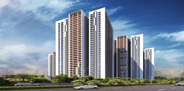
14TH Avenue
AR DEVELOPERS · Rangareddy · RERA P02400001037
14TH AVENUE is a plotted development in ALMASGUDA, Maheshwaram Mandal, Ranga Reddy District, developed by registered promoter AR DEVELOPERS. The RERA-filed site extent is 113252.96 sqmts, and the revised draft layout records 444 plots; no plot configurations or sizes are stated. Its TG-RERA registration number is P02400001037, and the project header lists the proposed completion date as 04/05/2022.
More from Ar Developers · 2 projects →
01What we found
Read from TG-RERA filings, approvals, land and registration records and court records. A court case is counted only when the court record states this project's survey number with its village, or names the project.
02Check before you pay
9 items to check before you pay, 6 high - from the title chain, court records and approvals, each with what to ask the builder or your advocate. An item may not be a problem with the project: records can be incomplete.
1. Project at a glance
Project identity
| Item | Project record |
|---|---|
| Registered project name | 14TH AVENUE RERA record |
| Project type | Plotted development / open-plot layout RERA record |
| Phase / registered portion | No phase name or separate phase is identified in the supplied record; registration is for the project identified above. RERA record |
| TG-RERA registration | P02400001037 RERA record |
| Registration validity | Certificate states valid from 16/07/2019 to 04/05/2022; no extension is recorded in the supplied certificate. This is the registration period, not a statement of completion or occupancy status. |
| Registered promoter | AR DEVELOPERS; the RERA filing identifies the organisation type as Partnership. RERA record RERA filing |
| RERA status | Registration certificate records grant under section 5. The project header labels it “New Project”; the supplied registration record does not establish current registration validity. RERA record |
Land and geographic identity
| Item | Project record |
|---|---|
| Locality / revenue village | ALMASGUDA; revenue village identified in the filed layout documents as Almasguda Village RERA record RERA filing |
| Mandal | Maheshwaram RERA record |
| District | Ranga Reddy RERA record |
| PIN | 501359 RERA record |
| Project survey numbers and subdivisions | 1/P, 6/P, 11, 12/P, 13, 14, 15, 16/P & 35/P RERA record |
| RERA-filed total/site extent | 113252.96 sqmts RERA filing |
| RERA-filed net area | 113252.96 sqmts RERA filing |
| Boundaries in filing | East: ROAD WIDTH 12; West: OTHER LAND; North: OTHER LAND; South: OTHER LAND RERA filing |
Development identity
| Item | Project record |
|---|---|
| Sanctioning authority / principal plan reference | HMDA layout permit 000103/LO/Plg/HMDA/2019, dated 29.07.2021, for a revised draft layout; the approval record notes delegation to Thukkuguda Municipality. |
| Other recorded local proceedings | Thukkuguda Municipality proceedings include draft-layout references G1/695/LO/2019 and Proc. Roc.No. G1/ 695/LO/2016. |
| Approved built-up area | Not stated in the supplied plotted-layout records. RERA filing |
| Buildings / floor configuration | Not disclosed; the supplied plans describe a plotted layout, not a building scheme. |
| Layout plot count | 444 plots is recorded in the revised draft layout plan. |
| Mortgaged plots | Plots 78 to 149 (Total 72 plots), stated as mortgaged in favour of HMDA under document 10581/2019; these are not permitted for sale while subject to the mortgage condition. |
| Layout land-use areas in the HMDA letter | Roads: 32045.84 Sq.mis (29.49%); open space: 8,192.26 Sq.mis (7.57%); social infrastructure: 2824.62 (2.60%); utility: 505.89 (0.43%). The letter also records 10169.86 Sq.mtrs as 15.19% of plotted area for the mortgaged plots. |
Offering and status
| Item | Project record |
|---|---|
| RERA-filed unit types / configuration counts | Unit schedule and booked/available inventory are not supplied. The project is registered as a plotted development. RERA record |
| Plot sizes | No verified plot-size schedule is supplied. Layout record |
| Construction / development stage | The supplied evidence includes promoter-filed progress information showing 80% completeness; this is a filing-derived figure, not independent site verification. RERA record |
| Completion dates | Project header lists proposed completion 04/05/2022. The Form B declaration dated 26" day of January 2019 separately states an undertaking to complete by 31st August, 2024. RERA record |
| Occupancy / completion certificate | No occupancy or completion certificate is supplied. The evidence concerns a plotted layout; no building-specific OC scope is identified. Document index |
| Layout final-release status | The supplied approval documents describe a revised draft layout and set out development and handover conditions before final layout issuance; a final-layout release certificate is not included in the supplied documents. |
2. The project story
- 14TH AVENUE is a proposed open-plot development in Almasguda Village, Maheshwaram Mandal, Ranga Reddy District. The registered land schedule covers survey subdivisions 1/P, 6/P, 11, 12/P, 13, 14, 15, 16/P and 35/P. The RERA filing identifies a site extent of 113252.96 sqmts. RERA record RERA filing
- The filed plan describes a 444-plot layout. The revised draft approval identifies plots 78 to 149—72 plots—as mortgaged to HMDA and states that other plots may be sold subject to the approval conditions. The records require infrastructure works and handover of specified roads, open space, social-infrastructure and utility areas before final layout release.
- The promoter’s filed progress figure is 80% completeness. It should be read as declared filing information, not as an independently verified inspection result. The supplied documents do not establish that the required works are complete, that the final layout has been released, or that an occupancy/completion certificate has been issued. RERA record Document index
3. Master plan, architecture & building design
This is a plotted layout, not a multi-storey apartment or villa plan in the supplied evidence. The revised draft plan records 444 plots and identifies roads, open space, social infrastructure and utility land. The HMDA letter specifies road widths of 18 mts and above and 60 feet and above; a separate recorded intimation requires a 12 Mtrs wide road to the site from the HT tower base.
The HMDA letter records the following land-use schedule for the revised draft layout:
| Layout component | Recorded figure |
|---|---|
| Roads | 32045.84 Sq.mis (29.49%) |
| Open space | 8,192.26 Sq.mis (7.57%) |
| Social infrastructure | 2824.62 (2.60%) |
| Utility area | 505.89 (0.43%) |
| Mortgaged plots | 10169.86 Sq.mtrs, stated as 15.19% of plotted area |
The drawing-derived layout record separately labels 66929.88 sqm as plotted area, 32166.79 sqm as roads, 8785.8 sqm as parks/open space, and 2823.86 sqm as social infrastructure; it describes the layout area statement as read from the approved drawing and notes that plot-count and size extraction should be checked against the drawing. Layout record
No building count, floor configuration, building footprint, parking levels, flat arrangement, or approved built-up area is established by the supplied plotted-layout documents. The HMDA DPMS layout lookup is reported as unavailable through the public internet; that limitation does not itself establish whether any later final-layout approval exists. HMDA
4. Homes, configurations & floor plans
The project is recorded as a plotted development. The supplied RERA evidence does not include a verified plot-by-plot schedule of plot numbers, dimensions, or sizes, or booked and available plot counts. RERA record Layout record
The layout plan records 444 plots. Plots 78 to 149 (Total 72 Plots) are identified as mortgaged to HMDA in the approval record. The approval states that plots other than the mortgaged plots may be sold, subject to the stated approval conditions.
No flat configurations, carpet areas, apartment saleable areas, or floor plans are supplied for this plotted project. The floor-plan review record reports 3 drawings in total, 0 measured, 1 scan pending, and 2 with no flats; it provides no plot measurements. Floor plans
5. Parking & vehicle circulation
The supplied records do not establish a sanctioned parking count or a plot-specific parking allocation. No separate visitor, accessible, or two-wheeler parking provision is quantified. Document index
The layout approval describes internal roads and requires roads to remain open for access to neighbouring sites; it also refers to road widths of 18 mts and above and 60 feet and above, and a 12 Mtrs wide road from the HT tower base in the municipal intimation. These are road-access conditions, not evidence of parking ownership or parking-space allocation.
6. Amenities, recreation & open spaces
The following facilities are stated in the revised draft-layout approval as layout development works or conditions. They are not presented here as independently verified completed facilities.
| Facility | Description / size | Evidence source | Declared progress / verified status |
|---|---|---|---|
| Internal roads | Black-top road formation; approval records road widths of 18 mts and above and 60 feet and above. | Required by the approval; completion not independently verified. | |
| Park / open space | Open space area 8,192.26 Sq.mis (7.57%) in the HMDA letter. | Required land-use provision; development status not independently verified. | |
| Avenue planting / green foliage | Avenue plantation and green foliage are specified in the approval conditions. | Required; completion not independently verified. | |
| Cycling tracks | Cycling tracks are listed among the development works. | Listed as required; completion not independently verified. | |
| Social infrastructure | 2824.62 (2.60%). | Area identified for handover to the Local Body by registered gift deed before final layout release. | |
| Utility area | 505.89 (0.43%). | Area identified for handover to the Local Body by registered gift deed before final layout release. | |
| Community / indoor facilities | No project-specific clubhouse, community hall, gym, indoor games or other indoor facility is established by the supplied approval record. | RERA amenities | Not evidenced in the supplied project approval material. |
7. Utilities, building services & safety
The revised draft-layout approval requires or describes the following proposed layout infrastructure: storm-water drains; underground drainage lines; a common septic tank/STP; internal water-supply pipelines and an overhead tank; an assured water-supply source and connection to a potable-water trunk/connecting pipeline approved by the relevant authorities; electrical supply lines, streetlights and a transformer; rainwater-harvesting pits; underground utility ducting; and space for solid-waste disposal with a bio-compost unit and source segregation. It also requires pedestrian footpaths and directs that they be paved, with footpath space left for pedestrians. These are approval requirements or stated development works, not proof of installation or operational status.
The plan extraction records 252 Nos of water-harvesting pits. The approval material does not establish actual water-source yield, tank capacity, STP capacity, electrical backup, EV charging, CCTV coverage, fire-protection systems, or accessible-design provisions. The supplied records describe a plotted layout and do not establish building-specific fire or vertical-transportation systems.
8. Location, access & connectivity
The registered location is Almasguda, Maheshwaram Mandal, Ranga Reddy District, Telangana, PIN 501359. RERA record The cadastral parcel centroid is recorded as 17.209363213390937, 78.4588859505201. Cadastral map
The location record gives the nearest sampled Outer Ring Road interchange at approximately 3.8 km. Location record The approval material identifies a required 12 Mtrs wide road to the site from the HT tower base and requires roads to remain open for neighbouring-site access. No public-transport distances or verified travel times are supplied in the project records used for this overview.
9. Developer & development status
The registered promoter is AR DEVELOPERS, identified in the RERA filing as a Partnership. The filing names DUBBAKA MAHIPAL REDDY as authorised signatory and lists I HAHRI HARA REDDY, D YASHIK REDDY and I RAHUL BRAHMA REDDY as partners. RERA filing Parties record
The RERA project record gives the promoter address as FLAT NO 2, DHANVI VENKAT VILLA, ALMASGUDA, ALMASGUDA, Maheshwaram, Ranga Reddy, 501359. The registration certificate separately prints the promoter office as Village: Madhapur, Mandal: Serilingampally, District: Ranga Reddy, Pin: 500033. Parties record
The Form B declaration is signed by D. Mahipal Reddy as Managing Partner of M/S AR Developers and states a completion undertaking of 31st August, 2024. The project header gives 04/05/2022 as the proposed completion date. The supplied evidence also records 80% completeness, which is a promoter-filed progress figure rather than an independent site assessment. RERA record
10. Approvals, official records & documents
| Identifier / date | P02400001037; issued 16/07/2019; validity ends 04/05/2022 |
|---|---|
| What the supplied document establishes | Form C registration certificate for 14TH AVENUE, identifying AR DEVELOPERS as promoter. |
| Identifier / date | 000103/LO/Plg/HMDA/2019; 29.07.2021 |
|---|---|
| What the supplied document establishes | Revised draft open-plot layout approval for the project survey schedule; records 444 plots in the related plan material and approval conditions including the 72 mortgaged plots and required works/handover. |
| Identifier / date | G1/_ /TKG/2018-19; dated 09.05.2019 |
|---|---|
| What the supplied document establishes | Intimation concerning draft-layout release, mortgage plots, infrastructure requirements and conditions before final layout release. |
| Identifier / date | Proc. Roc.No. G1/ 695/LO/2016; dated 20.05.2019 |
|---|---|
| What the supplied document establishes | Proceedings releasing the draft layout and setting conditions including the 72 mortgaged plots and required infrastructure/handover. |
| Identifier / date | 10581/2019; dated 17.04.2019 |
|---|---|
| What the supplied document establishes | Approval records identify plots 78 to 149 as mortgaged in favour of the Metropolitan Commissioner, HMDA. |
| Identifier / date | Dated 26" day of January 2019 |
|---|---|
| What the supplied document establishes | Promoter declaration and stated completion undertaking; it is a promoter declaration, not an independent certification of completion. |
| Identifier / date | Not supplied |
|---|---|
| What the supplied document establishes | The supplied record set contains revised draft-layout approvals and conditions, but no final-layout release certificate or project completion/occupancy certificate. Document index |
1. Project at a glance
Project identity
Registered project name: 14TH AVENUE
Project type: Plotted development / open-plot layout
Phase / registered portion: No phase name or separate phase is identified in the supplied record; registration is for the project identified above.
TG-RERA registration: P02400001037
Registration validity: Certificate states valid from 16/07/2019 to 04/05/2022; no extension is recorded in the supplied certificate. This is the registration period, not a statement of completion or occupancy status.
Registered promoter: AR DEVELOPERS; the RERA filing identifies the organisation type as Partnership.
RERA status: Registration certificate records grant under section 5. The project header labels it “New Project”; the supplied registration record does not establish current registration validity.
Land and geographic identity
Locality / revenue village: ALMASGUDA; revenue village identified in the filed layout documents as Almasguda Village
Mandal: Maheshwaram
District: Ranga Reddy
PIN: 501359
Project survey numbers and subdivisions: 1/P, 6/P, 11, 12/P, 13, 14, 15, 16/P & 35/P
RERA-filed total/site extent: 113252.96 sqmts
RERA-filed net area: 113252.96 sqmts
Boundaries in filing: East: ROAD WIDTH 12; West: OTHER LAND; North: OTHER LAND; South: OTHER LAND
Development identity
Sanctioning authority / principal plan reference: HMDA layout permit 000103/LO/Plg/HMDA/2019, dated 29.07.2021, for a revised draft layout; the approval record notes delegation to Thukkuguda Municipality.
Other recorded local proceedings: Thukkuguda Municipality proceedings include draft-layout references G1/695/LO/2019 and Proc. Roc.No. G1/ 695/LO/2016.
Approved built-up area: Not stated in the supplied plotted-layout records.
Buildings / floor configuration: Not disclosed; the supplied plans describe a plotted layout, not a building scheme.
Layout plot count: 444 plots is recorded in the revised draft layout plan.
Mortgaged plots: Plots 78 to 149 (Total 72 plots), stated as mortgaged in favour of HMDA under document 10581/2019; these are not permitted for sale while subject to the mortgage condition.
Layout land-use areas in the HMDA letter: Roads: 32045.84 Sq.mis (29.49%); open space: 8,192.26 Sq.mis (7.57%); social infrastructure: 2824.62 (2.60%); utility: 505.89 (0.43%). The letter also records 10169.86 Sq.mtrs as 15.19% of plotted area for the mortgaged plots.
Offering and status
RERA-filed unit types / configuration counts: Unit schedule and booked/available inventory are not supplied. The project is registered as a plotted development.
Plot sizes: No verified plot-size schedule is supplied.
Construction / development stage: The supplied evidence includes promoter-filed progress information showing 80% completeness; this is a filing-derived figure, not independent site verification.
Completion dates: Project header lists proposed completion 04/05/2022. The Form B declaration dated 26" day of January 2019 separately states an undertaking to complete by 31st August, 2024.
Occupancy / completion certificate: No occupancy or completion certificate is supplied. The evidence concerns a plotted layout; no building-specific OC scope is identified.
Layout final-release status: The supplied approval documents describe a revised draft layout and set out development and handover conditions before final layout issuance; a final-layout release certificate is not included in the supplied documents.
2. The project story
- 14TH AVENUE is a proposed open-plot development in Almasguda Village, Maheshwaram Mandal, Ranga Reddy District. The registered land schedule covers survey subdivisions 1/P, 6/P, 11, 12/P, 13, 14, 15, 16/P and 35/P. The RERA filing identifies a site extent of 113252.96 sqmts.
- The filed plan describes a 444-plot layout. The revised draft approval identifies plots 78 to 149—72 plots—as mortgaged to HMDA and states that other plots may be sold subject to the approval conditions. The records require infrastructure works and handover of specified roads, open space, social-infrastructure and utility areas before final layout release.
- The promoter’s filed progress figure is 80% completeness. It should be read as declared filing information, not as an independently verified inspection result. The supplied documents do not establish that the required works are complete, that the final layout has been released, or that an occupancy/completion certificate has been issued.
3. Master plan, architecture & building design
This is a plotted layout, not a multi-storey apartment or villa plan in the supplied evidence. The revised draft plan records 444 plots and identifies roads, open space, social infrastructure and utility land. The HMDA letter specifies road widths of 18 mts and above and 60 feet and above; a separate recorded intimation requires a 12 Mtrs wide road to the site from the HT tower base.
The HMDA letter records the following land-use schedule for the revised draft layout:
Roads: 32045.84 Sq.mis (29.49%)
Open space: 8,192.26 Sq.mis (7.57%)
Social infrastructure: 2824.62 (2.60%)
Utility area: 505.89 (0.43%)
Mortgaged plots: 10169.86 Sq.mtrs, stated as 15.19% of plotted area
The drawing-derived layout record separately labels 66929.88 sqm as plotted area, 32166.79 sqm as roads, 8785.8 sqm as parks/open space, and 2823.86 sqm as social infrastructure; it describes the layout area statement as read from the approved drawing and notes that plot-count and size extraction should be checked against the drawing.
No building count, floor configuration, building footprint, parking levels, flat arrangement, or approved built-up area is established by the supplied plotted-layout documents. The HMDA DPMS layout lookup is reported as unavailable through the public internet; that limitation does not itself establish whether any later final-layout approval exists.
4. Homes, configurations & floor plans
The project is recorded as a plotted development. The supplied RERA evidence does not include a verified plot-by-plot schedule of plot numbers, dimensions, or sizes, or booked and available plot counts.
The layout plan records 444 plots. Plots 78 to 149 (Total 72 Plots) are identified as mortgaged to HMDA in the approval record. The approval states that plots other than the mortgaged plots may be sold, subject to the stated approval conditions.
No flat configurations, carpet areas, apartment saleable areas, or floor plans are supplied for this plotted project. The floor-plan review record reports 3 drawings in total, 0 measured, 1 scan pending, and 2 with no flats; it provides no plot measurements.
5. Parking & vehicle circulation
The supplied records do not establish a sanctioned parking count or a plot-specific parking allocation. No separate visitor, accessible, or two-wheeler parking provision is quantified.
The layout approval describes internal roads and requires roads to remain open for access to neighbouring sites; it also refers to road widths of 18 mts and above and 60 feet and above, and a 12 Mtrs wide road from the HT tower base in the municipal intimation. These are road-access conditions, not evidence of parking ownership or parking-space allocation.
6. Amenities, recreation & open spaces
The following facilities are stated in the revised draft-layout approval as layout development works or conditions. They are not presented here as independently verified completed facilities.
| Facility | Description / size | Evidence source | Declared progress / verified status |
|---|---|---|---|
| Internal roads | Black-top road formation; approval records road widths of 18 mts and above and 60 feet and above. | Required by the approval; completion not independently verified. | |
| Park / open space | Open space area 8,192.26 Sq.mis (7.57%) in the HMDA letter. | Required land-use provision; development status not independently verified. | |
| Avenue planting / green foliage | Avenue plantation and green foliage are specified in the approval conditions. | Required; completion not independently verified. | |
| Cycling tracks | Cycling tracks are listed among the development works. | Listed as required; completion not independently verified. | |
| Social infrastructure | 2824.62 (2.60%). | Area identified for handover to the Local Body by registered gift deed before final layout release. | |
| Utility area | 505.89 (0.43%). | Area identified for handover to the Local Body by registered gift deed before final layout release. | |
| Community / indoor facilities | No project-specific clubhouse, community hall, gym, indoor games or other indoor facility is established by the supplied approval record. | Not evidenced in the supplied project approval material. |
7. Utilities, building services & safety
The revised draft-layout approval requires or describes the following proposed layout infrastructure: storm-water drains; underground drainage lines; a common septic tank/STP; internal water-supply pipelines and an overhead tank; an assured water-supply source and connection to a potable-water trunk/connecting pipeline approved by the relevant authorities; electrical supply lines, streetlights and a transformer; rainwater-harvesting pits; underground utility ducting; and space for solid-waste disposal with a bio-compost unit and source segregation. It also requires pedestrian footpaths and directs that they be paved, with footpath space left for pedestrians. These are approval requirements or stated development works, not proof of installation or operational status.
The plan extraction records 252 Nos of water-harvesting pits. The approval material does not establish actual water-source yield, tank capacity, STP capacity, electrical backup, EV charging, CCTV coverage, fire-protection systems, or accessible-design provisions. The supplied records describe a plotted layout and do not establish building-specific fire or vertical-transportation systems.
8. Location, access & connectivity
The registered location is Almasguda, Maheshwaram Mandal, Ranga Reddy District, Telangana, PIN 501359. The cadastral parcel centroid is recorded as 17.209363213390937, 78.4588859505201.
The location record gives the nearest sampled Outer Ring Road interchange at approximately 3.8 km. The approval material identifies a required 12 Mtrs wide road to the site from the HT tower base and requires roads to remain open for neighbouring-site access. No public-transport distances or verified travel times are supplied in the project records used for this overview.
9. Developer & development status
The registered promoter is AR DEVELOPERS, identified in the RERA filing as a Partnership. The filing names DUBBAKA MAHIPAL REDDY as authorised signatory and lists I HAHRI HARA REDDY, D YASHIK REDDY and I RAHUL BRAHMA REDDY as partners.
The RERA project record gives the promoter address as FLAT NO 2, DHANVI VENKAT VILLA, ALMASGUDA, ALMASGUDA, Maheshwaram, Ranga Reddy, 501359. The registration certificate separately prints the promoter office as Village: Madhapur, Mandal: Serilingampally, District: Ranga Reddy, Pin: 500033.
The Form B declaration is signed by D. Mahipal Reddy as Managing Partner of M/S AR Developers and states a completion undertaking of 31st August, 2024. The project header gives 04/05/2022 as the proposed completion date. The supplied evidence also records 80% completeness, which is a promoter-filed progress figure rather than an independent site assessment.
10. Approvals, official records & documents
| Identifier / date | P02400001037; issued 16/07/2019; validity ends 04/05/2022 |
|---|---|
| What the supplied document establishes | Form C registration certificate for 14TH AVENUE, identifying AR DEVELOPERS as promoter. |
| Identifier / date | 000103/LO/Plg/HMDA/2019; 29.07.2021 |
|---|---|
| What the supplied document establishes | Revised draft open-plot layout approval for the project survey schedule; records 444 plots in the related plan material and approval conditions including the 72 mortgaged plots and required works/handover. |
| Identifier / date | G1/_ /TKG/2018-19; dated 09.05.2019 |
|---|---|
| What the supplied document establishes | Intimation concerning draft-layout release, mortgage plots, infrastructure requirements and conditions before final layout release. |
| Identifier / date | Proc. Roc.No. G1/ 695/LO/2016; dated 20.05.2019 |
|---|---|
| What the supplied document establishes | Proceedings releasing the draft layout and setting conditions including the 72 mortgaged plots and required infrastructure/handover. |
| Identifier / date | 10581/2019; dated 17.04.2019 |
|---|---|
| What the supplied document establishes | Approval records identify plots 78 to 149 as mortgaged in favour of the Metropolitan Commissioner, HMDA. |
| Identifier / date | Dated 26" day of January 2019 |
|---|---|
| What the supplied document establishes | Promoter declaration and stated completion undertaking; it is a promoter declaration, not an independent certification of completion. |
| Identifier / date | Not supplied |
|---|---|
| What the supplied document establishes | The supplied record set contains revised draft-layout approvals and conditions, but no final-layout release certificate or project completion/occupancy certificate. |
Frequently asked questions
Is 14TH AVENUE registered with Telangana RERA?
Yes. 14TH AVENUE is registered with the Telangana Real Estate Regulatory Authority as P02400001037; the registration status is New Project.
Who is the developer of 14TH AVENUE?
The promoter named in the RERA registration is AR DEVELOPERS.
Where is 14TH AVENUE located?
14TH AVENUE is in ALMASGUDA, Maheshwaram, Rangareddy, Telangana (501359).
When will 14TH AVENUE be completed?
The promoter's proposed date of completion filed with RERA is 04/05/2022. This is the promoter's declaration, not a guarantee.
More projects in Almasguda