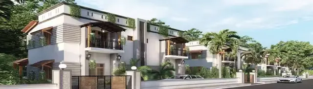
O.R.R. Midcity
INDO INFRA DEVELOPERS PRIVATE LIMITED · Rangareddy · RERA P02400002841
O.R.R. MIDCITY is a plotted development in Bandaravirala, Abdullapurmet Mandal, Ranga Reddy District, developed by Indo Infra Developers Private Limited. The registered land extent is 43,549.14 sq.m, with a net area of 42,864.50 sq.m; the supplied records do not establish a complete plot count or individual plot sizes, and no tower or floor configuration is stated. The offering is open plots. Its TG-RERA registration is P02400002841, issued 30/04/2021, and the promoter’s declared completion date is 06* March, 2024.
More from Indo Infra Developers Pvt Ltd · 3 projects →
01What we found
Read from TG-RERA filings, approvals, land and registration records and court records. A court case is counted only when the court record states this project's survey number with its village, or names the project.
02Check before you pay
12 items to check before you pay, 5 high - from the title chain, court records and approvals, each with what to ask the builder or your advocate. An item may not be a problem with the project: records can be incomplete.
1. Project at a glance
Project identity
| Item | Record |
|---|---|
| Registered project name | O.R.R. MIDCITY RERA record |
| Project type | Plotted development / open-plot layout RERA record |
| Phase / registered portion | The certificate identifies the registered project as a whole; no separate phase is stated. The registered survey description is 293/11/PART. |
| TG-RERA registration | P02400002841, issued 30/04/2021; certificate validity 30/04/2021–06/03/2024. No extension is recorded in the supplied certificate data. RERA record |
| Registered promoter | Indo Infra Developers Private Limited RERA record |
| RERA status | The certificate records registration under section 5 and the stated validity period. The supplied record does not establish a current extension or a current registration status beyond that period. |
Land and geographic identity
| Item | Record |
|---|---|
| Locality / revenue village | Bandaravirala; the HMDA draft-layout document also spells the village Bandaraviryal. RERA record |
| Mandal / district / PIN | Abdullapurmet, Ranga Reddy, 501505 RERA record |
| Project survey identification | Survey No. 293/11/PART in the project header and RERA certificate; the HMDA draft-layout letter describes the land as Survey No. 293/11 PART. RERA record |
| Site areas | Total site area 43,549.14 sq.m; master-plan-road-affected area 684.64 sq.m; net site area 42,864.5 sq.m in the HMDA draft-layout letter. |
| Registered land extent | 43,549.14 sq.m total; 42,864.50 sq.m net area, as entered in the RERA land details. RERA filing |
| Boundaries in RERA filing | East: OTHERS LAND; west: 45 FT PROPOSED ROAD; north: EXISTING 40 FT ROAD AND PROPOSED 100 FT ROAD; south: OTHERS LAND. RERA filing |
Development identity
| Item | Record |
|---|---|
| Sanctioning authority | Hyderabad Metropolitan Development Authority (HMDA) Approvals record |
| Principal layout approval | HMDA draft layout letter 000140/LO/Plg/HMDA/2021, approved 06 March, 2021. The project filing also gives 000140/LO/Plg/HMDA/2 as the plan approval number. Approvals record |
| Approved / filed area | RERA filing states approved built-up area 42,864.50 sq.m; HMDA letter describes 42,864.5 sq.m as net site area. These labels are reproduced as recorded; they are not interchangeable area measures. RERA filing |
| Buildings, floors and parking levels | Not applicable as a disclosed building configuration for this plotted-layout registration; no building count, floor configuration or parking levels are supplied. RERA record |
| Plot count | HMDA draft-layout document refers to plot numbers 112 to 133 in its mortgage condition; a complete total plot count is not established by the supplied records. |
| RERA-declared unit/plot count and sizes | Not available in the supplied structured project data. The drawing-derived layout extraction is incomplete for plot counts and plot sizes. Layout record |
Offering and status
| Item | Record |
|---|---|
| Offering | Open plots in a plotted layout; individual plot types, sizes, prices and inventory are not established by the supplied records. RERA record |
| Completion date | Promoter’s Form B declaration undertakes completion by 06* March, 2024; the RERA registration certificate also ends on 06/03/2024. These are separate records of the declared completion date and registration validity. |
| Construction / development stage | The supplied RERA amenity data reports percentage figures for selected infrastructure items, but does not establish an overall project-completion percentage or independently verified site progress. RERA amenities |
| Occupancy / completion certificate | No project completion certificate or occupancy certificate is identified in the supplied records. The registration certificate itself is not such a certificate. Document index |
2. The project story
O.R.R. MIDCITY is registered as a plotted development at Bandaravirala, Abdullapurmet Mandal, Ranga Reddy District, on the portion identified as Survey No. 293/11/PART. The HMDA filing describes a draft open-plot layout, rather than a multi-storey residential building project. RERA record
The HMDA layout document records a total site area of 43,549.14 sq.m, a road-affected area of 684.64 sq.m, and a net site area of 42,864.5 sq.m. Its area statement allocates land to plots, roads, park/open space and social infrastructure. HMDA’s document also sets out development and handover conditions before release of a final layout plan. The supplied material does not establish that those later steps have been completed.
The promoter declared a completion undertaking of 06* March, 2024. The supplied evidence does not provide a current, independently verified construction-status report or a project completion/occupancy certificate; percentage entries in the RERA amenity data should therefore be read as reported records, not independent verification of delivery. RERA amenities Document index
3. Master plan, architecture & building design
This is a plotted layout, so the available design evidence concerns land allocation and layout infrastructure rather than apartment plans or building elevations. The HMDA draft-layout document gives a net site area of 42,864.5 sq.m and identifies 22,769.29 sq.m as plotted area, 13,715.49 sq.m as layout-road area, 5,305.81 sq.m as park area and 1,073.83 sq.m as social-infrastructure area. It records 0 amenities area.
A software extraction of the approved layout drawing reports the same general land-use categories and percentages of the drawing’s net-area base: plots 22,769.29 sq.m (53.1%), roads 13,715.49 sq.m (32.0%), parks/open space 5,305.81 sq.m (12.4%), and social infrastructure 1,073.83 sq.m (2.5%). These are drawing-derived measurements and percentages, not a complete plot schedule; the extraction states that plot count and plot sizes are not complete. Layout record
The supplied material does not establish building footprints, floors, heights, apartment layouts, or a building-wise phase arrangement. The HMDA letter directs the applicant to hand over internal roads, open space, utility and social-infrastructure areas to the local body by registered gift deed before release of the final layout plan.
4. Homes, configurations & floor plans
The registered offering is plotted development, not apartments. The supplied data does not provide a complete RERA-filed plot inventory, plot-size schedule, booked/available counts or prices; no unit configuration table can therefore be completed from this record. RERA record Layout record
| Configuration | Units | Booked | Available | RERA saleable area | Measured carpet area | Loading (if supplied) |
|---|---|---|---|---|---|---|
| Plots | Not established | Not supplied | Not supplied | Plot areas not supplied | Not applicable | Not supplied |
The layout extraction reports a total plotted-area allocation of 22,769.29 sq.m, but it does not provide a complete count or size band for individual plots. The two drawing sheets listed in the floor-plan data contain no measured apartment plans; apartment carpet-area measurements are not applicable to this plotted offering. Layout record Floor plans
5. Parking & vehicle circulation
The available evidence does not establish a project-wide parking-space count, visitor or accessible parking provision, or an allocation of parking to individual plot purchasers. The HMDA letter identifies internal layout roads and includes a condition prohibiting construction on plots until final layout release; it does not specify parking arrangements.
The HMDA document states that Plot Nos. 112 to 133, to an extent of 3,485.28 sq.m, are mortgaged in favour of the Metropolitan Commissioner, HMDA, and says those plots/area are not to be sold or conveyed until HMDA’s necessary communication. This is a layout-document condition, not evidence of an individual buyer’s parking allocation.
6. Amenities, recreation & open spaces
The following infrastructure figures are reported in the supplied RERA amenity data. Percentages are presented as recorded and are not independent completion verification. RERA amenities
| Facility | Description / size | Evidence source | Declared progress / verified status |
|---|---|---|---|
| Internal roads & footpaths | Project infrastructure; no separate size stated | RERA amenity data | 100% recorded; independent verification not supplied |
| Water supply | No source, capacity or storage details supplied | RERA amenity data | 50% recorded |
| Sewerage (chamber, lines, septic tank, STP) | No capacity or treatment details supplied | RERA amenity data; HMDA draft-layout conditions list common septic tank / STP | 50% recorded in amenity data; delivery not independently verified |
| Green strip / tot lot / park | Layout park area 5,305.81 sq.m in HMDA area statement | RERA amenity data; | 50% recorded in amenity data; completion not independently verified |
| Street lighting | No quantity or specification supplied | RERA amenity data | 50% recorded |
| Water conservation / rainwater harvesting | HMDA conditions list rainwater-harvesting pits; no number or capacity supplied | RERA amenity data; | 50% recorded in amenity data |
| Electrical meter room / sub-station / receiving station | HMDA conditions list a transformer and transformer yard; no capacity supplied | RERA amenity data; | 50% recorded in amenity data |
| Social infrastructure | 1,073.83 sq.m in the HMDA area statement | Area is recorded; facility type and delivery status are not established | |
| Community buildings | No size or facility description supplied | RERA amenity data | 0% recorded |
| Storm-water drains | No size or design details supplied | RERA amenity data | 0% recorded |
| Sewage/sullage treatment and disposal | No further specification supplied | RERA amenity data | 0% recorded |
| Solid-waste management and disposal | HMDA conditions list a bio-compost unit; no capacity or completion evidence supplied | RERA amenity data; | 0% recorded in amenity data |
| Energy management | No details supplied | RERA amenity data | 0% recorded |
| Fire protection and fire-safety requirements | No details supplied | RERA amenity data | 0% recorded |
| Aggregate recreational open-space area | No separate figure in the RERA amenity entry; HMDA records park area 5,305.81 sq.m | RERA amenity data; | 0% recorded in the amenity entry; completion not independently verified |
The HMDA draft-layout letter also lists internal water-supply pipelines and an overhead tank. No storage capacity, water source or commissioning evidence is supplied.
7. Utilities, building services & safety
The HMDA draft-layout conditions list a common septic tank/STP, internal water-supply pipelines and an overhead tank, a transformer and transformer yard, rainwater-harvesting pits, and a bio-compost unit. The supplied records do not state capacities, detailed specifications, commissioning dates or independent verification of operation.
The RERA amenity data records water supply, sewerage infrastructure, rainwater harvesting and electrical meter-room/sub-station/receiving-station items at 50%; it records storm-water drains, sewage/sullage treatment and disposal, solid-waste management, energy management and fire protection/safety at 0%. These are reported status fields, not a determination of statutory compliance or proof of current site condition. RERA amenities
No project-specific evidence is supplied for backup power, EV charging, lift services, fire-access design, security systems, accessibility features or waste-segregation arrangements. As a plotted layout, building-level systems are not established by the supplied evidence. Document index RERA amenities
8. Location, access & connectivity
The registered location is Bandaravirala, Abdullapurmet Mandal, Ranga Reddy District, Telangana, PIN 501505. The supplied map record places the project at coordinates 17.3896517, 78.7191314. RERA record Location record
The RERA filing describes the north boundary as an existing 40 FT ROAD and proposed 100 FT ROAD, and the west boundary as a 45 FT PROPOSED ROAD. The HMDA draft-layout letter also refers to a 100 ft wide Master plan road and requires layout roads to be opened for accessibility to neighbouring sites. RERA filing
The nearest sampled Outer Ring Road interchange is listed at approximately 7.9 km. No public-transport routes, travel times or additional landmark distances are supplied. Location record
9. Developer & development status
The registered promoter is INDO INFRA DEVELOPERS PRIVATE LIMITED, a company. The RERA filing provides GSTIN 36AACCI8151M1Z8; the project evidence also identifies the company as incorporated under the Companies Act, 1956, with CIN U45400AP2011PTC078164. RERA record Corporate record
The project record names MADHAVA RAO MALLEM as a director and SIVA GANESH BABU MALLEM as an authorized signatory. In Form B, Mr. M Shiva Ganesh Babu declares on behalf of the company that the project would be completed by 06* March, 2024. This is the promoter’s declaration; the supplied material does not provide an independently verified current completion status. Parties record
The RERA certificate records registration through 06/03/2024 and no extension in the supplied certificate data. No completion or occupancy certificate is identified in the supplied documents.
10. Approvals, official records & documents
| What the supplied evidence establishes | Form C records O.R.R. MIDCITY, promoter Indo Infra Developers Private Limited, registration P02400002841, issued 30/04/2021, with validity to 06/03/2024. |
|---|
| What the supplied evidence establishes | Draft open-plot layout for Survey No. 293/11 PART, approval number 000140/LO/Plg/HMDA/2021, dated 06 March, 2021; it records land areas and conditions for development and final layout release. |
|---|
| What the supplied evidence establishes | Promoter affidavit dated 24thday of March'2021, including the promoter’s title-basis and completion declarations. |
|---|
| What the supplied evidence establishes | Report dated 20.03.2021, concerning open plots numbered 112 to 133 in Survey No. 293/11, with a stated extent of Ac 10.30 gts equivalent to 42,864.5 sq.m. |
|---|
| What the supplied evidence establishes | RDO proceeding dated 20.06.2020 concerning conversion of land in Sy.No.293/11 Part at Bandaravirala; the extracted document states that conversion permission does not itself confer title or ownership. |
|---|
| What the supplied evidence establishes | Project-filed statement searches Book 1 and related indexes for 01-01-1983 to 07-09-2020 and reports nine transactions; the document itself cautions that a fresh current EC is needed to confirm current records. |
|---|
| What the supplied evidence establishes | Drawing-derived layout data is available, but plot counts and individual plot sizes are not complete in the supplied extraction. |
|---|---|
| Source | Layout record |
| What the supplied evidence establishes | No project completion certificate or occupancy certificate is identified in the supplied materials. |
|---|---|
| Source | Document index |
1. Project at a glance
Project identity
Registered project name: O.R.R. MIDCITY
Project type: Plotted development / open-plot layout
Phase / registered portion: The certificate identifies the registered project as a whole; no separate phase is stated. The registered survey description is 293/11/PART.
TG-RERA registration: P02400002841, issued 30/04/2021; certificate validity 30/04/2021–06/03/2024. No extension is recorded in the supplied certificate data.
Registered promoter: Indo Infra Developers Private Limited
RERA status: The certificate records registration under section 5 and the stated validity period. The supplied record does not establish a current extension or a current registration status beyond that period.
Land and geographic identity
Locality / revenue village: Bandaravirala; the HMDA draft-layout document also spells the village Bandaraviryal.
Mandal / district / PIN: Abdullapurmet, Ranga Reddy, 501505
Project survey identification: Survey No. 293/11/PART in the project header and RERA certificate; the HMDA draft-layout letter describes the land as Survey No. 293/11 PART.
Site areas: Total site area 43,549.14 sq.m; master-plan-road-affected area 684.64 sq.m; net site area 42,864.5 sq.m in the HMDA draft-layout letter.
Registered land extent: 43,549.14 sq.m total; 42,864.50 sq.m net area, as entered in the RERA land details.
Boundaries in RERA filing: East: OTHERS LAND; west: 45 FT PROPOSED ROAD; north: EXISTING 40 FT ROAD AND PROPOSED 100 FT ROAD; south: OTHERS LAND.
Development identity
Sanctioning authority: Hyderabad Metropolitan Development Authority (HMDA)
Principal layout approval: HMDA draft layout letter 000140/LO/Plg/HMDA/2021, approved 06 March, 2021. The project filing also gives 000140/LO/Plg/HMDA/2 as the plan approval number.
Approved / filed area: RERA filing states approved built-up area 42,864.50 sq.m; HMDA letter describes 42,864.5 sq.m as net site area. These labels are reproduced as recorded; they are not interchangeable area measures.
Buildings, floors and parking levels: Not applicable as a disclosed building configuration for this plotted-layout registration; no building count, floor configuration or parking levels are supplied.
Plot count: HMDA draft-layout document refers to plot numbers 112 to 133 in its mortgage condition; a complete total plot count is not established by the supplied records.
RERA-declared unit/plot count and sizes: Not available in the supplied structured project data. The drawing-derived layout extraction is incomplete for plot counts and plot sizes.
Offering and status
Offering: Open plots in a plotted layout; individual plot types, sizes, prices and inventory are not established by the supplied records.
Completion date: Promoter’s Form B declaration undertakes completion by 06* March, 2024; the RERA registration certificate also ends on 06/03/2024. These are separate records of the declared completion date and registration validity.
Construction / development stage: The supplied RERA amenity data reports percentage figures for selected infrastructure items, but does not establish an overall project-completion percentage or independently verified site progress.
Occupancy / completion certificate: No project completion certificate or occupancy certificate is identified in the supplied records. The registration certificate itself is not such a certificate.
2. The project story
O.R.R. MIDCITY is registered as a plotted development at Bandaravirala, Abdullapurmet Mandal, Ranga Reddy District, on the portion identified as Survey No. 293/11/PART. The HMDA filing describes a draft open-plot layout, rather than a multi-storey residential building project.
The HMDA layout document records a total site area of 43,549.14 sq.m, a road-affected area of 684.64 sq.m, and a net site area of 42,864.5 sq.m. Its area statement allocates land to plots, roads, park/open space and social infrastructure. HMDA’s document also sets out development and handover conditions before release of a final layout plan. The supplied material does not establish that those later steps have been completed.
The promoter declared a completion undertaking of 06* March, 2024. The supplied evidence does not provide a current, independently verified construction-status report or a project completion/occupancy certificate; percentage entries in the RERA amenity data should therefore be read as reported records, not independent verification of delivery.
3. Master plan, architecture & building design
This is a plotted layout, so the available design evidence concerns land allocation and layout infrastructure rather than apartment plans or building elevations. The HMDA draft-layout document gives a net site area of 42,864.5 sq.m and identifies 22,769.29 sq.m as plotted area, 13,715.49 sq.m as layout-road area, 5,305.81 sq.m as park area and 1,073.83 sq.m as social-infrastructure area. It records 0 amenities area.
A software extraction of the approved layout drawing reports the same general land-use categories and percentages of the drawing’s net-area base: plots 22,769.29 sq.m (53.1%), roads 13,715.49 sq.m (32.0%), parks/open space 5,305.81 sq.m (12.4%), and social infrastructure 1,073.83 sq.m (2.5%). These are drawing-derived measurements and percentages, not a complete plot schedule; the extraction states that plot count and plot sizes are not complete.
The supplied material does not establish building footprints, floors, heights, apartment layouts, or a building-wise phase arrangement. The HMDA letter directs the applicant to hand over internal roads, open space, utility and social-infrastructure areas to the local body by registered gift deed before release of the final layout plan.
4. Homes, configurations & floor plans
The registered offering is plotted development, not apartments. The supplied data does not provide a complete RERA-filed plot inventory, plot-size schedule, booked/available counts or prices; no unit configuration table can therefore be completed from this record.
| Configuration | Units | Booked | Available | RERA saleable area | Measured carpet area | Loading (if supplied) |
|---|---|---|---|---|---|---|
| Plots | Not established | Not supplied | Not supplied | Plot areas not supplied | Not applicable | Not supplied |
The layout extraction reports a total plotted-area allocation of 22,769.29 sq.m, but it does not provide a complete count or size band for individual plots. The two drawing sheets listed in the floor-plan data contain no measured apartment plans; apartment carpet-area measurements are not applicable to this plotted offering.
5. Parking & vehicle circulation
The available evidence does not establish a project-wide parking-space count, visitor or accessible parking provision, or an allocation of parking to individual plot purchasers. The HMDA letter identifies internal layout roads and includes a condition prohibiting construction on plots until final layout release; it does not specify parking arrangements.
The HMDA document states that Plot Nos. 112 to 133, to an extent of 3,485.28 sq.m, are mortgaged in favour of the Metropolitan Commissioner, HMDA, and says those plots/area are not to be sold or conveyed until HMDA’s necessary communication. This is a layout-document condition, not evidence of an individual buyer’s parking allocation.
6. Amenities, recreation & open spaces
The following infrastructure figures are reported in the supplied RERA amenity data. Percentages are presented as recorded and are not independent completion verification.
| Facility | Description / size | Evidence source | Declared progress / verified status |
|---|---|---|---|
| Internal roads & footpaths | Project infrastructure; no separate size stated | RERA amenity data | 100% recorded; independent verification not supplied |
| Water supply | No source, capacity or storage details supplied | RERA amenity data | 50% recorded |
| Sewerage (chamber, lines, septic tank, STP) | No capacity or treatment details supplied | RERA amenity data; HMDA draft-layout conditions list common septic tank / STP | 50% recorded in amenity data; delivery not independently verified |
| Green strip / tot lot / park | Layout park area 5,305.81 sq.m in HMDA area statement | RERA amenity data; | 50% recorded in amenity data; completion not independently verified |
| Street lighting | No quantity or specification supplied | RERA amenity data | 50% recorded |
| Water conservation / rainwater harvesting | HMDA conditions list rainwater-harvesting pits; no number or capacity supplied | RERA amenity data; | 50% recorded in amenity data |
| Electrical meter room / sub-station / receiving station | HMDA conditions list a transformer and transformer yard; no capacity supplied | RERA amenity data; | 50% recorded in amenity data |
| Social infrastructure | 1,073.83 sq.m in the HMDA area statement | Area is recorded; facility type and delivery status are not established | |
| Community buildings | No size or facility description supplied | RERA amenity data | 0% recorded |
| Storm-water drains | No size or design details supplied | RERA amenity data | 0% recorded |
| Sewage/sullage treatment and disposal | No further specification supplied | RERA amenity data | 0% recorded |
| Solid-waste management and disposal | HMDA conditions list a bio-compost unit; no capacity or completion evidence supplied | RERA amenity data; | 0% recorded in amenity data |
| Energy management | No details supplied | RERA amenity data | 0% recorded |
| Fire protection and fire-safety requirements | No details supplied | RERA amenity data | 0% recorded |
| Aggregate recreational open-space area | No separate figure in the RERA amenity entry; HMDA records park area 5,305.81 sq.m | RERA amenity data; | 0% recorded in the amenity entry; completion not independently verified |
The HMDA draft-layout letter also lists internal water-supply pipelines and an overhead tank. No storage capacity, water source or commissioning evidence is supplied.
7. Utilities, building services & safety
The HMDA draft-layout conditions list a common septic tank/STP, internal water-supply pipelines and an overhead tank, a transformer and transformer yard, rainwater-harvesting pits, and a bio-compost unit. The supplied records do not state capacities, detailed specifications, commissioning dates or independent verification of operation.
The RERA amenity data records water supply, sewerage infrastructure, rainwater harvesting and electrical meter-room/sub-station/receiving-station items at 50%; it records storm-water drains, sewage/sullage treatment and disposal, solid-waste management, energy management and fire protection/safety at 0%. These are reported status fields, not a determination of statutory compliance or proof of current site condition.
No project-specific evidence is supplied for backup power, EV charging, lift services, fire-access design, security systems, accessibility features or waste-segregation arrangements. As a plotted layout, building-level systems are not established by the supplied evidence.
8. Location, access & connectivity
The registered location is Bandaravirala, Abdullapurmet Mandal, Ranga Reddy District, Telangana, PIN 501505. The supplied map record places the project at coordinates 17.3896517, 78.7191314.
The RERA filing describes the north boundary as an existing 40 FT ROAD and proposed 100 FT ROAD, and the west boundary as a 45 FT PROPOSED ROAD. The HMDA draft-layout letter also refers to a 100 ft wide Master plan road and requires layout roads to be opened for accessibility to neighbouring sites.
The nearest sampled Outer Ring Road interchange is listed at approximately 7.9 km. No public-transport routes, travel times or additional landmark distances are supplied.
9. Developer & development status
The registered promoter is INDO INFRA DEVELOPERS PRIVATE LIMITED, a company. The RERA filing provides GSTIN 36AACCI8151M1Z8; the project evidence also identifies the company as incorporated under the Companies Act, 1956, with CIN U45400AP2011PTC078164.
The project record names MADHAVA RAO MALLEM as a director and SIVA GANESH BABU MALLEM as an authorized signatory. In Form B, Mr. M Shiva Ganesh Babu declares on behalf of the company that the project would be completed by 06* March, 2024. This is the promoter’s declaration; the supplied material does not provide an independently verified current completion status.
The RERA certificate records registration through 06/03/2024 and no extension in the supplied certificate data. No completion or occupancy certificate is identified in the supplied documents.
10. Approvals, official records & documents
| What the supplied evidence establishes | Form C records O.R.R. MIDCITY, promoter Indo Infra Developers Private Limited, registration P02400002841, issued 30/04/2021, with validity to 06/03/2024. |
|---|
| What the supplied evidence establishes | Draft open-plot layout for Survey No. 293/11 PART, approval number 000140/LO/Plg/HMDA/2021, dated 06 March, 2021; it records land areas and conditions for development and final layout release. |
|---|
| What the supplied evidence establishes | Promoter affidavit dated 24thday of March'2021, including the promoter’s title-basis and completion declarations. |
|---|
| What the supplied evidence establishes | Report dated 20.03.2021, concerning open plots numbered 112 to 133 in Survey No. 293/11, with a stated extent of Ac 10.30 gts equivalent to 42,864.5 sq.m. |
|---|
| What the supplied evidence establishes | RDO proceeding dated 20.06.2020 concerning conversion of land in Sy.No.293/11 Part at Bandaravirala; the extracted document states that conversion permission does not itself confer title or ownership. |
|---|
| What the supplied evidence establishes | Project-filed statement searches Book 1 and related indexes for 01-01-1983 to 07-09-2020 and reports nine transactions; the document itself cautions that a fresh current EC is needed to confirm current records. |
|---|
| What the supplied evidence establishes | Drawing-derived layout data is available, but plot counts and individual plot sizes are not complete in the supplied extraction. |
|---|
| What the supplied evidence establishes | No project completion certificate or occupancy certificate is identified in the supplied materials. |
|---|
Frequently asked questions
Is O.R.R. MIDCITY registered with Telangana RERA?
Yes. O.R.R. MIDCITY is registered with the Telangana Real Estate Regulatory Authority as P02400002841; the registration status is New Project.
Who is the developer of O.R.R. MIDCITY?
The promoter named in the RERA registration is INDO INFRA DEVELOPERS PRIVATE LIMITED.
Where is O.R.R. MIDCITY located?
O.R.R. MIDCITY is in BANDARAVIRALA, Abdullapurmet, Rangareddy, Telangana (501505).
When will O.R.R. MIDCITY be completed?
The promoter's proposed date of completion filed with RERA is 06/03/2024. This is the promoter's declaration, not a guarantee.
More projects in Bandaravirala