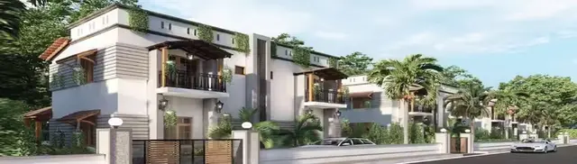
Landmark Elite - 1
N.S.REALTORS · Rangareddy · RERA P02400009324
LANDMARK ELITE - 1 is a plotted development in Bandaravirala, Abdullapurmet, Ranga Reddy. The registered promoter is N.S.REALTORS. The project covers 49,976.57 Sq.Mt and the layout drawing shows 196 residential plots, ranging from 132.94 sqm to 413.88 sqm; no towers or floors are specified. It is registered with TG-RERA under P02400009324, and the promoter’s Form B declares completion by 26/05/2026.
01What we found
Read from TG-RERA filings, approvals, land and registration records and court records. A court case is counted only when the court record states this project's survey number with its village, or names the project.
02Check before you pay
10 items to check before you pay, 3 high - from the title chain, court records and approvals, each with what to ask the builder or your advocate. An item may not be a problem with the project: records can be incomplete.
1. Project at a glance
Project identity
| Item | Record |
|---|---|
| Registered project name | LANDMARK ELITE - 1 RERA record |
| Project type / status | Plotted development; listed as a new project RERA record RERA filing |
| Phase / registered portion | No separate phase or phase-wise scope is identified in the supplied record. The registered project is a plotted layout. RERA record |
| TG-RERA registration | P02400009324; registered from 30 November 2024. The Form C certificate states validity through 26/05/2026, unless extended by the Authority. RERA record |
| Registered promoter | N.S.REALTORS (also styled N.S.Realtors / M/S N. S. REALTORS in filed records); entity type: partnership. RERA record Corporate record |
| RERA status | The supplied record identifies the project as registered. Current status beyond the certificate’s stated validity is not established by the supplied evidence. Approvals record |
Land and geographic identity
| Item | Record |
|---|---|
| Locality / revenue village | Bandaravirala; the HMDA drawing and draft letter also use the spelling Bandaraviryal. RERA record RERA filing |
| Mandal / district / PIN | Abdullapurmet / Ranga Reddy / 501505 RERA record RERA filing |
| Project survey number | 35P; no further subdivision is specified for the project parcel in the supplied project identity. RERA record Land records |
| Registered site extent | 49,976.57 Sq.Mt in the HMDA layout record; RERA land details state 49976.57 sqmts total and net area. RERA filing |
| Boundaries | North, south, east and west: “Neighbours Land.” RERA filing |
| Site-area breakdown shown on layout drawing | Plotted area 32203.72 sq.m; roads 12270.04 sq.m; organized open space/park 4251.13 sq.m; social infrastructure 1251.68 sq.m. These are drawing-derived figures. Layout record |
Development identity
| Item | Record |
|---|---|
| Sanctioning authority | Hyderabad Metropolitan Development Authority (HMDA) Approvals record |
| Principal layout approval | Draft layout approval 000065/LO/Plg/HMDA/2024, dated 30 November, 2024; application/file reference 055163/GHT/LT/U6/HMDA/13062022. Approvals record |
| Approved use and layout type | Residential open layout; the drawing specifies “Residential Bldg” plot sub-use and “Peri-Urban use zone.” |
| Approved built-up area / buildings / floors | Not disclosed in the supplied records; this is a plotted layout, and no building or floor schedule is supplied. RERA filing Document index |
| Authority-mortgaged area | 4856.52 Sq.mts, comprising plots 76-85, 104-107, 126-129, 148-151, 170-172, 191, 192, mortgaged to the Metropolitan Commissioner, HMDA. |
Offering and status
| Item | Record |
|---|---|
| Offered product | Residential plots. The approved layout drawing records 196 plots, with plot numbers and areas read from the drawing by software; verify against the drawing. Layout record |
| Plot-size range | Software-measured from the drawing: 132.94–413.88 sqm (159–495 sq yd). Layout record |
| Booked / available counts | Not established in the supplied project data. RERA record Document index |
| Construction stage | No independently verified site-progress evidence is supplied. HMDA’s filed document is described as draft layout approval, with development works and final layout release still required. |
| Completion timeline | The RERA certificate states registration validity through 26/05/2026; Form B declares completion by 26/05/2026. These are registration-validity and promoter-declared completion dates, respectively, not evidence of completion. |
| Occupancy / completion certificate | No occupancy or completion certificate is supplied. The record concerns a plotted layout. Document index |
2. The project story
LANDMARK ELITE - 1 is registered with TG-RERA as a plotted development in Survey No. 35P at Bandaravirala, Abdullapurmet Mandal, Ranga Reddy District. The project record identifies a residential open layout over 49,976.57 Sq.Mt. Its layout drawing shows plots arranged along internal roads, with areas separately marked for roads, open space/park and social infrastructure. RERA record Land records
The drawing-derived plot inventory contains 196 plots, with sizes ranging from 132.94 sqm to 413.88 sqm. Plot numbers and areas were read from drawing text by software; they are not a RERA-filed unit schedule. Layout record The supplied filing does not establish sales, booking availability or plot-wise allotments.
The HMDA document is identified as draft layout approval. It directs completion of development works and transfer of specified roads and open-space/social-infrastructure areas before final layout release; the record does not establish that those works are complete. The promoter’s Form B declares a completion date of 26/05/2026, but no independent site-progress verification or completion certificate is supplied.
3. Master plan, architecture & building design
This is a plotted residential layout, not a building or apartment scheme in the supplied approvals. The approved layout drawing covers 49,976.57 Sq.Mt and identifies 196 plots by printed plot number and area; the count and plot measurements are software-read from the drawing and should be checked against the original plan. Layout record
| Layout component | Area shown | Source / status |
|---|---|---|
| Plotted area | 32203.72 sq.m | Drawing-derived layout figure |
| Road area | 12270.04 sq.m | Drawing-derived layout figure |
| Organized open space / park area | 4251.13 sq.m | Drawing-derived layout figure |
| Social infrastructure area | 1251.68 sq.m | Drawing-derived layout figure |
| Utility area | 501.73 Sq.Mtrs | Labelled on the drawing |
The plan shows internal roads of varying widths, including a 30.00 abutting-road dimension and other printed road widths. The approval record also refers to roads of 18 mts and 60 feet. These are plan/approval references; the supplied evidence does not establish as-built road dimensions.
No building footprints, building heights, floors, parking levels, apartment arrangements or building-wise phase information are supplied. No FSI-counted area, gross built-up area, saleable area or carpet area is disclosed for this plotted project. Document index RERA filing
4. Homes, configurations & floor plans
The registered offering is plots, not apartments. The supplied RERA records do not provide a plot-wise RERA saleable-area schedule, booked/available counts or plot-specific agreement data. RERA record
| Supplied figure | 196 |
|---|---|
| Measurement basis | Software-read from plot numbers and areas printed on the layout drawing Layout record |
| Supplied figure | 132.94 / 139.63 / 413.88 sqm |
|---|---|
| Measurement basis | Software-measured from drawing; corresponding figures 159 / 167 / 495 sq yd Layout record |
| Supplied figure | 167 sq yd: 118 plots; 183 sq yd: 28; 222 sq yd: 9; 161 sq yd: 4; 244 sq yd: 2 |
|---|---|
| Measurement basis | Software-read from drawing text Layout record |
The two supplied drawings are layout sheets with no apartment floor plans; no carpet-area or room-dimension measurements are available. A plot’s land area is not a building carpet area or saleable apartment area. Floor plans Layout record
5. Parking & vehicle circulation
The supplied plan and project records do not establish a sanctioned count of car, two-wheeler, visitor or accessible parking spaces, nor do they document plot-wise parking allocation. The layout drawing identifies internal roads and plots but does not establish exclusive parking rights for any allottee. Document index
The HMDA draft approval identifies 4856.52 Sq.mts of authority-mortgaged plots; these are not identified as parking areas.
6. Amenities, recreation & open spaces
| Description / size | 4251.13 sq.m on the layout drawing; the draft letter separately states 4251.13 Sq. mtrs (8.51%) |
|---|---|
| Evidence source | HMDA-filed layout / draft letter |
| Declared progress / verified status | Shown in the approved layout record; completion is not independently verified. The draft letter requires park/open-space development and transfer before final layout release. |
| Description / size | 1251.68 sq.m on the layout drawing; draft letter states 1251.13 Sq.mtrs (2.50%) |
|---|---|
| Evidence source | HMDA-filed layout / draft letter |
| Declared progress / verified status | Area is designated in the records; no completed facility or specific community building is established. |
| Description / size | 3749.40 Sq.Mtrs |
|---|---|
| Evidence source | Layout-plan extraction |
| Declared progress / verified status | Labelled on the plan; delivered status not verified. |
| Description / size | 501.73 Sq.Mtrs |
|---|---|
| Evidence source | Layout-plan extraction |
| Declared progress / verified status | Designated on the plan; specific completed utility facility not verified. |
| Description / size | No separate area beyond the layout’s open-space designation is supplied |
|---|---|
| Evidence source | HMDA draft approval |
| Declared progress / verified status | Listed among required development works; completion not verified. |
| Description / size | No building or facility description supplied |
|---|---|
| Evidence source | RERA amenity record RERA amenities |
| Declared progress / verified status | RERA amenity field records 0%; no completed facility verified. |
7. Utilities, building services & safety
The HMDA draft approval lists infrastructure and development works for the layout, including storm-water drains, underground drainage lines, a common septic tank / STP, internal water-supply pipelines, an overhead tank, electrical supply lines, street lights, a transformer, rainwater-harvesting pits and a bio-compost unit. These are approval-recorded requirements or proposed works; the supplied evidence does not independently verify installation, operating status or capacity.
The layout-plan extraction also labels a transformer, dust bin and septic tank. The RERA amenity record marks water supply, sewerage, storm-water drains, street lighting and rainwater harvesting as “YES” at 15%; this is a filed progress/amenity entry, not independent verification of completed services. RERA amenities
No capacities or detailed specifications are supplied for water storage, sewage treatment, electricity supply or backup, waste processing, security, accessibility, fire protection or emergency access. The RERA amenity record lists fire protection and safety requirements at 0%; no compliance determination can be made from the supplied record. RERA amenities
8. Location, access & connectivity
The registered location is Bandaravirala, Abdullapurmet Mandal, Ranga Reddy District, Telangana, PIN 501505. The supplied geocode is 17.3896517, 78.7191314. RERA record Location record
The layout plan marks internal roads, with multiple printed widths; the HMDA draft letter states that roads are to be opened for access to neighbouring sites. The supplied record does not identify a verified public-transport connection or named nearby services.
The location data lists the nearest sampled Outer Ring Road interchange at approximately 7.9 km. Location record
9. Developer & development status
The registered promoter is N.S.REALTORS, a partnership. The supplied project records identify Prem Kumar Sanghi as authorized signatory and Sushma Sanghi and Nakul Sanghi as partners. Corporate record Parties record
The RERA registration certificate gives the promoter address as Village: Mandal: Himayatha Nagar, District: Hyderabad, Pin: 500029. The project filing lists Landmark # 2, Street No # 2, Bandaravirala, Abdullapurmet, Ranga Reddy, 501505 under address details. No official contact number, email or website is supplied. RERA filing
The promoter’s Form B declares that the project will be completed by 26/05/2026. This is a promoter undertaking, not a report of completed works. The supplied record contains no independently verified construction-progress assessment, plot-wise booking status or final layout release evidence.
10. Approvals, official records & documents
| Reference / date | P02400009324; certificate states validity from 30/11/2024 through 26/05/2026, unless extended |
|---|---|
| What the supplied record establishes | Project registration and stated conditions; not a sale agreement or title-conveyance instrument. |
| Reference / date | Approval 000065/LO/Plg/HMDA/2024; approved 30 November, 2024; application 055163/GHT/LT/U6/HMDA/13062022 |
|---|---|
| What the supplied record establishes | Draft layout approval for the residential open layout in Survey No. 35P. The letter records development conditions and requires further works and final layout release. |
| Reference / date | Permit 000065/LO/Plg/HMDA/2024; file 055163/GHT/LT/U6/HMDA/13062022; dated 30-11-2024 |
|---|---|
| What the supplied record establishes | Drawing of the proposed draft layout, including plots, roads, open space, social infrastructure, utility area and authority-mortgaged plots. |
| Reference / date | 7044/2024, dated 22/11/2024 |
|---|---|
| What the supplied record establishes | Approval records mortgage of specified plots measuring 4856.52 Sq.mts in favour of the Metropolitan Commissioner, HMDA. |
| Reference / date | 12 DECEMBER 2024 |
|---|---|
| What the supplied record establishes | Promoter declaration, including stated completion undertaking of 26/05/2026. |
No occupancy or completion certificate, final layout release, approved building-plan schedule or independently verified site-completion evidence is included in the supplied documents. The HMDA DPMS approved-layout lookup is recorded as unavailable through the public channel; that access limitation does not establish whether a separate portal record exists. Document index HMDA
1. Project at a glance
Project identity
Registered project name: LANDMARK ELITE - 1
Project type / status: Plotted development; listed as a new project
Phase / registered portion: No separate phase or phase-wise scope is identified in the supplied record. The registered project is a plotted layout.
TG-RERA registration: P02400009324; registered from 30 November 2024. The Form C certificate states validity through 26/05/2026, unless extended by the Authority.
Registered promoter: N.S.REALTORS (also styled N.S.Realtors / M/S N. S. REALTORS in filed records); entity type: partnership.
RERA status: The supplied record identifies the project as registered. Current status beyond the certificate’s stated validity is not established by the supplied evidence.
Land and geographic identity
Locality / revenue village: Bandaravirala; the HMDA drawing and draft letter also use the spelling Bandaraviryal.
Mandal / district / PIN: Abdullapurmet / Ranga Reddy / 501505
Project survey number: 35P; no further subdivision is specified for the project parcel in the supplied project identity.
Registered site extent: 49,976.57 Sq.Mt in the HMDA layout record; RERA land details state 49976.57 sqmts total and net area.
Boundaries: North, south, east and west: “Neighbours Land.”
Site-area breakdown shown on layout drawing: Plotted area 32203.72 sq.m; roads 12270.04 sq.m; organized open space/park 4251.13 sq.m; social infrastructure 1251.68 sq.m. These are drawing-derived figures.
Development identity
Sanctioning authority: Hyderabad Metropolitan Development Authority (HMDA)
Principal layout approval: Draft layout approval 000065/LO/Plg/HMDA/2024, dated 30 November, 2024; application/file reference 055163/GHT/LT/U6/HMDA/13062022.
Approved use and layout type: Residential open layout; the drawing specifies “Residential Bldg” plot sub-use and “Peri-Urban use zone.”
Approved built-up area / buildings / floors: Not disclosed in the supplied records; this is a plotted layout, and no building or floor schedule is supplied.
Authority-mortgaged area: 4856.52 Sq.mts, comprising plots 76-85, 104-107, 126-129, 148-151, 170-172, 191, 192, mortgaged to the Metropolitan Commissioner, HMDA.
Offering and status
Offered product: Residential plots. The approved layout drawing records 196 plots, with plot numbers and areas read from the drawing by software; verify against the drawing.
Plot-size range: Software-measured from the drawing: 132.94–413.88 sqm (159–495 sq yd).
Booked / available counts: Not established in the supplied project data.
Construction stage: No independently verified site-progress evidence is supplied. HMDA’s filed document is described as draft layout approval, with development works and final layout release still required.
Completion timeline: The RERA certificate states registration validity through 26/05/2026; Form B declares completion by 26/05/2026. These are registration-validity and promoter-declared completion dates, respectively, not evidence of completion.
Occupancy / completion certificate: No occupancy or completion certificate is supplied. The record concerns a plotted layout.
2. The project story
LANDMARK ELITE - 1 is registered with TG-RERA as a plotted development in Survey No. 35P at Bandaravirala, Abdullapurmet Mandal, Ranga Reddy District. The project record identifies a residential open layout over 49,976.57 Sq.Mt. Its layout drawing shows plots arranged along internal roads, with areas separately marked for roads, open space/park and social infrastructure.
The drawing-derived plot inventory contains 196 plots, with sizes ranging from 132.94 sqm to 413.88 sqm. Plot numbers and areas were read from drawing text by software; they are not a RERA-filed unit schedule. The supplied filing does not establish sales, booking availability or plot-wise allotments.
The HMDA document is identified as draft layout approval. It directs completion of development works and transfer of specified roads and open-space/social-infrastructure areas before final layout release; the record does not establish that those works are complete. The promoter’s Form B declares a completion date of 26/05/2026, but no independent site-progress verification or completion certificate is supplied.
3. Master plan, architecture & building design
This is a plotted residential layout, not a building or apartment scheme in the supplied approvals. The approved layout drawing covers 49,976.57 Sq.Mt and identifies 196 plots by printed plot number and area; the count and plot measurements are software-read from the drawing and should be checked against the original plan.
| Layout component | Area shown | Source / status |
|---|---|---|
| Plotted area | 32203.72 sq.m | Drawing-derived layout figure |
| Road area | 12270.04 sq.m | Drawing-derived layout figure |
| Organized open space / park area | 4251.13 sq.m | Drawing-derived layout figure |
| Social infrastructure area | 1251.68 sq.m | Drawing-derived layout figure |
| Utility area | 501.73 Sq.Mtrs | Labelled on the drawing |
The plan shows internal roads of varying widths, including a 30.00 abutting-road dimension and other printed road widths. The approval record also refers to roads of 18 mts and 60 feet. These are plan/approval references; the supplied evidence does not establish as-built road dimensions.
No building footprints, building heights, floors, parking levels, apartment arrangements or building-wise phase information are supplied. No FSI-counted area, gross built-up area, saleable area or carpet area is disclosed for this plotted project.
4. Homes, configurations & floor plans
The registered offering is plots, not apartments. The supplied RERA records do not provide a plot-wise RERA saleable-area schedule, booked/available counts or plot-specific agreement data.
| Plot information | Supplied figure | Measurement basis |
|---|---|---|
| Number of plots | 196 | Software-read from plot numbers and areas printed on the layout drawing |
| Smallest / median / largest plot | 132.94 / 139.63 / 413.88 sqm | Software-measured from drawing; corresponding figures 159 / 167 / 495 sq yd |
| Most common sizes shown | 167 sq yd: 118 plots; 183 sq yd: 28; 222 sq yd: 9; 161 sq yd: 4; 244 sq yd: 2 | Software-read from drawing text |
The two supplied drawings are layout sheets with no apartment floor plans; no carpet-area or room-dimension measurements are available. A plot’s land area is not a building carpet area or saleable apartment area.
5. Parking & vehicle circulation
The supplied plan and project records do not establish a sanctioned count of car, two-wheeler, visitor or accessible parking spaces, nor do they document plot-wise parking allocation. The layout drawing identifies internal roads and plots but does not establish exclusive parking rights for any allottee.
The HMDA draft approval identifies 4856.52 Sq.mts of authority-mortgaged plots; these are not identified as parking areas.
6. Amenities, recreation & open spaces
| Description / size | 4251.13 sq.m on the layout drawing; the draft letter separately states 4251.13 Sq. mtrs (8.51%) |
|---|---|
| Evidence source | HMDA-filed layout / draft letter |
| Declared progress / verified status | Shown in the approved layout record; completion is not independently verified. The draft letter requires park/open-space development and transfer before final layout release. |
| Description / size | 1251.68 sq.m on the layout drawing; draft letter states 1251.13 Sq.mtrs (2.50%) |
|---|---|
| Evidence source | HMDA-filed layout / draft letter |
| Declared progress / verified status | Area is designated in the records; no completed facility or specific community building is established. |
| Description / size | 3749.40 Sq.Mtrs |
|---|---|
| Evidence source | Layout-plan extraction |
| Declared progress / verified status | Labelled on the plan; delivered status not verified. |
| Description / size | 501.73 Sq.Mtrs |
|---|---|
| Evidence source | Layout-plan extraction |
| Declared progress / verified status | Designated on the plan; specific completed utility facility not verified. |
| Description / size | No separate area beyond the layout’s open-space designation is supplied |
|---|---|
| Evidence source | HMDA draft approval |
| Declared progress / verified status | Listed among required development works; completion not verified. |
| Description / size | No building or facility description supplied |
|---|---|
| Evidence source | RERA amenity record |
| Declared progress / verified status | RERA amenity field records 0%; no completed facility verified. |
7. Utilities, building services & safety
The HMDA draft approval lists infrastructure and development works for the layout, including storm-water drains, underground drainage lines, a common septic tank / STP, internal water-supply pipelines, an overhead tank, electrical supply lines, street lights, a transformer, rainwater-harvesting pits and a bio-compost unit. These are approval-recorded requirements or proposed works; the supplied evidence does not independently verify installation, operating status or capacity.
The layout-plan extraction also labels a transformer, dust bin and septic tank. The RERA amenity record marks water supply, sewerage, storm-water drains, street lighting and rainwater harvesting as “YES” at 15%; this is a filed progress/amenity entry, not independent verification of completed services.
No capacities or detailed specifications are supplied for water storage, sewage treatment, electricity supply or backup, waste processing, security, accessibility, fire protection or emergency access. The RERA amenity record lists fire protection and safety requirements at 0%; no compliance determination can be made from the supplied record.
8. Location, access & connectivity
The registered location is Bandaravirala, Abdullapurmet Mandal, Ranga Reddy District, Telangana, PIN 501505. The supplied geocode is 17.3896517, 78.7191314.
The layout plan marks internal roads, with multiple printed widths; the HMDA draft letter states that roads are to be opened for access to neighbouring sites. The supplied record does not identify a verified public-transport connection or named nearby services.
The location data lists the nearest sampled Outer Ring Road interchange at approximately 7.9 km.
9. Developer & development status
The registered promoter is N.S.REALTORS, a partnership. The supplied project records identify Prem Kumar Sanghi as authorized signatory and Sushma Sanghi and Nakul Sanghi as partners.
The RERA registration certificate gives the promoter address as Village: Mandal: Himayatha Nagar, District: Hyderabad, Pin: 500029. The project filing lists Landmark # 2, Street No # 2, Bandaravirala, Abdullapurmet, Ranga Reddy, 501505 under address details. No official contact number, email or website is supplied.
The promoter’s Form B declares that the project will be completed by 26/05/2026. This is a promoter undertaking, not a report of completed works. The supplied record contains no independently verified construction-progress assessment, plot-wise booking status or final layout release evidence.
10. Approvals, official records & documents
| Reference / date | P02400009324; certificate states validity from 30/11/2024 through 26/05/2026, unless extended |
|---|---|
| What the supplied record establishes | Project registration and stated conditions; not a sale agreement or title-conveyance instrument. |
| Reference / date | Approval 000065/LO/Plg/HMDA/2024; approved 30 November, 2024; application 055163/GHT/LT/U6/HMDA/13062022 |
|---|---|
| What the supplied record establishes | Draft layout approval for the residential open layout in Survey No. 35P. The letter records development conditions and requires further works and final layout release. |
| Reference / date | Permit 000065/LO/Plg/HMDA/2024; file 055163/GHT/LT/U6/HMDA/13062022; dated 30-11-2024 |
|---|---|
| What the supplied record establishes | Drawing of the proposed draft layout, including plots, roads, open space, social infrastructure, utility area and authority-mortgaged plots. |
| Reference / date | 7044/2024, dated 22/11/2024 |
|---|---|
| What the supplied record establishes | Approval records mortgage of specified plots measuring 4856.52 Sq.mts in favour of the Metropolitan Commissioner, HMDA. |
| Reference / date | 12 DECEMBER 2024 |
|---|---|
| What the supplied record establishes | Promoter declaration, including stated completion undertaking of 26/05/2026. |
No occupancy or completion certificate, final layout release, approved building-plan schedule or independently verified site-completion evidence is included in the supplied documents. The HMDA DPMS approved-layout lookup is recorded as unavailable through the public channel; that access limitation does not establish whether a separate portal record exists.
Frequently asked questions
Is LANDMARK ELITE - 1 registered with Telangana RERA?
Yes. LANDMARK ELITE - 1 is registered with the Telangana Real Estate Regulatory Authority as P02400009324; the registration status is New Project.
Who is the developer of LANDMARK ELITE - 1?
The promoter named in the RERA registration is N.S.REALTORS.
Where is LANDMARK ELITE - 1 located?
LANDMARK ELITE - 1 is in Bandaravirala, Abdullapurmet, Rangareddy, Telangana (501505).
When will LANDMARK ELITE - 1 be completed?
The promoter's proposed date of completion filed with RERA is 30/11/2026. This is the promoter's declaration, not a guarantee.
More projects in Bandaravirala