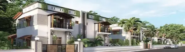
Landmark Elite - 2
N.S.REALTORS · Rangareddy · RERA P02400009960
LANDMARK ELITE - 2 is an open plotted layout in Bandaravirala, Abdullapurmet Mandal, Ranga Reddy District, developed by registered promoter N.S.REALTORS. The project covers 51,702.72 sq. m and comprises 173 plots, with plot sizes of 139.28–718.02 sq. m (166.6–858.7 sq. yd); no tower or floor configuration is stated. It is registered under TG-RERA number P02400009960, and the promoter’s Form B undertaking states completion by 05/07/2027.
01What we found
Read from TG-RERA filings, approvals, land and registration records and court records. A court case is counted only when the court record states this project's survey number with its village, or names the project.
02Check before you pay
7 items to check before you pay, 3 high - from the title chain, court records and approvals, each with what to ask the builder or your advocate. An item may not be a problem with the project: records can be incomplete.
Project at a glance
Project identity
| Item | Record |
|---|---|
| Registered project name | LANDMARK ELITE - 2 RERA record |
| Project type | Plotted development / open plotted layout RERA record RERA filing |
| Phase / registered portion | Not separately identified in the supplied record; the registration is for LANDMARK ELITE - 2 RERA record |
| TG-RERA registration | P02400009960 RERA record |
| Registration validity | 05/07/2025–05/07/2027; registration validity is distinct from the promoter’s completion undertaking |
| Registered promoter | N.S.REALTORS; entity type recorded as partnership RERA filing Corporate record |
| RERA status | Registered; certificate conditions include quarterly updates and the 70% separate-account requirement |
Land and geographic identity
| Item | Record |
|---|---|
| Locality / revenue village | Bandaravirala; the layout documents also use BANDARAVIRYAL and BANDARAVRALLA RERA record |
| Mandal / district / PIN | Abdullapurmet, Ranga Reddy, 501505 RERA record RERA filing |
| Project survey number(s) | Sy. No. 272P (also styled 272 P and Sy.Nos. 272 P in the filed layout records); no subdivision is stated in the project identity |
| Registered site extent | 51,702.72 sq. m |
| Net layout area | 50,413.67 sq. m in the layout drawing Layout record |
| RERA land-details areas | Total area 51,702.72 sq. m; affected area 18,424 sq. m; net area 33,278.72 sq. m RERA filing |
| Boundaries | East, west, north and south: NEIGHBOURS LAND RERA filing |
Development identity
| Item | Record |
|---|---|
| Sanctioning authority | Hyderabad Metropolitan Development Authority (HMDA) Approvals record |
| Principal layout approval | 013190/LO/HMDA/3560/GHT/2024, dated 05 July 2025 in the filed technical-approval record Approvals record |
| Approved built-up area | 0.00 proposed built-up area, both excluding and including parking, in the filed layout-plan figures; this is a plotted layout |
| Plots | 173 shown in the layout drawing Layout record |
| Buildings / floors | No building count or floor configuration is supplied for the registered plotted layout |
| Parking | No common parking area is shown in the layout-plan figures; the layout is not a residential building parking schedule |
Offering and status
| Item | Record |
|---|---|
| Unit type | Plots; layout drawing states 173 plots Layout record |
| Plot size range | Software-read from the approved layout drawing: 139.28–718.02 sq. m (166.6–858.7 sq. yd); drawing-derived figures should be checked against the drawing Layout record |
| Booked / available counts | Not disclosed in the supplied evidence RERA record Document index |
| Construction / development stage | No independently verified site-progress record supplied. The RERA filing’s amenity-progress entries report 10% for internal roads and footpaths, water supply, green strip/tot lot/park, street lighting and rainwater harvesting; several other listed items show 0% RERA amenities |
| Completion dates | Promoter’s Form B undertaking states 05/07/2027. The RERA certificate remains valid to 05/07/2027 |
| Occupancy / completion certificate | Not applicable as a conventional apartment-building status in the supplied plotted-layout evidence; no project occupancy or completion certificate is supplied Document index |
The project story
- LANDMARK ELITE - 2 is registered as an open plotted development in Sy. No. 272P, Bandaravirala, Abdullapurmet Mandal, Ranga Reddy District. Its TG-RERA certificate identifies the project and promoter; the filed HMDA layout drawing depicts 173 plots, internal roads, open space, social-infrastructure land and utility land.
- The project record gives a total site area of 51,702.72 sq. m. The layout drawing identifies 50,413.67 sq. m as net layout area and 12,177.03 sq. m as road area, alongside 3,865.90 sq. m of organized open space/park, 1,261.07 sq. m of social-infrastructure area and 512.06 sq. m of utility area. RERA filing Layout record
- The promoter’s Form B declares completion by 05/07/2027. The supplied evidence does not independently verify construction progress or completion on site; the RERA amenity-progress figures are filing disclosures, not an independent site inspection. RERA amenities
Master plan, architecture & building design
- This is a plotted layout, not a multi-storey residential building scheme. The HMDA layout drawing records 173 plots and a net layout area of 50,413.67 sq. m. Its stated land-use schedule is: 32,597.18 sq. m plotted area; 12,177.03 sq. m road area; 3,865.90 sq. m organized open space/park; 1,261.07 sq. m social infrastructure; and 512.06 sq. m utility area. It records 0.00 amenity area, 0.00 common parking area and 0.00 proposed built-up area, including and excluding parking. Layout record
- The drawing shows road widths including 9.14 mt., 12.19 mt., 12.00 MT WIDE EXISTING and 30.00 MT WIDE PROPOSED ROAD. A separate layout-plan sheet also lists 9.14 M WIDE ROAD, PROPOSED 100’0” ROAD and EXISTING 40'-0" WIDE ROAD.
- Plot sizes were software-read from the layout drawing, not stated here as RERA-filed saleable areas: 139.28 sq. m minimum, 167.3 sq. m median and 718.02 sq. m maximum. The drawing-derived plot-area bands are 68 plots at 150–200 sq. yd, 64 at 200–250 sq. yd, 16 at 250–300 sq. yd, 11 at 300–400 sq. yd, 13 at 400–500 sq. yd, and 1 at 500–1000 sq. yd. Layout record
Homes, configurations & floor plans
- The offering shown in the layout is 173 plots. The supplied evidence does not give booked or available plot counts, plot-wise saleable areas from the RERA unit schedule, or measured carpet areas. The floor-plan review records one layout sheet and no dwelling-unit floor-plan measurements; carpet-area measurements are therefore not available for this plotted project. Layout record Floor plans
- The drawing’s software-read plot-size range is 139.28–718.02 sq. m (166.6–858.7 sq. yd); this is not a carpet-area measurement. Layout record
| Configuration | Units | Booked | Available | RERA saleable area | Measured carpet area | Loading (if supplied) |
|---|---|---|---|---|---|---|
| Plots | 173 Layout record | Not disclosed | Not disclosed | Plot-wise RERA saleable area not supplied | Not applicable | Not supplied |
Parking & vehicle circulation
The HMDA layout drawing records 0.00 common parking area. No sanctioned parking-space count, visitor or accessible parking provision, vehicle ramp, parking-level arrangement, EV charging provision, or plot-specific parking allocation is supplied. A vendor listing mentions “Open Parking,” but this is a third-party listing, not an established sanctioned or plot-allocation record. Promoter website
Amenities, recreation & open spaces
The layout drawing allocates open space, social infrastructure and utilities. The separate RERA amenity schedule reports the progress figures below; these are filed progress entries, not independent verification of completion. The supplied evidence does not provide facility descriptions, dimensions or capacities beyond the layout-area figures. Layout record RERA amenities
| Facility | Description / size | Evidence source | Declared progress / verified status |
|---|---|---|---|
| Organized open space / park | 3,865.90 sq. m | Layout drawing | Green strip/TOT LOT/Park reported at 10% in RERA amenity schedule; not independently verified RERA amenities |
| Social infrastructure | 1,261.07 sq. m | Layout drawing | No separate progress figure supplied |
| Utility area | 512.06 sq. m | Layout drawing | No separate progress figure supplied |
| Internal roads and footpaths | Road area 12,177.03 sq. m | Layout drawing | Reported at 10% in RERA amenity schedule; not independently verified RERA amenities |
| Community buildings | No area or facility specified | RERA amenity schedule RERA amenities | 0% reported |
| Open parking | No layout area or count supplied | Third-party vendor listing Promoter website | Listing only; sanctioned provision or completion not established |
Utilities, building services & safety
The HMDA draft-layout letter lists a common septic tank / STP, over head tank, transformer and rain water harvesting pits among layout utilities. The RERA amenity schedule reports water supply and rainwater harvesting at 10%, while sewerage, storm-water drains, treatment and disposal of sewage/sullage water, solid-waste management, energy management, fire protection and electrical meter room/sub-station/receiving station are recorded at 0%. These are filing disclosures; the supplied record does not independently establish installed capacity, commissioning, or completion. RERA amenities
No water-source or storage capacity, STP capacity, reuse plan, transformer/substation capacity, backup-power provision, fire-system specification, security system, or accessibility specification is supplied. The HMDA fee-intimation document also states that HMWS and SB and T.S. Transco are not to provide permanent connections until an occupancy certificate is produced from the sanctioning authority.
Location, access & connectivity
The registered location is Bandaravirala, Abdullapurmet Mandal, Ranga Reddy District, Telangana, 501505. The supplied location record gives coordinates 17.3896517, 78.7191314 and lists the nearest sampled Outer Ring Road interchange at approximately 7.9 km. RERA record Location record
No public-transport details or further measured landmark distances are supplied. Location record
Developer & development status
The registered promoter is N.S.REALTORS, identified in the RERA filing as a partnership. The filing names Prem Kumar Sanghi as authorized signatory and Sushma Sanghi and Nakul Sanghi as partners. Corporate record Parties record
The supplied RERA certificate gives the project promoter’s address as “Village: Mandal: Himayatha Nagar, District: Hyderabad, Pin: 500029”; the project site address is in Bandaravirala, Abdullapurmet, Ranga Reddy. The supplied record does not provide an official promoter website or contact details. Parties record
The promoter’s Form B, dated 16/08/2025, declares that the project will be completed by 05/07/2027. This is a promoter undertaking; no independent progress or site-verification evidence is supplied.
Approvals, official records & documents
| Record | Supplied evidence |
|---|---|
| TG-RERA registration | Form C certificate for LANDMARK ELITE - 2, registration P02400009960, valid 05/07/2025–05/07/2027 |
| HMDA draft layout permission | Layout approval/proceedings 013190/LO/HMDA/3560/GHT/2024, dated 05 July 2025, for Sy. Nos. 272 P |
| HMDA layout drawing | Technical approval of draft layout; shows 173 plots, roads, open space, social infrastructure and utility areas |
| HMDA fee-intimation letter | Dated 19/05/2025; the document says the proposal is under process and expressly states it is not approval of the proposal or permission for development |
| HMDA mortgage / technical-approval correspondence | Records 21 mortgaged plots and layout-area handover conditions before release of final layout plans |
| Promoter declaration | Form B affidavit-cum-declaration dated 16/08/2025, including the promoter’s completion undertaking |
| Occupancy / completion certificate | None supplied for the plotted-layout record Document index |
Project at a glance
Project identity
Registered project name: LANDMARK ELITE - 2
Project type: Plotted development / open plotted layout
Phase / registered portion: Not separately identified in the supplied record; the registration is for LANDMARK ELITE - 2
TG-RERA registration: P02400009960
Registration validity: 05/07/2025–05/07/2027; registration validity is distinct from the promoter’s completion undertaking
Registered promoter: N.S.REALTORS; entity type recorded as partnership
RERA status: Registered; certificate conditions include quarterly updates and the 70% separate-account requirement
Land and geographic identity
Locality / revenue village: Bandaravirala; the layout documents also use BANDARAVIRYAL and BANDARAVRALLA
Mandal / district / PIN: Abdullapurmet, Ranga Reddy, 501505
Project survey number(s): Sy. No. 272P (also styled 272 P and Sy.Nos. 272 P in the filed layout records); no subdivision is stated in the project identity
Registered site extent: 51,702.72 sq. m
Net layout area: 50,413.67 sq. m in the layout drawing
RERA land-details areas: Total area 51,702.72 sq. m; affected area 18,424 sq. m; net area 33,278.72 sq. m
Boundaries: East, west, north and south: NEIGHBOURS LAND
Development identity
Sanctioning authority: Hyderabad Metropolitan Development Authority (HMDA)
Principal layout approval: 013190/LO/HMDA/3560/GHT/2024, dated 05 July 2025 in the filed technical-approval record
Approved built-up area: 0.00 proposed built-up area, both excluding and including parking, in the filed layout-plan figures; this is a plotted layout
Plots: 173 shown in the layout drawing
Buildings / floors: No building count or floor configuration is supplied for the registered plotted layout
Parking: No common parking area is shown in the layout-plan figures; the layout is not a residential building parking schedule
Offering and status
Unit type: Plots; layout drawing states 173 plots
Plot size range: Software-read from the approved layout drawing: 139.28–718.02 sq. m (166.6–858.7 sq. yd); drawing-derived figures should be checked against the drawing
Booked / available counts: Not disclosed in the supplied evidence
Construction / development stage: No independently verified site-progress record supplied. The RERA filing’s amenity-progress entries report 10% for internal roads and footpaths, water supply, green strip/tot lot/park, street lighting and rainwater harvesting; several other listed items show 0%
Completion dates: Promoter’s Form B undertaking states 05/07/2027. The RERA certificate remains valid to 05/07/2027
Occupancy / completion certificate: Not applicable as a conventional apartment-building status in the supplied plotted-layout evidence; no project occupancy or completion certificate is supplied
The project story
- LANDMARK ELITE - 2 is registered as an open plotted development in Sy. No. 272P, Bandaravirala, Abdullapurmet Mandal, Ranga Reddy District. Its TG-RERA certificate identifies the project and promoter; the filed HMDA layout drawing depicts 173 plots, internal roads, open space, social-infrastructure land and utility land.
- The project record gives a total site area of 51,702.72 sq. m. The layout drawing identifies 50,413.67 sq. m as net layout area and 12,177.03 sq. m as road area, alongside 3,865.90 sq. m of organized open space/park, 1,261.07 sq. m of social-infrastructure area and 512.06 sq. m of utility area.
- The promoter’s Form B declares completion by 05/07/2027. The supplied evidence does not independently verify construction progress or completion on site; the RERA amenity-progress figures are filing disclosures, not an independent site inspection.
Master plan, architecture & building design
- This is a plotted layout, not a multi-storey residential building scheme. The HMDA layout drawing records 173 plots and a net layout area of 50,413.67 sq. m. Its stated land-use schedule is: 32,597.18 sq. m plotted area; 12,177.03 sq. m road area; 3,865.90 sq. m organized open space/park; 1,261.07 sq. m social infrastructure; and 512.06 sq. m utility area. It records 0.00 amenity area, 0.00 common parking area and 0.00 proposed built-up area, including and excluding parking.
- The drawing shows road widths including 9.14 mt., 12.19 mt., 12.00 MT WIDE EXISTING and 30.00 MT WIDE PROPOSED ROAD. A separate layout-plan sheet also lists 9.14 M WIDE ROAD, PROPOSED 100’0” ROAD and EXISTING 40'-0" WIDE ROAD.
- Plot sizes were software-read from the layout drawing, not stated here as RERA-filed saleable areas: 139.28 sq. m minimum, 167.3 sq. m median and 718.02 sq. m maximum. The drawing-derived plot-area bands are 68 plots at 150–200 sq. yd, 64 at 200–250 sq. yd, 16 at 250–300 sq. yd, 11 at 300–400 sq. yd, 13 at 400–500 sq. yd, and 1 at 500–1000 sq. yd.
Homes, configurations & floor plans
- The offering shown in the layout is 173 plots. The supplied evidence does not give booked or available plot counts, plot-wise saleable areas from the RERA unit schedule, or measured carpet areas. The floor-plan review records one layout sheet and no dwelling-unit floor-plan measurements; carpet-area measurements are therefore not available for this plotted project.
- The drawing’s software-read plot-size range is 139.28–718.02 sq. m (166.6–858.7 sq. yd); this is not a carpet-area measurement.
| Configuration | Units | Booked | Available | RERA saleable area | Measured carpet area | Loading (if supplied) |
|---|---|---|---|---|---|---|
| Plots | 173 | Not disclosed | Not disclosed | Plot-wise RERA saleable area not supplied | Not applicable | Not supplied |
Parking & vehicle circulation
The HMDA layout drawing records 0.00 common parking area. No sanctioned parking-space count, visitor or accessible parking provision, vehicle ramp, parking-level arrangement, EV charging provision, or plot-specific parking allocation is supplied. A vendor listing mentions “Open Parking,” but this is a third-party listing, not an established sanctioned or plot-allocation record.
Amenities, recreation & open spaces
The layout drawing allocates open space, social infrastructure and utilities. The separate RERA amenity schedule reports the progress figures below; these are filed progress entries, not independent verification of completion. The supplied evidence does not provide facility descriptions, dimensions or capacities beyond the layout-area figures.
| Facility | Description / size | Evidence source | Declared progress / verified status |
|---|---|---|---|
| Organized open space / park | 3,865.90 sq. m | Layout drawing | Green strip/TOT LOT/Park reported at 10% in RERA amenity schedule; not independently verified |
| Social infrastructure | 1,261.07 sq. m | Layout drawing | No separate progress figure supplied |
| Utility area | 512.06 sq. m | Layout drawing | No separate progress figure supplied |
| Internal roads and footpaths | Road area 12,177.03 sq. m | Layout drawing | Reported at 10% in RERA amenity schedule; not independently verified |
| Community buildings | No area or facility specified | RERA amenity schedule | 0% reported |
| Open parking | No layout area or count supplied | Third-party vendor listing | Listing only; sanctioned provision or completion not established |
Utilities, building services & safety
The HMDA draft-layout letter lists a common septic tank / STP, over head tank, transformer and rain water harvesting pits among layout utilities. The RERA amenity schedule reports water supply and rainwater harvesting at 10%, while sewerage, storm-water drains, treatment and disposal of sewage/sullage water, solid-waste management, energy management, fire protection and electrical meter room/sub-station/receiving station are recorded at 0%. These are filing disclosures; the supplied record does not independently establish installed capacity, commissioning, or completion.
No water-source or storage capacity, STP capacity, reuse plan, transformer/substation capacity, backup-power provision, fire-system specification, security system, or accessibility specification is supplied. The HMDA fee-intimation document also states that HMWS and SB and T.S. Transco are not to provide permanent connections until an occupancy certificate is produced from the sanctioning authority.
Location, access & connectivity
The registered location is Bandaravirala, Abdullapurmet Mandal, Ranga Reddy District, Telangana, 501505. The supplied location record gives coordinates 17.3896517, 78.7191314 and lists the nearest sampled Outer Ring Road interchange at approximately 7.9 km.
No public-transport details or further measured landmark distances are supplied.
Developer & development status
The registered promoter is N.S.REALTORS, identified in the RERA filing as a partnership. The filing names Prem Kumar Sanghi as authorized signatory and Sushma Sanghi and Nakul Sanghi as partners.
The supplied RERA certificate gives the project promoter’s address as “Village: Mandal: Himayatha Nagar, District: Hyderabad, Pin: 500029”; the project site address is in Bandaravirala, Abdullapurmet, Ranga Reddy. The supplied record does not provide an official promoter website or contact details.
The promoter’s Form B, dated 16/08/2025, declares that the project will be completed by 05/07/2027. This is a promoter undertaking; no independent progress or site-verification evidence is supplied.
Approvals, official records & documents
TG-RERA registration: Form C certificate for LANDMARK ELITE - 2, registration P02400009960, valid 05/07/2025–05/07/2027
HMDA draft layout permission: Layout approval/proceedings 013190/LO/HMDA/3560/GHT/2024, dated 05 July 2025, for Sy. Nos. 272 P
HMDA layout drawing: Technical approval of draft layout; shows 173 plots, roads, open space, social infrastructure and utility areas
HMDA fee-intimation letter: Dated 19/05/2025; the document says the proposal is under process and expressly states it is not approval of the proposal or permission for development
HMDA mortgage / technical-approval correspondence: Records 21 mortgaged plots and layout-area handover conditions before release of final layout plans
Promoter declaration: Form B affidavit-cum-declaration dated 16/08/2025, including the promoter’s completion undertaking
Occupancy / completion certificate: None supplied for the plotted-layout record
Frequently asked questions
Is LANDMARK ELITE - 2 registered with Telangana RERA?
Yes. LANDMARK ELITE - 2 is registered with the Telangana Real Estate Regulatory Authority as P02400009960; the registration status is New Project.
Who is the developer of LANDMARK ELITE - 2?
The promoter named in the RERA registration is N.S.REALTORS.
Where is LANDMARK ELITE - 2 located?
LANDMARK ELITE - 2 is in Bandaravirala, Abdullapurmet, Rangareddy, Telangana (501505).
When will LANDMARK ELITE - 2 be completed?
The promoter's proposed date of completion filed with RERA is 05/11/2027. This is the promoter's declaration, not a guarantee.
More projects in Bandaravirala