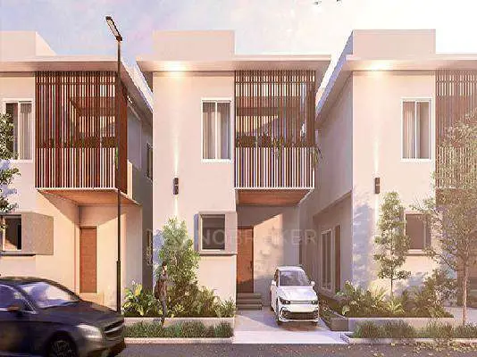
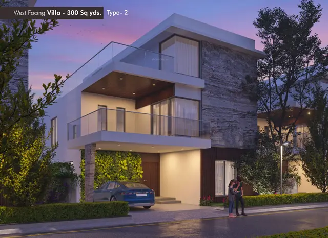
Green City Dukes County
GREEN CITY SAMARTH ESTATES & PROPERTIES LLP · Rangareddy · RERA P02400000391
GREEN CITY DUKES COUNTY is a plotted development in Kondakal, Shankarpalle mandal, Ranga Reddy district, developed by registered promoter GREEN CITY SAMARTH ESTATES & PROPERTIES LLP. The registered site extent is 134457.01 sq. m, and the layout drawing identifies plots numbered 1 to 392; buildings, floors and RERA-filed plot configurations are not disclosed. The project is registered with TG-RERA under P02400000391, with proposed and revised completion listed as 03/09/2021.
More from Green City Samarth Estates & Properties LLP · 3 projects →
01What we found
Read from TG-RERA filings, approvals, land and registration records and court records. A court case is counted only when the court record states this project's survey number with its village, or names the project.
02Check before you pay
8 items to check before you pay, 5 high - from the title chain, court records and approvals, each with what to ask the builder or your advocate. An item may not be a problem with the project: records can be incomplete.
1. Project at a glance
Project identity
| Field | Project record |
|---|---|
| Registered name | GREEN CITY DUKES COUNTY RERA record |
| Project type | Plotted development / open-plot layout RERA record RERA filing |
| Phase or registered portion | The RERA record identifies one registered project; no separate phase name or phase-wise extent is disclosed. RERA record |
| TG-RERA registration | P02400000391 RERA record |
| Registration validity | 08/03/2019 to 03/09/2021, stated as two years; certificate records no extension. This is the registration period, not the completion deadline. RERA record |
| Registered promoter | GREEN CITY SAMARTH ESTATES & PROPERTIES LLP RERA record Corporate record |
| RERA status | Recorded as On-Going Project. RERA filing |
Land and geographic identity
| Field | Project record |
|---|---|
| Locality / revenue village | Kondakal; the registered record identifies Kondakal village. RERA record RERA filing |
| Mandal / district / PIN | Shankarpalle / Ranga Reddy / 501203 RERA record |
| All project survey numbers and subdivisions | 158/P, 159/P and 163/P RERA record Land records |
| Registered site extent | 134457.01 sq. m in the RERA land fields. The HMDA draft layout letter states 134457.08 Sq.m as total and net site area. RERA filing |
| Boundaries recorded in RERA fields | North: Sy. No. 158P; South: Sy. No. 171; East: Sy. No. 160; West: Sy. No. 164. RERA filing |
Development identity
| Field | Project record |
|---|---|
| Sanctioning authority | Hyderabad Metropolitan Development Authority (HMDA) Approvals record |
| Principal layout approval | 000178/LO/Plg/HMDA/2018, dated 04 September, 2018, as recorded in the filed HMDA draft layout letter. Approvals record |
| Approval character | HMDA document is described as a Draft layout Letter, technically approving and forwarding a draft open-plot layout proposal. |
| Approved built-up area | 79594.92 sq. m is stated in RERA project fields. The supplied layout material is a plotted-layout record; no building or floor schedule is provided. RERA filing |
| Plots and layout arrangement | Drawing-derived layout data identifies plots numbered 1 to 392; the HMDA letter separately identifies plots 325 To 329 & 338 To 392 as mortgaged plots. Layout record |
| Buildings / floors / parking levels | Not disclosed for this plotted layout. Document index |
Offering and status
| Field | Project record |
|---|---|
| Unit type | Residential plots; the RERA filing identifies the project as plotted development. RERA record RERA filing |
| RERA-filed plot size range | Not available in the supplied RERA unit data. |
| Promoter-marketed plot size range | Approximately 165 to 400 Sq Yds; this is a vendor/marketing claim, not a RERA-filed figure. Promoter website |
| Booked / available counts | Not supplied. |
| Declared completion | The promoter’s Form B declares completion by 03rd September 2021; the RERA project record lists proposed and revised completion as 03/09/2021. RERA filing |
| Construction stage / progress | The supplied RERA amenity record reports 99% for internal roads and footpaths, water supply, sewerage, green strip/TOT LOT/park, street lighting, rainwater harvesting and the electrical meter room/sub-station/receiving station. These are filed progress figures, not independent site verification. RERA amenities |
| Occupancy / completion certificate | No occupancy or completion certificate is identified in the supplied project documents. The record does not establish an OC/CC for the layout. Document index |
2. The project story
GREEN CITY DUKES COUNTY is a plotted residential layout registered with TG-RERA as project P02400000391, in Kondakal village, Shankarpalle mandal, Ranga Reddy district, on survey numbers 158/P, 159/P and 163/P. The filed HMDA document describes an open-plot layout rather than apartment blocks or villas. The HMDA draft layout letter records a site area of 134457.08 Sq.m, with plots, internal roads, open space and social-infrastructure land identified in its area schedule. The drawing-derived layout record numbers plots 1 to 392; the available data does not establish plot-by-plot sizes or booked inventory. RERA record RERA filing Layout record
The RERA record’s completion date is 03/09/2021. Its amenity progress entry reports 99% for several listed infrastructure items, but that percentage is a project filing and has not been independently verified by a site inspection in the supplied evidence. No occupancy or completion certificate is present in the supplied documents. RERA filing RERA amenities Document index
3. Master plan, architecture & building design
This is a land subdivision, so the relevant design evidence is the approved-layout material rather than apartment floor plans. The HMDA draft layout letter states total site area and net site area of 134457.08 Sq.m, and identifies 79594.93 Sq.m as plotted area and 40738.53 Sq.m as layout road area. It also records 10757.86 Sq.m of open space and 3365.72 Sq.m of social-infrastructure area; its land-use schedule additionally lists 10085.36 as Park. The software-measured layout record, read from the approved layout drawing, gives a net layout area of 134457.08 sq. m and records: plots 79594.93 sq. m, roads 40738.53 sq. m, parks/open space 10757.86 sq. m, social infrastructure 3365.72 sq. m, and amenities 0.0 sq. m. The source cautions that drawing-derived readings should be checked against the drawing. Layout record
The layout record identifies 392 plot numbers (1 to 392), but does not provide a complete plot-size schedule. There is no supplied building arrangement, floor configuration, tower height, apartment circulation plan or building footprint information. Layout record Document index
4. Homes, configurations & floor plans
The RERA-filed offering is plotted development. No RERA unit-type table with plot counts, booked/available counts or saleable area by plot configuration is supplied.
| Configuration | Units | Booked | Available | RERA saleable area | Measured carpet area | Loading (if supplied) |
|---|---|---|---|---|---|---|
| Plots | Not supplied; drawing-derived plan numbers 1–392 | Not supplied | Not supplied | Not supplied | Not applicable / not supplied | Not supplied |
The drawing-derived count of 392 refers to plot numbers printed on the layout drawing; it is not a count of booked or available plots. The vendor lists plots of approximately 165 to 400 Sq Yds, which is marketing information rather than a RERA-filed size schedule. Layout record Promoter website
The supplied floor-plan record contains one layout sheet and two floor-plan items, but reports no measured apartment plans and one scan pending; it does not provide plot-level dimensions. Floor plans
5. Parking & vehicle circulation
The project is a plotted layout, and no sanctioned parking-space count, visitor or accessible parking provision, parking levels, parking allocation terms, ramps or EV charging details are supplied. The HMDA draft layout letter refers to internal layout roads and requires roads to be opened for access to neighbouring sites; the drawing-derived layout record measures 40738.53 sq. m of roads. Layout record
The vendor markets internal BT roads in widths of 60', 40' and 30', but the supplied official layout extract identifies road area rather than a complete road-width schedule. No exclusive parking right or unit-specific parking allocation is established by the supplied evidence. Promoter website
6. Amenities, recreation & open spaces
The RERA amenity record reports progress percentages for listed layout infrastructure. The HMDA draft layout letter also names proposed layout services and open-space/social-infrastructure land. Reported percentages are filing data, not independent confirmation of completion.
| Facility | Description / size | Evidence source | Declared progress / verified status |
|---|---|---|---|
| Internal roads & footpaths | Layout roads; HMDA letter records 40738.53 Sq.m road area | RERA amenities | RERA amenity record: 99%; not independently verified |
| Green strip / TOT LOT / park | HMDA letter records 10757.86 Sq.m open-space area; drawing-derived layout labels parks/open space as 10757.86 sq. m | RERA amenities Layout record | RERA amenity record: 99%; not independently verified |
| Social infrastructure | 3365.72 Sq.m in HMDA letter | No RERA amenity progress percentage supplied | |
| Community buildings | No area or facility details supplied | RERA amenities | RERA amenity record: 0% |
| Avenue plantation / landscaping | Vendor describes avenue plantation and designer landscaping; HMDA letter lists avenue plantation and park development | Promoter website | Vendor claim; completion not independently verified |
| Children’s play area / play areas | Listed in vendor marketing; no size or capacity supplied | Promoter website | Marketing claim; not independently verified |
| Swimming pool / multipurpose hall / flower gardens | Listed in vendor marketing; no size or capacity supplied | Promoter website | Marketing claims; no RERA progress or independent verification supplied |
7. Utilities, building services & safety
The HMDA draft layout letter lists the following as layout development provisions: common septic tank / STP, internal water-supply pipelines, overhead tank, transformer, avenue plantation, park development, rainwater-harvesting pits, street lighting, electricity facilities, storm-water drains and underground drainage lines. These are approval-document requirements or listed provisions; the supplied record does not establish capacity or independent completion.
| Evidence in the supplied record | Internal water-supply pipelines and overhead tank are listed in the HMDA letter; RERA amenity record lists water supply at 99%. No source or storage capacity is supplied. |
|---|---|
| Status evidence | Filed progress; not independently verified RERA amenities |
| Evidence in the supplied record | Common septic tank / STP, underground drainage lines and storm-water drains are listed in the HMDA letter. The RERA amenity record lists sewerage at 99% and storm-water drains at 0%. |
|---|---|
| Status evidence | Filed progress; not independently verified RERA amenities |
| Evidence in the supplied record | HMDA letter lists rainwater-harvesting pits; RERA amenity record lists water conservation/rainwater harvesting at 99%. |
|---|---|
| Status evidence | Filed progress; not independently verified RERA amenities |
| Evidence in the supplied record | Transformer and electricity facilities are listed in the HMDA letter. RERA amenity record reports the electrical meter room/sub-station/receiving station at 99%. |
|---|---|
| Status evidence | Filed progress; not independently verified RERA amenities |
| Evidence in the supplied record | Listed in the HMDA letter; RERA amenity record reports 99%. |
|---|---|
| Status evidence | Filed progress; not independently verified RERA amenities |
| Evidence in the supplied record | No project-specific fire-system or fire-clearance detail supplied. RERA amenity record lists fire protection/fire-safety requirements at 0%. |
|---|---|
| Status evidence | No completed provision established RERA amenities |
| Evidence in the supplied record | No project-specific waste-management, CCTV, access-control or accessibility details supplied. |
|---|---|
| Status evidence | Not established in supplied evidence RERA amenities Promoter website |
8. Location, access & connectivity
The registered location is Kondakal, Shankarpalle mandal, Ranga Reddy district, PIN 501203. The project land is identified in the RERA record as survey numbers 158/P, 159/P and 163/P. RERA record
The HMDA layout document identifies internal roads and requires them to be opened for access to neighbouring sites. A location record gives the nearest sampled Outer Ring Road interchange as approximately 10.0 km and an unnamed park as 2.1 km. These are supplied location measurements; no travel times are given in that record. Location record
The vendor markets the project as near Velimela and on a 100 ft wide road, and supplies travel-time claims for the Outer Ring Road, schools, colleges and other destinations. Those are promoter/vendor marketing claims, not RERA-filed project-location measurements. Promoter website
9. Developer & development status
The registered legal promoter is GREEN CITY SAMARTH ESTATES & PROPERTIES LLP, identified as an LLP in the project record. The promoter’s RERA filing names Samarth Agarwal as partner and authorized signatory. The supplied project data lists the promoter’s address as Sai Durga Towers, Road no 10, Kondakal, Kondakal, Shankarpalle, Ranga Reddy, 501203. Corporate record Parties record RERA record
The registration certificate records the project as valid from 08/03/2019 to 03/09/2021 and states that it was not extended in the supplied certificate data. Separately, the promoter’s Form B affidavit, dated 08 day of November 2018, declares a completion deadline of 03rd September 2021. These are registration validity and promoter-declared completion timing respectively.
The RERA amenity record reports selected infrastructure items at 99%, but no independent site verification is supplied. The project’s completed/occupied status and the status of any phase or individual plot are not established by the supplied record. RERA amenities Document index
10. Approvals, official records & documents
| What the supplied document establishes | FORM C records project GREEN CITY DUKES COUNTY, registration P02400000391, granted under section 5; validity 08/03/2019–03/09/2021. |
|---|
| What the supplied document establishes | Draft open-plot layout letter for Sy. Nos. 158/P, 159/P and 163/P, Kondakal; approval 000178/LO/Plg/HMDA/2018, dated 04 September, 2018. |
|---|
| What the supplied document establishes | A second extracted HMDA approval entry cites an LP number and printed date, but the approval number and instrument are partly illegible in the extraction. |
|---|
| What the supplied document establishes | Promoter-authorized affidavit declares legal title and a completion date of 03rd September 2021; its encumbrance clause is present but does not supply filled-in details. |
|---|
| What the supplied document establishes | One layout sheet is identified; drawing-derived records report 392 plot numbers and land-use areas. Plot sizes are not complete in the supplied extraction. |
|---|---|
| Reference | Layout record |
| What the supplied document establishes | No such certificate is identified in the supplied project documents. |
|---|---|
| Reference | Document index |
The publicly reachable HMDA Master Plan 2031 sheet is image-only, and the exact zone at the project survey has not been read from it. The HMDA approved-layout lookup is reported unavailable through the public portal in the supplied record; that unavailability does not establish refusal or cancellation. HMDA
1. Project at a glance
Project identity
Registered name: GREEN CITY DUKES COUNTY
Project type: Plotted development / open-plot layout
Phase or registered portion: The RERA record identifies one registered project; no separate phase name or phase-wise extent is disclosed.
TG-RERA registration: P02400000391
Registration validity: 08/03/2019 to 03/09/2021, stated as two years; certificate records no extension. This is the registration period, not the completion deadline.
Registered promoter: GREEN CITY SAMARTH ESTATES & PROPERTIES LLP
RERA status: Recorded as On-Going Project.
Land and geographic identity
Locality / revenue village: Kondakal; the registered record identifies Kondakal village.
Mandal / district / PIN: Shankarpalle / Ranga Reddy / 501203
All project survey numbers and subdivisions: 158/P, 159/P and 163/P
Registered site extent: 134457.01 sq. m in the RERA land fields. The HMDA draft layout letter states 134457.08 Sq.m as total and net site area.
Boundaries recorded in RERA fields: North: Sy. No. 158P; South: Sy. No. 171; East: Sy. No. 160; West: Sy. No. 164.
Development identity
Sanctioning authority: Hyderabad Metropolitan Development Authority (HMDA)
Principal layout approval: 000178/LO/Plg/HMDA/2018, dated 04 September, 2018, as recorded in the filed HMDA draft layout letter.
Approval character: HMDA document is described as a Draft layout Letter, technically approving and forwarding a draft open-plot layout proposal.
Approved built-up area: 79594.92 sq. m is stated in RERA project fields. The supplied layout material is a plotted-layout record; no building or floor schedule is provided.
Plots and layout arrangement: Drawing-derived layout data identifies plots numbered 1 to 392; the HMDA letter separately identifies plots 325 To 329 & 338 To 392 as mortgaged plots.
Buildings / floors / parking levels: Not disclosed for this plotted layout.
Offering and status
Unit type: Residential plots; the RERA filing identifies the project as plotted development.
RERA-filed plot size range: Not available in the supplied RERA unit data.
Promoter-marketed plot size range: Approximately 165 to 400 Sq Yds; this is a vendor/marketing claim, not a RERA-filed figure.
Booked / available counts: Not supplied.
Declared completion: The promoter’s Form B declares completion by 03rd September 2021; the RERA project record lists proposed and revised completion as 03/09/2021.
Construction stage / progress: The supplied RERA amenity record reports 99% for internal roads and footpaths, water supply, sewerage, green strip/TOT LOT/park, street lighting, rainwater harvesting and the electrical meter room/sub-station/receiving station. These are filed progress figures, not independent site verification.
Occupancy / completion certificate: No occupancy or completion certificate is identified in the supplied project documents. The record does not establish an OC/CC for the layout.
2. The project story
GREEN CITY DUKES COUNTY is a plotted residential layout registered with TG-RERA as project P02400000391, in Kondakal village, Shankarpalle mandal, Ranga Reddy district, on survey numbers 158/P, 159/P and 163/P. The filed HMDA document describes an open-plot layout rather than apartment blocks or villas. The HMDA draft layout letter records a site area of 134457.08 Sq.m, with plots, internal roads, open space and social-infrastructure land identified in its area schedule. The drawing-derived layout record numbers plots 1 to 392; the available data does not establish plot-by-plot sizes or booked inventory.
The RERA record’s completion date is 03/09/2021. Its amenity progress entry reports 99% for several listed infrastructure items, but that percentage is a project filing and has not been independently verified by a site inspection in the supplied evidence. No occupancy or completion certificate is present in the supplied documents.
3. Master plan, architecture & building design
This is a land subdivision, so the relevant design evidence is the approved-layout material rather than apartment floor plans. The HMDA draft layout letter states total site area and net site area of 134457.08 Sq.m, and identifies 79594.93 Sq.m as plotted area and 40738.53 Sq.m as layout road area. It also records 10757.86 Sq.m of open space and 3365.72 Sq.m of social-infrastructure area; its land-use schedule additionally lists 10085.36 as Park. The software-measured layout record, read from the approved layout drawing, gives a net layout area of 134457.08 sq. m and records: plots 79594.93 sq. m, roads 40738.53 sq. m, parks/open space 10757.86 sq. m, social infrastructure 3365.72 sq. m, and amenities 0.0 sq. m. The source cautions that drawing-derived readings should be checked against the drawing.
The layout record identifies 392 plot numbers (1 to 392), but does not provide a complete plot-size schedule. There is no supplied building arrangement, floor configuration, tower height, apartment circulation plan or building footprint information.
4. Homes, configurations & floor plans
The RERA-filed offering is plotted development. No RERA unit-type table with plot counts, booked/available counts or saleable area by plot configuration is supplied.
| Configuration | Units | Booked | Available | RERA saleable area | Measured carpet area | Loading (if supplied) |
|---|---|---|---|---|---|---|
| Plots | Not supplied; drawing-derived plan numbers 1–392 | Not supplied | Not supplied | Not supplied | Not applicable / not supplied | Not supplied |
The drawing-derived count of 392 refers to plot numbers printed on the layout drawing; it is not a count of booked or available plots. The vendor lists plots of approximately 165 to 400 Sq Yds, which is marketing information rather than a RERA-filed size schedule.
The supplied floor-plan record contains one layout sheet and two floor-plan items, but reports no measured apartment plans and one scan pending; it does not provide plot-level dimensions.
5. Parking & vehicle circulation
The project is a plotted layout, and no sanctioned parking-space count, visitor or accessible parking provision, parking levels, parking allocation terms, ramps or EV charging details are supplied. The HMDA draft layout letter refers to internal layout roads and requires roads to be opened for access to neighbouring sites; the drawing-derived layout record measures 40738.53 sq. m of roads.
The vendor markets internal BT roads in widths of 60', 40' and 30', but the supplied official layout extract identifies road area rather than a complete road-width schedule. No exclusive parking right or unit-specific parking allocation is established by the supplied evidence.
6. Amenities, recreation & open spaces
The RERA amenity record reports progress percentages for listed layout infrastructure. The HMDA draft layout letter also names proposed layout services and open-space/social-infrastructure land. Reported percentages are filing data, not independent confirmation of completion.
| Facility | Description / size | Evidence source | Declared progress / verified status |
|---|---|---|---|
| Internal roads & footpaths | Layout roads; HMDA letter records 40738.53 Sq.m road area | RERA amenity record: 99%; not independently verified | |
| Green strip / TOT LOT / park | HMDA letter records 10757.86 Sq.m open-space area; drawing-derived layout labels parks/open space as 10757.86 sq. m | RERA amenity record: 99%; not independently verified | |
| Social infrastructure | 3365.72 Sq.m in HMDA letter | No RERA amenity progress percentage supplied | |
| Community buildings | No area or facility details supplied | RERA amenity record: 0% | |
| Avenue plantation / landscaping | Vendor describes avenue plantation and designer landscaping; HMDA letter lists avenue plantation and park development | Vendor claim; completion not independently verified | |
| Children’s play area / play areas | Listed in vendor marketing; no size or capacity supplied | Marketing claim; not independently verified | |
| Swimming pool / multipurpose hall / flower gardens | Listed in vendor marketing; no size or capacity supplied | Marketing claims; no RERA progress or independent verification supplied |
7. Utilities, building services & safety
The HMDA draft layout letter lists the following as layout development provisions: common septic tank / STP, internal water-supply pipelines, overhead tank, transformer, avenue plantation, park development, rainwater-harvesting pits, street lighting, electricity facilities, storm-water drains and underground drainage lines. These are approval-document requirements or listed provisions; the supplied record does not establish capacity or independent completion.
| Evidence in the supplied record | Internal water-supply pipelines and overhead tank are listed in the HMDA letter; RERA amenity record lists water supply at 99%. No source or storage capacity is supplied. |
|---|---|
| Status evidence | Filed progress; not independently verified |
| Evidence in the supplied record | Common septic tank / STP, underground drainage lines and storm-water drains are listed in the HMDA letter. The RERA amenity record lists sewerage at 99% and storm-water drains at 0%. |
|---|---|
| Status evidence | Filed progress; not independently verified |
| Evidence in the supplied record | HMDA letter lists rainwater-harvesting pits; RERA amenity record lists water conservation/rainwater harvesting at 99%. |
|---|---|
| Status evidence | Filed progress; not independently verified |
| Evidence in the supplied record | Transformer and electricity facilities are listed in the HMDA letter. RERA amenity record reports the electrical meter room/sub-station/receiving station at 99%. |
|---|---|
| Status evidence | Filed progress; not independently verified |
| Evidence in the supplied record | Listed in the HMDA letter; RERA amenity record reports 99%. |
|---|---|
| Status evidence | Filed progress; not independently verified |
| Evidence in the supplied record | No project-specific fire-system or fire-clearance detail supplied. RERA amenity record lists fire protection/fire-safety requirements at 0%. |
|---|---|
| Status evidence | No completed provision established |
| Evidence in the supplied record | No project-specific waste-management, CCTV, access-control or accessibility details supplied. |
|---|---|
| Status evidence | Not established in supplied evidence |
8. Location, access & connectivity
The registered location is Kondakal, Shankarpalle mandal, Ranga Reddy district, PIN 501203. The project land is identified in the RERA record as survey numbers 158/P, 159/P and 163/P.
The HMDA layout document identifies internal roads and requires them to be opened for access to neighbouring sites. A location record gives the nearest sampled Outer Ring Road interchange as approximately 10.0 km and an unnamed park as 2.1 km. These are supplied location measurements; no travel times are given in that record.
The vendor markets the project as near Velimela and on a 100 ft wide road, and supplies travel-time claims for the Outer Ring Road, schools, colleges and other destinations. Those are promoter/vendor marketing claims, not RERA-filed project-location measurements.
9. Developer & development status
The registered legal promoter is GREEN CITY SAMARTH ESTATES & PROPERTIES LLP, identified as an LLP in the project record. The promoter’s RERA filing names Samarth Agarwal as partner and authorized signatory. The supplied project data lists the promoter’s address as Sai Durga Towers, Road no 10, Kondakal, Kondakal, Shankarpalle, Ranga Reddy, 501203.
The registration certificate records the project as valid from 08/03/2019 to 03/09/2021 and states that it was not extended in the supplied certificate data. Separately, the promoter’s Form B affidavit, dated 08 day of November 2018, declares a completion deadline of 03rd September 2021. These are registration validity and promoter-declared completion timing respectively.
The RERA amenity record reports selected infrastructure items at 99%, but no independent site verification is supplied. The project’s completed/occupied status and the status of any phase or individual plot are not established by the supplied record.
10. Approvals, official records & documents
| What the supplied document establishes | FORM C records project GREEN CITY DUKES COUNTY, registration P02400000391, granted under section 5; validity 08/03/2019–03/09/2021. |
|---|
| What the supplied document establishes | Draft open-plot layout letter for Sy. Nos. 158/P, 159/P and 163/P, Kondakal; approval 000178/LO/Plg/HMDA/2018, dated 04 September, 2018. |
|---|
| What the supplied document establishes | A second extracted HMDA approval entry cites an LP number and printed date, but the approval number and instrument are partly illegible in the extraction. |
|---|
| What the supplied document establishes | Promoter-authorized affidavit declares legal title and a completion date of 03rd September 2021; its encumbrance clause is present but does not supply filled-in details. |
|---|
| What the supplied document establishes | One layout sheet is identified; drawing-derived records report 392 plot numbers and land-use areas. Plot sizes are not complete in the supplied extraction. |
|---|
| What the supplied document establishes | No such certificate is identified in the supplied project documents. |
|---|
The publicly reachable HMDA Master Plan 2031 sheet is image-only, and the exact zone at the project survey has not been read from it. The HMDA approved-layout lookup is reported unavailable through the public portal in the supplied record; that unavailability does not establish refusal or cancellation.
Frequently asked questions
Is GREEN CITY DUKES COUNTY registered with Telangana RERA?
Yes. GREEN CITY DUKES COUNTY is registered with the Telangana Real Estate Regulatory Authority as P02400000391; the registration status is On-Going Project.
Who is the developer of GREEN CITY DUKES COUNTY?
The promoter named in the RERA registration is GREEN CITY SAMARTH ESTATES & PROPERTIES LLP.
Where is GREEN CITY DUKES COUNTY located?
GREEN CITY DUKES COUNTY is in Kondakal, Shankarpalle, Rangareddy, Telangana (501203).
When will GREEN CITY DUKES COUNTY be completed?
The promoter's proposed date of completion filed with RERA is 03/09/2021. This is the promoter's declaration, not a guarantee.
More projects in Kondakal