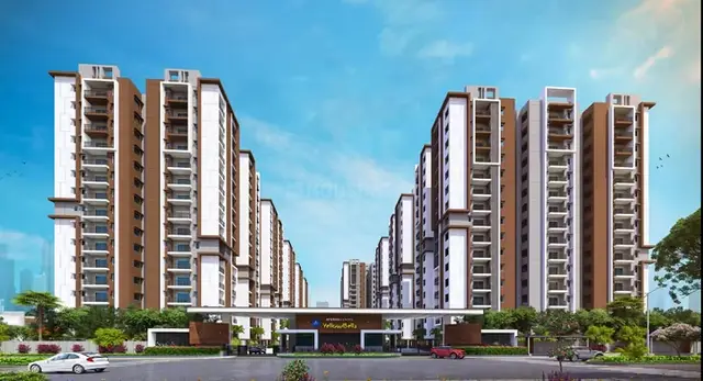
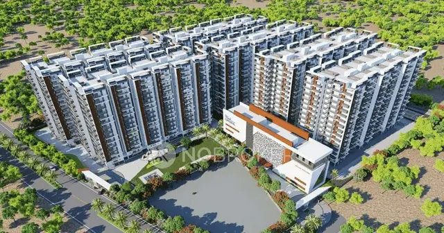
Manbhum One North
MANBHUM CONSTRUCTION COMPANY PRIVATE LIMITED · Medchal-Malkajgiri · RERA P02200001184
Manbhum One North is a residential plotted development at Gundlapochampally, Medchal Mandal, Medchal-Malkajgiri District, developed by the registered promoter MANBHUM CONSTRUCTION COMPANY PRIVATE LIMITED. The site area is 10,234.75 Sq.m, and the offering is residential plots; a plot count and plot-size schedule are not disclosed in the supplied RERA records. The project is registered with TG-RERA under P02200001184, and the promoter’s Form B declaration states a one-year completion period.
More from Manbhum Construction Company Pvt Ltd · 8 projects →
01What we found
Read from TG-RERA filings, approvals, land and registration records and court records. A court case is counted only when the court record states this project's survey number with its village, or names the project.
02Check before you pay
13 items to check before you pay, 7 high - from the title chain, court records and approvals, each with what to ask the builder or your advocate. An item may not be a problem with the project: records can be incomplete.
1. Project at a glance
Project identity
| Field | Record |
|---|---|
| Registered project name | Manbhum One North |
| Project type | Plotted development / residential plotted layout RERA record |
| Phase or registered portion | Not separately identified in the supplied registration record; registration is for the plotted project on Survey Nos. 8/8 and 8/9 |
| TG-RERA registration | P02200001184 |
| Registration validity | 16/09/2019 to 31/08/2020; the supplied certificate records no extension |
| Registered promoter | MANBHUM CONSTRUCTION COMPANY PRIVATE LIMITED |
| RERA status | New Project in the supplied project record; certificate records registration under section 5. Current registration status beyond the certificate’s stated validity is not established by the supplied material. RERA record |
Land and geographic identity
| Field | Record |
|---|---|
| Locality / revenue village | Gundlapochampally; also written “Gundla Pochampalle” in an approval document RERA record Land records |
| Mandal | Medchal RERA record Land records |
| District | Medchal-Malkajgiri RERA record Land records |
| PIN | 500043 RERA record |
| Project survey numbers and subdivisions | Survey No. 8/8 and Survey No. 8/9 Land records |
| Registered site extent | 10,234.75 Sq.m |
| Net site area | 10,234.75 Sq.m |
| Boundaries in RERA-filed land details | East: Railway Property; West: Primus Epsilon Layout; North: Primus Epsilon Layout; South: Primus Epsilon Layout, neighbours’ land and (the filed text is truncated) RERA filing |
Development identity
| Field | Record |
|---|---|
| Sanctioning / planning authority shown in project records | Hyderabad Metropolitan Development Authority (HMDA); municipal proceedings also appear in the filed approval documents Approvals record |
| Principal layout approval reference | 000184/LO/Plg/HMDA/2019, described in the supplied HMDA letter as a draft layout permission, dated 25 June, 2019 |
| Municipal proceedings reference | Proc.No.G1/08/ LO/2019; the supplied proceeding records a draft-layout release and conditions |
| Site area / approved built-up area | Site area is 10,234.75 Sq.m. An approved built-up area is not applicable or not stated in the supplied records for this plotted-layout project. |
| Plots and layout arrangement | The layout area statement records Plotted area 6150.36 Sq.m, Layout Road Area 2853.32 Sq.mtrs (27.88%), Organized open space/park Area/Utility Area 975.02 Sq.mtrs (9.53%), and Social Infra Structure area 256.05 Sq.mtrs (2.50%). The statement records amenities area as 0. |
| Buildings / floors | No building count or floor configuration is stated; the project is a plotted layout. The filed permission says buildings are not to be constructed in plots until final layout release. |
| Approval stage evidenced | The supplied HMDA letter is headed draft layout letter; municipal proceedings refer to release of the draft layout subject to conditions. A final layout permit is not established in the supplied documents. |
Offering and status
| Field | Record |
|---|---|
| Unit type | Residential plots RERA record |
| Filed plot configuration / size range | The supplied RERA records do not provide a complete plot-count or plot-size schedule. The layout drawing has not yielded a complete plot inventory in the supplied data. Layout record Document index |
| Booked / available counts | Not disclosed in the supplied material. Document index |
| Construction / development stage | The supplied records establish draft-layout documentation and development conditions, not independently verified on-site progress. |
| Completion dates | RERA certificate validity ends 31/08/2020. The Form B declaration states a one-year completion period; no revised completion date is established in the supplied documents. Registration validity and the project’s completion deadline are distinct. |
| Occupancy / completion certificate | Not applicable as a building OC is not established for this plotted-layout project; no project completion certificate is supplied. Document index |
2. The project story
Manbhum One North is registered as a residential plotted development at Gundlapochampally, Medchal Mandal, Medchal-Malkajgiri District, on Survey Nos. 8/8 and 8/9. The supplied land and layout records describe a 10,234.75 Sq.m site divided among plotted area, roads, open/park/utility space and social infrastructure. RERA record Land records
The RERA-filed materials include a draft layout permission and municipal proceedings setting conditions for development and eventual release of a final layout. They specify that layout infrastructure is to be developed and that buildings are not to be constructed in plots until the final layout is issued. The supplied evidence does not establish that those works were completed, that the final layout was released, or that the site’s current physical progress has been independently inspected.
The RERA Form B is a promoter declaration, signed through Managing Director Sri P. Ramakrishna Rao, that the project completion period is one year. That declaration is not itself evidence of completed works.
3. Master plan, architecture & building design
This is a plotted layout, not a multi-storey building scheme. The supplied layout area statement records:
| Layout component | Area / share as recorded | Evidence |
|---|---|---|
| Total site area | 10,234.75 Sq.m | |
| Net site area | 10,234.75 Sq.m | |
| Plotted area | 6150.36 Sq.m | |
| Layout road area | 2853.32 Sq.mtrs (27.88%) | |
| Organized open space/park Area/Utility Area | 975.02 Sq.mtrs (9.53%) | |
| Social infrastructure area | 256.05 Sq.mtrs (2.50%) | |
| Amenities area | 0 |
The HMDA letter describes a draft layout and records road widths of 18 Mtrs and above and 60 feet and above. A separate filed drawing extract is headed “DRAFT LAYOUT,” labels the land-use zone Residential and lists road widths of 9M, 12M and 18M; it also states that it is for site development only.
The layout drawing’s plot inventory is incomplete in the supplied extraction, so plot count, plot-by-plot sizes, orientation and detailed internal arrangement cannot be reliably summarized here. The supplied approval records identify plots 1, 2, 9 and 14 as mortgaged to HMDA; see the approval record for the stated conditions. Layout record
4. Homes, configurations & floor plans
The offering shown in the supplied project record is residential plots. There is no complete RERA-filed plot count, plot-size schedule, booking/availability schedule or plot-wise saleable-area schedule in the supplied data.
| Configuration | Units | Booked | Available | RERA saleable area | Measured carpet area | Loading (if supplied) |
|---|---|---|---|---|---|---|
| Residential plots | Not disclosed | Not disclosed | Not disclosed | Plot-wise areas not established in supplied RERA records | Not applicable | Not supplied |
The approved-layout drawing extraction is incomplete for plot-level measurements. The floor-plan data also reports no flats in two drawings and one scan pending; apartment carpet-area measurements therefore do not apply to this plotted offering. Layout record Floor plans
5. Parking & vehicle circulation
The supplied RERA and approval records do not state a parking-space count, visitor or accessible parking provision, parking allocation to plots, or a parking layout. Vehicle circulation is evidenced only at the layout-road level: approval documents refer to layout roads and require roads to remain open for access to neighbouring sites.
6. Amenities, recreation & open spaces
The following facilities appear in the supplied layout-approval conditions or the RERA amenities data. “YES / 100%” is the status recorded in the supplied RERA amenities schedule; it is not independent confirmation that a facility is complete or operational.
| Description / size | Layout roads recorded as 2853.32 Sq.mtrs (27.88%); approval records also refer to roads 18 Mtrs and above and 60 feet and above. |
|---|---|
| Evidence source | RERA amenities |
| Declared progress / verified status | RERA amenities schedule: YES / 100%; not independently verified complete. |
| Description / size | Open space/park/utility area recorded as 975.02 Sq.mtrs (9.53%). |
|---|---|
| Evidence source | RERA amenities |
| Declared progress / verified status | RERA amenities schedule: YES / 100%; not independently verified complete. |
| Description / size | 256.05 Sq.mtrs (2.50%). |
|---|---|
| Declared progress / verified status | Area recorded in layout statement; delivered status not established. |
| Description / size | Street lighting is listed among the development works; RERA amenities schedule records street lighting YES / 100%. |
|---|---|
| Evidence source | RERA amenities |
| Declared progress / verified status | Declared in the schedule; not independently verified complete. |
| Description / size | Approval condition includes rain-water-harvesting pits; RERA amenities schedule records water conservation/rain water harvesting YES / 100%. |
|---|---|
| Evidence source | RERA amenities |
| Declared progress / verified status | Declared in the schedule; not independently verified complete. |
| Description / size | No area or facility detail supplied; RERA amenities schedule records 0%. |
|---|---|
| Evidence source | RERA amenities |
| Declared progress / verified status | Not recorded as provided in the schedule. |
The RERA amenities schedule also records water supply, sewerage (chamber, lines, septic tank, STP), storm-water drains and an electrical meter room/sub-station/receiving station as YES / 100%. Their planned scope is summarized under Utilities below; the schedule does not independently verify completion. RERA amenities
7. Utilities, building services & safety
The approval documents list intended layout infrastructure including storm-water drains, underground drainage lines, a common septic tank / STP, internal water-supply pipelines, an overhead tank, electrical supply lines, streetlights, a transformer, avenue plantation, park development and rain-water-harvesting pits. The HMDA letter also describes protected water supply including OHT and sumps, underground ducting of utilities, a transformer yard, an independent sewerage-disposal system, solid waste and a bio-compost unit. These are approval-record descriptions and conditions, not confirmation of installed or operational services.
The RERA amenities schedule marks water supply, sewerage, storm-water drains and the electrical meter room/sub-station/receiving station as YES / 100%, and records sewage-treatment/disposal, solid-waste management and energy management at 0%. It also records fire protection and fire-safety requirements at 0%. These entries are declared schedule statuses, not independent inspections or statutory-compliance findings. RERA amenities
No supplied record specifies water source or storage capacity, STP capacity, power-backup capacity, lift provision, fire-system details, security systems, accessibility provisions or waste-processing capacity. As a plotted layout, building-level vertical transportation and building configuration are not established in the supplied project records.
8. Location, access & connectivity
The registered location is Gundlapochampally, Medchal Mandal, Medchal-Malkajgiri District, PIN 500043, on Survey Nos. 8/8 and 8/9. RERA record Land records
The supplied location data lists the Outer Ring Road nearest sampled interchange at 6.8 km, Gundla Pochampally railway station at 1.0 km, Telangana Grameena Bank at 0.1 km, Mallareddy Institute of Technology and Science at 2.4 km, an unnamed hospital at 2.9 km, an unnamed park at 1.2 km, and “abhaya” school at 0.8 km. These are supplied location-record distances; no travel times are provided. Location record
The promoter’s website description refers to Gundlapochampally, Kompally and North Hyderabad, but the project’s registered location used here is Gundlapochampally. Promoter website RERA record
9. Developer & development status
The registered promoter is MANBHUM CONSTRUCTION COMPANY PRIVATE LIMITED, a private limited company. The supplied corporate identifier is GSTIN 36AAFCM1195G2ZF. The RERA registration certificate gives the promoter’s office field as “Village: Mandal: District: Hyderabad, Pin: 500034.” The supplied project address details separately identify MANBHUM INSIGNIA, Banjara Hills, and the project locality; a complete registered-office street address is not established in the provided material. Corporate record RERA filing
The promoter’s Form B declares a one-year completion period and a commitment to deposit 70% of amounts realised into a separate account for construction and land cost. The TG-RERA certificate records registration validity from 16/09/2019 through 31/08/2020 and does not record an extension. The supplied documents do not establish the project’s current development progress or completion status.
The approval records describe layout works including roads, drainage, water supply, electrical infrastructure, plantation, parks and rainwater harvesting, and require completion of the specified development works within three years. The supplied material does not establish fulfilment of those conditions.
10. Approvals, official records & documents
| What the supplied document establishes | Form C records Manbhum One North, registration P02200001184, under section 5, valid 16/09/2019–31/08/2020; no extension is recorded in the supplied certificate. |
|---|
| What the supplied document establishes | Draft layout letter under approval reference 000184/LO/Plg/HMDA/2019, dated 25 June, 2019, for the plotted layout on Survey Nos. 8/8 and 8/9. |
|---|
| What the supplied document establishes | Proceedings reference Proc.No.G1/08/ LO/2019 concerning release of a draft layout permit and conditions for the site. |
|---|
| What the supplied document establishes | “DRAFT LAYOUT” drawing extract identifying Residential land use and road widths; it says the layout is for site development only. |
|---|
| What the supplied document establishes | Promoter declaration dated 26* day of July, 2019, including the one-year completion undertaking and title/encumbrance statements. These are promoter assertions. |
|---|
| What the supplied document establishes | Site, net, plotted, road, park/open-space and social-infrastructure area figures as summarized above. |
|---|
A final layout release, completion certificate, or independent evidence of completed infrastructure is not included in the supplied document set.
1. Project at a glance
Project identity
Registered project name: Manbhum One North
Project type: Plotted development / residential plotted layout
Phase or registered portion: Not separately identified in the supplied registration record; registration is for the plotted project on Survey Nos. 8/8 and 8/9
TG-RERA registration: P02200001184
Registration validity: 16/09/2019 to 31/08/2020; the supplied certificate records no extension
Registered promoter: MANBHUM CONSTRUCTION COMPANY PRIVATE LIMITED
RERA status: New Project in the supplied project record; certificate records registration under section 5. Current registration status beyond the certificate’s stated validity is not established by the supplied material.
Land and geographic identity
Locality / revenue village: Gundlapochampally; also written “Gundla Pochampalle” in an approval document
Mandal: Medchal
District: Medchal-Malkajgiri
PIN: 500043
Project survey numbers and subdivisions: Survey No. 8/8 and Survey No. 8/9
Registered site extent: 10,234.75 Sq.m
Net site area: 10,234.75 Sq.m
Boundaries in RERA-filed land details: East: Railway Property; West: Primus Epsilon Layout; North: Primus Epsilon Layout; South: Primus Epsilon Layout, neighbours’ land and (the filed text is truncated)
Development identity
Sanctioning / planning authority shown in project records: Hyderabad Metropolitan Development Authority (HMDA); municipal proceedings also appear in the filed approval documents
Principal layout approval reference: 000184/LO/Plg/HMDA/2019, described in the supplied HMDA letter as a draft layout permission, dated 25 June, 2019
Municipal proceedings reference: Proc.No.G1/08/ LO/2019; the supplied proceeding records a draft-layout release and conditions
Site area / approved built-up area: Site area is 10,234.75 Sq.m. An approved built-up area is not applicable or not stated in the supplied records for this plotted-layout project.
Plots and layout arrangement: The layout area statement records Plotted area 6150.36 Sq.m, Layout Road Area 2853.32 Sq.mtrs (27.88%), Organized open space/park Area/Utility Area 975.02 Sq.mtrs (9.53%), and Social Infra Structure area 256.05 Sq.mtrs (2.50%). The statement records amenities area as 0.
Buildings / floors: No building count or floor configuration is stated; the project is a plotted layout. The filed permission says buildings are not to be constructed in plots until final layout release.
Approval stage evidenced: The supplied HMDA letter is headed draft layout letter; municipal proceedings refer to release of the draft layout subject to conditions. A final layout permit is not established in the supplied documents.
Offering and status
Unit type: Residential plots
Filed plot configuration / size range: The supplied RERA records do not provide a complete plot-count or plot-size schedule. The layout drawing has not yielded a complete plot inventory in the supplied data.
Booked / available counts: Not disclosed in the supplied material.
Construction / development stage: The supplied records establish draft-layout documentation and development conditions, not independently verified on-site progress.
Completion dates: RERA certificate validity ends 31/08/2020. The Form B declaration states a one-year completion period; no revised completion date is established in the supplied documents. Registration validity and the project’s completion deadline are distinct.
Occupancy / completion certificate: Not applicable as a building OC is not established for this plotted-layout project; no project completion certificate is supplied.
2. The project story
Manbhum One North is registered as a residential plotted development at Gundlapochampally, Medchal Mandal, Medchal-Malkajgiri District, on Survey Nos. 8/8 and 8/9. The supplied land and layout records describe a 10,234.75 Sq.m site divided among plotted area, roads, open/park/utility space and social infrastructure.
The RERA-filed materials include a draft layout permission and municipal proceedings setting conditions for development and eventual release of a final layout. They specify that layout infrastructure is to be developed and that buildings are not to be constructed in plots until the final layout is issued. The supplied evidence does not establish that those works were completed, that the final layout was released, or that the site’s current physical progress has been independently inspected.
The RERA Form B is a promoter declaration, signed through Managing Director Sri P. Ramakrishna Rao, that the project completion period is one year. That declaration is not itself evidence of completed works.
3. Master plan, architecture & building design
This is a plotted layout, not a multi-storey building scheme. The supplied layout area statement records:
| Layout component | Area / share as recorded | Evidence |
|---|---|---|
| Total site area | 10,234.75 Sq.m | |
| Net site area | 10,234.75 Sq.m | |
| Plotted area | 6150.36 Sq.m | |
| Layout road area | 2853.32 Sq.mtrs (27.88%) | |
| Organized open space/park Area/Utility Area | 975.02 Sq.mtrs (9.53%) | |
| Social infrastructure area | 256.05 Sq.mtrs (2.50%) | |
| Amenities area | 0 |
The HMDA letter describes a draft layout and records road widths of 18 Mtrs and above and 60 feet and above. A separate filed drawing extract is headed “DRAFT LAYOUT,” labels the land-use zone Residential and lists road widths of 9M, 12M and 18M; it also states that it is for site development only.
The layout drawing’s plot inventory is incomplete in the supplied extraction, so plot count, plot-by-plot sizes, orientation and detailed internal arrangement cannot be reliably summarized here. The supplied approval records identify plots 1, 2, 9 and 14 as mortgaged to HMDA; see the approval record for the stated conditions.
4. Homes, configurations & floor plans
The offering shown in the supplied project record is residential plots. There is no complete RERA-filed plot count, plot-size schedule, booking/availability schedule or plot-wise saleable-area schedule in the supplied data.
| Configuration | Units | Booked | Available | RERA saleable area | Measured carpet area | Loading (if supplied) |
|---|---|---|---|---|---|---|
| Residential plots | Not disclosed | Not disclosed | Not disclosed | Plot-wise areas not established in supplied RERA records | Not applicable | Not supplied |
The approved-layout drawing extraction is incomplete for plot-level measurements. The floor-plan data also reports no flats in two drawings and one scan pending; apartment carpet-area measurements therefore do not apply to this plotted offering.
5. Parking & vehicle circulation
The supplied RERA and approval records do not state a parking-space count, visitor or accessible parking provision, parking allocation to plots, or a parking layout. Vehicle circulation is evidenced only at the layout-road level: approval documents refer to layout roads and require roads to remain open for access to neighbouring sites.
6. Amenities, recreation & open spaces
The following facilities appear in the supplied layout-approval conditions or the RERA amenities data. “YES / 100%” is the status recorded in the supplied RERA amenities schedule; it is not independent confirmation that a facility is complete or operational.
| Description / size | Layout roads recorded as 2853.32 Sq.mtrs (27.88%); approval records also refer to roads 18 Mtrs and above and 60 feet and above. |
|---|---|
| Declared progress / verified status | RERA amenities schedule: YES / 100%; not independently verified complete. |
| Description / size | Open space/park/utility area recorded as 975.02 Sq.mtrs (9.53%). |
|---|---|
| Declared progress / verified status | RERA amenities schedule: YES / 100%; not independently verified complete. |
| Description / size | 256.05 Sq.mtrs (2.50%). |
|---|---|
| Declared progress / verified status | Area recorded in layout statement; delivered status not established. |
| Description / size | Street lighting is listed among the development works; RERA amenities schedule records street lighting YES / 100%. |
|---|---|
| Declared progress / verified status | Declared in the schedule; not independently verified complete. |
| Description / size | Approval condition includes rain-water-harvesting pits; RERA amenities schedule records water conservation/rain water harvesting YES / 100%. |
|---|---|
| Declared progress / verified status | Declared in the schedule; not independently verified complete. |
| Description / size | No area or facility detail supplied; RERA amenities schedule records 0%. |
|---|---|
| Declared progress / verified status | Not recorded as provided in the schedule. |
The RERA amenities schedule also records water supply, sewerage (chamber, lines, septic tank, STP), storm-water drains and an electrical meter room/sub-station/receiving station as YES / 100%. Their planned scope is summarized under Utilities below; the schedule does not independently verify completion.
7. Utilities, building services & safety
The approval documents list intended layout infrastructure including storm-water drains, underground drainage lines, a common septic tank / STP, internal water-supply pipelines, an overhead tank, electrical supply lines, streetlights, a transformer, avenue plantation, park development and rain-water-harvesting pits. The HMDA letter also describes protected water supply including OHT and sumps, underground ducting of utilities, a transformer yard, an independent sewerage-disposal system, solid waste and a bio-compost unit. These are approval-record descriptions and conditions, not confirmation of installed or operational services.
The RERA amenities schedule marks water supply, sewerage, storm-water drains and the electrical meter room/sub-station/receiving station as YES / 100%, and records sewage-treatment/disposal, solid-waste management and energy management at 0%. It also records fire protection and fire-safety requirements at 0%. These entries are declared schedule statuses, not independent inspections or statutory-compliance findings.
No supplied record specifies water source or storage capacity, STP capacity, power-backup capacity, lift provision, fire-system details, security systems, accessibility provisions or waste-processing capacity. As a plotted layout, building-level vertical transportation and building configuration are not established in the supplied project records.
8. Location, access & connectivity
The registered location is Gundlapochampally, Medchal Mandal, Medchal-Malkajgiri District, PIN 500043, on Survey Nos. 8/8 and 8/9.
The supplied location data lists the Outer Ring Road nearest sampled interchange at 6.8 km, Gundla Pochampally railway station at 1.0 km, Telangana Grameena Bank at 0.1 km, Mallareddy Institute of Technology and Science at 2.4 km, an unnamed hospital at 2.9 km, an unnamed park at 1.2 km, and “abhaya” school at 0.8 km. These are supplied location-record distances; no travel times are provided.
The promoter’s website description refers to Gundlapochampally, Kompally and North Hyderabad, but the project’s registered location used here is Gundlapochampally.
9. Developer & development status
The registered promoter is MANBHUM CONSTRUCTION COMPANY PRIVATE LIMITED, a private limited company. The supplied corporate identifier is GSTIN 36AAFCM1195G2ZF. The RERA registration certificate gives the promoter’s office field as “Village: Mandal: District: Hyderabad, Pin: 500034.” The supplied project address details separately identify MANBHUM INSIGNIA, Banjara Hills, and the project locality; a complete registered-office street address is not established in the provided material.
The promoter’s Form B declares a one-year completion period and a commitment to deposit 70% of amounts realised into a separate account for construction and land cost. The TG-RERA certificate records registration validity from 16/09/2019 through 31/08/2020 and does not record an extension. The supplied documents do not establish the project’s current development progress or completion status.
The approval records describe layout works including roads, drainage, water supply, electrical infrastructure, plantation, parks and rainwater harvesting, and require completion of the specified development works within three years. The supplied material does not establish fulfilment of those conditions.
10. Approvals, official records & documents
| What the supplied document establishes | Form C records Manbhum One North, registration P02200001184, under section 5, valid 16/09/2019–31/08/2020; no extension is recorded in the supplied certificate. |
|---|
| What the supplied document establishes | Draft layout letter under approval reference 000184/LO/Plg/HMDA/2019, dated 25 June, 2019, for the plotted layout on Survey Nos. 8/8 and 8/9. |
|---|
| What the supplied document establishes | Proceedings reference Proc.No.G1/08/ LO/2019 concerning release of a draft layout permit and conditions for the site. |
|---|
| What the supplied document establishes | “DRAFT LAYOUT” drawing extract identifying Residential land use and road widths; it says the layout is for site development only. |
|---|
| What the supplied document establishes | Promoter declaration dated 26* day of July, 2019, including the one-year completion undertaking and title/encumbrance statements. These are promoter assertions. |
|---|
| What the supplied document establishes | Site, net, plotted, road, park/open-space and social-infrastructure area figures as summarized above. |
|---|
A final layout release, completion certificate, or independent evidence of completed infrastructure is not included in the supplied document set.
Frequently asked questions
Is Manbhum One North registered with Telangana RERA?
Yes. Manbhum One North is registered with the Telangana Real Estate Regulatory Authority as P02200001184; the registration status is New Project.
Who is the developer of Manbhum One North?
The promoter named in the RERA registration is MANBHUM CONSTRUCTION COMPANY PRIVATE LIMITED.
Where is Manbhum One North located?
Manbhum One North is in Gundlapochampally, Medchal, Medchal-Malkajgiri, Telangana (500043).
When will Manbhum One North be completed?
The promoter's proposed date of completion filed with RERA is 31/08/2020. This is the promoter's declaration, not a guarantee.
More projects in Gundlapochampally