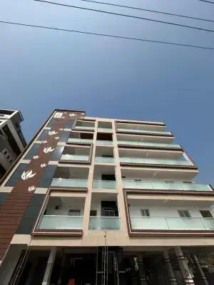
Bhadradri Township
BHADRADRI TOWNSHIP · Suryapet · RERA P01900005048
BHADRADRI TOWNSHIP is a residential plotted layout in Kodada / Kodad -1, Kodad / Kodada Mandal, Suryapet District, developed by registered promoter BHADRADRI TOWNSHIP. The RERA-filed site area is 96009.99 sqmts, and the approved layout contains 294 residential plots, with drawing-derived sizes from 117.3 sqm to 349.96 sqm; towers and floors are not disclosed. The project is registered under TG-RERA **P01900005048**, and the proposed completion date is 23/05/2024.
01What we found
Read from TG-RERA filings, approvals, land and registration records and court records. A court case is counted only when the court record states this project's survey number with its village, or names the project.
02Check before you pay
8 items to check before you pay, 2 high - from the title chain, court records and approvals, each with what to ask the builder or your advocate. An item may not be a problem with the project: records can be incomplete.
1. Project at a glance
Project identity
| Field | Record |
|---|---|
| Registered project name | BHADRADRI TOWNSHIP RERA record |
| Project type | Plotted development / residential layout RERA record RERA filing |
| Phase or registered portion | A single registered project is identified; no phase name is disclosed. RERA record |
| TG-RERA registration | P01900005048, issued 13/09/2022; registration certificate states validity through 23/05/2024. |
| RERA status in supplied record | Registration validity ended 23/05/2024; no extension is recorded in the supplied certificate. This is separate from the filed completion certificate and the layout OC information below. RERA record |
| Registered promoter | BHADRADRI TOWNSHIP; entity type stated in the project filing as Partnership. RERA record RERA filing |
Land and geographic identity
| Field | Record |
|---|---|
| Locality / village as recorded | Kodada / Kodad -1; the layout approval describes the site as Kodada Revenue Village. RERA record |
| Mandal | Kodad / Kodada Mandal RERA record |
| District | Suryapet RERA record |
| PIN | 508206 RERA record |
| Project survey numbers and subdivisions | 447/2, 449/1/1, 459/2, 451, 458/A, 458/AA, 449/3, 454/A2, 454/EE3, 454/E1, 454/E2, 447/1/1, 448/A, 448/AA, 450/AA1, 450/A1/3, 450/A1/2, 452/A2, 454/A3, 454/A6, 456/2, 458,/E, 447/1, 449/1/2, 450/A1/1, 459/1, 460/1, 454/A5, 454/A4, 454/EE1, 449/2-1, 450/AA2, 454/AA1, 454/AA2, 454/AA4, 457/2, 456/1/3, 455/A1/1/2, 455/A2/1/2, 457/1/2, 454/U3, 446/1/1/2/2/2, 446/1/1/2/1/2, 454/B5, 454/C2/2, 454/D2, 454/D3/1, 454/E1/1, 454/A1/1. |
| RERA-filed site area | Total area 96009.99 sqmts; net area 96009.99 sqmts; area affected in road widening/FTL of tanks/nala widening 0. RERA filing |
| Approved layout extent | Tentative layout approval records 23 Acer 28.96 Gts; 114827 Sq. Yds. Final layout approval records Ac 23.72 Gts 114827 Sq. Yds. |
| Boundaries in RERA filing | East, west, north and south: OTHERS LAND. RERA filing |
Development identity
| Field | Record |
|---|---|
| Sanctioning authority | KODADA Municipality/Municipal Corporation, as stated in the layout approval records. The RERA filing identifies DTCP as authority for the plan approval. Approvals record |
| Principal layout approval | Tentative LP 0012/LO/3046/2022, approved date shown in the supplied approval record as 06/11/2022 1:24:30 PM. |
| Final layout approval | Final LP 0026/FLT/3046/2023; application 011249/FLT/DTCP/3046/0031/2023. |
| Approved plotted area / other land uses | Final approval records plotted area 14 Ac 11.69 Gts; 69177 Sq. Yds (60.24%), roads 6 Ac 18.38 Gts; 31264 Sq. Yds (27.23%), open space 2 Ac 5.63 Gts; 10362 Sq. Yds (9.02%), social infrastructure 0 Ac 23.76 Gts; 2874 Sq. Yds (2.5%), and utilities 0 Ac 9.5 Gts; 1149 Sq. Yds (1%). |
| Buildings / floors | Not disclosed as a multi-building or apartment development; this is a plotted layout. Individual building permissions are to be considered separately under the final layout conditions. |
| Approved built-up area | RERA filing lists 57840.78 sqmts as approved built-up area; the layout approvals do not provide a building-level floor schedule. RERA filing |
| Plot count | 294 plots in the tentative and final layout records. |
Offering and status
| Field | Record |
|---|---|
| Product | Residential plots; the final layout requires detached dwelling use for a single family per site. RERA record |
| Plot sizes | The approved drawing-derived schedule contains 294 plots; software reading identified sizes from 117.3 sqm to 349.96 sqm (about 140.3 sqyd to 418.5 sqyd). Drawing-derived sizes require verification against the plan. Layout record |
| Booked / available plots | Not disclosed in the supplied records. RERA record |
| Construction stage | The RERA header records 80% completeness; this is a recorded progress figure, not an independent site inspection. RERA record |
| Completion date | RERA registration record lists proposed completion 23/05/2024. No revised completion date is supplied. RERA record |
| Occupancy / completion certificate | An architect’s Form 1A filed on 15-02-2025 states the project is completed in all aspects and identifies layout Occupancy Certificate 0026lFLT1304612023, dated 09-October-2023, with DTCP as competent authority. The supplied extract describes the layout-level certificate; no individual plot-house OC is evidenced. |
2. The project story
- BHADRADRI TOWNSHIP is registered as a residential plotted layout in Kodad -1/Kodada Revenue Village, Kodad Mandal, Suryapet District. The records describe a layout of 294 residential plots rather than a development of apartment towers or completed houses. The final layout conditions provide for detached dwelling use designed for one family per plot; individual house construction is subject to separate building permission. RERA record
- The layout approval allocates land to plots, internal roads, open space, social infrastructure and utilities. Its conditions call for roads and infrastructure works, including storm-water drains, underground drainage and common septic tank/STP, water pipelines and overhead tank, electrical lines and street lighting, avenue planting, park development and rainwater-harvesting pits. These are specified development works in the approval record; the supplied material does not independently verify their current physical completion.
- The RERA record gives 80% completeness, while the architect’s Form 1A states completion in all aspects and records a layout-level OC dated 09-October-2023. Those are distinct record assertions: the supplied material does not include an independent site inspection or evidence of occupancy certificates for houses on individual plots. RERA record
3. Master plan, architecture & building design
The development is organized as a plotted layout. The final layout approval records 294 plots and the following land-use distribution:
| Layout use | Approved area | Share |
|---|---|---|
| Plotted area | 14 Ac 11.69 Gts; 69177 Sq. Yds | 60.24% |
| Roads | 6 Ac 18.38 Gts; 31264 Sq. Yds | 27.23% |
| Open space (park) | 2 Ac 5.63 Gts; 10362 Sq. Yds | 9.02% |
| Social infrastructure | 0 Ac 23.76 Gts; 2874 Sq. Yds | 2.5% |
| Utilities | 0 Ac 9.5 Gts; 1149 Sq. Yds | 1% |
The RERA filing states a site area of 96009.99 sqmts and approved built-up area of 57840.78 sqmts; it does not supply a building-by-building plan, floor configuration, building footprint or phase-wise building schedule. The layout approval requires roads to remain open for access to neighbouring land and does not permit shops or industrial uses except at sites specially reserved for such proposals; the final-layout extract also states dwelling use for the plotted sites. RERA filing RERA filing
- The layout schedule is drawing-derived rather than a RERA unit disclosure: software read 294 plots with sizes, with a smallest of 117.3 sqm, median 199.28 sqm, and largest 349.96 sqm. The drawing record notes that the plot count and sizes should be checked against the approved drawing. Layout record
4. Homes, configurations & floor plans
- This project offers plots, not apartment configurations. The approved layout records 294 plots; no plot-wise booking or availability schedule is supplied. RERA record
| Configuration | Units | Booked | Available | RERA saleable area | Measured carpet area | Loading (if supplied) |
|---|---|---|---|---|---|---|
| Residential plots | 294 | Not disclosed | Not disclosed | Not disclosed | Not applicable | Not supplied |
- Drawing-derived plot sizes are software-measured from the layout schedule, not stated as a RERA unit-level area disclosure. The schedule records 117.3–349.96 sqm (approximately 140.3–418.5 sqyd), with a median of 199.28 sqm (approximately 238.3 sqyd). Layout record
- For plots, “carpet area” and apartment common-area loading are not applicable. The RERA filing’s 96009.99 sqmts is the filed site area, not an individual plot’s saleable area. Plot-specific identification, dimensions, boundary and availability should be confirmed against the approved plan and the proposed allotment/conveyance documents. RERA filing Layout record
5. Parking & vehicle circulation
- The layout approval sets aside 27.23% for roads and requires roads to be opened for access to neighbouring sites; it also records a Common Parking Area in the final-layout amenities/utilities list. No parking-space count, visitor or accessible-space allocation, individual plot parking entitlement, or EV-charging provision is supplied.
- The tentative approval records mortgage of identified plots to the Municipality as a layout-development condition. The approved record does not establish that any drawn or designated parking area is exclusively allocated to a particular plot purchaser.
6. Amenities, recreation & open spaces
The layout approval describes specified layout works and reserved land. The RERA amenities record marks several infrastructure items as available, but that is a filed declaration and not independent verification of present condition. RERA amenities
| Facility | Park / open space |
|---|---|
| Description / size | 2 Ac 5.63 Gts; 10362 Sq. Yds (9.02%) in the final layout approval |
| Declared progress / verified status | Reserved in the approved layout; physical completion not independently verified. |
| Facility | Recreational open space |
|---|---|
| Description / size | RERA amenities record identifies aggregate recreational open space; the layout approval records park/open-space land above. |
| Evidence source | RERA amenities |
| Declared progress / verified status | RERA amenities record marks it 100%; no independent verification supplied. |
| Facility | Social infrastructure site |
|---|---|
| Description / size | 0 Ac 23.76 Gts; 2874 Sq. Yds (2.5%) |
| Declared progress / verified status | Land reserved; no specific facility or operating status disclosed. |
| Facility | Common parking area |
|---|---|
| Description / size | No count or area supplied |
| Declared progress / verified status | Listed in final-layout amenities/utilities; current provision not independently verified. |
The supplied records do not identify a clubhouse, indoor recreation facility, named sports facility or community-building specification. RERA amenities
7. Utilities, building services & safety
The layout approval describes a planned infrastructure package; the RERA amenities record separately marks water supply, sewerage, storm-water drains, street lighting and electrical meter room/sub-station/receiving station as available. These records do not provide system capacities or an independent inspection of delivered services. RERA amenities
| Evidence in the record | Approval calls for internal water-supply pipelines, an overhead tank and an assured water-supply source; it also reserves utility land for a water reservoir. |
|---|---|
| Limitation | Source, storage capacity and current operation are not specified. |
| Evidence in the record | Approval calls for underground drainage lines and a common septic tank/STP, plus storm-water drains. |
|---|---|
| Limitation | Capacity, treatment/reuse arrangements and completed/operating status are not established. |
| Evidence in the record | Approval calls for electrical supply lines, a transformer and street lights; RERA amenities list an electrical meter room/sub-station/receiving station. RERA amenities |
|---|---|
| Limitation | Supply capacity and backup arrangements are not disclosed. |
| Evidence in the record | Approval identifies solid-waste management in the utilities description; RERA amenities lists solid-waste management/disposal at 0%. RERA amenities |
|---|---|
| Limitation | The supplied record does not establish a functioning waste-management system. |
| Evidence in the record | Approval calls for rainwater-harvesting pits; RERA amenities lists water conservation/rainwater harvesting at 0%. RERA amenities |
|---|---|
| Limitation | Quantity, capacity and installation status are not supplied. |
| Evidence in the record | No project-specific fire-system or accessibility details are supplied. RERA amenities |
|---|---|
| Limitation | Do not infer these from the plotted-layout approval. |
8. Location, access & connectivity
- The registered location is Kodad -1/Kodada, Kodad Mandal, Suryapet District, Telangana, PIN 508206. The layout approval identifies Kodada Revenue Village, and its conditions require internal roads to be kept open for access to neighbouring lands. RERA record
- A location record gives coordinates 16.9947802, 79.9749826 and a sampled nearest Outer Ring Road interchange distance of 146.6 km. The source describes the interchange as approximate; no additional approach-road, public-transport or landmark details are supplied. Location record
9. Developer & development status
- The registered promoter is BHADRADRI TOWNSHIP, identified in the RERA filing as a partnership. The filing lists GSTIN 36AAZFB6904D1Z8 and an address at 4-112/12/C, BODI GUTTA, KODADA, Kodad, Suryapet, Telangana 508206. The registration certificate lists the promoter office as Village: Bhavani Nagar, Mandal: Kodad, District: Suryapet, Pin: 508206. RERA filing RERA filing Corporate record
- The registration certificate records validity from 13/09/2022 to 23/05/2024. The RERA header gives proposed completion 23/05/2024 and completeness 80%; an architect’s Form 1A, dated 15-02-2025, states the layout was completed in all aspects and records the layout OC. The supplied evidence does not include a revised completion date or independent site-progress verification. RERA record
10. Approvals, official records & documents
| Identifier / date | P01900005048; issued 13/09/2022; valid through 23/05/2024 |
|---|---|
| Scope and source | Form C registration certificate for BHADRADRI TOWNSHIP. |
| Identifier / date | 0012/LO/3046/2022; approval date shown as 06/11/2022 1:24:30 PM |
|---|---|
| Scope and source | KODADA Municipality/Municipal Corporation approval for a 294-plot residential layout; extent stated as 23 Acer 28.96 Gts; 114827 Sq. Yds. |
| Identifier / date | 0026/FLT/3046/2023; application 011249/FLT/DTCP/3046/0031/2023 |
|---|---|
| Scope and source | KODADA Municipality/Municipal Corporation final layout plan for 294 plots. |
| Identifier / date | 0026lFLT1304612023, dated 09-October-2023 |
|---|---|
| Scope and source | Form 1A identifies DTCP as competent authority and describes the certificate as for the layout. |
| Identifier / date | Project number not legible or stated in the supplied OCR |
|---|---|
| Scope and source | Promoter declaration on title, encumbrances, completion and fund-handling undertakings; the declaration’s project/promoter text and date are partly illegible. |
| Identifier / date | Drawing source 252039; two layout sheets |
|---|---|
| Scope and source | Software-derived plot count and plot-size readings; the drawing record cautions that these should be checked against the drawing. Layout record |
The supplied record does not include a building-by-building sanction or house-level occupancy certificate. The final-layout approval states that individual building permissions are to be considered separately.
1. Project at a glance
Project identity
Registered project name: BHADRADRI TOWNSHIP
Project type: Plotted development / residential layout
Phase or registered portion: A single registered project is identified; no phase name is disclosed.
TG-RERA registration: P01900005048, issued 13/09/2022; registration certificate states validity through 23/05/2024.
RERA status in supplied record: Registration validity ended 23/05/2024; no extension is recorded in the supplied certificate. This is separate from the filed completion certificate and the layout OC information below.
Registered promoter: BHADRADRI TOWNSHIP; entity type stated in the project filing as Partnership.
Land and geographic identity
Locality / village as recorded: Kodada / Kodad -1; the layout approval describes the site as Kodada Revenue Village.
Mandal: Kodad / Kodada Mandal
District: Suryapet
PIN: 508206
Project survey numbers and subdivisions: 447/2, 449/1/1, 459/2, 451, 458/A, 458/AA, 449/3, 454/A2, 454/EE3, 454/E1, 454/E2, 447/1/1, 448/A, 448/AA, 450/AA1, 450/A1/3, 450/A1/2, 452/A2, 454/A3, 454/A6, 456/2, 458,/E, 447/1, 449/1/2, 450/A1/1, 459/1, 460/1, 454/A5, 454/A4, 454/EE1, 449/2-1, 450/AA2, 454/AA1, 454/AA2, 454/AA4, 457/2, 456/1/3, 455/A1/1/2, 455/A2/1/2, 457/1/2, 454/U3, 446/1/1/2/2/2, 446/1/1/2/1/2, 454/B5, 454/C2/2, 454/D2, 454/D3/1, 454/E1/1, 454/A1/1.
RERA-filed site area: Total area 96009.99 sqmts; net area 96009.99 sqmts; area affected in road widening/FTL of tanks/nala widening 0.
Approved layout extent: Tentative layout approval records 23 Acer 28.96 Gts; 114827 Sq. Yds. Final layout approval records Ac 23.72 Gts 114827 Sq. Yds.
Boundaries in RERA filing: East, west, north and south: OTHERS LAND.
Development identity
Sanctioning authority: KODADA Municipality/Municipal Corporation, as stated in the layout approval records. The RERA filing identifies DTCP as authority for the plan approval.
Principal layout approval: Tentative LP 0012/LO/3046/2022, approved date shown in the supplied approval record as 06/11/2022 1:24:30 PM.
Final layout approval: Final LP 0026/FLT/3046/2023; application 011249/FLT/DTCP/3046/0031/2023.
Approved plotted area / other land uses: Final approval records plotted area 14 Ac 11.69 Gts; 69177 Sq. Yds (60.24%), roads 6 Ac 18.38 Gts; 31264 Sq. Yds (27.23%), open space 2 Ac 5.63 Gts; 10362 Sq. Yds (9.02%), social infrastructure 0 Ac 23.76 Gts; 2874 Sq. Yds (2.5%), and utilities 0 Ac 9.5 Gts; 1149 Sq. Yds (1%).
Buildings / floors: Not disclosed as a multi-building or apartment development; this is a plotted layout. Individual building permissions are to be considered separately under the final layout conditions.
Approved built-up area: RERA filing lists 57840.78 sqmts as approved built-up area; the layout approvals do not provide a building-level floor schedule.
Plot count: 294 plots in the tentative and final layout records.
Offering and status
Product: Residential plots; the final layout requires detached dwelling use for a single family per site.
Plot sizes: The approved drawing-derived schedule contains 294 plots; software reading identified sizes from 117.3 sqm to 349.96 sqm (about 140.3 sqyd to 418.5 sqyd). Drawing-derived sizes require verification against the plan.
Booked / available plots: Not disclosed in the supplied records.
Construction stage: The RERA header records 80% completeness; this is a recorded progress figure, not an independent site inspection.
Completion date: RERA registration record lists proposed completion 23/05/2024. No revised completion date is supplied.
Occupancy / completion certificate: An architect’s Form 1A filed on 15-02-2025 states the project is completed in all aspects and identifies layout Occupancy Certificate 0026lFLT1304612023, dated 09-October-2023, with DTCP as competent authority. The supplied extract describes the layout-level certificate; no individual plot-house OC is evidenced.
2. The project story
- BHADRADRI TOWNSHIP is registered as a residential plotted layout in Kodad -1/Kodada Revenue Village, Kodad Mandal, Suryapet District. The records describe a layout of 294 residential plots rather than a development of apartment towers or completed houses. The final layout conditions provide for detached dwelling use designed for one family per plot; individual house construction is subject to separate building permission.
- The layout approval allocates land to plots, internal roads, open space, social infrastructure and utilities. Its conditions call for roads and infrastructure works, including storm-water drains, underground drainage and common septic tank/STP, water pipelines and overhead tank, electrical lines and street lighting, avenue planting, park development and rainwater-harvesting pits. These are specified development works in the approval record; the supplied material does not independently verify their current physical completion.
- The RERA record gives 80% completeness, while the architect’s Form 1A states completion in all aspects and records a layout-level OC dated 09-October-2023. Those are distinct record assertions: the supplied material does not include an independent site inspection or evidence of occupancy certificates for houses on individual plots.
3. Master plan, architecture & building design
The development is organized as a plotted layout. The final layout approval records 294 plots and the following land-use distribution:
| Layout use | Approved area | Share |
|---|---|---|
| Plotted area | 14 Ac 11.69 Gts; 69177 Sq. Yds | 60.24% |
| Roads | 6 Ac 18.38 Gts; 31264 Sq. Yds | 27.23% |
| Open space (park) | 2 Ac 5.63 Gts; 10362 Sq. Yds | 9.02% |
| Social infrastructure | 0 Ac 23.76 Gts; 2874 Sq. Yds | 2.5% |
| Utilities | 0 Ac 9.5 Gts; 1149 Sq. Yds | 1% |
The RERA filing states a site area of 96009.99 sqmts and approved built-up area of 57840.78 sqmts; it does not supply a building-by-building plan, floor configuration, building footprint or phase-wise building schedule. The layout approval requires roads to remain open for access to neighbouring land and does not permit shops or industrial uses except at sites specially reserved for such proposals; the final-layout extract also states dwelling use for the plotted sites.
- The layout schedule is drawing-derived rather than a RERA unit disclosure: software read 294 plots with sizes, with a smallest of 117.3 sqm, median 199.28 sqm, and largest 349.96 sqm. The drawing record notes that the plot count and sizes should be checked against the approved drawing.
4. Homes, configurations & floor plans
- This project offers plots, not apartment configurations. The approved layout records 294 plots; no plot-wise booking or availability schedule is supplied.
| Configuration | Units | Booked | Available | RERA saleable area | Measured carpet area | Loading (if supplied) |
|---|---|---|---|---|---|---|
| Residential plots | 294 | Not disclosed | Not disclosed | Not disclosed | Not applicable | Not supplied |
- Drawing-derived plot sizes are software-measured from the layout schedule, not stated as a RERA unit-level area disclosure. The schedule records 117.3–349.96 sqm (approximately 140.3–418.5 sqyd), with a median of 199.28 sqm (approximately 238.3 sqyd).
- For plots, “carpet area” and apartment common-area loading are not applicable. The RERA filing’s 96009.99 sqmts is the filed site area, not an individual plot’s saleable area. Plot-specific identification, dimensions, boundary and availability should be confirmed against the approved plan and the proposed allotment/conveyance documents.
5. Parking & vehicle circulation
- The layout approval sets aside 27.23% for roads and requires roads to be opened for access to neighbouring sites; it also records a Common Parking Area in the final-layout amenities/utilities list. No parking-space count, visitor or accessible-space allocation, individual plot parking entitlement, or EV-charging provision is supplied.
- The tentative approval records mortgage of identified plots to the Municipality as a layout-development condition. The approved record does not establish that any drawn or designated parking area is exclusively allocated to a particular plot purchaser.
6. Amenities, recreation & open spaces
The layout approval describes specified layout works and reserved land. The RERA amenities record marks several infrastructure items as available, but that is a filed declaration and not independent verification of present condition.
| Facility | Park / open space |
|---|---|
| Description / size | 2 Ac 5.63 Gts; 10362 Sq. Yds (9.02%) in the final layout approval |
| Declared progress / verified status | Reserved in the approved layout; physical completion not independently verified. |
| Facility | Recreational open space |
|---|---|
| Description / size | RERA amenities record identifies aggregate recreational open space; the layout approval records park/open-space land above. |
| Declared progress / verified status | RERA amenities record marks it 100%; no independent verification supplied. |
| Facility | Social infrastructure site |
|---|---|
| Description / size | 0 Ac 23.76 Gts; 2874 Sq. Yds (2.5%) |
| Declared progress / verified status | Land reserved; no specific facility or operating status disclosed. |
| Facility | Common parking area |
|---|---|
| Description / size | No count or area supplied |
| Declared progress / verified status | Listed in final-layout amenities/utilities; current provision not independently verified. |
The supplied records do not identify a clubhouse, indoor recreation facility, named sports facility or community-building specification.
7. Utilities, building services & safety
The layout approval describes a planned infrastructure package; the RERA amenities record separately marks water supply, sewerage, storm-water drains, street lighting and electrical meter room/sub-station/receiving station as available. These records do not provide system capacities or an independent inspection of delivered services.
| Evidence in the record | Approval calls for internal water-supply pipelines, an overhead tank and an assured water-supply source; it also reserves utility land for a water reservoir. |
|---|---|
| Limitation | Source, storage capacity and current operation are not specified. |
| Evidence in the record | Approval calls for underground drainage lines and a common septic tank/STP, plus storm-water drains. |
|---|---|
| Limitation | Capacity, treatment/reuse arrangements and completed/operating status are not established. |
| Evidence in the record | Approval calls for electrical supply lines, a transformer and street lights; RERA amenities list an electrical meter room/sub-station/receiving station. |
|---|---|
| Limitation | Supply capacity and backup arrangements are not disclosed. |
| Evidence in the record | Approval identifies solid-waste management in the utilities description; RERA amenities lists solid-waste management/disposal at 0%. |
|---|---|
| Limitation | The supplied record does not establish a functioning waste-management system. |
| Evidence in the record | Approval calls for rainwater-harvesting pits; RERA amenities lists water conservation/rainwater harvesting at 0%. |
|---|---|
| Limitation | Quantity, capacity and installation status are not supplied. |
| Evidence in the record | No project-specific fire-system or accessibility details are supplied. |
|---|---|
| Limitation | Do not infer these from the plotted-layout approval. |
8. Location, access & connectivity
- The registered location is Kodad -1/Kodada, Kodad Mandal, Suryapet District, Telangana, PIN 508206. The layout approval identifies Kodada Revenue Village, and its conditions require internal roads to be kept open for access to neighbouring lands.
- A location record gives coordinates 16.9947802, 79.9749826 and a sampled nearest Outer Ring Road interchange distance of 146.6 km. The source describes the interchange as approximate; no additional approach-road, public-transport or landmark details are supplied.
9. Developer & development status
- The registered promoter is BHADRADRI TOWNSHIP, identified in the RERA filing as a partnership. The filing lists GSTIN 36AAZFB6904D1Z8 and an address at 4-112/12/C, BODI GUTTA, KODADA, Kodad, Suryapet, Telangana 508206. The registration certificate lists the promoter office as Village: Bhavani Nagar, Mandal: Kodad, District: Suryapet, Pin: 508206.
- The registration certificate records validity from 13/09/2022 to 23/05/2024. The RERA header gives proposed completion 23/05/2024 and completeness 80%; an architect’s Form 1A, dated 15-02-2025, states the layout was completed in all aspects and records the layout OC. The supplied evidence does not include a revised completion date or independent site-progress verification.
10. Approvals, official records & documents
| Identifier / date | P01900005048; issued 13/09/2022; valid through 23/05/2024 |
|---|---|
| Scope and source | Form C registration certificate for BHADRADRI TOWNSHIP. |
| Identifier / date | 0012/LO/3046/2022; approval date shown as 06/11/2022 1:24:30 PM |
|---|---|
| Scope and source | KODADA Municipality/Municipal Corporation approval for a 294-plot residential layout; extent stated as 23 Acer 28.96 Gts; 114827 Sq. Yds. |
| Identifier / date | 0026/FLT/3046/2023; application 011249/FLT/DTCP/3046/0031/2023 |
|---|---|
| Scope and source | KODADA Municipality/Municipal Corporation final layout plan for 294 plots. |
| Identifier / date | 0026lFLT1304612023, dated 09-October-2023 |
|---|---|
| Scope and source | Form 1A identifies DTCP as competent authority and describes the certificate as for the layout. |
| Identifier / date | Project number not legible or stated in the supplied OCR |
|---|---|
| Scope and source | Promoter declaration on title, encumbrances, completion and fund-handling undertakings; the declaration’s project/promoter text and date are partly illegible. |
| Identifier / date | Drawing source 252039; two layout sheets |
|---|---|
| Scope and source | Software-derived plot count and plot-size readings; the drawing record cautions that these should be checked against the drawing. |
The supplied record does not include a building-by-building sanction or house-level occupancy certificate. The final-layout approval states that individual building permissions are to be considered separately.
Frequently asked questions
Is BHADRADRI TOWNSHIP registered with Telangana RERA?
Yes. BHADRADRI TOWNSHIP is registered with the Telangana Real Estate Regulatory Authority as P01900005048; the registration status is New Project.
Who is the developer of BHADRADRI TOWNSHIP?
The promoter named in the RERA registration is BHADRADRI TOWNSHIP.
Where is BHADRADRI TOWNSHIP located?
BHADRADRI TOWNSHIP is in KODADA, Kodad -1, Kodad, Suryapet, Telangana (508206).
When will BHADRADRI TOWNSHIP be completed?
The promoter's proposed date of completion filed with RERA is 23/05/2024. This is the promoter's declaration, not a guarantee.
More projects in Kodad 1