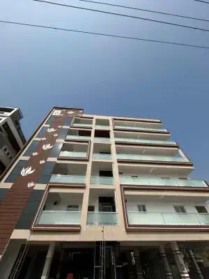
Mahathi Nagar
Smt. DONGARI LAKSHMAMMA AND OTHERS · Suryapet · RERA P01900006853
MAHATHI NAGAR is a residential plotted development in Kodad -1, Kodad Mandal, Suryapet District. The registered promoter is Smt. DONGARI LAKSHMAMMA AND OTHERS. The project covers 7571.13 sq.m and comprises 26 residential plots, with drawing-based plot sizes of 151.65–217.21 sq.m; towers and floors are not applicable to the approved plotted layout. Its TG-RERA registration number is P01900006853, and the RERA project record lists proposed completion as 18/07/2025.
01What we found
Read from TG-RERA filings, approvals, land and registration records and court records. A court case is counted only when the court record states this project's survey number with its village, or names the project.
02Check before you pay
7 items to check before you pay, 4 high - from the title chain, court records and approvals, each with what to ask the builder or your advocate. An item may not be a problem with the project: records can be incomplete.
Project at a glance
Project identity
| Item | Project record |
|---|---|
| Registered name | MAHATHI NAGAR RERA record |
| Project type | Plotted development / residential layout RERA record RERA filing |
| Phase / registered portion | Not separately identified; registration is for the project on the listed survey lands |
| TG-RERA registration | P01900006853 |
| Registration validity | 05/09/2023 to 18/07/2025; the certificate records no extension |
| Registered promoter | Smt. DONGARI LAKSHMAMMA AND OTHERS RERA record |
| RERA status in supplied record | Registered project; the stated registration validity has expired, and no extension is recorded in the certificate |
Land and geographic identity
| Item | Project record |
|---|---|
| Locality / revenue village | Kodad -1 in the RERA record; approval documents describe Kodada Revenue Village |
| Mandal / district / PIN | Kodad / Suryapet / 508206 |
| Project survey numbers and subdivisions | 920/AA5, 920/AA4/1/2/2, 920/AA4/1/2/1, 920/AA4/1/3, 920/A1/3/4 |
| Registered site extent | Not stated as a separate field in the registration certificate. The final layout approval records Ac 1.87 Gts 9055 Sq. Yds |
| Net / total area | 7571.13 sq.m total and net area in the RERA land details Land records |
| Boundaries in RERA land details | East: Agricultural Fields; West: Agricultural Fields; North: Agricultural Fields; South: Road Land records |
Development identity
| Item | Project record |
|---|---|
| Sanctioning authority | KODADA Municipality/Municipal Corporation |
| Final layout approval | 007823/LO/DTCP/3046/0024/2023; final layout approval is recorded in the filed document |
| Approval date | The RERA record lists 18/07/2023; the approval-document register lists 02 August, 2023. See the approval index below for the documents RERA filing Approvals record |
| Approved plotted area | 5085.04 sq.m in the RERA layout drawing extraction Layout record |
| Built-up area | RERA fields list approved built-up area as 5085.04 sq.m; no building-level configuration is provided RERA filing |
| Buildings / floors | Not applicable to the approved plotted layout as described in the final layout plan; individual building permissions are to be considered separately |
| Parking | The final layout document lists “Common Parking Area”; no space count or allocation is supplied |
| Approved / RERA-declared plots | Final layout approval records 26 plots; the RERA drawing-based layout record also counts 26 plots Layout record |
Offering and status
| Item | Project record |
|---|---|
| Unit type | Plots; no apartment or villa configuration is supplied Layout record |
| Plot sizes | Software-read from the approved layout drawing: 151.65–217.21 sq.m (smallest to largest); median 195.1 sq.m Layout record |
| Booked / available counts | Not supplied in the available project data RERA filing |
| Declared completion dates | Form B declares completion by 18th JAN 2025; the RERA project record lists proposed completion as 18/07/2025 RERA record |
| Completion / occupancy evidence | A filed Form–1A architect certificate states the project is completed in all aspects. The supplied material does not identify a separate occupancy certificate; for this plotted layout, the available completion record is the architect certificate |
| Construction stage | The architect certificate reports overall completion; this is a filed professional certificate, not an independent site inspection |
The project story
- MAHATHI NAGAR is registered as a residential plotted layout in Kodad, Suryapet district, covering the five listed survey subdivisions. The final layout approval describes 26 plots and residential dwelling use. It also states that individual building permissions are considered separately; the layout approval itself is not a building plan for homes.
- The layout drawing’s software-read area statement allocates land to plots, roads, park/open space, utilities and social infrastructure. The filed Form–1A certificate reports that the project is completed in all aspects. That is a promoter-filed completion document signed by the identified architect; the supplied evidence does not establish an independent physical inspection or separately identify an occupancy certificate. Layout record
Master plan, architecture & building design
The approved development is a plotted layout, not a tower or apartment scheme. The final layout approval records 26 plots and residential use, with sites intended for detached single-family dwellings. It requires prior approval for plot amalgamation or subdivision and states that individual building permission is considered separately.
The layout drawing’s software-read area statement gives the following land-use split. These are drawing-derived figures, not a separate survey measurement:
| Layout use | Area | Share of net layout area | Evidence |
|---|---|---|---|
| Plots | 5085.04 sq.m | 67.2% | Software-read from drawing Layout record |
| Roads | 1535.95 sq.m | 20.3% | Software-read from drawing Layout record |
| Parks / open space | 683.6 sq.m | 9.0% | Software-read from drawing Layout record |
| Utilities | 75.84 sq.m | 1.0% | Software-read from drawing Layout record |
| Social infrastructure | 190.71 sq.m | 2.5% | Software-read from drawing Layout record |
| Amenities | 0.0 sq.m | 0.0% | Software-read from drawing Layout record |
The final-layout document separately records open space, social infrastructure, utilities, roads and plotted area, including 9.03% open space, 2.52% social infrastructure, 1% utilities, 20.29% roads and 67.16% plotted area.
No approved residential building floor plans, building heights, tower arrangement, building footprints, lifts, stairs, apartment circulation or phase-wise building layout are evidenced. The RERA fields record approved built-up area of 5085.04 sq.m, but the supplied material does not explain a building-level scope for that field. RERA filing
Homes, configurations & floor plans
The offering evidenced in the final layout plan is 26 residential plots. The plot sizes below are read by software from the approved layout drawing; the project data cautions that drawing-based readings should be checked against the drawing. Layout record
| Configuration | Units | Booked | Available | RERA saleable area | Measured carpet area | Loading (if supplied) |
|---|---|---|---|---|---|---|
| Residential plots | 26 | Not supplied | Not supplied | Not supplied | Not applicable | Not supplied |
| Drawing-based plot-size summary | Measurement |
|---|---|
| Smallest plot | 151.65 sq.m (181.4 sq.yd) |
| Median plot | 195.1 sq.m (233.3 sq.yd) |
| Largest plot | 217.21 sq.m (259.8 sq.yd) |
| Size bands | 1 plot: 150–200 sq.yd; 21 plots: 200–250 sq.yd; 4 plots: 250–300 sq.yd |
These plot sizes are software-measured from the layout drawing, not RERA-filed saleable-area figures. Apartment carpet-area and common-area loading concepts do not apply to the plotted offering. No plot-wise booking or availability schedule is supplied. Layout record RERA filing
Parking & vehicle circulation
- The final layout approval lists a Common Parking Area, but the supplied record does not give a parking-space count, vehicle type, visitor or accessible provision, or plot-wise parking allocation. The RERA/vendor specification lists Open Parking. No parking arrangement should be treated as an exclusive right for a particular plot without the relevant sale and allocation documents. Promoter website
- The layout documents require roads to remain open for access to neighbouring lands. The RERA land details identify a road along the southern boundary; no road widths, entry/exit design, internal driveway dimensions, pedestrian separation, ramps or EV charging provision are supplied. Land records
Amenities, recreation & open spaces
The final layout approval identifies the facilities and reserved areas below. Approval-document references describe layout development works and requirements; the Form–1A certificate reports overall completion, but the supplied evidence does not independently verify each facility’s on-site delivery.
| Facility | Description / size | Evidence source | Declared progress / verified status |
|---|---|---|---|
| Park / open space | 683.6 sq.m in drawing extraction; approval records 9.03% | Layout record | Earmarked in layout; individual completion not independently verified |
| Social infrastructure | 190.71 sq.m in drawing extraction; approval records 2.52% | Layout record | Reserved area shown; specific facility/use not detailed |
| Roads | 1535.95 sq.m in drawing extraction; approval records 20.29% | Layout record | Layout provision; completion not independently verified |
| Utilities area | 75.84 sq.m in drawing extraction; approval records 1% | Layout record | Reserved area; contents include proposed/required utility works described in approval conditions |
| Common parking area | No size or count supplied | Listed in final-layout document; delivery not independently verified |
No clubhouse, indoor recreation facility, sports facility or separately sized community building is evidenced. The RERA amenities record shows “Community Buildings” at 0% and “Aggregate area of recreational Open Space” at 0%; those entries are progress fields and do not, by themselves, explain the separate layout drawing’s park/open-space allocation. RERA amenities Layout record
Utilities, building services & safety
The layout approval describes development works including internal water-supply pipelines, an assured water-supply source, an overhead tank or sump, storm-water drains, underground drainage lines and a common septic tank/STP, electrical supply lines, street lighting, a transformer, avenue plantation and rainwater-harvesting pits. These are approval-document requirements/descriptions, not independent confirmation that each item is operational.
| Evidence in the project record | Water supply, borewell, water reservoir, internal pipelines and an overhead tank/sump are listed Promoter website |
|---|---|
| Status limitation | Source yield, storage capacity and operational status not supplied |
| Evidence in the project record | Underground drainage, common septic tank/STP, storm-water drains and sewage treatment/disposal are listed RERA amenities |
|---|---|
| Status limitation | Capacity, connection details and operational status not supplied |
| Evidence in the project record | Rainwater-harvesting structures/pits are specified in the layout documents |
|---|---|
| Status limitation | Quantity and completion not independently verified |
| Evidence in the project record | Transformer, electrical supply lines, street lighting and electrical meter room/sub-station are listed RERA amenities Promoter website |
|---|---|
| Status limitation | Capacity and operational status not supplied |
| Evidence in the project record | Solid Waste Management appears in the tentative-layout conditions and vendor amenity list Promoter website |
|---|---|
| Status limitation | The RERA amenities record shows Solid Waste Management and Disposal at 0%; delivery is not established RERA amenities |
| Evidence in the project record | No project-specific fire system, access-control, CCTV, accessibility or emergency-access details supplied |
|---|---|
| Status limitation | Not established in the available documents |
The RERA amenities record marks “Fire Protection And Fire Safety Requirements” at 0%. The supplied material does not establish fire-system provision, statutory fire clearance or accessibility features. RERA amenities
Location, access & connectivity
The registered location is Kodad -1, Kodad Mandal, Suryapet District, Telangana, PIN 508206. The approval documents refer to Kodada Revenue Village. The RERA boundary description places agricultural fields to the east, west and north, and a road to the south. Land records
A location record provides coordinates 16.9947802, 79.9749826 and lists the nearest sampled Outer Ring Road interchange at 146.6 km. This is the only measured connectivity distance supplied; no public-transport information or further landmark distances are provided. Location record
Developer & development status
- The registered promoter is Smt. DONGARI LAKSHMAMMA AND OTHERS. The RERA record describes the organization type as “Others” and the project arrangement as “JOINT DEVELOPMENT”; a more specific legal-entity type and corporate identifier are not established in the supplied material. The registration certificate gives the promoter office as Village: Srimannarayana Colony, Mandal: Kodad, District: Suryapet, PIN 508206. No official contact details or website are supplied. RERA record RERA filing
- Form B is a promoter declaration made by authorized signatory KOLLU SRIKAR. It states a completion undertaking of 18th JAN 2025; the RERA project record separately lists proposed completion as 18/07/2025. The filed Form–1A architect certificate reports overall project completion; it is not an independent site inspection, and no separate occupancy certificate is identified in the supplied documents. RERA record
Approvals, official records & documents
| Identifier / date | P01900006853; issued 05/09/2023; valid to 18/07/2025 |
|---|---|
| What it establishes in the supplied file | Registration of MAHATHI NAGAR and listed conditions |
| Identifier / date | 0013/LO/3046/2023; document lists 02 August, 2023 |
|---|---|
| What it establishes in the supplied file | Tentative layout for 26 plots and conditions |
| Identifier / date | 007823/LO/DTCP/3046/0024/2023 |
|---|---|
| What it establishes in the supplied file | Final residential layout plan for 26 plots, with land-use allocation and conditions |
| Identifier / date | Declaration dated July 2023 |
|---|---|
| What it establishes in the supplied file | Promoter’s title, encumbrance, fund-management and completion declarations |
| Identifier / date | Project certificate identifies P01900006853 and final layout certificate 007823/LO/DTCP/3046/0024/2023 |
|---|---|
| What it establishes in the supplied file | Architect’s statement that the project is completed in all aspects; signed by SYED ZAMEER HASAN, COA CA/2013/61075 |
| Identifier / date | Document 345087 |
|---|---|
| What it establishes in the supplied file | Title-search report is on file; its detailed findings are addressed in the Land & Title section |
The supplied file does not identify a separate occupancy certificate or individual building permissions for homes. The final layout approval states that individual building permissions are considered separately.
Project at a glance
Project identity
Registered name: MAHATHI NAGAR
Project type: Plotted development / residential layout
Phase / registered portion: Not separately identified; registration is for the project on the listed survey lands
TG-RERA registration: P01900006853
Registration validity: 05/09/2023 to 18/07/2025; the certificate records no extension
Registered promoter: Smt. DONGARI LAKSHMAMMA AND OTHERS
RERA status in supplied record: Registered project; the stated registration validity has expired, and no extension is recorded in the certificate
Land and geographic identity
Locality / revenue village: Kodad -1 in the RERA record; approval documents describe Kodada Revenue Village
Mandal / district / PIN: Kodad / Suryapet / 508206
Project survey numbers and subdivisions: 920/AA5, 920/AA4/1/2/2, 920/AA4/1/2/1, 920/AA4/1/3, 920/A1/3/4
Registered site extent: Not stated as a separate field in the registration certificate. The final layout approval records Ac 1.87 Gts 9055 Sq. Yds
Net / total area: 7571.13 sq.m total and net area in the RERA land details
Boundaries in RERA land details: East: Agricultural Fields; West: Agricultural Fields; North: Agricultural Fields; South: Road
Development identity
Sanctioning authority: KODADA Municipality/Municipal Corporation
Final layout approval: 007823/LO/DTCP/3046/0024/2023; final layout approval is recorded in the filed document
Approval date: The RERA record lists 18/07/2023; the approval-document register lists 02 August, 2023. See the approval index below for the documents
Approved plotted area: 5085.04 sq.m in the RERA layout drawing extraction
Built-up area: RERA fields list approved built-up area as 5085.04 sq.m; no building-level configuration is provided
Buildings / floors: Not applicable to the approved plotted layout as described in the final layout plan; individual building permissions are to be considered separately
Parking: The final layout document lists “Common Parking Area”; no space count or allocation is supplied
Approved / RERA-declared plots: Final layout approval records 26 plots; the RERA drawing-based layout record also counts 26 plots
Offering and status
Unit type: Plots; no apartment or villa configuration is supplied
Plot sizes: Software-read from the approved layout drawing: 151.65–217.21 sq.m (smallest to largest); median 195.1 sq.m
Booked / available counts: Not supplied in the available project data
Declared completion dates: Form B declares completion by 18th JAN 2025; the RERA project record lists proposed completion as 18/07/2025
Completion / occupancy evidence: A filed Form–1A architect certificate states the project is completed in all aspects. The supplied material does not identify a separate occupancy certificate; for this plotted layout, the available completion record is the architect certificate
Construction stage: The architect certificate reports overall completion; this is a filed professional certificate, not an independent site inspection
The project story
- MAHATHI NAGAR is registered as a residential plotted layout in Kodad, Suryapet district, covering the five listed survey subdivisions. The final layout approval describes 26 plots and residential dwelling use. It also states that individual building permissions are considered separately; the layout approval itself is not a building plan for homes.
- The layout drawing’s software-read area statement allocates land to plots, roads, park/open space, utilities and social infrastructure. The filed Form–1A certificate reports that the project is completed in all aspects. That is a promoter-filed completion document signed by the identified architect; the supplied evidence does not establish an independent physical inspection or separately identify an occupancy certificate.
Master plan, architecture & building design
The approved development is a plotted layout, not a tower or apartment scheme. The final layout approval records 26 plots and residential use, with sites intended for detached single-family dwellings. It requires prior approval for plot amalgamation or subdivision and states that individual building permission is considered separately.
The layout drawing’s software-read area statement gives the following land-use split. These are drawing-derived figures, not a separate survey measurement:
| Layout use | Area | Share of net layout area | Evidence |
|---|---|---|---|
| Plots | 5085.04 sq.m | 67.2% | Software-read from drawing |
| Roads | 1535.95 sq.m | 20.3% | Software-read from drawing |
| Parks / open space | 683.6 sq.m | 9.0% | Software-read from drawing |
| Utilities | 75.84 sq.m | 1.0% | Software-read from drawing |
| Social infrastructure | 190.71 sq.m | 2.5% | Software-read from drawing |
| Amenities | 0.0 sq.m | 0.0% | Software-read from drawing |
The final-layout document separately records open space, social infrastructure, utilities, roads and plotted area, including 9.03% open space, 2.52% social infrastructure, 1% utilities, 20.29% roads and 67.16% plotted area.
No approved residential building floor plans, building heights, tower arrangement, building footprints, lifts, stairs, apartment circulation or phase-wise building layout are evidenced. The RERA fields record approved built-up area of 5085.04 sq.m, but the supplied material does not explain a building-level scope for that field.
Homes, configurations & floor plans
The offering evidenced in the final layout plan is 26 residential plots. The plot sizes below are read by software from the approved layout drawing; the project data cautions that drawing-based readings should be checked against the drawing.
| Configuration | Units | Booked | Available | RERA saleable area | Measured carpet area | Loading (if supplied) |
|---|---|---|---|---|---|---|
| Residential plots | 26 | Not supplied | Not supplied | Not supplied | Not applicable | Not supplied |
Smallest plot: 151.65 sq.m (181.4 sq.yd)
Median plot: 195.1 sq.m (233.3 sq.yd)
Largest plot: 217.21 sq.m (259.8 sq.yd)
Size bands: 1 plot: 150–200 sq.yd; 21 plots: 200–250 sq.yd; 4 plots: 250–300 sq.yd
These plot sizes are software-measured from the layout drawing, not RERA-filed saleable-area figures. Apartment carpet-area and common-area loading concepts do not apply to the plotted offering. No plot-wise booking or availability schedule is supplied.
Parking & vehicle circulation
- The final layout approval lists a Common Parking Area, but the supplied record does not give a parking-space count, vehicle type, visitor or accessible provision, or plot-wise parking allocation. The RERA/vendor specification lists Open Parking. No parking arrangement should be treated as an exclusive right for a particular plot without the relevant sale and allocation documents.
- The layout documents require roads to remain open for access to neighbouring lands. The RERA land details identify a road along the southern boundary; no road widths, entry/exit design, internal driveway dimensions, pedestrian separation, ramps or EV charging provision are supplied.
Amenities, recreation & open spaces
The final layout approval identifies the facilities and reserved areas below. Approval-document references describe layout development works and requirements; the Form–1A certificate reports overall completion, but the supplied evidence does not independently verify each facility’s on-site delivery.
| Facility | Description / size | Evidence source | Declared progress / verified status |
|---|---|---|---|
| Park / open space | 683.6 sq.m in drawing extraction; approval records 9.03% | Earmarked in layout; individual completion not independently verified | |
| Social infrastructure | 190.71 sq.m in drawing extraction; approval records 2.52% | Reserved area shown; specific facility/use not detailed | |
| Roads | 1535.95 sq.m in drawing extraction; approval records 20.29% | Layout provision; completion not independently verified | |
| Utilities area | 75.84 sq.m in drawing extraction; approval records 1% | Reserved area; contents include proposed/required utility works described in approval conditions | |
| Common parking area | No size or count supplied | Listed in final-layout document; delivery not independently verified |
No clubhouse, indoor recreation facility, sports facility or separately sized community building is evidenced. The RERA amenities record shows “Community Buildings” at 0% and “Aggregate area of recreational Open Space” at 0%; those entries are progress fields and do not, by themselves, explain the separate layout drawing’s park/open-space allocation.
Utilities, building services & safety
The layout approval describes development works including internal water-supply pipelines, an assured water-supply source, an overhead tank or sump, storm-water drains, underground drainage lines and a common septic tank/STP, electrical supply lines, street lighting, a transformer, avenue plantation and rainwater-harvesting pits. These are approval-document requirements/descriptions, not independent confirmation that each item is operational.
| Evidence in the project record | Water supply, borewell, water reservoir, internal pipelines and an overhead tank/sump are listed |
|---|---|
| Status limitation | Source yield, storage capacity and operational status not supplied |
| Evidence in the project record | Underground drainage, common septic tank/STP, storm-water drains and sewage treatment/disposal are listed |
|---|---|
| Status limitation | Capacity, connection details and operational status not supplied |
| Evidence in the project record | Rainwater-harvesting structures/pits are specified in the layout documents |
|---|---|
| Status limitation | Quantity and completion not independently verified |
| Evidence in the project record | Transformer, electrical supply lines, street lighting and electrical meter room/sub-station are listed |
|---|---|
| Status limitation | Capacity and operational status not supplied |
| Evidence in the project record | Solid Waste Management appears in the tentative-layout conditions and vendor amenity list |
|---|---|
| Status limitation | The RERA amenities record shows Solid Waste Management and Disposal at 0%; delivery is not established |
| Evidence in the project record | No project-specific fire system, access-control, CCTV, accessibility or emergency-access details supplied |
|---|---|
| Status limitation | Not established in the available documents |
The RERA amenities record marks “Fire Protection And Fire Safety Requirements” at 0%. The supplied material does not establish fire-system provision, statutory fire clearance or accessibility features.
Location, access & connectivity
The registered location is Kodad -1, Kodad Mandal, Suryapet District, Telangana, PIN 508206. The approval documents refer to Kodada Revenue Village. The RERA boundary description places agricultural fields to the east, west and north, and a road to the south.
A location record provides coordinates 16.9947802, 79.9749826 and lists the nearest sampled Outer Ring Road interchange at 146.6 km. This is the only measured connectivity distance supplied; no public-transport information or further landmark distances are provided.
Developer & development status
- The registered promoter is Smt. DONGARI LAKSHMAMMA AND OTHERS. The RERA record describes the organization type as “Others” and the project arrangement as “JOINT DEVELOPMENT”; a more specific legal-entity type and corporate identifier are not established in the supplied material. The registration certificate gives the promoter office as Village: Srimannarayana Colony, Mandal: Kodad, District: Suryapet, PIN 508206. No official contact details or website are supplied.
- Form B is a promoter declaration made by authorized signatory KOLLU SRIKAR. It states a completion undertaking of 18th JAN 2025; the RERA project record separately lists proposed completion as 18/07/2025. The filed Form–1A architect certificate reports overall project completion; it is not an independent site inspection, and no separate occupancy certificate is identified in the supplied documents.
Approvals, official records & documents
| Identifier / date | P01900006853; issued 05/09/2023; valid to 18/07/2025 |
|---|---|
| What it establishes in the supplied file | Registration of MAHATHI NAGAR and listed conditions |
| Identifier / date | 0013/LO/3046/2023; document lists 02 August, 2023 |
|---|---|
| What it establishes in the supplied file | Tentative layout for 26 plots and conditions |
| Identifier / date | 007823/LO/DTCP/3046/0024/2023 |
|---|---|
| What it establishes in the supplied file | Final residential layout plan for 26 plots, with land-use allocation and conditions |
| Identifier / date | Declaration dated July 2023 |
|---|---|
| What it establishes in the supplied file | Promoter’s title, encumbrance, fund-management and completion declarations |
| Identifier / date | Project certificate identifies P01900006853 and final layout certificate 007823/LO/DTCP/3046/0024/2023 |
|---|---|
| What it establishes in the supplied file | Architect’s statement that the project is completed in all aspects; signed by SYED ZAMEER HASAN, COA CA/2013/61075 |
| Identifier / date | Document 345087 |
|---|---|
| What it establishes in the supplied file | Title-search report is on file; its detailed findings are addressed in the Land & Title section |
The supplied file does not identify a separate occupancy certificate or individual building permissions for homes. The final layout approval states that individual building permissions are considered separately.
Frequently asked questions
Is MAHATHI NAGAR registered with Telangana RERA?
Yes. MAHATHI NAGAR is registered with the Telangana Real Estate Regulatory Authority as P01900006853; the registration status is New Project.
Who is the developer of MAHATHI NAGAR?
The promoter named in the RERA registration is Smt. DONGARI LAKSHMAMMA AND OTHERS.
Where is MAHATHI NAGAR located?
MAHATHI NAGAR is in Kodada, Kodad -1, Kodad, Suryapet, Telangana (508206).
When will MAHATHI NAGAR be completed?
The promoter's proposed date of completion filed with RERA is 18/07/2025. This is the promoter's declaration, not a guarantee.
More projects in Kodad 1