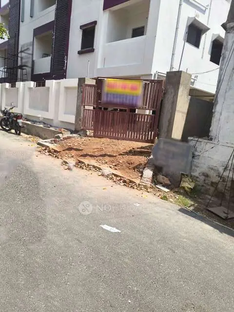
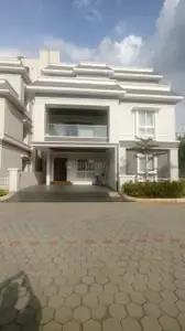
Sree Dharani Heights
SREE DHARANI DEVELOPERS · Rangareddy · RERA P02400004278
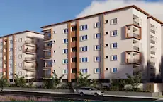
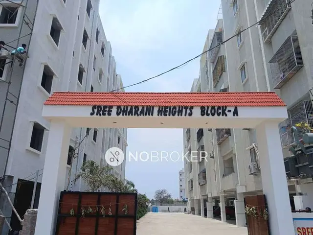
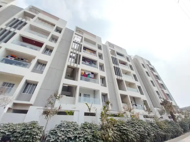
SREE DHARANI HEIGHTS is a residential apartment project in PEDDAAMBERPET, Abdullapurmet, Ranga Reddy. It is being developed by registered promoter SREE DHARANI DEVELOPERS on a site of 2,006.31 sq. m, with one residential building of 1 Stilt + 5 upper floors and 35 3BHK homes. The project is registered with TG-RERA under P02400004278, and the project header lists proposed completion as 08/02/2027.
More from Sree Dharani Developers · 2 projects →
01What we found
Read from TG-RERA filings, approvals, land and registration records and court records. A court case is counted only when the court record states this project's survey number with its village, or names the project.
02Check before you pay
11 items to check before you pay, 4 high - from the title chain, court records and approvals, each with what to ask the builder or your advocate. An item may not be a problem with the project: records can be incomplete.
1. Project at a glance
Project identity
| Field | Project record |
|---|---|
| Registered name | SREE DHARANI HEIGHTS RERA record |
| Project type | Residential apartment project RERA record RERA filing |
| Phase / registered portion | A single residential building is recorded; no phase name or separate phase number is disclosed. RERA filing |
| TG-RERA registration | P02400004278 RERA record |
| Registration validity | 16/03/2022 to 08/10/2026; this is the stated registration period, not the construction-completion deadline. RERA record |
| Registered promoter | SREE DHARANI DEVELOPERS RERA record Corporate record |
| RERA status in the supplied record | New Project; the certificate states registration under section 5. No extension is recorded in the supplied certificate. RERA record |
Land and geographic identity
| Field | Project record |
|---|---|
| Locality / revenue village | PEDDAAMBERPET; the filed plan describes Pedda Amberpet Village and Municipality. RERA record RERA filing |
| Mandal | Abdullapurmet RERA record RERA filing |
| District | Ranga Reddy RERA record RERA filing |
| PIN | 501505 RERA record |
| Project survey identifiers | Sy. No. 592 part; Sy. Nos. 592 and 579; Plot No. 77 in Sy. Nos. 592 and 579. These are the identifiers used in the filed plan and registration record. RERA filing |
| Registered site extent | 2,006.31 sq. m RERA filing |
| Total / net area | Total area 2,006.31 sq. m; net area 2,006.31 sq. m. RERA filing |
| Boundaries filed with RERA | North: 30 FT WIDE ROAD; South: PLOT NO 78; East: PLOT NO 76 AND PLOT NO 78; West: NEIGHBOURS LAND. RERA filing |
Development identity
| Field | Project record |
|---|---|
| Sanctioning authority | HMDA; the building-permit record states plans are to be sanctioned and released by Pedda Amberpet Municipality / Municipal Corporation. Approvals record |
| Principal building approval | Approval No. 010852/BP/HMDA/2234/GHT/2022, dated 21 December, 2022. Approvals record |
| Building / block count | One residential building is recorded. RERA filing |
| Sanctioned configuration | 1 Stilt + 5 upper floors; the supplied permit records a building height of 14.99. No separate basement or podium level is identified in that configuration. |
| Approved built-up area | The HMDA approval records Total Built up Area (In Sq.mts) 6,025.95; it also lists Built up Area 6025.95. |
| RERA-filed unit count | 35 units, in one building; the unit record lists 3BHK. RERA unit table RERA unit details |
| Plan-document parking figures | The supplied plan records PROPOSED NUMBER OF PARKINGS 2; the HMDA permit extraction does not give a parking-space count. |
Offering and status
| Field | Project record |
|---|---|
| Unit type | 3BHK RERA unit table RERA unit details |
| RERA-filed saleable area | 63.04 sq. m RERA unit table RERA unit details |
| Booked / available | 25 booked; 10 available, as last read from the TG-RERA portal. The portal record supplied has no as-of date, so these counts are indicative. RERA unit table RERA unit details |
| Completion deadline | Promoter’s Form B declares completion by 08/10/2026. The project header separately lists proposed completion 08/02/2027; the source data does not identify the latter as an original or revised deadline. RERA record |
| Construction stage | No construction-progress percentage or independently verified site-stage evidence is supplied. RERA amenities Document index |
| Occupancy / completion certificate | No occupancy or completion certificate is included in the supplied project documents. The building-permit record states an Occupancy Certificate is compulsory before occupation. Document index |
2. The project story
SREE DHARANI HEIGHTS is a registered residential apartment project in Pedda Amberpet, Abdullapurmet Mandal, Ranga Reddy District. Its RERA filing identifies land described as open land in Sy. No. 592 part and Plot No. 77 in Sy. Nos. 592 and 579, with a site extent of 2,006.31 sq. m. RERA record RERA filing
The filed building-permit material describes one residential building with stilt parking and five upper floors. The RERA unit record lists 35 3BHK homes; it records 25 as booked and 10 as available, but provides no as-of date for those booking figures. RERA unit table
The supplied documents establish the approval configuration and promoter-declared completion dates, but do not establish current construction progress or that any portion has been completed or occupancy-certified. The project’s registration validity, stated completion deadlines and OC status are separate matters; no OC is present in the supplied record. RERA record Document index
3. Master plan, architecture & building design
The filed plan describes a single residential apartment building on a 2,006.31 sq. m site. The building-permit record states 1 Stilt + 5 upper floors. The revised plan records 35 dwelling units, a proposed coverage area of 1,032.20 sq. m, and vacant plot area of 974.11 sq. m.
Area figures are reported as labelled in the supplied records: the HMDA approval lists total built-up area of 6,025.95 sq. m; the revised plan lists TOTAL PROPOSED BUILT UP AREA EXCLUDING PARKING 4645.67 SQ.MT. and TOTAL PROPOSED BUILT UP AREA INCLUDING PARKING 6026.67 SQ.MT. The plan also lists NET BUA RESIDENTIAL 4530.55 SQ.MT. These are distinct source labels and are not treated here as interchangeable measures.
The revised plan labels a lift and stair, a distribution transformer, sump, septic tank and rainwater harvesting. It does not supply a measured floor-by-floor unit arrangement, lift count or capacity, or detailed internal circulation information in the available extracted data. The supplied plan and permit describe a stilt-and-upper-floor building; no separate basement or podium is identified.
4. Homes, configurations & floor plans
| Configuration | Units | Booked | Available | RERA saleable area | Measured carpet area | Loading (if supplied) |
|---|---|---|---|---|---|---|
| 3BHK | 35 | 25 | 10 | 63.04 sq. m | Not available | Not supplied |
Unit type, count, booking and saleable-area figures are from the TG-RERA unit record; the booking record has no as-of date. RERA unit table RERA unit details
The supplied floor-plan data contains no measured 3BHK carpet-area result. Carpet area and saleable area are different measures: the supplied measurement note describes software-measured carpet area as drawing-based and not a RERA disclosure, while RERA saleable area is the filed figure and includes the home’s share of common areas. No drawing-derived room dimensions or balcony/utility measurements are available here. Floor plans RERA unit details
5. Parking & vehicle circulation
The building-permit record describes the stilt as for vehicle parking. The revised plan lists PROPOSED NUMBER OF PARKINGS 2 and Parking area 1381.00; the supplied extraction does not specify the unit of the parking-area figure.
The records supplied do not establish the final sanctioned space count, visitor or accessible parking provision, EV charging, parking allocation to individual units, or whether any drawn bay is exclusively allocated. The plan labels a 9.00MT WIDE MAINROAD; no detailed driveway, ramp or pedestrian-separation information is available in the extracted material.
6. Amenities, recreation & open spaces
| Description / size | Tot-lot and greenery are listed; the RERA amenities record labels “Green Strip/TOT LOT/Park.” No size is supplied. |
|---|---|
| Evidence source | RERA amenities |
| Declared progress / verified status | Listed in filed plan / RERA amenities; progress shown as 0%. No independent completion evidence supplied. |
| Description / size | Rainwater harvesting structures are listed. |
|---|---|
| Evidence source | RERA amenities |
| Declared progress / verified status | Listed; RERA amenities progress shown as 0%. No independent completion evidence supplied. |
| Description / size | Listed in third-party vendor amenity data only. |
|---|---|
| Evidence source | Promoter website |
| Declared progress / verified status | Not established as a RERA-filed or delivered facility. |
The supplied RERA amenities record also includes community buildings, recreational open space, internal roads and footpaths, street lighting and energy management, with progress shown as 0% for the listed items. Those entries do not establish completion. RERA amenities
7. Utilities, building services & safety
The filed approval and plan records list a transformer, garbage house, rainwater-harvesting structures, septic tank and STP; the revised plan also labels a sump, lift and stair. The HMDA approval calls for STP provision, while the RERA amenities record marks water supply and sewerage-related provision as “YES” and shows 0% progress for the listed amenities. These are recorded provisions, not evidence of completed installation or operational performance. RERA amenities
The plan and approval materials refer to fire-safety requirements and electrical fire-safety conditions. No fire-system equipment schedule, clearance certificate, lift capacity, water-storage capacity, electrical-backup capacity, waste-management operating details, CCTV/access-control specification or accessibility design detail is supplied.
8. Location, access & connectivity
The registered location is PEDDAAMBERPET, Abdullapurmet Mandal, Ranga Reddy District, Telangana, PIN 501505. The filed site boundary identifies a 30 FT WIDE ROAD to the north, and the plan describes a 9.00MT WIDE MAINROAD. RERA record RERA filing
The location record lists the nearest sampled Outer Ring Road interchange at approximately 4.0 km, Ramadevi Public School at 1.0 km, S.G.M Govt Polytechnic at 2.3 km, Urban Primary Health Centre Abdullapur at 2.9 km, and HDFC Bank at 2.8 km. These are location-record distances; no travel times are supplied. Location record
9. Developer & development status
The registered promoter is SREE DHARANI DEVELOPERS, recorded as a partnership. Its GSTIN is 36AEHFS6338C1ZZ. The promoter’s filed address is ROAD NO 1 7TH CROSS, PEDDA AMBERPET, ABDULLAPURMET, Abdullapurmet, Ranga Reddy, 501505. The supplied record does not provide an official contact number, email address or website. Corporate record RERA filing RERA filing
The promoter’s Form B, dated 07-10-2021, declares completion by 08/10/2026. The project header also lists proposed completion as 08/02/2027, without identifying it as an original or revised deadline. No construction-progress percentage or OC is established in the supplied documents. RERA record Document index
10. Approvals, official records & documents
| Identifier / date | P02400004278; issued 16/03/2022, valid through 08/10/2026 |
|---|---|
| Scope and source | Form C registration for SREE DHARANI HEIGHTS. |
| Identifier / date | 003393/BP/HMDA/0394/GHT/2021; dated 16 February, 2022 |
|---|---|
| Scope and source | Building permission for a residential building of 1 Stilt + 5 upper floors; the record names HMDA and Pedda Amberpet Municipality / Municipal Corporation. |
| Identifier / date | 010852/BP/HMDA/2234/GHT/2022; dated 21 December, 2022 |
|---|---|
| Scope and source | Building-construction approval recorded for the project site. |
| Identifier / date | Permit / inward reference TS/070615/2022; plan date 07-11-2022 |
|---|---|
| Scope and source | Revised plan extraction describes 35 dwelling units and the proposed building and area particulars. The extracted plan text does not identify a clearly filled approval number or sanctioning authority. |
| Identifier / date | Dated 07-10-2021 |
|---|---|
| Scope and source | Promoter affidavit containing title, encumbrance and completion declarations. |
| Identifier / date | TG-RERA portal record; no booking-count as-of date supplied |
|---|---|
| Scope and source | Land area, boundaries, unit type and indicative booked/available counts. RERA filing RERA unit table |
The supplied documents do not include an occupancy or completion certificate. The building-permit record states that an Occupancy Certificate is compulsory before occupation.
1. Project at a glance
Project identity
Registered name: SREE DHARANI HEIGHTS
Project type: Residential apartment project
Phase / registered portion: A single residential building is recorded; no phase name or separate phase number is disclosed.
TG-RERA registration: P02400004278
Registration validity: 16/03/2022 to 08/10/2026; this is the stated registration period, not the construction-completion deadline.
Registered promoter: SREE DHARANI DEVELOPERS
RERA status in the supplied record: New Project; the certificate states registration under section 5. No extension is recorded in the supplied certificate.
Land and geographic identity
Locality / revenue village: PEDDAAMBERPET; the filed plan describes Pedda Amberpet Village and Municipality.
Mandal: Abdullapurmet
District: Ranga Reddy
PIN: 501505
Project survey identifiers: Sy. No. 592 part; Sy. Nos. 592 and 579; Plot No. 77 in Sy. Nos. 592 and 579. These are the identifiers used in the filed plan and registration record.
Registered site extent: 2,006.31 sq. m
Total / net area: Total area 2,006.31 sq. m; net area 2,006.31 sq. m.
Boundaries filed with RERA: North: 30 FT WIDE ROAD; South: PLOT NO 78; East: PLOT NO 76 AND PLOT NO 78; West: NEIGHBOURS LAND.
Development identity
Sanctioning authority: HMDA; the building-permit record states plans are to be sanctioned and released by Pedda Amberpet Municipality / Municipal Corporation.
Principal building approval: Approval No. 010852/BP/HMDA/2234/GHT/2022, dated 21 December, 2022.
Building / block count: One residential building is recorded.
Sanctioned configuration: 1 Stilt + 5 upper floors; the supplied permit records a building height of 14.99. No separate basement or podium level is identified in that configuration.
Approved built-up area: The HMDA approval records Total Built up Area (In Sq.mts) 6,025.95; it also lists Built up Area 6025.95.
RERA-filed unit count: 35 units, in one building; the unit record lists 3BHK.
Plan-document parking figures: The supplied plan records PROPOSED NUMBER OF PARKINGS 2; the HMDA permit extraction does not give a parking-space count.
Offering and status
Unit type: 3BHK
RERA-filed saleable area: 63.04 sq. m
Booked / available: 25 booked; 10 available, as last read from the TG-RERA portal. The portal record supplied has no as-of date, so these counts are indicative.
Completion deadline: Promoter’s Form B declares completion by 08/10/2026. The project header separately lists proposed completion 08/02/2027; the source data does not identify the latter as an original or revised deadline.
Construction stage: No construction-progress percentage or independently verified site-stage evidence is supplied.
Occupancy / completion certificate: No occupancy or completion certificate is included in the supplied project documents. The building-permit record states an Occupancy Certificate is compulsory before occupation.
2. The project story
SREE DHARANI HEIGHTS is a registered residential apartment project in Pedda Amberpet, Abdullapurmet Mandal, Ranga Reddy District. Its RERA filing identifies land described as open land in Sy. No. 592 part and Plot No. 77 in Sy. Nos. 592 and 579, with a site extent of 2,006.31 sq. m.
The filed building-permit material describes one residential building with stilt parking and five upper floors. The RERA unit record lists 35 3BHK homes; it records 25 as booked and 10 as available, but provides no as-of date for those booking figures.
The supplied documents establish the approval configuration and promoter-declared completion dates, but do not establish current construction progress or that any portion has been completed or occupancy-certified. The project’s registration validity, stated completion deadlines and OC status are separate matters; no OC is present in the supplied record.
3. Master plan, architecture & building design
The filed plan describes a single residential apartment building on a 2,006.31 sq. m site. The building-permit record states 1 Stilt + 5 upper floors. The revised plan records 35 dwelling units, a proposed coverage area of 1,032.20 sq. m, and vacant plot area of 974.11 sq. m.
Area figures are reported as labelled in the supplied records: the HMDA approval lists total built-up area of 6,025.95 sq. m; the revised plan lists TOTAL PROPOSED BUILT UP AREA EXCLUDING PARKING 4645.67 SQ.MT. and TOTAL PROPOSED BUILT UP AREA INCLUDING PARKING 6026.67 SQ.MT. The plan also lists NET BUA RESIDENTIAL 4530.55 SQ.MT. These are distinct source labels and are not treated here as interchangeable measures.
The revised plan labels a lift and stair, a distribution transformer, sump, septic tank and rainwater harvesting. It does not supply a measured floor-by-floor unit arrangement, lift count or capacity, or detailed internal circulation information in the available extracted data. The supplied plan and permit describe a stilt-and-upper-floor building; no separate basement or podium is identified.
4. Homes, configurations & floor plans
| Configuration | Units | Booked | Available | RERA saleable area | Measured carpet area | Loading (if supplied) |
|---|---|---|---|---|---|---|
| 3BHK | 35 | 25 | 10 | 63.04 sq. m | Not available | Not supplied |
Unit type, count, booking and saleable-area figures are from the TG-RERA unit record; the booking record has no as-of date.
The supplied floor-plan data contains no measured 3BHK carpet-area result. Carpet area and saleable area are different measures: the supplied measurement note describes software-measured carpet area as drawing-based and not a RERA disclosure, while RERA saleable area is the filed figure and includes the home’s share of common areas. No drawing-derived room dimensions or balcony/utility measurements are available here.
5. Parking & vehicle circulation
The building-permit record describes the stilt as for vehicle parking. The revised plan lists PROPOSED NUMBER OF PARKINGS 2 and Parking area 1381.00; the supplied extraction does not specify the unit of the parking-area figure.
The records supplied do not establish the final sanctioned space count, visitor or accessible parking provision, EV charging, parking allocation to individual units, or whether any drawn bay is exclusively allocated. The plan labels a 9.00MT WIDE MAINROAD; no detailed driveway, ramp or pedestrian-separation information is available in the extracted material.
6. Amenities, recreation & open spaces
| Description / size | Tot-lot and greenery are listed; the RERA amenities record labels “Green Strip/TOT LOT/Park.” No size is supplied. |
|---|---|
| Declared progress / verified status | Listed in filed plan / RERA amenities; progress shown as 0%. No independent completion evidence supplied. |
| Description / size | Rainwater harvesting structures are listed. |
|---|---|
| Declared progress / verified status | Listed; RERA amenities progress shown as 0%. No independent completion evidence supplied. |
| Description / size | Listed in third-party vendor amenity data only. |
|---|---|
| Declared progress / verified status | Not established as a RERA-filed or delivered facility. |
The supplied RERA amenities record also includes community buildings, recreational open space, internal roads and footpaths, street lighting and energy management, with progress shown as 0% for the listed items. Those entries do not establish completion.
7. Utilities, building services & safety
The filed approval and plan records list a transformer, garbage house, rainwater-harvesting structures, septic tank and STP; the revised plan also labels a sump, lift and stair. The HMDA approval calls for STP provision, while the RERA amenities record marks water supply and sewerage-related provision as “YES” and shows 0% progress for the listed amenities. These are recorded provisions, not evidence of completed installation or operational performance.
The plan and approval materials refer to fire-safety requirements and electrical fire-safety conditions. No fire-system equipment schedule, clearance certificate, lift capacity, water-storage capacity, electrical-backup capacity, waste-management operating details, CCTV/access-control specification or accessibility design detail is supplied.
8. Location, access & connectivity
The registered location is PEDDAAMBERPET, Abdullapurmet Mandal, Ranga Reddy District, Telangana, PIN 501505. The filed site boundary identifies a 30 FT WIDE ROAD to the north, and the plan describes a 9.00MT WIDE MAINROAD.
The location record lists the nearest sampled Outer Ring Road interchange at approximately 4.0 km, Ramadevi Public School at 1.0 km, S.G.M Govt Polytechnic at 2.3 km, Urban Primary Health Centre Abdullapur at 2.9 km, and HDFC Bank at 2.8 km. These are location-record distances; no travel times are supplied.
9. Developer & development status
The registered promoter is SREE DHARANI DEVELOPERS, recorded as a partnership. Its GSTIN is 36AEHFS6338C1ZZ. The promoter’s filed address is ROAD NO 1 7TH CROSS, PEDDA AMBERPET, ABDULLAPURMET, Abdullapurmet, Ranga Reddy, 501505. The supplied record does not provide an official contact number, email address or website.
The promoter’s Form B, dated 07-10-2021, declares completion by 08/10/2026. The project header also lists proposed completion as 08/02/2027, without identifying it as an original or revised deadline. No construction-progress percentage or OC is established in the supplied documents.
10. Approvals, official records & documents
| Identifier / date | P02400004278; issued 16/03/2022, valid through 08/10/2026 |
|---|---|
| Scope and source | Form C registration for SREE DHARANI HEIGHTS. |
| Identifier / date | 003393/BP/HMDA/0394/GHT/2021; dated 16 February, 2022 |
|---|---|
| Scope and source | Building permission for a residential building of 1 Stilt + 5 upper floors; the record names HMDA and Pedda Amberpet Municipality / Municipal Corporation. |
| Identifier / date | 010852/BP/HMDA/2234/GHT/2022; dated 21 December, 2022 |
|---|---|
| Scope and source | Building-construction approval recorded for the project site. |
| Identifier / date | Permit / inward reference TS/070615/2022; plan date 07-11-2022 |
|---|---|
| Scope and source | Revised plan extraction describes 35 dwelling units and the proposed building and area particulars. The extracted plan text does not identify a clearly filled approval number or sanctioning authority. |
| Identifier / date | Dated 07-10-2021 |
|---|---|
| Scope and source | Promoter affidavit containing title, encumbrance and completion declarations. |
| Identifier / date | TG-RERA portal record; no booking-count as-of date supplied |
|---|---|
| Scope and source | Land area, boundaries, unit type and indicative booked/available counts. |
The supplied documents do not include an occupancy or completion certificate. The building-permit record states that an Occupancy Certificate is compulsory before occupation.
Other registrations of Sree Dharani Heights
Frequently asked questions
Is SREE DHARANI HEIGHTS registered with Telangana RERA?
Yes. SREE DHARANI HEIGHTS is registered with the Telangana Real Estate Regulatory Authority as P02400004278; the registration status is New Project.
Who is the developer of SREE DHARANI HEIGHTS?
The promoter named in the RERA registration is SREE DHARANI DEVELOPERS.
Where is SREE DHARANI HEIGHTS located?
SREE DHARANI HEIGHTS is in ABDULLAPURMET, PEDDAAMBERPET, Rangareddy, Telangana (501505).
When will SREE DHARANI HEIGHTS be completed?
The promoter's proposed date of completion filed with RERA is 08/02/2027. This is the promoter's declaration, not a guarantee.
More projects in Peddaamberpet