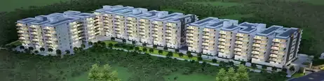
Mantoor Mukunda
MANTOOR INFRASTRUCTURE PVT LTD · Sangareddy · RERA P01100009696
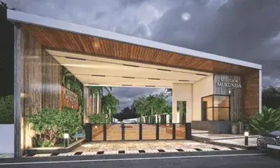
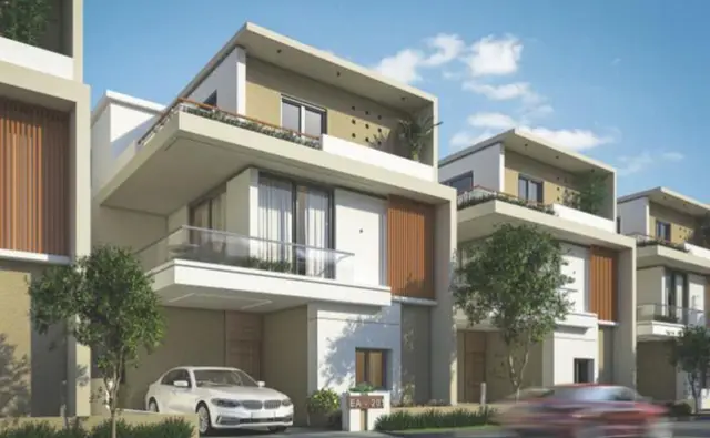
MANTOOR MUKUNDA is a residential villa development in Velimela, RC PURAM mandal, Sangareddy district. It is being developed by the registered promoter MANTOOR INFRASTRUCTURE PVT LTD. The project covers 31,391.70 sq.mts and comprises 86 villas, with 84 “G PLUS TWO VILLA” units, one “G PUS TWO VILLA” and one “G PLUS THREE VILLA”; the HMDA layout record states 3 floors generally. It is registered with TG-RERA as P01100009696, with proposed completion on 22/08/2030.
More from Mantoor Infrastructure Pvt Ltd · 5 projects →
01What we found
Read from TG-RERA filings, approvals, land and registration records and court records. A court case is counted only when the court record states this project's survey number with its village, or names the project.
02Check before you pay
8 items to check before you pay, 5 high - from the title chain, court records and approvals, each with what to ask the builder or your advocate. An item may not be a problem with the project: records can be incomplete.
1. Project at a glance
Project identity
| Field | Record |
|---|---|
| Registered project name | MANTOOR MUKUNDA RERA record |
| Project type | Residential villa development; HMDA filing describes a layout with housing, without gated community. RERA record |
| Phase / registered portion | A separate phase name is not disclosed. TG-RERA registration is for the project on the listed survey lands. |
| TG-RERA registration | P01100009696 |
| Registration validity | 22/04/2025 to 22/04/2030; five years unless extended by the Authority. This is registration validity, not the project completion deadline. |
| Registered promoter | MANTOOR INFRASTRUCTURE PVT LTD |
| RERA status | Registered; certificate is a Form C TG-RERA registration certificate. |
Land and geographic identity
| Field | Record |
|---|---|
| Locality | Velimela RERA record RERA filing |
| Revenue village | Velimela (also rendered as Velimela(TM) in HMDA layout documents) RERA record |
| Mandal | RC PURAM in the TG-RERA project record; HMDA documents state Ramachandrapuram. RERA record |
| District / PIN | Sangareddy / 502300 RERA record |
| Project survey numbers and subdivisions | 266, 267, 268/PART, 269/PART, 270/PART, 397/PART, 398/PART |
| Site area | TG-RERA land details record 31,391.70 sq.mts total area, 2,729.53 sq.mts affected by road widening/FTL of tanks/nala widening, and 28,662.17 sq.mts net area. RERA filing |
| Layout-area breakdown | HMDA layout records 28,807.63 sq.mts as net layout area; the drawing’s area statement separately lists 2,000.01 sq.mts road-widening area and 584.06 sq.mts nala area. |
| Boundaries | North: 40 FEET ROAD; south, east and west: NEIGHBOURE LAND. RERA filing |
Development identity
| Field | Record |
|---|---|
| Sanctioning authority | Hyderabad Metropolitan Development Authority (HMDA) Approvals record |
| Principal approval | 014185/LO/HMDA/3872/SKP/2024, dated 22 April, 2025 in the approval record. Approvals record |
| Approval scope | Layout with housing; the filed record describes residential villa use and 86 plots/villas. |
| Approved built-up area | HMDA filing states 27,721.87 sq.mtrs including parking and 26,504.82 sq.mts excluding parking. |
| Building count / arrangement | The RERA record identifies 86 approved building units; the layout drawing depicts individual villa plots and three-floor villa configurations, not apartment towers. RERA filing |
| Floors / height | The HMDA layout record states 3 floors and 9.60 MT building height generally; it separately lists TYPE 05 BLDG HT: 11.49 MT and other total-height annotations. |
| Parking levels | Not disclosed as a separate parking level. The approval area statement distinguishes built-up area including and excluding parking. |
| Unit counts | 86 approved building units; 86 proposed building units in the RERA land details. RERA filing |
Offering and status
| Field | Record |
|---|---|
| Unit type | Villas. The RERA unit table records 84 “G PLUS TWO VILLA” units, one “G PLUS THREE VILLA,” and one “G PUS TWO VILLA.” RERA unit table |
| RERA-filed saleable area | 316.18 sq.m for 84 “G PLUS TWO VILLA” units; 318.17 sq.m for one “G PUS TWO VILLA”; 692.48 sq.m for one “G PLUS THREE VILLA.” RERA unit table |
| Booked / available | Filing data lists 0 booked and 86 available across the three rows. Booking figures are portal-record figures with no stated as-of date, so treat them as indicative. RERA unit table RERA unit table |
| Construction stage | No reliable current construction-stage or independently verified site-progress record is supplied. The RERA registration is for a new project. RERA record Document index |
| Completion date | The TG-RERA project information states proposed completion 22/08/2030. The Form-B declaration separately undertakes completion by 22/04/2030. RERA filing |
| OC / completion certificate | No occupancy or completion certificate is supplied. The record does not establish that any villa or phase has received one. Document index |
2. The project story
MANTOOR MUKUNDA is a residential villa layout in the registered Velimela project area, covering survey numbers 266, 267, 268/PART, 269/PART, 270/PART, 397/PART and 398/PART. Its registered promoter is MANTOOR INFRASTRUCTURE PVT LTD, and the project is registered with TG-RERA as P01100009696. RERA record
The HMDA layout record provides for 86 plots/villas, with residential building configurations generally described as ground plus two upper floors; a separate Type 14 annotation describes stilt plus three upper floors. The supplied RERA unit data records 86 villas, but does not supply a dependable construction-progress breakdown by villa or phase. Accordingly, the portal’s available-unit counts should not be read as proof that the villas are complete or ready for possession. RERA unit table Document index
3. Master plan, architecture & building design
The HMDA layout drawing describes a residential layout with housing and identifies 86 individual subplots. Its area statement records 28,807.63 sq.m net layout area, comprising 15,419.48 sq.m plotted area, 8,117.34 sq.m roads, 3,607.19 sq.m organized open space/park, 494.94 sq.m utilities and 1,168.47 sq.m buffer zone. The same drawing separately records 31,391.70 sq.m total site area, 2,000.01 sq.m road-widening area and 584.06 sq.m nala area.
The filed building schedule describes three-floor villa types, with a general stated height of 9.60 MT and a separate 11.49 MT annotation for Type 05. A Type 14 annotation states 1 Stilt + 3 upper floors. No apartment-tower arrangement, flats-per-floor schedule, lift or stair details are supplied.
The approved-area figures are reported separately: 27,721.87 sq.m proposed built-up area including parking and 26,504.82 sq.m excluding parking. The layout record also lists 27,721.87 sq.m as total built-up area. These are approval-record figures; no carpet-area schedule is supplied for the villas.
4. Homes, configurations & floor plans
TG-RERA’s unit table records three villa rows. The filing does not provide a recognizable room-configuration description for these rows, so the RERA-filed labels and areas are retained below. RERA unit table RERA unit details
| Configuration (as filed) | Units | Booked | Available | RERA saleable area | Measured carpet area | Loading (if supplied) |
|---|---|---|---|---|---|---|
| G PLUS TWO VILLA | 84 | 0 | 84 | 316.18 sq.m | Not supplied | Not supplied |
| G PUS TWO VILLA | 1 | 0 | 1 | 318.17 sq.m | Not supplied | Not supplied |
| G PLUS THREE VILLA | 1 | 0 | 1 | 692.48 sq.m | Not supplied | Not supplied |
The portal figures show 86 available and zero booked, but have no stated as-of date. The supplied floor-plan review records seven drawings, with two measured and five scans pending; its measured plans are categorized as 1BHK and 2BHK, with no match to the RERA villa configurations. No software-measured carpet area or room dimensions are therefore reported for these villas. RERA unit table Floor plans
Saleable area and carpet area are not interchangeable: the supplied RERA figures are saleable areas, while no verified carpet-area measurements for the listed villas are available. RERA unit table Floor plans
5. Parking & vehicle circulation
The approval record distinguishes 26,504.82 sq.m built-up area excluding parking from 27,721.87 sq.m including parking, but does not provide a reliable parking-space count, parking allocation by villa, visitor or accessible spaces, or a separate parking-level plan. The layout area statement records 0.00 sq.m common parking area.
The layout drawing shows internal roads, including 12.00 mt and 9.00 mt internal roads, and annotations for 30.00MT roads. It does not establish exclusive parking rights for an individual buyer.
6. Amenities, recreation & open spaces
The HMDA layout documents list layout-level facilities and infrastructure. The RERA amenities record marks several infrastructure categories “YES,” but reports 0 progress for the listed items; that is a filed status, not independent confirmation of completion. RERA amenities
| Facility | Description / size | Evidence source | Declared progress / verified status |
|---|---|---|---|
| Park / organized open space | 3,607.19 sq.m | HMDA layout area statement | RERA amenities lists green strip/tot lot/park; progress recorded as 0. Independent completion not verified. RERA amenities |
| Tot-lots | Drawing labels 1,620 sq.m, 977 sq.m and 809 sq.m | Layout drawing | Shown in drawing; no completed status supplied. |
| Clubhouse | Identified as “CLUB HOUSE”; no size or capacity stated | Layout drawing | No progress or completion evidence supplied. |
| Cycle track | Listed as a required layout development feature | HMDA layout approval record | Completion not verified. |
| Community buildings | Listed in RERA amenities | TG-RERA amenities RERA amenities | Progress recorded as 0; completion not verified. |
| Landscaping / green strip | Green strip, avenue plantation and park development are identified | Layout drawing and HMDA record | No completed status supplied. |
7. Utilities, building services & safety
HMDA’s layout record identifies proposed layout services, including internal water-supply lines, an overhead tank and sumps, a protected water-supply system, underground drainage, a common septic tank/STP, storm-water drainage and rainwater-harvesting pits. It also lists electrical supply lines, street lighting, transformers, underground ducting for utilities, solid-waste disposal space and a bio-compost unit. These are approval-record development requirements or plan annotations; the supplied evidence does not establish that they are completed or operational.
The RERA amenities list records water supply, sewerage, storm-water drains, street lighting, water conservation/rainwater harvesting and an electrical meter room/sub-station/receiving station as available “YES,” while showing 0 progress for the listed items. No capacities, supply agreements, commissioning records, lift details, fire-system test records, security arrangements or accessibility plan are supplied. RERA amenities
8. Location, access & connectivity
The registered location is Velimela, RC PURAM mandal, Sangareddy district, PIN 502300. The site boundary information identifies a 40 FEET ROAD to the north. The layout drawing also labels proposed and existing 30-metre, 12-metre and 9-metre roads, along with 40-foot and 30-foot roads; these are drawing annotations, not a statement of current public-road access conditions. RERA record RERA filing
The supplied location data identifies the Financial District (Nanakramguda) at 1.2 km from the cadastral parcel centroid. No other independently measured distances or verified public-transport details are provided. Location record
9. Developer & development status
The registered promoter is MANTOOR INFRASTRUCTURE PVT LTD, a company. The supplied corporate identifier is CIN U45400TG2015PTC099325; the GSTIN is 36AAJCM7975J2ZO. The project record lists MANTOOR RAVINDER REDDY as Managing Director/authorized signatory and GIRIDHAR REDDY PEDDAMANTOOR as director. Corporate record Parties record
The promoter’s project address in the filing is Maa Sai Nilayam, Mumbai Highway, Madeenaguda, with the project locality shown as Velimela, RC PURAM, Sangareddy, PIN 502300. The registration certificate gives the promoter’s address as Miyapur, Serilingampally, Ranga Reddy district, PIN 500049. No official promoter contact details are supplied here. Parties record
The RERA record labels the project “New Project.” Current construction progress and villa-by-villa completion are not established by the supplied material. The project information gives a proposed completion date of 22/08/2030; the Form-B affidavit records a completion undertaking of 22/04/2030. RERA record RERA filing
10. Approvals, official records & documents
| Record | What the supplied evidence establishes |
|---|---|
| TG-RERA registration certificate — P01100009696 | Form C certificate for MANTOOR MUKUNDA; validity 22/04/2025–22/04/2030. |
| HMDA principal layout approval — 014185/LO/HMDA/3872/SKP/2024 | Approval record dated 22 April, 2025, covering the residential layout with housing and 86 plots/villas. |
| HMDA layout drawing | Provides layout area statement, plot count, road annotations, open-space and utility areas, and building/floor annotations. |
| HMDA draft layout letter and related approval records | Supplied records identify HMDA as authority and include layout and infrastructure conditions. |
| HMDA mortgage letter | Records Plot/Villa Nos. 81 to 85, stated as 698.06 sq.m, mortgaged in favour of the Metropolitan Commissioner, HMDA. |
| Form-B promoter declaration | Declares a legal-title basis, land free of encumbrances, project-fund undertakings and completion by 22/04/2030. This is a promoter declaration. |
| Occupancy/completion certificate | Not supplied; no OC or completion-certified scope is established in the reviewed material. Document index |
| Commencement certificates | No separate project commencement certificate is established by the supplied extracts; the uploaded items labelled “Commencement Certificates” contain HMDA layout/mortgage material. Document index |
The HMDA layout record lists requirements for internal roads, drainage, water supply, sewage treatment, rainwater harvesting, lighting, park development and utility infrastructure. Their listing in the approval documents should not be read as evidence that the works have been completed.
1. Project at a glance
Project identity
Registered project name: MANTOOR MUKUNDA
Project type: Residential villa development; HMDA filing describes a layout with housing, without gated community.
Phase / registered portion: A separate phase name is not disclosed. TG-RERA registration is for the project on the listed survey lands.
TG-RERA registration: P01100009696
Registration validity: 22/04/2025 to 22/04/2030; five years unless extended by the Authority. This is registration validity, not the project completion deadline.
Registered promoter: MANTOOR INFRASTRUCTURE PVT LTD
RERA status: Registered; certificate is a Form C TG-RERA registration certificate.
Land and geographic identity
Locality: Velimela
Revenue village: Velimela (also rendered as Velimela(TM) in HMDA layout documents)
Mandal: RC PURAM in the TG-RERA project record; HMDA documents state Ramachandrapuram.
District / PIN: Sangareddy / 502300
Project survey numbers and subdivisions: 266, 267, 268/PART, 269/PART, 270/PART, 397/PART, 398/PART
Site area: TG-RERA land details record 31,391.70 sq.mts total area, 2,729.53 sq.mts affected by road widening/FTL of tanks/nala widening, and 28,662.17 sq.mts net area.
Layout-area breakdown: HMDA layout records 28,807.63 sq.mts as net layout area; the drawing’s area statement separately lists 2,000.01 sq.mts road-widening area and 584.06 sq.mts nala area.
Boundaries: North: 40 FEET ROAD; south, east and west: NEIGHBOURE LAND.
Development identity
Sanctioning authority: Hyderabad Metropolitan Development Authority (HMDA)
Principal approval: 014185/LO/HMDA/3872/SKP/2024, dated 22 April, 2025 in the approval record.
Approval scope: Layout with housing; the filed record describes residential villa use and 86 plots/villas.
Approved built-up area: HMDA filing states 27,721.87 sq.mtrs including parking and 26,504.82 sq.mts excluding parking.
Building count / arrangement: The RERA record identifies 86 approved building units; the layout drawing depicts individual villa plots and three-floor villa configurations, not apartment towers.
Floors / height: The HMDA layout record states 3 floors and 9.60 MT building height generally; it separately lists TYPE 05 BLDG HT: 11.49 MT and other total-height annotations.
Parking levels: Not disclosed as a separate parking level. The approval area statement distinguishes built-up area including and excluding parking.
Unit counts: 86 approved building units; 86 proposed building units in the RERA land details.
Offering and status
Unit type: Villas. The RERA unit table records 84 “G PLUS TWO VILLA” units, one “G PLUS THREE VILLA,” and one “G PUS TWO VILLA.”
RERA-filed saleable area: 316.18 sq.m for 84 “G PLUS TWO VILLA” units; 318.17 sq.m for one “G PUS TWO VILLA”; 692.48 sq.m for one “G PLUS THREE VILLA.”
Booked / available: Filing data lists 0 booked and 86 available across the three rows. Booking figures are portal-record figures with no stated as-of date, so treat them as indicative.
Construction stage: No reliable current construction-stage or independently verified site-progress record is supplied. The RERA registration is for a new project.
Completion date: The TG-RERA project information states proposed completion 22/08/2030. The Form-B declaration separately undertakes completion by 22/04/2030.
OC / completion certificate: No occupancy or completion certificate is supplied. The record does not establish that any villa or phase has received one.
2. The project story
MANTOOR MUKUNDA is a residential villa layout in the registered Velimela project area, covering survey numbers 266, 267, 268/PART, 269/PART, 270/PART, 397/PART and 398/PART. Its registered promoter is MANTOOR INFRASTRUCTURE PVT LTD, and the project is registered with TG-RERA as P01100009696.
The HMDA layout record provides for 86 plots/villas, with residential building configurations generally described as ground plus two upper floors; a separate Type 14 annotation describes stilt plus three upper floors. The supplied RERA unit data records 86 villas, but does not supply a dependable construction-progress breakdown by villa or phase. Accordingly, the portal’s available-unit counts should not be read as proof that the villas are complete or ready for possession.
3. Master plan, architecture & building design
The HMDA layout drawing describes a residential layout with housing and identifies 86 individual subplots. Its area statement records 28,807.63 sq.m net layout area, comprising 15,419.48 sq.m plotted area, 8,117.34 sq.m roads, 3,607.19 sq.m organized open space/park, 494.94 sq.m utilities and 1,168.47 sq.m buffer zone. The same drawing separately records 31,391.70 sq.m total site area, 2,000.01 sq.m road-widening area and 584.06 sq.m nala area.
The filed building schedule describes three-floor villa types, with a general stated height of 9.60 MT and a separate 11.49 MT annotation for Type 05. A Type 14 annotation states 1 Stilt + 3 upper floors. No apartment-tower arrangement, flats-per-floor schedule, lift or stair details are supplied.
The approved-area figures are reported separately: 27,721.87 sq.m proposed built-up area including parking and 26,504.82 sq.m excluding parking. The layout record also lists 27,721.87 sq.m as total built-up area. These are approval-record figures; no carpet-area schedule is supplied for the villas.
4. Homes, configurations & floor plans
TG-RERA’s unit table records three villa rows. The filing does not provide a recognizable room-configuration description for these rows, so the RERA-filed labels and areas are retained below.
| Configuration (as filed) | Units | Booked | Available | RERA saleable area | Measured carpet area | Loading (if supplied) |
|---|---|---|---|---|---|---|
| G PLUS TWO VILLA | 84 | 0 | 84 | 316.18 sq.m | Not supplied | Not supplied |
| G PUS TWO VILLA | 1 | 0 | 1 | 318.17 sq.m | Not supplied | Not supplied |
| G PLUS THREE VILLA | 1 | 0 | 1 | 692.48 sq.m | Not supplied | Not supplied |
The portal figures show 86 available and zero booked, but have no stated as-of date. The supplied floor-plan review records seven drawings, with two measured and five scans pending; its measured plans are categorized as 1BHK and 2BHK, with no match to the RERA villa configurations. No software-measured carpet area or room dimensions are therefore reported for these villas.
Saleable area and carpet area are not interchangeable: the supplied RERA figures are saleable areas, while no verified carpet-area measurements for the listed villas are available.
5. Parking & vehicle circulation
The approval record distinguishes 26,504.82 sq.m built-up area excluding parking from 27,721.87 sq.m including parking, but does not provide a reliable parking-space count, parking allocation by villa, visitor or accessible spaces, or a separate parking-level plan. The layout area statement records 0.00 sq.m common parking area.
The layout drawing shows internal roads, including 12.00 mt and 9.00 mt internal roads, and annotations for 30.00MT roads. It does not establish exclusive parking rights for an individual buyer.
6. Amenities, recreation & open spaces
The HMDA layout documents list layout-level facilities and infrastructure. The RERA amenities record marks several infrastructure categories “YES,” but reports 0 progress for the listed items; that is a filed status, not independent confirmation of completion.
| Facility | Description / size | Evidence source | Declared progress / verified status |
|---|---|---|---|
| Park / organized open space | 3,607.19 sq.m | HMDA layout area statement | RERA amenities lists green strip/tot lot/park; progress recorded as 0. Independent completion not verified. |
| Tot-lots | Drawing labels 1,620 sq.m, 977 sq.m and 809 sq.m | Layout drawing | Shown in drawing; no completed status supplied. |
| Clubhouse | Identified as “CLUB HOUSE”; no size or capacity stated | Layout drawing | No progress or completion evidence supplied. |
| Cycle track | Listed as a required layout development feature | HMDA layout approval record | Completion not verified. |
| Community buildings | Listed in RERA amenities | TG-RERA amenities | Progress recorded as 0; completion not verified. |
| Landscaping / green strip | Green strip, avenue plantation and park development are identified | Layout drawing and HMDA record | No completed status supplied. |
7. Utilities, building services & safety
HMDA’s layout record identifies proposed layout services, including internal water-supply lines, an overhead tank and sumps, a protected water-supply system, underground drainage, a common septic tank/STP, storm-water drainage and rainwater-harvesting pits. It also lists electrical supply lines, street lighting, transformers, underground ducting for utilities, solid-waste disposal space and a bio-compost unit. These are approval-record development requirements or plan annotations; the supplied evidence does not establish that they are completed or operational.
The RERA amenities list records water supply, sewerage, storm-water drains, street lighting, water conservation/rainwater harvesting and an electrical meter room/sub-station/receiving station as available “YES,” while showing 0 progress for the listed items. No capacities, supply agreements, commissioning records, lift details, fire-system test records, security arrangements or accessibility plan are supplied.
8. Location, access & connectivity
The registered location is Velimela, RC PURAM mandal, Sangareddy district, PIN 502300. The site boundary information identifies a 40 FEET ROAD to the north. The layout drawing also labels proposed and existing 30-metre, 12-metre and 9-metre roads, along with 40-foot and 30-foot roads; these are drawing annotations, not a statement of current public-road access conditions.
The supplied location data identifies the Financial District (Nanakramguda) at 1.2 km from the cadastral parcel centroid. No other independently measured distances or verified public-transport details are provided.
9. Developer & development status
The registered promoter is MANTOOR INFRASTRUCTURE PVT LTD, a company. The supplied corporate identifier is CIN U45400TG2015PTC099325; the GSTIN is 36AAJCM7975J2ZO. The project record lists MANTOOR RAVINDER REDDY as Managing Director/authorized signatory and GIRIDHAR REDDY PEDDAMANTOOR as director.
The promoter’s project address in the filing is Maa Sai Nilayam, Mumbai Highway, Madeenaguda, with the project locality shown as Velimela, RC PURAM, Sangareddy, PIN 502300. The registration certificate gives the promoter’s address as Miyapur, Serilingampally, Ranga Reddy district, PIN 500049. No official promoter contact details are supplied here.
The RERA record labels the project “New Project.” Current construction progress and villa-by-villa completion are not established by the supplied material. The project information gives a proposed completion date of 22/08/2030; the Form-B affidavit records a completion undertaking of 22/04/2030.
10. Approvals, official records & documents
TG-RERA registration certificate — P01100009696: Form C certificate for MANTOOR MUKUNDA; validity 22/04/2025–22/04/2030.
HMDA principal layout approval — 014185/LO/HMDA/3872/SKP/2024: Approval record dated 22 April, 2025, covering the residential layout with housing and 86 plots/villas.
HMDA layout drawing: Provides layout area statement, plot count, road annotations, open-space and utility areas, and building/floor annotations.
HMDA draft layout letter and related approval records: Supplied records identify HMDA as authority and include layout and infrastructure conditions.
HMDA mortgage letter: Records Plot/Villa Nos. 81 to 85, stated as 698.06 sq.m, mortgaged in favour of the Metropolitan Commissioner, HMDA.
Form-B promoter declaration: Declares a legal-title basis, land free of encumbrances, project-fund undertakings and completion by 22/04/2030. This is a promoter declaration.
Occupancy/completion certificate: Not supplied; no OC or completion-certified scope is established in the reviewed material.
Commencement certificates: No separate project commencement certificate is established by the supplied extracts; the uploaded items labelled “Commencement Certificates” contain HMDA layout/mortgage material.
The HMDA layout record lists requirements for internal roads, drainage, water supply, sewage treatment, rainwater harvesting, lighting, park development and utility infrastructure. Their listing in the approval documents should not be read as evidence that the works have been completed.
Frequently asked questions
Is MANTOOR MUKUNDA registered with Telangana RERA?
Yes. MANTOOR MUKUNDA is registered with the Telangana Real Estate Regulatory Authority as P01100009696; the registration status is New Project.
Who is the developer of MANTOOR MUKUNDA?
The promoter named in the RERA registration is MANTOOR INFRASTRUCTURE PVT LTD.
Where is MANTOOR MUKUNDA located?
MANTOOR MUKUNDA is in VELIMELA, RC PURAM, Sangareddy, Telangana (502300).
When will MANTOOR MUKUNDA be completed?
The promoter's proposed date of completion filed with RERA is 22/08/2030. This is the promoter's declaration, not a guarantee.
More projects in Velimela