Sgd Elite
SGD INFRA · Rangareddy · RERA P02400010237
SGD ELITE is a plotted development in Chinthapalliguda village, Ibrahimpatnam mandal, Ranga Reddy district, developed by registered promoter SGD INFRA. The layout covers a total area of 63816.17 sq.m, with a net layout area of 62845.47 sq.m, and the filed plan identifies 213 residential plots; building and floor configurations are not applicable. The project is registered with TG-RERA under P02400010237, and the promoter’s Form B undertaking states completion by 14.10.2028.
01What we found
Read from TG-RERA filings, approvals, land and registration records and court records. A court case is counted only when the court record states this project's survey number with its village, or names the project.
02Check before you pay
10 items to check before you pay, 3 high - from the title chain, court records and approvals, each with what to ask the builder or your advocate. An item may not be a problem with the project: records can be incomplete.
1. Project at a glance
Project identity
| Field | Project record |
|---|---|
| Registered project name | SGD ELITE RERA record |
| Project type | Plotted development / residential open-plot layout RERA record |
| Phase or registered portion | Phase not disclosed; registration identifies the layout across the survey references listed below |
| TG-RERA registration | P02400010237 RERA record |
| Registration validity | 14 October 2025–14 October 2028, unless extended by the Authority RERA record |
| Registered promoter | SGD INFRA, identified as a partnership in the project filing RERA record RERA filing |
| RERA status | Registered project; the certificate records a three-year registration period |
Land and geographic identity
| Field | Project record |
|---|---|
| Locality and revenue village | CHITHAPALLY GUDA VILLAGE; the RERA certificate also renders the village as Chinthapalliguda RERA filing |
| Mandal | Ibrahimpatnam RERA record |
| District | Ranga Reddy RERA record |
| PIN | 501510 RERA record |
| Project survey numbers | 15 PART, 18 PART, 19 PART, 20 PART, 40 PART and 41 PART |
| Registered site extent | Total layout area 63816.17 sq.m; net layout area 62845.47 sq.m |
| Boundaries recorded in RERA filing | East: OTHERS LAND; West: OWNERS RETAINED LAND; North: OTHERS LAND; South: OTHERS LAND RERA filing |
Development identity
| Field | Project record |
|---|---|
| Sanctioning authority | Hyderabad Metropolitan Development Authority (HMDA) |
| Principal layout permit | 0800/HMDA/SWDL/2025, dated 14/10/2025; the filed document is described as a DRAFT LAYOUT LETTER RERA record |
| Application/file reference | 003161/HMDA/00908/SWDL/SHZ/2025 |
| Plots shown | 213 plots in the filed layout-plan extraction Layout record |
| Approved built-up area | 37465.4 sq.m is recorded in the RERA land/built-up-area fields; the layout document separately labels 37465.40 sq.m as plotted area RERA filing |
| Buildings / floors | Not applicable to the plotted-layout offering; no building or floor configuration is disclosed in the supplied project records |
| Common parking | Layout-plan extraction records 0.00 sq.m common parking area |
Offering and status
| Field | Project record |
|---|---|
| Offering | Residential plots; plot schedule extraction identifies 213 plots Layout record |
| Plot-size range | Software-measured from the approved layout drawing: 126.25–622.91 sq.m (151–745 sq.yd); drawing-derived values should be checked against the drawing Layout record |
| Booked / available plots | Not disclosed in the supplied records Document index |
| Development stage | RERA registration records a “New Project”; the HMDA-filed layout letter is a draft-layout permission requiring development works and later final-layout release. Physical progress is not independently established by the supplied evidence RERA record |
| Completion deadline | The promoter’s Form B undertaking states completion by 14.10.2028 |
| Registration end date | 14 October 2028, unless extended by TG-RERA |
| Completion / occupancy certificate | No completion certificate or occupancy certificate is supplied for the layout; the layout letter sets out later completion and occupancy-certificate requirements |
2. The project story
SGD ELITE is registered with TG-RERA as a plotted-development project in Chinthapalliguda village, Ibrahimpatnam mandal, Ranga Reddy district. The registered land references are Survey Nos. 15 PART, 18 PART, 19 PART, 20 PART, 40 PART and 41 PART. The filing identifies a net layout area of 62845.47 sq.m within a total layout area of 63816.17 sq.m.
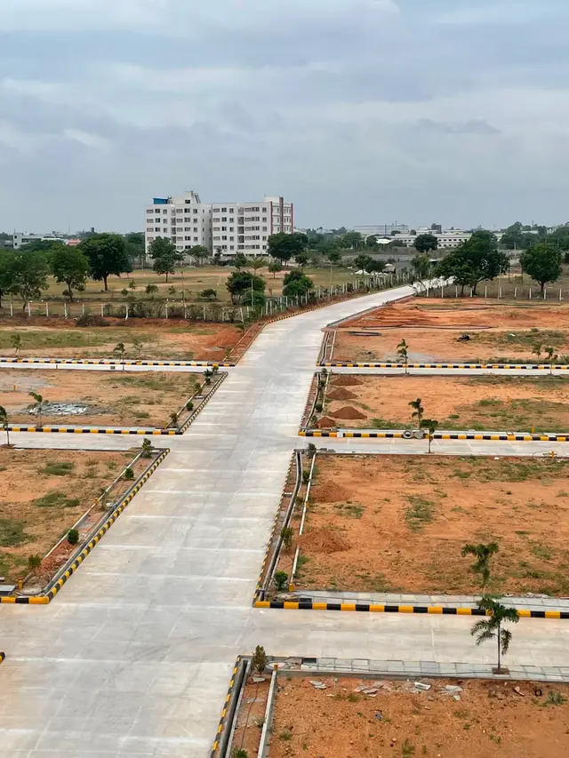
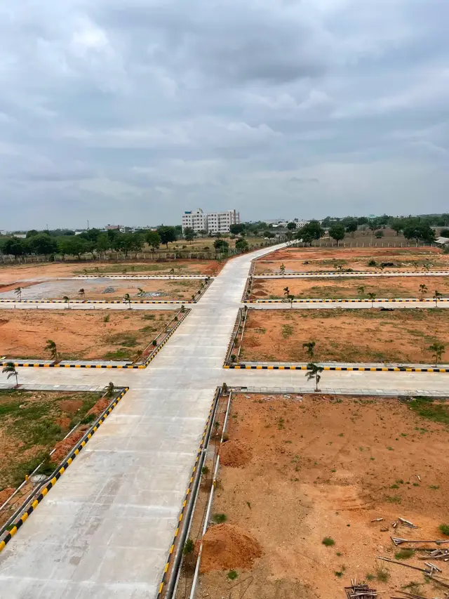
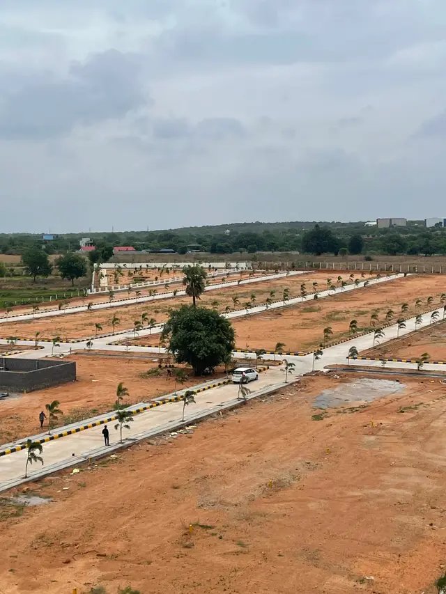
The HMDA-filed layout record shows a residential open-plot arrangement with 213 plots, internal roads, open-space/park areas, social-infrastructure land and utility land. The submitted HMDA document is identified as a draft layout letter: it permits development subject to stated conditions, requires infrastructure works and the transfer of specified roads and open spaces before release of the final layout, and does not itself establish title.
The promoter’s Form B declares a completion date of 14.10.2028. That is a promoter undertaking, not independently verified construction progress. The supplied records do not establish the current on-site completion of roads, parks, utilities or other works, and do not include a final-layout release or completion/occupancy certificate.
3. Master plan, architecture & building design
This is a plotted layout, not a multi-storey residential building. The filed layout schedule identifies 213 plots; the software-measured drawing extraction reports plot sizes from 126.25 sq.m (151 sq.yd) to 622.91 sq.m (745 sq.yd), with a median of 167.23 sq.m (200 sq.yd). These are drawing-derived measurements and should be verified against the approved drawing. Layout record
The HMDA-filed layout area statement records 63816.17 sq.m total layout area and 62845.47 sq.m net layout area. Its listed land-use components include plotted area of 37465.40 sq.m (59.62%), roads of 17517.13 sq.m (27.87%), open space of 4837.15 sq.m (7.70%), social infrastructure of 1631.55 sq.m (2.60%), and utilities of 618.79 sq.m (0.98%). The drawing extraction also lists 775.43 sq.m as buffer area and records 490.77 sq.m as road widening.
The layout document identifies open-space/park portions of 1384.52 sq.m, 3201.14 sq.m and 251.49 sq.m. It also labels public utility, STP, sump, transformer, green-belt/buffer references and a cycling track in the drawing-derived features. These are plan labels; the evidence supplied does not establish that the facilities have been completed.
The filed drawing lists a 30.0 m proposed road, a 10.06 m existing road, a 15 m wide main road, and internal approach-road widths of 9.14 m and 12.15 m. Other road-width labels appear in the drawing extraction; the exact alignment and applicability of each label should be read from the plan itself.
4. Homes, configurations & floor plans
The registered offering is plots rather than apartments. The supplied layout schedule identifies 213 plots; no booked or available inventory count is provided. Plot sizes measured from the drawing are software-derived, not RERA-filed saleable or carpet areas. Layout record
| Plot-size band (sq.yd) | Plot-size band (sq.m) | Plots |
|---|---|---|
| 150–200 | 125–167 | 104 |
| 200–250 | 167–209 | 63 |
| 250–300 | 209–251 | 18 |
| 300–400 | 251–334 | 24 |
| 400–500 | 334–418 | 1 |
| 500–1000 | 418–836 | 3 |
The measured drawing extraction lists a smallest plot size of 126.25 sq.m (151.0 sq.yd), a median of 167.23 sq.m (200.0 sq.yd) and a largest of 622.91 sq.m (745.0 sq.yd). These are software-measured values and should be checked against the layout drawing. No apartment configurations, carpet areas, saleable areas, or loading figures are applicable or disclosed for this plotted offering. Layout record
5. Parking & vehicle circulation
The HMDA-filed layout area statement records 0.00 sq.m as common parking area. The supplied records do not establish designated resident or visitor parking, parking-space counts, individual plot parking allocations, or exclusive parking rights.
The layout plan includes internal roads and approach-road widths, including 15 m for the main road and 9.14 m and 12.15 m for main internal approach roads. The plan also identifies a proposed 30.0 m road and an existing 10.06 m road. No specific vehicle-entry/exit design, pedestrian separation, or EV-facility provision for this plotted layout is established in the supplied project evidence.
6. Amenities, recreation & open spaces
The HMDA-filed layout identifies open-space/park areas, social infrastructure, utilities and a cycling track. Separately, the RERA amenities data marks internal roads and footpaths, water supply, a green strip/tot-lot/park, street lighting and rainwater harvesting as available; the recorded progress percentages are 0. “Available” is a filed status, not independent confirmation of delivery. RERA amenities
| Description / size | 4837.15 sq.m total; listed portions are 1384.52 sq.m, 3201.14 sq.m and 251.49 sq.m |
|---|---|
| Evidence source | HMDA-filed layout |
| Declared progress / verified status | Shown in layout; completion not independently verified |
| Description / size | 1631.55 sq.m |
|---|---|
| Evidence source | HMDA-filed layout |
| Declared progress / verified status | Allocated in layout; specific completed facility not established |
| Description / size | Identified on layout drawing; no size supplied |
|---|---|
| Evidence source | HMDA-filed layout |
| Declared progress / verified status | Drawing label; completion not independently verified |
| Description / size | No total length or completed area supplied |
|---|---|
| Evidence source | RERA amenities; HMDA-filed layout RERA amenities |
| Declared progress / verified status | Marked available; progress recorded as 0; not independently verified |
| Description / size | No separate size supplied beyond layout open-space areas |
|---|---|
| Evidence source | RERA amenities; HMDA-filed layout RERA amenities |
| Declared progress / verified status | Marked available; progress recorded as 0; not independently verified |
| Description / size | No quantity or specification supplied |
|---|---|
| Evidence source | RERA amenities RERA amenities |
| Declared progress / verified status | Marked available; progress recorded as 0; not independently verified |
| Description / size | No capacity or source stated in the amenities entry |
|---|---|
| Evidence source | RERA amenities RERA amenities |
| Declared progress / verified status | Marked available; progress recorded as 0; not independently verified |
| Description / size | No quantity or capacity supplied |
|---|---|
| Evidence source | RERA amenities; HMDA-filed conditions RERA amenities |
| Declared progress / verified status | Marked available; progress recorded as 0; not independently verified |
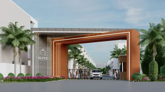
The promoter’s website-derived vendor information additionally lists a clubhouse, swimming pool, entrance arch, landscaped gardens, children’s play areas, walking tracks and community spaces. These are promoter-marketed claims and are not established by the supplied HMDA layout approval or RERA progress data. Promoter website
7. Utilities, building services & safety
The HMDA-filed layout letter lists infrastructure and utility provisions including internal water-supply pipelines, an overhead tank, potable/drinking-water supply, electrical supply lines, street lights, a transformer, underground drainage, storm-water drains, rainwater-harvesting pits, and solid-waste/bio-compost provisions. The layout-derived labels also include an STP and sump. These are proposed or plan-listed provisions; capacities, operational status and independent completion verification are not supplied.
The RERA amenities data marks water supply, sewerage, storm-water drains, street lighting, solid-waste management, sewage treatment and disposal, water conservation/rainwater harvesting, energy management, fire safety and electrical/substation facilities as amenity categories, but does not provide technical specifications or completion evidence for these items. RERA amenities
The HMDA-filed conditions require development of the layout and its infrastructure, including rainwater-harvesting structures and a transformer space, and set out requirements concerning fire safety, services, and later completion/occupancy certification. These conditions describe obligations and approvals to be addressed; they do not demonstrate that the relevant works or clearances have been completed.
8. Location, access & connectivity
The registered location is Chinthapalliguda, Ibrahimpatnam mandal, Ranga Reddy district, PIN 501510. The project’s filed address also uses “CHITHAPALLY GUDA VILLAGE.” RERA record
The layout drawing identifies an existing 10.06 m road, a proposed 30.0 m road, a 15 m main road, and internal approach roads labelled 9.14 m and 12.15 m. The location dataset records the nearest sampled Outer Ring Road interchange at 11.8 km (approx.). Location record
The promoter’s website-derived material describes the project as near Bonguloor Junction / ORR Exit No. 12 and gives travel-time claims for nearby destinations. Those are promoter-marketed claims; no travel times are independently verified in the supplied location evidence. Promoter website
9. Developer & development status
The registered promoter is SGD INFRA, identified in the RERA filing as a partnership. The filing gives GSTIN 36AFQFS3833L1ZT. The project’s RERA registration certificate lists the promoter at Himayatha Nagar, Hyderabad, 500029; the project filing gives a project-related address at BABUKHAN ESTATES, SHOP NO 170, FIRST FLOOR, Chithapally Guda Village, Ibrahimpatnam, Ranga Reddy, 501510. RERA filing Corporate record RERA record
The promoter’s Form B, signed for SGD INFRA by its representative, declares that the project will be completed by 14.10.2028. The registration certificate is valid through 14 October 2028, unless extended by TG-RERA. These dates are distinct: the first is the promoter’s declared completion undertaking, while the second is the registration-validity period. The supplied records do not establish site progress or a completion/occupancy certificate.
10. Approvals, official records & documents
| Record | Supplied evidence and scope |
|---|---|
| TG-RERA registration | Form C certificate for SGD ELITE, registration P02400010237, naming SGD INFRA as promoter; valid 14/10/2025–14/10/2028, unless extended |
| HMDA layout permit | 0800/HMDA/SWDL/2025, approved 14/10/2025; filed record describes a draft open-plot layout covering the project survey numbers |
| HMDA application/file | 003161/HMDA/00908/SWDL/SHZ/2025 |
| Layout drawing and area statement | Filed drawing identifies 213 plots, plot/road/open-space/social-infrastructure/utility areas, and road widths |
| Layout conditions and reserved plots | HMDA-filed draft layout letter records 44 mortgaged plots in favour of the Metropolitan Commissioner, HMDA, and states that final-layout release follows completion of works and specified handovers |
| Road-affected area gift deed | The layout extraction identifies Gift Deed No. 14973/2025 for road-affected land; the supplied HMDA extraction records 490.67 sq.m |
| Promoter declaration | Form B declares the promoter’s title basis, encumbrance position and completion undertaking; it is a promoter declaration |
| Completion / occupancy record | No project completion certificate, occupancy certificate or final-layout release document is included in the supplied evidence Document index |
1. Project at a glance
Project identity
Registered project name: SGD ELITE
Project type: Plotted development / residential open-plot layout
Phase or registered portion: Phase not disclosed; registration identifies the layout across the survey references listed below
TG-RERA registration: P02400010237
Registration validity: 14 October 2025–14 October 2028, unless extended by the Authority
Registered promoter: SGD INFRA, identified as a partnership in the project filing
RERA status: Registered project; the certificate records a three-year registration period
Land and geographic identity
Locality and revenue village: CHITHAPALLY GUDA VILLAGE; the RERA certificate also renders the village as Chinthapalliguda
Mandal: Ibrahimpatnam
District: Ranga Reddy
PIN: 501510
Project survey numbers: 15 PART, 18 PART, 19 PART, 20 PART, 40 PART and 41 PART
Registered site extent: Total layout area 63816.17 sq.m; net layout area 62845.47 sq.m
Boundaries recorded in RERA filing: East: OTHERS LAND; West: OWNERS RETAINED LAND; North: OTHERS LAND; South: OTHERS LAND
Development identity
Sanctioning authority: Hyderabad Metropolitan Development Authority (HMDA)
Principal layout permit: 0800/HMDA/SWDL/2025, dated 14/10/2025; the filed document is described as a DRAFT LAYOUT LETTER
Application/file reference: 003161/HMDA/00908/SWDL/SHZ/2025
Plots shown: 213 plots in the filed layout-plan extraction
Approved built-up area: 37465.4 sq.m is recorded in the RERA land/built-up-area fields; the layout document separately labels 37465.40 sq.m as plotted area
Buildings / floors: Not applicable to the plotted-layout offering; no building or floor configuration is disclosed in the supplied project records
Common parking: Layout-plan extraction records 0.00 sq.m common parking area
Offering and status
Offering: Residential plots; plot schedule extraction identifies 213 plots
Plot-size range: Software-measured from the approved layout drawing: 126.25–622.91 sq.m (151–745 sq.yd); drawing-derived values should be checked against the drawing
Booked / available plots: Not disclosed in the supplied records
Development stage: RERA registration records a “New Project”; the HMDA-filed layout letter is a draft-layout permission requiring development works and later final-layout release. Physical progress is not independently established by the supplied evidence
Completion deadline: The promoter’s Form B undertaking states completion by 14.10.2028
Registration end date: 14 October 2028, unless extended by TG-RERA
Completion / occupancy certificate: No completion certificate or occupancy certificate is supplied for the layout; the layout letter sets out later completion and occupancy-certificate requirements
2. The project story
SGD ELITE is registered with TG-RERA as a plotted-development project in Chinthapalliguda village, Ibrahimpatnam mandal, Ranga Reddy district. The registered land references are Survey Nos. 15 PART, 18 PART, 19 PART, 20 PART, 40 PART and 41 PART. The filing identifies a net layout area of 62845.47 sq.m within a total layout area of 63816.17 sq.m.
The HMDA-filed layout record shows a residential open-plot arrangement with 213 plots, internal roads, open-space/park areas, social-infrastructure land and utility land. The submitted HMDA document is identified as a draft layout letter: it permits development subject to stated conditions, requires infrastructure works and the transfer of specified roads and open spaces before release of the final layout, and does not itself establish title.
The promoter’s Form B declares a completion date of 14.10.2028. That is a promoter undertaking, not independently verified construction progress. The supplied records do not establish the current on-site completion of roads, parks, utilities or other works, and do not include a final-layout release or completion/occupancy certificate.
3. Master plan, architecture & building design
This is a plotted layout, not a multi-storey residential building. The filed layout schedule identifies 213 plots; the software-measured drawing extraction reports plot sizes from 126.25 sq.m (151 sq.yd) to 622.91 sq.m (745 sq.yd), with a median of 167.23 sq.m (200 sq.yd). These are drawing-derived measurements and should be verified against the approved drawing.
The HMDA-filed layout area statement records 63816.17 sq.m total layout area and 62845.47 sq.m net layout area. Its listed land-use components include plotted area of 37465.40 sq.m (59.62%), roads of 17517.13 sq.m (27.87%), open space of 4837.15 sq.m (7.70%), social infrastructure of 1631.55 sq.m (2.60%), and utilities of 618.79 sq.m (0.98%). The drawing extraction also lists 775.43 sq.m as buffer area and records 490.77 sq.m as road widening.
The layout document identifies open-space/park portions of 1384.52 sq.m, 3201.14 sq.m and 251.49 sq.m. It also labels public utility, STP, sump, transformer, green-belt/buffer references and a cycling track in the drawing-derived features. These are plan labels; the evidence supplied does not establish that the facilities have been completed.
The filed drawing lists a 30.0 m proposed road, a 10.06 m existing road, a 15 m wide main road, and internal approach-road widths of 9.14 m and 12.15 m. Other road-width labels appear in the drawing extraction; the exact alignment and applicability of each label should be read from the plan itself.
4. Homes, configurations & floor plans
The registered offering is plots rather than apartments. The supplied layout schedule identifies 213 plots; no booked or available inventory count is provided. Plot sizes measured from the drawing are software-derived, not RERA-filed saleable or carpet areas.
| Plot-size band (sq.yd) | Plot-size band (sq.m) | Plots |
|---|---|---|
| 150–200 | 125–167 | 104 |
| 200–250 | 167–209 | 63 |
| 250–300 | 209–251 | 18 |
| 300–400 | 251–334 | 24 |
| 400–500 | 334–418 | 1 |
| 500–1000 | 418–836 | 3 |
The measured drawing extraction lists a smallest plot size of 126.25 sq.m (151.0 sq.yd), a median of 167.23 sq.m (200.0 sq.yd) and a largest of 622.91 sq.m (745.0 sq.yd). These are software-measured values and should be checked against the layout drawing. No apartment configurations, carpet areas, saleable areas, or loading figures are applicable or disclosed for this plotted offering.
5. Parking & vehicle circulation
The HMDA-filed layout area statement records 0.00 sq.m as common parking area. The supplied records do not establish designated resident or visitor parking, parking-space counts, individual plot parking allocations, or exclusive parking rights.
The layout plan includes internal roads and approach-road widths, including 15 m for the main road and 9.14 m and 12.15 m for main internal approach roads. The plan also identifies a proposed 30.0 m road and an existing 10.06 m road. No specific vehicle-entry/exit design, pedestrian separation, or EV-facility provision for this plotted layout is established in the supplied project evidence.
6. Amenities, recreation & open spaces
The HMDA-filed layout identifies open-space/park areas, social infrastructure, utilities and a cycling track. Separately, the RERA amenities data marks internal roads and footpaths, water supply, a green strip/tot-lot/park, street lighting and rainwater harvesting as available; the recorded progress percentages are 0. “Available” is a filed status, not independent confirmation of delivery.
| Facility | Description / size | Evidence source | Declared progress / verified status |
|---|---|---|---|
| Open spaces / parks | 4837.15 sq.m total; listed portions are 1384.52 sq.m, 3201.14 sq.m and 251.49 sq.m | HMDA-filed layout | Shown in layout; completion not independently verified |
| Social infrastructure | 1631.55 sq.m | HMDA-filed layout | Allocated in layout; specific completed facility not established |
| Cycling track | Identified on layout drawing; no size supplied | HMDA-filed layout | Drawing label; completion not independently verified |
| Internal roads and footpaths | No total length or completed area supplied | RERA amenities; HMDA-filed layout | Marked available; progress recorded as 0; not independently verified |
| Green strip / tot-lot / park | No separate size supplied beyond layout open-space areas | RERA amenities; HMDA-filed layout | Marked available; progress recorded as 0; not independently verified |
| Street lighting | No quantity or specification supplied | RERA amenities | Marked available; progress recorded as 0; not independently verified |
| Water supply | No capacity or source stated in the amenities entry | RERA amenities | Marked available; progress recorded as 0; not independently verified |
| Rainwater harvesting | No quantity or capacity supplied | RERA amenities; HMDA-filed conditions | Marked available; progress recorded as 0; not independently verified |
The promoter’s website-derived vendor information additionally lists a clubhouse, swimming pool, entrance arch, landscaped gardens, children’s play areas, walking tracks and community spaces. These are promoter-marketed claims and are not established by the supplied HMDA layout approval or RERA progress data.
7. Utilities, building services & safety
The HMDA-filed layout letter lists infrastructure and utility provisions including internal water-supply pipelines, an overhead tank, potable/drinking-water supply, electrical supply lines, street lights, a transformer, underground drainage, storm-water drains, rainwater-harvesting pits, and solid-waste/bio-compost provisions. The layout-derived labels also include an STP and sump. These are proposed or plan-listed provisions; capacities, operational status and independent completion verification are not supplied.
The RERA amenities data marks water supply, sewerage, storm-water drains, street lighting, solid-waste management, sewage treatment and disposal, water conservation/rainwater harvesting, energy management, fire safety and electrical/substation facilities as amenity categories, but does not provide technical specifications or completion evidence for these items.
The HMDA-filed conditions require development of the layout and its infrastructure, including rainwater-harvesting structures and a transformer space, and set out requirements concerning fire safety, services, and later completion/occupancy certification. These conditions describe obligations and approvals to be addressed; they do not demonstrate that the relevant works or clearances have been completed.
8. Location, access & connectivity
The registered location is Chinthapalliguda, Ibrahimpatnam mandal, Ranga Reddy district, PIN 501510. The project’s filed address also uses “CHITHAPALLY GUDA VILLAGE.”
The layout drawing identifies an existing 10.06 m road, a proposed 30.0 m road, a 15 m main road, and internal approach roads labelled 9.14 m and 12.15 m. The location dataset records the nearest sampled Outer Ring Road interchange at 11.8 km (approx.).
The promoter’s website-derived material describes the project as near Bonguloor Junction / ORR Exit No. 12 and gives travel-time claims for nearby destinations. Those are promoter-marketed claims; no travel times are independently verified in the supplied location evidence.
9. Developer & development status
The registered promoter is SGD INFRA, identified in the RERA filing as a partnership. The filing gives GSTIN 36AFQFS3833L1ZT. The project’s RERA registration certificate lists the promoter at Himayatha Nagar, Hyderabad, 500029; the project filing gives a project-related address at BABUKHAN ESTATES, SHOP NO 170, FIRST FLOOR, Chithapally Guda Village, Ibrahimpatnam, Ranga Reddy, 501510.
The promoter’s Form B, signed for SGD INFRA by its representative, declares that the project will be completed by 14.10.2028. The registration certificate is valid through 14 October 2028, unless extended by TG-RERA. These dates are distinct: the first is the promoter’s declared completion undertaking, while the second is the registration-validity period. The supplied records do not establish site progress or a completion/occupancy certificate.
10. Approvals, official records & documents
TG-RERA registration: Form C certificate for SGD ELITE, registration P02400010237, naming SGD INFRA as promoter; valid 14/10/2025–14/10/2028, unless extended
HMDA layout permit: 0800/HMDA/SWDL/2025, approved 14/10/2025; filed record describes a draft open-plot layout covering the project survey numbers
HMDA application/file: 003161/HMDA/00908/SWDL/SHZ/2025
Layout drawing and area statement: Filed drawing identifies 213 plots, plot/road/open-space/social-infrastructure/utility areas, and road widths
Layout conditions and reserved plots: HMDA-filed draft layout letter records 44 mortgaged plots in favour of the Metropolitan Commissioner, HMDA, and states that final-layout release follows completion of works and specified handovers
Road-affected area gift deed: The layout extraction identifies Gift Deed No. 14973/2025 for road-affected land; the supplied HMDA extraction records 490.67 sq.m
Promoter declaration: Form B declares the promoter’s title basis, encumbrance position and completion undertaking; it is a promoter declaration
Completion / occupancy record: No project completion certificate, occupancy certificate or final-layout release document is included in the supplied evidence
Frequently asked questions
Is SGD ELITE registered with Telangana RERA?
Yes. SGD ELITE is registered with the Telangana Real Estate Regulatory Authority as P02400010237; the registration status is New Project.
Who is the developer of SGD ELITE?
The promoter named in the RERA registration is SGD INFRA.
Where is SGD ELITE located?
SGD ELITE is in CHITHAPALLY GUDA VILLAGE, Chinthapalliguda, Ibrahimpatnam, Rangareddy, Telangana (501510).
When will SGD ELITE be completed?
The promoter's proposed date of completion filed with RERA is 14/02/2029. This is the promoter's declaration, not a guarantee.
More projects in Chinthapalliguda