SYLVANOR by BLUEFIN
BLUEFIN CONSTRUCTIONS LLP · Rangareddy · RERA P02400008643
SYLVANOR by BLUEFIN is a gated residential development at Mokila Village, Shankarpalle Mandal, Ranga Reddy District. It is being developed by registered promoter BLUEFIN CONSTRUCTIONS LLP on a total site area of 182310.88 sq.m, with residential buildings generally Ground Floor + 2 Floors and 147 5BHK homes. The project is registered under TG-RERA number P02400008643, with a RERA filing completion date of 02/07/2030.
01What we found
Read from TG-RERA filings, approvals, land and registration records and court records. A court case is counted only when the court record states this project's survey number with its village, or names the project.
02Check before you pay
9 items to check before you pay, 3 high - from the title chain, court records and approvals, each with what to ask the builder or your advocate. An item may not be a problem with the project: records can be incomplete.
1. Project at a glance
Project identity
| Item | TG-RERA / project record |
|---|---|
| Registered project name | SYLVANOR by BLUEFIN RERA record |
| Project type | Residential; the filed layout and permit describe a gated community with housing. RERA record RERA filing |
| Phase / registered portion | Not separately identified as a numbered phase. The registration and the revised permit identify the development on Survey Nos. 16–22. RERA record |
| TG-RERA registration | P02400008643 RERA record |
| Registration validity | 02/07/2024–02/07/2030. This is the registration period, not the project completion deadline. |
| Registered promoter | BLUEFIN CONSTRUCTIONS LLP; entity type: LLP. RERA filing Corporate record |
| RERA status | The project record labels it On-Going Project. The registration certificate records registration; no occupancy certificate is identified in the evidence reviewed. RERA filing |
Land and geographic identity
| Item | Project record |
|---|---|
| Locality / revenue village | Mokila Village; locality recorded as Mokila. |
| Mandal / district / PIN | Shankarpalle Mandal, Ranga Reddy District; PIN 501203. RERA record |
| Project survey numbers | Survey Nos. 16, 17, 18, 19, 20, 21 and 22. The project record gives no project-level subdivision schedule. RERA filing Land records |
| Total site area | 182310.88 sq.m. RERA filing |
| Net layout area | 180864.19 sq.m; the revised permit separately records 1446.69 sq.m as NALA-affected area. |
| Boundaries recorded in the project filing | North: vacant land; South: vacant land; East: vacant land; West: part of agricultural land and existing building. RERA filing |
| Area affected in road widening / FTL / Nala widening | The RERA land record states 1446.69 sq.m. The revised permit describes this as NALA-affected area. RERA filing |
Development identity
| Item | Project record |
|---|---|
| Principal authority / permit | Mokila Gram Panchayat LAYOUT WITH HOUSING – REVISED PERMIT ORDER, permit no. 1285/HMDA/SWDL/2025, dated 20/12/2025. The permit identifies HMDA as the planning authority in the linked technical approval record. |
| HMDA technical layout record | HMDA application 006895/HMDA/02068/SWDL/SKP2/2025-ADD; technical layout approval forwarded to Mokila Gram Panchayat for release of proceedings and plans. |
| Approved built-up area | The revised permit states Total Sanctioned Built Up Area 137915.68 (sq.m as stated in the permit’s area context). |
| Building count / unit count | Permit records 148 dwelling units; TG-RERA unit data lists 147 5BHK homes and separately contains “AMENITIES” and “SPORTS COMPLEX” rows. The RERA filing also states 149 total building units, including one amenities row; counts refer to different filed records/categories and should not be read as 149 homes. RERA filing RERA unit table |
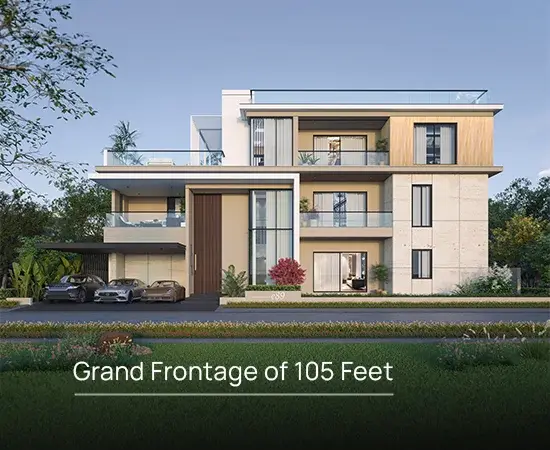
| Residential building form | Revised permit drawings identify residential buildings as Ground Floor + 2 Floors. The permit’s headline height is 11.95 m; amenity buildings are separately described. |
| Parking / building levels | Permit lists parking floor levels as Cellar 0, Stilt 0, Upper Floors 0; the site plan separately records proposed parking area 4054.37 sq.m and visitor parking area 238.64 sq.m. No per-home allocation is established by these figures. |
| Sanctioned layout land-use schedule | Plotted Area 100000.94 sq.m (55.29%); Road Area 48320.38 sq.m (26.72%); Organized Open Space 23705.65 sq.m (13.11%); Buffer Area 1436.51 sq.m (0.79%); Utility Area 406.97 sq.m (0.23%); Amenities Plot Area 5405.52 sq.m (2.99%). |
Offering and status
| Item | Project record |
|---|---|
| RERA-filed home type | 5BHK; 147 units. RERA unit table RERA unit table |
| RERA-filed saleable area | 921.96 sq.m per filed 5BHK unit. RERA unit table |
| Booked / available | 20 booked; 127 available, as last read from the TG-RERA portal; the record supplies no as-of date, so these counts are indicative. RERA unit table |
| Construction stage | Project status is recorded as On-Going; no independently verified site-progress measurement is supplied. RERA filing |
| Completion dates | Form B undertaking: 02 July 2030; RERA filing completion date: 02/07/2030; revised permit completion deadline: 19/12/2030. These are recorded separately because the documents state different project timelines. RERA filing |
| Occupancy / completion certificate | No OC or completion certificate is identified in the supplied records. The revised permit makes OC compulsory before occupation. The evidence does not establish OC issuance for any building or portion. |
2. The project story
- The project record describes a gated residential development at Mokila Village, Shankarpalle Mandal, on Survey Nos. 16, 17, 18, 19, 20, 21 and 22. The revised permit covers a total site area of 182310.88 sq.m, with a net layout area of 180864.19 sq.m. It identifies residential villas / group-housing plots and common amenity and sports-complex buildings.
- The RERA unit record identifies 147 5BHK homes, with 20 booked and 127 available as last read from the portal (no as-of date supplied). The revised permit records 148 dwelling units; the RERA unit table also includes separate entries for “AMENITIES” and “SPORTS COMPLEX,” which are not home configurations. RERA unit table RERA unit table
- The project is recorded as ongoing. The approval records describe construction and layout development requirements, but the supplied evidence does not independently verify current on-site progress or identify any phase or building as completed or occupancy-certified. RERA filing
3. Master plan, architecture & building design
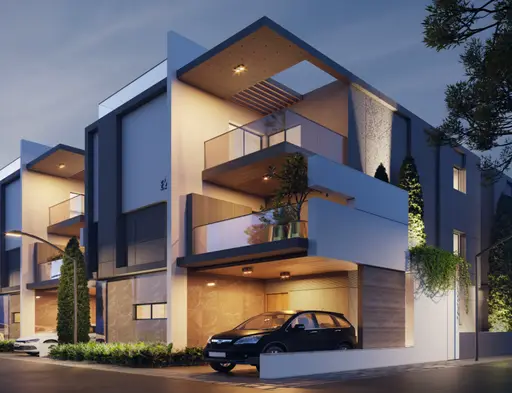
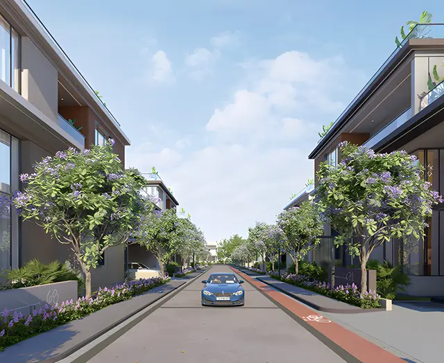
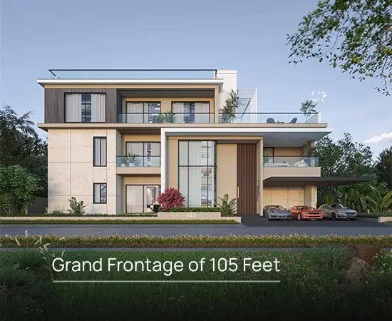
The revised permit presents the scheme as a layout with gated-community housing, rather than a single apartment tower. Its site plan divides the net layout area among residential plots, roads, organized open space, utilities, buffer area and amenity plots. The drawing identifies plots as proposed or altered and depicts residential buildings generally as ground floor plus two floors.
| Drawing / permit item | Recorded detail |
|---|---|
| Total site / net layout area | 182310.88 sq.m / 180864.19 sq.m. |
| Residential built-up area | Total sanctioned built-up area 137915.68 as stated in the revised permit. The permit does not label this figure as saleable area or carpet area. |
| Residential form | The permit’s listed buildings are generally Ground Floor + 2 Floors; the plan gives 11.95 m as the building height from ground level for the residential buildings. |
| Amenity buildings | The drawings identify AMENITIES-1 as 2 Cellars + Ground Floor + 3 Floors, and a SPORTS COMPLEX as Ground Floor + 1 Floor. |
| Site land-use schedule | Plotted Area 100000.94 sq.m (55.29%); Road Area 48320.38 sq.m (26.72%); Organized Open Space 23705.65 sq.m (13.11%); Buffer Area 1436.51 sq.m (0.79%); Amenities Plot Area 5405.52 sq.m (2.99%); Utility Area 406.97 sq.m (0.23%). |
| Internal network | The revised permit drawings label internal roads, including 12.0 m and 18.0 m roads, and identify a proposed 45 m master-plan road and existing road connections. |
The figures above are from the revised permit and its site-plan record. The available material does not provide a consolidated schedule of all approved floor plans, residential building footprints, typical floor layouts, lift counts, stair counts or building-by-building floor-area totals.
4. Homes, configurations & floor plans
The TG-RERA filing records 147 5BHK homes. Its filed saleable-area figure is not carpet area; it should not be treated as a drawing-measured internal floor area. A separate software measurement from drawings describes a 1BHK configuration, but the RERA configuration record does not include that type. The measured plans are flagged for review, and 27 drawings remain pending scan review. RERA unit table RERA unit details Floor plans
| Configuration | Units | Booked | Available | RERA saleable area | Measured carpet area | Loading (if supplied) |
|---|---|---|---|---|---|---|
| 5BHK | 147 | 20 | 127 | 921.96 sq.m | Not supplied | Not supplied |
The drawing-measurement record separately reports 1BHK plans with a software-measured carpet-area median of 436.8 sq.m (range 436.2–437.4 sq.m, or median 4702 sq.ft). This is not a TG-RERA-filed configuration or area, and the measurement record says it needs review. It should not be used as a description of the RERA-filed 5BHK homes. RERA unit details Floor plans
The RERA unit table also contains one “AMENITIES” row and one “SPORTS COMPLEX” row. They are not presented here as homes for sale. RERA unit table
5. Parking & vehicle circulation
The revised permit’s parking schedule lists Cellar 0, Stilt 0 and Upper Floors 0 for parking-floor levels. The site-plan record separately shows proposed parking area of 4054.37 sq.m and visitor parking area of 238.64 sq.m. The permit also labels parking and visitor parking, but the evidence does not establish parking-space counts, accessible or two-wheeler spaces, or a unit-wise allocation.
The revised permit states that cellar and stilt areas approved for parking are to be used exclusively for vehicle parking. The supplied record does not establish an individual buyer’s parking entitlement; a drawn or proposed parking area is not evidence of exclusive allocation.
6. Amenities, recreation & open spaces
The revised permit and associated site-plan record identify the following facilities. Their inclusion in a plan or permit is not evidence that they have been completed or independently inspected.
| Facility | Description / size | Evidence source | Declared progress / verified status |
|---|---|---|---|
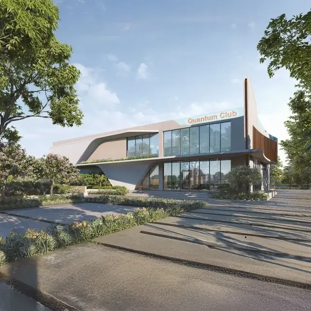
| Clubhouse | “CLUB HOUSE - 1”; 3365.19 sq.m. | Revised site-plan record | Shown in the plan; completion not independently verified. |
| Sports complex | “SPORTS COMPLEX - 1”; 2040.33 sq.m. | Revised site-plan record | Shown in the plan; completion not independently verified. |
| Additional sports complex | “SPORTS COMPLEX (Proposed)”; 914.28 sq.m, Ground Floor + 1 Upper Floor. | Revised site-plan record | Identified as proposed; completion not independently verified. |
| Amenities building | “AMENITIES-1 (Altered)”; 1830.83 sq.m, 2 Cellars + Ground Floor + 3 Upper Floors. | Revised site-plan record | Identified as altered; completion not independently verified. |
| Tot-lot / organized open space | 23705.65 sq.m; permit also calls this organized open space / parks. | Site plan and revised permit | Planned; handover to local body by registered gift deed is a stated permit condition. |
| Utility area | 406.97 sq.m. | Revised site-plan record | Planned; handover to local body by registered gift deed is a stated permit condition. |
| Landscape / greenery | Tot-lot, greenstrip and peripheral greenery are labelled. | Site-plan / permit record | Drawn or required; completion not independently verified. |
The plans also list a proposed amenity programme including a swimming pool, yoga, gym, co-working space, theatre, café/shop, grocery, creche, senior-citizen room and sports facilities. These are plan-listed facilities, not independently verified completed amenities.
7. Utilities, building services & safety
The revised permit sets out layout-development works and service requirements. These describe planned or required infrastructure; the supplied evidence does not establish completion, operating capacity or independent testing.
| Service | What the project record states |
|---|---|
| Water | Internal water-supply pipelines, an assured water-supply source, overhead tank (OHT) and sumps are listed as development works. No source yield, storage capacity or treatment capacity is supplied. |
| Sewerage and drainage | Underground drainage lines, common septic tank / STP, storm-water drains and NALA channelisation are specified. No STP capacity or commissioning evidence is supplied. |
| Rainwater | Rainwater-harvesting pits are specified; the permit lists 23 pits and states 4 nos per Acre in its requirements. |
| Electrical | Electrical supply lines, street lights, transformer / transformer yard and underground utility ducting are listed. |
| Solid waste | Garbage house and bio-compost unit are listed in the permit materials. |
| Fire / life safety | Fire NOC RC. No. 52541020902024, dated 23/05/2024, is recorded in the HMDA draft layout letter. The evidence does not establish an occupancy-stage fire clearance or completed fire systems. |
| Digital infrastructure | The permit materials require broadband/digital infrastructure provisions and common access / CTI before OC. |
| EV charging | EV charging infrastructure is listed as a permit requirement for parking areas; no installed count or operating status is supplied. |
| Accessibility | The permit includes accessibility requirements for specified public/semi-public buildings. The supplied material does not establish completed accessible routes or facilities in the residential homes. |
8. Location, access & connectivity
- The registered project location is Mokila Village, Shankarpalle Mandal, Ranga Reddy District, Telangana, PIN 501203. The project’s site and permit records identify Survey Nos. 16–22. RERA record
- The permit drawings identify internal roads, including 12.0 m and 18.0 m roads, and refer to a proposed 45 m master-plan road. These are drawing labels, not a statement about present road completion or travel time.
- A supplied location dataset lists nearby points with distances, including Financial District (Nanakramguda) 1.2 km, IndusInd Bank 0.4 km, an unnamed bus station 2.2 km, Manuu Polytechnic Hyderabad 1.6 km, Sankaraya Eye Hospital 1.6 km, South India Shopping Mall 2.6 km, an unnamed park 1.2 km, and Nanakramguda Government Primary School 0.5 km. These are supplied mapped-distance records; the method and verification date are not stated. Location record
9. Developer & development status
- The registered legal promoter is BLUEFIN CONSTRUCTIONS LLP, an LLP; the project brand is SYLVANOR by BLUEFIN. The project record identifies GSTIN 36AAXFB7220L1ZY. Its listed address is Plot No. 411, H. No. 1-65/2/A, Ravindra C OP H S Ltd, Kakatiya Hills, Mokila Village, Shankarpalle Mandal, Shankarpalle, Ranga Reddy, PIN 501203. Corporate record Parties record RERA filing
- The promoter’s Form B affidavit, signed by authorised signatory DONTIREDDY ANIL KUMAR and dated 11.07.2024, declares a completion undertaking of 02 July 2030 and states that 70% of amounts realised will be deposited in a separate scheduled-bank account for construction and land cost. These are promoter declarations in the filed affidavit.
- The project record labels the project ongoing and the RERA completion date as 02/07/2030. The revised permit separately states completion before 19/12/2030. No independently verified construction-progress percentage or OC for any phase or building is supplied. RERA filing
10. Approvals, official records & documents
| Record | What it establishes in this review |
|---|---|
| TG-RERA Form C certificate, P02400008643 | Registration of SYLVANOR by BLUEFIN, valid 02/07/2024–02/07/2030; certificate includes standard registration conditions. |
| HMDA draft layout letter, permit no. 000030/LO/Plg/HMDA/2024, dated 02 July 2024 | Technical approval and forwarding of the layout proposal for Survey Nos. 17–22 to the local authority; letter says further local-authority action is required before release of final layout. |
| HMDA approval-for-layout-permission record, application 006895/HMDA/02068/SWDL/SKP2/2025-ADD, dated 20/12/2025 | Technical layout record for Survey Nos. 16–22, stating it was forwarded to Mokila Gram Panchayat for release of proceedings and plans. |
| Mokila Gram Panchayat revised permit, 1285/HMDA/SWDL/2025, dated 20/12/2025 | Revised gated-community layout permit; records 148 dwelling units, sanctioned built-up area 137915.68, site area 182310.88 sq.m, and conditional development requirements. |
| Revised layout/site plan, file 006895/HMDA/02068/SWDL/SKP2/2025-ADD | Site arrangement, land-use schedule, proposed and altered residential buildings, amenity facilities, roads, open space, utilities and parking labels. |
| HMDA mortgage letter | Records mortgage security over identified plots/villas in favour of the Metropolitan Commissioner, HMDA, pending required development and further authority communication. |
| Fire NOC reference | HMDA draft layout letter records Fire NOC RC. No. 52541020902024, dated 23/05/2024. |
| Promoter Form B affidavit | Filed promoter declaration of title basis, encumbrance statement, completion undertaking and separate-account commitments. |
| OC / completion certificate | No OC or completion certificate for the project or a specific building/phase is identified in the supplied records. |
The HMDA DPMS approved-layout lookup is reported as unavailable through the public channel in the supplied project record; that limitation does not itself establish a decision by HMDA. The permit materials identify conditions that must be fulfilled before final handover and occupation, but this overview does not determine compliance with those conditions. HMDA
1. Project at a glance
Project identity
Registered project name: SYLVANOR by BLUEFIN
Project type: Residential; the filed layout and permit describe a gated community with housing.
Phase / registered portion: Not separately identified as a numbered phase. The registration and the revised permit identify the development on Survey Nos. 16–22.
TG-RERA registration: P02400008643
Registration validity: 02/07/2024–02/07/2030. This is the registration period, not the project completion deadline.
Registered promoter: BLUEFIN CONSTRUCTIONS LLP; entity type: LLP.
RERA status: The project record labels it On-Going Project. The registration certificate records registration; no occupancy certificate is identified in the evidence reviewed.
Land and geographic identity
Locality / revenue village: Mokila Village; locality recorded as Mokila.
Mandal / district / PIN: Shankarpalle Mandal, Ranga Reddy District; PIN 501203.
Project survey numbers: Survey Nos. 16, 17, 18, 19, 20, 21 and 22. The project record gives no project-level subdivision schedule.
Total site area: 182310.88 sq.m.
Net layout area: 180864.19 sq.m; the revised permit separately records 1446.69 sq.m as NALA-affected area.
Boundaries recorded in the project filing: North: vacant land; South: vacant land; East: vacant land; West: part of agricultural land and existing building.
Area affected in road widening / FTL / Nala widening: The RERA land record states 1446.69 sq.m. The revised permit describes this as NALA-affected area.
Development identity
Principal authority / permit: Mokila Gram Panchayat LAYOUT WITH HOUSING – REVISED PERMIT ORDER, permit no. 1285/HMDA/SWDL/2025, dated 20/12/2025. The permit identifies HMDA as the planning authority in the linked technical approval record.
HMDA technical layout record: HMDA application 006895/HMDA/02068/SWDL/SKP2/2025-ADD; technical layout approval forwarded to Mokila Gram Panchayat for release of proceedings and plans.
Approved built-up area: The revised permit states Total Sanctioned Built Up Area 137915.68 (sq.m as stated in the permit’s area context).
Building count / unit count: Permit records 148 dwelling units; TG-RERA unit data lists 147 5BHK homes and separately contains “AMENITIES” and “SPORTS COMPLEX” rows. The RERA filing also states 149 total building units, including one amenities row; counts refer to different filed records/categories and should not be read as 149 homes.
Residential building form: Revised permit drawings identify residential buildings as Ground Floor + 2 Floors. The permit’s headline height is 11.95 m; amenity buildings are separately described.
Parking / building levels: Permit lists parking floor levels as Cellar 0, Stilt 0, Upper Floors 0; the site plan separately records proposed parking area 4054.37 sq.m and visitor parking area 238.64 sq.m. No per-home allocation is established by these figures.
Sanctioned layout land-use schedule: Plotted Area 100000.94 sq.m (55.29%); Road Area 48320.38 sq.m (26.72%); Organized Open Space 23705.65 sq.m (13.11%); Buffer Area 1436.51 sq.m (0.79%); Utility Area 406.97 sq.m (0.23%); Amenities Plot Area 5405.52 sq.m (2.99%).
Offering and status
RERA-filed home type: 5BHK; 147 units.
RERA-filed saleable area: 921.96 sq.m per filed 5BHK unit.
Booked / available: 20 booked; 127 available, as last read from the TG-RERA portal; the record supplies no as-of date, so these counts are indicative.
Construction stage: Project status is recorded as On-Going; no independently verified site-progress measurement is supplied.
Completion dates: Form B undertaking: 02 July 2030; RERA filing completion date: 02/07/2030; revised permit completion deadline: 19/12/2030. These are recorded separately because the documents state different project timelines.
Occupancy / completion certificate: No OC or completion certificate is identified in the supplied records. The revised permit makes OC compulsory before occupation. The evidence does not establish OC issuance for any building or portion.
2. The project story
- The project record describes a gated residential development at Mokila Village, Shankarpalle Mandal, on Survey Nos. 16, 17, 18, 19, 20, 21 and 22. The revised permit covers a total site area of 182310.88 sq.m, with a net layout area of 180864.19 sq.m. It identifies residential villas / group-housing plots and common amenity and sports-complex buildings.
- The RERA unit record identifies 147 5BHK homes, with 20 booked and 127 available as last read from the portal (no as-of date supplied). The revised permit records 148 dwelling units; the RERA unit table also includes separate entries for “AMENITIES” and “SPORTS COMPLEX,” which are not home configurations.
- The project is recorded as ongoing. The approval records describe construction and layout development requirements, but the supplied evidence does not independently verify current on-site progress or identify any phase or building as completed or occupancy-certified.
3. Master plan, architecture & building design
The revised permit presents the scheme as a layout with gated-community housing, rather than a single apartment tower. Its site plan divides the net layout area among residential plots, roads, organized open space, utilities, buffer area and amenity plots. The drawing identifies plots as proposed or altered and depicts residential buildings generally as ground floor plus two floors.
Total site / net layout area: 182310.88 sq.m / 180864.19 sq.m.
Residential built-up area: Total sanctioned built-up area 137915.68 as stated in the revised permit. The permit does not label this figure as saleable area or carpet area.
Residential form: The permit’s listed buildings are generally Ground Floor + 2 Floors; the plan gives 11.95 m as the building height from ground level for the residential buildings.
Amenity buildings: The drawings identify AMENITIES-1 as 2 Cellars + Ground Floor + 3 Floors, and a SPORTS COMPLEX as Ground Floor + 1 Floor.
Site land-use schedule: Plotted Area 100000.94 sq.m (55.29%); Road Area 48320.38 sq.m (26.72%); Organized Open Space 23705.65 sq.m (13.11%); Buffer Area 1436.51 sq.m (0.79%); Amenities Plot Area 5405.52 sq.m (2.99%); Utility Area 406.97 sq.m (0.23%).
Internal network: The revised permit drawings label internal roads, including 12.0 m and 18.0 m roads, and identify a proposed 45 m master-plan road and existing road connections.
The figures above are from the revised permit and its site-plan record. The available material does not provide a consolidated schedule of all approved floor plans, residential building footprints, typical floor layouts, lift counts, stair counts or building-by-building floor-area totals.
4. Homes, configurations & floor plans
The TG-RERA filing records 147 5BHK homes. Its filed saleable-area figure is not carpet area; it should not be treated as a drawing-measured internal floor area. A separate software measurement from drawings describes a 1BHK configuration, but the RERA configuration record does not include that type. The measured plans are flagged for review, and 27 drawings remain pending scan review.
| Configuration | Units | Booked | Available | RERA saleable area | Measured carpet area | Loading (if supplied) |
|---|---|---|---|---|---|---|
| 5BHK | 147 | 20 | 127 | 921.96 sq.m | Not supplied | Not supplied |
The drawing-measurement record separately reports 1BHK plans with a software-measured carpet-area median of 436.8 sq.m (range 436.2–437.4 sq.m, or median 4702 sq.ft). This is not a TG-RERA-filed configuration or area, and the measurement record says it needs review. It should not be used as a description of the RERA-filed 5BHK homes.
The RERA unit table also contains one “AMENITIES” row and one “SPORTS COMPLEX” row. They are not presented here as homes for sale.
5. Parking & vehicle circulation
The revised permit’s parking schedule lists Cellar 0, Stilt 0 and Upper Floors 0 for parking-floor levels. The site-plan record separately shows proposed parking area of 4054.37 sq.m and visitor parking area of 238.64 sq.m. The permit also labels parking and visitor parking, but the evidence does not establish parking-space counts, accessible or two-wheeler spaces, or a unit-wise allocation.
The revised permit states that cellar and stilt areas approved for parking are to be used exclusively for vehicle parking. The supplied record does not establish an individual buyer’s parking entitlement; a drawn or proposed parking area is not evidence of exclusive allocation.
6. Amenities, recreation & open spaces
The revised permit and associated site-plan record identify the following facilities. Their inclusion in a plan or permit is not evidence that they have been completed or independently inspected.
| Facility | Description / size | Evidence source | Declared progress / verified status |
|---|---|---|---|
| Clubhouse | “CLUB HOUSE - 1”; 3365.19 sq.m. | Revised site-plan record | Shown in the plan; completion not independently verified. |
| Sports complex | “SPORTS COMPLEX - 1”; 2040.33 sq.m. | Revised site-plan record | Shown in the plan; completion not independently verified. |
| Additional sports complex | “SPORTS COMPLEX (Proposed)”; 914.28 sq.m, Ground Floor + 1 Upper Floor. | Revised site-plan record | Identified as proposed; completion not independently verified. |
| Amenities building | “AMENITIES-1 (Altered)”; 1830.83 sq.m, 2 Cellars + Ground Floor + 3 Upper Floors. | Revised site-plan record | Identified as altered; completion not independently verified. |
| Tot-lot / organized open space | 23705.65 sq.m; permit also calls this organized open space / parks. | Site plan and revised permit | Planned; handover to local body by registered gift deed is a stated permit condition. |
| Utility area | 406.97 sq.m. | Revised site-plan record | Planned; handover to local body by registered gift deed is a stated permit condition. |
| Landscape / greenery | Tot-lot, greenstrip and peripheral greenery are labelled. | Site-plan / permit record | Drawn or required; completion not independently verified. |
The plans also list a proposed amenity programme including a swimming pool, yoga, gym, co-working space, theatre, café/shop, grocery, creche, senior-citizen room and sports facilities. These are plan-listed facilities, not independently verified completed amenities.
7. Utilities, building services & safety
The revised permit sets out layout-development works and service requirements. These describe planned or required infrastructure; the supplied evidence does not establish completion, operating capacity or independent testing.
Water: Internal water-supply pipelines, an assured water-supply source, overhead tank (OHT) and sumps are listed as development works. No source yield, storage capacity or treatment capacity is supplied.
Sewerage and drainage: Underground drainage lines, common septic tank / STP, storm-water drains and NALA channelisation are specified. No STP capacity or commissioning evidence is supplied.
Rainwater: Rainwater-harvesting pits are specified; the permit lists 23 pits and states 4 nos per Acre in its requirements.
Electrical: Electrical supply lines, street lights, transformer / transformer yard and underground utility ducting are listed.
Solid waste: Garbage house and bio-compost unit are listed in the permit materials.
Fire / life safety: Fire NOC RC. No. 52541020902024, dated 23/05/2024, is recorded in the HMDA draft layout letter. The evidence does not establish an occupancy-stage fire clearance or completed fire systems.
Digital infrastructure: The permit materials require broadband/digital infrastructure provisions and common access / CTI before OC.
EV charging: EV charging infrastructure is listed as a permit requirement for parking areas; no installed count or operating status is supplied.
Accessibility: The permit includes accessibility requirements for specified public/semi-public buildings. The supplied material does not establish completed accessible routes or facilities in the residential homes.
8. Location, access & connectivity
- The registered project location is Mokila Village, Shankarpalle Mandal, Ranga Reddy District, Telangana, PIN 501203. The project’s site and permit records identify Survey Nos. 16–22.
- The permit drawings identify internal roads, including 12.0 m and 18.0 m roads, and refer to a proposed 45 m master-plan road. These are drawing labels, not a statement about present road completion or travel time.
- A supplied location dataset lists nearby points with distances, including Financial District (Nanakramguda) 1.2 km, IndusInd Bank 0.4 km, an unnamed bus station 2.2 km, Manuu Polytechnic Hyderabad 1.6 km, Sankaraya Eye Hospital 1.6 km, South India Shopping Mall 2.6 km, an unnamed park 1.2 km, and Nanakramguda Government Primary School 0.5 km. These are supplied mapped-distance records; the method and verification date are not stated.
9. Developer & development status
- The registered legal promoter is BLUEFIN CONSTRUCTIONS LLP, an LLP; the project brand is SYLVANOR by BLUEFIN. The project record identifies GSTIN 36AAXFB7220L1ZY. Its listed address is Plot No. 411, H. No. 1-65/2/A, Ravindra C OP H S Ltd, Kakatiya Hills, Mokila Village, Shankarpalle Mandal, Shankarpalle, Ranga Reddy, PIN 501203.
- The promoter’s Form B affidavit, signed by authorised signatory DONTIREDDY ANIL KUMAR and dated 11.07.2024, declares a completion undertaking of 02 July 2030 and states that 70% of amounts realised will be deposited in a separate scheduled-bank account for construction and land cost. These are promoter declarations in the filed affidavit.
- The project record labels the project ongoing and the RERA completion date as 02/07/2030. The revised permit separately states completion before 19/12/2030. No independently verified construction-progress percentage or OC for any phase or building is supplied.
10. Approvals, official records & documents
TG-RERA Form C certificate, P02400008643: Registration of SYLVANOR by BLUEFIN, valid 02/07/2024–02/07/2030; certificate includes standard registration conditions.
HMDA draft layout letter, permit no. 000030/LO/Plg/HMDA/2024, dated 02 July 2024: Technical approval and forwarding of the layout proposal for Survey Nos. 17–22 to the local authority; letter says further local-authority action is required before release of final layout.
HMDA approval-for-layout-permission record, application 006895/HMDA/02068/SWDL/SKP2/2025-ADD, dated 20/12/2025: Technical layout record for Survey Nos. 16–22, stating it was forwarded to Mokila Gram Panchayat for release of proceedings and plans.
Mokila Gram Panchayat revised permit, 1285/HMDA/SWDL/2025, dated 20/12/2025: Revised gated-community layout permit; records 148 dwelling units, sanctioned built-up area 137915.68, site area 182310.88 sq.m, and conditional development requirements.
Revised layout/site plan, file 006895/HMDA/02068/SWDL/SKP2/2025-ADD: Site arrangement, land-use schedule, proposed and altered residential buildings, amenity facilities, roads, open space, utilities and parking labels.
HMDA mortgage letter: Records mortgage security over identified plots/villas in favour of the Metropolitan Commissioner, HMDA, pending required development and further authority communication.
Fire NOC reference: HMDA draft layout letter records Fire NOC RC. No. 52541020902024, dated 23/05/2024.
Promoter Form B affidavit: Filed promoter declaration of title basis, encumbrance statement, completion undertaking and separate-account commitments.
OC / completion certificate: No OC or completion certificate for the project or a specific building/phase is identified in the supplied records.
The HMDA DPMS approved-layout lookup is reported as unavailable through the public channel in the supplied project record; that limitation does not itself establish a decision by HMDA. The permit materials identify conditions that must be fulfilled before final handover and occupation, but this overview does not determine compliance with those conditions.
Frequently asked questions
Is SYLVANOR by BLUEFIN registered with Telangana RERA?
Yes. SYLVANOR by BLUEFIN is registered with the Telangana Real Estate Regulatory Authority as P02400008643; the registration status is On-Going Project.
Who is the developer of SYLVANOR by BLUEFIN?
The promoter named in the RERA registration is BLUEFIN CONSTRUCTIONS LLP.
Where is SYLVANOR by BLUEFIN located?
SYLVANOR by BLUEFIN is in Shankarpalle Mandal, Shankarpalle, Rangareddy, Telangana (501203).
When will SYLVANOR by BLUEFIN be completed?
The promoter's proposed date of completion filed with RERA is 02/11/2030. This is the promoter's declaration, not a guarantee.
More projects in Shankarpalle