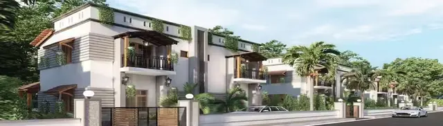
Spalena Wavon
SRI JAGATHSWAPNA INFRA PROJECTS · Rangareddy · RERA P02400004836
SPALENA WAVON is a Plotted Development in Bandaravirala, Abdullapurmet, Ranga Reddy. The registered promoter is SRI JAGATHSWAPNA INFRA PROJECTS, and the filed land details state a total area of 92,464.95 sq.mts and a net area of 87,785.97 sq.mts; the title-report extract describes an HMDA layout of 306 plots. The supplied record does not specify towers, floors, or plot configurations. It is registered with TG-RERA under P02400004836, with a proposed completion date of 30/09/2023.
More from Sri Jagathswapna Infra Projects · 6 projects →
01What we found
Read from TG-RERA filings, approvals, land and registration records and court records. A court case is counted only when the court record states this project's survey number with its village, or names the project.
02Check before you pay
8 items to check before you pay, 4 high - from the title chain, court records and approvals, each with what to ask the builder or your advocate. An item may not be a problem with the project: records can be incomplete.
1. Project at a glance
Project identity
| Field | Record |
|---|---|
| Registered project name | SPALENA WAVON |
| Project type / registered portion | Plotted Development; project phase or separately registered portion is not specified in the available record. RERA record |
| TG-RERA registration number | P02400004836 |
| Registration validity | 23/08/2022 to 30/09/2023; the certificate states a period of “1 years.” Registration validity is distinct from the completion deadline. |
| Registered promoter | SRI JAGATHSWAPNA INFRA PROJECTS |
| RERA status in supplied record | New Project; the supplied certificate states the validity dates above and records no extension. Current registration status should be confirmed with TG-RERA. RERA record |
Land and geographic identity
| Field | Record |
|---|---|
| Locality / revenue village | Bandaravirala; also rendered as Bandaraviryala / Bandaraviryal in filed document text. RERA record |
| Mandal / district / PIN | Abdullapurmet / Ranga Reddy / 501505 RERA record |
| Project survey number(s) | 293/3; the available TG-RERA certificate identifies this survey number. No subdivision beyond 293/3 is specified in that certificate. |
| Registered site extent | Not established by the supplied TG-RERA certificate extract. |
| Filed land area | Total area 92,464.95 sq.mts; area affected by road widening/FTL of tanks/nala widening 4,678.98 sq.mts; net area 87,785.97 sq.mts. These are filed land-detail figures. RERA filing |
| Boundaries in filing | East: NEIGHBOURS LAND; West: ROAD WIDTH 150FT; North: NEIGHBOURS LAND; South: NEIGHBOURS LAND. RERA filing |
Development identity
| Field | Record |
|---|---|
| Sanctioning authority / approval | Hyderabad Metropolitan Development Authority (HMDA); filed plan approval number 19/LO/Plg/HMDA/2021. RERA record Approvals record |
| Principal approval document | HMDA letter 039588/GHT/LT/U6/HMDA/01102020, dated 21-09-2021, addressed to the Executive Authority of Bandaraviryala Gram Panchayath and relating to layout development. |
| Approved built-up area | 54,243.66 sq.mts is recorded as approved built-up area in the RERA filing; the available material does not explain its application to this plotted layout. RERA filing |
| Plot/layout count and arrangement | The title-report extract describes HMDA layout approval for 306 plots; the approval drawing and plot schedule are not available in the supplied material for review. |
| Buildings / floors / parking levels | Not disclosed for this plotted development in the supplied material. |
| Approved versus RERA-declared plot counts | The supplied records do not establish a comparable approved plot count and RERA-declared plot count. |
Offering and status
| Field | Record |
|---|---|
| Offering | Open plots; plot sizes, plot schedule and RERA-filed saleable-area range are not established in the supplied structured RERA records. RERA record |
| Booked / available plots | Not disclosed in the supplied evidence. |
| RERA-filed completion date | 30/09/2023. RERA record |
| Construction/development stage | The filing records 80% completeness; this is a declared figure, not an independent site verification. RERA record |
| Occupancy / completion certificate | No occupancy or completion certificate is identified in the supplied material. The project is plotted; the available evidence does not establish the status or scope of any completion certification. Document index |
2. The project story
- SPALENA WAVON is registered with TG-RERA as a plotted development in Bandaravirala village, Abdullapurmet mandal, Ranga Reddy district, on Survey No. 293/3. The RERA-filed land details give a total area of 92,464.95 sq.mts, an affected area of 4,678.98 sq.mts, and a net area of 87,785.97 sq.mts. RERA record RERA filing
- The project record identifies HMDA as the planning authority and gives the filed plan approval number 19/LO/Plg/HMDA/2021. The HMDA letter supplied for review concerns development of a layout and includes conditions for layout works. The title-report extract refers to an approved layout of 306 plots, but a plot schedule or layout drawing was not available here to describe plot-by-plot organization. Approvals record
- The filing states 80% completeness and a proposed completion date of 30/09/2023. Those are recorded project disclosures, not independent confirmation of on-site progress. The supplied evidence does not include a verified site inspection or a completion/occupancy certificate. RERA record Document index
3. Master plan, architecture & building design
- This is a plotted layout, not an apartment or multi-storey building project in the supplied records. The RERA filing identifies Survey No. 293/3, total land area 92,464.95 sq.mts, affected area 4,678.98 sq.mts, net area 87,785.97 sq.mts, and approved built-up area 54,243.66 sq.mts. The filing does not define the built-up-area figure’s scope for this layout. RERA filing RERA filing
- The HMDA letter describes layout development and requires the applicant to undertake the layout’s development works. Its stated conditions include underground ducting for utilities and services, space for solid-waste disposal in addition to mandatory open space, development of a bio-compost unit, and source segregation of garbage. These are approval conditions, not evidence that the works have been completed.
- The title-report extract describes an HMDA layout approval for 64,874.88 Sq.yards comprising 306 plots. The approved layout drawing, plot schedule, road widths, parks/open-space schedule, utility-land allocation and phase organization are not available in the supplied drawing records for independent description. Floor plans
4. Homes, configurations & floor plans
- The registered offering is plotted development. The available RERA material does not provide plot-type counts, booked/available inventory, or a RERA-filed saleable-area schedule. The table below therefore distinguishes unavailable RERA details from third-party listing information.
| Configuration | Units | Booked | Available | RERA saleable area | Measured carpet area | Loading (if supplied) |
|---|---|---|---|---|---|---|
| Plots | Not established | Not disclosed | Not disclosed | Not disclosed | Not applicable / not measured | Not supplied |
- A third-party listing describes plot sizes of 1503 Sq Ft, 1719 Sq Ft, 2025 Sq Ft, 2160 Sq Ft and 2502 Sq Ft; these are not presented as RERA-filed plot areas. Promoter website
- Two drawing records are noted, but neither was measured: both are scans pending review. No plot measurements or configuration schedule can be verified from those drawings in the supplied material. Floor plans
5. Parking & vehicle circulation
- The supplied records do not establish parking-space counts, visitor or accessible parking, parking allocation to individual plots, or parking arrangements. The HMDA approval letter requires layout works and underground ducting of utility and service lines, but does not provide a parking schedule in the extracted material.
- The filed land details state a western boundary of ROAD WIDTH 150FT; the available evidence does not provide the internal road layout, access points, driveway widths or pedestrian-circulation plan. RERA filing
6. Amenities, recreation & open spaces
The RERA amenities record marks the following infrastructure or facilities as available in the filing. Each item has 0% recorded progress; this does not establish delivery or independent verification. The HMDA letter separately sets conditions for solid-waste disposal and bio-composting. RERA amenities
| Facility | Description / size | Evidence source | Declared progress / verified status |
|---|---|---|---|
| Green strip / tot lot / park | Size and individual components not specified | RERA amenities record RERA amenities | Marked “YES”; 0% progress; not independently verified |
| Aggregate recreational open space | Area not specified | RERA amenities record RERA amenities | Marked “YES”; 0% progress; not independently verified |
| Community buildings | No description or size supplied | RERA amenities record RERA amenities | Progress 0%; availability not stated |
| Kids play area | Size not specified | Third-party listing Promoter website | Listing claim; no progress or independent verification supplied |
| Lawn with pathway | Size not specified | Third-party listing Promoter website | Listing claim; no progress or independent verification supplied |
7. Utilities, building services & safety
- The RERA amenities record marks internal roads and footpaths, water supply, sewerage, storm-water drains, sewage and sullage treatment/disposal, rainwater harvesting, and an electrical meter room/sub-station/receiving station as available in the filing. It records 0% progress for each item, so the record does not establish completion. Storage capacity, treatment capacity, water source, electrical capacity and operating status are not supplied. RERA amenities
- The HMDA approval letter requires underground ducting of utilities and services, solid-waste disposal space in addition to mandatory open space, a bio-compost unit and source segregation. The RERA amenities record separately lists solid-waste management and disposal without marking availability or supplying progress beyond 0%. RERA amenities
- The supplied evidence does not specify fire-safety systems, accessibility provisions, security systems, backup power, EV charging or utility capacities. No statutory compliance or completed service should be inferred from the listed facilities alone. RERA amenities Document index
8. Location, access & connectivity
- The registered location is Bandaravirala, Abdullapurmet, Ranga Reddy, Telangana, 501505, on Survey No. 293/3. The filed western boundary is described as ROAD WIDTH 150FT. RERA record RERA filing
- A supplied location record gives a sampled distance of 8.0 km to the nearest sampled Outer Ring Road interchange. The point is identified approximately in the record; it does not specify a travel time or route. Location record
- A third-party listing describes the site as adjacent to Dino World and nearer to Outer Ring Road Exit No-10. This is a listing claim, not a RERA-filed connectivity measurement. The supplied evidence does not establish public-transport access or distances to other landmarks. Promoter website
9. Developer & development status
- The registered promoter is SRI JAGATHSWAPNA INFRA PROJECTS, identified in the RERA filing as a Partnership. Its GSTIN is 36ADHFS5273R1Z6. RERA record Corporate record
- The filed address is L BLOCK, ST NO 1, KAKATIYA NAGAR, BANDA RAVIRALA, ABDULLAPURMET, Abdullapurmet, Ranga Reddy, 501505. The listed authorized signatory is PENDYALA VAMSHI KRISHNA; the listed partners are PENDYALA KRISHNA MURTHY and TUDI KIRANMAYEE. Corporate record
- The filing records 80% completeness and a proposed completion date of 30/09/2023. These are project-record disclosures; the supplied material does not independently verify current physical progress or show a completion/occupancy certificate. The TG-RERA certificate records registration validity through 30/09/2023; that validity date is separate from the completion date. RERA record Document index
10. Approvals, official records & documents
| Identifier / scope | P02400004836, SPALENA WAVON; valid 23/08/2022–30/09/2023 |
|---|---|
| Evidence available | Form C registration certificate; includes separate-account condition. |
| Identifier / scope | 19/LO/Plg/HMDA/2021; authority shown as HMDA |
|---|---|
| Evidence available | RERA filing identifies this as the plan approval number. Approvals record |
| Identifier / scope | 039588/GHT/LT/U6/HMDA/01102020, dated 21-09-2021; addressed to the Executive Authority of Bandaraviryala Gram Panchayath |
|---|---|
| Evidence available | Extracted letter sets layout-development conditions and states the permission is not proof of land title. |
| Identifier / scope | Survey No. 293/3, Bandaravirala village |
|---|---|
| Evidence available | Advocate title-search report extract; describes land records, layout proceedings and title history. The supplied extract is not a complete final opinion. |
| Identifier / scope | Agreement of Sale 456/2022, dated 18 June 2022 |
|---|---|
| Evidence available | RERA-filed title material concerns plotted land and identifies the agreement as not itself a conveyance of title. |
| Identifier / scope | Separate-account and withdrawal clauses |
|---|---|
| Evidence available | Partial extract; it does not include the complete declaration or its identifying particulars. |
| Identifier / scope | Registration number P02400004836; certificate dated 17.04.2025 |
|---|---|
| Evidence available | Chartered Accountant’s certificate for registration/subsequent withdrawal of money; it is not an occupancy or completion certificate. |
The supplied material does not include a reviewed approved layout drawing or plot schedule, a completion/occupancy certificate, or evidence of a registration extension. The HMDA public approved-layout lookup is reported unavailable in the supplied record; that access limitation does not itself establish refusal or non-approval. HMDA Document index
1. Project at a glance
Project identity
Registered project name: SPALENA WAVON
Project type / registered portion: Plotted Development; project phase or separately registered portion is not specified in the available record.
TG-RERA registration number: P02400004836
Registration validity: 23/08/2022 to 30/09/2023; the certificate states a period of “1 years.” Registration validity is distinct from the completion deadline.
Registered promoter: SRI JAGATHSWAPNA INFRA PROJECTS
RERA status in supplied record: New Project; the supplied certificate states the validity dates above and records no extension. Current registration status should be confirmed with TG-RERA.
Land and geographic identity
Locality / revenue village: Bandaravirala; also rendered as Bandaraviryala / Bandaraviryal in filed document text.
Mandal / district / PIN: Abdullapurmet / Ranga Reddy / 501505
Project survey number(s): 293/3; the available TG-RERA certificate identifies this survey number. No subdivision beyond 293/3 is specified in that certificate.
Registered site extent: Not established by the supplied TG-RERA certificate extract.
Filed land area: Total area 92,464.95 sq.mts; area affected by road widening/FTL of tanks/nala widening 4,678.98 sq.mts; net area 87,785.97 sq.mts. These are filed land-detail figures.
Boundaries in filing: East: NEIGHBOURS LAND; West: ROAD WIDTH 150FT; North: NEIGHBOURS LAND; South: NEIGHBOURS LAND.
Development identity
Sanctioning authority / approval: Hyderabad Metropolitan Development Authority (HMDA); filed plan approval number 19/LO/Plg/HMDA/2021.
Principal approval document: HMDA letter 039588/GHT/LT/U6/HMDA/01102020, dated 21-09-2021, addressed to the Executive Authority of Bandaraviryala Gram Panchayath and relating to layout development.
Approved built-up area: 54,243.66 sq.mts is recorded as approved built-up area in the RERA filing; the available material does not explain its application to this plotted layout.
Plot/layout count and arrangement: The title-report extract describes HMDA layout approval for 306 plots; the approval drawing and plot schedule are not available in the supplied material for review.
Buildings / floors / parking levels: Not disclosed for this plotted development in the supplied material.
Approved versus RERA-declared plot counts: The supplied records do not establish a comparable approved plot count and RERA-declared plot count.
Offering and status
Offering: Open plots; plot sizes, plot schedule and RERA-filed saleable-area range are not established in the supplied structured RERA records.
Booked / available plots: Not disclosed in the supplied evidence.
RERA-filed completion date: 30/09/2023.
Construction/development stage: The filing records 80% completeness; this is a declared figure, not an independent site verification.
Occupancy / completion certificate: No occupancy or completion certificate is identified in the supplied material. The project is plotted; the available evidence does not establish the status or scope of any completion certification.
2. The project story
- SPALENA WAVON is registered with TG-RERA as a plotted development in Bandaravirala village, Abdullapurmet mandal, Ranga Reddy district, on Survey No. 293/3. The RERA-filed land details give a total area of 92,464.95 sq.mts, an affected area of 4,678.98 sq.mts, and a net area of 87,785.97 sq.mts.
- The project record identifies HMDA as the planning authority and gives the filed plan approval number 19/LO/Plg/HMDA/2021. The HMDA letter supplied for review concerns development of a layout and includes conditions for layout works. The title-report extract refers to an approved layout of 306 plots, but a plot schedule or layout drawing was not available here to describe plot-by-plot organization.
- The filing states 80% completeness and a proposed completion date of 30/09/2023. Those are recorded project disclosures, not independent confirmation of on-site progress. The supplied evidence does not include a verified site inspection or a completion/occupancy certificate.
3. Master plan, architecture & building design
- This is a plotted layout, not an apartment or multi-storey building project in the supplied records. The RERA filing identifies Survey No. 293/3, total land area 92,464.95 sq.mts, affected area 4,678.98 sq.mts, net area 87,785.97 sq.mts, and approved built-up area 54,243.66 sq.mts. The filing does not define the built-up-area figure’s scope for this layout.
- The HMDA letter describes layout development and requires the applicant to undertake the layout’s development works. Its stated conditions include underground ducting for utilities and services, space for solid-waste disposal in addition to mandatory open space, development of a bio-compost unit, and source segregation of garbage. These are approval conditions, not evidence that the works have been completed.
- The title-report extract describes an HMDA layout approval for 64,874.88 Sq.yards comprising 306 plots. The approved layout drawing, plot schedule, road widths, parks/open-space schedule, utility-land allocation and phase organization are not available in the supplied drawing records for independent description.
4. Homes, configurations & floor plans
- The registered offering is plotted development. The available RERA material does not provide plot-type counts, booked/available inventory, or a RERA-filed saleable-area schedule. The table below therefore distinguishes unavailable RERA details from third-party listing information.
| Configuration | Units | Booked | Available | RERA saleable area | Measured carpet area | Loading (if supplied) |
|---|---|---|---|---|---|---|
| Plots | Not established | Not disclosed | Not disclosed | Not disclosed | Not applicable / not measured | Not supplied |
- A third-party listing describes plot sizes of 1503 Sq Ft, 1719 Sq Ft, 2025 Sq Ft, 2160 Sq Ft and 2502 Sq Ft; these are not presented as RERA-filed plot areas.
- Two drawing records are noted, but neither was measured: both are scans pending review. No plot measurements or configuration schedule can be verified from those drawings in the supplied material.
5. Parking & vehicle circulation
- The supplied records do not establish parking-space counts, visitor or accessible parking, parking allocation to individual plots, or parking arrangements. The HMDA approval letter requires layout works and underground ducting of utility and service lines, but does not provide a parking schedule in the extracted material.
- The filed land details state a western boundary of ROAD WIDTH 150FT; the available evidence does not provide the internal road layout, access points, driveway widths or pedestrian-circulation plan.
6. Amenities, recreation & open spaces
The RERA amenities record marks the following infrastructure or facilities as available in the filing. Each item has 0% recorded progress; this does not establish delivery or independent verification. The HMDA letter separately sets conditions for solid-waste disposal and bio-composting.
| Facility | Description / size | Evidence source | Declared progress / verified status |
|---|---|---|---|
| Green strip / tot lot / park | Size and individual components not specified | RERA amenities record | Marked “YES”; 0% progress; not independently verified |
| Aggregate recreational open space | Area not specified | RERA amenities record | Marked “YES”; 0% progress; not independently verified |
| Community buildings | No description or size supplied | RERA amenities record | Progress 0%; availability not stated |
| Kids play area | Size not specified | Third-party listing | Listing claim; no progress or independent verification supplied |
| Lawn with pathway | Size not specified | Third-party listing | Listing claim; no progress or independent verification supplied |
7. Utilities, building services & safety
- The RERA amenities record marks internal roads and footpaths, water supply, sewerage, storm-water drains, sewage and sullage treatment/disposal, rainwater harvesting, and an electrical meter room/sub-station/receiving station as available in the filing. It records 0% progress for each item, so the record does not establish completion. Storage capacity, treatment capacity, water source, electrical capacity and operating status are not supplied.
- The HMDA approval letter requires underground ducting of utilities and services, solid-waste disposal space in addition to mandatory open space, a bio-compost unit and source segregation. The RERA amenities record separately lists solid-waste management and disposal without marking availability or supplying progress beyond 0%.
- The supplied evidence does not specify fire-safety systems, accessibility provisions, security systems, backup power, EV charging or utility capacities. No statutory compliance or completed service should be inferred from the listed facilities alone.
8. Location, access & connectivity
- The registered location is Bandaravirala, Abdullapurmet, Ranga Reddy, Telangana, 501505, on Survey No. 293/3. The filed western boundary is described as ROAD WIDTH 150FT.
- A supplied location record gives a sampled distance of 8.0 km to the nearest sampled Outer Ring Road interchange. The point is identified approximately in the record; it does not specify a travel time or route.
- A third-party listing describes the site as adjacent to Dino World and nearer to Outer Ring Road Exit No-10. This is a listing claim, not a RERA-filed connectivity measurement. The supplied evidence does not establish public-transport access or distances to other landmarks.
9. Developer & development status
- The registered promoter is SRI JAGATHSWAPNA INFRA PROJECTS, identified in the RERA filing as a Partnership. Its GSTIN is 36ADHFS5273R1Z6.
- The filed address is L BLOCK, ST NO 1, KAKATIYA NAGAR, BANDA RAVIRALA, ABDULLAPURMET, Abdullapurmet, Ranga Reddy, 501505. The listed authorized signatory is PENDYALA VAMSHI KRISHNA; the listed partners are PENDYALA KRISHNA MURTHY and TUDI KIRANMAYEE.
- The filing records 80% completeness and a proposed completion date of 30/09/2023. These are project-record disclosures; the supplied material does not independently verify current physical progress or show a completion/occupancy certificate. The TG-RERA certificate records registration validity through 30/09/2023; that validity date is separate from the completion date.
10. Approvals, official records & documents
| Identifier / scope | P02400004836, SPALENA WAVON; valid 23/08/2022–30/09/2023 |
|---|---|
| Evidence available | Form C registration certificate; includes separate-account condition. |
| Identifier / scope | 19/LO/Plg/HMDA/2021; authority shown as HMDA |
|---|---|
| Evidence available | RERA filing identifies this as the plan approval number. |
| Identifier / scope | 039588/GHT/LT/U6/HMDA/01102020, dated 21-09-2021; addressed to the Executive Authority of Bandaraviryala Gram Panchayath |
|---|---|
| Evidence available | Extracted letter sets layout-development conditions and states the permission is not proof of land title. |
| Identifier / scope | Survey No. 293/3, Bandaravirala village |
|---|---|
| Evidence available | Advocate title-search report extract; describes land records, layout proceedings and title history. The supplied extract is not a complete final opinion. |
| Identifier / scope | Agreement of Sale 456/2022, dated 18 June 2022 |
|---|---|
| Evidence available | RERA-filed title material concerns plotted land and identifies the agreement as not itself a conveyance of title. |
| Identifier / scope | Separate-account and withdrawal clauses |
|---|---|
| Evidence available | Partial extract; it does not include the complete declaration or its identifying particulars. |
| Identifier / scope | Registration number P02400004836; certificate dated 17.04.2025 |
|---|---|
| Evidence available | Chartered Accountant’s certificate for registration/subsequent withdrawal of money; it is not an occupancy or completion certificate. |
The supplied material does not include a reviewed approved layout drawing or plot schedule, a completion/occupancy certificate, or evidence of a registration extension. The HMDA public approved-layout lookup is reported unavailable in the supplied record; that access limitation does not itself establish refusal or non-approval.
Frequently asked questions
Is SPALENA WAVON registered with Telangana RERA?
Yes. SPALENA WAVON is registered with the Telangana Real Estate Regulatory Authority as P02400004836; the registration status is New Project.
Who is the developer of SPALENA WAVON?
The promoter named in the RERA registration is SRI JAGATHSWAPNA INFRA PROJECTS.
Where is SPALENA WAVON located?
SPALENA WAVON is in ABDULLAPURMET, Bandaravirala, Rangareddy, Telangana (501505).
When will SPALENA WAVON be completed?
The promoter's proposed date of completion filed with RERA is 30/09/2023. This is the promoter's declaration, not a guarantee.
More projects in Bandaravirala