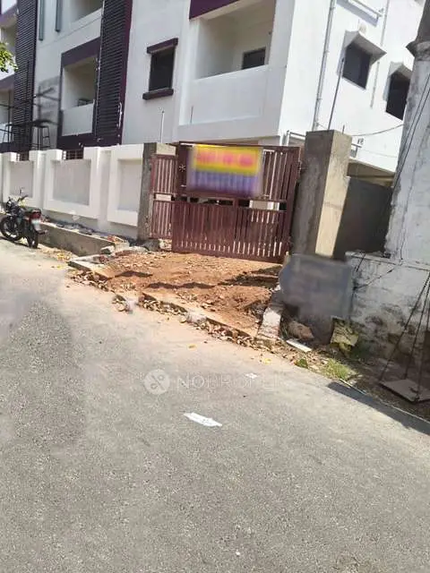
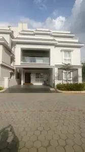
Shrika Developers
SIDDENKI RESHMI AND SIDDENKI RODASI · Rangareddy · RERA P02400011329
SHRIKA DEVELOPERS is a plotted development in Malkajgiri Municipal Corporation, Abdullapurmet Mandal, Ranga Reddy District. The registered promoter is SIDDENKI RESHMI AND SIDDENKI RODASI. The site area is 15678.20 sq. m, and the layout drawing’s software-read schedule records 63 plots ranging from 125.06 sq. m to 198.98 sq. m; no tower or floor configuration is stated. The project is registered with TG-RERA under P02400011329, and the promoter’s Form B declaration undertakes completion by 05th August, 2029.
01What we found
Read from TG-RERA filings, approvals, land and registration records and court records. A court case is counted only when the court record states this project's survey number with its village, or names the project.
02Check before you pay
10 items to check before you pay, 4 high - from the title chain, court records and approvals, each with what to ask the builder or your advocate. An item may not be a problem with the project: records can be incomplete.
1. Project at a glance
Project identity
| Item | Record |
|---|---|
| Registered project name | SHRIKA DEVELOPERS RERA record |
| Project type / phase | Plotted development; identified as a new project. A separate phase or registered-portion description is not disclosed. RERA record RERA filing |
| TG-RERA registration | P02400011329 |
| Registration validity | 05/08/2026 to 05/08/2029; the certificate states a three-year term, unless extended by the Authority. This is registration validity, not an occupancy certificate or proof of completion. |
| Registered promoter | SIDDENKI RESHMI AND SIDDENKI RODASI |
| RERA status | The supplied FORM ‘C’ certificate records registration granted under section 5. |
Land and geographic identity
| Item | Record |
|---|---|
| Locality | Malkajgiri Municipal Corporation RERA record RERA filing |
| Revenue village | PEDDAAMBERPET in the project filing; the layout documents describe Pedda Amberpet Village. RERA record RERA filing |
| Mandal / district / PIN | Abdullapurmet / Ranga Reddy / 501505 RERA record RERA filing |
| Project survey number and subdivision | 600/P RERA record Land records |
| Registered site extent | 15678.20 sq. m RERA filing |
| Net / total layout area | 15678.2 sq. m in the draft layout area statement. Layout record |
| Boundaries | East: LAND IN SY NO 601; West: LAND IN SY NO 599; North: LAND IN SY NO 600 PART; South: EXISTING HMDA LAYOUT. RERA filing |
Development identity
| Item | Record |
|---|---|
| Layout authority and principal approval | Draft layout permission records HMDA technical approval / Layout Permit 2382/HMDA/SWDL/2026, dated 05/08/2026; the draft letter records Malkajgiri Municipal Corporation as the authority releasing draft layout permission. Approvals record |
| Application / file number | 018992/HMDA/04629/SWDL/GTK/2026 (also printed with spacing in one extract). Approvals record |
| Development form | Open-plot layout. No building or floor configuration is supplied; the draft permission states that construction on plots is not to be allowed until HMDA issues the final layout. |
| Approved built-up area | The RERA filing lists 8993.77 sq. m as “Approved Built up Area”; it is not identified in the supplied evidence as a building-area specification for this plotted layout. RERA filing |
| Layout-drawing plot count | 63 plots, read from the layout drawing’s plot schedule by software; verify against the drawing. Layout record |
| Mortgage area | 1379.14 sq. m, covering Plot Nos. 1 to 9, according to the filed draft-layout and mortgage material. RERA filing |
| Common parking area | 0.0 sq. m in the draft layout area statement. |
Offering and status
| Item | Record |
|---|---|
| Offering | Plots; no plot-specific saleable-area schedule or inventory status is supplied in the RERA evidence summarized here. RERA filing |
| Drawing-derived plot sizes | Software-read layout schedule: 63 plots, ranging from 125.06 sq. m to 198.98 sq. m; verify against the approved drawing. Layout record |
| Booked / available | Not disclosed in the supplied records. The filed allotment-letter template has unfilled allottee and plot particulars. |
| Development stage | The supplied layout permission is described as a draft layout. No independently verified site-progress record is supplied. |
| Completion commitment | Promoter’s Form B declaration undertakes completion by 05th August, 2029. This is a promoter declaration, not independent confirmation of progress or completion. |
| Completion / occupancy certificate | No completion or occupancy certificate is identified in the supplied evidence. The project is a plotted layout; the final layout release is also not evidenced here. |
2. The project story
- SHRIKA DEVELOPERS is registered with TG-RERA as a plotted development at PEDDAAMBERPET, Abdullapurmet Mandal, Ranga Reddy District, on survey 600/P. The filing describes a site of 15678.20 sq. m; the filed layout drawing’s area statement allocates the land among plots, roads, open space, social infrastructure and utilities. RERA record Land records Layout record
- The project evidence describes a draft layout permission rather than a completed development. The draft letter identifies HMDA technical approval 2382/HMDA/SWDL/2026 and records requirements for layout works and transfer of designated common areas before final layout release. It also states that building construction in plots is not to be permitted until the final layout is issued. The supplied records do not establish that those works are complete, that final layout plans have been released, or that any completion/occupancy certificate has been issued.
- The layout drawing’s software-read plot schedule indicates 63 plots, but individual plot availability, booking status and allotment are not established by the supplied records. The RERA-filed allotment letter is a template with its allottee and plot particulars unfilled. Layout record
3. Master plan, architecture & building design
This is a plotted layout, not a building project described through tower or apartment plans. The layout drawing’s area statement uses a net layout area of 15678.2 sq. m. Its stated allocation is:
| Layout use | Area | Share shown in drawing |
|---|---|---|
| Plotted area | 8993.77 sq. m | 57.36% |
| Road area | 4910.31 sq. m | 31.32% |
| Open space area | 1191.20 sq. m | 7.60% |
| Social infrastructure area | 392.50 sq. m | 2.50% |
| Utilities area | 190.42 sq. m | 1.21% |
| Buffer area | 0.0 sq. m | — |
| Common parking area | 0.0 sq. m | 0.0% |
| Amenities area | 0.0 sq. m | 0.0% |
| Green belt area | 0.0 sq. m | 0.0% |
| Total net layout | 15678.2 sq. m | 100.0% |
Layout record
- The layout drawing’s software-read schedule records 63 plots. The supplied size summary gives a smallest plot of 125.06 sq. m, a median of 139.35 sq. m, and a largest of 198.98 sq. m; sizes are software-measured from the drawing and should be checked against it. Layout record
- The draft layout material specifies roads of 18 mts and identifies internal roads, open space, social infrastructure and utility land in the area statement. The draft permission requires roads to be opened for access to neighbouring sites and specifies handover of designated roads, open space, social infrastructure and utility areas to the local body before final layout release.
- The RERA filing lists an “Approved Built up Area” of 8993.77 sq. m, while the layout area statement labels the same figure as “Plotted Area.” These figures are retained as recorded; no building configuration or building-level built-up-area schedule is supplied here. RERA filing Layout record
- No residential buildings, floors, basements, towers or apartment configurations are evidenced in the supplied project materials.
4. Homes, configurations & floor plans
This is a plotted development; apartment or villa configurations and apartment carpet-area measurements are not supplied. The RERA evidence does not establish a booked-versus-available plot count. RERA filing
| Plot offering | Count | Booked | Available | RERA-filed saleable area | Drawing-based size |
|---|---|---|---|---|---|
| Plots | 63* | Not disclosed | Not disclosed | Not disclosed | 125.06–198.98 sq. m; software-read from layout drawing |
\*Plot count and plot sizes are software-read from the layout drawing’s schedule and require verification against the drawing. Layout record
The only supplied floor-plan review records one layout sheet and no apartment floor plan. Plot area should not be confused with apartment carpet area or a RERA-filed saleable-area figure; no unit-level area schedule is provided here. Floor plans Layout record
5. Parking & vehicle circulation
- The draft layout area statement records 0.0 sq. m for common parking. No sanctioned count of car or two-wheeler spaces, visitor or accessible parking provision, parking allotments, or parking-space ownership arrangements is established in the supplied evidence.
- The draft layout material specifies 18 mts roads and requires roads to be opened for access to neighbouring sites. No road-by-road circulation plan, vehicle entry/exit details, pedestrian separation or EV charging provision is described in the supplied extracts.
6. Amenities, recreation & open spaces
The draft layout documentation identifies proposed layout facilities and land uses. “Available” in the RERA amenity list or inclusion in a draft layout document is not evidence that the facility has been completed or independently verified.
| Facility | Description / size | Evidence source | Declared progress / verified status |
|---|---|---|---|
| Open space / park | Open space area 1191.20 sq. m (7.60%); park development is listed. | Layout record | Shown in draft layout material; completion not established. |
| Internal roads and footpaths | Road area 4910.31 sq. m (31.32%); draft extract specifies 18 mts roads. | Layout record | Shown in draft layout material; handover and completion not established. |
| Social infrastructure | 392.50 sq. m (2.50%). | Layout record | Area is provided in the draft layout statement; facility details and completion are not supplied. |
| Utilities land | 190.42 sq. m (1.21%). | Layout record | Area is provided in the draft layout statement; completion is not established. |
| Community buildings | No size or specific facility description supplied. | RERA amenities | No completion evidence supplied. |
| Amenities area | 0.0 sq. m in the draft layout area statement. | Recorded area; no separate amenity facility is specified. |
The draft permission requires transfer of the roads, open space, social infrastructure and utilities areas by registered gift deed to the local body before final layout release.
7. Utilities, building services & safety
The draft layout letter lists infrastructure intended for the layout, but the supplied material does not independently verify installation or operation.
| Supplied description | Internal water-supply pipelines and overhead tank are listed. |
|---|---|
| Evidence / status | Draft layout documentation; capacities, source and completion are not supplied. |
| Supplied description | Underground drainage lines and a common septic tank / STP are listed. |
|---|---|
| Evidence / status | Draft layout documentation; capacity, treatment design, reuse and completion are not supplied. |
| Supplied description | Storm-water drains and rainwater-harvesting pits are listed. |
|---|---|
| Evidence / status | Draft layout documentation; completion is not verified. |
| Supplied description | Electrical supply lines, transformer, transformer yard and street lights are listed. |
|---|---|
| Evidence / status | Draft layout documentation; capacity, backup and completion are not supplied. |
| Supplied description | Bio-compost unit is listed. |
|---|---|
| Evidence / status | Draft layout documentation; capacity and operational status are not supplied. |
| Supplied description | No project-specific fire-protection design or clearance is supplied. |
|---|---|
| Evidence / status | Not established in the supplied project evidence. RERA amenities |
| Supplied description | No accessible circulation or ramp details are supplied. |
|---|---|
| Evidence / status | Not established in the supplied project evidence. |
8. Location, access & connectivity
- The registered project location is PEDDAAMBERPET, Abdullapurmet Mandal, Ranga Reddy District, PIN 501505, with the filing identifying Malkajgiri Municipal Corporation as the locality. The layout documents describe Pedda Amberpet Village. RERA record RERA filing
- The supplied location record lists the Outer Ring Road nearest sampled interchange at approximately 6.6 km. The supplied geocode names Geological Survey of India Training Institute, Ward 11 Nagole, as its returned location label; it is not presented as the registered project address. No other measured approach-road, public-transport or landmark distances are supplied. Location record
9. Developer & development status
- The registered promoter is SIDDENKI RESHMI AND SIDDENKI RODASI. The RERA filing classifies the organization as “Others,” with the description “Joint Development”; a more specific legal-entity type is not established in the supplied records. RERA record RERA filing
- The registration certificate lists the promoter office as Village: peddagolkonda, Mandal: Shamshabad, District: Ranga Reddy, Pin: 501218. A project-site contact number, official website and other official contacts are not supplied.
- The promoter’s Form B, dated 25th September, 2026, declares completion by 05th August, 2029 and makes declarations concerning title, encumbrances, project accounts and pending approvals. These are promoter declarations; the supplied evidence does not independently establish construction progress, completion of the layout works or final layout release.
10. Approvals, official records & documents
| Record | What the supplied document establishes |
|---|---|
| TG-RERA registration certificate | FORM ‘C’ records project P02400011329, project name SHRIKA DEVELOPERS, promoter SIDDENKI RESHMI AND SIDDENKI RODASI, and validity from 05/08/2026 to 05/08/2029. |
| Draft layout permission | Draft layout letter records HMDA technical approval / Layout Permit 2382/HMDA/SWDL/2026, dated 05/08/2026, for the plotted layout on 600/P. It sets out layout conditions and designated areas for transfer before final layout release. |
| HMDA draft layout letter / application record | Records application 018992/HMDA/04629/SWDL/GTK/2026 and forwarding to Malkajgiri Municipal Corporation for release of proceedings and plans; the supplied extract says this letter itself does not record their release. |
| Mortgage deed | Registered simple mortgage deed in favour of the Metropolitan Commissioner, HMDA, covers Plot Nos. 1 to 9, measuring 1379.14 sq. m, as security for layout works. |
| Form B declaration | Promoter-filed declaration dated 25th September, 2026, including the stated completion undertaking and project-account declarations. |
| Allotment letter | Filed template; allottee, plot particulars, booking amount and price are unfilled. |
| Layout drawing | One layout sheet; software-read schedule identifies 63 plots and area allocations. Layout record |
No completion/occupancy certificate or final layout release is identified in the supplied evidence. The public HMDA approved-layout lookup is reported unavailable from the supplied project record; this does not establish whether a later final layout record exists. HMDA
1. Project at a glance
Project identity
Registered project name: SHRIKA DEVELOPERS
Project type / phase: Plotted development; identified as a new project. A separate phase or registered-portion description is not disclosed.
TG-RERA registration: P02400011329
Registration validity: 05/08/2026 to 05/08/2029; the certificate states a three-year term, unless extended by the Authority. This is registration validity, not an occupancy certificate or proof of completion.
Registered promoter: SIDDENKI RESHMI AND SIDDENKI RODASI
RERA status: The supplied FORM ‘C’ certificate records registration granted under section 5.
Land and geographic identity
Locality: Malkajgiri Municipal Corporation
Revenue village: PEDDAAMBERPET in the project filing; the layout documents describe Pedda Amberpet Village.
Mandal / district / PIN: Abdullapurmet / Ranga Reddy / 501505
Project survey number and subdivision: 600/P
Registered site extent: 15678.20 sq. m
Net / total layout area: 15678.2 sq. m in the draft layout area statement.
Boundaries: East: LAND IN SY NO 601; West: LAND IN SY NO 599; North: LAND IN SY NO 600 PART; South: EXISTING HMDA LAYOUT.
Development identity
Layout authority and principal approval: Draft layout permission records HMDA technical approval / Layout Permit 2382/HMDA/SWDL/2026, dated 05/08/2026; the draft letter records Malkajgiri Municipal Corporation as the authority releasing draft layout permission.
Application / file number: 018992/HMDA/04629/SWDL/GTK/2026 (also printed with spacing in one extract).
Development form: Open-plot layout. No building or floor configuration is supplied; the draft permission states that construction on plots is not to be allowed until HMDA issues the final layout.
Approved built-up area: The RERA filing lists 8993.77 sq. m as “Approved Built up Area”; it is not identified in the supplied evidence as a building-area specification for this plotted layout.
Layout-drawing plot count: 63 plots, read from the layout drawing’s plot schedule by software; verify against the drawing.
Mortgage area: 1379.14 sq. m, covering Plot Nos. 1 to 9, according to the filed draft-layout and mortgage material.
Common parking area: 0.0 sq. m in the draft layout area statement.
Offering and status
Offering: Plots; no plot-specific saleable-area schedule or inventory status is supplied in the RERA evidence summarized here.
Drawing-derived plot sizes: Software-read layout schedule: 63 plots, ranging from 125.06 sq. m to 198.98 sq. m; verify against the approved drawing.
Booked / available: Not disclosed in the supplied records. The filed allotment-letter template has unfilled allottee and plot particulars.
Development stage: The supplied layout permission is described as a draft layout. No independently verified site-progress record is supplied.
Completion commitment: Promoter’s Form B declaration undertakes completion by 05th August, 2029. This is a promoter declaration, not independent confirmation of progress or completion.
Completion / occupancy certificate: No completion or occupancy certificate is identified in the supplied evidence. The project is a plotted layout; the final layout release is also not evidenced here.
2. The project story
- SHRIKA DEVELOPERS is registered with TG-RERA as a plotted development at PEDDAAMBERPET, Abdullapurmet Mandal, Ranga Reddy District, on survey 600/P. The filing describes a site of 15678.20 sq. m; the filed layout drawing’s area statement allocates the land among plots, roads, open space, social infrastructure and utilities.
- The project evidence describes a draft layout permission rather than a completed development. The draft letter identifies HMDA technical approval 2382/HMDA/SWDL/2026 and records requirements for layout works and transfer of designated common areas before final layout release. It also states that building construction in plots is not to be permitted until the final layout is issued. The supplied records do not establish that those works are complete, that final layout plans have been released, or that any completion/occupancy certificate has been issued.
- The layout drawing’s software-read plot schedule indicates 63 plots, but individual plot availability, booking status and allotment are not established by the supplied records. The RERA-filed allotment letter is a template with its allottee and plot particulars unfilled.
3. Master plan, architecture & building design
This is a plotted layout, not a building project described through tower or apartment plans. The layout drawing’s area statement uses a net layout area of 15678.2 sq. m. Its stated allocation is:
| Layout use | Area | Share shown in drawing |
|---|---|---|
| Plotted area | 8993.77 sq. m | 57.36% |
| Road area | 4910.31 sq. m | 31.32% |
| Open space area | 1191.20 sq. m | 7.60% |
| Social infrastructure area | 392.50 sq. m | 2.50% |
| Utilities area | 190.42 sq. m | 1.21% |
| Buffer area | 0.0 sq. m | — |
| Common parking area | 0.0 sq. m | 0.0% |
| Amenities area | 0.0 sq. m | 0.0% |
| Green belt area | 0.0 sq. m | 0.0% |
| Total net layout | 15678.2 sq. m | 100.0% |
- The layout drawing’s software-read schedule records 63 plots. The supplied size summary gives a smallest plot of 125.06 sq. m, a median of 139.35 sq. m, and a largest of 198.98 sq. m; sizes are software-measured from the drawing and should be checked against it.
- The draft layout material specifies roads of 18 mts and identifies internal roads, open space, social infrastructure and utility land in the area statement. The draft permission requires roads to be opened for access to neighbouring sites and specifies handover of designated roads, open space, social infrastructure and utility areas to the local body before final layout release.
- The RERA filing lists an “Approved Built up Area” of 8993.77 sq. m, while the layout area statement labels the same figure as “Plotted Area.” These figures are retained as recorded; no building configuration or building-level built-up-area schedule is supplied here.
- No residential buildings, floors, basements, towers or apartment configurations are evidenced in the supplied project materials.
4. Homes, configurations & floor plans
This is a plotted development; apartment or villa configurations and apartment carpet-area measurements are not supplied. The RERA evidence does not establish a booked-versus-available plot count.
| Plot offering | Count | Booked | Available | RERA-filed saleable area | Drawing-based size |
|---|---|---|---|---|---|
| Plots | 63* | Not disclosed | Not disclosed | Not disclosed | 125.06–198.98 sq. m; software-read from layout drawing |
\*Plot count and plot sizes are software-read from the layout drawing’s schedule and require verification against the drawing.
The only supplied floor-plan review records one layout sheet and no apartment floor plan. Plot area should not be confused with apartment carpet area or a RERA-filed saleable-area figure; no unit-level area schedule is provided here.
5. Parking & vehicle circulation
- The draft layout area statement records 0.0 sq. m for common parking. No sanctioned count of car or two-wheeler spaces, visitor or accessible parking provision, parking allotments, or parking-space ownership arrangements is established in the supplied evidence.
- The draft layout material specifies 18 mts roads and requires roads to be opened for access to neighbouring sites. No road-by-road circulation plan, vehicle entry/exit details, pedestrian separation or EV charging provision is described in the supplied extracts.
6. Amenities, recreation & open spaces
The draft layout documentation identifies proposed layout facilities and land uses. “Available” in the RERA amenity list or inclusion in a draft layout document is not evidence that the facility has been completed or independently verified.
| Facility | Description / size | Evidence source | Declared progress / verified status |
|---|---|---|---|
| Open space / park | Open space area 1191.20 sq. m (7.60%); park development is listed. | Shown in draft layout material; completion not established. | |
| Internal roads and footpaths | Road area 4910.31 sq. m (31.32%); draft extract specifies 18 mts roads. | Shown in draft layout material; handover and completion not established. | |
| Social infrastructure | 392.50 sq. m (2.50%). | Area is provided in the draft layout statement; facility details and completion are not supplied. | |
| Utilities land | 190.42 sq. m (1.21%). | Area is provided in the draft layout statement; completion is not established. | |
| Community buildings | No size or specific facility description supplied. | No completion evidence supplied. | |
| Amenities area | 0.0 sq. m in the draft layout area statement. | Recorded area; no separate amenity facility is specified. |
The draft permission requires transfer of the roads, open space, social infrastructure and utilities areas by registered gift deed to the local body before final layout release.
7. Utilities, building services & safety
The draft layout letter lists infrastructure intended for the layout, but the supplied material does not independently verify installation or operation.
| Supplied description | Internal water-supply pipelines and overhead tank are listed. |
|---|---|
| Evidence / status | Draft layout documentation; capacities, source and completion are not supplied. |
| Supplied description | Underground drainage lines and a common septic tank / STP are listed. |
|---|---|
| Evidence / status | Draft layout documentation; capacity, treatment design, reuse and completion are not supplied. |
| Supplied description | Storm-water drains and rainwater-harvesting pits are listed. |
|---|---|
| Evidence / status | Draft layout documentation; completion is not verified. |
| Supplied description | Electrical supply lines, transformer, transformer yard and street lights are listed. |
|---|---|
| Evidence / status | Draft layout documentation; capacity, backup and completion are not supplied. |
| Supplied description | Bio-compost unit is listed. |
|---|---|
| Evidence / status | Draft layout documentation; capacity and operational status are not supplied. |
| Supplied description | No project-specific fire-protection design or clearance is supplied. |
|---|---|
| Evidence / status | Not established in the supplied project evidence. |
| Supplied description | No accessible circulation or ramp details are supplied. |
|---|---|
| Evidence / status | Not established in the supplied project evidence. |
8. Location, access & connectivity
- The registered project location is PEDDAAMBERPET, Abdullapurmet Mandal, Ranga Reddy District, PIN 501505, with the filing identifying Malkajgiri Municipal Corporation as the locality. The layout documents describe Pedda Amberpet Village.
- The supplied location record lists the Outer Ring Road nearest sampled interchange at approximately 6.6 km. The supplied geocode names Geological Survey of India Training Institute, Ward 11 Nagole, as its returned location label; it is not presented as the registered project address. No other measured approach-road, public-transport or landmark distances are supplied.
9. Developer & development status
- The registered promoter is SIDDENKI RESHMI AND SIDDENKI RODASI. The RERA filing classifies the organization as “Others,” with the description “Joint Development”; a more specific legal-entity type is not established in the supplied records.
- The registration certificate lists the promoter office as Village: peddagolkonda, Mandal: Shamshabad, District: Ranga Reddy, Pin: 501218. A project-site contact number, official website and other official contacts are not supplied.
- The promoter’s Form B, dated 25th September, 2026, declares completion by 05th August, 2029 and makes declarations concerning title, encumbrances, project accounts and pending approvals. These are promoter declarations; the supplied evidence does not independently establish construction progress, completion of the layout works or final layout release.
10. Approvals, official records & documents
TG-RERA registration certificate: FORM ‘C’ records project P02400011329, project name SHRIKA DEVELOPERS, promoter SIDDENKI RESHMI AND SIDDENKI RODASI, and validity from 05/08/2026 to 05/08/2029.
Draft layout permission: Draft layout letter records HMDA technical approval / Layout Permit 2382/HMDA/SWDL/2026, dated 05/08/2026, for the plotted layout on 600/P. It sets out layout conditions and designated areas for transfer before final layout release.
HMDA draft layout letter / application record: Records application 018992/HMDA/04629/SWDL/GTK/2026 and forwarding to Malkajgiri Municipal Corporation for release of proceedings and plans; the supplied extract says this letter itself does not record their release.
Mortgage deed: Registered simple mortgage deed in favour of the Metropolitan Commissioner, HMDA, covers Plot Nos. 1 to 9, measuring 1379.14 sq. m, as security for layout works.
Form B declaration: Promoter-filed declaration dated 25th September, 2026, including the stated completion undertaking and project-account declarations.
Allotment letter: Filed template; allottee, plot particulars, booking amount and price are unfilled.
Layout drawing: One layout sheet; software-read schedule identifies 63 plots and area allocations.
No completion/occupancy certificate or final layout release is identified in the supplied evidence. The public HMDA approved-layout lookup is reported unavailable from the supplied project record; this does not establish whether a later final layout record exists.
Frequently asked questions
Is SHRIKA DEVELOPERS registered with Telangana RERA?
Yes. SHRIKA DEVELOPERS is registered with the Telangana Real Estate Regulatory Authority as P02400011329; the registration status is New Project.
Who is the developer of SHRIKA DEVELOPERS?
The promoter named in the RERA registration is SIDDENKI RESHMI AND SIDDENKI RODASI.
Where is SHRIKA DEVELOPERS located?
SHRIKA DEVELOPERS is in Malkajgiri Municipal Corporation, PEDDAAMBERPET, Abdullapurmet, Rangareddy, Telangana (501505).
When will SHRIKA DEVELOPERS be completed?
The promoter's proposed date of completion filed with RERA is 05/08/2029. This is the promoter's declaration, not a guarantee.
More projects in Peddaamberpet